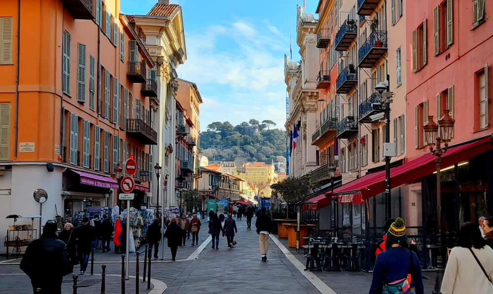
After a quiet morning we walk a few steps to the bus stop and get the 1:00 pm No. 33 bus that goes right to the Rathaus stop in the Old Town where we need to get off.
Lynn tells me that she last visited Heidelberg in June 1985. What she remembers is: the Old Bridge with its ‘salt and pepper’ towers; discovering that footpaths in town are divided into a pedestrian lane and bicycle lane and make sure you don’t walk in the wrong one (DING-DING!), and attempting to watch an episode of ‘Bonanza’ on TV that was dubbed in German with Lorne Greene’s gracious and melodious voice replaced with a harsh, guttural one, more akin to Hoss’s!
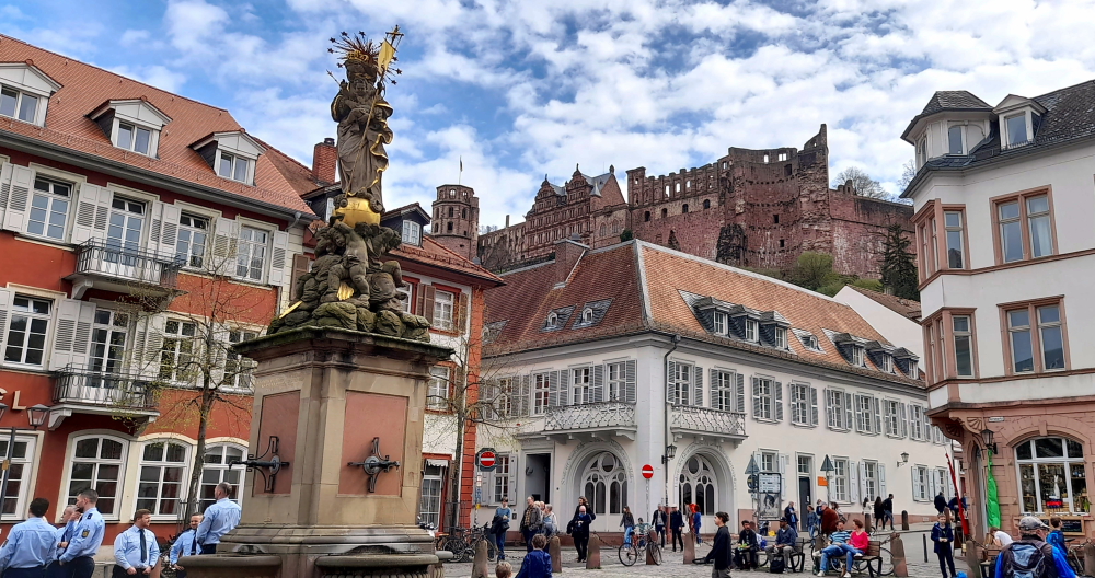
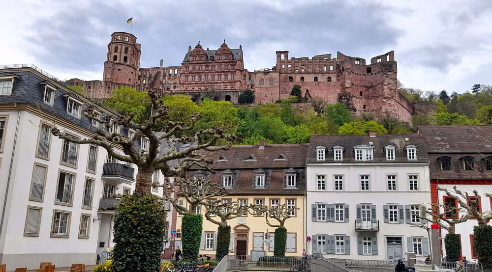
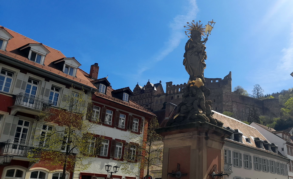
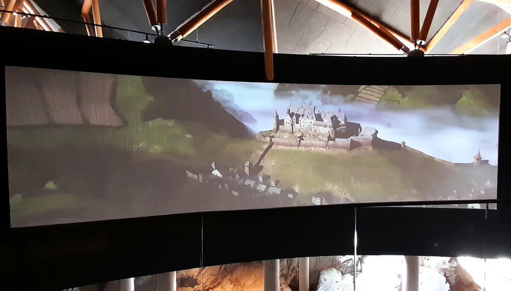
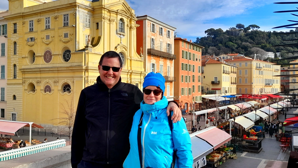
Kornmarkt with Heidelberg Castle on the hill.
We are booked on a 2:00 pm GuruWalk and need to meet in front of the Rathaus in Marktplaz. As we arrive 30 minutes early we go for a quick wander. Yesterday, we arrived in rain and 13 Deg. C. Today it’s due to be 26 and tomorrow 27!
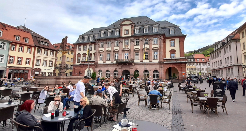
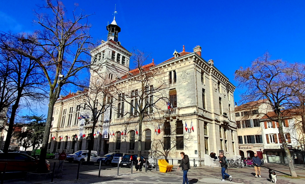
Rathaus in Marktplaz.
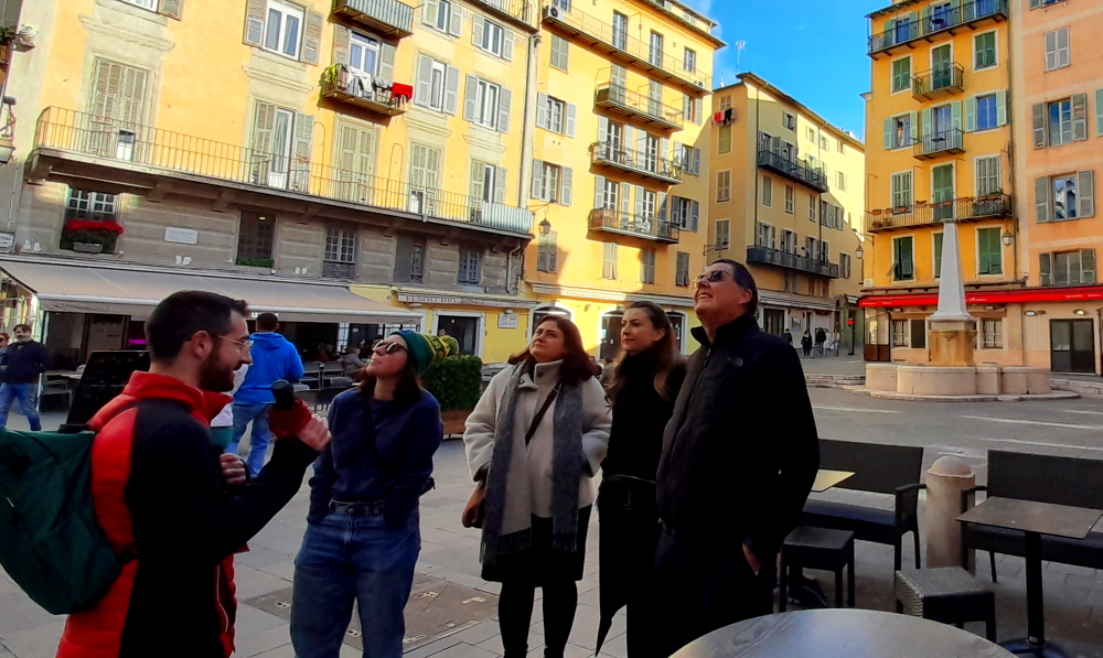
By the time 2:00 pm arrives, it has clouded over and a cold breeze has arrived. Unlike our guide – “look for a guy with a moustache” – but we find the rest of our party: Catherine, French but lives in Germany and Johanne and her husband from Canada who now live in Israel.
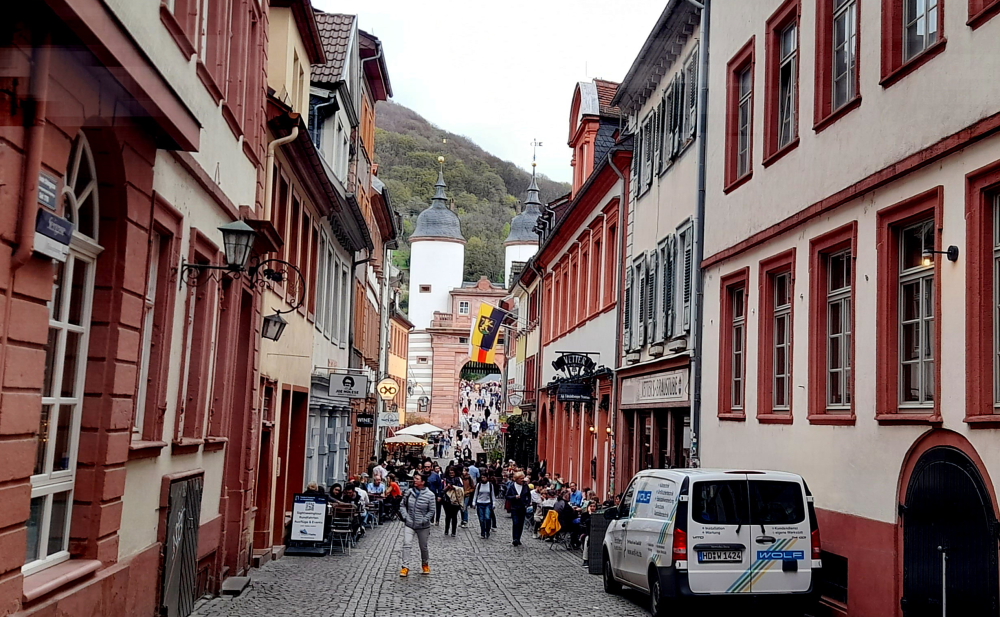
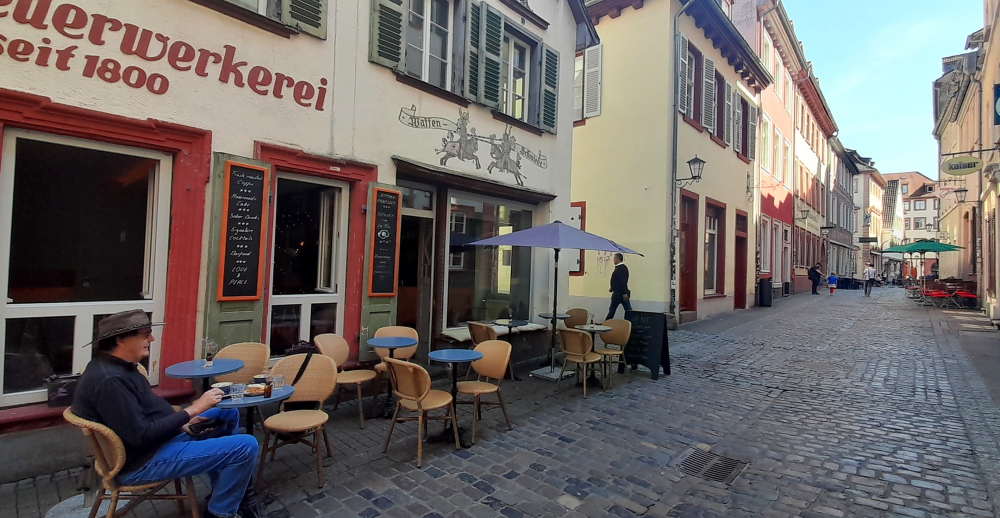
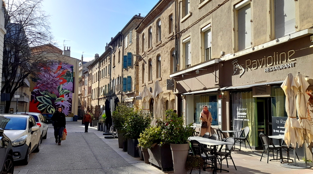
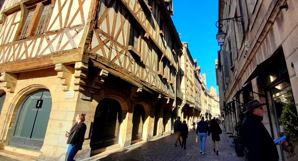
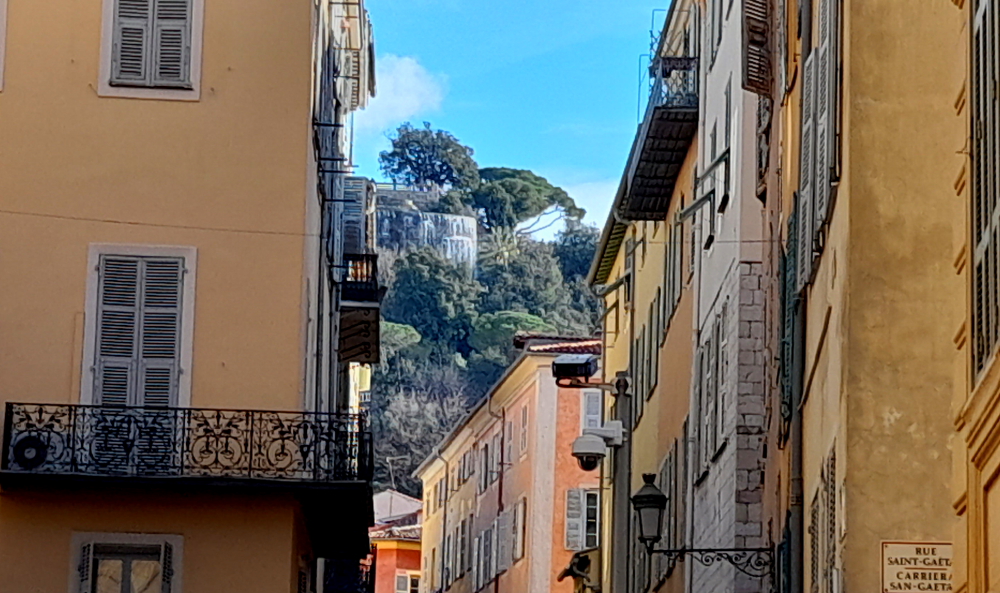
Steingasse off Markplatz leading to the Old Bridge (Alte Brucke) over the Neckar River.
We all thought we had been communicating with our guide, Henry, a Brit who has lived in Heidelberg for 12 years, but turns out our guide today is Viktor, from Siberia, who is undertaking his PhD in this university town of Heidelberg.
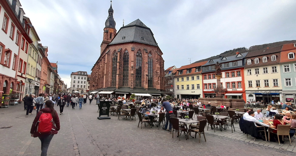
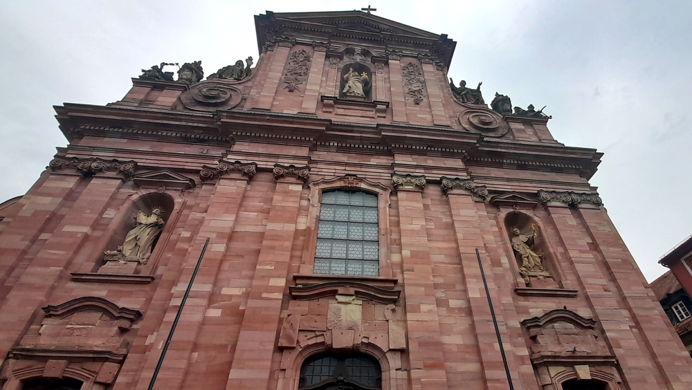
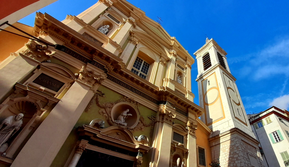
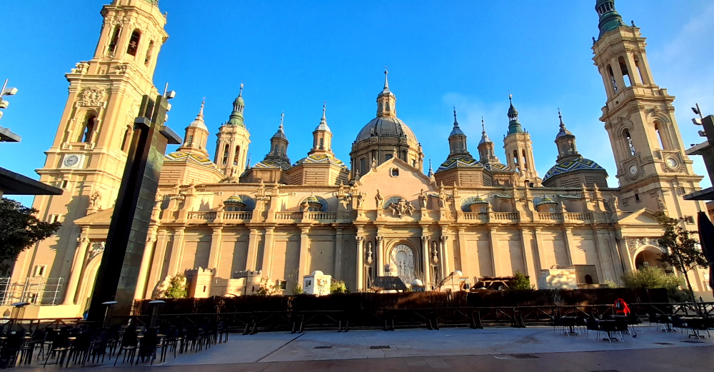
Our first stop is outside the Heiliggeistkirche on Marktplatz. founding year 1398. Ludwig III laid the foundation for the later famous Palatine Library, the Biblioteca Palatina, by having the first books placed in the galleries of this church. During the reign of Louis V (1508-1544), when the most important palace buildings were also being constructed, the tower continued to be built and completed.
In the course of the Reformation, the church changed several times between Lutheran and Reformed-Calvinist denominations. In 1563, the Heidelberg Catechism emerged as the Reformed confession. With the 30 Year War and the conquest of Heidelberg by Catholic troops, the city, and the church became Catholic for many years, and as spoils of war, Pope Gregory XV had the Biblioteca Palatina brought to Rome in 1623.
Marktplaz & the rear of the Church of the Holy Spirit (Heiliggeistkirche).
In the course of the Palatine-Orléans War of Succession, the church was severely damaged in 1693. Only the one tombstone of the Elector Ruprecht II, the founder of the church, is preserved. Of the once 5000 books and 3524 manuscripts, only 885 made it back to Heidelberg in 1816, all the rest remained in the Vatican.
In the following two centuries, both Catholics and Protestants laid claim to the church in equal measure, so that, separated by a dividing wall, Catholic mass was celebrated in the chancel and Protestant services in the nave. 1936 an agreement was reached with the Catholic Church whereby the church passed entirely into the possession of the Protestant Church in Baden [heidelberg-marketing.de].
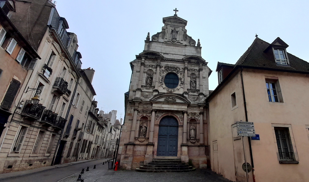
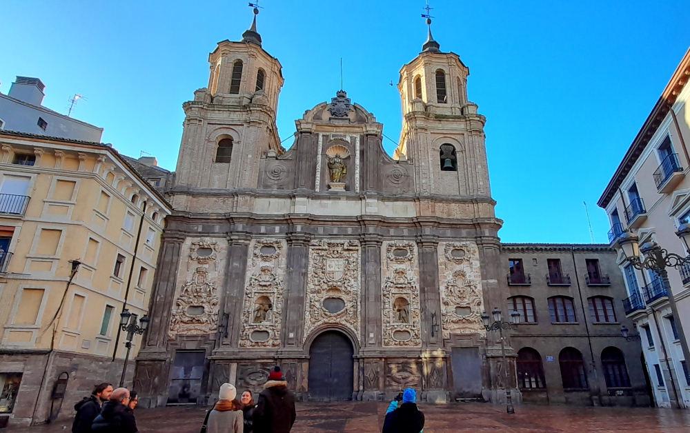
The Jesuit Church
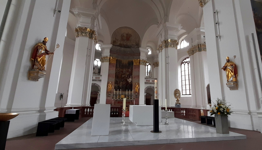
From the Marktplatz our next stop is the Jesuit Church (Jesuitenkirche). During the 16th century Heidelberg was the centre of a tug-of-war between Lutherans, Calvanists, Catholics and Protestants. The construction of the Jesuit Church began in 1712, and was built in several phases, the last one adding the tower from 1866 – 1872.
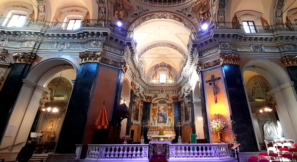
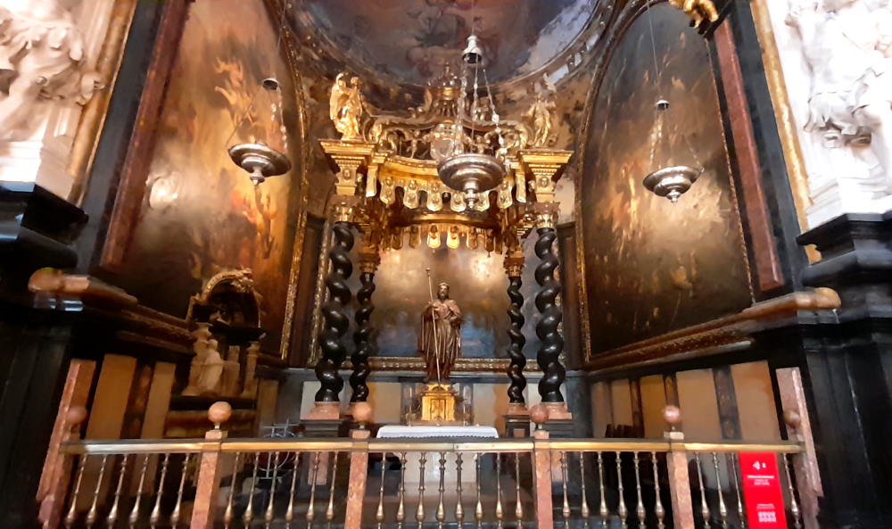
Inside the church.
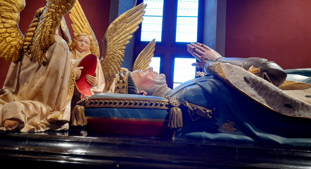
The baroque furnishings are no longer preserved today but the altar painting by the Kaulbach student Andreas Müller has been. The Elector Frederick the Victorious is buried in a crypt in the northeast corner of the church.
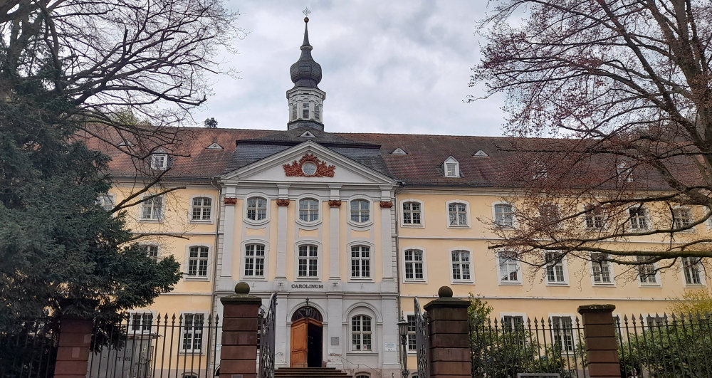
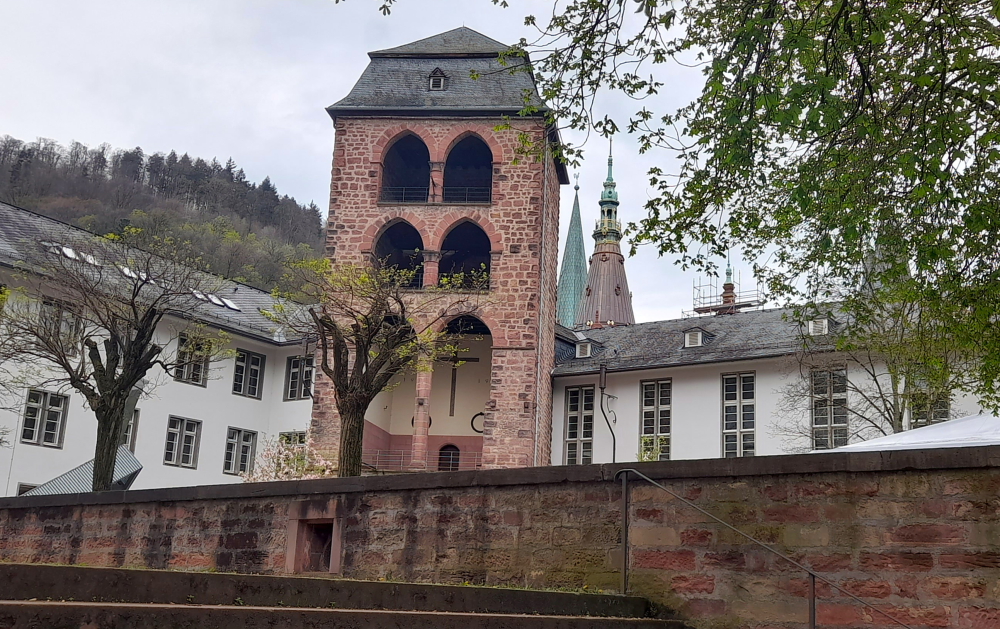
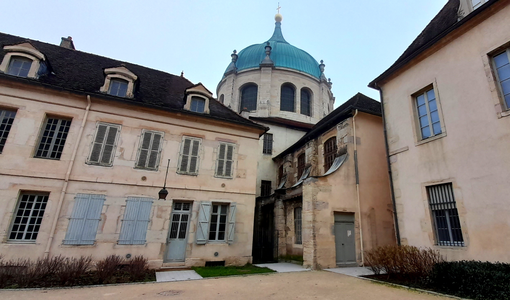
University of Heidelberg building near the Jesuit Church.
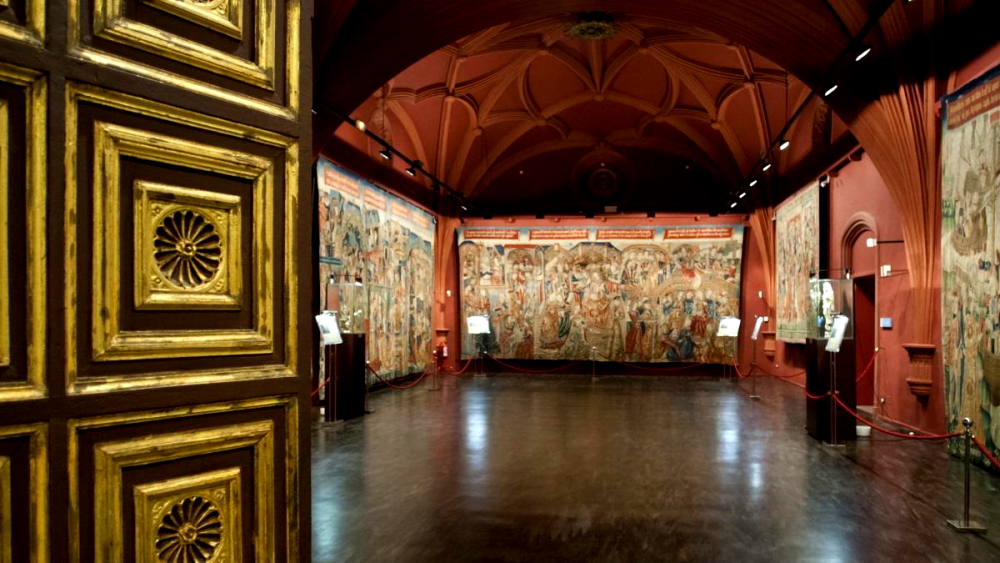
To the east of the church is the entrance to the former Jesuit college. Originally, the facilities of the Jesuits comprised a grammar school (today the Philosophical Seminary) and the Carolinum seminar, which is now used by the university administration. The church is home to the Museum of Ecclesiastical Arts (Museum für sakrale Kunst und Liturgie) [heidelberg-marketing.de].
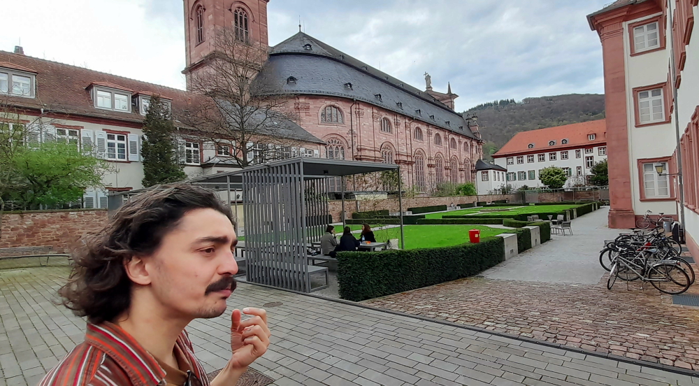
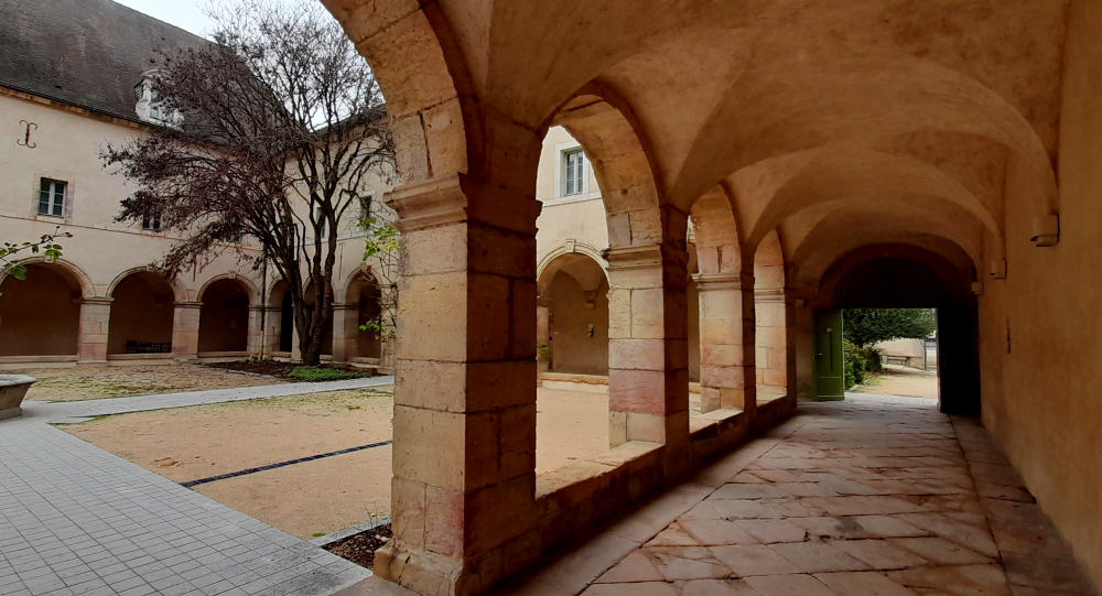
Vikor & the Jesuit College/garden next to the Jesuit Church.
From here we walk to Karlsplatz (Karls Square) where we are treated to an unobstructed view of Heidelberg Castle. Named after Grand Duke Karl Friedrich of Baden, the square extends over the area of the Franciscan monastery, which was demolished in 1803.
Not only home to the Heidelberg Academy of Sciences and the Palais Boisserée, the Square is also home to two of Heidelberg’s oldest and best-known student pubs and several fraternity houses. Generations of fraternity students have been guests at the “Zum Seppl” inn, built in 1634, and the “Zum Roten Ochsen,” built right next door in 1703 [heidelberg-marketing.de].
Karlplatz.
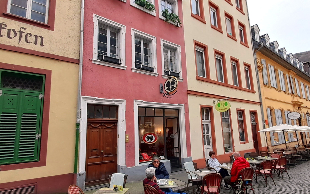
Walking towards the river we walk past the ‘salt and pepper’ pillars of the Old Bridge (which we return to after the tour) to Chocolaterie Knösel on Haspelgasse. Established in 1863, it soon became a popular meeting place among Heidelberg’s residents, male students and the young ladies attending Heidelberg’s finishing school whose governesses and chaperones were never far away.
Chocolaterie Knösel on Haspelgasse.
These secret longings did not go unnoticed by the chocolatier, Fridolin Knösel. One day he created a particularly delicious chocolate delight, which he impishly called the ‘Studentenkuss’. Given as a present, it was such an exquisite, gallant token of affection that not even the chaperones could object [heidelbergerstudentenkuss.de].
A short walk from here we arrive at Universitätsplatz where there is a plaque dedicated to Martin Luther. Heidelberg University played a leading part in Medieval Scholasticism, Renaissance humanism, the German Reformation, and in the subsequent conflict between Lutheranism and Calvinism during the 15th and 16th centuries.
Plaque commemorating Martin Luther’s Heidelberg Disputation, 1518.
In April 1518, a few months after proclaiming his 95 Theses, Martin Luther was received in Heidelberg, to defend them.
Tower at the University’s History Department.
He was invited to introduce his theology at the tri-annual meeting of his Augustinian Hermits order in Heidelberg. The Heidelberg Disputation took place on April 26, 1518, in the lecture hall of the liberal arts faculty at the University.
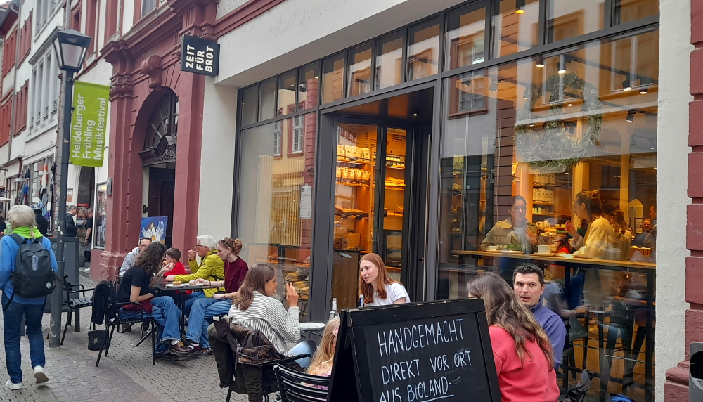
Zeit Fur Brot on Hauptstrasse – best cinnamon buns in town!
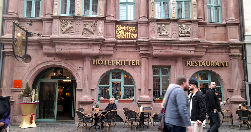
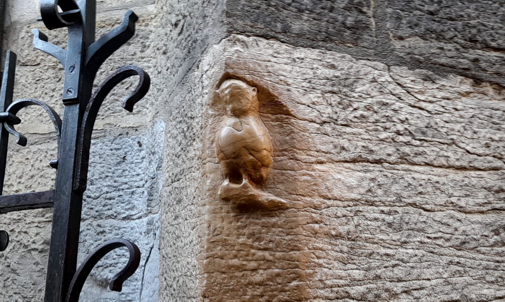
Walking up Hauptstrasse towards Marktplatz our final stop is in front of Hotel Ritter. The historic town house Zum Ritter Sankt Georg (Knight St. George) was built in the year 1592 by the cloth merchant Carolus (Charles) Belier and served as an inn already 300 years ago. It is one of the few buildings to survive the War of Succession not to mention numerous fires. Standing across from the Church of the Holy Spirit, it was built in the style of the late Renaissance. It is named after the sculpture at the top.
Hotel Ritter.
From here we head to the river and the iconic Alte Brucke.
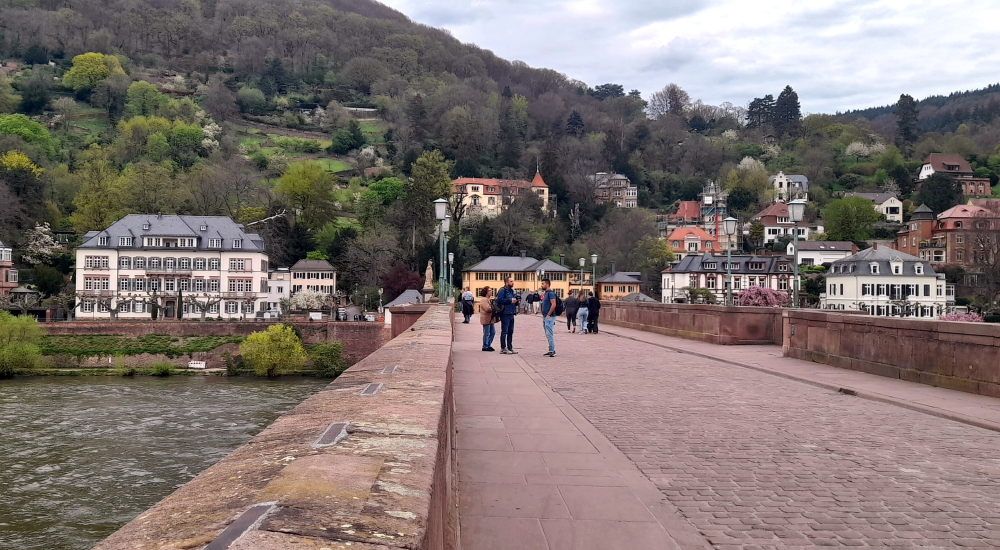
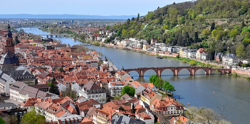
View from the bridge towards the Old Town.
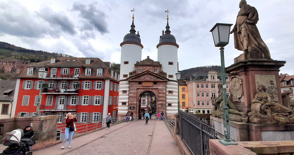
The Karl Theodor Bridge, commonly known as the Old Bridge (Alte Brücke), is an arch bridge in Heidelberg that crosses the Neckar river.
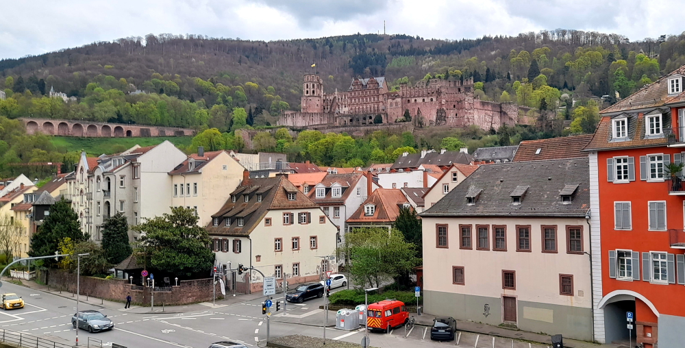
View of Heidelberg Castle from the bridge.
It connects the Old City with the eastern part of the Neuenheim district of the city on the opposite bank.
View towards the Neuenheim district on the opposite bank.
The current bridge, made of Neckar sandstone and the ninth built on the site, was erected 1786-1788 by Elector Charles Theodore, and is one of the best-known landmarks and tourist destinations in Heidelberg.
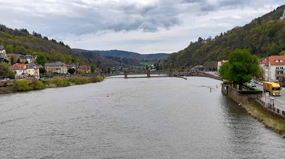
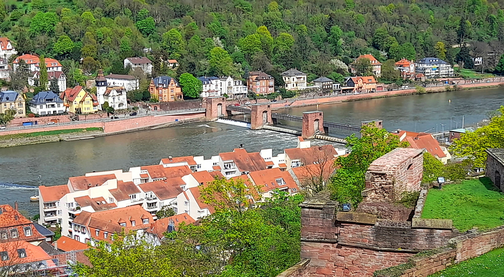
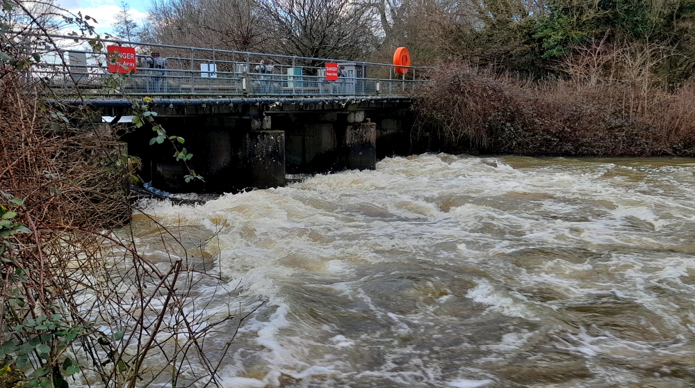
Neckar River view upstream towards weir.
A medieval bridge gate is on the side of the old town, and was originally part of the town wall. Baroque tower helmets were added as part of the erection of the stone bridge in 1788.
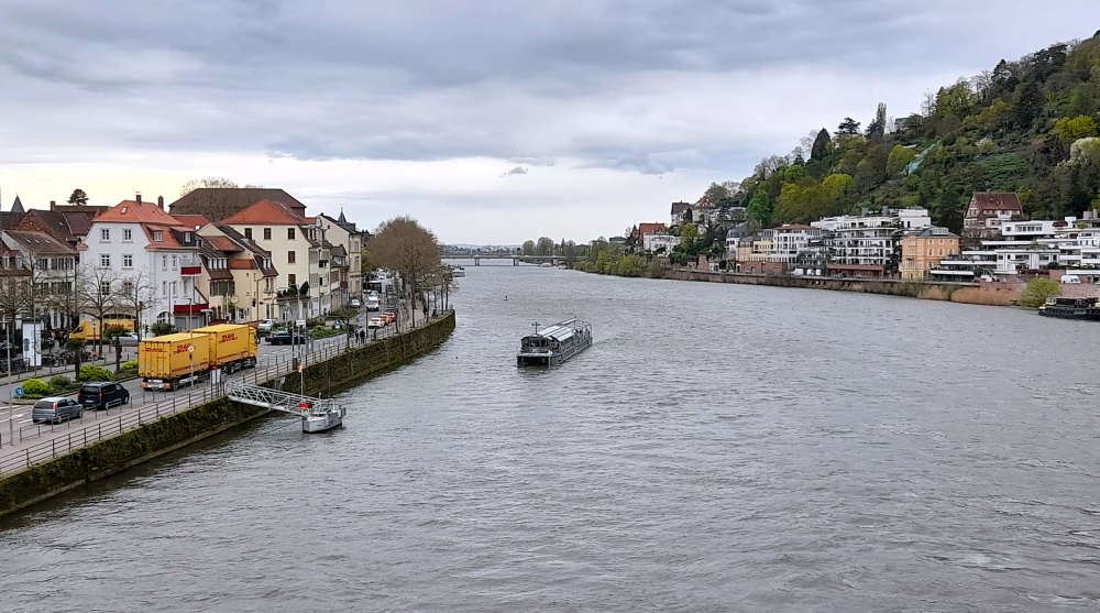
View downstream towards the Theodor-Heuss-Brucke.
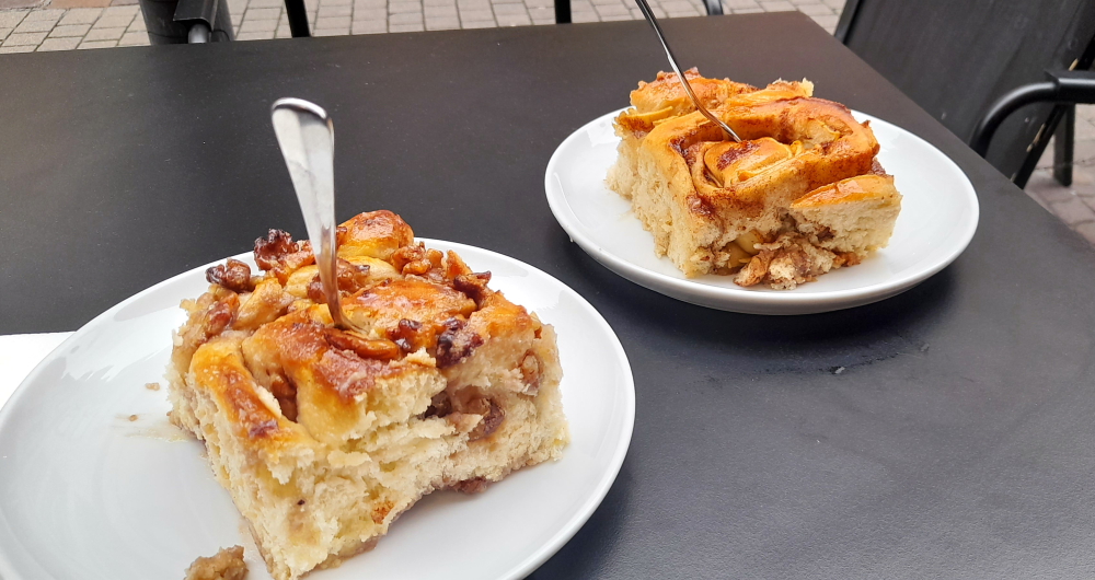
By this time we are absolutely famished so we make a beeline for Zeit Fur Brot on Hauptstrasse for a cinnamon bun each.
Cinnamon buns – one with walnuts, the other with apples.
Then catch the No. 33 bus back to the Aparthotel.
6 April, 2024
Another 27 Deg. C. day today so around 10:30 am we catch the No. 22 tram that terminates at Bismarkplatz where we swing by a Deutsche Bank ATM before promenading along the Hauptstrasse to the Old Town.
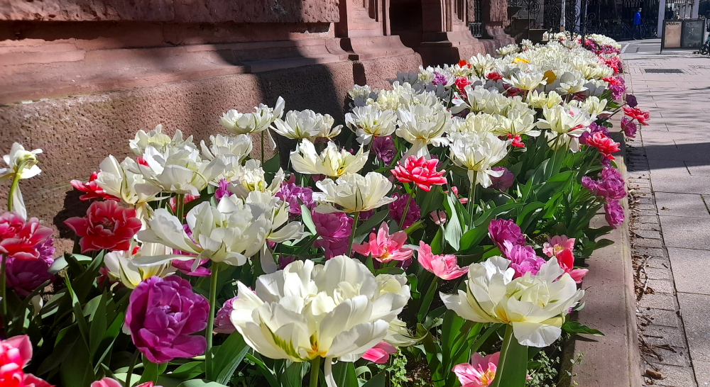
Exotic tulips near Bismarkplatz.
Lynn has a hair appointment at noon and as it’s 11:30 am we stop for some excellent ‘kaffee und kuchen’ at La Fee cafe, near Marktplaz. It’s a nice haven from the busy cafes and heaving Hauptstrasse just one block over.
La Fee cafe on Untere Strasse.
During the 30 minutes that Lynn is under the scissors, I wander over to Station Kornmarkt to find out how to procure tickets for the funicular to Heidelberg Castle.
Kornmarkt-Madonna.
The beauty of buying the funicular tickets is that it’s for the return trip, it includes access to 2 museums within the castle and I can buy it from an English-speaking ticket machine with a credit card and without having to wait in a queue. Result!
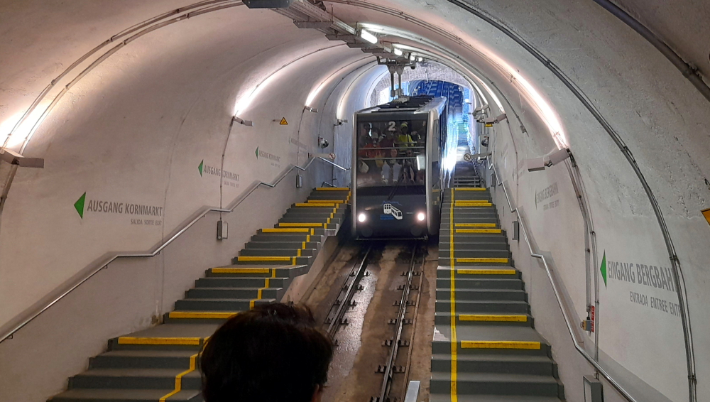
Funicular car arriving at Station Kornmarkt.
As soon as Lynn arrives we walk through the barriers and within a couple of minutes a car arrives. The Heidelberger Bergbahn funicular railway runs from Kornmakt to the summit of the Königstuhl via the castle. We get off at the Castle stop.
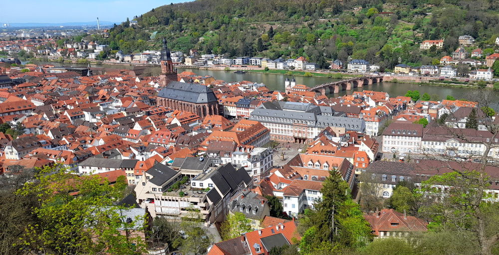
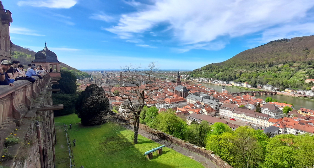
View of the Old Town from the Castle’s western wall.
Needless to say the Castle and its grounds are busy and by the time we leave some 3 hours later it’s absolutely heaving.
View of the Neckar River & the Old Bridge (Alte Brucke).
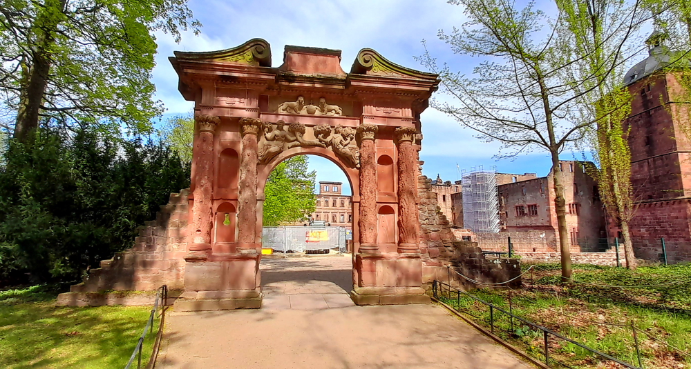
Towards the entrance to the Castle is the Elizabeth Tower (Elisabethentor). Built in 1615 by the French engineer and garden architect Salomon de Caus in the style of a Roman triumphal arch, and renovated in 1951.
Elisabethentor.
Built in only 1 night by Kurfurst Friedrich V (1610-19) for his spouse Elisabeth Stuart as a birthday present, originally integrated in the ornamental garden on the raised bulwark, the “Stuckgarten”.
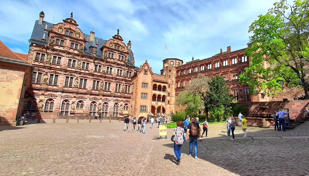
Castle inner courtyard.
The castle is a mix of styles from Gothic to Renaissance. Prince Elector Ruprecht III (1398–1410) erected the first building in the inner courtyard as a royal residence.
View from the Castle Balcony.
In the 16th and 17th centuries, the Prince Electors added two palace buildings and turned the fortress into a castle.
View towards the weir on the Neckar River.
The two dominant buildings at the eastern and northern side of the courtyard were erected during the rule of Ottheinrich (1556–1559) and Friedrich IV (1583–1610). Under Friedrich V (1613–1619), the main building of the west side was erected, the so-called “English Building”.
Prince-Elector Friedrich V had the Hortus Palatinus, a representative palace garden, installed between 1616 and 1619. Grottoes, ornate beds, intimate garden alcoves, and “magical machines” were planned across staggered terraces, for the pleasure of courtly society. However, today, it is uncertain how many of the plans were implemented. In the western area of the palace grounds, old fortifications gave way to the garden. The Artillery Garden was built here as a walled-in, private pleasure garden for Electress Elizabeth.
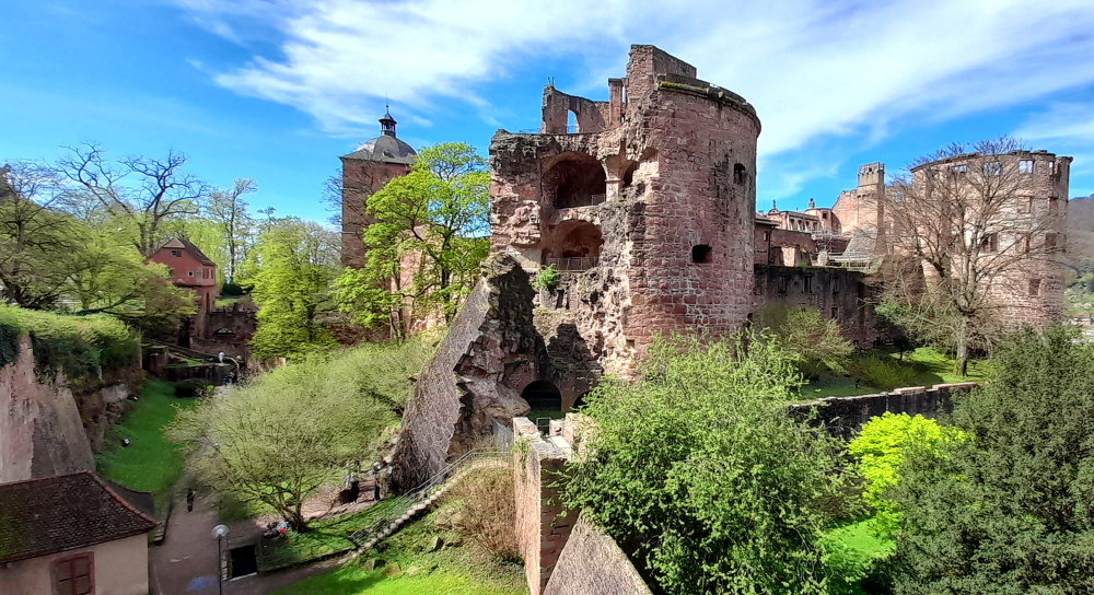
Gesprenger Turm blown up during the Palatinate War of Succession in 1693.
The castle and its garden were destroyed several times during the Thirty Years’ War and the Palatine War of Succession. As Prince Elector Karl Theodor tried to restore the castle, lightning struck in 1764, and ended all attempts at rebuilding.
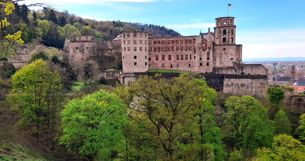
View of the castle from the Scheffelterrasse.
Later on, the castle was misused as a quarry; stones from the castle were taken to build new houses in Heidelberg. This was stopped in 1800 by Count Charles de Graimberg, who then began the process of preserving the castle.
Old Bridge view from the end of the Scheffelterrasse.
The castle is surrounded by a park, Schlossgarten, where the famous poet Johann von Goethe once walked. A bronze bust next to a large, stone bench are in his honour.
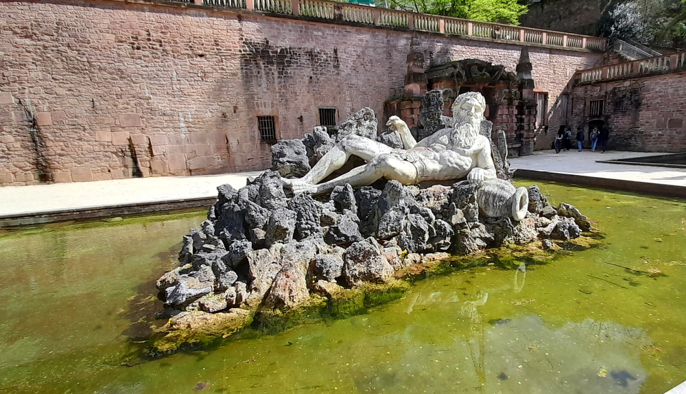
Father Rhein (Vater Rhein) sculpture in front of Large Grotto (Grosse Grotte).
At 2:45 pm we join the queue to get back onto the funicular to ascend 1 more stop to the Molkenkur station.
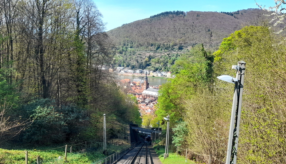
View from the funicular from Molkenkur Station.
From there, one of the oldest electrically-operated mountain railroads continues to the King’s Chair (Konigstuhl), the highest point in the city, at an altitude of over 550 metres. But, the waiting time to get this train is over an hour so we stay in the car and ride it back down to Kornmarkt Station.
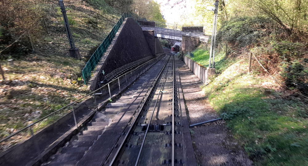
Steep descent to Schloss Station.
One of Viktor’s restaurant recommendations is the “Schnitzelbank” on Bauamtsgasse, a 10-minute walk towards Bismarkplatz. Excellent choice!
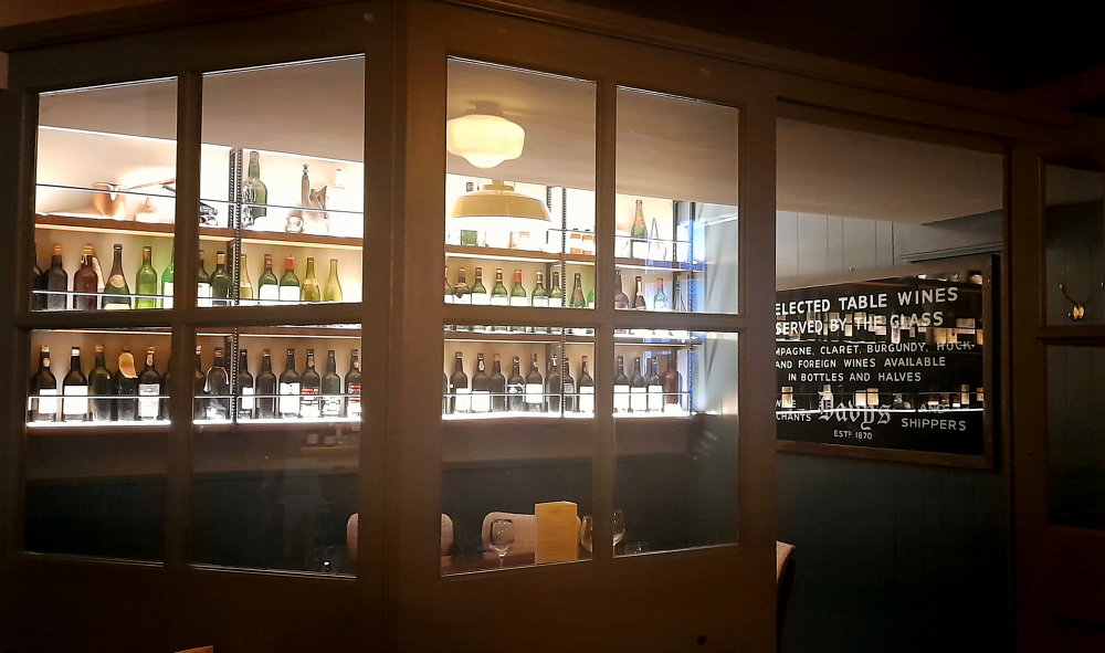
It turns out to be a hole-in-the-wall tavern. A small, rustic wine bar steeped in history, established in 1882 as a cooper’s workshop that made barrels for the local winemakers then became a bar in 1900. Indoors it’s very snug with a few former wooden workbenches for tables to share and old workshop tools for decoration. It offers authentic dishes from Baden and the Pfalz region. Outdoors there are a few tables on the pavement. Besides kitchen staff who we don’t see but hear above banging away at schnitzels, it’s run by 2 great guys who work in an impossibly small serving area with a dumb-waiter and a dishwasher.
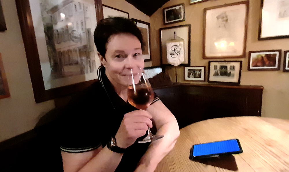
A cooling, crackling, Rose.
We opt for the cool interior after walking around in the sun the past few hours. As it’s around 3.30 pm we get a table to ourselves and indulge our taste buds with delicious classic schnitzel dishes accompanied by salad, potatoes and noodles, washed down by a chilled pils and a semi-dry rose.
When I ask my standard question to one of the waiters whether there is WiFi, he chuckles and says, “Sorry. You’re here to eat, drink and talk!”
Wooden workbenches & old tools decorate this small tavern.
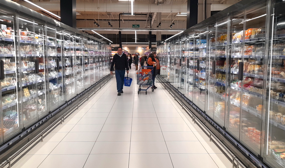
Time to walk back to Bismarkplaz and catch a No. 22 tram to the Aparthotel. While Lynn goes to the local Alnatura supermarket I put on a couple of loads of laundry. Long story short, the hotel’s guest laundry is busy (including a hotel guest who doesn’t understand the WeWash app and tries to highjack our washing machine, mid-wash!) and by the time the tumble dryer finishes its 2.5 hour cycle (!) it’s midnight.
7 April 2024
Another sunny, 24 Deg. C. day. Thanks to the late night we have a late start to the day which is taken up with ironing, packing and catching up on 2 days of blog.
Tomorrow we drive 275 km over 3 hours to a self-catering holiday home in Altenburg, Germany which is just down the road from Rheinfall, Switzerland, for a couple of days.
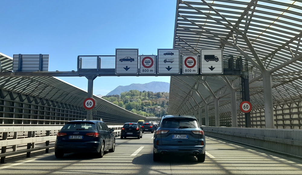
8 April, 2024
By the time we hit the road at 11:00 am it has clouded over but it’s 26 Deg. C. Originally we were going to take the 5, 8, 81 roads past Stuttgart to the Swiss border but just before we are to take the 8, I get a traffic notification that there is a 17-minute tailback so we continue on the 5.
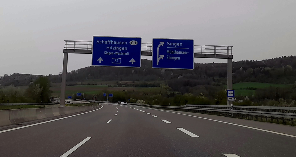
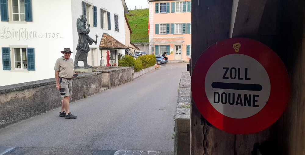
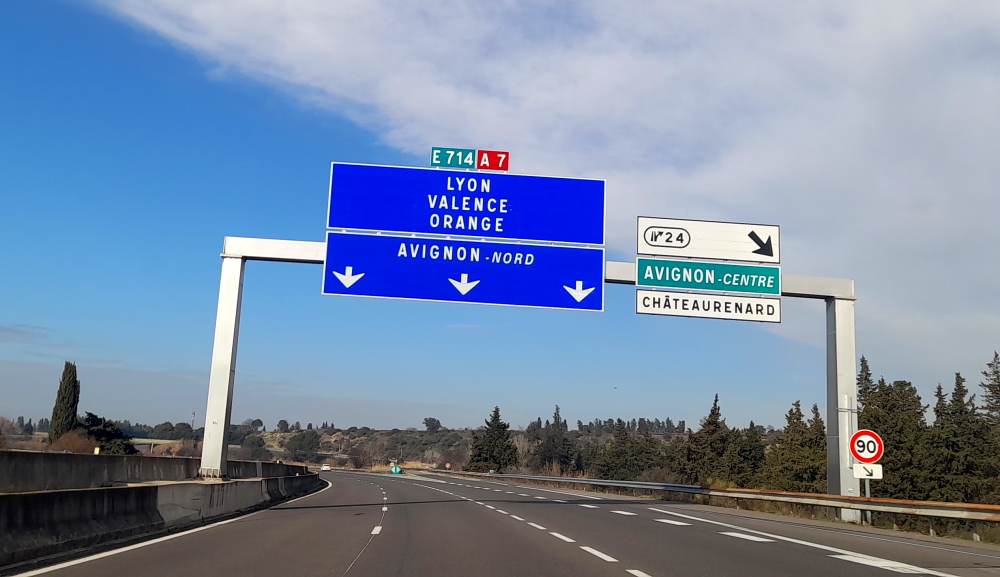
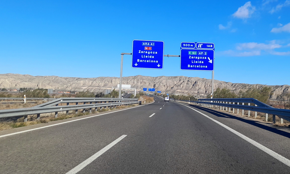
Road sign to CH – Switzerland.
The GPS ends up taking us to Freiburg im Breisgau, over some hills to join the 81 just outside of the border – an extra 60 km and an extra hour. Which is why I love German autobahns with no speed limits. Got the Insignia up to 161 kph!
In the meantime it starts to rain and I discover that the left windscreen wiper blade is disintegrating. Now, it would have been useful to have found this out yesterday as our hotel was directly over the road from an Opel dealership!
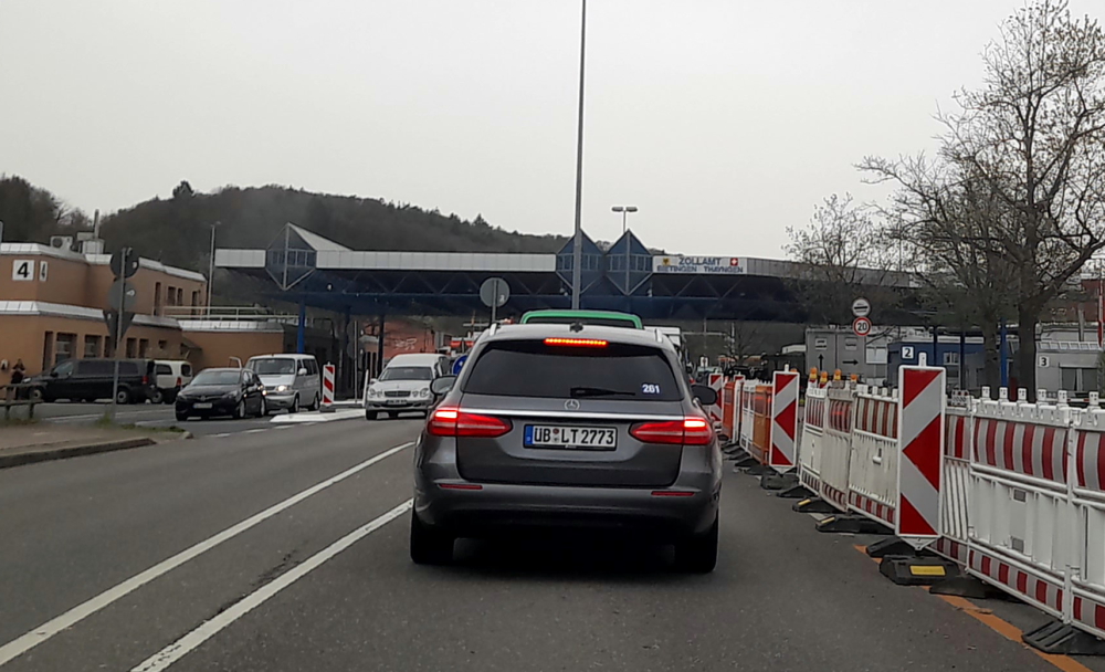
Swiss border near Thayngen, Switzerland.
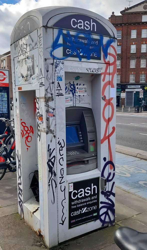
Although there are plenty of Swiss border guards at the barrier the booths are unmanned so we drive through and stop immediately at a cash point to purchase our mandatory highway vignette for Eu40 and stick it on the windscreen. They are valid for 14 months from 1 December of the preceding year through to 31 January of the following year – i.e. ours will expire on 31/01/2025.
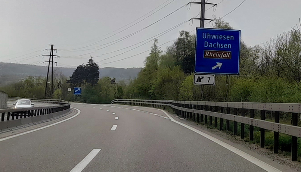
Turnoff to Rheinfall.
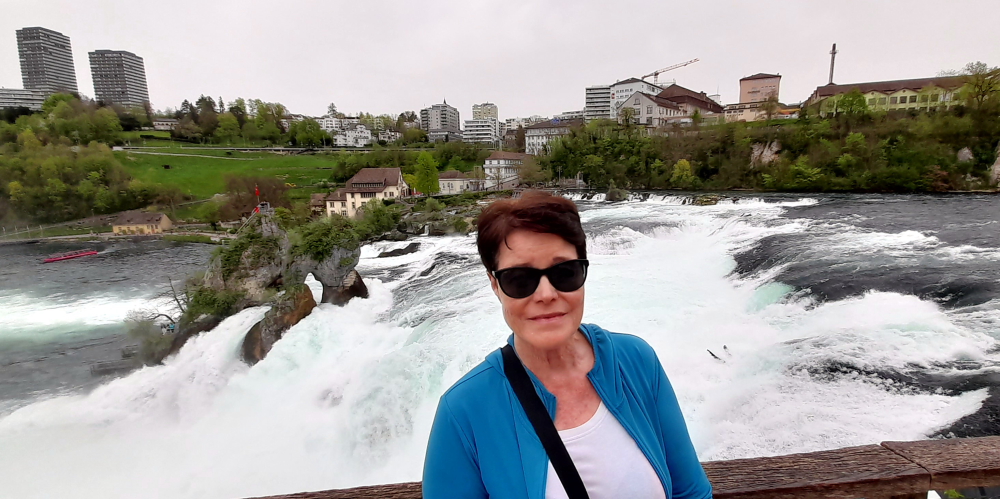
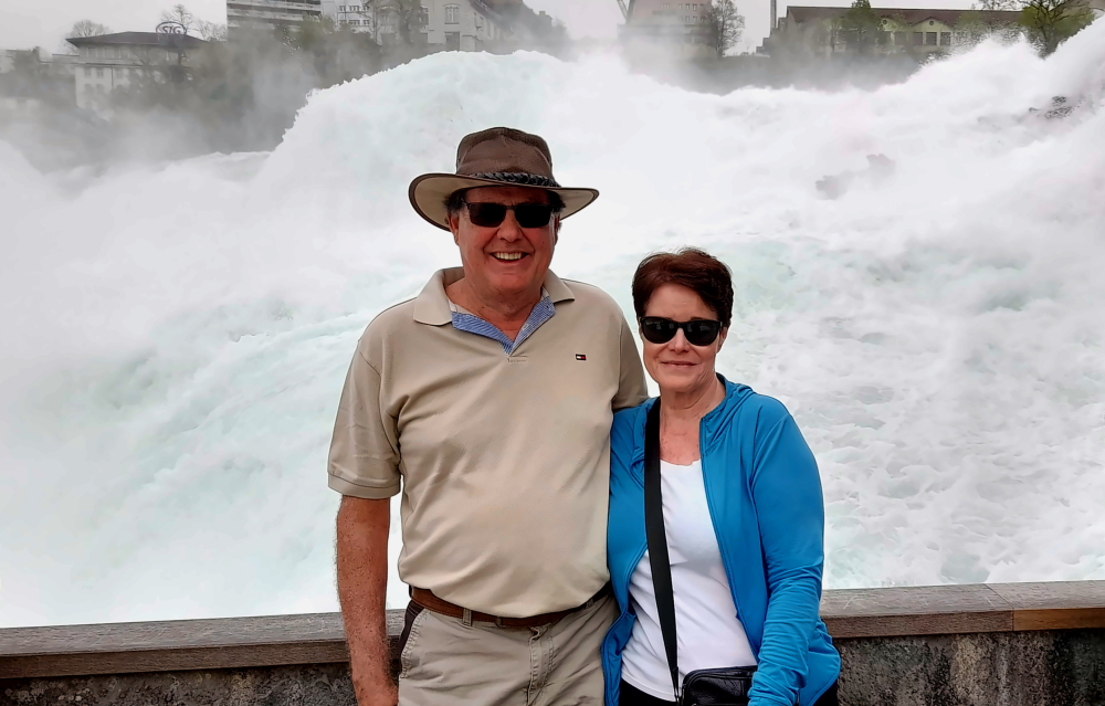
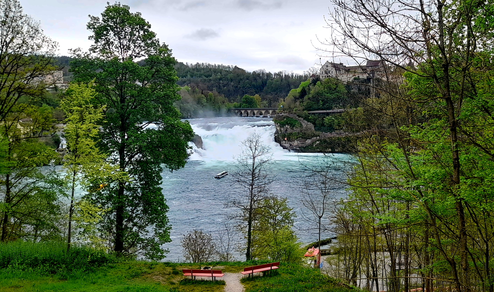
Also, our original plan in staying at Altenburg for 2 days was to visit the awesome Rheinfall but as the weather forecast is to change tomorrow to over 90% rain and the temperature to drop from 26 Deg. C to 14, we decide to call in on our way.
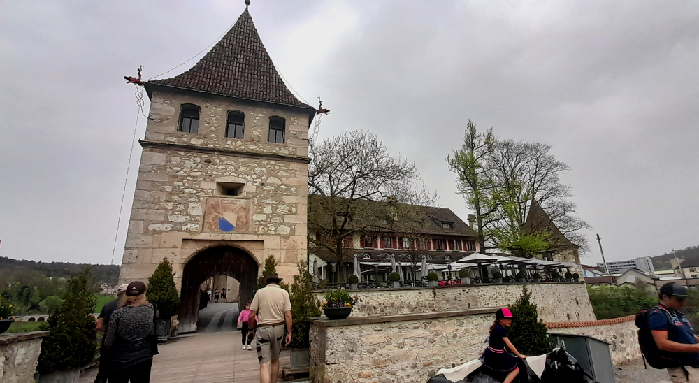
Laufen Castle entrance to the Falls.
When I was last here around 2005 it was free to view this amazing natural phenomenon. Now, it’s CHF5 for parking and CHF5 each to go through the turnstile!
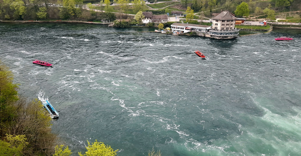
Boats embark from the opposite side of the river & travel to the base of the falls.
And, last time there were no boats. Now there are several that embark from the opposite side of the river and either motor to the base of the falls or one will actually drop you off at the rocky outcrop mid-stream.
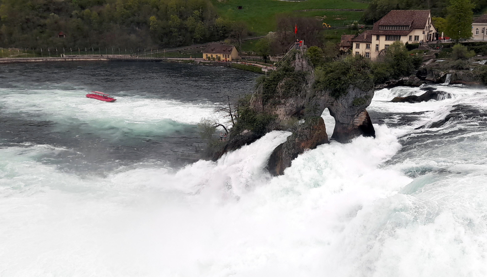
Rocky outcrop in the middle of the Rhine River & Falls but sports a Swiss flag.
Honestly, this place is becoming just like the Niagra Falls’ experience, but with smaller boats!
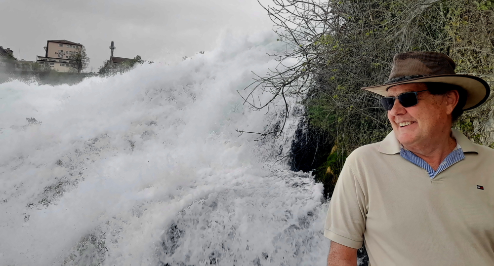
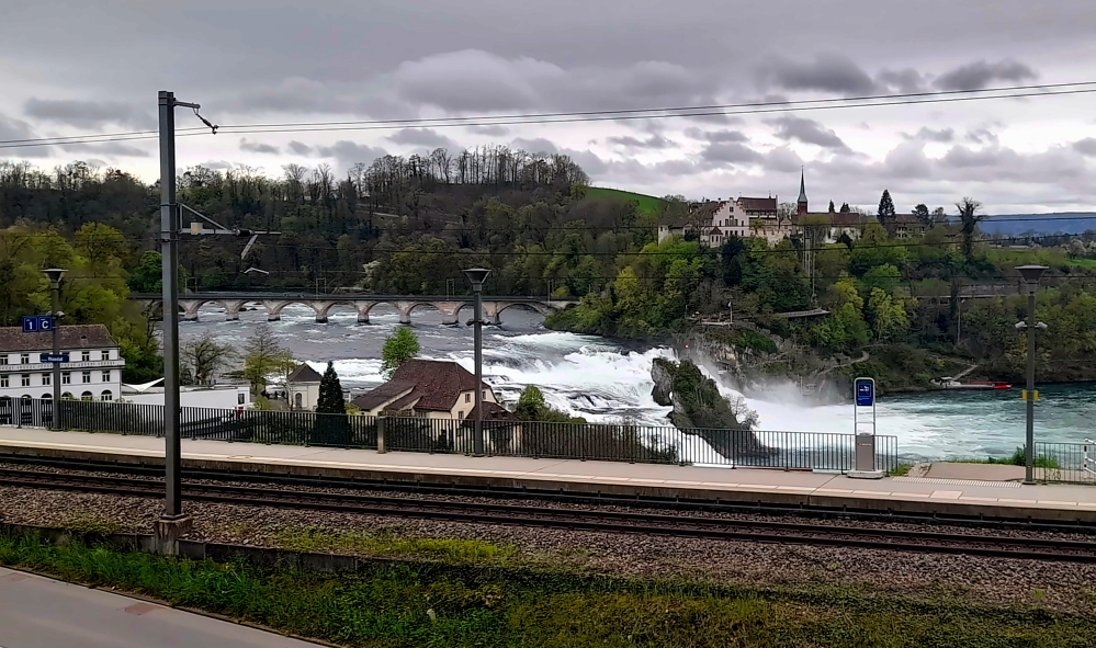
Commencement of the falls.
The Rhine Falls, formerly also called Grosser Laufen, located 4 km SW below the city of Schaffhausen, is one of the 3 largest waterfalls in Europe.
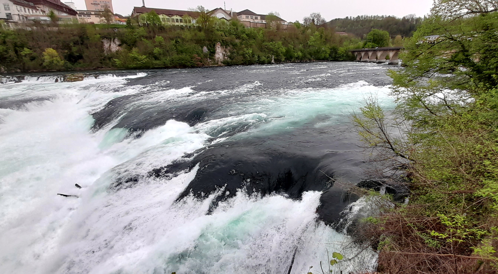
Falls with the town of Neuhausen on the opposite bank.
The others are The Sarpsfossen in Norway, which is equally high, and the Dettifoss in Iceland, which is twice as high. The Sarpsfossen has an average of 577 m³/s with more water, while the Dettifossen only has about half as much water.
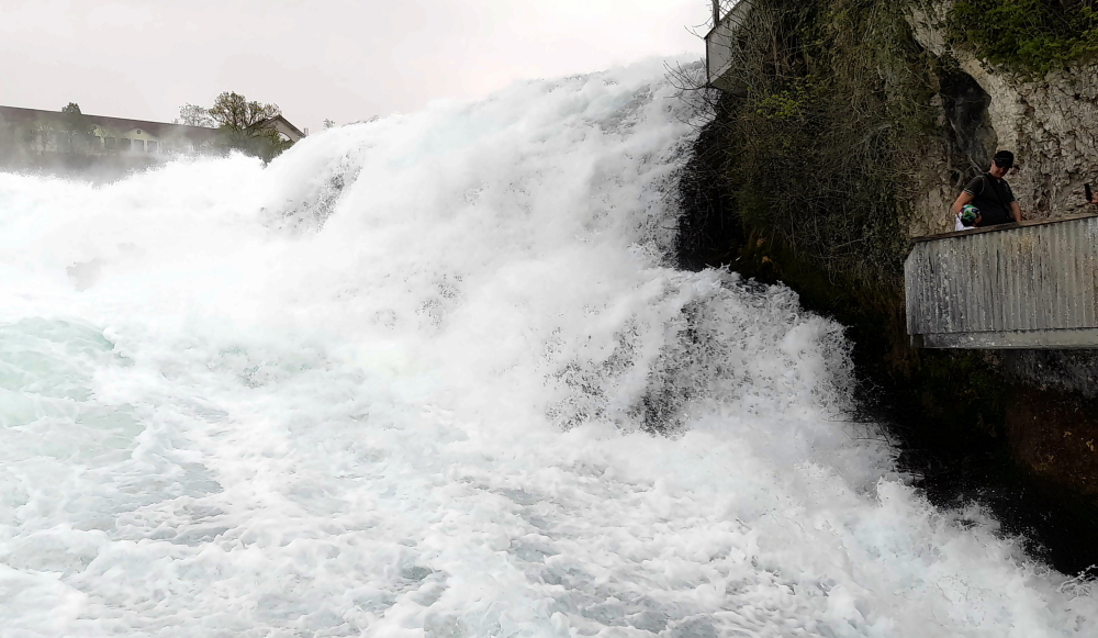
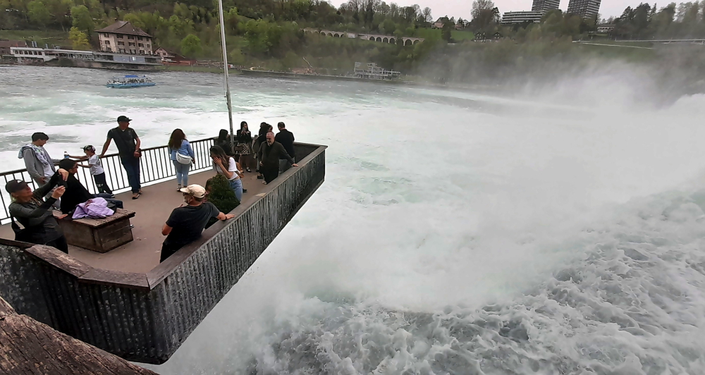
Fischetz – the highest of the viewpoints.
The reason we are here today is because we gave the one in Norway a miss as it was too far off our route to view it, when we could so easily come here.
Middle viewpoint with Fischetz viewpoint just visible above it.
The Rhine Falls is 23 metres high and 150 metres wide. The scour in the impact zone is 13 metres deep.
Kanzeli – the lowest viewpoint – a protruding platform over the rapids.
At average water levels in the Rhine, 373 cubic metres of water per second fall over the rocks in the Rhine Falls (average summer discharge: around 600 m³/s). The highest flow rate was measured in 1965 at 1250 cubic metres, the lowest flow rate was in 1921 at 95 cubic metres/second. The outflow was similarly low in 1880, 1913 and 1953. In 2013 it was visited by 1,300,000 visitors.
On Kanzeli platform – behind you!!!
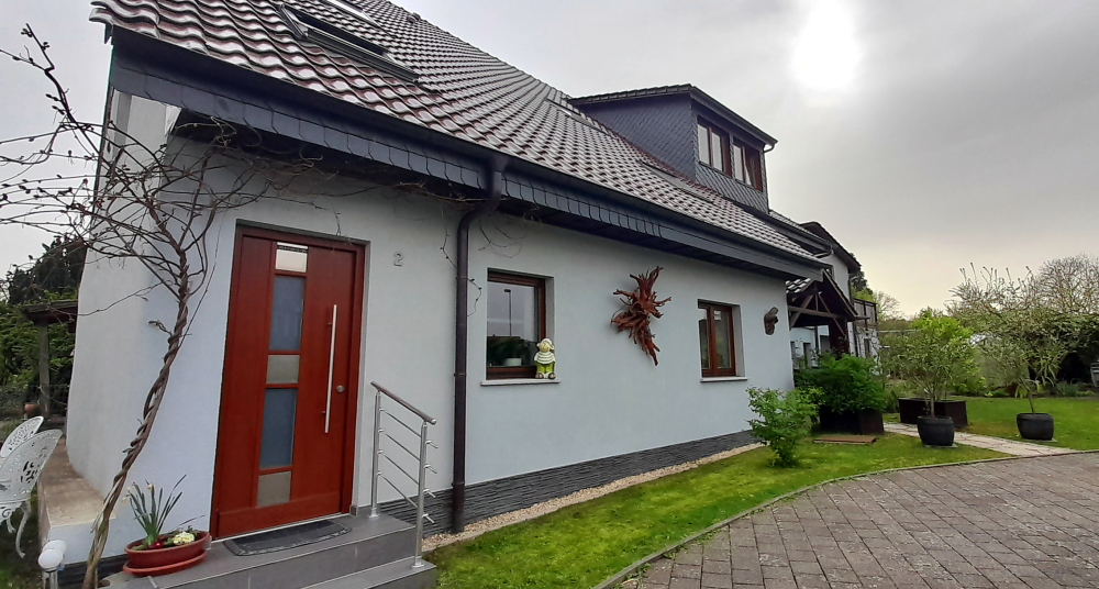
After a quick stop at a nearby supermarket we drive the 10 minutes’ to our accommodation in Altenburg. This involves crossing back into Germany at a small, semi-derelict, closed border control building at a rural T-junction.
Schellenberg 2, Altenburg.
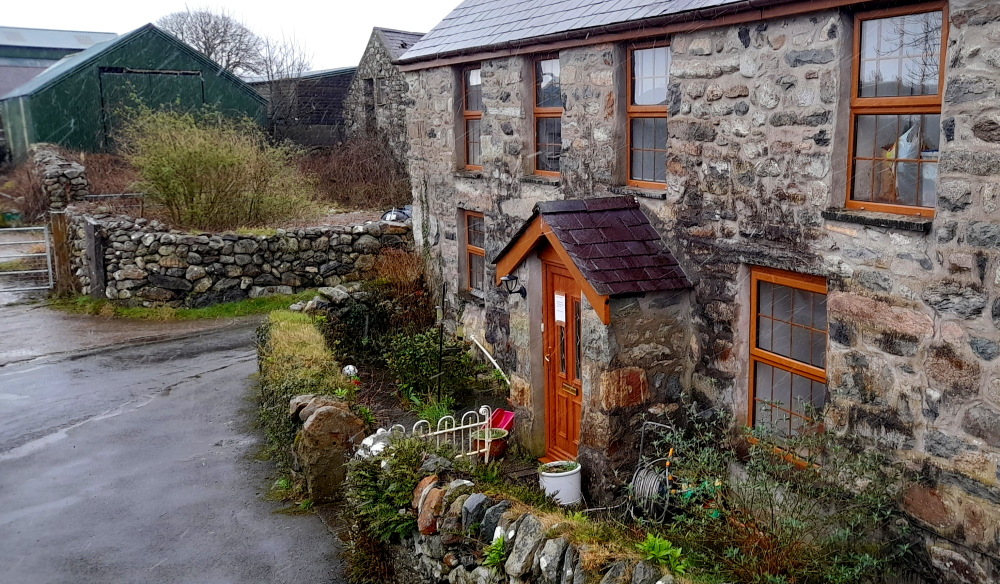
It turns out that our small cottage, adjacent to the owners’ house (to the right) is also attached to a much larger, and old-style farmhouse at the rear which has a yard. In this small community, there are a number of older-style, large farmhouses, interspersed with smaller, newer dwellings.
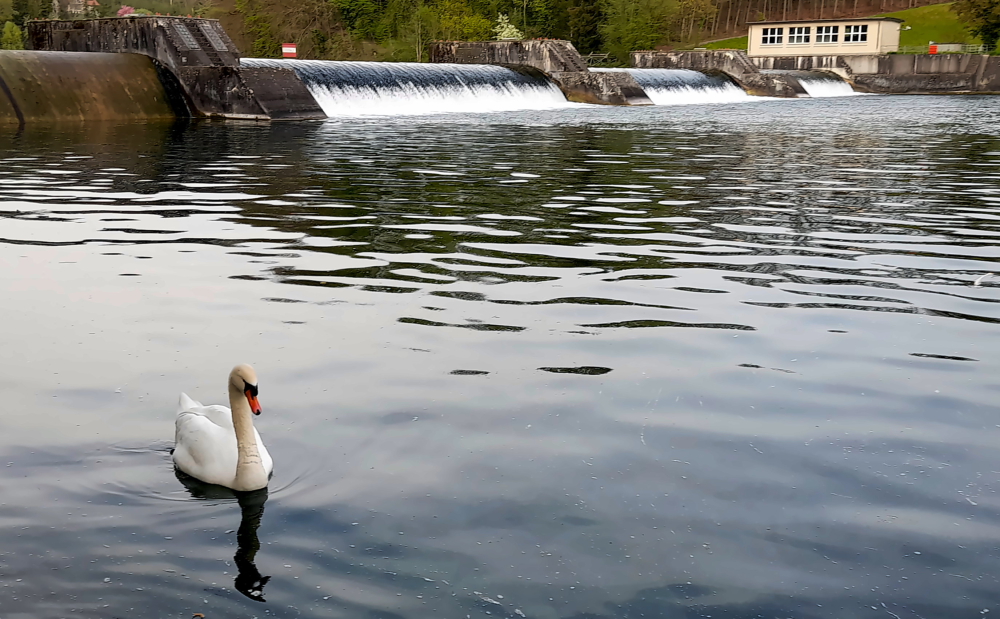
Rhine River – upstream.
And the Rhine River is just a 5-minute walk away, so after a quick unpack we head out the door, walk part way down Trottenberg (street), then take a small downhill path past people’s grassy backyards until we arrive at the shoreline.
Rhine River – downstream with covered bridge in the distance.
It’s difficult to imagine that we are downstream from the turbulent waters of the Falls, as the water is almost at a standstill. So still and clear that we can easily see the vegetation on the bottom.
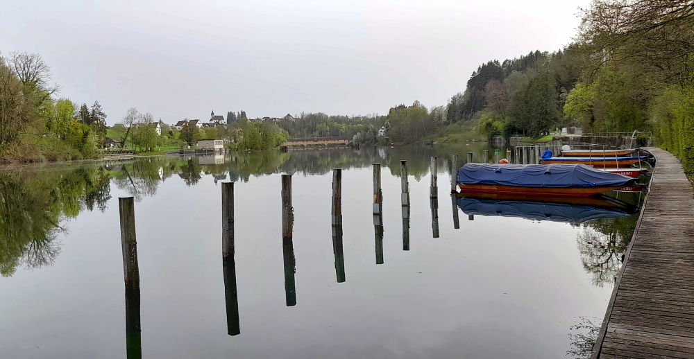
Small weir.
Part of the reason for the water’s stillness is a small weir between where we arrived at the shoreline and the covered bridge further downstream.
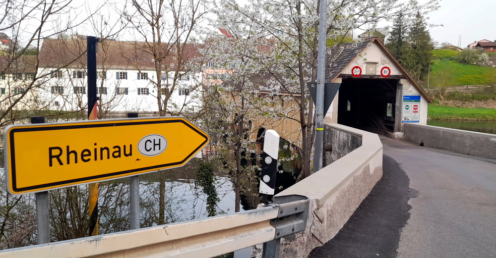
Zollbrucke to town of Rheinau.
When we arrive at the bridge we discover it’s the border between Germany and Switzerland, again. Switzerland is on the other side with the border actually running down the middle of the river.
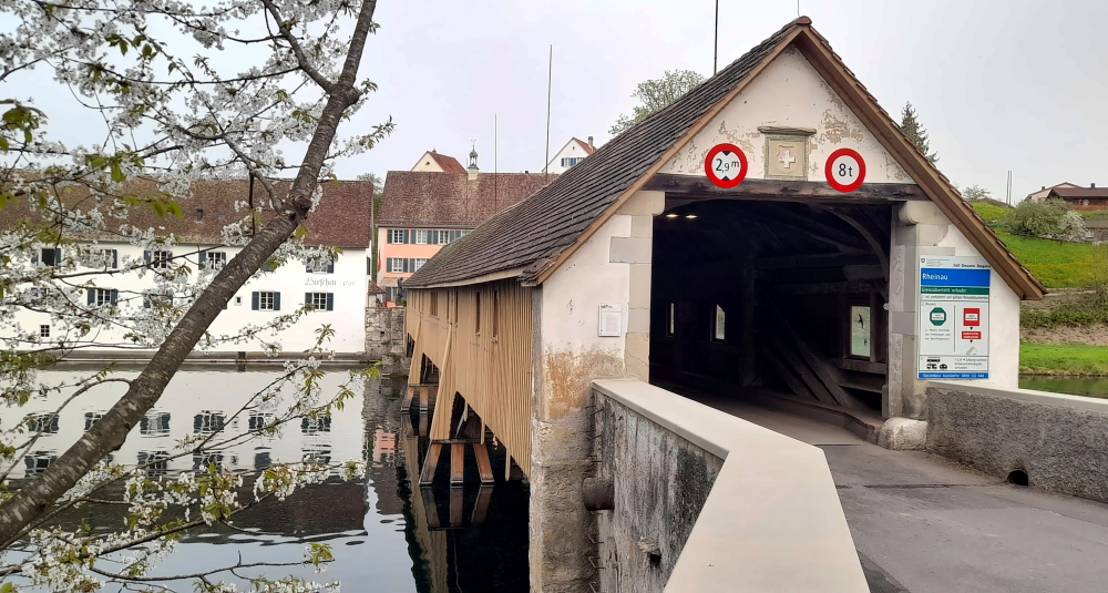
The Rheinau-Altenburg Rhine Bridge.
The Rheinau–Altenburg Rhine Bridge is a road bridge that spans the High Rhine and the border between Switzerland and Germany. The covered wooden bridge is designed for one lane and is one of the rare pile bridges today.
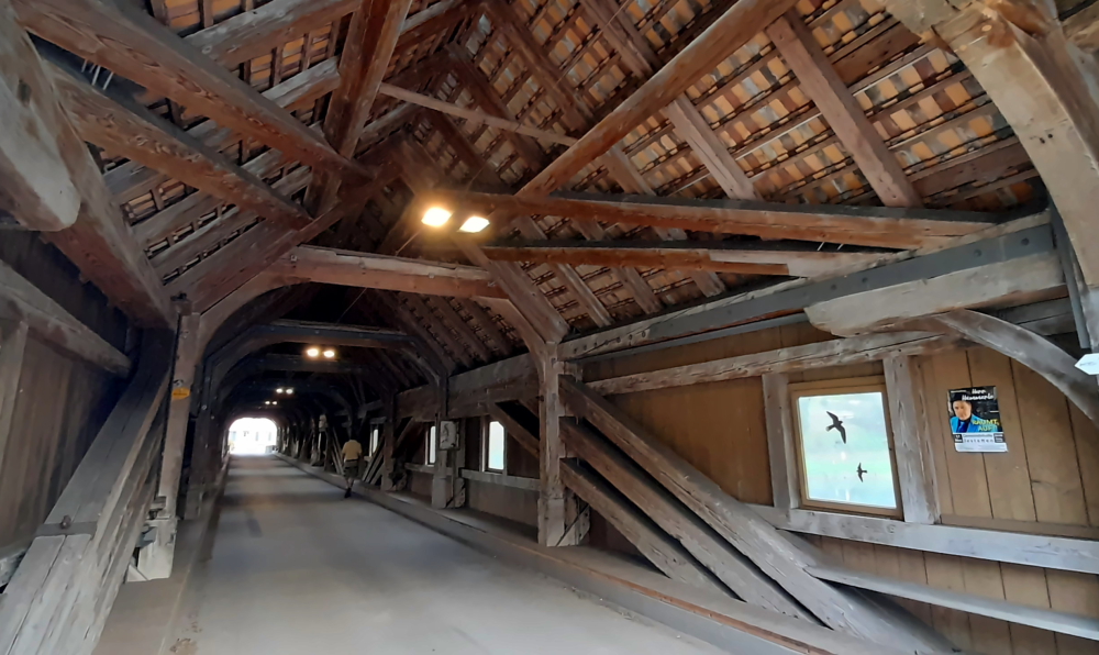
Wooden interior of the bridge.
The first references to a Rhine bridge near Rheinau date from the year 1247 and it was documented in 1324. The narrow, covered wooden bridge with four to five pile bays was mentioned in a purchase agreement in 1355 by the Rheinau abbot Heinrich V. von Aitlingen and initially served the Rheinau monastery as a connection to its lands on the northern side of the Rhine.
From 1444 to 1799 the bridge was subjected to damage during numerous wars. Between 1804 and 1806, Blasius Balteschwiler built the current oak structure on behalf of the Canton of Zurich for 6,600 guilders. Major repairs were carried out in 1885, 1918-1930 and 1954 with extensive repair work costing 2 million francs in 1988.
Swiss side with bronze statue of patron saint, Saint Nepomuk replacing the 1732-1872 sandstone one.
As we are retracing our steps I see a flurry of bubbles hit the river’s surface which to me indicate there are divers below. Sure enough, it is a dive site due to little current, high visibility and the canyons and sinkholes in the Rhine.
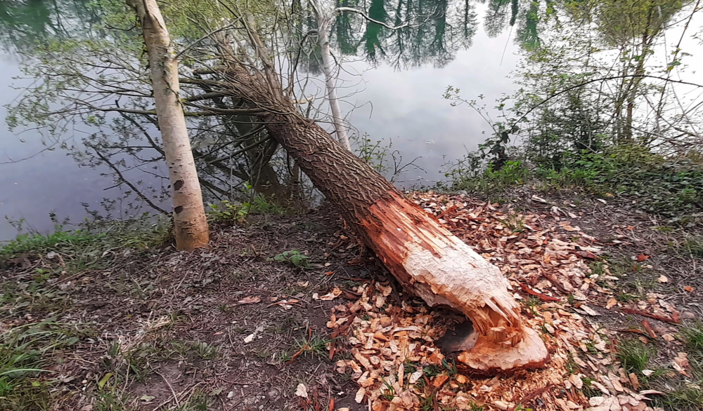
Beavers???
On the map we see that we can take the shoreline path past our entry point to a path that joins Trottenberg. We pass by a tree that has been felled into the river by what appears to be by axe, except there are teeth marks on the trunk! Beavers?? And apparently there are, along the Rhine between Lake Constance and Basel and we are halfway along that route.
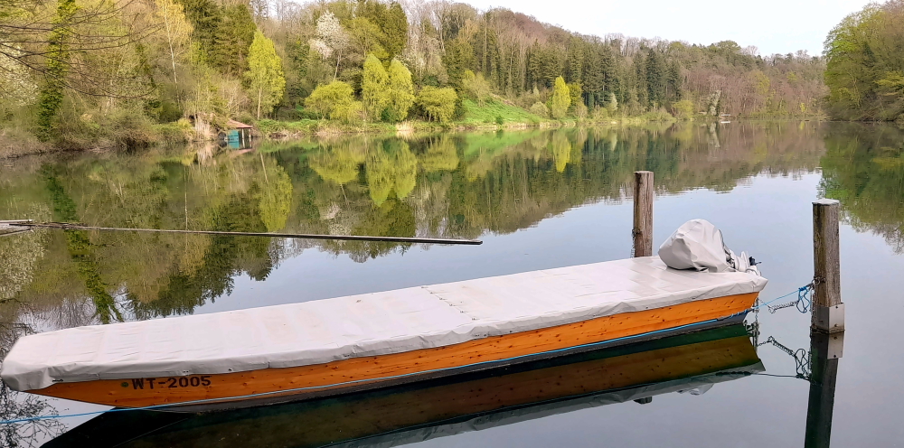
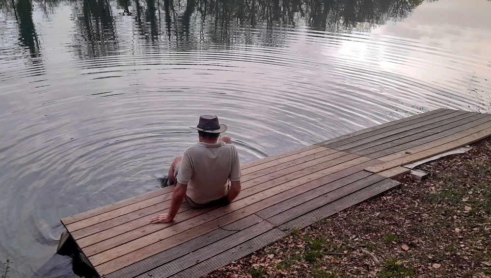
Huck Finn – sans fishing rod.
At the point where the track joins Trottenberg there is a space where several long, streamlined canoes are stored by the shore. Here we wash the soles of our boots from the muddy patches we’ve walked through. It is just so quiet and peaceful sitting here on the decking.
9 April, 2024
No rain yet, but it’s 9 Deg. C. outside. Brrr!
Yesterday, when driving along the road from the supermarket to our accommodation, we saw the Falls from the other side of the river and the imposing Laufen Castle above on the Zurich side. So we pop out over the border to get a photo this morning.
Laufen Castle above the Falls.
Unfortunately, there are no places to park to take a shot on Nohlstrasse, so I have to park briefly in a private car park while Lynn scampers about trying to capture the scene – hindered by a railway line, traffic, trees and overhead cables.
Interestingly, as we drive back to Altenburg, past the closed, old border post, there’s a black van filled with border guards parked out front!
View of the Castle & Falls further downstream.
We spend the rest of the day catching up the blog and getting organised for our drive tomorrow which will take us further south into central Switzerland to Beckenried on Lake Lucerne.
10 April, 2024
Today’s trip is around 120 km that should take us about 1.5 hours. At 10:00 am when we depart it’s sunny and 10 Deg. C. We have at least 2 stops on the way: 1 to refuel and the other to purchase new windscreen wipers. But, before then, 12 minutes later we cross back into Switzerland at Rafz-Solgen.
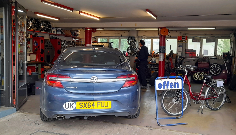
Getting new windscreen wiper blades fitted at Glattbrugg.
The A51 takes us around Zurich airport and about an hour after our departure I find a small servo that has an even smaller auto workshop attached in Glattbrugg. For CHF50 we get new, flexible blades and the guy even fits them for us. Hoorah! (Incidentally, turns out to be a good price as they would have cost the same in Australia, but unfitted!)
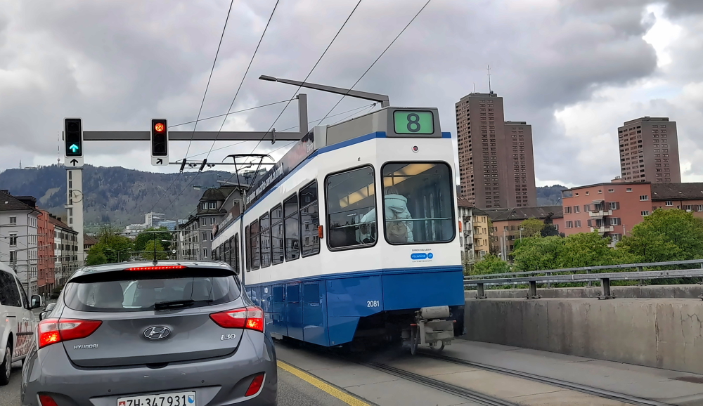
Driving through the suburbs of Zurich.
I want to avoid the direct route to our next destination as it will take us through Lucerne.
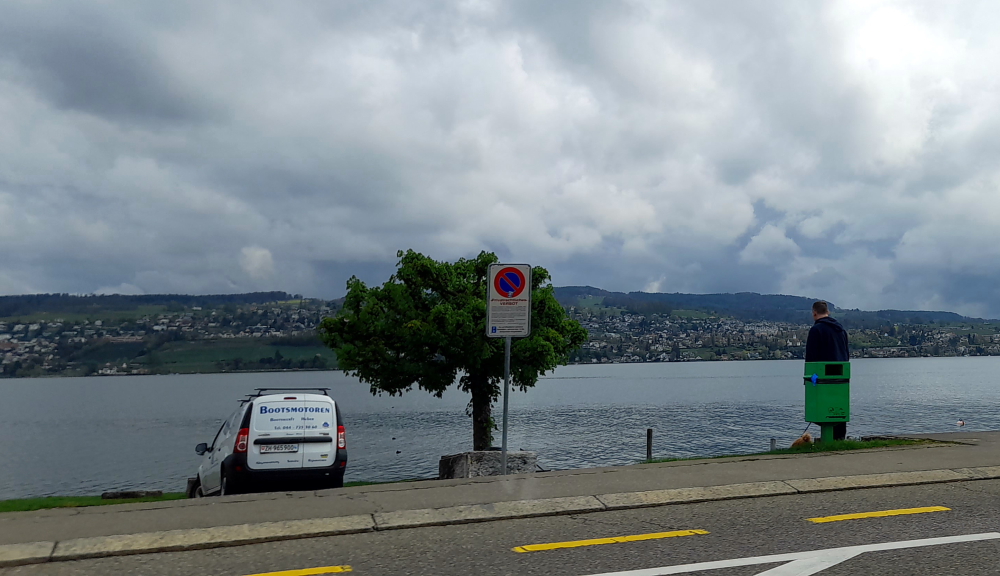
Driving alongside Lake Zurich (Zurichsee) near Thalwil.
Instead, we take the 3 road SE that hugs Lake Zurich past Thalwil, where we stayed in 2012 when we visited Meg, Nev and the kids, until Wollerau where we take the 8 south across the hills. It’s now raining but the new wiper blades are working a treat.
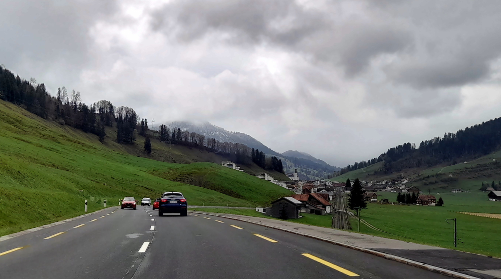
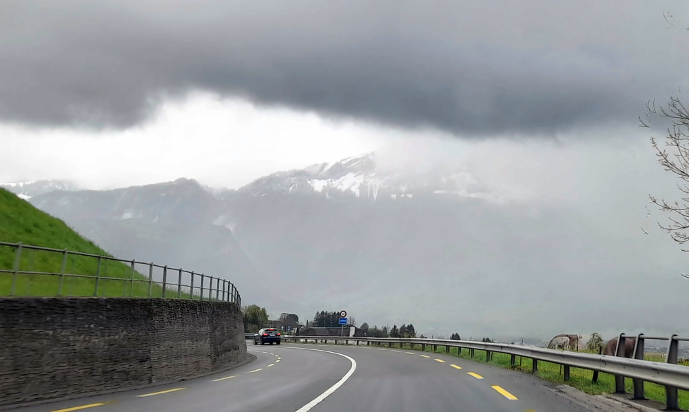
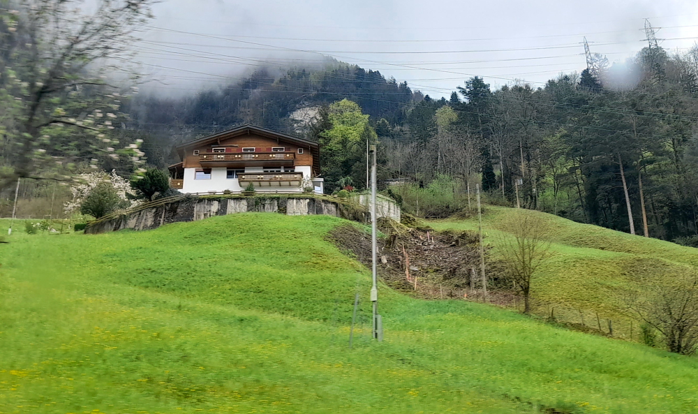
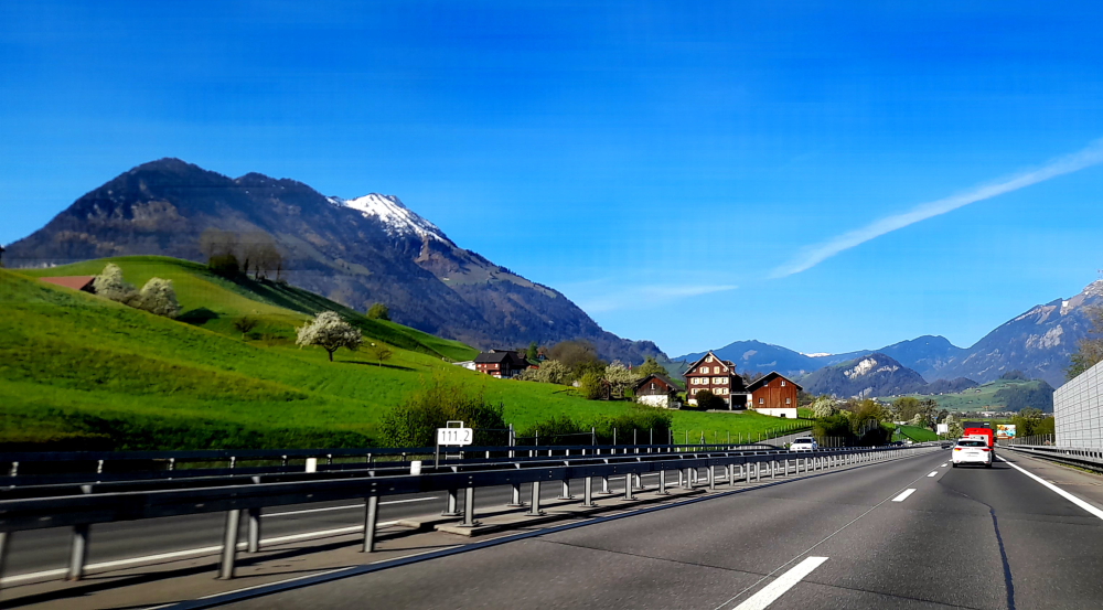
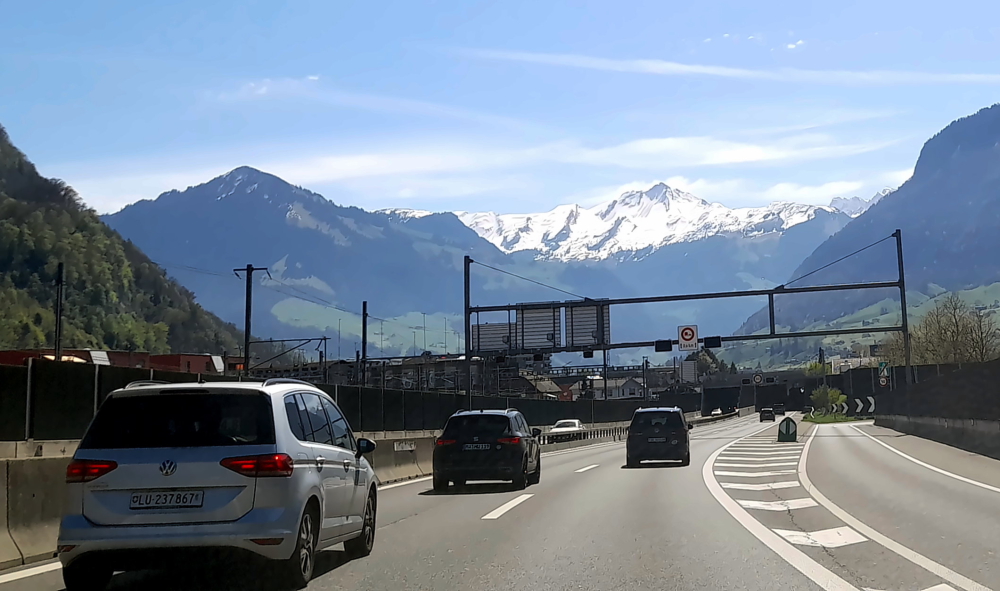
Steep, green slopes & snow-covered hills.
The landscape changes to steep, green hills with snow-capped hills looming in the distance. It’s now 5 Deg.
Road near Seewen.
In need of a pit stop, we cut down to Seewen on the shores of Lauerzersee (Lake Lauerz).
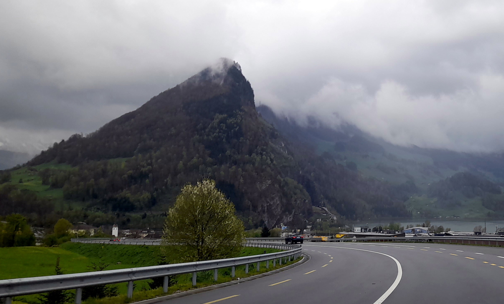
Dramatic geology at Seewen on Lauerzersee.
Soon after, having driven through the 1.1 km Mosi Tunnel that bypasses Ingenbohl, we are driving on the A2 that hugs the shoreline of the southern branch of the next lake, Lake Lucerne.
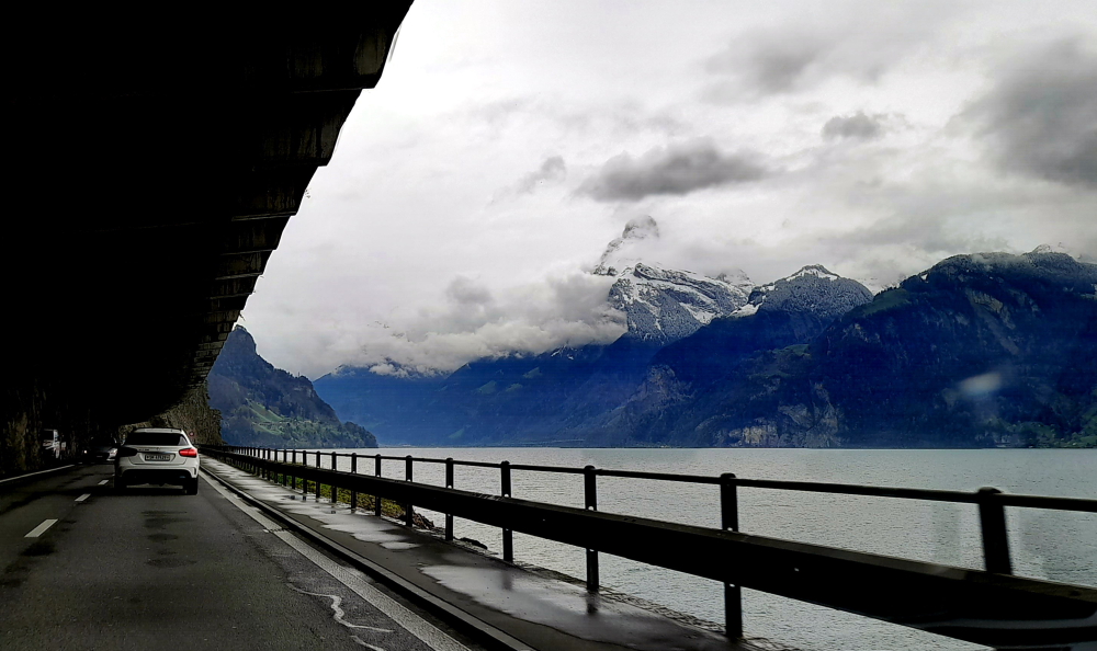
Axenstrasse, Lake Lucerne.
Along this part of the shoreline, on Axenstrasse, we are driving either through short tunnels or under massive concrete overhangs with impressive mountainous views across the lake.
Typical dwellings & landscape near Sisikon, Lake Lucerne.
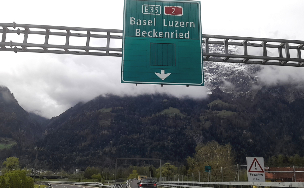
Finally, at Fluelen, at the bottom end of the lake, we see a sign to our destination, Beckenried.
Sign to Beckenried at Fluelen.
From here we drive NW up the lake, through the 17 km Seelisberg Tunnel, to our lakeside hotel at Beckenried Neiderdorf and arrive around 1:00 pm – in sparkling sunshine!
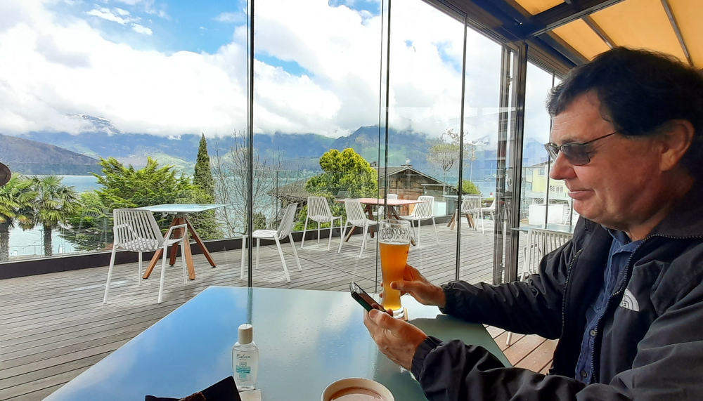
A refreshing drink while we wait for check-in.
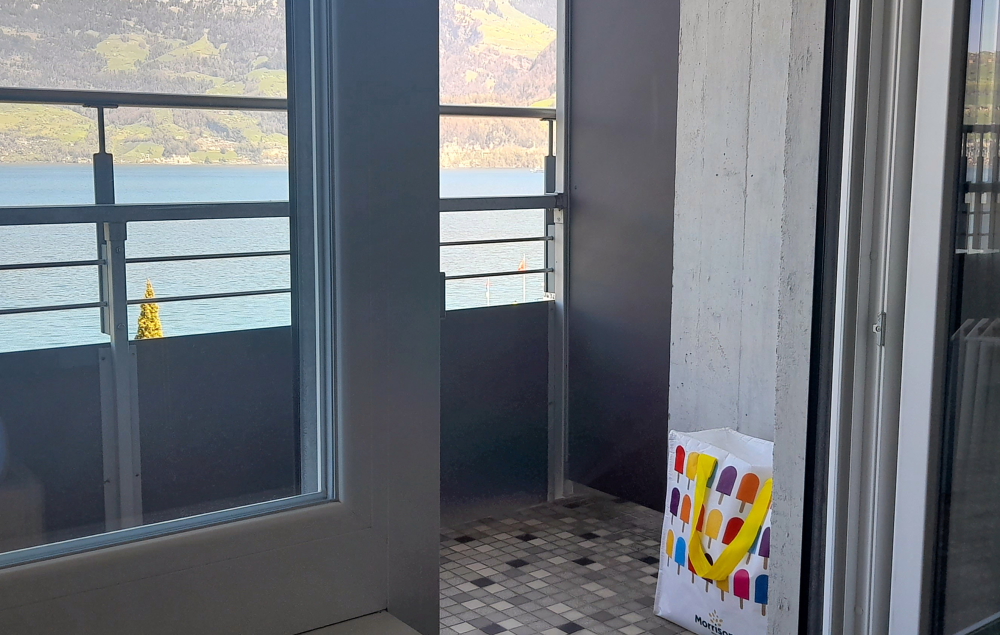
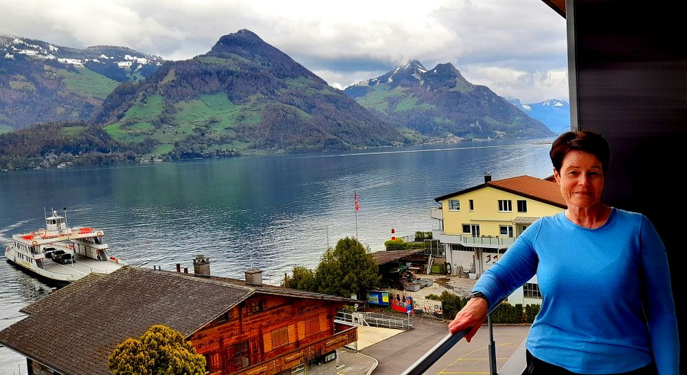
While we wait for our room to be ready we take advantage of the hotel’s terrace and its gorgeous views over the lake. About an hour later we move in, unpack and have a cuppa with chilled milk from our cold bag (no minibar in our room) which we’ve located on the balcony. With the balcony out of the sun, cold overnight temperatures and the freezing balcony tiles it’s up to the task!
Our DIY fridge.
Around 4:00 pm we decide to walk the 20 minutes into the village of Beckenried to check it out and also the bus and ferry transportation options into Lucerne.
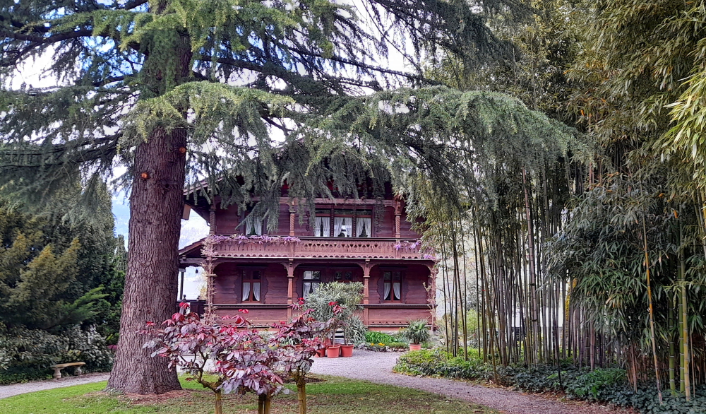
Ermitage – public park in Beckenried.
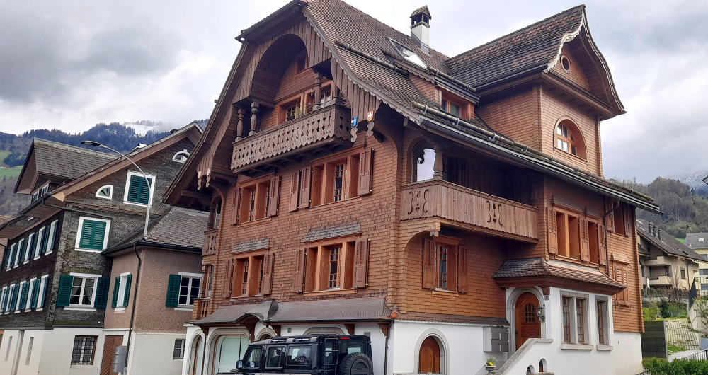
The town is full of both traditional, wooden shingle or carved wooden houses and ugly, newer tiled ones.
One of the more traditional dwellings in Beckenried.
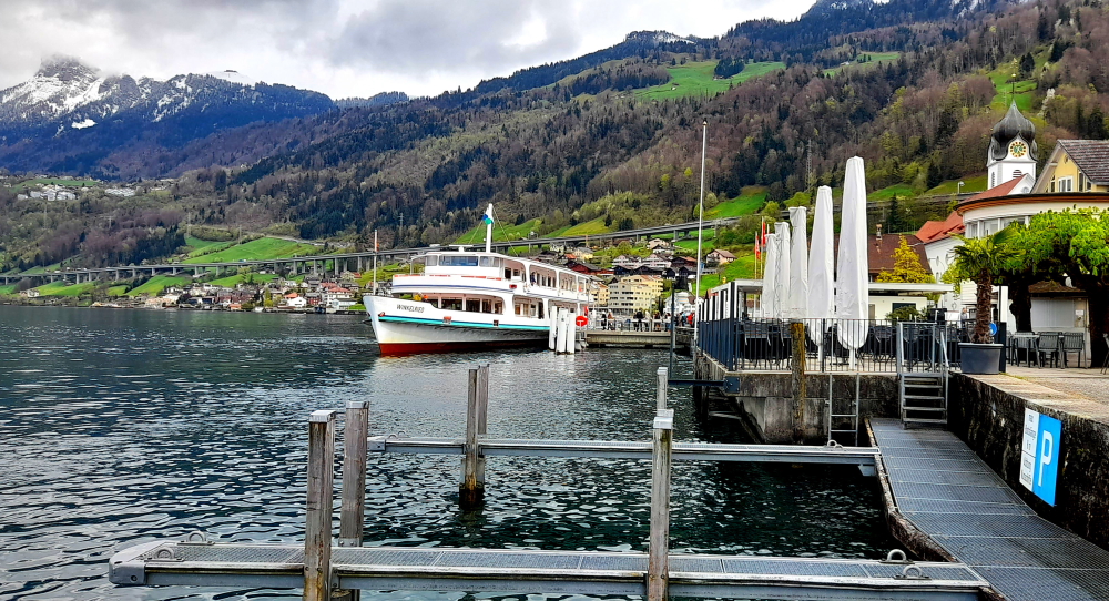
At Beckenried village there is the terminal for the passenger ferry that goes to Lucerne, whereas next door to our hotel is the car ferry that crosses the lake.
View NE up the lake towards Ingenbohl.
Our original plan was to take the passenger ferry to Lucerne and return for a day trip. After our inquiries today we discover that it would cost us CHF64 each and a total of 2.5 hours. To take the bus and connect to the train in Stans would cost us CHF20 each and 2.5 hours.
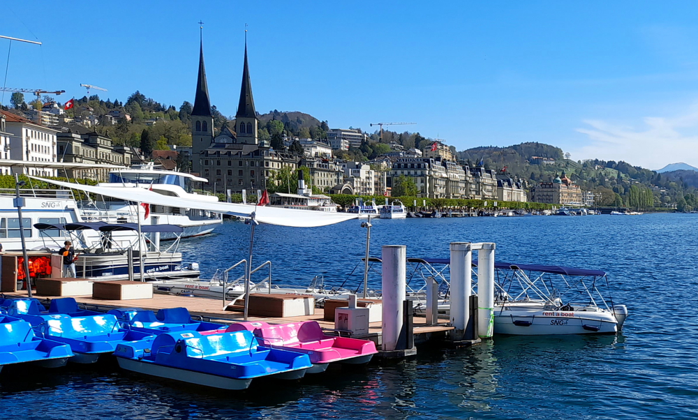
The passenger ferry to Lucerne.
Taking the car has won out as it will cost us CHF8 for 3 hours’ parking, CHF8 for fuel and 45 minutes. That’s CHF128 v CHF40 v CHF16 or, the Ozzie equivalent of AUD215 v AUD68 v AUD26. Obviously the Swiss have no interest in promoting cheap, public transport! Perhaps they could meet their zero emissions targets but promoting public transport.
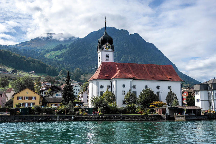
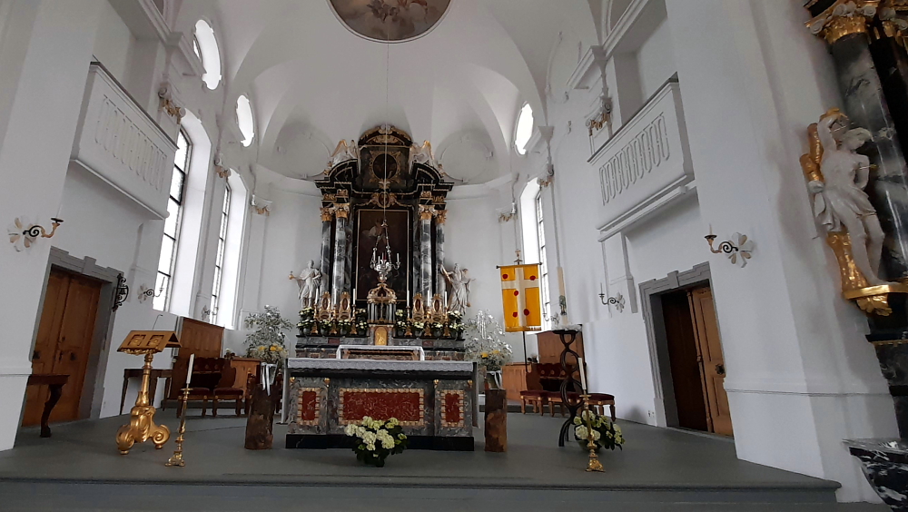
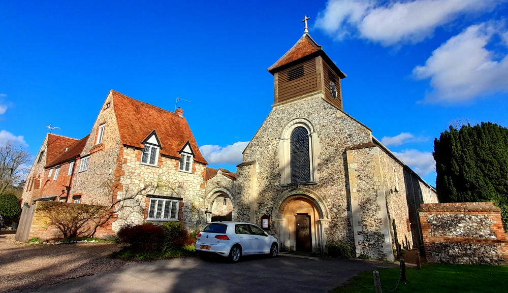
Across the road from the passenger ferry terminal is St Heinrich’s Church. A first chapel (Heinrich’s patron saint) is mentioned as early as 1323. Today’s church was constructed by Niklaus Purtschert in 1792-1807. Inside it has baroque features reminiscent of the Catholic churches that Lynn saw in Austria.
Katholische Kirche St. Heinrich, Beckenried (photo by Phyllis Taylor).
As the above photo by Phyllis Taylor (uploaded to fineartamerica.com on 26/07/2019) conveys both the beauty of the church and the town far better than our meager street shot and only possible from a boat, we’ve used it instead.
Altar, St. Heinrich Church.
An interesting fact that she mentions is that the church has its own boathouse on the lake!
The town also has a cable car that travels up the mountain called Klewenalp which is behind the town. Sadly, it’s closed for maintenance until May.
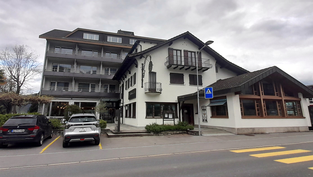
Street view of our Hotel Seerauch, with modern extension at the rear.
We get back to the hotel around 5:00 pm then head to its restaurant an hour later.
View from our balcony with car ferry about to dock.
Glad we don’t plan on eating here every night. Lynn has consomme (CHF13 – AUD22) and I have a small chicken breast (CHF32 – AUD54). We avoid alcohol and have a carafe of tap water instead – even that cost CHF2.50 (AUD4.20). What a joke!
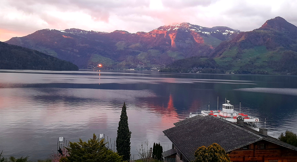
Sunset across the lake.
Fortunately, the colours of sunset make up for it – priceless!
11 April, 2024
Although a top of 15 Deg. C. and sunshine is forecast for today we decide we’ll have a rest day to enjoy the gorgeous view and will drive into Lucerne tomorrow as it’s due to be sunny and 19.
Alarmingly, we sit and watch the snow on the opposite hillsides melt before our very eyes!
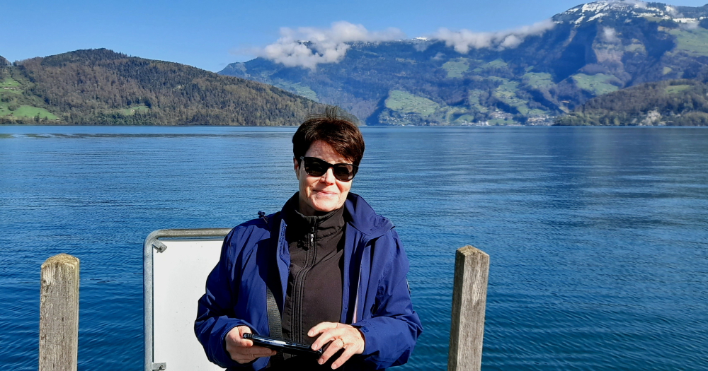
Hotel pier.
After a late breakfast we walk down to the piers in front of the hotel.
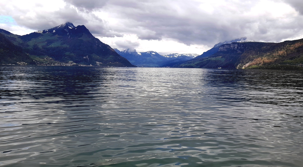
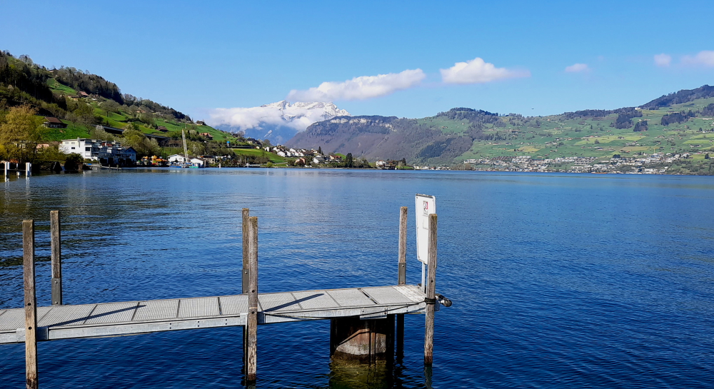
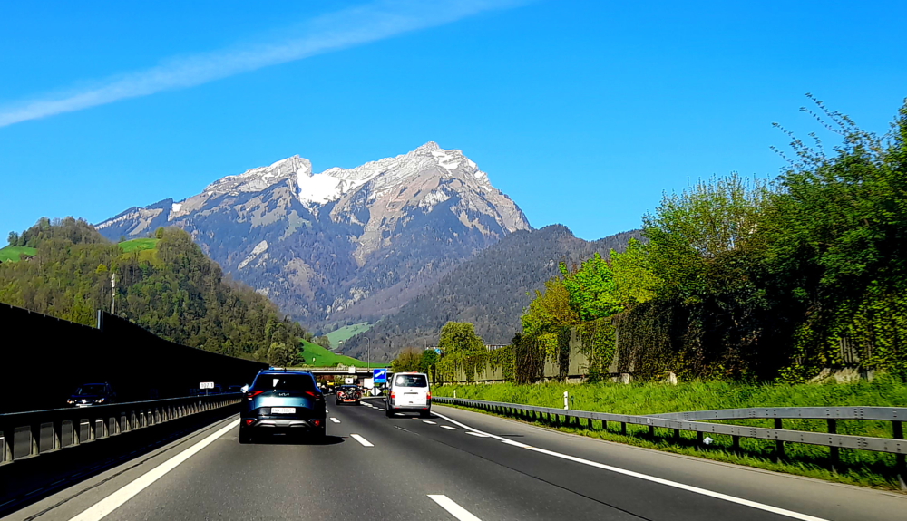
Mt Pilatus – view from the shoreline.
Here we get a better view of the mountain towards the west which is Mt Pilatus. The mountain is composed of several peaks, the highest (2,128.5 m) is named Tomlishorn. During the summer, the “Golden Round Trip” — a popular route for tourists — involves riding a boat from Lucerne across its lake to Alpnachstad, ascending on the cogwheel railway, descending on the aerial cableways and panorama gondolas, and catching a bus back to Lucerne. I hate to think what that would cost! Luckily we couldn’t do it this time of year, anyway.
Mt Pilatus – up close & personal, from the hotel.
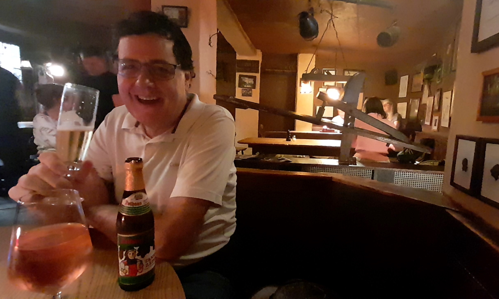
Tonight we are going to try a small, Swiss restaurant for dinner which is over the road from the hotel – Restaurant Schafli. Hopefully it will have more realistic prices or we might be on a diet of pizza for the next few days. As it turns out it has a very limited menu – tonight it’s serving a toasted cheese and ham sandwich and a small, cold meat and cheese platter. Together with a small, local beer and glass of rose cost us Eu50 (A$90) cash!
12 April, 2024
It’s 14 Deg. C. and 9:30 am as we drive out of the hotel car park on our 20-minute drive into Lucerne.
Driving on the A2 towaards Lucerne.
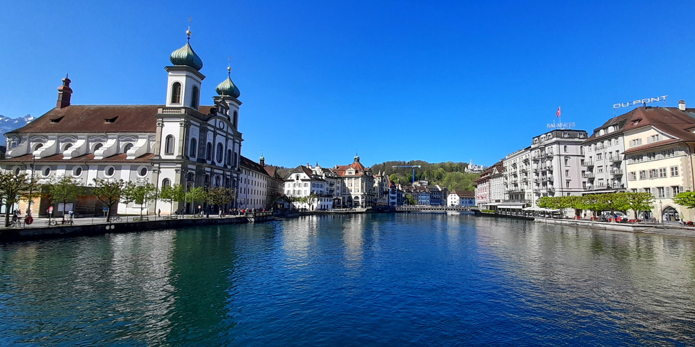
Why are we visiting Lucerne? So that Lynn can see the Kapellbrucke (Chapel Bridge) which captured her imagination in the 1960s when she was about 9 or 10 years old when she first saw a Peter Stuyvesant advert before a Saturday matinee at the Regent cinema in her hometown of Albury.
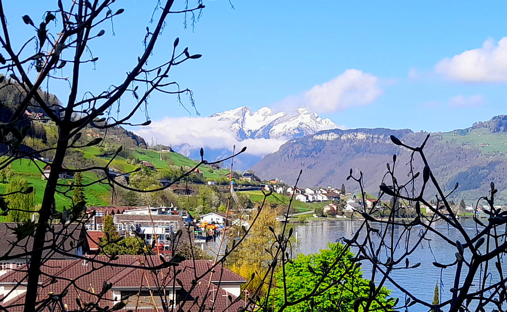
Mt Pilatus – with much less snow than yesterday!
She has a vivid memory of the advert that showed a group of beautiful people, enjoying a jetset lifestyle, arriving on Lake Lucerne and the bridge was in the background. She said to her mother who was sitting next to her: “Wow! Where is that?” to which her mother replied: “Somewhere in Switzerland, I think.”
Despite the advert’s impact, over the past 55 or so years she has not resorted to “… Peter Stuyvesant, your international passport to smoking pleasure” – rather she has enjoyed many years of traveling pleasure thanks to her own passports!
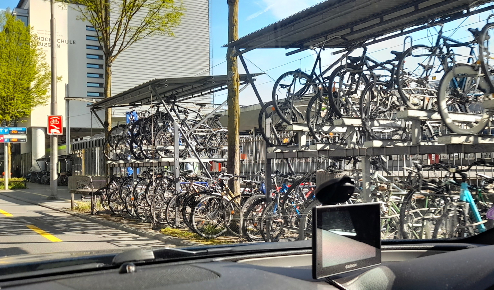
Multi-story bike park near the Bahnhof.
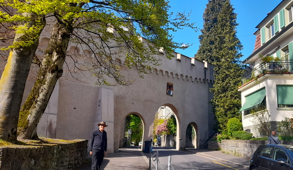
Lynn has chosen 4 sites for us to visit today: the Lion monument, the Musegg Wall, the Old Town and the Chapel Bridge.
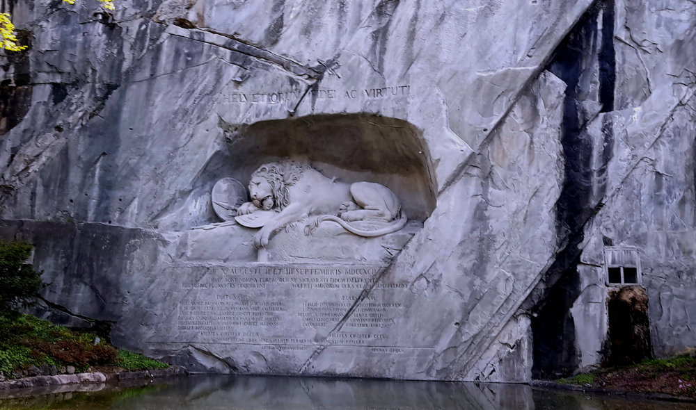
Carved out of rock, “Dying Lion of Lucerne” commemorates the heroism in 1792 of hundreds of Swiss soldiers serving King Louis XVI who died attempting to protect his Tuileries Palace in Paris during the French revolution.
Carl Pfyffer von Altishofen (1771-1840) who was a young Swiss Guard’s officer witnessed events of the French Revolution but was on furlough in Lucerne during the insurrection of 10 August 1792. Creating a monument to his fallen comrades that day became his life’s purpose. Designed in Rome by Danish artist Bertel Thorvaldsen and carved in the rock face of a former quarry by stonemason Lukas Ahorn from Constance, in 1821 he saw the work completed.
Mark Twain has described this monument as: “…the saddest and most moving pieces of rock in the world”. [The Official Lucerne City Guide].
“Dying Lion of Lucerne”.
10 minutes’ walk SW brings us to the Musegg Wall. With its 9 towers it forms part of Lucerne’s historic fortifications.
The Musegg Wall.
We enter via the Schirmer Tower. Dating from 1420 it was last restored in 1995 after being partially destroyed by fire the previous year.
Musegg Wall & the Pulver Tower.
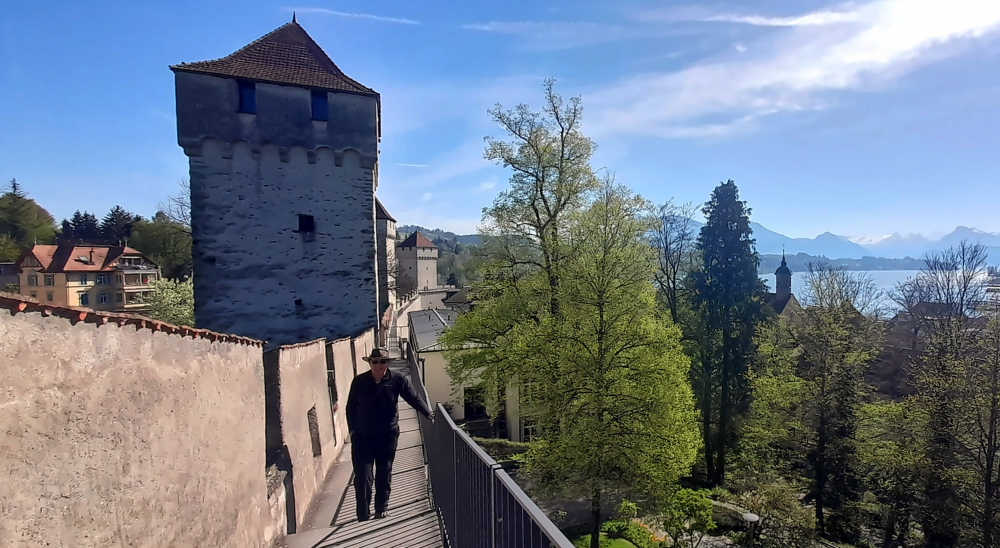
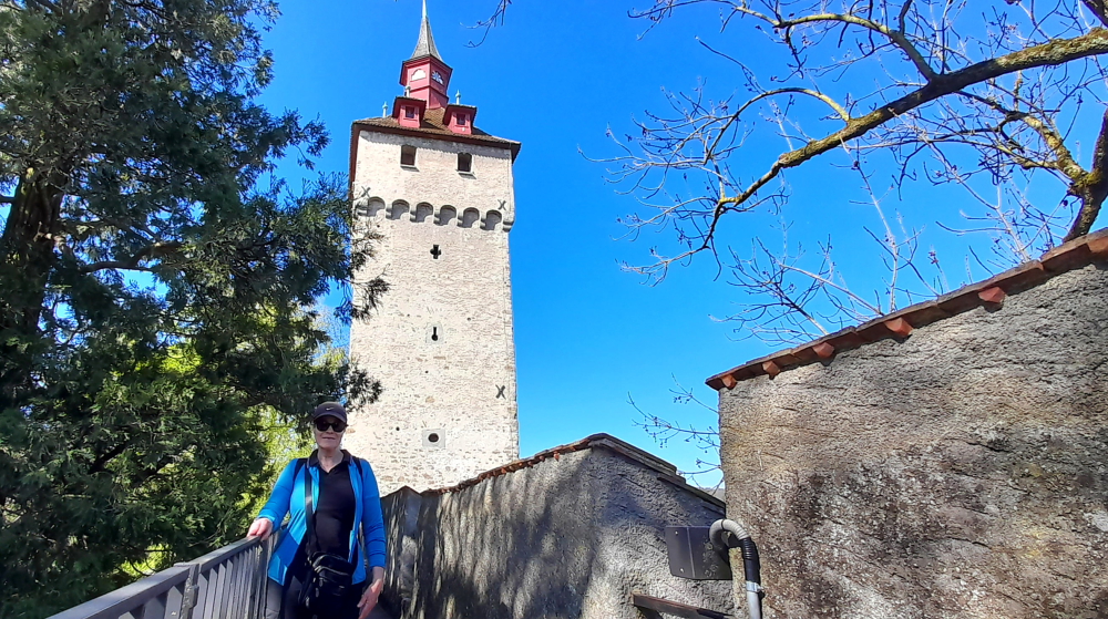
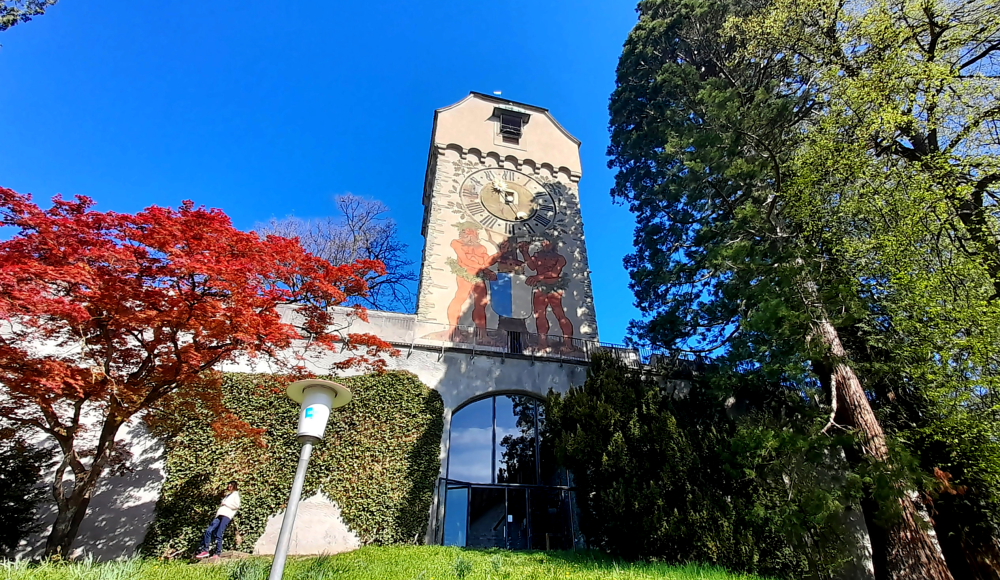
Walking along the Wall past the Pulver Tower we come to the Zyt Tower – the clock tower.
Zyt Tower – side view.
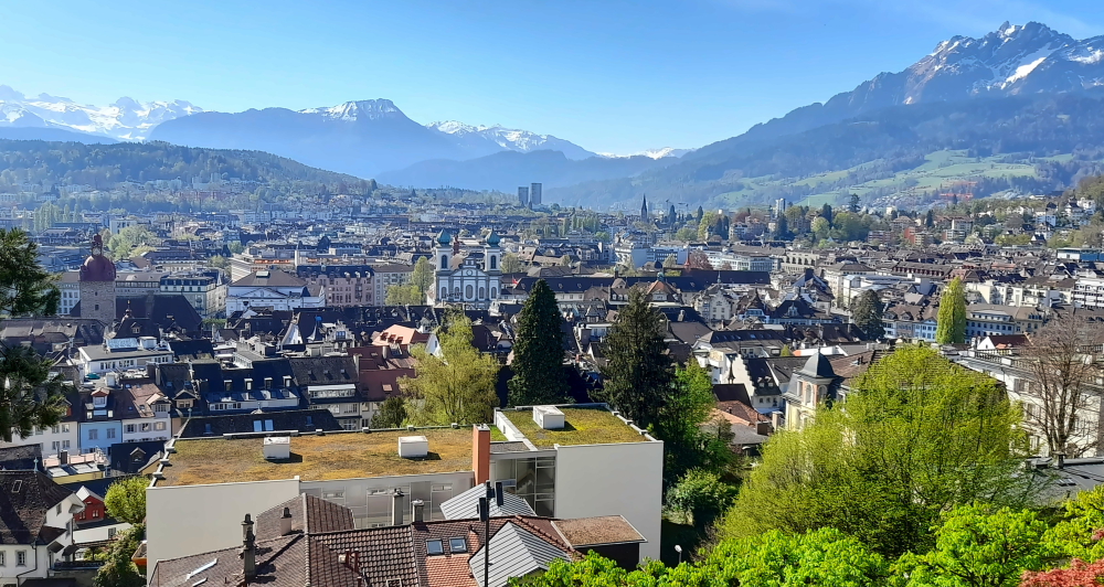
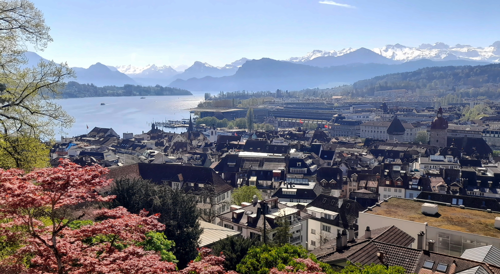
From the city wall to the right we have a commanding view of the mountains to the south of Lucerne plus the Old and New Towns.
Mt Pilatus (R) & Urner Alps (L).
And to the left the Water Tower that is part of the Chapel Bridge, the Bahnhof and the beginning of Lake Lucerne.
View over the Bahnhof and Lake Lucerne.
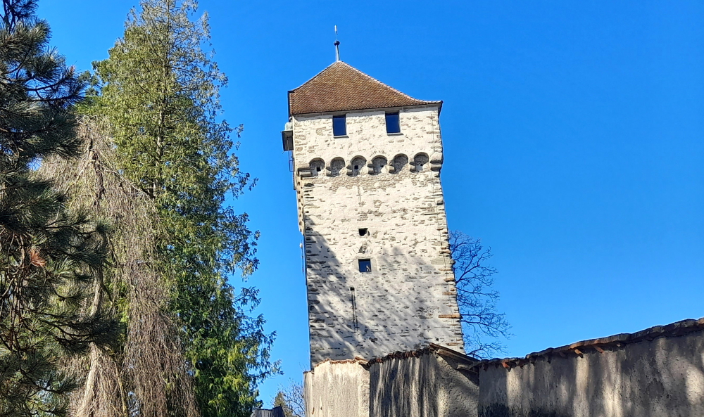
Walking as far as we can on the city wall we come to the Wacht (Watch) Tower. The medieval tower replaced by the Wacht Twer was being used to store 350 hundredweight of gunpowder when it was hit by lightning on 30 July 1701. The town’s fire wardens relocated to the Wacht from the Luegisland Tower in 1768.
Wacht Tower.
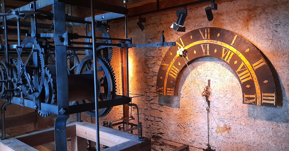
Retracing our steps we enter the Zyt Tower. This tower was erected in 1403 for defensive and timekeeping purposes.
A clock mechanism in the Zyt Tower.
At the time, it accommodated the oldest public clock in existence. The clock turret once rose alone above the battlements until 1408 when it was incorporated within the tower’s newly-created attic floor.
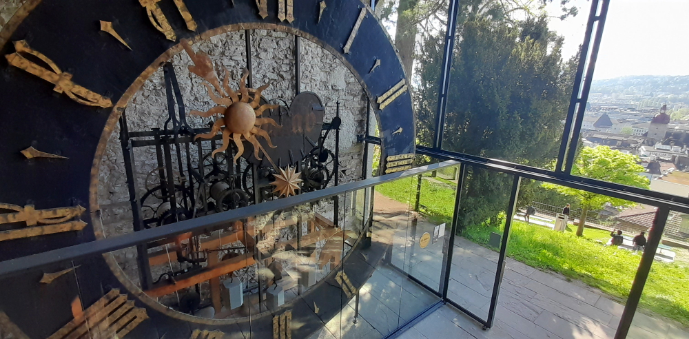
Another clock mechanism on the ground floor of the Zyt Tower.
The clock mechanism was replaced in 1535. This clock has the privilege of chiming the hour 1 minute before all the other clocks in the town – which we can attest to when we exited the tower at 2 minutes to 11 o’clock.
Zyt Tower – front view.
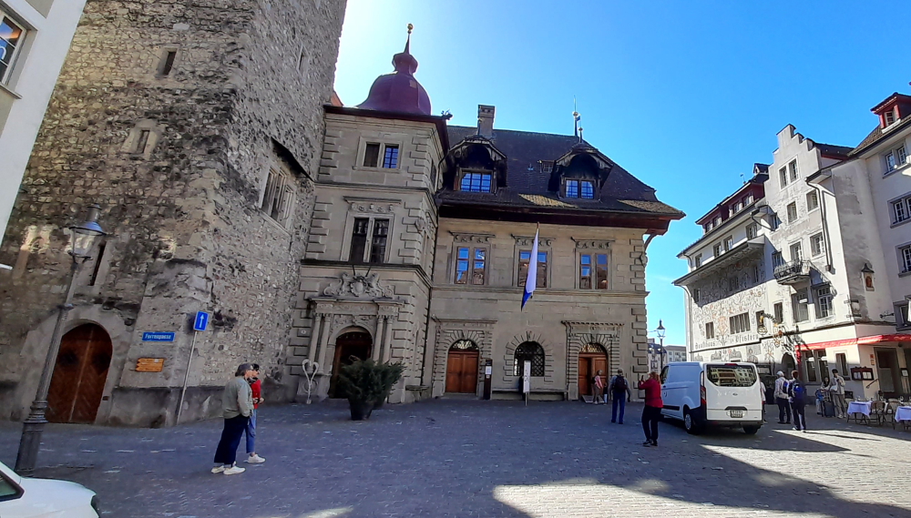
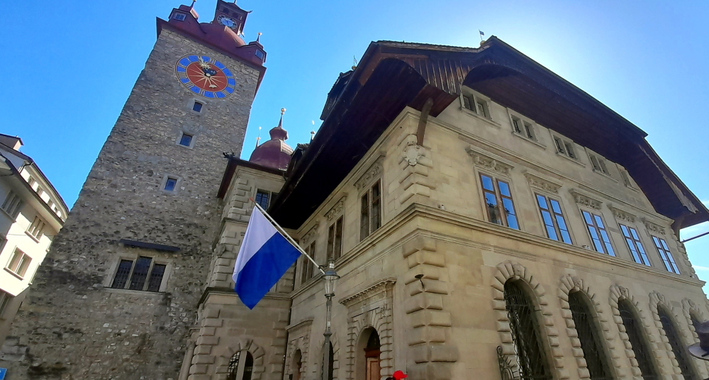
Straight downhill from here we enter the Old Town and the Kornmarkt 7 minutes later. Here at the Kornmarkt, in the middle of the Old Town near the Reuss River, is the Rathaus where photos of a small wedding are taking place.
Rathaus on Kornmarkt.
The Italian architect and master builder Anton Isenmann built the structure between 1602 and 1606 in the Italian Renaissance style. The grain chute is on the ground floor. It used to be a department store and is now used for exhibitions and concerts.
On the 1st floor is the Parliament Hall with two monumental paintings by painters Melchior Wyrsch and Josef Reinhart. The coffered ceiling, paneling and 18th century oven give this room its character. The Conference Hall is in the empiric style, built by Josef Singer. Today, civil weddings are primarily celebrated here.
Rathaus & Tower.
The Old Chancellery of Renward Cysats is located on the upper floor of the medieval family tower, while the New Chancellery, built in the Italian Baroque style, is located between the town hall and the tower. The wide, drawn-down roof is a Bernese farmhouse roof. In the attic is a dovecote, built in 2003 [luzern-com].
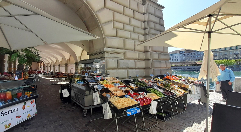
Market stalls in Rathaus colonnade next to Reuss River.
Adjacent to the Rathaus is the Rathaussteg Bridge, a narrow pedestrian bridge which crosses over the Reuss River next to the Chapel Bridge.
Reuss River view upstream from the Rathaussteg Bridge.
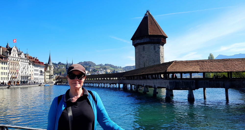
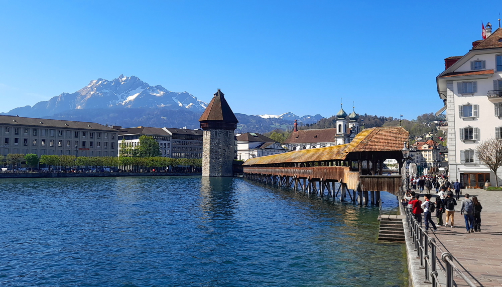
Finally, THE iconic bridge and its Water Tower – or as Lynn knows it as, the Peter Stuyvesant bridge.
View of Chapel Bridge & Water Tower from Rathaussteg Bridge.
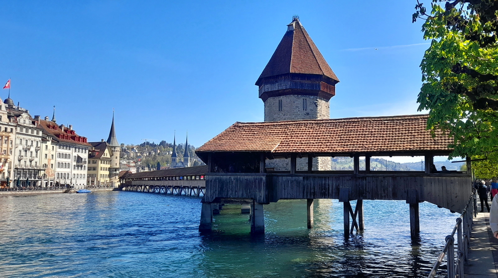
Built around 1300 – before the Chapel Bridge – the octagonal tower stands in the middle of the Reuss River.
The Bridge dog-legs across the River.
It served as a fortification and lookout post and was a cornerstone of the defenses.
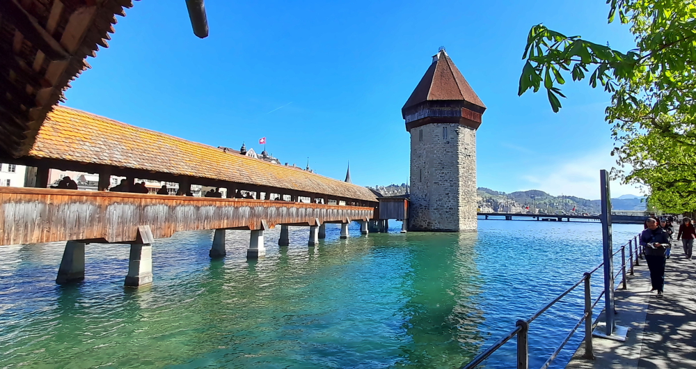
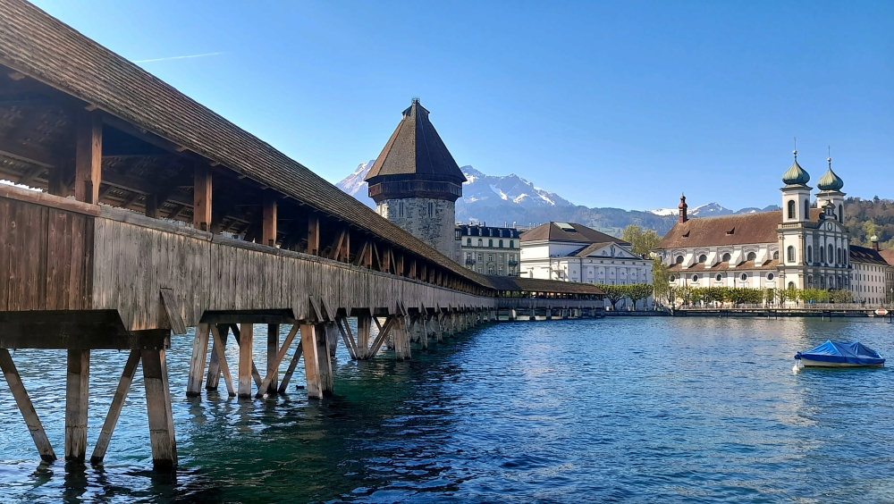
View of the Bridge & Tower from the southern bank.
Over the ensuing years it was used to store the town’s archives and treasure, and it even saw use as a prison and torture chamber. Over 34 m in height, this Lucerne landmark is Switzerland’s most-photographed monument.
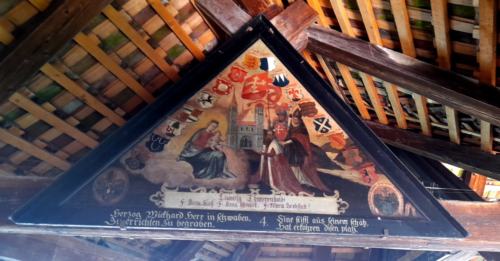
Ttriangular painting in bridge’s gables.
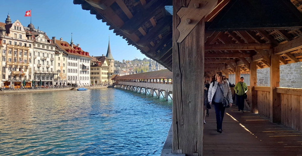
The Chapel Bridge is the oldest and, at 204.7 m, the 2nd longest roofed timber bridge in Europe. It was built around 1365 as a battlement and links the Old Town and “New Town” which are separated by the Reuss. The bridge’s gables feature triangular paintings depicting important scenes from Swiss history.
View from the bridge towards the Zur-Gilgen Tower on the northern bank.
On 18 August 1993 the bridge fell victim to a blaze, which as blamed on a carelessly discarded cigarette. “Appropriate” says Lynn, “given the Peter Stuyvesant connection!”
View of eastern side of the bridge from northern bank back-dropped by Mt Pilatus.
The conflagration destroyed a large part of the structure including 78 of the 111 famous pictures. Swiftly rebuilt and restored it was inaugurated and reopened to pedestrians on 14 April 1994.
View of western side of the bridge from Rosengartplatz on the northern bank.
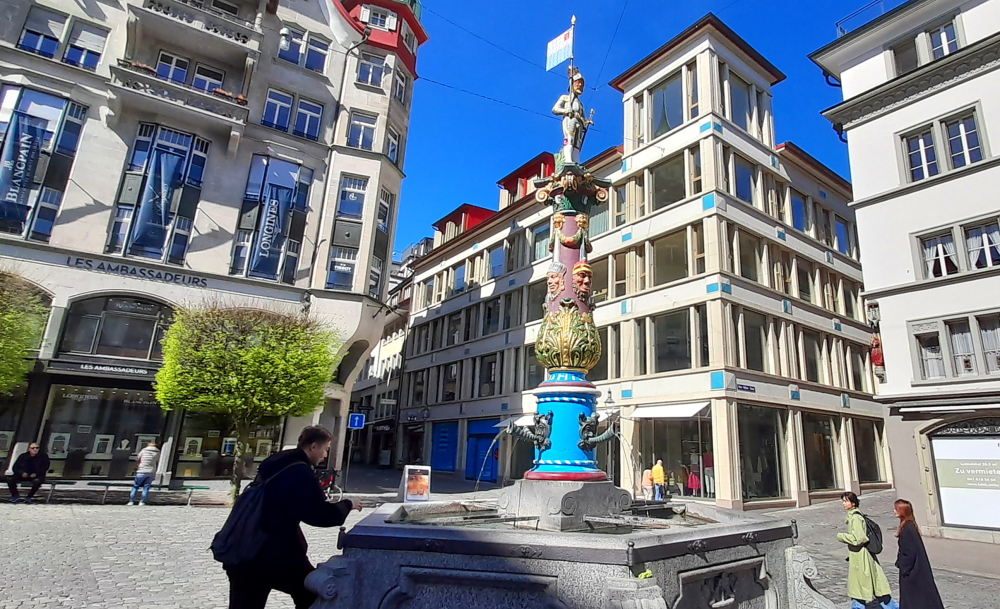
Across Rosengartplatz and through an alleyway next to Peterskapelle is another marketplace, Kapellplatz. Here, at the entrance to Lucerne’s Old Town stands the Fritschi fountain with its colourful column. The fountain features a bannerman atop a pillar adorned with multiple carnival masks, among them those of Fritschi and his spouse. Water pours into the fountain’s base from four jester masks. Designed by the architect August von Rhyn, the fountain was unveiled on October 14, 1918.
Fritschi Fountain in Kapellplatz.
The Fritschi fountain holds significance in Lucerne’s annual carnival celebrations, the roots of which stretch back to the 15th century. The Fritschi parade starts Carnival Season whereby a life-sized straw effigy of Fritschi is paraded through the city in the company of various guilds and clubs. The procession is led by drummers and pipers, trailed by soldiers donning substantial beards and armor. This parade commemorates both the onset of the Lenten Season and a historic military triumph.
View from Seebrucke where the river joins Lake Lucerne.
The car park is a short, 3 minute walk from here. We’ve been away for 1 hour and 45 minutes.
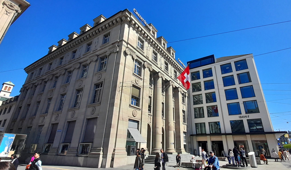
Lynn’s former employer, Credit Suisse, now owned by UBS.
Driving back to the hotel we can see that snow that is on the lee side of hills on this side of Lake Lucerne still have snow, unlike their counterparts on the opposite side of the Lake.
Driving south on the A2 towards Beckenried.
We’re back just after noon. All up, our return trip to Lucerne has cost us less than we thought – about CHF7 (A$12) compared to CHF 128 (A$215) by ferry.
Around 4:30 pm we walk into Beckenried to the bakery/eatery opposite the ferry terminal and pick up a couple of salads and apple strudels which we’ll have for dinner, sitting out on our balcony watching the sun set.
13 April, 2024
A bright and sunny 26 Deg. C today. So, another lazy day catching up the blog and soaking up the lakeside view. Around 4:00 pm we walk into town to the pizzeria.
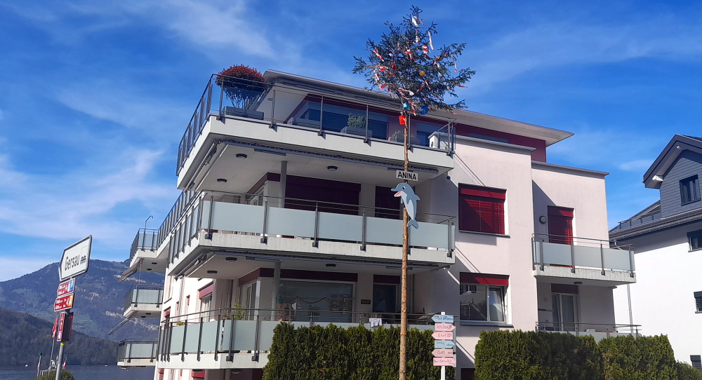
On our way we pass by several houses that have notices outside indicating that they each have had a new arrival to the household – signs with the baby’s name, date of birth, even weight! One house has taken the novel approach of decorating a very tall fir tree in their front yard for baby Anina. So what looks like a Christmas tree is, in fact, a Baby tree. Actually, I suppose they are the same thing!
No, it’s not a Christmas tree – it’s a Baby tree.
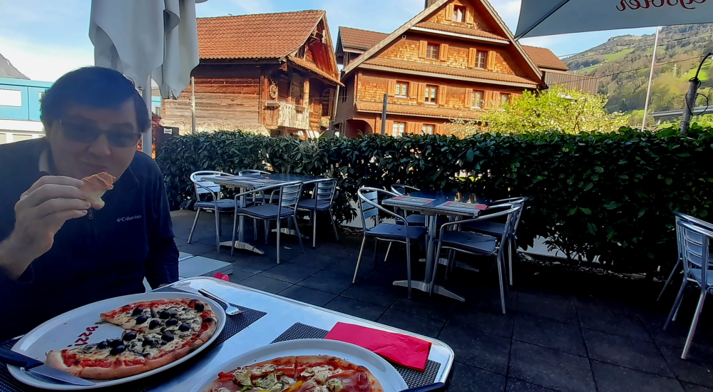
Next door to the cable car station is Pizzeria Klewen. On Sundays it’s open from 10:30 am which is why we are here at 4.30 pm and have the place to ourselves. We order a 10″ pizza each which is the perfect size and take in the views down to the lake, the surrounding neighbourhood and up the hill.
Traditional Italian pizza, traditional Swiss houses.
Tomorrow we have a 3 hour 15 minute drive to Tortona in Italy.
14 April, 2024
Another 26 Deg. C. day in Beckenried as we depart the hotel at 10:15 am while it’s still only 15. When we arrive in Tortona around 1:30 pm it should be 28.
As soon as we turn onto the A2 that runs past Beckenried the car GPS informs me that we have 170 km before we turn off.
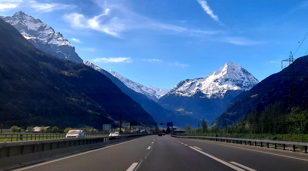
View of Mt Bristen (3073m) from the A2 near Erstfeld – 20 km before Gotthard Tunnel.
About 30 minutes later we are stopped on the freeway – for a set of traffic lights on red. Turns out this is the beginning of the Gotthard Tunnel – all 17 km of it – that passes under the mountains from Goschenen to Airolo. When we enter the tunnel it’s 20 Deg. C. but driving through it the outside temp. gets to 31!
Which is when we realise that the car’s air conditioning system isn’t bloody working! The same air conditioner that we had fixed back in October 2022, a couple of weeks after we bought the car. We resort to driving with the windows down.
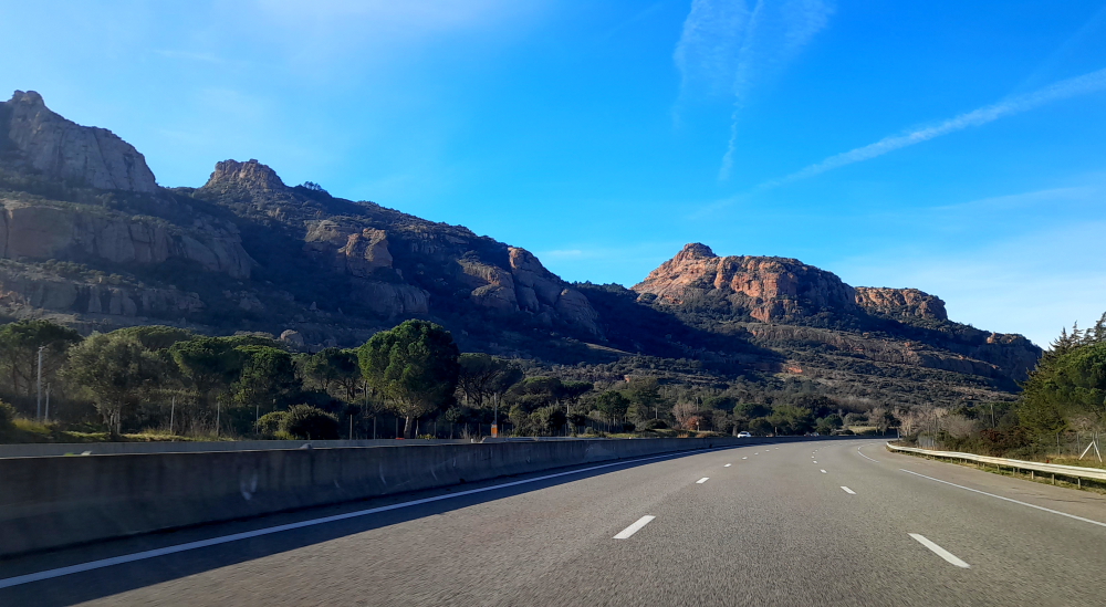
Heading towards the Italian border.
When we emerge from the tunnel on the other side of the Alps, the landscape has taken on a distinct Italian look and feel, such as ‘Uscita’ for exit instead of ‘Ausfahrt’ and ‘Benvenuto’ instead of ‘Willkomen’ – even though the border is still another hour (111 km) away.
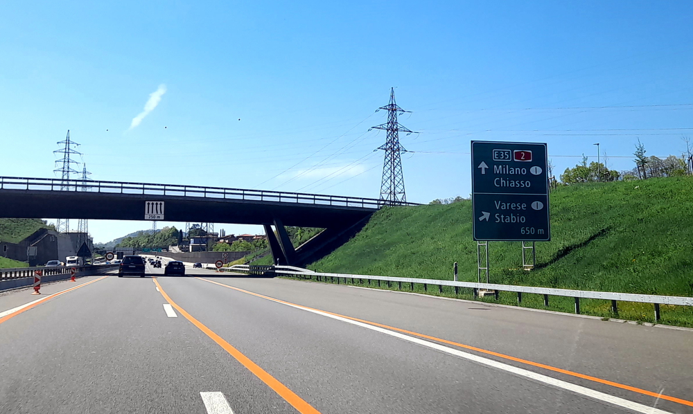
Approaching the Italian border near Chiasso.
Finally, the border hoves into view – thanks to the tailback that has formed. At the barrier the fast lane becomes the slow lane as it’s that lane that the border police are stopping cars. The lane that we are in continues unhindered.
From here on the A9 then A7 it takes us 1 hour 15 minutes to bypass Milan and Pavia, and pay 3 Italian tolls totaling Eu11, to arrive at our gorgeous Art Deco guest house on Castle Hill in Tortona. Like our last visit to Italy back in 2014 it costs more for tolls than it does for fuel.
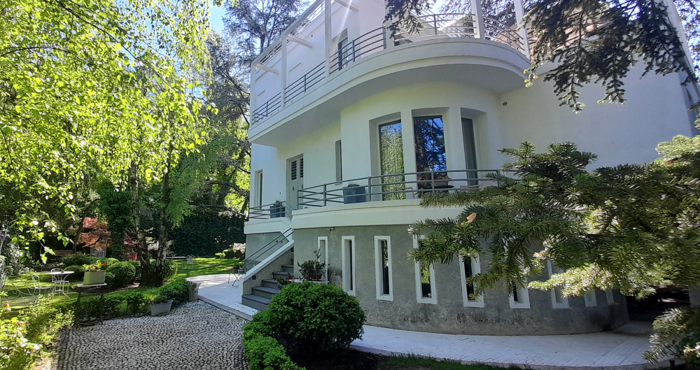
Casa Cuniolo Guest House, Tortona.
Cuniolo house was built in 1936 on the grounds of Castle Tortona alongside the Royal Gate. The surrounding Castle Park, overlooking the centre of Tortona, is built on the old fortress that dates back to Roman times but which has had many transformations over the centuries from Barbarossa and Spanish rule to Napoleon.
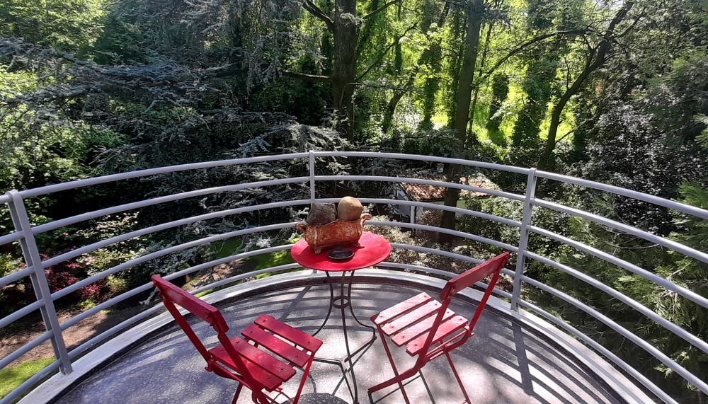
Our 2nd-floor bedroom’s balcony.
It was built by Giuseppe Cuniolo to be used as a home for the family of his son, the painter Gigi Cuniolo (1903-1976), a Piedmontese exponent of 20th century landscape painting.
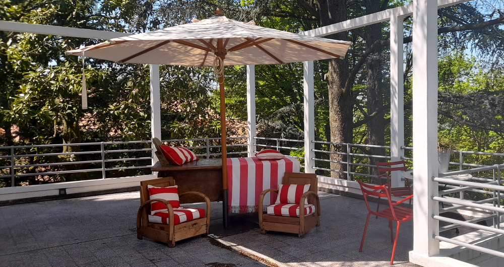
And our terrace.
We have a large room on the 2nd floor, with a large bathroom, a small balcony and a large terrace facing opposite aspects.
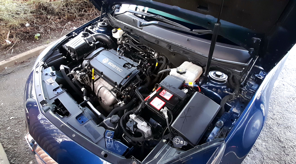
After we unpack I check under the bonnet and conclude that it is possibly the air conditioner’s compressor or its clutch that is the problem, so not a cheap fix. Tomorrow I’ll have to get our host to phone the Opel dealer in La Spezia, where we are next staying for a week, to check the car in.
And we soon realise we are back on Italian time for dinner – nothing opens before 7:30 pm where we are booked at a local trattoria, some 15 minutes’ walk down the hill.
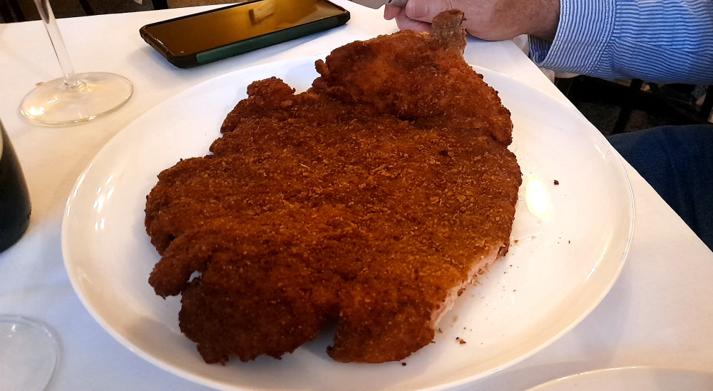
The tratt isn’t very elegant and has a very limited menu but I order the house special which turns out to be a massive 30cm schnitzel and Lynn just orders a couple of vegetable side dishes. We also ordered a half bottle of very nice red wine. I could only manage half of my schnitzel so it will be lunch for tomorrow. At least the price for dinner was a little more realistic than we experienced in Switzerland. Our total bill was EU 36.00 (A$60).
As it’s Easter break we decide to depart at 10:30 am to arrive at LeShuttle terminal early. We’re booked on the 2:20 pm train so don’t need to be there until 1:20 pm for check-in, but we have a flexible ticket so may be able to board an earlier train.
I put the terminal co-ordinates into the car GPS, selecting ‘avoid toll roads’ only for it to tell me that the route we are to take, via the M25, that the tolls are unavoidable.
Thank goodness Lynn does the same with her MapsMe offline maps and informs me that we can, in fact, get there toll free, following the A20/M20 to the 11A exit from the M20 straight to LeShuttle check-in booths where we arrive at 11:45 am.
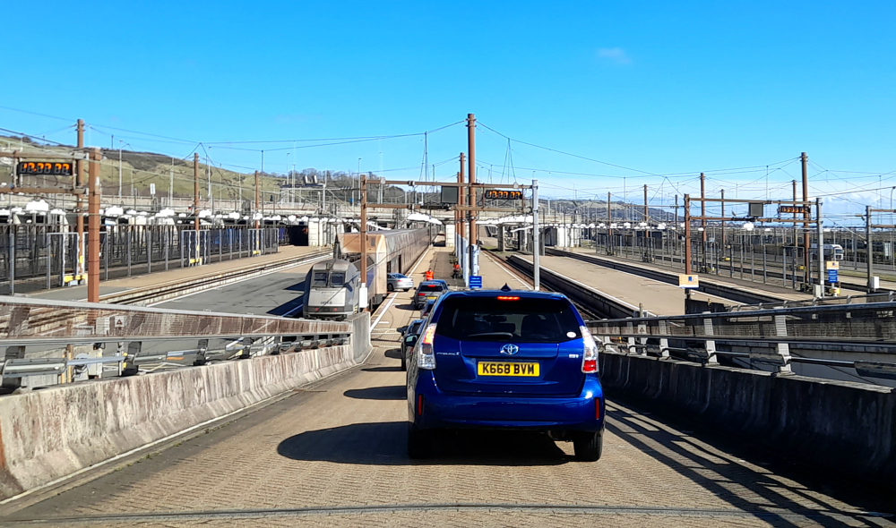
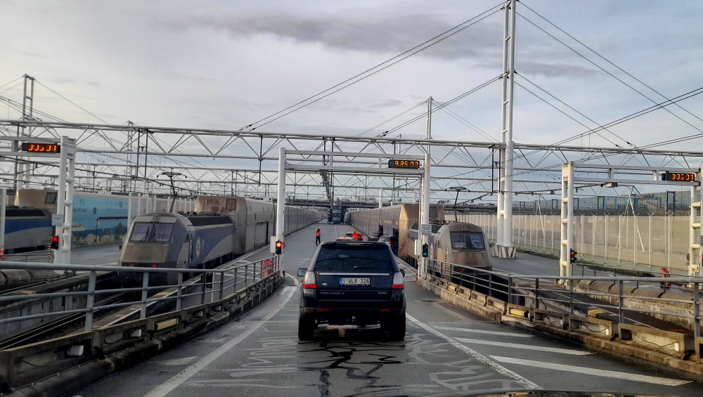
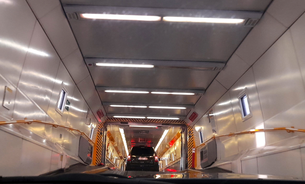
Boarding Le Shuttle again at Folkestone, UK.
Unlike the last 2 times we’ve used LeShuttle we don’t get to drive straight onto the train, thanks to the crowds. Rather we park and wait in the terminal over a coffee for 55 minutes until we get the call at 12:45 pm to proceed through both passport controls and drive onto the train.
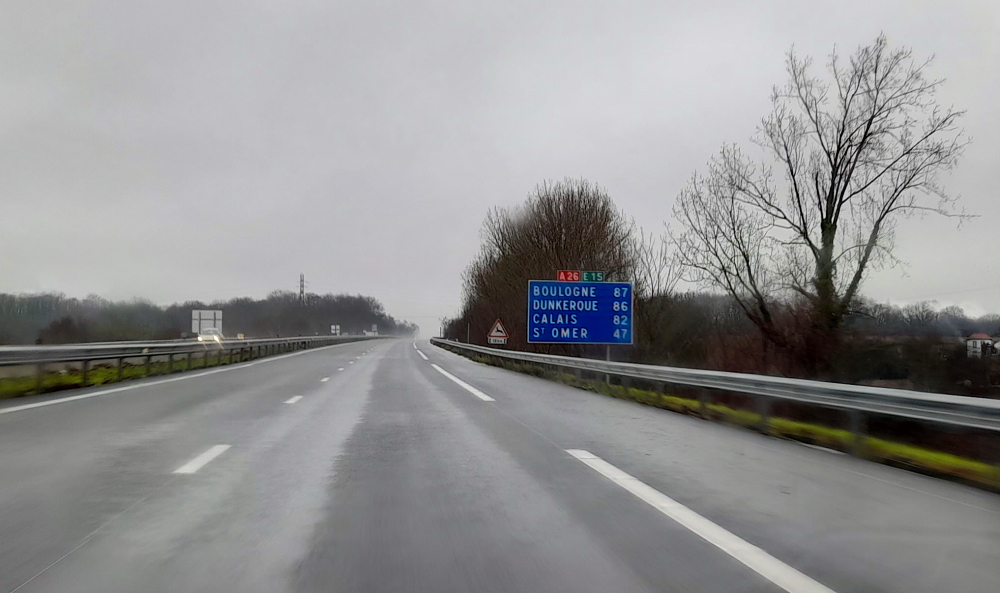
Promptly the train departs at 1:15 pm and we arrive at Calais some 35 minutes later.
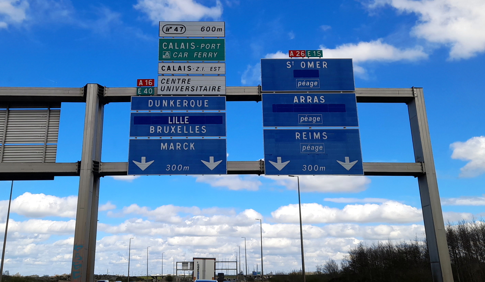
Driving to Dunkirk.
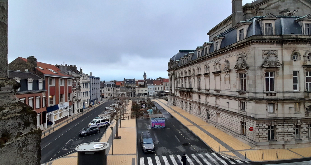
In Dunkirk, our apartment is a block back from the beach, east of Malo-Les-Bains.
We follow our usual drill: unpack then drive to our nearest supermarket (Leclerc) for provisions. As today is Wednesday and Friday is Good Friday when all the shops and presumably restaurants will be closed, we plan to eat in tonight and Friday night. We drive to Luxembourg on Easter Saturday.
Fortunately, we find some English-speaking movies on YouTube and watch the hilarious 1976 ‘The Cheap Detective’ starring Peter Falk (of Columbo fame) and this movie’s send-up of ‘Casablanca’ and ‘The Maltese Falcon’.
28 March, 2024
One thing we do love about France is the use of window shutters for blocking out light and noise. When we wake we discover we’ve slept for 11.5 hours!
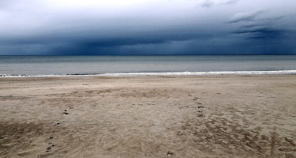
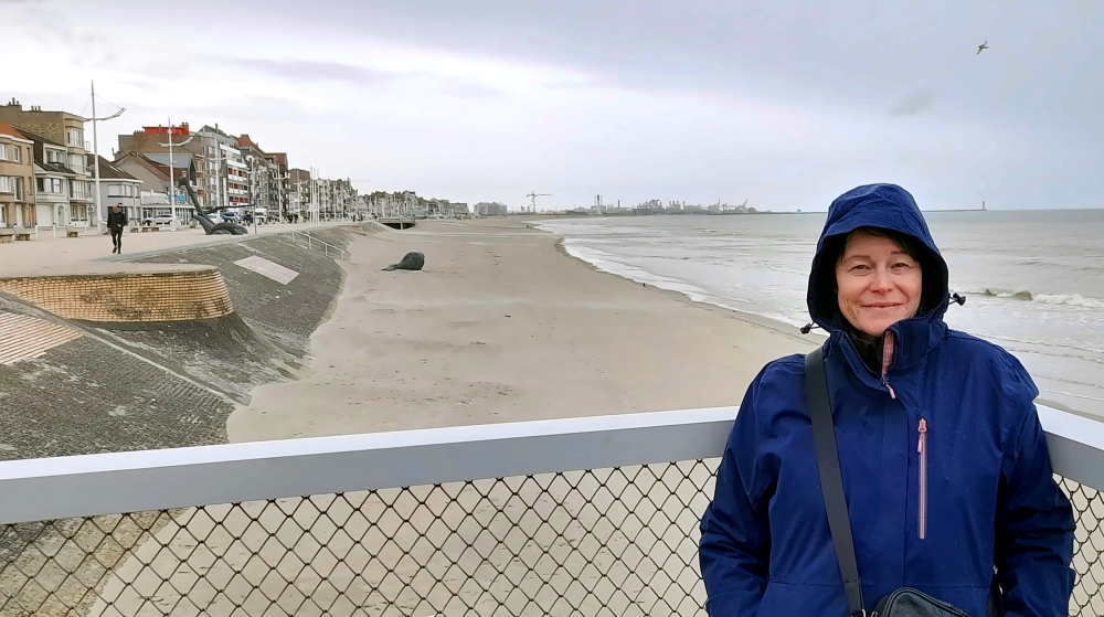
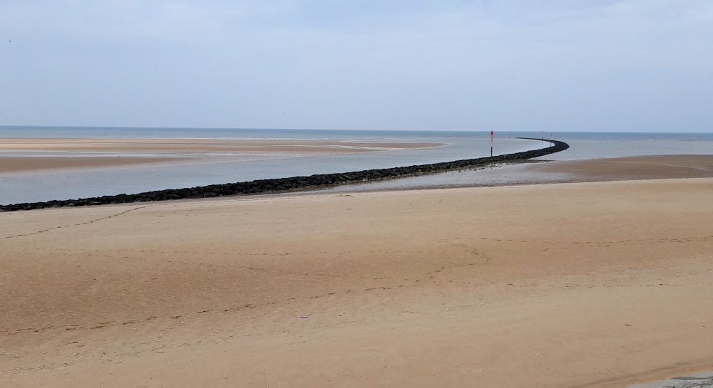
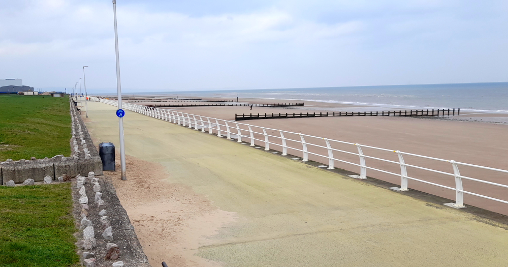
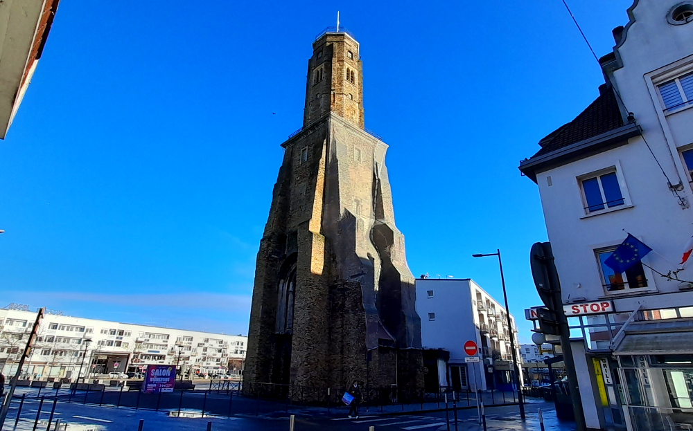
Although it’s raining lightly and quite windy, we still venture outdoors to view the famous beach.
Dirty water and dark clouds.
In May and June of 1940, Dunkirk was the scene of a major turning point in history. During the Second World War, the famous Operation Dynamo succeeded in evacuating more than 338,000 soldiers to England, in only nine days.
View west along the beach at Dunkirk.
The relative calm of the “Phoney War” period that followed the 1939 declaration of war between Britain and Germany suddenly ended on 10th May 1940, when Germany launched an attack on Holland, Belgium and Luxembourg. In the space of just a few days, the German army had pushed through and the allies were retreating towards the North.
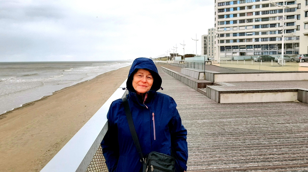
View east along the beach.
Fearing that its troops would be trapped, and judging the battle to be lost, Britain decided to evacuate the troops retreating on Dunkirk by sea. Admiral Ramsay led the evacuation, which the British called ‘Operation Dynamo’.
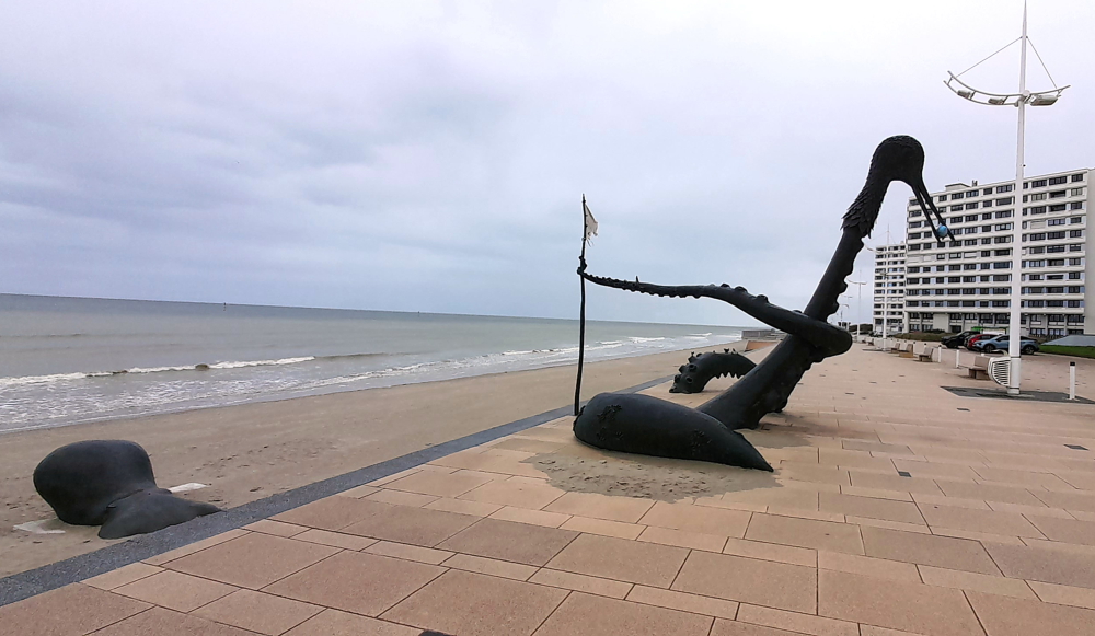
Peck-uliar sculpture of an octopus with 1 tentacle ending in a bird’s head eating a fish!
England sent over everything and anything that could float: warships, commercial vessels, fishing boats, sailing boats, barges and “little ships” that had never before been more than a few miles off the coast. Under continual aerial attack, more than 330,000 allied soldiers, including 120,000 French and a few thousand Belgian soldiers were evacuated through Dunkirk, and about a third of the soldiers left from the beaches. 40,000 soldiers were left behind and taken prisoner. Most of them belonged to the divisions in charge of slowing down Germany’s advance, a crucial element in the operation’s success.
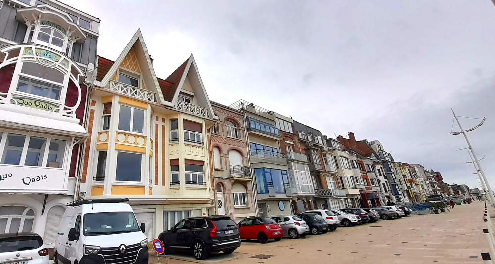
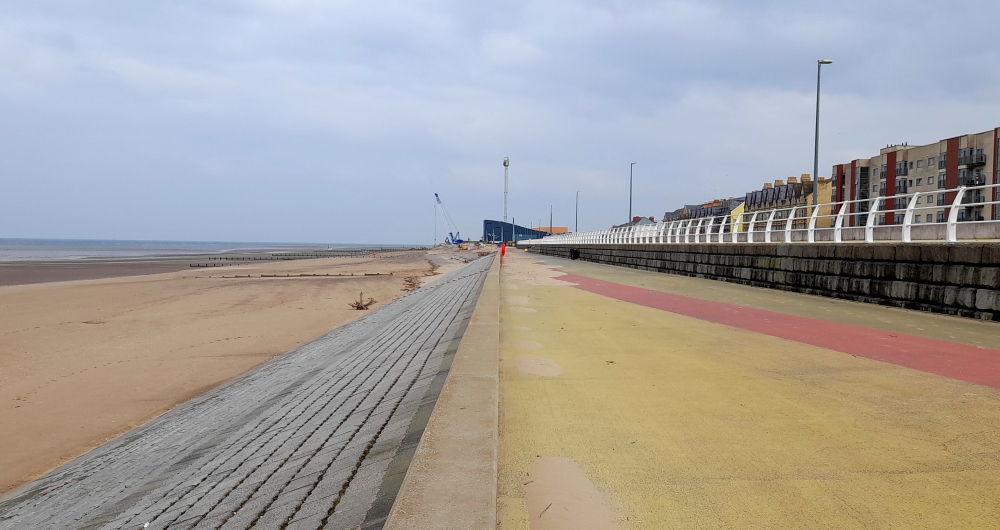
Digue de Mer houses.
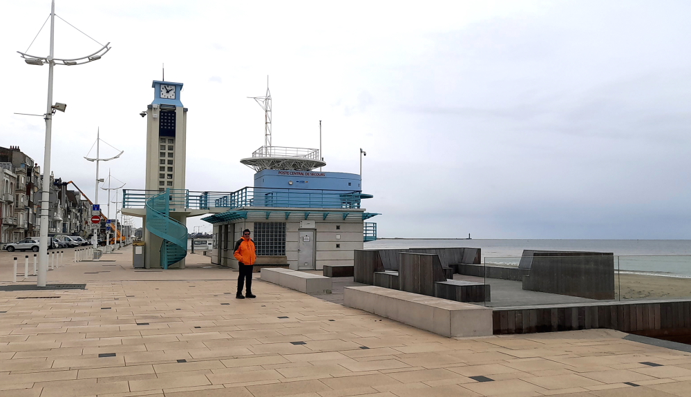
Today there is a road that runs parallel to the beach, Digue de Mer (sea wall), upon which there is a variety of buildings – both ‘new’ high-rise and the more traditional houses, often with cafes, bars or restaurants on the ground floor.
And the usual beach-side sights: a building for emergency services …
Art deco ‘secours’ centre.
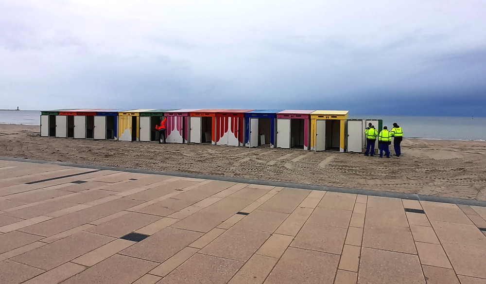
… and colourful beach huts. Thank heavens that Australia has maintained that the sea and river fronts are common property and nobody can “own” or build on the shores or rent out space on ugly sun beds, etc.
Assembling the bathing boxes on the beach.
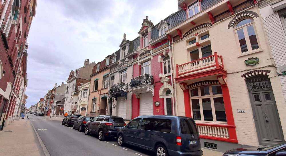
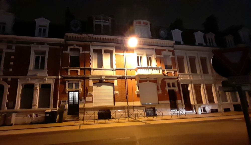
Surprisingly, given the war, most of the houses in the side streets still retain their French-ness, the rest are ‘modern’ brick monstrosities.
French-style houses in Dunkirk with balconies and mouldings.
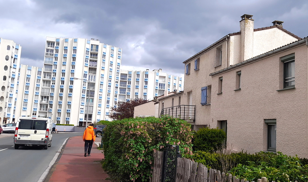
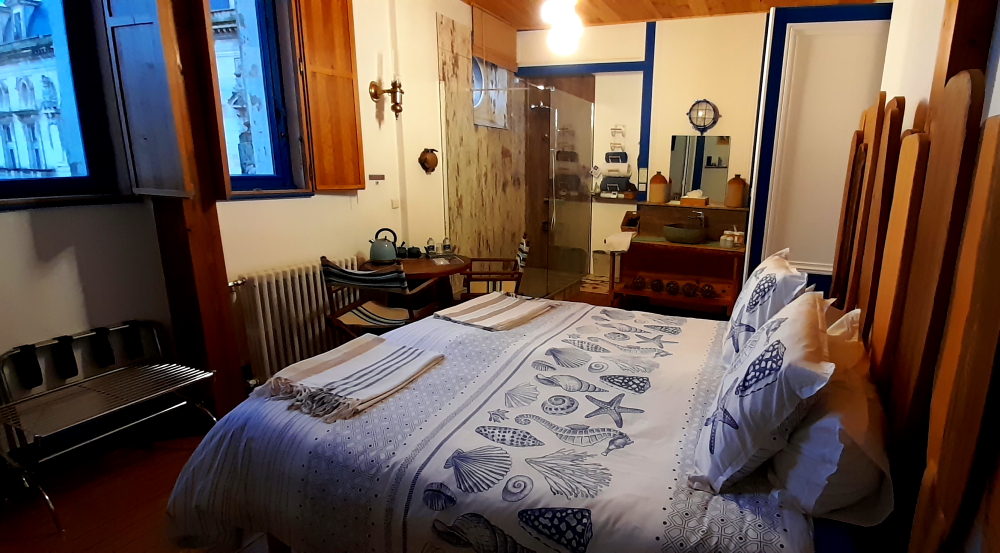
We return to our apartment which is a 3-story building amongst 2-story dwellings that have that rural village cottages look. Unlike its rustic exterior, the apartment has been renovated inside creating quite a spacious apartment with an outdoor terrace.
Holiday apartment on Rue de Gembloux.
Given our coastal location, we’re going to forego the usual ‘moules’ and try the local sushi house for dinner this evening instead.
29 March, 2024
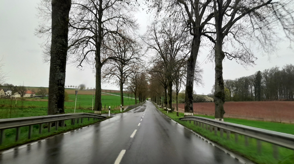
As we have about a 3.75-hour drive to cover the 396 km to our next destination in Luxembourg we depart at 10:05 am in 10 Deg. C and rain. We should arrive around 1:50 pm.
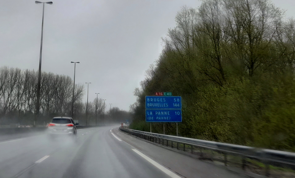
Our route will take us past Bruges, Ghent, around Brussels and Luxembourg to the Mercure Kikuoka Golf & Spa about 25 minutes’ drive SE from Luxembourg City – essentially we will drive the length of both Belgium and Luxembourg finishing 10 minutes’ drive from the German border at Remich.
12 minutes after departing we cross the border into Belgium. Soon after I get an error message on the dashboard console: “Air con has been stopped due to engine high temperature.” WTF??
The usual inclement weather in Belgium.
It’s then I notice that the Engine Temperature gauge is not registering at all. It’s still at its starting point, not half way around where it should be after driving the car for half an hour. Terrific! Why couldn’t this have happened while we were in the UK in an English-speaking country with RAC breakdown service and not on Easter Saturday!
Fortunately, a service station is up ahead so we pull in so that I can check under the hood. Nothing seems amiss – no hoses blown, no leaking coolant, even the engine isn’t that hot to touch. Logic tells me that it’s the console gauge that has had a brain fart so I decide it’s safe to continue, even though the error message persists.
Discussing the issue we decide to pull into the next lay-by – where it turns out there are a couple of police cars with flashing blue lights. It seems that they have intercepted a lorry with a load of African illegal immigrants in the back. Away from the fracas I retrieve the OBD2 (On-Board Diagnostics computer) gizmo from the boot, the one that I bought when I had the issue with the faulty radiator sensor back in October 2022. I put it through its paces, turn on the ignition, the engine temperature gauge springs into life and the error message disappears. Thank goodness for that! Probably a faulty cheap Chinese computer chip in the car or is it the fact that the poor car has had to endure the constant wet weather in the UK and Europe.
A good outcome for us but not so the gaggle of Africans that a bevy of police are interrogating plus the police officer who is photographing the contents of the back of a lorry in the lay-by. Time to hit the road or we might be next!
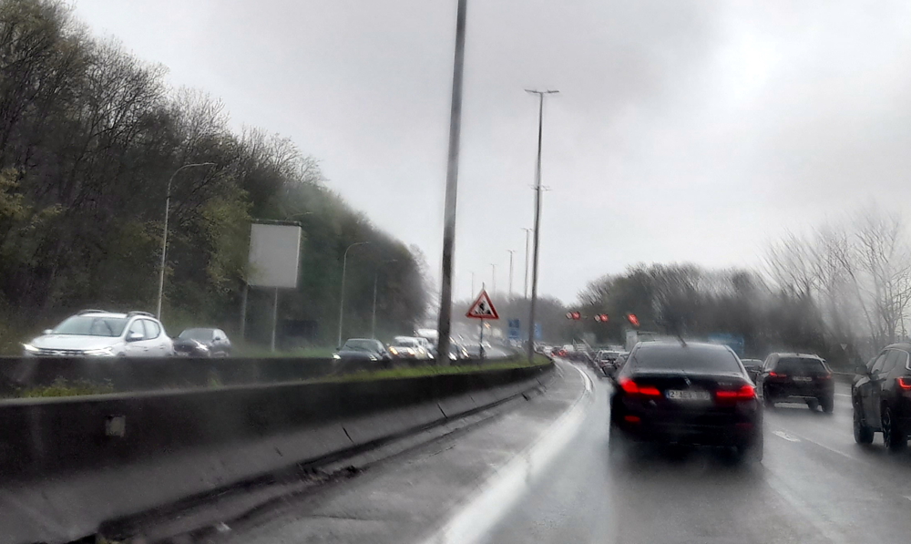
Then the usual traffic jams on Belgian freeways.
Now that that drama is over we have to contend with the usual Belgian roadworks and interminable tail backs and traffic jams, especially on the northern E19 RO ring road around Brussels. Since we left Dunkirk it’s been unbelievable the amount of traffic on the roads on an Easter Saturday.
More than one Belgian traffic jam.
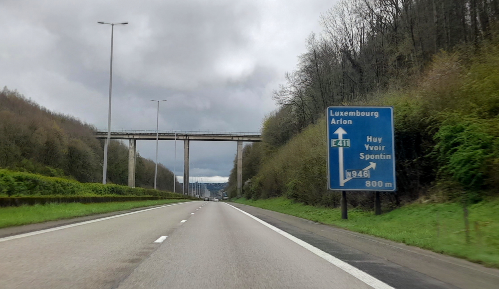
We finally break free of that madness when we hit the E411 on the other side of Brussels and drive the length of Belgium.
Nary a car on the E411 to Luxembourg.
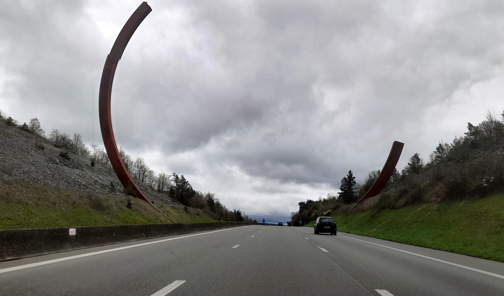
At the 90 km mark on the E411, near Lavaux-Sainte-Anne, is apparently the largest sculpture in the world. A monumental work by French internationally-renown artist, Bernar Venet, the steel, “L’Arc Majeur” weighs 200 tonnes, measures 60 meters high and was installed in 2019. It was in response to then French President, Mitterand, asking that works of art be installed along highways – presumably French highways, that is, not Belgian ones??
Art work or a bloody big Piston ring?
But, 34 years later, to celebrate the 200th anniversary of John Cockerill arriving at Seraing, the Cockerill CMI Welding Expertise Center in Seraing produced it, a showcase of Walloon Region know-how in the field of construction.
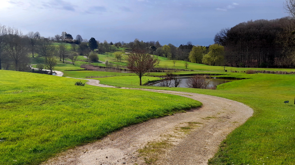
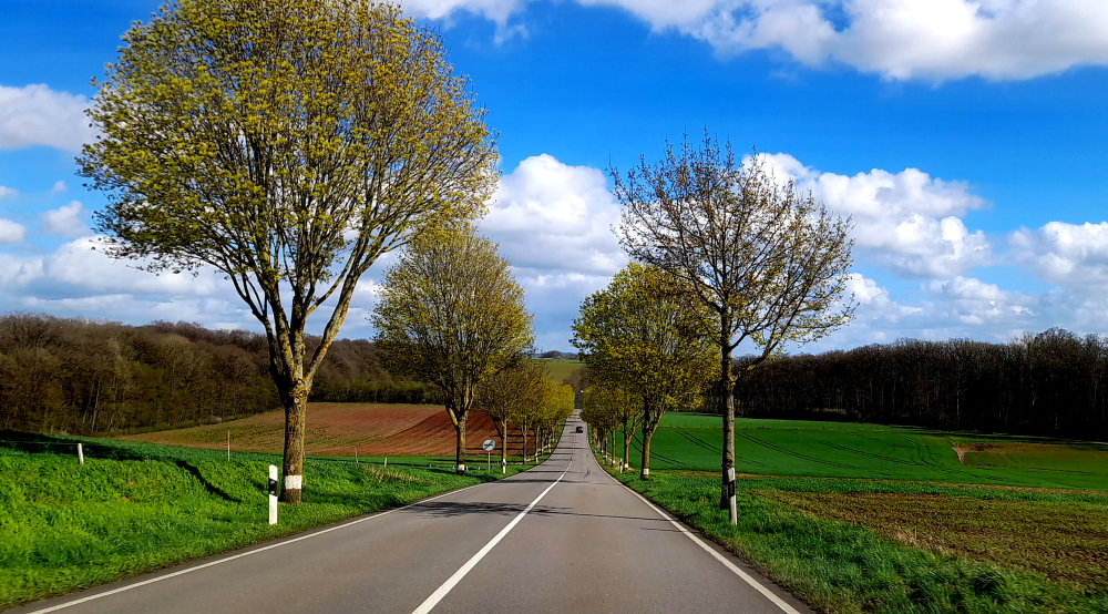
Instead of daffodils planted along footpaths, the local villages have planted tulips. The nearer we get to Scheierhaff, where the Golf Resort is located, the more remote, rural, picturesque and serene becomes the landscape.
Countryside leading to the hotel.
We finally stagger into reception at 3:05 pm – a 75-minute delay – and quickly unpack so we can unwind with a glass of red and an excellent meal in the hotel restaurant after our “3 countries, 3 traffic jams, 3 pee stops and a check engine warning sign” day.
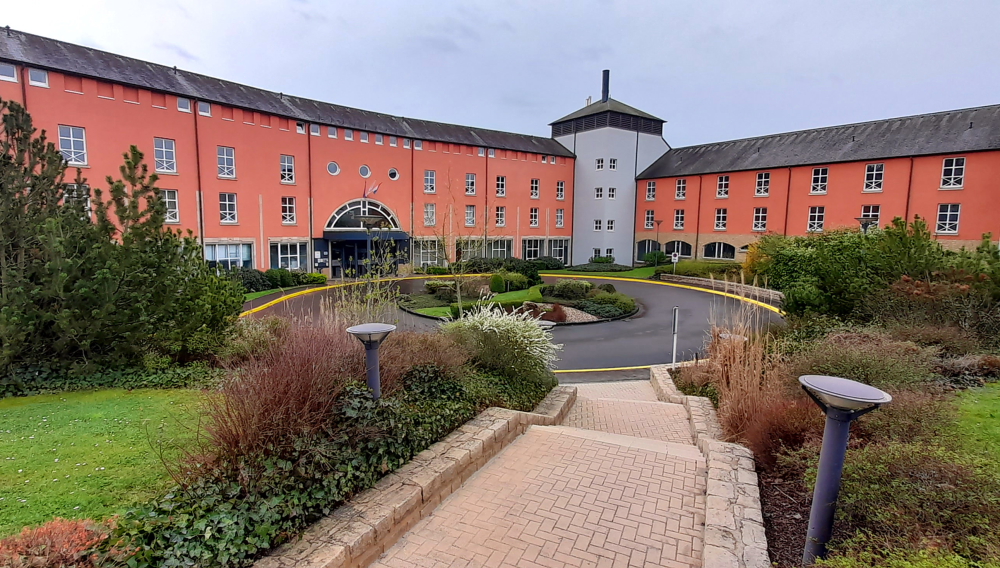
View of the main entrance to the Mercure.
Our desire for an early night is scuppered by having to turn the clock forward an hour for tomorrow’s commencement of Central European Summer Time.
31 March, 2024
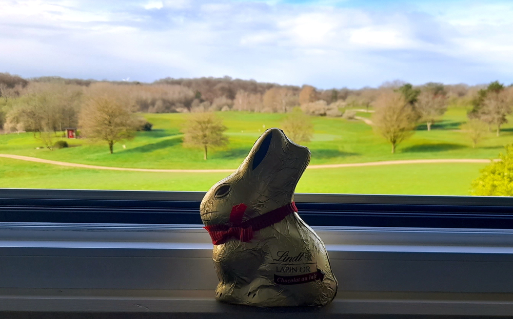
Happy Easter! Although the weather forecast for our entire 5-day stay in Luxembourg is for rain we wake to a bright, sunny day.
Let me out before they eat me!
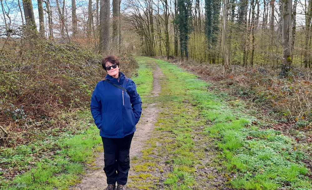
After breakfast we decide to enjoy the sunshine with a walk in the Luxembourg bush.
From road to boggy trail.
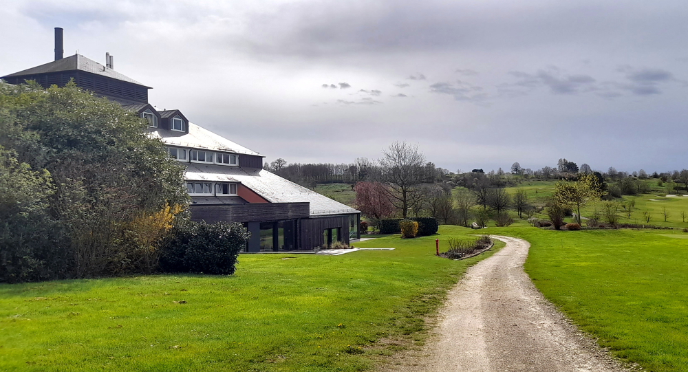
The trail turns out to be too boggy to be enjoyable so we walk around the golf resort instead.
View over the back 9.
The path around the back of the hotel looks over the back 9 as well as the restaurant, bar and wellness areas of the hotel.
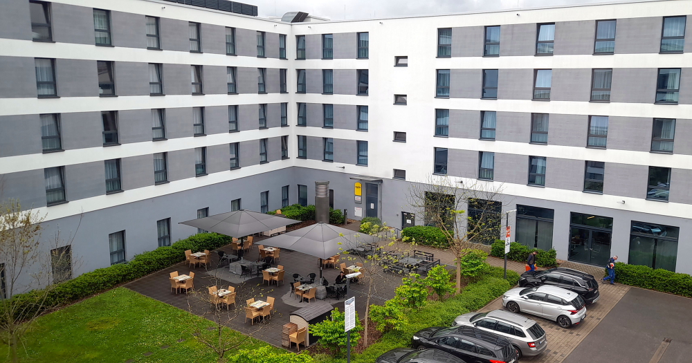
View of the accommodation, restaurant, bar and wellness areas.
A lazy day in watching golfers progress around the course with a meal in the hotel bistro tonight.
1 April, 2024
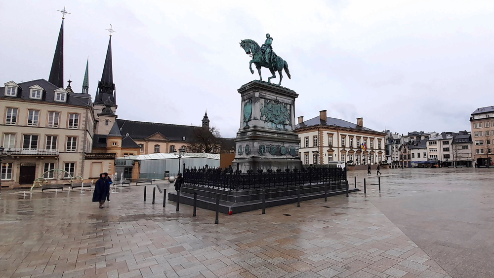
Happy April Fool’s Day! Even though it’s raining we’re going to drive the 18 minutes into Luxembourg city for a quick squizz at the Old Town. In the past we have both been to Luxembourg for work but the banks’ offices were in the new town. So, we park in the Knuedler car park which is under the Place Guillaume II in the Old Town and surface by his statue.
Since the middle of the 13th century, this square, named after William II, King of the Netherlands and Grand Duke of Luxembourg, has accommodated the church and the monastery of the order of Saint Francis. In common parlance the square is also called Knuedler – derived from the Luxembourgish word “Knued” denoting the knot in the belt of the Franciscan friars.
Guillaume II statue in Place Guillaume II with Notre-Dame Cathedral spires (L).
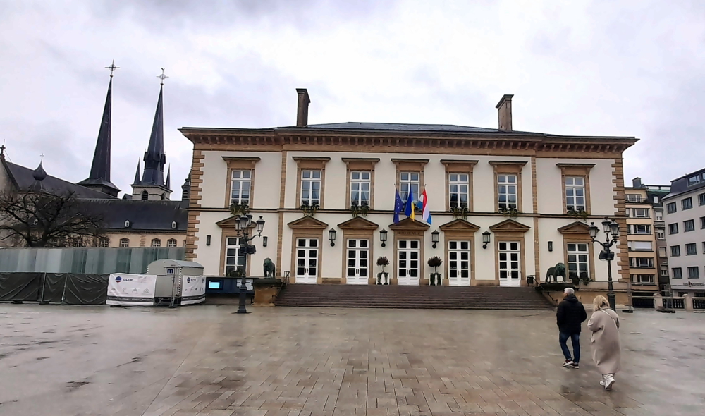
In 1797 the French seized the monastery with all its grounds and disposed of it part by part. In the following centuries the whole cluster of edifices was pulled down and the square redesigned. Today, the William Square hosts not only the Town Hall and the Luxembourg City Tourist Office, but also plenty of markets, open air concerts and feasts [Luxembourg ma ville].
Town Hall.
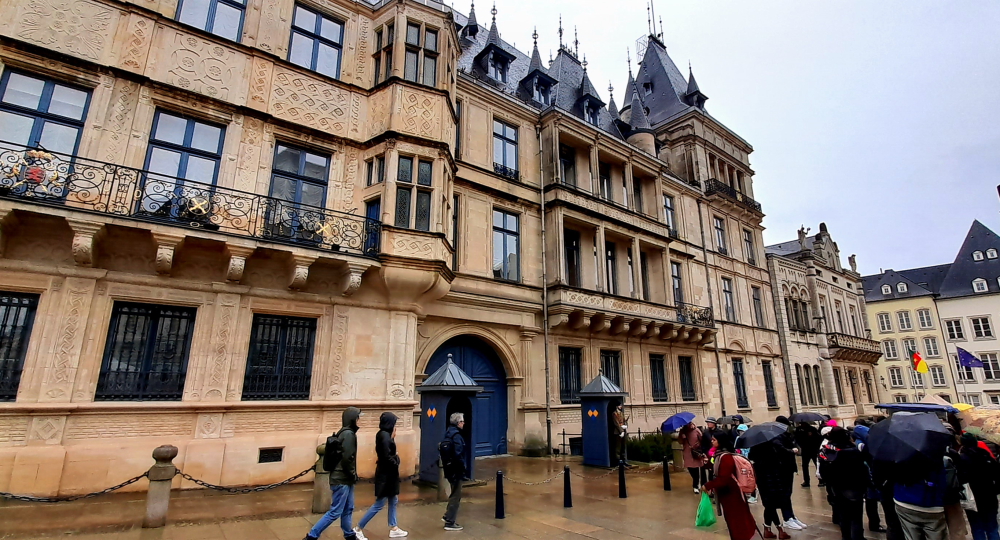
A short walk from the square, along Rue de la Reine we come to the Grand Ducal Palace which has only 1 guard standing on duty.
Grand Ducal Palace.
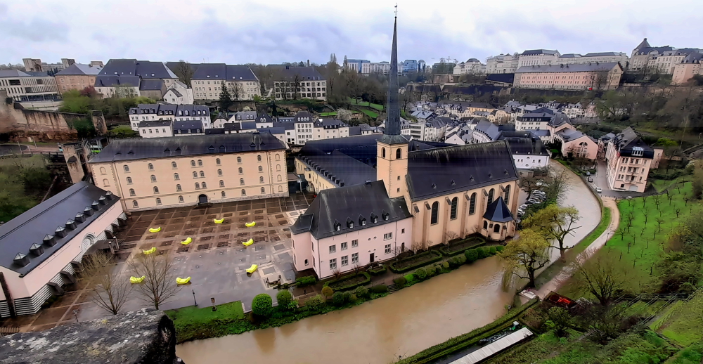
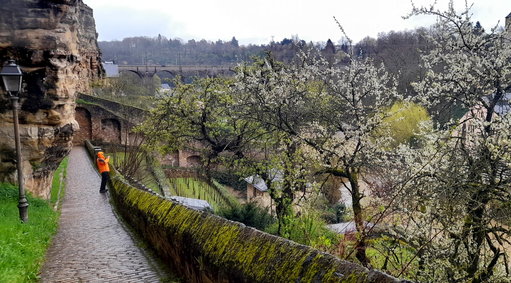
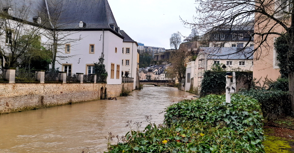
From here we walk along Rue de la Boucherie, past a host of small marquee tents that are part of a street market, alongside Saint-Michel’s Church and onto the Bock Casemates, also the N1 road.
View from the Casemates over the River Aizette, Church of Saint-Jean & Plateau du Rham.
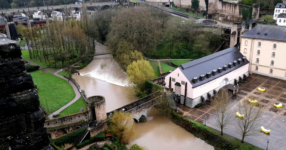
The Bock (Luxembourgish: Bockfiels) is a promontory in the north-eastern corner of Luxembourg City’s old historical district.
Pont de Stierchen straddling the River Alzette.
Offering a natural fortification, its rocky cliffs tower above the River Alzette, which surrounds it on three sides.
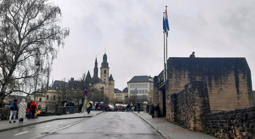
View back to the Old Town from the Pont du Chateau on top of the Casements.
It was here that Count Siegfried built his Castle of Lucilinburhuc in 963, providing a basis for the development of the town that became Luxembourg.
Walkway from the casements to the river.
Over the centuries, the Bock and the surrounding defenses were reinforced, attacked, and rebuilt time and time again as the armies of the Burgundians, Habsburgs, Spaniards, Prussians, and French vied for victory over one of Europe’s most strategic strongholds, the Fortress of Luxembourg.
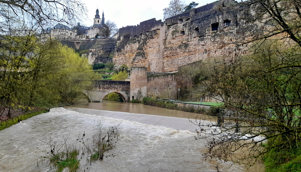
View upstream from Pont de Stierchen with casement galleries on the right.
Warring did not stop until the Treaty of London was signed in 1867, calling for the demolition of the fortifications. Ruins of the old castle and the vast underground system of passages and galleries known as the casemates continue to be a major tourist attraction.
On account of these impressive fortifications, Luxembourg was even given the epithet of the “Gibraltar of the North”. In 1994, the casements were inscribed on the UNESCO World Heritage List.
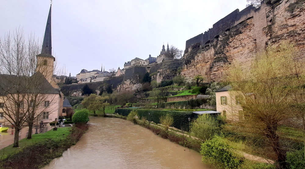
View from pedestrian bridge towards Pont de Stierchen & Eglise Saint-Michel.
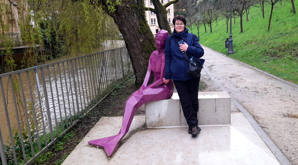
After crossing over the pedestrian bridge we walk upstream along the river bank where we come across a bright purple sculpture of a mermaid.
Melusina.
According to legend, Melusina was the wife of Sigfried, 1st count of Luxembourg, living in his castle on the rocky Bock promontory. On their marriage, Melusina required her husband never to see her during a particular day and night of the week.
House foundations forming part of the Alzette River bank.
One fine day, unable to resist his curiosity, Sigfried spied her in her bath through the keyhole of her room’s door and discovered her fish’s tail. Melusina, noting that her husband was watching her, then vanished forever into the torrents of the Alzette river.
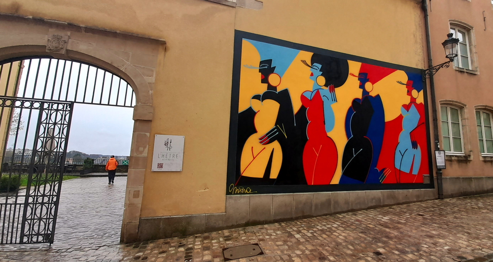
Entrance to Restaurant L’Hetre Beim Musee on Rue du St Esprit.
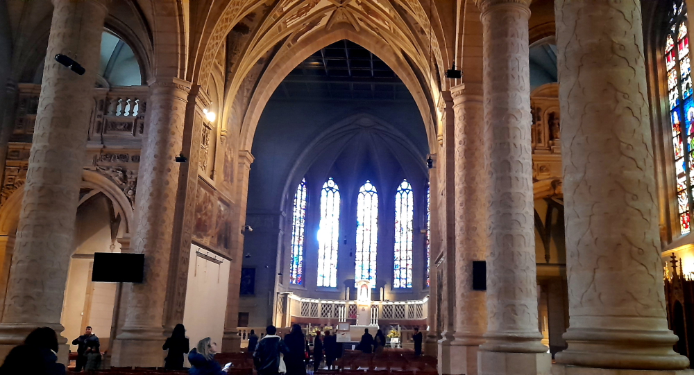
Walking up some switchback roads we arrive outside the Notre-Dame Cathedral.
Interior of Notre=Dame Cathedral.
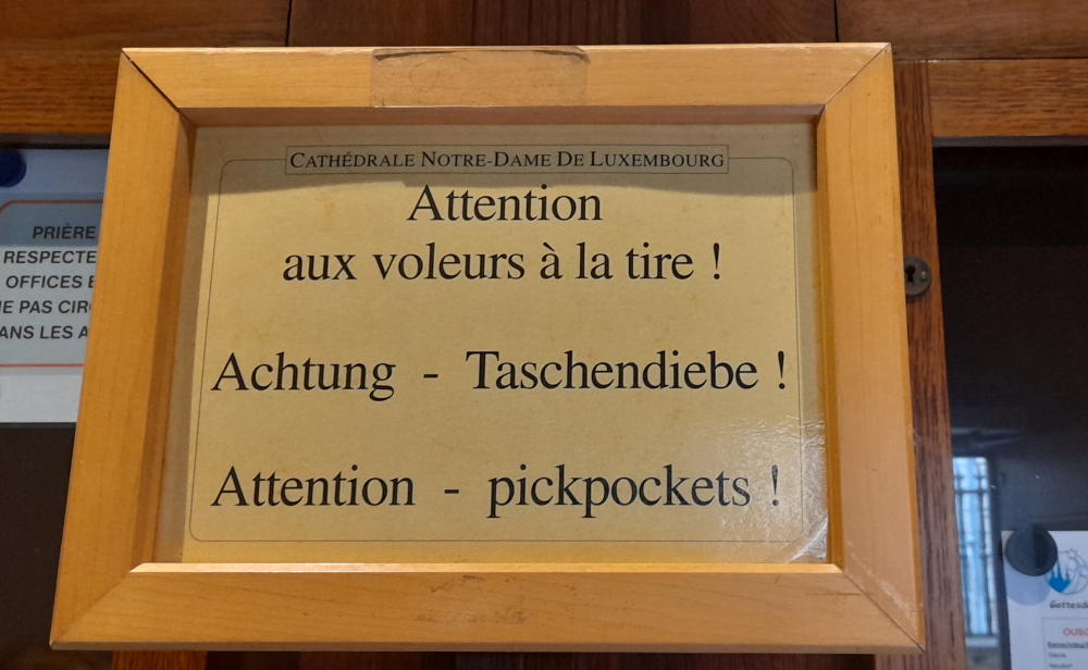
Where Lynn is a little taken aback by a prominent sign in the cathedral’s vestibule warning against pickpockets!
Is nothing sacred??
In all we spend about 1.5 hours wandering about the Old Town. After refueling (at Eu1.63/litre cheaper than France and Belgium) we drive back to the Resort where, over the course of the afternoon, the course is inundated with periods of alternating torrential rain and sunshine.
2 April, 2024
As today is supposed to be the least wet day of our stay, we plan to drive 51 km north to Chateau de Vianden, also close to the German border. But first, what makes Luxembourg, Luxembourg?
The Grand Duchy of Luxembourg is a small landlocked country in Western Europe bordered by Belgium, Germany and France. It is a representative democracy headed by a constitutional monarch, Grand Duke Henri, making it the world’s only remaining sovereign grand duchy.
Its capital, Luxembourg, is 1 of 4 institutional seats of the EU (together with Brussels, Frankfurt, and Strasbourg) and the seat of several EU institutions, notably the Court of Justice of the European Union. It is also a founding member of the EU, OECD, the UN, NATO, and Benelux. While Luxembourgish is the only national language of the Grand Duchy and its people, French is the only language for legislation, and all three – Luxembourgish, French and German – are used for country’s administrative matters.
With an area of 2,586 square kilometers (998 sq mi), Luxembourg is Europe’s 7th-smallest country. In 2023, it had a population of 660,809, which makes it 1 of the least-populated countries in Europe, albeit with the highest population growth rate with foreigners accounting for nearly half the population.
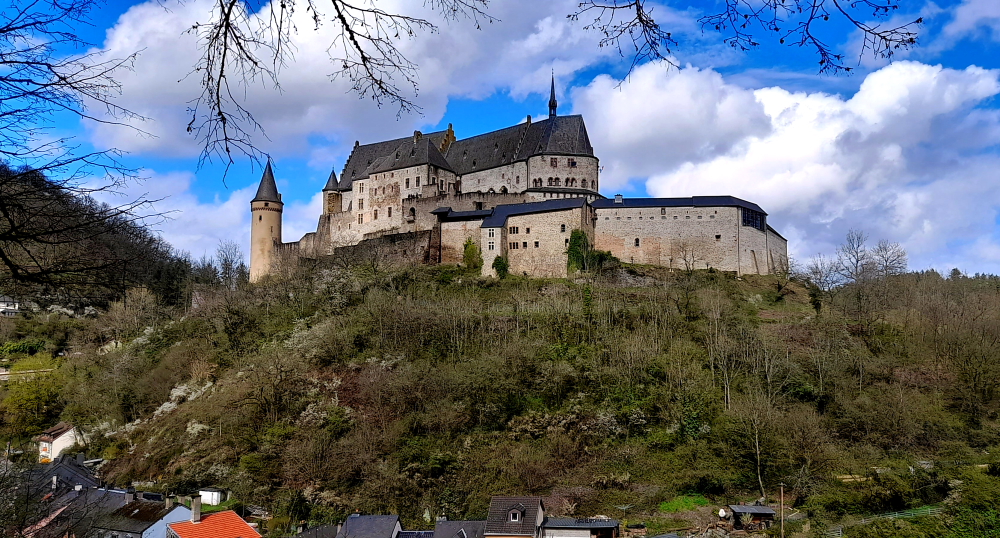
Back to Castle Vianden – “one of the 21 most beautiful castles in the world” (CNN).
Viandan Castle – view from Grand-Rue.
Vianden Castle was constructed between the 11th and 14th centuries on the foundations of a Roman ‘castellum’.
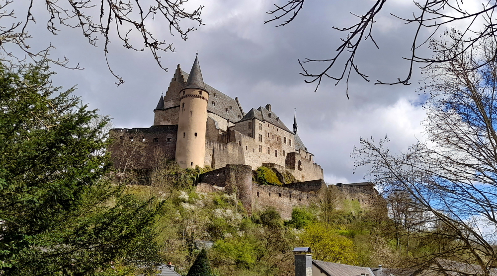
Castle view from Montee du Chateau.
It is one of the largest and most beautiful feudal residences of the romanesque and gothic periods in Europe.
Inner wall view from the castle bailey.
Until the beginning of the 15th century it was the seat of the influential counts of Vianden who could boast their close connections to the Royal Family of France and the German imperial court.
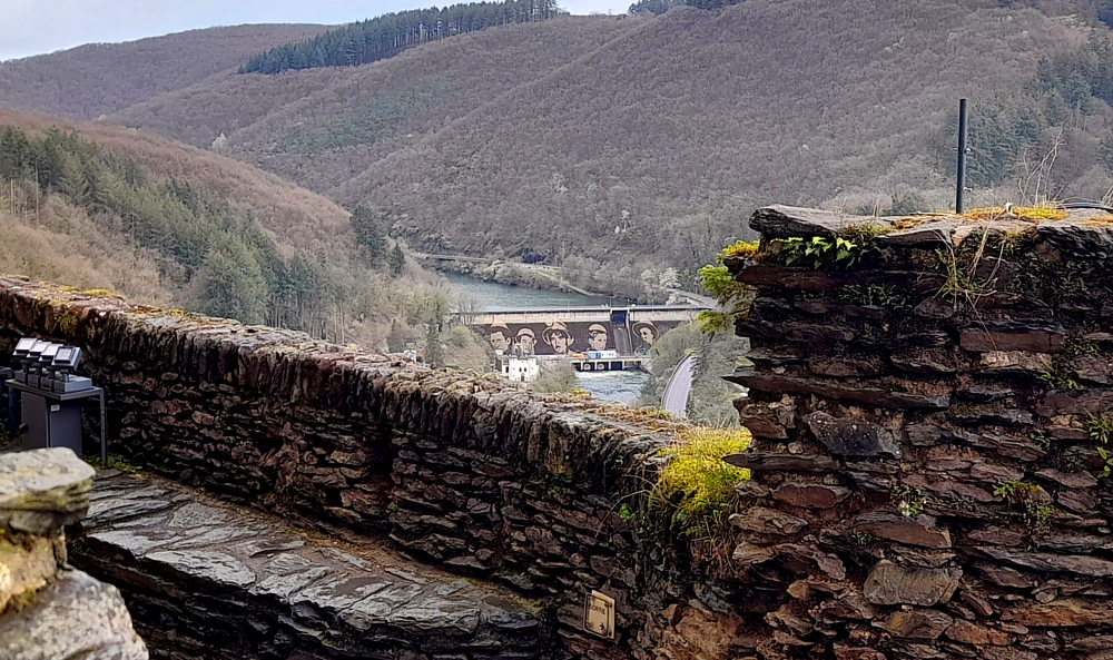
View of Viandan Dam/’reverse graffiti’ artwork on River Our from castle entrance.
Henry I of Vianden (1220-1250) is known as ‘the Sun Count’ for it is during his tenure that the holdings, lifestyle and influence of the House of Vianden reached its zenith.
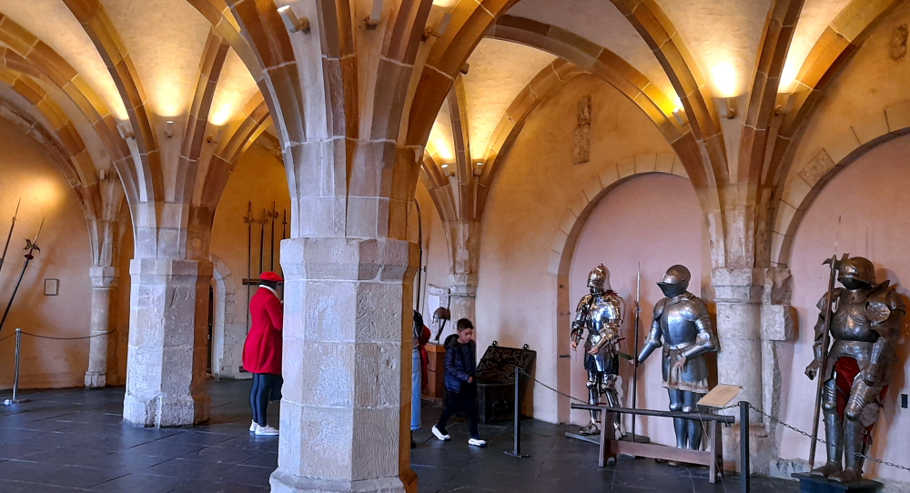
Arms Hall.
His ancestors were influential in the Ardennes, Eifel and Luxembourg regions for hundreds of years.
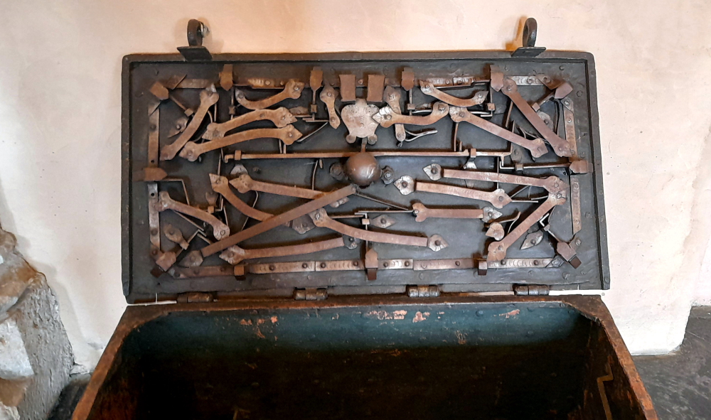
Arms Hall – complicated locking mechanism for chest.
His wife, Margarete of Courtenay, was of the French Royal Family, daughter of the Latin Emperor of Constantinople, sister-in-law to the King of Hungary and cousin to King Philip-Augustus.
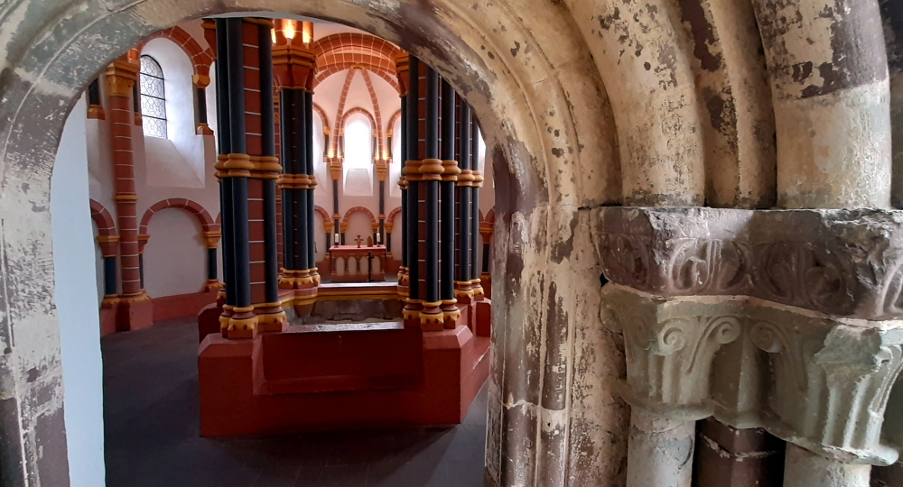
Upper Chapel – used by nobility.
Margarete’s ancestors, included the Crusaders from the Houses of Flanders and Hainault, Henry’s and Margarete’s son, Frederic had served in the Fifth Crusade.
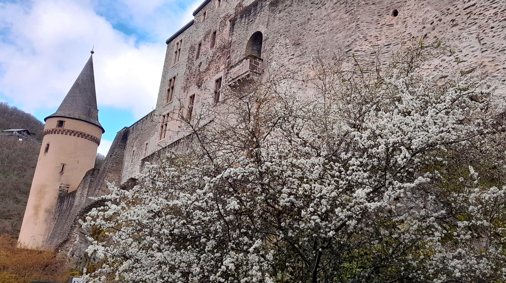
View of houses within old castle wall.
In 1417, the dominion passed by inheritance to the House of Nassau, which, in 1530 collected the principality of Orange as well.
Loggia-style gallery.
From then on, the castle was no longer the official residence of the counts.
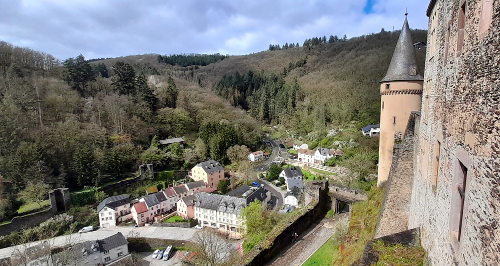
View of Vianden township.
The rich architecture the House of Nassau inherited can still be seen today, as no further modifications were made.
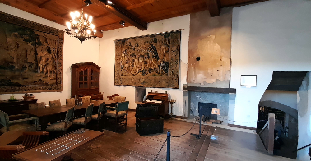
Banqueting Hall.
The main construction parts of the castle which are preserved today, in particular the chapel and the small and large palaces, originate from the end of the 12th and the first half of the 13th century.
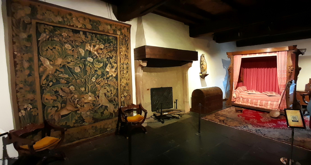
Bedroom.
The ‘Quartier de Juliers’ on the western side of the large palace (no longer existing today), originates from the beginning of the 14th century. The House of Nassau was only constructed at the beginning of the 17th century.
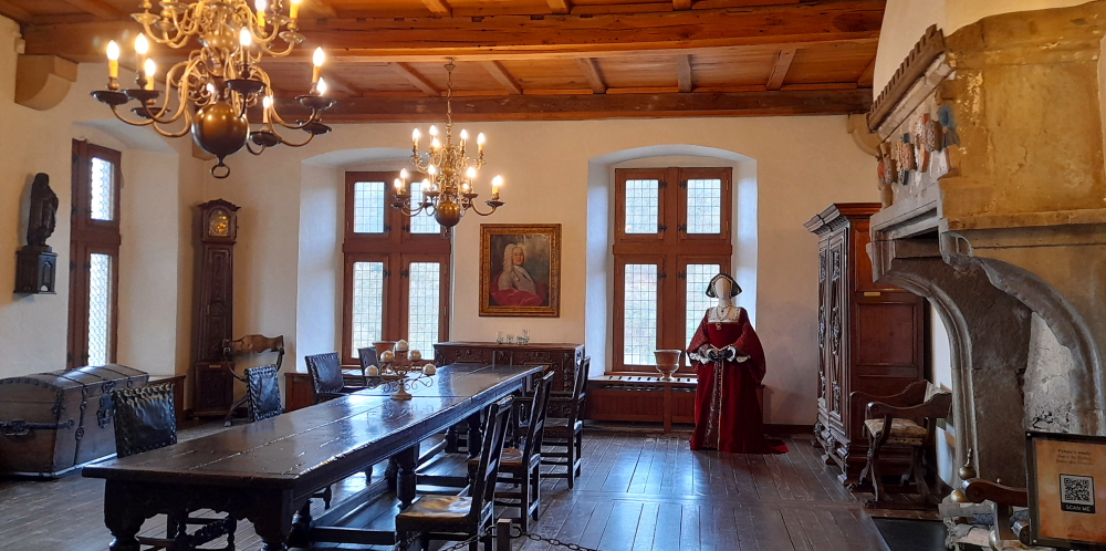
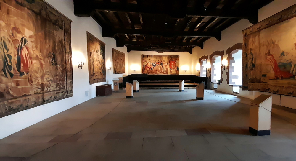
Vic. Abens Hall – event space with tapestries.
In 1820, under the reign of King William I of Holland, the castle was sold piece by piece, and as a result, it fell into a state of ruin.
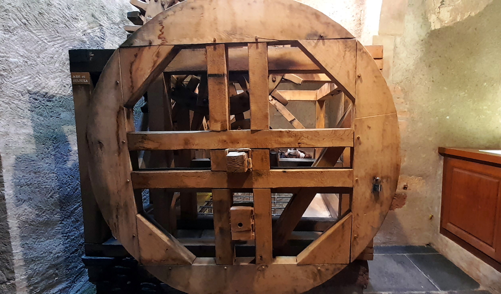
Grand Kitchen.
It was a pile of rubble until the family of the Grand Duke of Luxembourg transferred it to State ownership in 1977.
Wooden wheel over deep well off Grand Kitchen.
Since restored to its former glory, the castle now ranks as a monument of not only regional, but European importance [castle-vianden.lu].
Dining Hall off Grand Kitchen.
Several halls are dedicated to those responsible for the castle’s restoration, in particular: Charles Arendt and Jemmy Koltz.
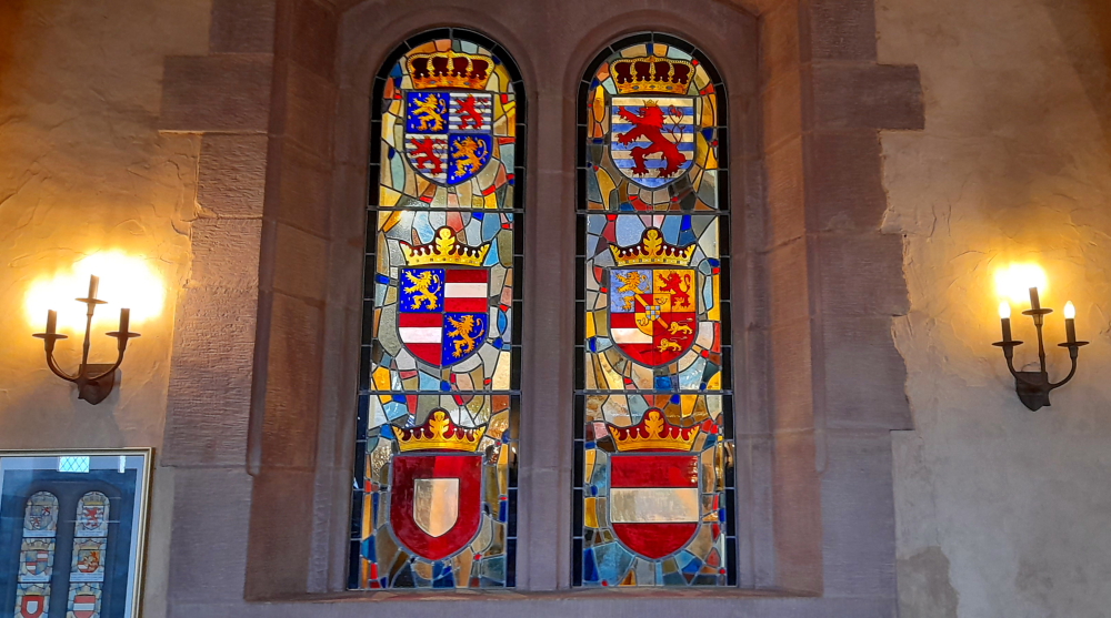
Knights’ Hall – stained glass coats of arms.
Jean Charles Wenzeslas Arendt (1825-1910) was state architect for Luxembourg and author of over 130 publications, mainly on architectural and art historical topics. He carried out extensive restorations of historical buildings, including the ruins of the Vianden Castle.
Presentation in the Information Centre.
Jean-Pierre (“Jemmy”) Koltz (1909-1989) was a Luxembourgish engineer, technician and historian. His main research topic and his passion was the building history of the Luxembourg fortress. He was also president of the Syndicat d’Initiative of the City of Luxembourg and of the Commission des sites et monuments nationaux where he was involved the restoration of various castles, especially the reconstruction of Vianden Castle.
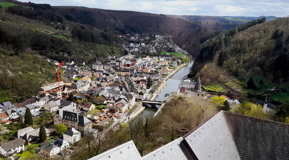
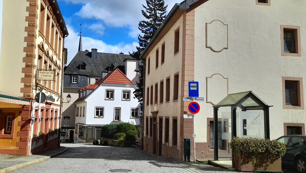
Vianden Town.
Below the castle is the picturesque, medieval walled town of Vianden. Within its walls is the Gothic Trinitarian Church which has a 13th-century cloister and the Victor Hugo Literary Museum is in a house that hosted the writer in 1871 during his political exile from France.
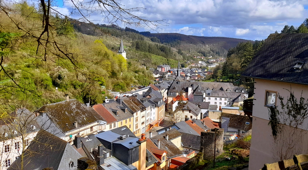
View of Vianden Town from N17.
In total we spend 3 hours wandering through the castle and enjoy the hour’s drive in sunshine back to the hotel.
Stark contrast to the rain-drenched countryside we saw 3 days ago.
Tonight we drive 10 minutes to a small, family restaurant in the town of Remich on the banks of the Moselle River. The food is pretty good but the meal is so large that we could have shared it.
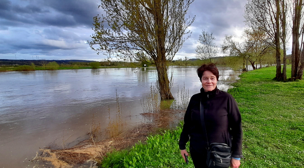
Post-dinner walk along the flooded Moselle River.
3 April, 2024
It has rained hard all day but we have no plans to be outside. Lynn has a massage booked this afternoon and I plan to spend that time in the indoor heated pool and jacuzzi.
We are heading to Heidelberg tomorrow but since it is only a few hours’ drive we plan to check out at noon and do our packing in the morning.
4 April, 2024
After breakfast this morning we have a WhatApp video call with my grandson for his 3rd birthday. As you would expect he is more interested in spending time playing with his birthday presents than talking to his grandfather. Still, we have an interesting call with Vanessa to catch up on their lives and get to see the ‘new’ addition to their family, Zara.
At 11:00 am we check out of the hotel and load up the car in the heavy rain and head across the Moselle River into Germany.
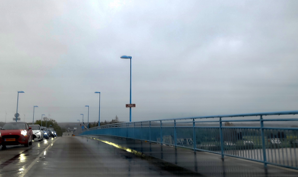
Crossing the Moselle River at Remich.
It rains heavily all the way to Heidelberg and, as usual, we encounter a heavy traffic jam near Mannheim where the freeway comes to a complete standstill. We manage to find a detour on smaller back roads direct to a supermarket just south of Heidelberg where we do our usual grocery shopping before checking in to our Aparthotel for the next 4 nights.
We have a suite at the Staycity Aparthotel just out of the centre of Heidelberg. The suite is modern and very comfortable.
View from our apartment in Heidelberg.
Tomorrow we are heading in to the old town for a walking tour but this afternoon we are just relaxing and doing our laundry in the hotel laundromat.
We leave Llanrwst, Wales at 10:00 am for our 147km drive to Ludlow, Shropshire, England, about a 2-hour drive. It’s sunny and the air has lost its chill as it’s 12 Deg. C.
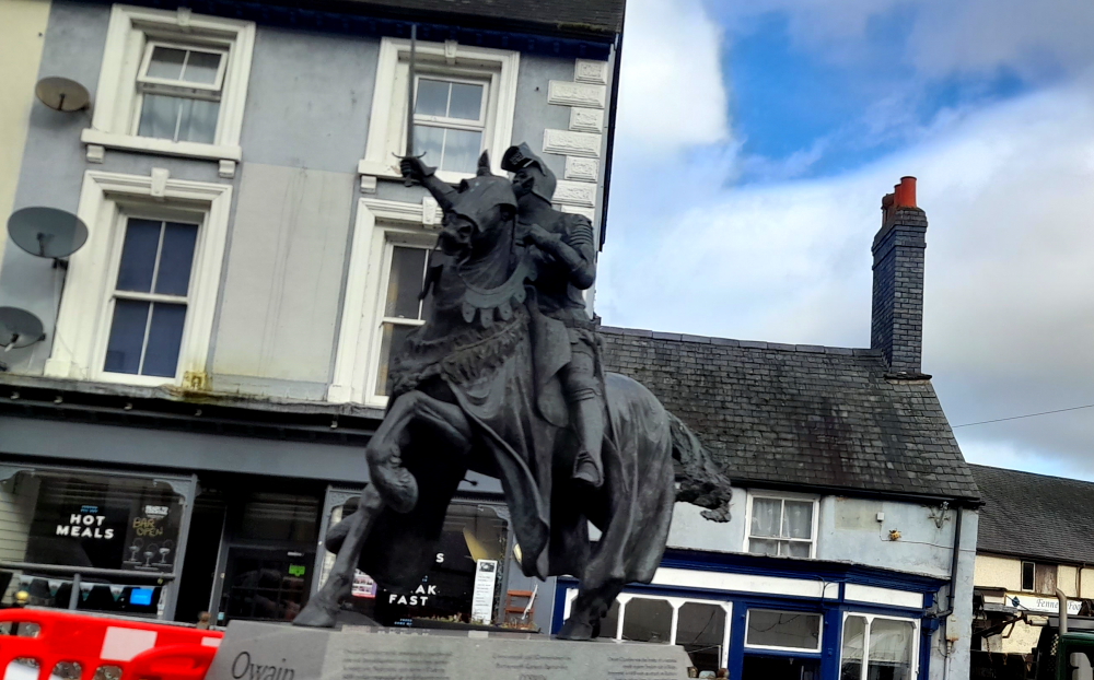
Our route takes us along the A5 through Corwen where we see a rather fearsome, life-size bronze statue of a knight on a steed, Owain Glyndwr (1359-1415) which is opposite the pub that bears his name. He had a home in Carrog, near Corwen, back in the day.
Also known as Owain ap Gruffydd he was a Welsh leader who led a long and fierce war of independence which he hoped would end English rule in Wales during the late Middle Ages. He formed the first Welsh parliament and is believed to be the last native-born leader to unite Wales in a common cause. He was the self-proclaimed Prince of Wales with a reign lasting from 1400-1415.
Owain Glyndwr.
We also pass signs for the Pontcysyllte Aqueduct, a navigable aqueduct that carries the Llangollen Canal across the River Dee in the Vale of Llangollen in northeast Wales.
The 18-arched stone and cast iron structure is for narrowboats and was completed in 1805 having taken ten years to design and build. It is 12 feet (3.7 metres) wide and is the longest aqueduct in Great Britain as well as the highest canal aqueduct in the world.
Pontcysyllte Aqueduct.
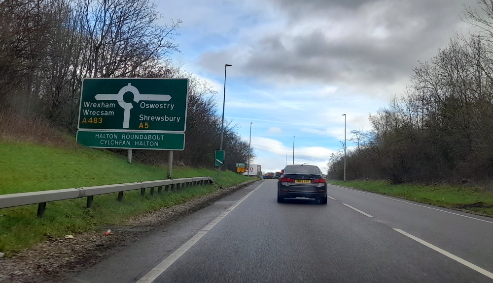
Soon after we arrive at a roundabout that by turning right we continue on the A5 towards Shewsbury. Going left we would end up in Wrexham which has achieved recent fame thanks to actor Ryan Reynolds and his mate, Rob McElhenney, buying its football club. We turn right.
Wrexham or Shrewsbury?
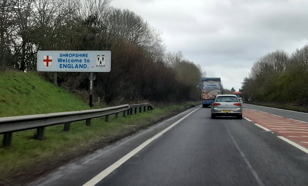
2 minutes later we cross the River Ceiriog and enter England once again. Bypassing Shrewsbury we take the A49.
Wales-English border.
It isn’t until we are virtually at Ludlow that we finally see a sign for it as you need to take the B4361 off the A49 to get there.
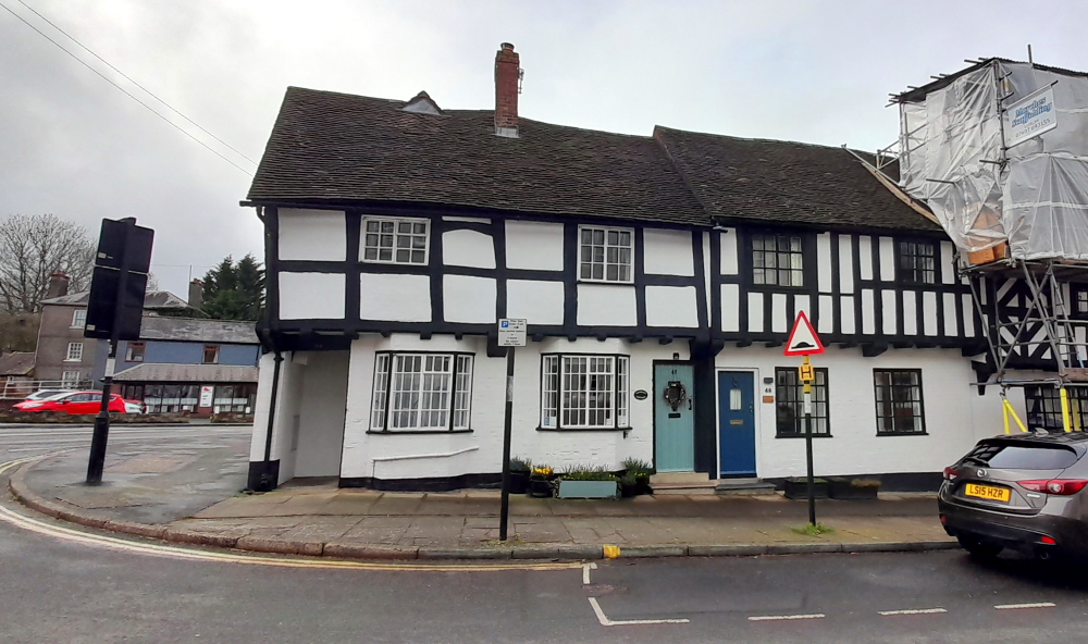
Fortunately, our hosts had agreed to an early check in so after shopping at the nearby Tesco we arrive at ‘Charlie’s Cottage’ in Lower Corve Street at 1:45 pm.
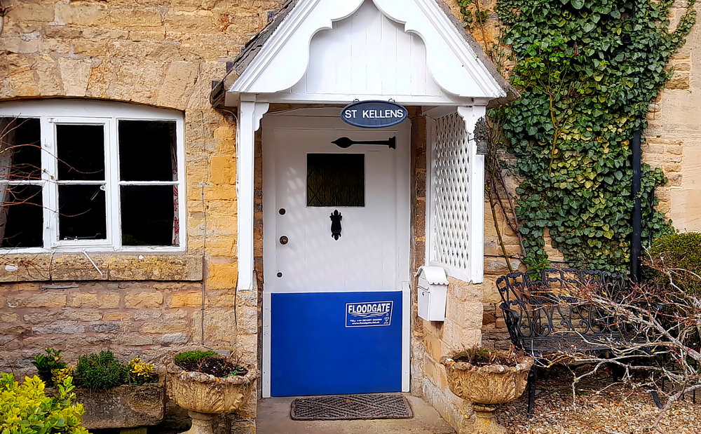
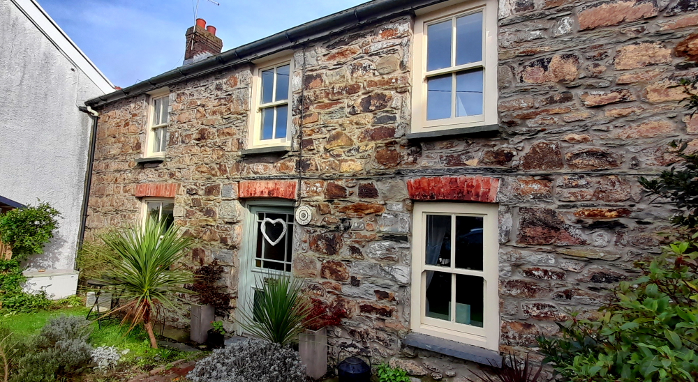
Charlie’s Cottage, Ludlow (the one with the pale blue door).
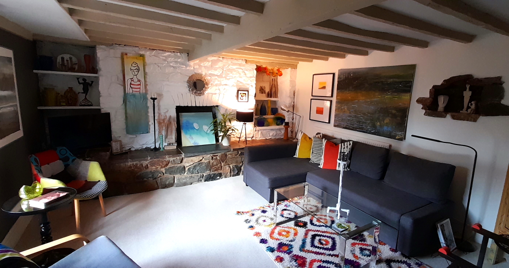
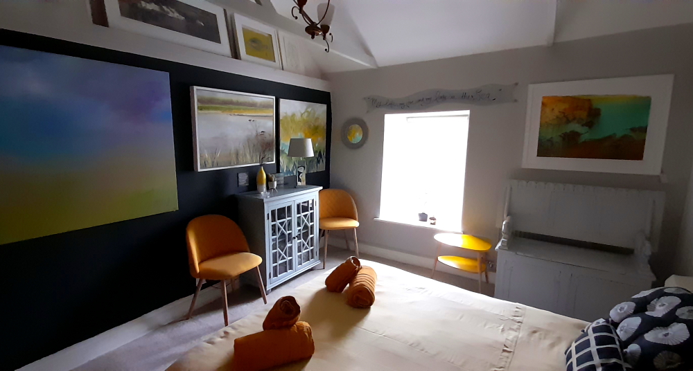
And what a delightful, cozy cottage it is, too. A Grade II* listed building built about 1650 and retains many of its original features – sloping beams, old brick fireplaces and the sloping floor in the main bedroom – not to mention the care and attention to its exquisite decor. Plus it’s functional and I don’t have to ‘duck or grouse’ at all!
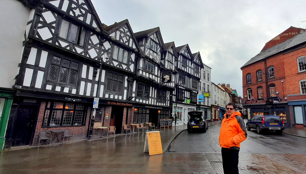
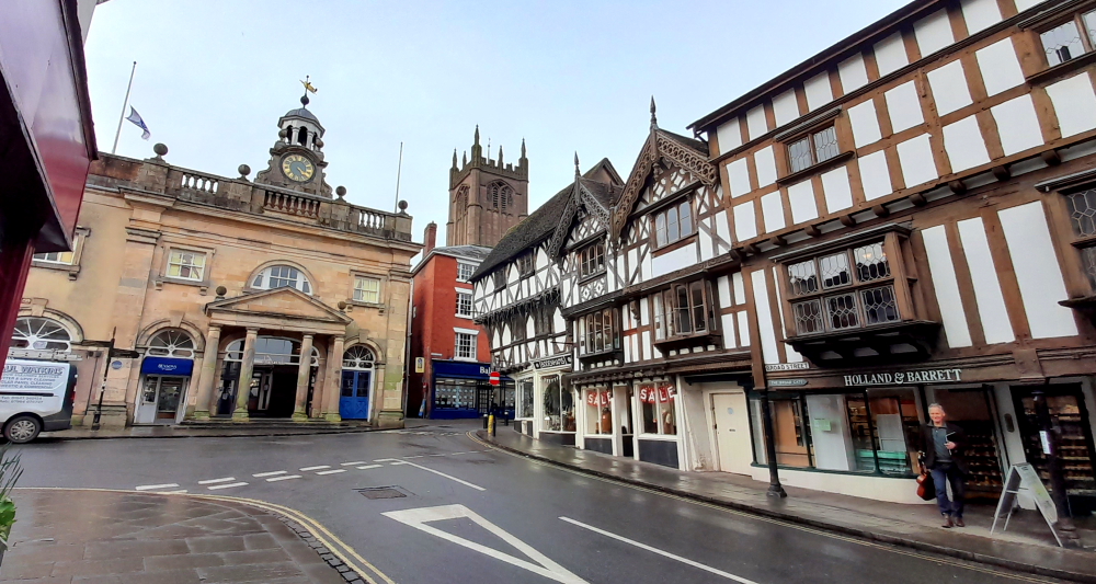
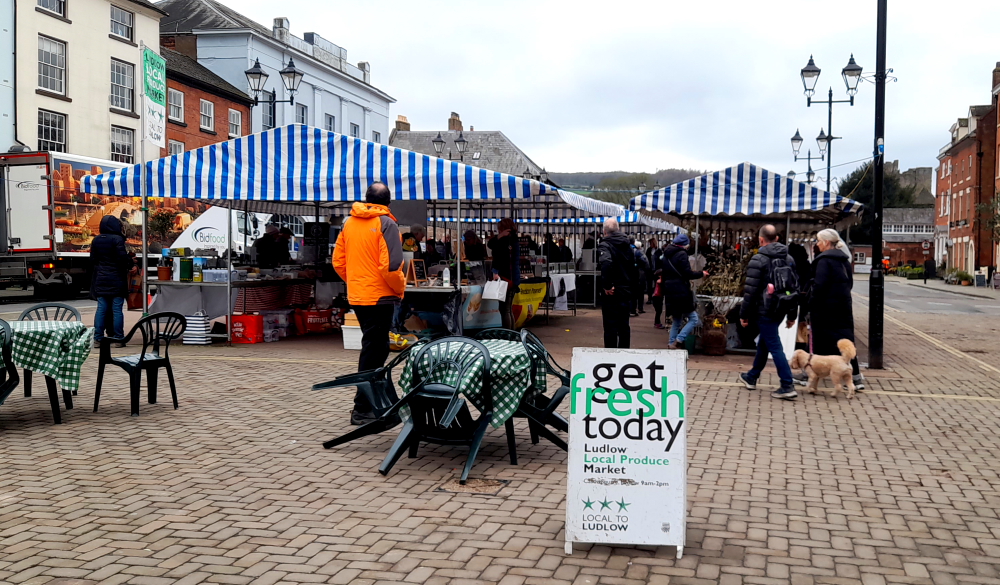
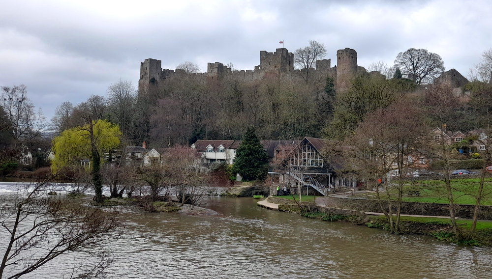
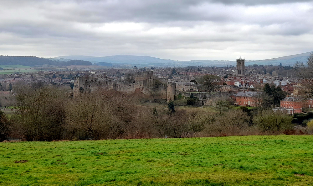
After unpacking we take an exploratory walk up the street. Ludlow is a thriving medieval market town and an architectural gem. The historic town centre and the 11th century Ludlow Castle are situated on a cliff above the River Teme and are surrounded by the south Shropshire countryside and the Welsh Marches.
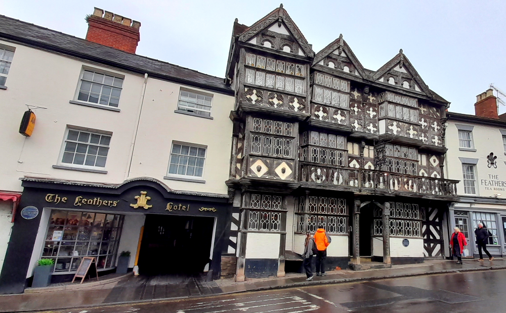
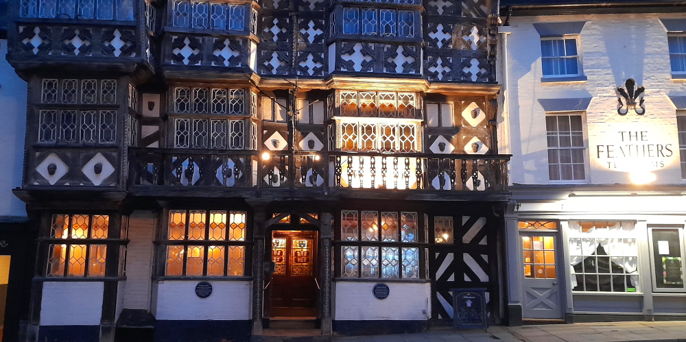
The Feathers Hotel, Ludlow.
First of its architectural gems we come across is The Feathers Hotel. Built in 1619 by an ambitious attorney called Rees Jones, who moved to Ludlow to pursue his career at the ‘Council of the Marches’, the building was converted into a hotel by his grandson 50 years later and has been welcoming guests since 1670.
The Feathers’ famous half-timbered Tudor façade is adorned with carved wooden motifs of the Prince of Wales’ three feathers emblem, which gives the hotel its name. Guests have stepped through The Feathers’ original studded plank front door, which survives to this day, and enjoyed food, drink, rest and relaxation within its Jacobean interior for over 400 years. [Feathers website].
Around the corner is Ye Olde Bull Ring Tavern. The area where the Corve Street track once turned into the early trading market was given the name of The Bull Ring, due to the fact that livestock was bought and sold there in an early version of a cattle market.
Built around 1365 on the former site of a cattle market, the buildings grew into houses and a pub. The original tavern is the central twin gable roofs. In the 18th century the house with the twin left gable roofs was an ale store, a shop. The shop at the right was, in 1905, Woodhouse Chemist, later bought by Boots; now a book shop. Mr Woodhouse had been Mayor in 1909 when the Princess of Wales, later Queen Mary, came to Ludlow and her patronage of his shop – the local tale is that she bought a toothbrush – entitled him to display the royal coat of arms.
Ye Olde Bull Ring Tavern.
Nikolaus Pevsner in his 1958 book ‘The Buildings of England: Shropshire,’ said, “they make up the longest continuous Elizabethan and Jacobean timber-framed frontages in Ludlow.”
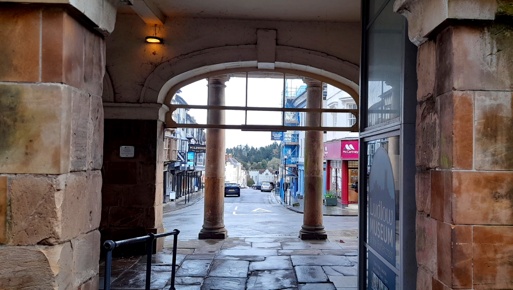
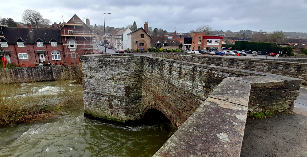
Further along is The Buttercross, now the Ludlow Museum. The building is prominently located within the historic walled town of Ludlow, forming a key focal point at the head of Broad Street. The Buttercross occupies the main approach to the town centre from the south, forming a pivotal point on the junction of Broad and High Streets that leads from Ludford Bridge via Broadgate to the Ludlow Castle gates. {Welcome to Ludlow].
View through The Buttercross building down Broad Street to Broadgate.
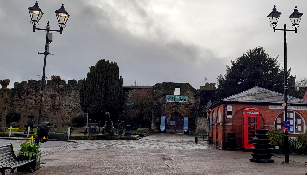
Walking along High Street we pass several pubs, passageways and the market square that leads to Ludlow Castle – a ruined medieval fortification. The castle was probably founded by Walter de Lacy after the Norman conquest and was one of the first stone castles to be built in England. Throughout history its owners were Geoffrey de Geneville (1250s), Roger Mortimer (1351), and Richard, Duke of York (1425). When Richard’s son, Edward IV, seized the throne in 1461 it passed into the ownership of the Crown.
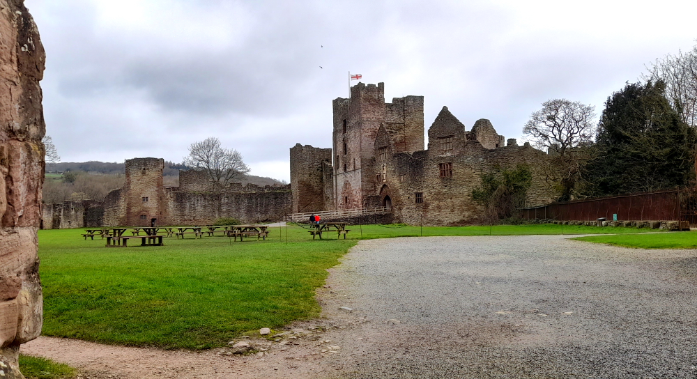
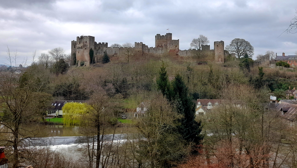
Ludlow Castle ruins.
Ludlow Castle was chosen as the seat of the Council of Wales and the Marches, effectively acting as the capital of Wales. The Castle was held by the Royalists during the English Civil War of the 1640s, until it was besieged and taken by a Parliamentarian army in 1646. Henry, 1st Earl of Powis, leased the property from the Crown in 1772 while his brother-in-law, Edward, 1st Earl of Powis bought the castle outright in 1811. In the 21st century it is still owned by the Earl of Powis and operated as a tourist attraction.
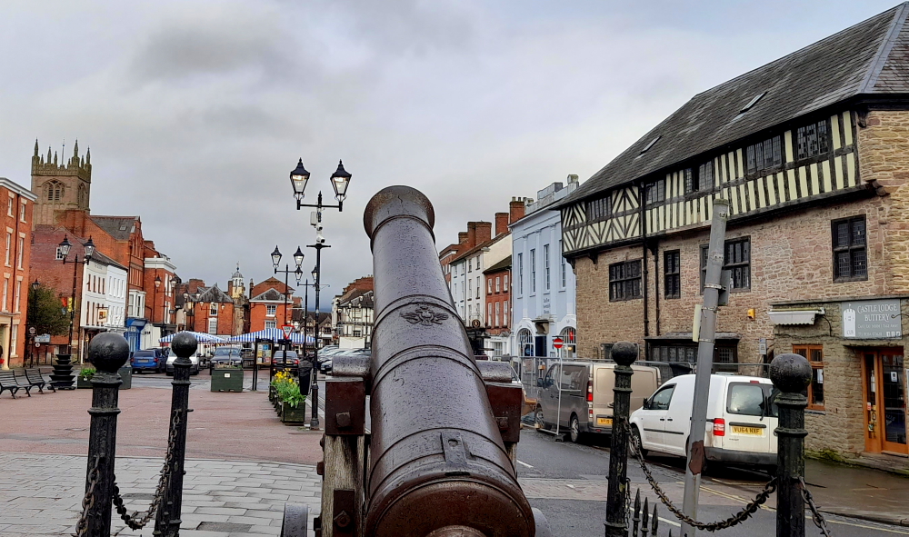
Ludlow market square.
Returning to the Buttercross, we pass by the Assembly Rooms until we reach Broad Street which we walk down.
The Buttercross, St Laurence’s Church and retail shops on Broad Street.
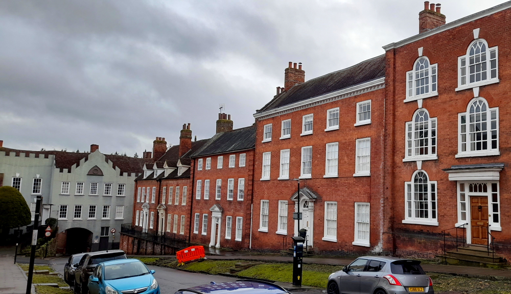
Broad Street, perhaps the finest street in Ludlow, has a variety of terraced town houses from Tudor to Georgian eras, many with heritage listings and several sporting blue plaques. It also has The Angel pub, an inn since at least 1555. In 1822 the Aurora coach went from this pub to London – in 27 hours!
Elegant Georgian terraced town houses in Broad Street.
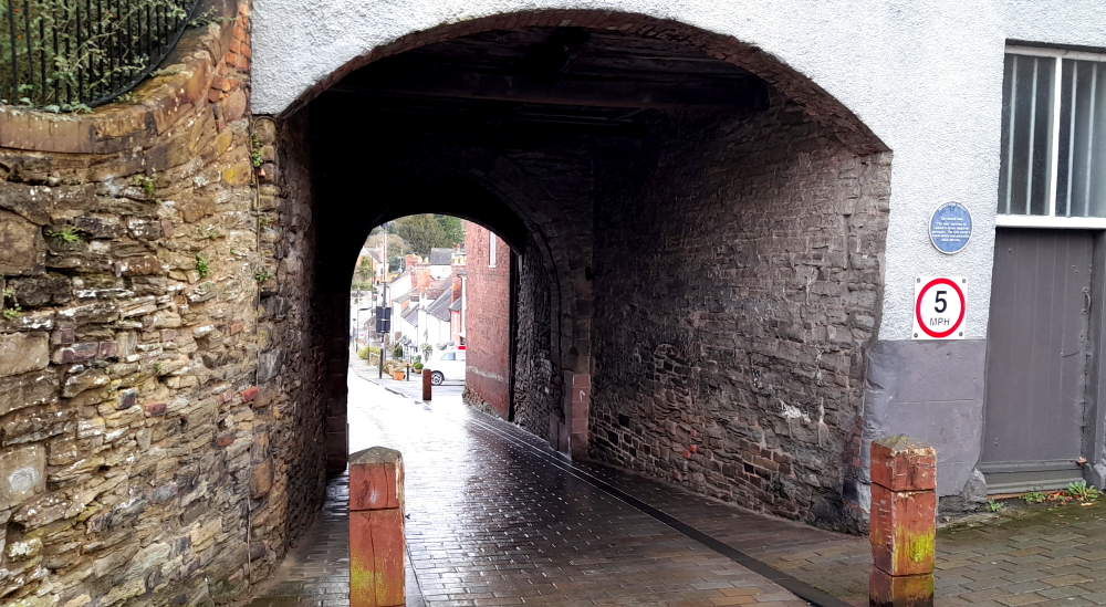
At the bottom of Broad Street is The Broad Gate, the only survivor of Ludlow’s 7 medieval gateways.
The Broad Gate.
The 13th century drum towers and portcullis arch survive.
Reverse side of Broad Gate and drum tower.
13 March, 2024
As it’s supposed to be raining later today we take off back up the A49 for 11km to Stokesay Castle. Needless to say, it starts raining immediately we start driving.
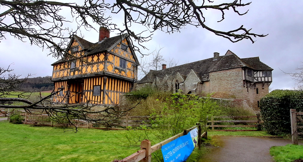
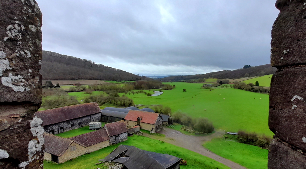
Rather than a castle, per se, Stokesay Castle is one of the finest surviving fortified manor houses in England, situated at Stokesay, north of Ludlow. The castle was never intended to be a serious military fortification. Originally designed as a prestigious, secure, comfortable home, the castle has changed very little since the 13th century, and is a rare, surviving example of a near complete set of medieval buildings.
Stokesay Castle from the churchyard.
It was largely built in its present form in the late 13th century by Laurence of Ludlow, on the earlier castle founded by its original owners the de Lacy family, then passed to their de Verdun heirs, who retained feudal overlordship of Stokesay until at least 1317.
Laurence ‘of’ Ludlow was one of the leading wool merchants in England, who intended it to form a secure private house and generate income as a commercial estate. Laurence’s descendants continued to own the castle until the 16th century, when it passed through various private owners. By the time of the outbreak of the First English Civil War in 1642, Stokesay was owned by William Craven, 1st Earl of Craven (1608–1697), a supporter of King Charles I. After the Royalist war effort collapsed in 1645, Parliamentary forces besieged the castle in June and quickly forced its garrison to surrender. Parliament ordered the property to be slighted, but only minor damage was done to the walls, allowing Stokesay to continue to be used as a house by the Baldwyn family until the end of the 17th century.
Restoration work was carried out in the 1830s and 1850s by William Craven, the second Earl of Craven. In 1869 the Craven estate, then heavily in debt, was sold to the wealthy industrialist John Derby Allcroft who paid for extensive restoration during the 1870s.
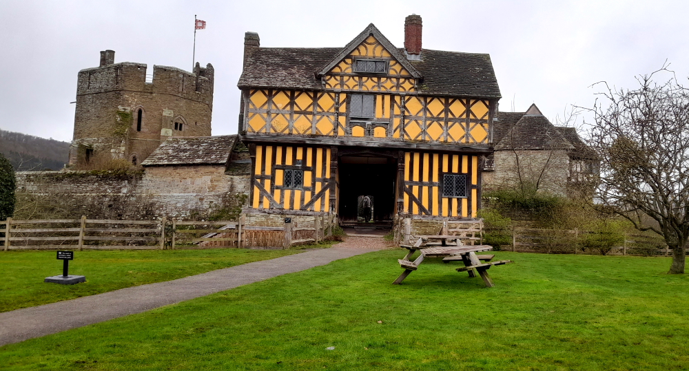
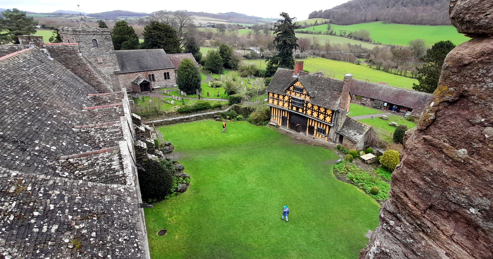
Architecturally, the castle has an entrance way through a 17th-century timber and plaster gatehouse.
Gatehouse fronting the manor house and South Tower.
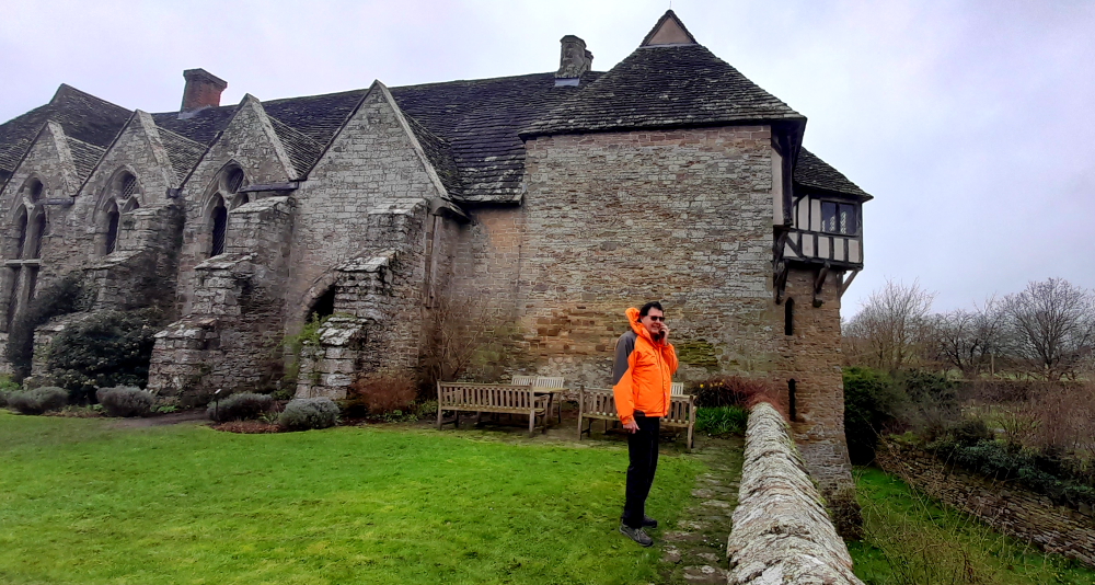
It’s surrounded by a walled, moated enclosure.
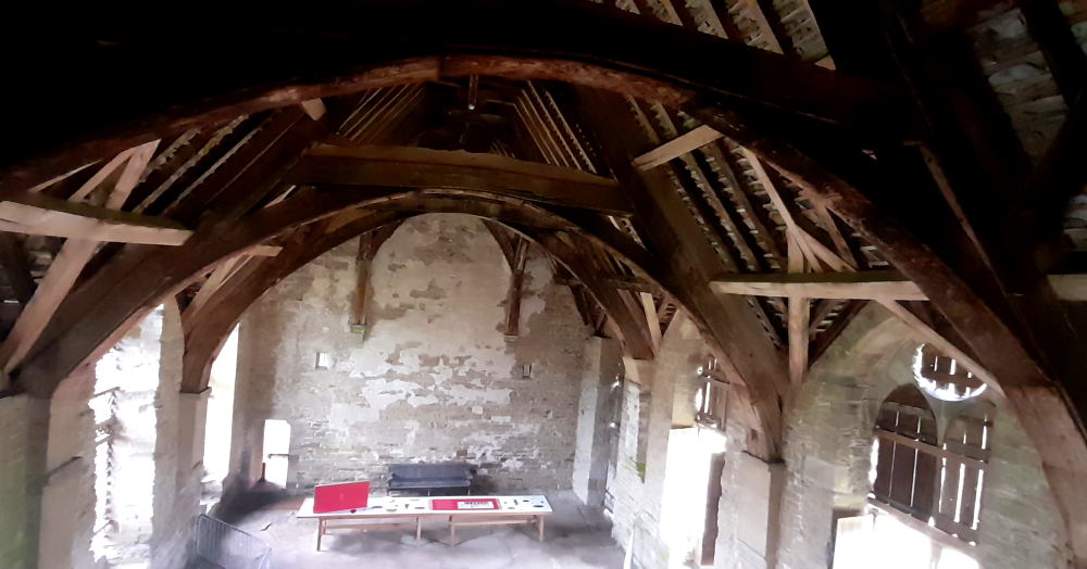
View of the Great Hall, North Tower and moated enclosure from the courtyard.
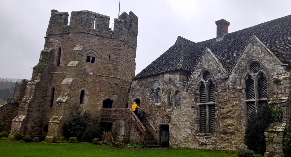
Inside, the courtyard faces a stone hall and solar block, protected by two stone towers.
View of the South Tower, Solar Block and Great Hall from the courtyard.
The hall features a 13th-century wooden-beamed ceiling and staircase, and 17th-century carved figures ornament the gatehouse and the solar block.
Great Hall with wooden-beamed ceiling.
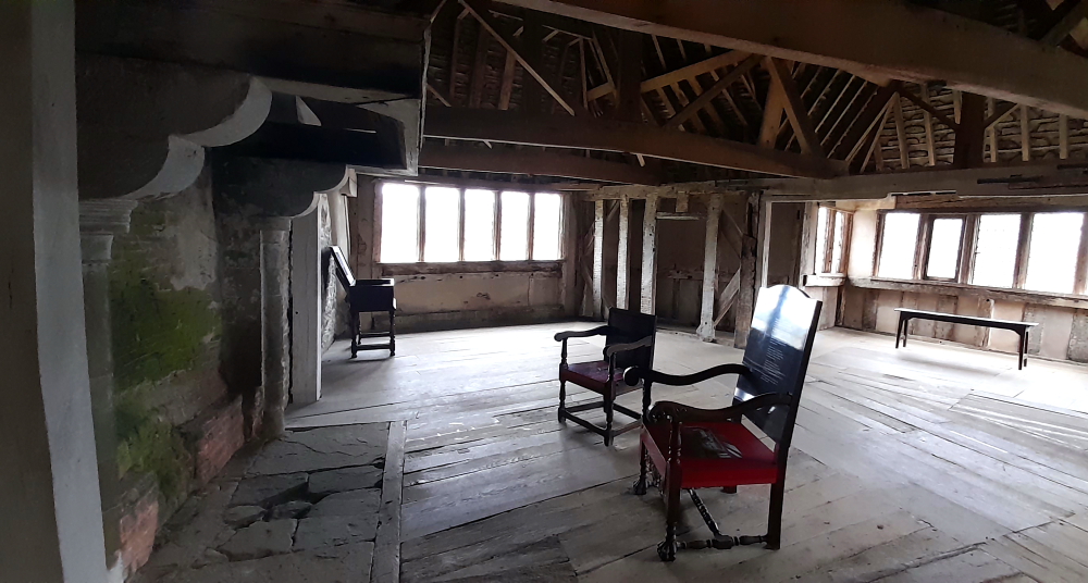
Up the worn, wooden staircase at the end of the Great Hall is access to the North Tower and a spacious room. It features a simple wooden-beamed ceiling similar to the great hall’s, a large fireplace with a wooden canopy and dual-aspect views through diamond-shaped Italian glass and lead light windows. Tapestries would have hung on the walls.
Spacious room with wooden-beamed ceiling.
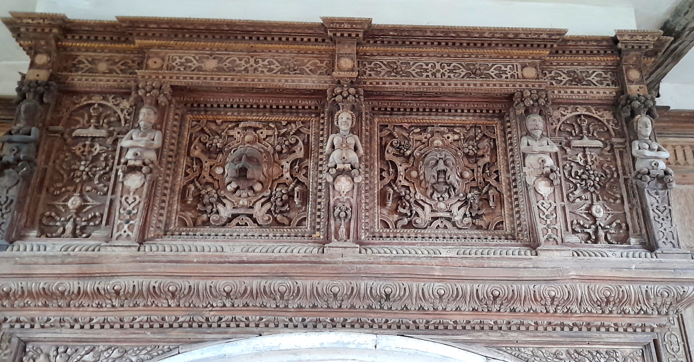
By contrast, the room in the Solar Block as decorated by the Baldwyn family some 400 years later in the 17th century is highly decorated with wood panelling, a plaster ceiling and an outstanding Jacobean fireplace overmantel which would have been painted in vivid colours at the time.
Jacobean fireplace overmantel.
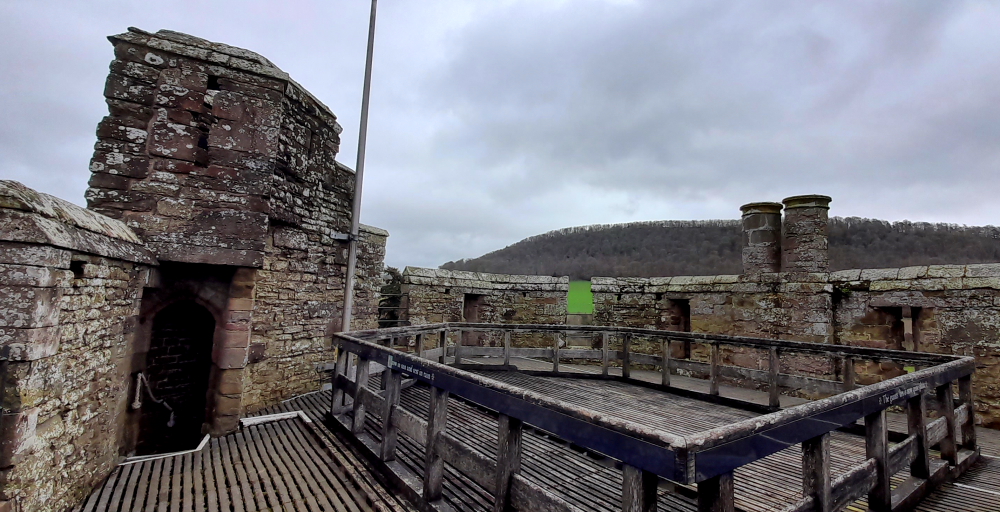
At the top of the North Tower are the parapets …
North Tower parapets.
… with commanding views of the surrounding Shropshire countryside …
View from parapets towards Ludlow.
… and a bird’s eye view of the castle’s buildings.
View of castle buildings from the parpets.
The castle became a popular location for tourists and artists, and was formally opened to paying visitors in 1908.
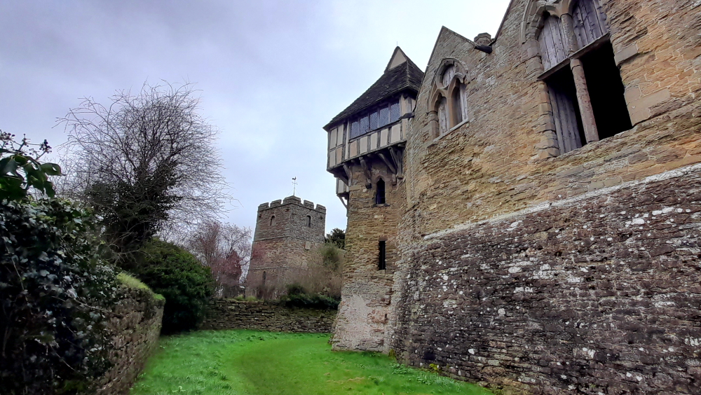
Church & North Tower from the moat.
Allcroft’s descendants fell into financial difficulties during the early 20th century, and had difficulty covering the costs of maintaining Stokesay. In 1986 Jewell Magnus-Allcroft finally agreed to place Stokesay Castle into the guardianship of English Heritage, and the castle was left to the organisation on her death in 1992. English Heritage carried out extensive restoration of the castle in the late 1980s. In the 21st century, Stokesay Castle continues to be operated as a tourist attraction.
The Feathers’ illumination.
Returning from dining at The George Inn on Castle Street this evening, as the town descended into twilight, its buildings became illuminated, some of them showing off their colourful stained glass..
14 March, 2024
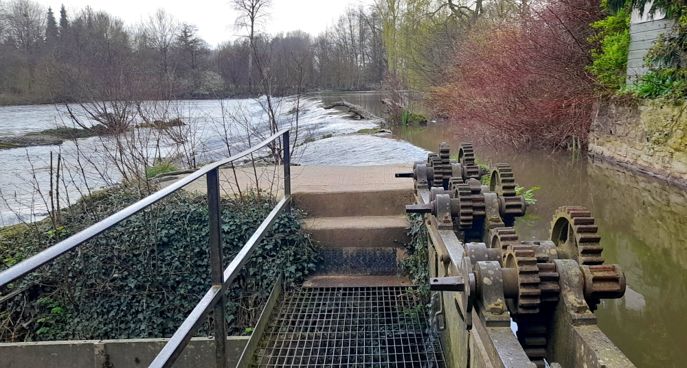
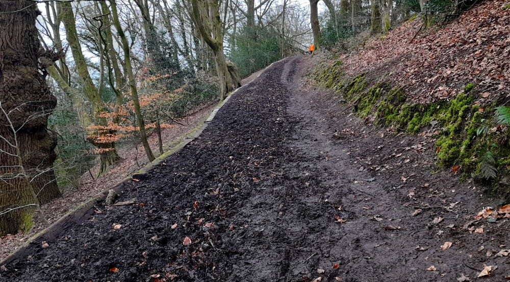
According to the weather forecast there is a brief window of ‘no rain’ between 11:00 am and 1:00 pm today so we venture out to see Ludlow Castle, the River Teme and Whitcliffe Common.
Market stalls in Market Square.
Previously we had arrived at the Market Square too late in the day to see the markets, but not today. Lots of local produce on sale.
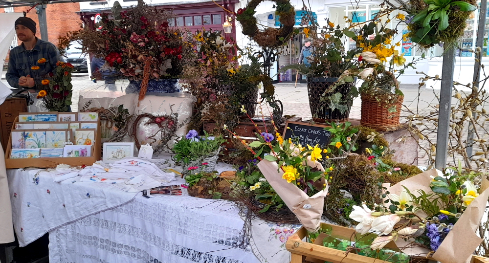
Floral stall at the market.
At the top end of Market Square is Ludlow Castle. Walter de Lacy, a trusted member of the household of William fitzOsbern, arrived in England with the conquering army of William the Conqueror in 1066.
FitzOsbern was rewarded for his loyal part in William’s victory with an Earldom over the lands of Hereford and planned to keep his new acquisition secure by developing a string of castles along the border of England and Wales.
Walter de Lacy was granted the manor of Stanton, which contained the site of present day Ludlow. Walter’s sons, Roger and Hugh, built the earliest surviving parts of the Castle that can still be seen today, and the de Lacy family retained the lordship until the end of the 13th century.
View of the Castle from the Outer Gatehouse on Castle Square.
1473-1483 Ludlow Castle was the home of Prince Edward (known as one of the ’Princes in the Tower’). He was in residence here when he learned of the death of his father, Edward IV, and assumed the title of King Edward V.
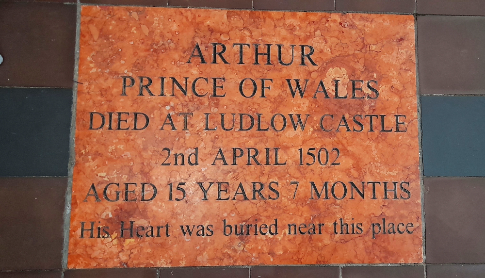
Prince Arthur (eldest son of Henry VII) spent a few months at Ludlow with his wife Catherine of Aragon before his death here on 2 April 1502. Catherine went on to marry Arthur’s brother, who became Henry VIII and their daughter, Mary, spent three winters at the castle between 1525 and 1528.
Throughout the 16th and 17th centuries, Ludlow Castle was held by the Crown, except for a brief time during the Civil War and the Commonwealth.
View through the Outer Gatehouse down Market Square.
The castle held great status as the centre of administration for the shires of the Marches and for Wales. The Council of the Marches was set up by Edward IV when he sent his son Edward, Prince of Wales, to live at Ludlow in 1473. It became responsible for the government of Wales and the border counties. For over a century Ludlow was seen as the capital of Wales and its courts were kept busy hearing criminal, civil and ecclesiastical cases. The result was a surge in construction at the castle to house the judges. Although primarily an administration hub, the castle had many features of an Elizabethan stately home. The Council was dissolved in 1641 but was revived with fewer powers from 1660 until its abolition in 1689.
Further along the Castle wall we walk through an entrance to the Castle Walk, between an outer and inner wall that leads us to the riverside. Here there is an old sluice gate that used to regulate flows into the River Teme.
Old sluice gate on the River Teme.
Taking the riverside path we walk under the stone Dinham Bridge, the work of Shrewsbury mason and contractor, John Straphen, who completed it in 1823.
Dinham Bridge over the River Teme.
In 1646 the town was besieged by a Parliamentary force and the castle was surrendered after negotiation. The castle was abandoned after 1689 when the Council of the Marches was dissolved and power was centralised in London. The townspeople looted the castle for useful materials and it soon became a ruin.
View of Ludlow Castle from Dinham Bridge.
In the 1760s the Government considered demolishing the castle, a costly exercise, so instead it was leased to the Earl of Powis in 1771. The castle began to attract visitors as part of the new tourism movement concentrating on the Picturesque style, and as part of this, walks were set out around the castle.
The Earl of Powis bought the castle in 1811 and it is now owned by the Trustees of the Powis Castle Estate on behalf of the family. [Ludlow Castle website].
Castle view from the opposite river bank.
Walking across the bridge we arrive at Whitcliffe Common and take the stairs and path to the top of the hill.
Here there are panoramic views of the Castle, Church, town and surrounding Shropshire countryside.
View of Ludlow town from Whitcliffe Common lookout.
Thanks to all the rain we’ve had the paths are a tad boggy.
Beating a path in the mud.
After walking down the hill we join The Bread Walk (workers were paid in bread so they didn’t squander their wages on booze) that overlooks the river until it meets Ludford Corner. Turning left we walk over the town’s second, but famous, bridge, Ludford Bridge.
Known as the Battle/Rout of Ludford Bridge which occurred on 12 October 1459 during the War of the Roses. A combined Yorkist force under the command of Richard, Duke of York, the Earl of Salisbury and the Earl of Warwick was routed by the Royal army after the Yorkists’ Calais garrison switched sides making a battle for the Yorkists futile. As a consequence of the battle, York, Salisbury and Warwick fled into exile in the dead of night although their army was pardoned the following day.
With the three strongest Yorkists out of the country it appeared that King Henry VI was once again secure in his position. However, the Yorkist faction regrouped very quickly and attacked in force in 1460 and 1461. [Schoolshistory.org.uk].
Ludford Bridge.
On the other side we are met by this rather interesting street sign at the corner of Lower Broad Street and Temeside.
Not sure exactly what the sat. nav. error is.
We walk up Lower Broad Street to Broad Gate and the Wheatsheaf Inn which is built onto the old town wall. We’re having dinner here tonight.
View of Broad Gate & the Wheatsheaf Inn from Lower Broad Street.
Broad Street leads uphill to the Buttercross and nearby at the corner of Market Square and Harp Lane is the Harp Lane Deli which has an amazing variety of tempting goodies. Pity Brisbane hasn’t one of these delectable shops in town!
Tantalising interior of the Harp Lane Deli.
I’ve built up a thirst after all that hill walking so we stop in at the Rose and Crown, the entrance of which is through a large wooden door and courtyard off Church Street.
The bar at the Rose and Crown.
A large sign over the front door states that the deeds of the inn date from 1102 and recorded as the Rose and Crown since the 13th century – one of the ancient public houses in England plying its trade continually as an inn for over 600 years.
We certainly appreciate that its interior is quirky with unmatched wood paneling creating nooks and crannies, rather than the Feathers Inn which has modernised its interior.
As we are in Church Street we slip through a laneway named Callens and into St Laurence’s Church. What a revelation!
St Laurence’s Church.
Now, I’m not a church visitor, I leave that to Lynn, but I must say this church is in outstanding condition thanks to the efforts of the Palmers’ Guild and others through the centuries and The Conservation Trust for St Laurence’s Church today.
St Laurence was one of the seven deacons of Rome who assisted the Bishop of Rome (the Pope). He was placed in charge of the administration of Church goods and care for the poor. For undertaking this duty, Laurence is regarded as one of the first archivists of the Church and is the patron saint of librarians.
Due to an act of defiance whereby instead of handing over the riches of the church to the authorities, he instead presented the poor to whom he referred to as ‘the riches of the church’. This act of defiance led to his martyrdom on 10 August 258. The traditional account of his death says that he was roasted on a gridiron, which has become his symbol [stlaurences.org.uk].
View of the Chancel.
The parish church was established as a place of worship in association with the founding of Ludlow by the Normans in the late 11th century. It is situated atop the hill around which the medieval town developed. The church was rebuilt in the year 1199 and has had several later additions and modifications.
Carved wooden detail of choir stalls.
The tower is 48 metres high to the top of the pinnacles and commands expansive views of the town and surrounding countryside. Notable features include an extensive set of misericords in the choir stalls as well as fine stained glass windows.
Prince Arthur (1486-1502) was the eldest son and heir of King Henry VII. In 1492 he became Prince of Wales and spent some time at Ludlow Castle as head of the Council of the Marches.
In November 1501 Arthur made an arranged marriage with Catherine of Aragon. They came to Ludlow Castle several months later but on 2 April 1502 he died of sweating sickness.
His ‘heart’ (euphemism for bowels!) was buried at St Laurence’s. 3 weeks later, with much pageantry, a funeral service was held after which the body was taken in procession to Worcester Cathedral, 33 miles away, where a chantry chapel marks his grave.
Stone placed in the Chancel.
Another feature of the church is the ornate carved altar screen and the beautifully preserved 16th century tombs of Council of Marches nobles – here Sir Robert Townshend, Knight Chief Justice of the Council of Wales and Chester and Dame Alice, his wife (1555).
Sir Robert Townshend & Dame Alice tomb adjacent to ornate altar screen.
Elsewhere Edmund Walter, also a Chief Justice (1592) and an ornate wall-mounted monument with 3 coats of arms to “the Right Honorable Syr Henrye Sydney, Knight of the most Noble Order of the Garter, Lorde President of the Councell of Wales and the Ladye Marye daughter of ye famous Duke of Northumberland who died in Ludlow Castle” (1574).
View from the Choir towards the West window.
The stone tracery of the West window dates from the remodelling of the church in the second quarter of the 15th century, but the glass is 19th century. The artist was Thomas Willement, the ‘Father of Victorian Stained Glass’. The figures in the 11 main panels are connected with Ludlow’s history, 7 of whom were Lords of Ludlow.
West window.
The other remarkable feature of the church are the 3 modern additions that do not detract from the sacred space within this edifice: the Icon Coffee Shop, the Gift Shop and an informal seating area with leather settees, not to mention the church is a venue for recitals and concerts – a church dedicated to serving its community.
15 March, 2024
After breakfast while I’m sorting the photos for the blog, Lynn decides to venture into town once more to discover parts we have missed. In particular, Mill Street which runs between the Ludlow Assembly Rooms and the Castle Lodge Buttery. Here resides the Guild Hall, a 15th century timber structure remodelled in red brick in 1768, which housed the Ludlow Magistrates’ Court. In 2012 Ludlow Town Council took up residence and the chamber now used for council meetings.
Guildhall & adjacent Coach House.
Built around 1410 by the influential religious guild of Palmers (pilgrims to the Holy Land) who supported St Laurence’s Church and sold in 1552 to the town for civil use, is notable for being the only known aisled hall in Ludlow. Despite extensive 18th century refurbishments, the hall retains its original 15th century roof.
Mill Street ends at the old town walls and the site of what was Mill Gate.
Turning right onto Camp Lane follows the town wall which joins the street named Dinham. On this street is Dinham House, an 18th century town house used by the Knights of Downton, the Johnes of Croft Castle and the Earls of Powis.
Dinham House (centre).
Apparently Lucien Bonaparte, brother of, was a prisoner here in 1811.
Further up the road is Dinham Hall, built in 1792 by Samuel Nash, agent of Richard Payne Knight of Downton Castle – and currently for sale! At No. 2 Dinham – the half-timbered house on the left in above photo – a blue plaque states: “‘Newly built’ in 1656 after burning in the Civil War.”
The Fish Feast at The Corner House restaurant on the Bull Ring is the venue for dinner tonight. I order a sea bream which is just delicious and perfectly cooked – not a sentiment I usually make about English cuisine!
16 March, 2024
After checking out at 10:15 am we drive directly to Lower Slaughter for a 4-night stay at The Slaughters Country Inn which takes about 1.5 hours to cover the 108km. The Slaughters (Upper and Lower) are between Stow-on-the-Wold to the north and Bourton-on-the-Water to the south in the Cotswolds.
The name ‘slaughter’ makes it sound like the villages have a dark history. But it’s a mispronunciation of the Old English word ‘slothre’ which means muddy or miry place, and came about due to the River Eye which flows through both villages.
The view of the hotel grounds from our room.
We arrive at 12:45 pm but check-in isn’t until 3. Fortunately our room becomes available around 1:30 pm so after a quick unpack we pull up the chairs and settle in to watch the final 3 matches of the 6 Nations Rugby tournament that start at 2:15 pm. In particular, the exciting Ireland v Scotland game which Ireland finally wins 17-13 and retains its Championship crown for another 2 years.
17 March, 2024
It’s such a nice, sunny morning that after breakfast we wander around the village of Lower Slaughter.
Entrance to The Slaughters Country Inn.
Through the village and in front of the Inn runs the River Eye, its waters quite shallow and crystal clear.
River Eye in front of the Inn.
Across the road from the Inn is the Lower Slaughters Manor, now an hotel. It is known that a manor house stood on the site before the Conquest, even as early as 1004 A.D. In 1443, the Manor became a convent housing nuns from the order of Syon, the order being granted the land during this period. The Manor was returned to the crown in 1603 and in 1611 was granted to Sir George Whitmore, High Sheriff of Gloucestershire. It remained in his family until 1964 when it became a hotel. The property was purchased by Andrew Brownsword Hotels, who also own The Slaughters Country Inn, in 2011 and renamed The Slaughters Manor House [slaughtersmanor.co.uk].
The Slaughters Manor House.
Next door to the Manor House is St Mary’s Church which was built in the Norman and then the Decorated style. It was rebuilt in the Victorian era in the Decorated Gothic style.
St Mary’s Church.
Like the village, the church is in immaculate condition and features interior arches.
Interior of St Mary’s Church, Lower Slaughter.
Walking along the river path in the direction of Upper Slaughter we come to The Old Mill on the edge of the river.
The Old Mill with intact wooden water wheel.
In April last year it was announced that the mill, a popular Cotswolds’ attraction and which also housed a museum, gift and craft shop and cafe was to close 2 months later after 35 years. Many have stopped to take photographs of the water wheel at the mill, which was built in the 19th century and was last used commercially in 1958. The site is one of the reasons why the village has in the past been named as the prettiest in the UK [gloucestershirelive.co.uk].
Row of honey-coloured stone cottages opposite the Lower Slaughter Hall.
When we return to the Inn about 30 minutes later the sun has broken through again so we have a coffee on the terrace.
Terrace for coffee. Our room is the 2nd-floor gabled window behind Lynn.
The Inn is located on an area formerly known as Washbourne’s Place which took its name from the family who owned it in 1470. The building was originally divided into three farm-workers cottages with a stable block.
Sun-lit hotel grounds viewed from the terrace.
In the early 1920’s the cottages were converted into a large private house before it became an Eton cramming school. The boy’s assembly and dining room was located in what is now the Inn’s bar area and Westbury, one of the Superior bedrooms, used to be the location of the Headmaster’s office. The barn building was a recreation area, with the upper floor covered by a large model railway.
View of the terrace from the pond.
After its school days Washbourne’s Place reverted once again to private ownership and in 1988, the house opened as a hotel, known as Washbourne Court. In 2011 the Brownsword family bought the hotel and reinvented the property as a traditional country inn, renaming it The Slaughters Country Inn [theslaughtersinn.co.uk].
Lynn with Igor & Tania in front of The Old Mill.
Today, Lynn has invited her friends, Tania and Igor, who have graciously driven from their home in Princes Risborough, Buckinghamshire to join us for Sunday Lunch at The Inn.
Tania & Lynn in front of the Manor House.
Lynn and Tania first met when Lynn lead a project at a Barclays office around the corner from Pall Mall, London in 1999 where Tania worked in IT and they’ve remained firm friends. They last saw each other at Lynn’s farewell bash in April 2010 and have stayed in touch since. After a delightful lunch in the restaurant catching up and coffee on the terrace where we discuss Russia – their homeland which they left years ago – the 4 of us wander around the village in warm sunshine before they depart. Perhaps we will next see them in Brisbane?
18 March, 2024
An amazing top of 15 Deg. C. is predicted today with little chance of rain so we don our boots and jackets and walk the Warden’s Way to Bourton-on-the-Water – about 30 minutes to walk the 2.4km.
Today is Monday and, as we enter town around 11:30 am in mid-March, the town is already starting to heave with visitors and cars vying for parking spots.
One of the first places we come across is the The Duke of Wellington pub on Sherborne Street. This is where I stayed for several days during winter in about 1984. In contrast to today, there was snow on the ground and very quiet with few tourists.
The Duke of Wellington pub.
From here we take the path along the River Windrush that bisects the town. At the Sherborne Street bridge the river runs between a bakery and the Motoring Museum – complete with a Mini made from grass.
The Motoring Museum at Bourton-on-the-Water.
Walking to Bourton this morning it was evident that Spring is just around the corner – the increased volume and variety of birdsong, spring blooms and leaf buds on bare branches – such as the willow near the Sherborne Street bridge.
Willow with spring foliage on the River Windrush.
Unfortunately, large swathes of grass have become trampled and muddy at the river’s edge on the upper reaches, so there are incidents of red and white tape cordoning off areas – a bit of an eye sore.
Downstream view.
But lower downstream the scenery is quite picturesque with a variety of stone bridges and houses.
View upstream.
Retracing our steps on the other side of the river, walking along the High Street, there is a filigree town sign.
Bourton town sign.
Of course, the Poms being their eccentric selves, demands a gesture – in this case a crocheted cover topped with a rodent ensemble for the Royal Mail post box!
Crazy crochet!
The past few weeks in Wales we’ve seen lots of magnolia trees with tiny buds. Here they are finally in full bloom.
Magnificent magnolias.
RIght, that’s Bourton done. Time to retrace our steps to Lower Slaughter. The Avenue passes by St Lawrence’s Church and tomb stones.
St Lawrence’s Church.
There has been a church on this site since 709 AD. The church also has a list of Rectors dating back to 1291. Like St Laurence’s Church in Ludlow, the interior space has been reconfigured to meet the current needs of the community in addition to its pews.
Altar, ceiling and stained glass within St Lawrence’s Church.
Besides the small, ornate altar screen, the church’s ceiling is decorated with heraldic devices. 8 of those are listed on a board including that of Queen Elizabeth I, sometime Patron of the Living; The Diocese of Worcester to which the Parish belonged before 1540 and that of Gloucester to which the Parish has been since that date; Wadham College, Oxford, the present Patron; Evesham Abbey, the Abbot of which was Lord of the Manor of Bourton until the Dissolution; and 2 other Lords of the Manor Sir Thomas Edmunds (one-time Lord) and Lord Chandos described as Lord of the Manor and although this seems to imply the current Lord, it may in fact refer to the 1650s!
Heraldic devices decorating the church’s ceiling.
And just a ‘friendly’ reminder that we are using a public footpath that is bordered by rural properties – a sign that dogs and sheep don’t mix.
Friendly reminder!
Back at The Inn the afternoon has become overcast and colder. With the forecast tomorrow for rain we plan to drive into Stow-on-the-Wold for a look-see then further north onto Moreton-in-Marsh, some 7.5 miles away from Slaughter, to spend some time in what is the nearest laundromat.
19 March, 2024
After a 10-minute drive north we arrive at Moreton-in-Marsh and parking the car nearby we head to The Laundrette on New Road.
The Laundrette.
It’s a busy little place with 2 ladies in attendance to either do your laundry for you or to assist DIYers like us – “I’ll have 20 pounds’ worth of 1 pound coins, please!” – as there’s no credit card reader in sight.
That’s about right.
The laundromat is relatively expensive but our next laundry isn’t for another 9 days in Dunkirk.
Laundry time at Moreton-in-Marsh.
While our 3 loads of washing are swishing away we turn the corner onto the High Street to check out the Tuesday market.
Flat cap stall at the markets.
1.5 hours later we are out the door with our clothes washed, dried and folded and my wallet GBP18 lighter, we jump in the car for our return journey. We deviate to drive through Stow-in-the-Wold. We pass by the Market Cross but nary a parking spot to be found.
Back at The Inn, Lynn starts on my ironing but is soon interrupted by the housekeeper who arrives to clean our room. We take our leave and walk to see what’s at Upper Slaughter, savouring the 16 Deg. C. temperature along the way.
Walking up the Becky Hill road we pass by the impressive Upper Slaughter Manor House.
Upper Slaughter Manor House.
At the edge of the village is a small hill upon which sits Saint Peter’s Church. Like St Lawrence’s Church in Bourton, this church once belonged to Evesham Abbey and although it dates to the 12th century there are numerous 19th century modifications made to look much older.
St Peter’s Church, Upper Slaughter.
Its interior has a similar layout to St Mary’s Church in Lower Slaughter. What is different are the very simple, but nonetheless beautiful, painted panels on the altar, with the painted motif repeated on each organ pipe.
Alter of St Peter’s Church, Upper Slaughter.
Down the hill we come across the Lords of the Manor Hotel & Restaurant which is next door to the Upper Slaughter Manor House but separated by a fence.
Our Cotswolds tip: Don’t stay in the congested and crowded destinations of Stow and Bourton. Rather, stay at one of the Slaughters and relax in serene countryside pampered in affordable luxury. Using one of the Slaughters as a base, get to really enjoy the Cotswolds’ countryside by taking the easy walks to Stow and Bourton, saving yourself the hassle of trying to find non-existent parking spots.
Lords of the Manor Hotel & Restaurant.
At this point we decide to return to Lower Slaughter via the Warden’s Way which will involve walking across muddy fields and along a muddy path.
The Warden’s Way trail.
The path soon converges with the River Eye which we discover is actually privately owned – well, the canal part at least – according to a prominent waterside sign.
“Private water”.
It appears that the river has 2 branches, the small stream itself and a branch which was diverted to become the wider canal that now cascades past a sluice gate and the wooden wheel at the Old Mill.
Canal above the Old Mill.
Bordering the river on either side are honey-coloured, stone cottages. The cottages on the Mill side of the river are lower and several sport a metal plate that is kept in place by 2 side runners. These metal plates are ‘flood gates’ to prevent flood water from seeping in under the door.
Flood mitigation, English style.
Honey ham and smoked salmon baguettes are just the ticket for a light bar meal this evening before we head upstairs to pack an overnight bag ready for our trip to Richmond in the morning for a 2-night stay.
20 March, 2024
It’s 14 Deg. C. when we drive out of the hotel’s car park at 10:45 am. It should take us about 1 hour 45 minutes to drive the 140km to Richmond, so arriving around 12:30 pm at Susie and Paul’s. We take the A424 through the beautiful, ancient market town of Burford then the A40 around Oxford. At 11:30 am when we join the M40 the sun shines through and the temperature nudges up a degree.
About 20 minutes later we grind to a halt at the back of a very long traffic jam on the M40. Fortunately, this occurs just before the A40 slip road to High Wycombe, which we slowly make our way over to and exit the motorway. As we are now driving through towns our progress is hampered by following lorries on narrow roads, people parked on double yellow lines, pedestrian crossings, traffic lights etc. We phone Paul to let him know we have been delayed and won’t be arriving any time soon.
Stopped and stranded on the M40.
At Loudwater, on the other side of High Wycombe, we chance that the M40 is clear, which it is, so we join it once again. Finally we arrive at Lorne Road at 1:20 pm – the traffic jam and diversion costing us 50 minutes!
By 3:00 pm the sun is shining and it’s 18 Deg. C. so we decide a walk is in order. We cross Richmond Green, onto Cholmondeley Walk along the River Thames, under Richmond Bridge, up Terrace Gardens then back home, in time to meet Colin (their miniature dachshund) who has been away on a play day.
Where the Towpath meets Richmond Bridge.
This evening we are dining at The White Horse pub which is Susie and Paul’s “local”. Beforehand, Lynn’s friend Mary, who lives in Ealing, will be joining us at the house for drinks. They first met in 1990 when they both worked for BP Oil (UK) at Hemel Hempstead and last saw each other just before Lynn left the UK in April 2010.
Old-style string vs wire closure.
To celebrate, we pop the cork on the 2nd bottle of champers we purchased at the cellar door at Jean Milan in the Champagne Region. Interestingly, its cork is secured by string which has been stuck to the bottle by a red, wax seal. The champers is divine – a subtle hint of apricot with tiny bubbles.
Pre-dinner champers.
Lynn had booked our table at the pub several months ago so imagine our surprise when we arrive to learn that Wednesday night is “Quiz Night”, starting tonight!
We had planned on sharing a quiet dinner to catch up but given the layout of the pub it will be impossible to compete with the Quiz Master on the microphone for the next couple of hours so we decide to enter the quiz and quickly call ourselves “Colin’s Crew”.
Great minds winning the Pub Quiz.
3 hours later of cryptic, audio and visual questions – including both Susie and Paul each winning the 2 free drinks rounds – Colin’s Crew is declared the winner with a total of 65.5 points and awarded a GBP50 bar tab voucher. Needless to say, it was the input of the 3 Poms that won the day.
Let’s do this again in 14 years’ time!
We plan to use the GBP50 voucher tomorrow night when we return yet again for dinner.
21 March, 2024
While Susie is at the gym this morning we decide to go out for coffee, taking Colin with us for the walk. Our “coffee run” turns into a 3-hour walk thanks to Colin’s tiny legs.
Cool dude with cute canine.
We start out by reversing our walk from yesterday, walking to Richmond Hill and into the Terrace Gardens to the Holyhock Cafe for coffee.
Terrace Gardens.
From here down to the river and walking upstream along the towpath to the Ham House Ferry Terminal.
Two men & a dog.
“Ferry Terminal” is perhaps a tad overstated – it’s a small clearing with a couple of brick steps on the river bank where a tinny pulls in before crossing back across the river. GBP2/adult. Dogs free, of course!
Colin enjoying a rest at the mid-point of our walk.
Walking back up the other side of the river we cross over Richmond Bridge.
Crossing back over Richmond Bridge.
And walk up Hill Rise to The Vineyard then home.
Old-style florist shop on Hill Rise.
For ease and convenience (and damned fine food and wine) we’re booked into The White Horse again for dinner where we use last night’s voucher to cover our bar tab. This time to meet up with another friend and former colleague of Lynn’s, Richard, who lives in nearby Wimbledon.
16 years’ worth of catching up in 4 hours.
Their paths diverged in 2008 when Lynn started working at Credit Suisse but they kept in touch and here they are catching up some 16 years later.
22 March, 2024
At 9:00 am we say farewell to Susie and Colin who are getting the train to High Street Kensington where Susie works 2 days a week. We have a leisurely breakfast with Paul then say farewell to him as we drive from Richmond to Greenwich via the South Circular.
Along the way, at Lewisham, we pass by the church that we are going to visit tomorrow as part of my family tree research.
Parish Church of St Mary the Virgin, Lewisham.
What should have taken 40 minutes to drive the 26km to the Novotel Greenwich takes an hour 15 minutes thanks to the tortuous route that the South Circular takes along suburban streets.
After parking the car and having a coffee our room is ready so we unpack and catch up on the past 3 days before we head out to the local Chinese.
23 March, 2024
Our task today is to trace my Great Great grandparents – George Till and his wife Mary Lambert Hawkins. We found George’s birthplace of Beals Oak Farm, Wenbash Lane, South Wadhurst in East Sussex back in November 2022. And that he had lived in Little Snape, Wadhurst, East Sussex in 1851 while Mary had lived in High Street, Ticehurst, East Sussex that same census year.
Records state that they were married in the Parish Church of St Mary the Virgin in High Street, Lewisham on 5 August 1867. So we jump on the DLR next door to our hotel at Greenwich and walk some 20 minutes from the DLR station at Lewisham to arrive at the church.
Lewisham DLR station.
St Mary’s Church has stood on this spot for about a thousand years. The present church stands on the site of previous parish churches dating back probably to the 10th century when the whole of Lewisham was owned and administered by the Abbey of St Peter’s, Ghent in Flanders. The tower of the present church was built 1471-1512 and is the oldest structure in Lewisham. Restoration work was carried out on it in 1907.
The present church was built 1774-1777 and then restored and re-ordered in 1881. At the time of my great great grandparents’ wedding the interior was plain and austere: a ceiling hiding the roof structure, high dark oak box pews, slender iron pillars supporting the galleries, a western gallery and organ, a 3-decker pulpit and a plain, wooden altar in a small rounded apse at the east end.
Inside St Mary’s Church, Lewisham.
In 1881 new building work took place creating the present interior which became Victorian in style. The apse was taken down and the present chancel built.
In 1931 as part of the church’s 1,000-birthday festival, a chapel to Our Lady was created under the north gallery.
The 1995-96 re-ordering was the first major work to be carried out since 1881 with considerable repair, restoration and modernisation. Together with the 2016 Re-roofing project, all culminating in the church we see today.
Help from Rev. Steve Hall, the current vicar.
As it’s such a fine day today and we know that the DLR is running we decide to carry on with the family research we were going to do tomorrow. So we catch the DLR from Lewisham to Bank.
Canary Wharf DLR station where Lynn used to alight when she worked at Canary Wharf.
Rather than take the train to Aldgate we opt to walk through the streets of London.
Royal Exchange Building at Bank.
Here we walk past some familiar landmarks such as the Royal Exchange where Lynn had her farewell bash in 2010.
Lloyds of London Insurance building.
As well as taking in the changes that have occurred since Lynn left in 2010.
The Gherkin.
On our way to Duke’s Place, Aldgate we pass by an Austin 7.
An Austin 7 parked in downtown London.
At the corner of Duke’s Place and St James’s Passage there is supposed to be a plaque marking the site of the Great Synagogue from 1690-1941. After much searching the surrounding area I finally find it high up on a wall of a modern building.
Plaque re. Great Synagogue, Duke’s Place, 1690-1941.
Joseph Hart, my 4 times great grandfather was born in Duke’s Place on 25 September 1791 and was married to Esther Garcia at the Great Synagogue on 2 May 1810.
Original Police telephone box in adjacent Aldgate Square to Duke’s Place.
Walking to Aldgate East station we take the District Line, getting off at Stepney Green. Here we are in search of the cemetery where Joseph Hart was buried.
We find the Mile End (Jewish) Ashkenazi Old Cemetery, Alderney Road, Bethnal Green which is adjacent to the modern Mile End campus of the Queen Mary University. Unfortunately, it is completely walled with sole access via a small wooden door with a keypad but burials had stopped around 1770.
Queens’ Building, Queen Mary University, Mile End Campus.
Further along Mile End Road we pass by the stately Queens’ Building of the Queen Mary University. It turns out there is another cemetery to the right of, and behind, this building which we will need to check out on Monday.
Brokesley Street, formerly Lincoln Street, London with view of Canary Wharf towers in the distance.
Our last task is to find the house in which Joseph died in on 5 May 1884 at 73 Lincoln Street, London (renamed Brokesley Street, Mile End) so we walk several more blocks up Mile End Road until we find that street.
73 Brokesley (formerly Lincoln) Street, Mile End.
Time to head home so we walk a further couple of blocks until we reach the Bow Church DLR station. En route we pass by what appears to be an old telephone box now housing an ATM machine, complete with graffiti. This is the third one we’ve seen today during our travels.
I bet Superman was surprised when he went to change in this phone booth!
We have a short wait for a DLR to arrive. Although it terminates at Canary Wharf all we need to do is move to the opposite platform to catch the DLR to Lewisham, alighting at Greenwich.
Bow Church DLR Station.
We’re hardly home when we notice storm clouds heading our way. 15 minutes later sunshine turns to hail.
View of a storm coming from our hotel window. The Shard is centre.
It quickly passes by and sunshine returns.
Passing storm. 02 Arena centre & Cutty Sark masts to right of 02.
Exiting the Greenwich DLR station earlier we discover Davy’s Wine Vaults next door which is where we return to for dinner. The Wine Merchants and Shippers were established in 1870 supplying “Claret, Champagne, Hock and Burgundy. Port (the most noted Vintages) Sherry and Madeira.” Today’s complex of Wine Shop and Vaults reflects its heritage with historic memorabilia and a quaint floor layout including some small, one-off private dining rooms.
Private dining room.
When we get into the lift there is an ad hoc sign taped to the wall in small print that says, “If you can return a spare key card to reception you will be rewarded with either a free drink or free parking.” 5 minutes later we are rewarded with a GBP50 refund on our GBP100 parking fee. Bonus!
As we’ve finished most of the family tree research and tomorrow’s weather is due to be fine, we’ll take the day off to wander around Greenwich.
24 March, 2024
About 11:30 am we walk up Greenwich High Road to King William Walk then into Greenwich Park.
Greenwich High Street with view to Cutty Sark.
At 13 Deg. C. there are lots of people about in cafes and walking in the Park mostly with baby carriages and/or dogs.
Royal Observatory view of Queen’s House & Colonnade backdropped by Canary Wharf towers.
Up the hill at the Royal Observatory we pass by a set of instruments that designated Public Standards of Length and I straddle the Greenwich/Prime Meridian – a standard longitudinal point at 0 Deg.
British measurements.
Plus another measurement mechanism – for time. As the industrial world came into shape, trains, factories and global businesses could use Greenwich Mean Time as a universal measure of time, meaning that the timings of journeys, transactions and production periods could be standardised across the whole planet. On the outer wall of the Observatory is the Shepherd Gate Clock which has an unusual 24-hour display.
Shepherd Gate Clock – Greenwich Mean Time.
From the Observatory we walk down the hill past a row of ancient trees, including the Queen Elizabeth’s Oak, thought to have been planted in the 12th century with traditions linked to Queen Elizabeth 1 and King Henry VIII.
Ancient trees.
Next to this oak, another English oak was planted by Prince Philip in 1992 to commemorate 40 years of the reign of Queen Elizabeth II.
Colonnade linking Queen’s House with the National Maritime Museum.
At the bottom of the hill is Queen’s House, a former royal residence built between 1616 and 1635. It was built near the now demolished Greenwich Palace, a few miles downriver from the City of London.
View of the Royal Observatory from Queen’s House Colonnade.
Across the road is the main campus of the University of Greenwich, at the Old Royal Naval College. The Old Royal Naval College are buildings that serve as the architectural centrepiece of Maritime Greenwich, a World Heritage Site.
View of University of Greenwich from Queen’s House.
The buildings were originally constructed to serve as Greenwich Hospital, designed by Christopher Wren, and built between 1696 and 1712.
View of Queen’s House from the University of Greenwich.
The hospital closed in 1869 and so between 1873 and 1998 the buildings were used as a training establishment for the Royal Naval College, Greenwich.
King William Court, University of Greenwich.
This was originally the site of Bella Court, built by Humphrey, Duke of Gloucester, and subsequently renamed Palace of Placentia by Margaret of Anjou upon its confiscation. Rebuilt by Henry VII, it was thenceforth more commonly known as Greenwich Palace.
The Grand Square, University of Greenwich.
As such, it was the birthplace of Tudor monarchs Henry VIII, Mary I, and Elizabeth I, and reputedly the favourite palace of Henry VIII. The palace fell into disrepair during the English Civil War. With the exception of the incomplete John Webb building, the palace was finally demolished in 1694.
Stone marking the site of Greenwich Palace.
Near the Greenwich Pier is the rotunda that houses the staircase and lift to access the Greenwich Foot Tunnel which passes under the River Thames connecting the south bank with the Isle of Dogs at Millwall.
Tile-lined Greenwich Foot Tunnel.
The tunnel was designed by civil engineer Sir Alexander Binnie for London County Council and constructed by contractor John Cochrane & Co. The project started in June 1899 and the tunnel opened on 4 August 1902. The tunnel replaced an expensive and sometimes unreliable ferry service allowing workers living south of the Thames to reach their workplaces in the London docks and shipyards in or near the Isle of Dogs. Its creation owed much to the efforts of working-class politician Will Crooks, who had worked in the docks and, after chairing the LCC’s Bridges Committee responsible for the tunnel, later served as Labour MP for Woolwich.
Northern rotunda with view of Cutty Sark across the Thames.
The cast-iron tunnel is 1,215 feet (370.2 m) long, 50 feet (15.2 m) deep and has an internal diameter of about 9 feet (2.74 m). The cast-iron rings are coated with concrete and surfaced with some 200,000 white glazed tiles.
Riverside view of the University of Greenwich.
The northern end was damaged by bombs during WWII and repairs included a thick steel and concrete inner lining that substantially reduces the diameter for a short distance. The northern shaft staircase has 87 steps; the southern one has 100.
Site of WWII bomb damage & tunnel repair.
Retracing our steps we emerge next to the Cutty Sark. Since we both visited it years ago, its hull is now encircled by a transparent shell which protects it and also provides visitors the opportunity to view the hull from below.
Cutty Sark was built exclusively for the China tea trade. Tea had been enjoyed in Asia for centuries, but it did not reach Britain until the 1650s. Initially hailed for its medicinal qualities, tea was mainly enjoyed by the wealthy. But by the early 19th century working families were consuming it twice daily. It was also huge business, with over 28 million kilograms imported in 1869 alone.
A fashion developed among Victorians for consuming the first tea to be unloaded in London. This spurred the ‘great tea races’ and a spirit of intense competition: get home first and you could command huge prices. That’s why, as a clipper ship, Cutty Sark was designed to be fast.
On its maiden voyage, the ship departed London on 15 February 1870, bound for Shanghai. On this outward voyage the ship carried a general cargo, including wine, spirits and beer and manufactured goods. After successfully reaching China on 31 May, the ship was loaded with 1,305,812 lbs of tea. After only 25 days in port in Shanghai the ship sped back to London, arriving on 13 October the same year [Royal Museums Greenwich].
The Cutty Sark.
Walking back to the hotel we pass by Greenwich Market, a pretty 19th-century covered market selling unique gifts and knick-knacks, which is absolutely heaving this afternoon.
Greenwich Market.
25 March, 2024
Today, Lynn has arranged to meet up with another friend and former colleague, Dr Elizabeth Shepherd, who is Professor of Archives and Records Management and Head of Department at University College London (UCL) and currently on sabbatical writing her 3rd book, this time about the role of women archivists in recent history.
Wilkins Building & Main Quad, UCL.
Elizabeth joined the Department of Information Studies (as it is now known) at UCL in 1992. They met in 1993 when Lynn was organising, on behalf of the International Records Management Trust, a team of consultants to visit The Gambia on an Overseas Development Agency trip to advise The Gambian Government and its civil servants on archives and records management in government. Both were consultants on that trip.
Catch-up coffee in the Houseman Room, UCL.
Their association continued when Lynn undertook her MSc at UCL during 1995-97. Elizabeth employed Lynn as a Research Assistant then later for a semester as a Lecturer in Records Management to undergrad. students, both part-time positions.
It truly was about ‘geographies’ as the interviewer, an MA student, was in London on a Skype call to Lynn in Northern Ireland as we’d just arrived from our trip to Iceland and were about to return to the USA to continue our travels there, only to fly home to Australia from San Diego a week later on 19 March due to COVID.
Flaxman Gallery, UCL Library.
Elizabeth took us on a brief tour of the campus including the Library, the Jeremy Bentham booth, the Henry Morley building where the Department used to be located to Foster Court, its current location.
I learnt that the ‘mannequin’ of Jeremy Bentham displayed below is framed around his skeleton and that his head is actually an artifact in a box in the UCL Archives. Weird, or what!
The strange “auto-icon” of Jeremy Bentham, founder of UCL.
As we have 2 hours before we need to meet up with another friend of Lynn’s, we decide to take the Tube to Mile End to check out the Jewish cemetery, the Novo Cemetery, located within the grounds of Queen Mary University, the one we missed on Saturday.
In 1657 with the encouragement of Oliver Cromwell, then Head of State, Jews were allowed to return to England after an absence of over 350 years. Many who arrived were descendants of families that had fled persecution in Spain and Portugal. Upon arrival in London they founded a synagogue in the City of London (at Duke’s Place) and acquired a burial ground (the Velho) in Mile End, at an adjacent site, on the now Alderney Road, which was used from 1696 as a cemetery by London’s growing Ashkenazi (Eastern European Jewish) community.
By the beginning of the 18th century, the Velho was nearly full. Plans were made for a second, much larger Sephardi burial ground nearby. In 1726, about 400 metres to the east of the Velho, another former orchard, was leased by the Sephardi community.
The first burials at the Novo (new) cemetery took place in 1733. Over the next 150 years, most Sephardi burials in London took place here. By the middle of the 19th century, another expansion became necessary, and in 1855 a further 1.7 acres were added to the east, between the pre-existing cemetery and the Regent’s Canal. Those buried here include the comic actor David Belasco, alias David James (1839-93); Joseph Elmaleh (1809-86), chief rabbi of Mogador and Austrian consul in Morocco, and several members of the prestigious Montefiore family.
By the end of the century, London’s more affluent Sephardim had moved away from the City and East End and, in 1897 the Novo was effectively superseded by a new Sephardi burial ground at Hoop Lane in Golders Green. The north-eastern part of the Novo remained open for adult burials until 1906.
Standing next to a couple of Hart tombstones in The Novo Cemetery, Mile End.
Here amongst the Montefiores, da Costas and Belascos I find a couple of Hart and Garcia tombstones, but not the ones we are specifically searching for – Joseph Hart buried 1884 and his wife, Esther nee Garcia, buried 1853.
Back on the Tube we arrive at 33 King William Street, Wells Fargo’s London HQ, with 15 minutes to spare. Unfortunately, we discover that Lynn’s friend, Masaki, has had to work at home today due to childcare issues, so we continue to Greenwich.
We dine at the local Pizza Express and I have to say that both their pizzas and wine offerings aren’t half bad and are reasonably priced.
26 March, 2024
There’s the off-chance that Masaki may be able to make it to Greenwich today. In the meantime we catch up with the blog and get organised for our trip to catch LeShuttle from Folkestone tomorrow and our upcoming 7.5 week trip through Luxembourg, southern Germany, Switzerland, NW Italy, and France.
We end up leaving our accommodation half an hour earlier than planned which means we are at LeShuttle check-in 2 hours before our scheduled departure of 11:18 am. Nevertheless, we are offered an earlier train of 10:18 am which we accept and promptly proceed to the French, then UK, border controls then line up in the short queue to board the train.
Boarding Le Shuttle to depart Calais.
Perhaps the Danish border guards linked our passports on the ‘system’ as since Lynn’s run-in with them in Copenhagen in July last year we’ve not had an issue with her exceeding the Schengen’s limitation while she has been travelling with me in Europe. Result!
Soon we are waved onto the train and park and before we know it, we are rolling – even though the time is only 09:48 am!
Inside Le Shuttle.
35 minutes later we are rolling off the train at Folkestone and half an hour later, after driving through a misty and muddy landscape, we arrive at the Burns’s at Anvil Green.
Foggy Kent on our way to Anvil Green.
After a quick repack we give Alex our cast-offs that are destined for the charity shop and drive 5 minutes in the family’s Daimler to the Compasses Inn, their ‘local’ for lunch with Alex.
Lunch with Alex at her “local”.
When we arrive we have the place to ourselves and quickly commandeer a table by the open fire as it is really chilly outside.
To say their main courses are ‘generous’ is an understatement!
A full rack of dinosaur ribs.
Fond farewells to Alex then we hit the road at 2:45 pm for the 2.5 hour drive to Wokingham in mizzle to stay with Barbaran and Stuart for the next few days.
Arriving in Wokingham.
Although it’s been 15 months since we last saw them in Spain, it’s just like it was yesterday as we sit down to catch up. After watching the 6 Nations rugby match “on the telly” between England and Wales (16-14), we sit down to a delicious homemade meal and have an early night.
11 February, 2024
It’s still grey, raining and miserable so we opt for a lazy day in. After a late breakfast we continue chatting until the next 6 Nations rugby match on TV – Ireland v Italy (36-0) – a masterful display and lesson in how to play the game and much to Barbaran’s delight- given she is Irish.
For dinner we are driven half an hour away to Reading where we are booked into the London Street Brasserie, a former 18th-century toll house by the River Kennet for great food and wine.
On our way home Barbaran insists we call into the local casino to try our luck at roulette. Needless to say we lose our meager bets quickly but I am instrumental in getting Barbaran to place a bet on black and win her some money back.
12 February, 2024
A nice sunny day greets us this morning but we have some chores to get done before we get out and enjoy the countryside today.
First job is to head down to the local pharmacy to get ourselves a flu shot since we can’t get a Covid booster thanks to the inefficiencies of the UK NHS system. It has been well over a year since our last Covid booster so the next best thing is to get a flu shot.
Lynn is eligible for a free shot but mine costs me GBP14.00. I would have been glad to pay for a Covid jab but that was way too hard to organise. Makes you appreciate the Australian health system despite it having a small cost vs the NHS free system. At least we can access the health system when we need it in Australia!
Our second task today is to have three new tyres fitted to the Insignia. I was planning to have the tyres last until we sold the car in May but they are already worn down to the legal limit and we still have a month travelling around soggy Wales before our 2-month driving tour of Luxembourg, Switzerland, Italy and our week with the Leggieries back in the Champagne region.
The third compulsory task today is to visit the car wash that Stuart and their eldest son, Alexander, own to have the Insignia cleaned inside and out. The car is still sporting Spanish dust from our 9 days in Montblanc and the mud from Kent.
Once the shots and the new tyres have been done I leave the car at the car wash and we all go for a drive in the countryside.
A walk in the sunshine interrupted by a flooded trail.
Initially we were going to walk around a lake near Sunbury-on-Thames and have a spot of lunch at the local pub but, alas, the path is flooded, the pub is closed and the area is about to be over-run by a film crew.
Canal has flooded into the Thames River.
Plan B is to drive 45 minutes in the opposite direction to Hurley Lock which is between Henley-on-Thames and Marlow. We park in the charming village of Hurley and take the path to the Lock. Although the canal and the Thames are flooded, at least we don’t need to abort our walk.
Even the weir has overflowed.
Several dog walkers are out and about but it will be several months before the tea shop is open again.
No Music here.. just looking for a loo.
Walking back into the village we check out the St Mary the Virgin Church. The first church was probably built c.700 AD when St. Birinus passed up the Thames. During the next 200 years the Danes may have sacked Hurley during their occupation of Reading and the battle of Danesfield. Next mention is in 894 when the Danes are reported to have “Traversed Herlei” during their march from Essex to Gloucester.
The village grew around the small Saxon church and the lands came under the control of Esgar (Asgar), the Chief Staller and Master of the Horse to Edward the Confessor in the middle of the 11th Century.
After the Conquest, William I confiscated all the lands at Hurley and gave them to his trusted supporter, Geoffrey de Mandeville, for services rendered. In 1086, at the request of Geoffrey de Mandeville’s second wife Leceline, Bishop Osmund of Old Sarum dedicated the rebuilt church at Hurley as a Benedictine Priory, a cell to Westminster Abbey.
The Domesday Book, compiled during this time, states that the village of Hurley consisted of a church together with a mill, 2 fisheries, 25 villagers, 12 cottagers and 10 slaves.
St Mary the Virgin Church, Hurley.
1536 saw the Dissolution of the Monasteries by Henry VIII and Hurley Priory did not escape. The entire eastern end of the church and the transepts were demolished until only approximately the present day building was left.
In 1545 the estates passed to John Lovelace and much of the materials from the Old Priory were used to build the first Ladye Place Mansion. At the turn of the 17th century, Richard, 1st Baron Lovelace of Hurley, installed the bell turret and the largest bell. A major restoration took place in 1852.
From there we walk to the Olde Bell – today a stylish coaching inn with a restaurant and rooms that dates from 1135 – for a spot of lunch. Now this pub serves lunch from noon-5:00 pm – how civilised!
Lunch at the Olde Bell, Hurley.
When we return to the house Stuart and I drive down to the car wash to collect the Insignia.
Sparkling clean car at the Waves Car Wash, Wokingham.
It has been a while since we had the inside of the windows cleaned and as I’m running out of ceramic car polish I also have a coating of it applied. The car now looks immaculate. I take some photos of the car so that when we come to sell it in May I have the photos ready just in case the weather is not conducive when we need it to be.
I also had the engine bay cleaned just to help the sales process. It’s also come up a treat.
Like brand new under the bonnet.
Barbaran cooks us a delish chilli con carne which we have while we watch a movie on TV, then hit the sack.
13 February, 2024
It’s 9 Deg. C. and mizzling when we say farewell at 11:45 am for our 197 km drive to Cwmdu, Wales, via Tesco’s first for fuel and provisions as the weather forecast for the next few days is – rain.
Hitting the road again.
Mizzle soon turns to rain and while crossing the Prince of Wales Bridge from England to Wales over the River Severn, it’s bucketing down.
Crossing the Prince of Wales Bridge from England to Wales.
We arrive around 3:00 pm and settle into our “Scenic Welsh Cottage in the Brecon Beacons”.
Our cottage for the next 4 days.
Not too sure about scenic as we can’t see the surrounding countryside thanks to the mist but it is definitely a cozy, 3-BR farmhouse cottage, lovingly looked after by the family since the 1950s, complete with family heirlooms.
During our drive here we noticed that there isn’t a supermarket or a pub that is open for the next two nights within a 20 minute drive so after we unpack we have to head out to look for a supermarket. My GPS says that there is a Tescos 13 km away. Little did I realise that 13km meant “as the crow flies” and due to the hills, valleys and lack of main roads the drive is 25km and takes over half an hour. Driving back to the cottage in the dark and wet is a major headache and one of the reasons that we would never live in a remote country region of the UK. Nice place to visit but WHO THE HELL WOULD LIVE HERE?.
14 February, 2024
A grey start to the day but we get glimpses of the surrounding hillsides as rain shower after rain shower pass by.
View from the cottage.
We spend the day catching up the blog and doing several loads of washing and ironing. We even have a visit from a guy from a broadband company who’s come to extend the WiFi coverage at one end of the cottage. Lynn asks him if he wants a cup of tea to which he replies in a magnificent Welsh accent: “Thanks, but can I have a glass of the Council’s pop, please.” Turns out he wanted a glass of water!
Before we know it, it’s dusk. Time for another meal in and a movie on TV. Hopefully the local pub is open tomorrow night as I have no intention of trying to drive these narrow lanes in the dark and wet again.
15 February, 2024
It’s cold and raining again today so we take the opportunity to go through our “stuff” to jettison anything that is unnecessary. I also backup our photos of the past couple of months and make a few alternative plans for when we are back in the UK in late May for selling the car.
It doesn’t help that we slept in until after 11:00 am and didn’t have breakfast until midday. It’s nice to be able to just hibernate occasionally when the weather outside is cold and wet and the countryside is absolutely quiet. Not even a bird or sheep to break the silence.
Tonight we plan to go to the local pub for dinner but when we arrive at the hotel car park there are no lights on. The publican comes out to meet us in the car park to apologise that they planned to be open but are having electrical issues, the electrician has not been able to rectify the problems so they won’t be opening tonight. She assures us that they will be open tomorrow night.
The next closest pub is the Bear Hotel in Crickhowell which is about 7 km away. I hate driving in these wet conditions when the narrow roads are busy with local traffic but we have no choice.
The Bear Hotel.
Luckily the food is excellent and there is good parking and a lively atmosphere in the pub. Hopefully our local is open tomorrow night.
16 February, 2024
We are out of bed slightly earlier than we were yesterday but it’s still raining outside. It looks like we will have another lazy day inside and do the little things that we have neglected these past few months.
It’s now 2:30 pm and there is a break in the weather and for the first time in Wales we can see patches of blue sky. It’s not forecast to be dry very long so I map out a driving route through the Brecon Beacons National Park for our relocation to Llanelli tomorrow. Since the ground is absolutely saturated we decide to minimise our driving on local roads and try to at least stay on A roads. Even taking a zig-zag route through the Park it’s still only a couple of hours’ drive from here to Llanelli.
Tonight we try to have dinner at the pub just down the road but again we are told that they are not serving food tonight. How hard is it to open the kitchen on a Friday night? We have to drive down to the neighbouring village. This time we stop at the Nantyffin (try to pronounce that!) Cider Mill Inn which is a few kilometres closer than the Bear Hotel. The food is not quite as good as the Bear’s but it will do on this very wet and windy night. At least we have a table by the fire.
Red wine and a warming fireplace.
17 February, 2024
We are out of bed early (or at least early for us) this morning as we have to check out by 10:00 am. How uncivilised on a winter’s morning! The weather is no better this morning so our drive around the National Park is in heavy rain and regular fog patches. Just getting to an A road is an effort as our GPS takes us up and over the hills behind the cottage. Luckily there are very few cars or tractors on the lanes this morning.
That’s not a road!
The country lanes even take us over a number of cattle grids and we come across a closed gate on the main road between villages. Talk about back of beyond.
Lynn gets wet manning the gate.
As we climb higher into the National Park we find ourselves driving in thick fog. The plan was to stop at a few lookouts to get some views of the National Park. All we see are views of low cloud.
Best view we get all day.
It’s Saturday morning and at every lay-by in the National Park there is barely a parking space available. These crazy Welshpeople are all out either hiking, jogging or cycling in this crazy weather that is almost too poor to even drive through.
At the highest point on the drive through the Park the sun is almost shining through the clouds. The edge of the road is an absolute bog so passing cars in the opposite direction means we have to come to a complete stop without leaving the bitumen. We even come across a small car on its roof and it appears that they drifted on to the muddy verge and slid into the ditch and rolled over.
Almost sunshine at the highest point of the Park.
By 2:00 pm we arrive in Llanelli and stop in at the local Tesco for supplies. We are camped in a 1970s house on a housing estate for the next 4 nights. Another AirBnB equivalent that should not be on Booking.com. Still, with this weather forecast for the next few days at least it is warm and dry inside. The original plan was to visit the local beaches and drive around the Gower Peninsula Area of Outstanding Natural Beauty but not if this weather persists. Maybe another four-day rest may be in order. At least we can watch the rugby on TV.
18 February, 2024
After breakfast there is a hint of blue sky so we take the opportunity to take a 25-minute walk each way back to Tesco to buy a few items that we missed yesterday. At least we get some exercise and fresh air.
On our return to the house Lynn finds a tea towel in a kitchen drawer featuring the Welsh alphabet. Even with this, the language makes absolutely no sense what so ever. Chinese is easier!
The Welsh Alphabet.
This afternoon we spend time putting together an itinerary for our trip back to the Champagne region in May, ready for our Skype call with our Philly friends, Becky and Jerry, on Tuesday to finalise.
19 February, 2024
Sunshine! Time to hit the road to check out the Gower Peninsula and its Area of Outstanding Natural Beauty. When we were in Ireland early last year staying at the Golf Resort we met a Welshman there and he said: “If ever you get to Wales make sure you visit the Gower Peninsula. It is incredible!” So, we’ll see …
Exiting Llanelli all we see is litter along the A484 roadside and all things rugby – rugby fields, impressive rugby stadium (Parc y Scarlets) and even rugby goal posts on a roundabout. These rugby posts were used in Llanelli’s famous 9-3 victory over the touring New Zealand All Blacks in 1972. The posts, 9.6m tall and set 5.5m apart, faced an uncertain future after Llanelli’s Stradey Park, where they stood for decades, was replaced by Parc y Scarlets. Now they are the gateway to the town.
Stradey Rugby Posts – Berwick Roundabout.
We drive over the bridge which straddles the RIver Loughor and take the B4295 along the coast through Penclawdd to Oldwalls then a small road past the Britannia Inn, onto Frog Lane.
This takes us through Llanmadoc trying to get a view of the beach. We come to a dead end. Typical of Wales, we are stopped by a caravan park that has prime real estate overlooking the beach so we backtrack to St Madoc’s Church.
Stone walls, houses & hedges on the B4295.
St Madoc is reputed to have founded a church here in the 6th century, and the present building is 13th century.
Set in one windowsill is a lettered stone dating from the 6th century which was discovered in 1861 in the walls of the old parsonage house, and commemorates ‘Advenctus son of Guanus’. In the west wall is a crude pillar cross and a boundary marker dating from the 7th to 9th centuries, whilst the font is probably Norman.
During the 12th century the parish was controlled by the Knights Templar, before passing to the Knights Hospitaller of St John of Jerusalem, though no visible evidence now remains of this. The Revd J D Davies, a skilled woodcarver, was Rector here from 1860 to 1911. He carved the oak altar frontal and led the major restoration begun in 1865.
13th century St Medoc’s Church.
From here we return to Oldwalls then drive through Burry to join up with the A4118 to Port Eynon.
Lifesaving hut & beach at Port Eynon Bay.
According to the visitswanseabay.com: “Port Eynon Bay is safe, sandy and award winning, with both a Blue Flag and a Seaside Award.” Porkies??!!
Award winning, “sandy” Port Eynon Bay Beach.
Returning along the A4118 we turn off onto Kittle Hill Lane, drive down the hill to the junction with the A4067 then turn right to drive to the Victorian seaside town of Mumbles – Mwmblwls to a Welshman!
View of Swansea Bay from the A4067 to Mumbles.
We stop for a coffee at Verdi’s Restaurant at Knab Rock then drive past the Mumbles Pier and Ferris Wheel before we turn around and drive to the intersection with the A4216. We were planning on booking accommodation here but I’m glad we didn’t. Today’s a Monday. The place is heaving; there’s not much parking available and half the town is under scaffolding.
View of Swansea across the bay from Mumbles Road.
The A4216 takes us north up to the top of the Peninsular to rejoin the A484 to Llanelli. Our conclusion: the Gower Peninsula is not a patch on the Ring of Kerry or even the Beara Peninsula in SW Ireland.
Flowering jonquil verges along the A4216.
En route we stop at the Tesco shopping centre. Yesterday, we noticed a Trespass store there with an end of season sale so we call in to see if we can find an outdoor hiking jacket for Lynn to replace her bright blue Helly Hansen sailing jacket we bought in Ireland in 2014. As luck would have it we find a navy blue replacement for Eur133 so, sadly, her HH jacket will be consigned to Vinnies.
Cracking a bottle of Jean Milan Blanc de Blancs Extra Brut.
Now, we have 2 bottles of champagne that we need to enjoy so we crack 1 of them to celebrate Lynn’s new jacket – and its participation in many more new adventures. So, any old excuse, really!
20 February, 2024
Yet another cold, dark and damp day in 1970’s Llanelli. Between rain showers we decide to walk the 25 minutes to the shopping mall to pick up a few items for dinner and see if Timpsons have a replacement watch band for Lynn’s dive watch.
The rain holds off for the entire trip so not only do we get a replacement watch band but Lynn also has her shoulder bag restitched. It cost more to repair it than it did to buy it at the market in Cordoba, Spain over a year ago but the bag works for Lynn and we are unlikely to find another at the price for a long time.
A few more stores visited and we have everything done that needed repairing or replacing. We even manage to return to the house before the rain starts again.
Tomorrow we are heading to Fishguard on the West Coast of Wales which is a short ferry ride to Ireland from the Goodwick Harbour.
Since Fishguard is only about 1.5 hours’ drive away we will take the coast roads but still try to avoid B roads due to the likely risk of local flooding.
21 February, 2024
We leave Llanelli around 11:00 am. It’s 12 Deg. C. and raining and drive a rambling route that takes us by Carmarthen, St Clears, Tenby, Pembroke, over the Daugleddau River, Newgale, Solva, Saint David’s, Trevine, Mathry, Goodwick and into Fishguard.
Travelling around we are constantly reminded we are in Wales, with the bi-lingual road signs and other reminders like Ambulance/Ambiwlans. Some Welsh words are totally unrecognisable, but some are similar to English – like when a deaf person speaks and they don’t quite get the enunciation right. And, if the pronunciation of Ll is Fl as in Llandudno, then is Ff pronounced Lf as in ffrani (frenzy)??
An Ambiwlans.
By 12:10 pm we arrive at the popular Victorian seaside town of Tenby with its cobbled streets, pastel-coloured houses, Tudor Merchant’s House and Museum, and harbour.
Some of Tenby’s pastel houses on the harbour front.
Apparently Tenby has not 1, but 4, sandy beaches and, in summer, there are daily boat trips to Skomer, Skokholm and Caldey Islands, the latter home to Cistercian monks who hand make chocolates and perfume. Today we can hardly see the harbour thanks to the rain obliterating the view. Of what we see, Tenby looks like a place worth a visit in the sunshine.
Five Arches, Tenby – part of the original 13th century town wall gate.
Regardless of our attempts to avoid local flooding we can’t avoid it on the A4139 between Penally and Lydstep, the other side of Tenby. Funnily enough, we drive past a sign that says: “Pond Field Glamping”!
Even the A roads are flooded.
Finally, after 2 hours of constant rain, it stops and the sun comes out. By this time we are cresting the hill overlooking the beach south of Newgale and St Brides Bay.
Sunshine at last – St Brides Bay & Newgale.
More local flooding is evident here at Newgale where a small lake has formed on low-lying land adjacent to the A487.
Newgale-on-Pond?
15 minutes’ later we are driving through picturesque St David’s via the pretty hamlet of Solva. St David’s is Britain’s smallest city with the largest cathedral dating back to the 12th century. It’s documented that 2 pilgrimages to St David’s equaled 1 pilgrimage to Rome.
Nun Street, St David’s.
Shortly after we are driving through Mathry, twinned with Champagne-Vigny, France – closer to Cognac than Epernay.
Mathry near the A487.
Here we get a glimpse of the countryside towards the coast.
Sweeping pastoral views from Mathry towards the Preseli Hills.
The A487 takes us to Goodwick at the opposite end of the harbour to Fishguard. Here the Stena Line ferry is sailing for Rosslare, Ireland, reminding us of this harbour’s history as more than a century ago, in the midst of the race for ever-faster transatlantic travel, Fishguard achieved global fame when the Mauretania sailed in from New York.
The Cunard Steamship Company had chosen Fishguard as its first port-of-call for its Atlantic liners. In its inaugural crossing from New York to Fishguard, the Cunard ship Mauretania gained the much-coveted Blue Riband for the fastest Atlantic passage time of 4 days and 14 hours.
The Daily Mail described scenes of excitement as it was first sighted on the headland on 30 August 1909: ‘her four great red funnels with their black tops were sighted round Strumble Head. Every point of vantage from the cliffs on the Goodwick side to the ruined fort on the old Fishguard side was lined with people, whose cheers crossed the dancing blue waves, borne on the brisk southerly breeze to greet the Cunarder.’
The Stena Line ferry leaving Goodwick for Rosslare, Co. Wexford.
Ten local women in Welsh costume presented sprigs of white and purple heather to the passengers as they landed, flags hung from every house, local lifeboats danced on the waves and the Territorial Artillery fired a salute [Ports Past & Present].
Quite a contrast to today where there is hardly a soul about the harbour and the town thanks to the freezing cold wind.
“An Artist’s Cottage” in Fishguard.
At last we arrive at our accommodation, an 18th century stone cottage owned by an artist who is also using the cottage as a gallery of her artwork. Needless to say it has a colourful and characterful interior design, a nice change from some of the more unimaginative self-catering places we have stayed in.
Lounge room.
However, as I find out, it’s more functional as an art gallery than as a house. But the cottage’s location is excellent, just a 5-minute walk to the local Co-op supermarket and, better still, just a 2-minute walk to what turns out to be the excellent Royal Oak pub, which becomes our ‘local’.
Like sleeping in an art gallery – oh, that’s right, we are!
Now, this local pub is not your ordinary local. 227 years ago tomorrow, on 22 February 1797, four French warships sailed into Fishguard Bay with a force of 1400 soldiers led by Colonel Tate, an Irish/American veteran of the American War of Independence. They hoped to set up a base in Fishguard and recruit a revolutionary army to march on England.
However, Fishguard was well defended by a fort, the ruins of which can still be seen on the cliffs overlooking Lower Town, and when it fired its cannon (with blanks!) at the small fleet as it entered Fishguard bay, they beat a hasty retreat landing instead at Carreg Wastad near Llanwnda, a few miles down the coast from Goodwick.
Three days later the army surrendered in the Royal Oak pub on Fishguard Square and the Battle of Fishguard was over.
Off to the Royal Oak pub.
After some delicious pub grub we return to the cottage to watch a couple of Netflix movies, after sorting out a hitch with the heating.
22 February, 2024
It rained hard all last night but we both get a good night’s sleep. It’s freezing cold and windy outside so we plan to spend the day inside and catch up on the blog and do some laundry. I have spent most of the morning fighting with the pathetic internet. Typical of an 18th century cottage – the internet can’t penetrate the thick stone walls and the power points aren’t in accessible locations. It doesn’t help that the owner is an artist and uses the cottage as an art gallery. It’s a better art gallery layout than a functional cottage.
The below-mentioned couch & unsuitable occasional table in the sitting room.
In desperation I move the laptop closer to the router but there is no comfortable table or desk so I try to use the couch and an unsuitable occasional table for the laptop. My back is going to be very painful by tonight.
View of the cottage terrace from the kitchen.
We’re booked into the excellent Royal Oak for dinner again this evening, followed by more Netflix movies tonight.
23 February, 2024
After breakfast we head to our local – for their excellent coffee – then venture over the road to the Town Hall to view the Last Invasion Tapestry.
The Town Hall and Library.
The story of the Battle of Fishguard in 1797 is told in an embroidered tapestry which was designed and sewn by 73 local women and at least 3 men. It’s in a similar format and shape as the Bayeux tapestry and like the Bayeux tapestry is 100 foot long. The tapestry was commissioned as a permanent legacy of the Invasion Bicentenary commemorations in 1997. It took four years to complete and is on permanent exhibition in a purpose-built gallery attached to the Library in Fishguard Town Hall.
The Last Invasion Tapestry – all 100 feet of it.
Opposite the Town Hall is St Mary’s Church where a headstone was erected in 1897 in memory of Jemima Nicholas (1750-1832), a Welsh heroine during the 1797 Battle of Fishguard.
Headstone for Jemima Nicholas.
According to folk legend, armed with a pitchfork, Nicholas led a group of women and rounded up 12 French soldiers who had been drinking, and held them captive inside a locked church overnight. The French soldiers may have mistaken local women wearing their traditional tall black hats and long red cloaks for Grenadier Guards, and surrendered before they realised their mistake. The French surrendered shortly afterwards at the Royal Oak. She was awarded a lifetime pension for her efforts.
View of River Gwaun outlet from Bridge Street.
Although rain looks imminent, we walk down the A487 to Lower Town/Fishguard (Abergwaun) en route to the Fishguard Fort. We cross the bridge over the River Gwaun then take a left to walk up the hill. During this time there are several rain showers which test Lynn’s new jacket.
We pass by the Ship Inn made famous by the filming of Under Milkwood in 1971 as the cast and crew, notably Richard Burton and Peter O’Toole, regularly frequented this pub.
The Ship Inn.
After scaling the hill we take a pathway off the main road where we get a view of the fort ruins on the point directly on the Pembrokeshire Coast Path Trail.
Fishguard Fort is an 18th-century fortification on the rocky promontory of Castle Point. In 1779 an American privateer named the Black Prince captured a local ship and demanded a ransom of £1000 from the Fishguard townsfolk. The Black Prince sailing under a French flag, and its captain Stephen Manhant, a Boston native, were commissioned by the US government to attack British targets as part of their efforts to gain independence from Britain. The Black Prince was very successful as a privateer, destroying more than 30 British ships over the course of three months.
The townsfolk of Fishguard rejected Manhant’s ransom demands who responded by bombarding the town, damaging St Mary’s Church and several houses. A local ship fired back, followed by cannon fire from the shore. Manhant decided it wasn’t worth the trouble, and the Black Prince sailed away.
Fishguard Fort ruins at Castle Point.
To prevent similar attacks in the future, an artillery fort was built on Castle Point, at the eastern approach to the harbour. Fishguard Fort was completed in 1781, just two years after the attack.
The fort was armed with eight 9-pounder cannons. It was manned by three invalided gunners from Woolwich, London. The fort later became the headquarters for the local militia, known as the ‘Fishguard Fencibles’.
Gun battery.
The Last Invasion was the only action that the fort ever faced. The fort continued to be manned until the early 19th century, but was then allowed to decay. However, it came back into use during WWII when searchlights and Lewis machine guns defended Fishguard Port against German seaplanes.
View from the fort looking NE to Cemaes Head.
We retrace our steps and have a good view of the entry of the River Gwaun into the harbour, Lower Fishguard and its Quay Street where parts of Under Milkwood were filmed in 1971.
Lower Fishguard and its Quay Street.
Not that we are creatures of habit or anything, but we are looking forward to more delicious tucker at our ‘local’ tonight.
Having Welsh Faggots for dinner at The Royal Oak.
24 February, 2024
As usual it is a cold, wet and windy day so the plan today is to watch the 6 Nations Rugby on TV at the pub. We were told to be at the pub by about 1:00 pm to get a good seat. However when we arrive the place is heaving and seating is impossible so we head back home to watch the game on our TV.
After a half hour of trying to access live TV (based on the instructions provided by the cottage owner) we have to phone the owner to come and sort the TV.
After a lot of trial and mostly error we manage to get the game live on the Welsh BBC channel which means that the commentary is in Welsh. At least we can watch the game.
First up is Wales vs Ireland which Ireland wins quite easily 31-7. Perhaps just as well we didn’t go to the pub – no doubt lots of glum faces. We change to the UK BBC channel to watch England vs Scotland for the second game of the afternoon – 30-21 to England.
25 February, 2024
It will take us just over 2 hours to arrive at our next accommodation at Llawryglyn so we decide to make a couple of stops along the way.
We leave at 10:15 am and a chilly 8 Deg. C. 20 minutes’ drive away is our first stop, the archaeological site known as Pentre Ifan – a Neolithic burial chamber. Today it is a dolmen, the bare bones of a burial chamber that would originally have been covered with an earthen mound. The giant 5m ‘capstone’ appears to be precariously balanced on three ‘uprights’, though it has remained in place for over 5,000 years.
Pentre Ifan’s outline neatly frames the Preseli Hills towering above, the source of the famous Pembrokeshire ‘bluestones’ that went into the making of Stonehenge as well as Pentre Ifan itself.
Pentre Ifan.
To rejoin the A487 the GPS takes us on an exit road, only to be confronted by a ford. Given the amount of rain that has fallen recently, thank goodness the water is less than a foot deep.
How deep is the water?
Our next stop are the Aberystwyth Castle ruins. The castle was built in response to the First Welsh War in the late 13th century, replacing an earlier fortress located a mile to the south. During a national uprising by Owain Glyndŵr, the Welsh captured the castle in 1404, but it was recaptured by the English four years later. In 1637 it became a Royal mint by Charles I, and produced silver shillings. The castle was slighted by Oliver Cromwell in 1649.
Aberystwyth Castle curtain wall.
The inner ward was built in a diamond-shaped concentric castle, with a twin D-shaped gatehouse keep and mural towers at each corner. The outer ward is described as consisting of a “twin D-shaped gatehouse, a barbican, a rock-cut ditch and a large curtain wall with towers”.
Aberystwyth Castle North Gate.
After shopping for supplies at Morrisons we take the A44 across country through a pretty river valley with pine forest-clad hills rising either side.
B4569 with view of Trefeglwys in the distance.
After we join the A470 it takes us to Llanidloes where we take the B4569 to Trefeglwys. Turning left at the centre of the village on the road to Llawryglyn we drive another 5 minutes and arrive at the cottage at about 2:30 pm. We are surrounded by sheep-dotted steep, green hills that drop into a stream.
Just as wonky on the inside as well.
Fortunately the cottage is nice and warm. It seems to be a former family cottage that was turned into a holiday rental some 15 years ago without alteration or de-cluttering.
Mind your head!
Original furniture and furnishings and typical of old, rural cottages, cobwebs, dust, low doorways and ceilings and narrow stairs!
26 February, 2024
Thanks to a skylight in the bedroom we are woken by brilliant sunshine. Venturing outside the cottage we are greeted by freezing cold air and all we can hear is the breeze in the trees and the sound of fast, flowing water from the Afon (River) Trannon below.
View from the front door.
Our cottage garden has loads of spring flowers coming into bloom: cherry blossom trees, daffodils, jonquils, crocuses, snow drops and primulas.
Early morning crocuses.
To make the most of the sunshine we take the B4569 through Caersws to Newtown which turns out to be a disappointing sprawling town with few charming Victorian buildings.
As we approach the cottage on our return we decide to continue on this road to the hamlet of Llawryglyn then on back roads to the B4518 for a view of the Clywedog Reservoir.
Glimpse of the Clywedog Reservoir.
Turning north then east on more back roads we rejoin the road back to our cottage.
How green is my valley?
Our local pub, The Red Lion, in Trefeglwys won’t be open for dinner until Wednesday evening, so we’ll dine in again tonight. Probably just as well as it’s forecast to be -1 Deg C tonight.
27 February, 2024
As today’s forecast is for 9 Deg. C. and 36% chance of rain we decide to go for a bit of a drive so we drive south for 45 minutes to the Victorian spa town of Llandrindod Wells, or ‘Landod’ or ‘Dod’ as it’s known to locals.
Station Crescent, Dod.
The ‘healing qualities’ of the local spring waters, first enjoyed by the Romans, attracted visitors to the area in large numbers during the mid 18th century.
Chalybeate (iron rich) spring near the Pump Rooms.
As a result, the town enjoyed an economic boom and a number of hotels were built.
1879 spring water fountain donated by the Lord of the Manor.
During the ‘season’ between May and mid-September, visitors to Llandrindod would take the waters at the pump rooms at the Rock Park and Pump House Hotel entertained by orchestras, and in its heyday the resort enjoyed a vast array of activities ranging from golf to horse racing.
The Glen Usk Hotel.
Most of the town’s architecture dates from the boom periods of the Victorian and Edwardian eras when ornate hotels and shops were built, including the Metropole and the Glen Usk hotels and the Albert Hall theatre.
An example of the style of shops during its spa town era.
The town attractions include an 18 hole golf course, (originally 9 holes built in 1893), 3 international standard outdoor bowling greens dating from 1912 which regularly host national and international events and is a regular venue for the start/finish of many annual National Car, Bike and Cycle rallies. [Visit Mid Wales]
However, on this cold (now 7 Deg. C.), dull and drizzling day it’s not a patch on Buxton, another Victorian spa town, in Derbyshire.
On our route back to the cottage we drive via the Elan Valley, 70 sq. miles of hills, woodlands and lakes within the rugged Cambrian mountains.
The Elan Valley Reservoirs are a chain of man-made lakes created from damming the Elan and Claerwen rivers within the Elan Valley. The dams, reservoirs and 73-mile aqueduct were built a hundred years ago to supply desperately needed clean water to Birmingham. It was an epic feat of civil engineering set within an area of outstanding scenic beauty.
There are four dams on the river Elan; from the lowest Caban Coch, to Garreg Dju, Peny Garreg and the highest, Craig Goch.
Caban Coch Dam – view of the dam wall and downstream.
Caban Coch Dam is the simplest and most functional in appearance of all the dams, resembling a natural waterfall when the reservoir is full.
Caban Coch Dam – view of the wall and dam behind.
It’s such an impressive sight, driving to the top of the wall, as illustrated by its statistics. Height: 37m. Length: 186m. Area: 220ha. Volume: 35,530 megalitres (ML – 1 million litres).
Continuing along the winding road, the next dam is Garreg Ddu which serves a dual role. It is a low, completely submerged dam which plays a vital role in maintaining a constant supply of water to Birmingham.
Garreg Ddu Dam.
It also supports masonry pillars carrying the access roadway to the neighbouring valley of the River Claerwen.
Nant Dolfolau brook that flows into Garreg Ddu Dam.
Pen y Garreg is the third dam up the Elan Valley, often referred to as the ‘middle dam.’ Height: 37m. Length: 161m. Area: 50ha. Volume: 6,055ML.
Pen y Garreg Dam.
Finally, Craig Goch Dam, the highest upstream of the series of dams and is often referred to as the ‘top dam.’ As with all the dams, work started with the arrival of the railway line at the site. With this dam the line had the furthest to go and a rocky outcrop had to be blasted and dug through on the route to the site, now known as ‘Devil’s Gulch.’
Craig Goch Dam.
Work on excavating the foundations for a secure base for the structure started in July 1897, some three years after the start of work on the lowest dam at Caban Coch.
Craig Goch Dam – domed valve tower.
Craig Goch is seen by many as the most attractive of the dams, with an elegantly curved retaining wall and a series of arches carrying a narrow roadway across the top of the dam.
Craig Goch Dam – dam-side view of the roadway.
It has a domed valve tower and the structure is typical of the ‘Birmingham Baroque’ style of much of the waterworks scheme. Height: 36m. Length: 156m. Area: 88ha. Volume: 9200ML. [Cwm Eden Valley].
The GPS then takes us to the village of Rhayader on the A470 via the mountain road.
Mountain road at the northern tip of the Craig Goch reservoir.
It’s only as we approach the cottage around 4:00 pm that the rain, that has been falling since we left, actually stops – 36% probability my foot!
28 February, 2024
Another cold and wet day – perfect for catching up the blog and getting organised for our departure tomorrow.
This evening our “local”, the Red Lion, is serving food from 5:00 pm. En route I drop Lynn off at the road junction in Trefeglwys village for a photo of the village church while I park the car at the pub.
Sitting in the middle of the village and looking out over the surrounding countryside is St Michael’s church, a local landmark. It was originally founded by Bledrws in the 12th century, and the building has been adapted and refurbished over the years since then. The present building dates only from the 1863-5 refurbishment. Its unusual square, timbered bell turret consists of four louvred apertures and houses its 15th century bell.
St Michael’s Church, Trefeglwys.
The pub is empty when we arrive just after 5:00 pm, only the 3 staff and the chef, who we share a joke with, but soon the local men drift in to sit at the bar with their pints and to have a natter.
The Red Lion pub & some of the locals.
By the time we leave an hour later all the bar seats are taken. Apparently the pub is under new management and there are signs that it will do well – good food and heavy, local patronage. After all, the locals would have to drive 10 minutes in either direction for a pint if this pub shut down.
29 February, 2024
As we need to check out by 10:00 am and can’t check in until 3:30 pm we have some 5 hours to kill so I plan another circuitous route. It’s 8 Deg. C. when we depart and for once – no rain!
When we get to nearby Caersws we take the A470 NW to meet the A489 then SW, driving through the town of Machynlleth with its distinctive clock tower which was built by the town’s residents to celebrate the coming of age of the eldest son of the Fifth Marquess of Londonderry – Charles Stewart Vane-Tempest (Viscount Castlereagh) – in 1873.
A competition to design the clock tower attracted 30 to 40 entries. The winner was architect Henry Kennedy, of Bangor. His design was built by Edward Edwards, a local builder. It was made mostly of stone from Tremadog, near Porthmadog, complemented by red sandstone from Mansfield, Nottinghamshire. The tower stands 24 metres high, to the base of the weathervane.
Town clock, Machynlleth.
The clock tower became a meeting point for temperance (anti-drunkenness) campaigners. Hundreds of people gathered here in 1907 to greet General William Booth, founder of the Salvation Army, who paused for five minutes while on his way to Aberystwyth. [historypoints.org].
Here we turn north to take the A493 SW to the coast but find that the road is – CLOSED! With no diversion signs we continue north until we can turn left on to the B4405 past the lake, Llyn Mwyngil, on a parallel route to the coast.
Just as we make the turn we are startled by the sight of a large, military cargo plane heading straight for us at low altitude before it continues its lumbering way up a nearby valley.
Low-flying military cargo plane.
This route takes us down the pretty valley of Afon Dysmynni with its astonishingly green pastures – greener than Irish green!
Afon Dysmynni valley.
We join our intended A493 on the coast and follow it up past Fairbourne until we join the A470 near Llanelltyd then the A487 to Portmadog. Here we drive through a town with 16 letters in its name – Penrhyndeudraeth – that’s over half the letters in the (English) alphabet!
View of sand spit from the A 493 with Fairbourne this side & Barmouth the other.
Originally we were going to visit the picturesque village of Portmeirion, which is near Porthmadog, but it would have cost us GBP20 for the privilege.
Portmeirion Village
As Lynn had already spent a week living in the village one Christmas including dining at the Hotel Portmeirion for Christmas lunch, I declined the suggestion to visit for myself.
To enter Porthmadog we drive across The Cob sea wall, the building of which was the idea of William Alexander Madocks (1773-1828). Madocks built the town of Porthmadog (Port Madoc originally). Before The Cob people had to employ experienced guides to cross the sands safely, and a boat had to be used at high tide. Work began in 1805 and it was opened officially in 1811. [People’s Collection Wales].
Crossing The Cob.
After stocking up on supplies and fuel at Tesco we drive past Criccieth and its castle to the Promenade and beach at Pwllheli.
Pwllheli beach.
We still have 2 hours to kill so we drive across the peninsula and cross the Menai Suspension Bridge to the pretty town of Beaumaris on the island of Anglesey.
Entering Beaumaris, Anglesey.
Our intention is to spend some time visiting Beaumaris Castle but with nearby parking costing GBP6 on top of the castle entrance fee of GBP18, I stay with the car while Lynn jumps out and takes some photos.
View from Beaumaris Castle to the mountainous shoreline of North Wales.
The Castle was built as part of Edward I’s campaign to conquer north Wales after 1282. Work began in 1295 following the Madog ap Llywelyn uprising. Edward’s invasion of Scotland soon diverted funding from the project and work stopped, recommencing after an invasion scare in 1306. When work finally ceased around 1330 a total of £15,000 had been spent, a huge sum for the period, but the castle remained incomplete.
In 1403 the Castle was taken by Welsh forces during the rebellion of Owain Glyndŵr, but recaptured by royal forces in 1405. In March 1592, the Welsh Roman Catholic priest and martyr William Davies was imprisoned here and was eventually hanged, drawn and quartered a year later.
South Gatehouse, Beaumaris Castle, Anglesey.
Following the outbreak of the English Civil War in 1642, the castle was held by forces loyal to Charles I, holding out until 1646 when it surrendered to the Parliamentary armies. Despite forming part of a local royalist rebellion in 1648, the castle escaped slighting and was garrisoned by Parliament, but fell into ruin around 1660, eventually forming part of a stately home and park in the 19th century. In the 21st century, the ruined castle is still a tourist attraction.
UNESCO considers Beaumaris to be one of “the finest examples of late 13th century and early 14th century military architecture in Europe”. The fortification is built of local stone, with a moated outer ward guarded by 12 towers and 2 gatehouses, overlooked by an inner ward with 2 large, D-shaped gatehouses and 6 massive towers. The south gate could be reached by ship, allowing the castle to be directly supplied by sea. Today, this access is blocked by houses and a large car park.
Beaumaris Castle & its partial moat.
Time to head to our accommodation so we cross the impressive Menai Suspension Bridge once again, which is undergoing repairs.
In 1819, civil engineer Thomas Telford began working on ambitious improvements to the journey between London and the port of Holyhead for vessels to Ireland. Recognising the danger to travelers that crossing the Menai Straits involved, Telford designed a groundbreaking piece of civil engineering – the Menai Bridge.
Menai Suspension Bridge between the mainland & Anglesey.
Completed on 30 January 1826, the Menai Bridge was the biggest suspension bridge in the world at the time. Sixteen huge chains held up 579 feet of deck, allowing 100 feet of clear space beneath. This allowed tall sailing ships navigating the seaway to pass underneath, whilst spanning the Straits at its narrowest point.
One-way traffic due to repairs.
The Menai Bridge not only made Telford’s reputation as a civil engineer, together with his road improvements, it also dramatically reduced the time and danger it took to travel from London to Holyhead – the journey time was cut 36 hours to 27. [Menai Heritage].
By 3:30 pm we arrive at Graianog Farm, a working sheep farm, which is off the A487 between Llanllyfni and Pant Glas – and it is freezing. Apparently the farm is really busy this time of year thanks to lambing. That makes for hardy lambs and hardy farmers. Our host greets us wearing what can only be described as foul weather gear that trawler men wear – the antidote to Welsh wind and rain he tells us.
We move into the stone farmhouse conversion next to the main farm house and settle in for the evening.
1 March, 2024
4 Deg. C. is the forecast maximum today with an overnight of -1. And, as predicted, around 10:00 am it starts to sleet with flurries of snow for an hour or so.
Sleeting at the farm.
We’re booked into The Goat Inn – Tafarn Yr Afr – at Glandwyfach, about 6 minutes’ drive away for dinner. The sun is starting to break through around 4:00 pm so by 5:15 pm we decide to head to the pub early for a pre-dinner drink and to ensure we drive at least one way on the narrow lane in the daylight.
This morning’s snow still evident on the hill tops.
It’s lucky that we leave early as the road (more like a driveway) is not registered on our GPS. The lane is narrow and potholed but not much worse than the longer alternative. It’s a very chilly 3 Deg. C. outside and there is snow on all the hill tops either side of the valley.
The Goat Inn.
The Goat Inn car park is nearly full as we arrive at around 5:30 pm. For a country pub this one seems more like a 4 star restaurant. It is warm and cozy inside and since they have a gin specialty Lynn orders a Hendricks and I order a Morretti Berra while we interrogate the menu. The food is quite reasonable quality and similarly priced. It must be the best pub in the area as it is booked out tonight including a party in the adjoining room.
Our drive back to the cottage is slow and careful in the very cold and dark night. No street lamps on this route!
2 March, 2024
The cold weather is very conducive to a late sleep-in and since we plan to have a quiet day in we don’t finish breakfast until nearly midday. Lynn books us on GuruWalks for Heidelberg, Turin, Tallinn, Riga, Kaunas and Vilnius.
At least there are patches of blue sky today but I’m starting to be very over the cold and wet of not-so-sunny Wales.
The sheep yard across the road.
Ha! Just read that Wales has had its warmest February since records began in 1884. Hate to be here for its coldest!!
3 March, 2024
A sunny but chilly catch-up day where Lynn finalises arrangements for our week in London between meeting up with some more of her friends and finishing off our ancestry research.
4 March, 2024
Check-out time is 10:00 am, so after a farewell chat with our host, Guto, we take the A487/A55/A470 to LLandudno.
Told you Wales is wet & boggy!
We are about 3 km from Llandudno when the highway comes to a complete stop. There is no indication of the problem and no escape off the highway. We sat for about 20 minutes in the line of traffic before it started to move again. Along the way there were no signs of what caused the delay. Just another road closure without any proper traffic management. Typical of European thoughtlessness.
Llandudno is the largest seaside resort in Wales located in Conwy County Borough. The town’s name means “Church of Saint Tudno”.
View of snow-capped mountain range before the A55/A5 junction.
The town developed from Stone, Bronze and Iron Age settlements over many hundreds of years on the slopes of the limestone headland, known to seafarers as the Great Orme (207m) and to landsmen as the Creuddyn Peninsula which juts into the Irish Sea. Its origins in recorded history are with the Manor of Gogarth conveyed by King Edward I to Annan, Bishop of Bangor in 1284.
Great Orme from the Pier.
Mostly owned by Mostyn Estates, the Great Orme is home to several large herds of wild Kashmiri goats originally descended from a pair presented by the Shah of Persia to Queen Victoria and subsequently given to Lord Mostyn.
In 1848, Owen Williams, an architect and surveyor from Liverpool, presented Lord Mostyn with plans to develop the marshlands behind Llandudno Bay as a holiday resort. These were enthusiastically pursued by Lord Mostyn.
North Parade in 1887.
The waterfront buildings have changed very little since the Victorian Era.
North Parade in 2024.
The influence of the Mostyn Estate and its agents over the years was paramount in the development of Llandudno, especially after the appointment of George Felton as surveyor and architect in 1857 with much of central Llandudno developed under Felton’s supervision between 1857 and 1877.
Llandudno Pier.
The Llandudno Pier is on the North Shore. Built in 1877, it’s a Grade II listed building.
View towards the end of the Pier.
The pier was extended in 1884 in a landward direction along the side of what was the Baths Hotel where the Grand Hotel now stands.
Snow on the background mountains of Snowdonia seen behind the Grand Hotel.
The West Shore is a quiet beach on the estuary of the River Conwy. It was here at Pen Morfa that Alice Liddell (of Alice in Wonderland fame) spent the long summer holidays of her childhood.
The Grand Hotel by the Pier.
That explains the number of Alice in Wonderland character sculptures that dot the town.
Llandudno Esplanade.
For most of the length of Llandudno’s North Shore there is a wide curving Victorian promenade.
The St.George’s Hotel where I stayed over 20 years ago.
The road, collectively known as The Parade, has a different name for each block and it is on these parades and crescents that many of Llandudno’s hotels are built.
The St.George’s Hotel dining room.
Elisabeth of Wied, the Queen Consort of Romania and also known as writer Carmen Sylva, stayed in Llandudno for five weeks in 1890.
Neville Cres at the East end of the Promenade.
On leaving, she described Wales as “a beautiful haven of peace”. Translated into Welsh as “hardd, hafan, hedd”, it became the town’s official motto.
Looking West back to Llundudno.
Running behind the promenade is Mostyn Street leading to Mostyn Broadway and Mostyn Avenue.
Mostyn Street near Holy Trinity Church.
These are the main shopping streets of Llandudno with Mostyn Street lined with high street shops with pavement verandahs, major banks and building societies, two churches, amusement arcades and the town’s public library.
Emmanuel Christian Centre (L) & Conwy Town Hall (R) on Lloyd Street.
A little known fact is that Australia’s 7th Prime Minister, Billy Hughes, attended school in Llandudno.
After a stop a Llandudno Junction’s Tesco for provisions and fuel we go to join the A55 for a short distance to get on to the A470 south only to find that it is – CLOSED! Fortunately the A547 does the same thing so soon we are on the right road and arrive at the town of Llanrwst and our accommodation, The Coach House, about 20 minutes later.
Arriving at The Coach House in Llanrwst.
While unpacking our very pleasant hosts arrive (their office is in the stone cottage next door) to introduce themselves and to check that we have everything.
5 March, 2024
Today’s forecast is for 10 Deg. C. and 10% chance of rain so we decide to get out the door for one of the scenic drives we had planned on taking during this stay. 2 seconds out the gate it starts to rain.
As we are driving through the charming village of Bets-y-Coed, gateway to Snowdonia National Park, we stop at a Trespass outdoor shop and buy Lynn a new pair of winter trousers for half price as her other pair are beginning to disintegrate after constant wash and wear since their purchase in December 2022.
From here we take the A5 to Capel Curig then the A4086 past Llynau Mymbyr lake which has a smattering of snow on the opposite hilltop.
Lake Llynau Mymbyr.
Further on we take the A498 fork which passes by Llyn Gwynant.
A498 driving towards Llyn Gwynant.
We stop at a view point above Llyn Gwynant at which time it starts to rain heavily. I think we’ve passed the 10% chance of rain point.
Llyn Gwynant.
The road continues past the next lake, Llyn Dinas, until we arrive at the village of Beddgelert.
Road past Llyn Dinas.
By now it’s 12:30 pm and still raining so we find a cafe for a hot beverage. Unfortunately, it seems to be the ‘only cafe in the village’ so it attracts a number of rain-bedraggled walkers who choose to bring their pooches indoors, too. It’s like dining in a kennel with snarling, barking, whining, drooling, sneezing and shedding dogs!
Let’s hope that Australia doesn’t fall into the trap of allowing dogs into eating establishments.
Stone bridge crossing the Afon Colwyn at Beddgelert.
Needless to say we make a quick exit after there are 4 dogs occupying the confined space and retrace our route to Llanwrst.
By the time we return to the viewpoint overlooking Llyn Gwynant once again it has stopped raining. In front of us is a clearer view of the opposite side of the valley at the top end of the lake.
Opposite side of the valley towards Gallt y Wenalt.
In the opposite direction to the lake there is now a clear view of drifting cloud in front of a snow-capped peak.
View NE from Llyn Gwynant view point.
Tonight we have a Skype call with our Philly friends, Becky and Jerry, to finalise our trip to the Champagne region with them in May.
6 March, 2024
Sunshine and the promise of 11 Deg. C. and a 5% chance of rain convinces us to scoot out the door and drive the 32 minutes to the Llanberis Lake Railway depot at Gilfach Ddu in order to get a good view of Mt Snowdon.
View of the main house from upstairs bedroom window.
To a certain extent we retrace our route from yesterday along the A5 to Capel Curig.
A4086 driving past Lake Llynau Mymbyr.
But then we take the A4086 through the Llanberis Pass.
Through the Llanberis Pass on the A4086.
Then onto Nant Peris, past Llyn Peris, the 13th century Dolbadarn Castle, skirt Llanberis, cross the Afon y Bala to arrive in the car park that serves both the Railway depot and the National Slate Museum at around 11:50 am.
Llanberis Lake Railway returning to Gilfach Ddu station from Llanberis Station.
The small steam engine will take us on a 5-mile, 1 hour, return journey alongside Lake Padarn, in the heart of Snowdonia, hauled by one of Railway’s restored vintage steam engines rescued from the nearby Dinorwic slate quarries.
Counterweight mechanism that delivered a slate-filled dolly to the Vivian Quarry base & an empty one to the top at the same time.
The train departs at 12:15 pm but first drives to the nearby station at Llanberis to deposit and collect passengers, then the small engine skips to the front again to take us on our journey.
Moving the engine at Penllyn Station for the return trip.
From Llanberis the train runs non-stop through the Padarn Country Park passing the former Dinorwic slate quarries and workshops at Gilfach Ddu station.
View of Mt Snowdon.
It joins the 1845 slate railway route to run along the shores of Lake Padarn to Penllyn.
Checking out the cabin’s simple interior.
Along the lake and at Penllyn we have great views of Snowdon, the highest peak in England and Wales.
Short stop at Cei Llydan.
There’s a short stop at Cei Llydan on the return journey and we alight at Gilfach Ddu where we visit the National Slate Museum.
At its peak in the 19th century, Dinorwig was the second-largest slate quarry in the world. In the mornings, thousands of men in flat caps hiked up the zig-zag path to the quarry huts which perch high on Elidir’s mountainside, their clogs clacking on slate waste. Once, slate carved from the quarries here in North Wales was sent all around the world, literally roofing the Industrial Revolution.
The National Slate Museum established 3 years after the quarry closed in 1969.
Located in the Victorian workshops that were built in the shadow of Elidir mountain on the site of the vast Dinorwig quarry is now the Museum.
Museum courtyard with one of the quarries, Vivian Quarry, in the background.
Its workshops and buildings are designed as though quarrymen and engineers have just put down their tools and left the courtyard for home.
Parlour in the Chief Engineer’s house.
The Dinorwig Workshops were built in 1870 and serviced all the needs of the quarry. Over 100 men were employed here with skills to make the operation self-sufficient.
Slate trimming after having split the slates.
Wood from local trees was lifted in by crane to make trucks, sleepers and engines for slate tansport. In the smithy and foundry, men built and repaired machinery.
The foundry with moulds in the sand.
Pattern makers crafted hugh wooden pattern templates for cast metal machine parts.
Wooden casting patterns on the wall.
The giant water wheel provided power. Today it’s the largest working waterwheel on mainland Britain – 15.4m in diameter, 1.5m wide and built around a 0.3m axle it was constructed in 1870 by De Winton of Caernarfon.
Quarry water wheel.
The original was replaced in 1925 by a Pelton turbine, still in use, but remarkably the water wheel was not scrapped. Restored to full working order in 1982 it’s powered by water from the opposite side of the valley, carried by a 0.6m diameter cast iron pipeline. Water is gravity fed onto the wheel without the need for pumping.
Gravity-fed water wheel.
At its height, Dinorwig Quarry employed 3,000 men. By this time the landowner (Assheton) had built Port Dinorwig at the nearest coast, he’d built a steam railway to transport the slate there, and he’d also built a grand workshop and state-of-the-art quarry hospital.
As we exit the Museum around 3:00 pm the air is getting chilly. We stop in at the Snowdon Mountain steam railway office but are advised that the train up Mount Snowdon won’t be running until 23 March.
Driving back along Lake Llyn Peris we can see the extent of the Dinorwig Quarries on the opposite side where the mountain’s slate bones are exposed in a series of square-cut quarried galleries that reach almost to its summit. Names like Australia, Tasmania, The Mills, Serengeti, Wellington, Hefod Owen and even Mordor!
Alarmingly, for every ton of slate produced, 20 tons of waste material was dumped.
The remaining scars of the former Dinorwig slate quarries.
Back home we treat ourselves to a warming cuppa and a slice of buttered bara brith.
7 March, 2024
Today’s forecast is for 8 Deg. C. and rain so we opt for a day in to catch up. Late afternoon we walk around Betws-y-coed and have dinner at The Stables – another dog-loving restaurant!
As tomorrow’s forecast is for 9% rain and 9 Deg. C. we plan to drive the northern coast of Wales through Colwyn Bay to Rhyl.
8 March, 2024
At 11:50 am it’s cloudy and 8 Deg. C. when we hit the A548 and drive to the Point of Ayr which is at the NE tip of Wales.
Past Abergele at Towyn where the A548 runs parallel to the beach we see depressing caravan park after caravan park lining the road. What a tawdry part of Wales.
Depressing caravan parks in Towyn.
Who in their right mind would want to holiday here? It would be exchanging one housing estate for another!
Bridge over River Clwyd at Foryd Harbour.
We stop on West Parade at Rhyl to check out the views. Firstly straight out to sea where the river mouth empties into the Irish Sea.
View of River Clwyd mouth from West Parade, Rhyl.
And a view of the beach front looking NE up West Parade.
View NE up the beach at Rhyl.
Driving through Rhyl we come across 2 features: its Skytower and …
Rhyl Skytower.
… its town clock.
Rhyl Clock Tower.
At the Clock Tower roundabout West Parade becomes East Parade and finally Marine Parade. The beach view is pretty much the same – boring mud flats (with a hint of sand) and dirty miniture waves.
When we get to the Point of Ayr there is nil view of the beach from the levy path as it’s obscured by a vast swathe of grassland. Our advice: give this part of Wales a miss. That’s 3 hours of our life we’ll never get back!
Beach view SW down Marine Parade towards Rhyl town centre.
Around 4:00 pm we drive into Betws-y-coed for dinner. I manage to find an eatery that doesn’t cater to bloody dogs – the Hangin’ Pizzeria – which is near the railway station.
Betws-y-coed Railway Station.
The Pizzeria is a delight: serving food Midday til 8 pm, quirky industrial decor, well organised and laid out, clean, varied drinks and pizza menu at reasonable prices, excellent service by a young staff and delicious 12″ pizzas.
Bar within the Hangin’ Pizzeria.
Why can’t all UK eateries be this good??
9 March, 2024
It’s dull and raining when we emerge this morning and rain is also forecast for all day tomorrow. We were contemplating circumnavigating Anglesey today but thanks to poor visibility there is no point. During the afternoon I stumble across the thrilling England v Ireland (23-22) 6 Nations Rugby match on TV which England wins by 1 point thanks to a quick field goal in the dying seconds of the game. Unfortunately we miss the earlier game between Italy v Scotland which Italy surprisingly wins 31-29.
10 March, 2024
Today we’ll do a final load of laundry, tie up some loose ends with our future bookings and watch the Wales v France rugby match. Although holding their own in the first half, Wales fades and France wins 45-24. We also have a catch up Skype call this evening with our friends Larry and Joan who now live on Vancouver Island.
11 March, 2024
Another dull and damp day which we’ll spend packing up and getting organised for our trip to Ludlow, Shropshire, tomorrow.
We have four days in Ludlow and four more days in the Cotswolds before spending a week in London catching up with some of Lynn’s friends and finalising the last of our Ancestry research. Then it is back across the Channel to complete our last couple of months traveling around the parts of France, Italy, Luxembourg and Switzerland that will complete our bucket list locations.
After 4 blissful days in the village of La Napoule we retrace our journey along the A8/E80 to just before Avignon where we take a right onto the A7. We need to check out at noon but can’t check into our next accommodation until 5:00pm. With the trip only taking 3 hours, we have some time to kill. Therefore, our first destination is the village of Mirmande which is 32 km south of Valence.
Leaving the rugged beauty of the Cote d’Azur.
It’s a lovely sunny day and 8 Deg. C. when we depart the hotel at 11:03am. Would you believe, within half an hour of driving, we come across not one, but two, accidents on the opposite carriage way – the first with 2 fire units in attendance. Not surprising as it is a Sunday and given the risks that we’ve seen French drivers take such as cutting in front of you to change lanes and other haphazard forms of driving. There are some dreadful and dangerous driving examples and probably the worst that we have seen so far in Europe.
It seems that French drivers don’t know how to use their cruise control. The speed limit on the freeways is 130 kph but we are in no hurry so I set our cruise control to 116 kph and stay in the slow lane other than when passing trucks who are limited to 90 kph.
On many occasions a French driver would slowly pass us doing about 120 kph then move back into our lane with about 1 car length between us. They would then slow to about 110 kph and I would have to pas them again. One woman passed us three times doing the same thing. I eventually decided to speed up and put some distance between her and us and thankfully we didn’t see her again. Perhaps it is a women driver thing that they can’t work out how to use the cruise controls as every one of the drivers that did this to us was a woman driver. It helps driving on the RHS as I get to see the French drivers up close and personal when we pass them on the freeways.
What??! 2 accidents within 30 minutes? Must be a Sunday!
2 hours into our journey we see the first road sign to Valence.
Road sign to Valence.
An hour later, after we take a rural road, we arrive at the idyllic hillside village of Mirmande, a French commune located in the Drôme department in the Auvergne-Rhône-Alpes region of France.
The hillside village of Mirmande surrounded by orchards.
“One of the most beautiful villages in France”, in Drome. Hidden behind the ramparts, intertwined in a labyrinth of alleys, the houses of Mirmande have preserved their beautiful stone facades and their old doors.
The walled town is not anywhere near as beautiful as our favourite medieval town of Spello in Umbria, Italy but still quite pleasant.
Restaurant Margot, Mirmande.
We park outside the village and walk to its base. Shortly we come across Restaurant Margot which seems to be open so we pop in for a hot chocolate each.
After the wonderful, friendly service we received from the staff at the Pullman, the owner’s taciturn ‘welcome’ is disappointing.
Interior, Restaurant Margot, Mirmande.
However, the restaurant is beautifully appointed, from its curved vaulted ceiling to its chandelier, framed colourful posters advertising past art exhibitions and a wall featuring framed butterflies which turns out to be wall paper.
View over Saint Pierre church from Rue du Rempart, Mirmande.
Our goal is to walk to the top of the town where the medieval Eglise Sainte-Foy is located which we achieve in about 15 minutes, wending our way upwards along steep medieval cobblestone-paved laneways between stone walls and cottages and passing several galleries and artisanal workshops.
Eglise Sainte-Foy, Mirmande.
From a feudal point of view, Mirmande was a land (or lordship) first owned by the Adhémar, with the first part of the village built by the Adhémar de Monteil family in the 12th century. From the 14th century it passed to the bishops of Valencia who gave its inhabitants a charter of freedoms in 1469.
Nuclear power station in the distance.
In 1835 the village hosted 5 annual fairs, had a few tile factories and 5 silk-working factories.
NW view from the church.
After the disappearance, at the end of the 19th century, of silkworm breeding which supported nearly 3,000 people and which supplied the silk industry in Lyons 135 km north, it was fruit production which ensured Mirmande its development and reputation.
Typical stone & tiled cottage in the village.
During WWII, the Resistance was established in 1942. From April 1944, Mirmande was home to a marquis. According to Pierre de Saint-Prix, he notably contributed to hiding opponents and refractors to the STO, with the support of many notables of the village (including the mayor dismissed by the Vichy authorities, Charles Caillet).
Narrow alleyways with supporting wall arches.
Then based in Mirmande, the painter Marcelle Rivier actively participated in this movement as a liaison agent. Following the failed arrest of Pierre de Saint-Prix by the Gestapo, the latter took refuge in the woods, upstream from the Caillet farm.The Mirmande marquis participated in receiving airdrops and in certain sabotage and skirmishes.
One of several ancient, wooden doors.
After the village’s decline in the 20th century, 2 men contributed to the resurrection of this village: the cubist painter André Lhote, attracting numerous artists and organizing large-scale exhibitions, and the famous volcanologist Haroun Tazieff who was its mayor for 10 years from 1979-1989.
Light blue window shutters a common feature of the village.
After we leave the village it is our intention to call into a Leclerc hypermarket for supplies. But, as it’s Sunday no supermarkets are open, not even Carrefours Expresses.
We arrive at the accommodation at 4:30pm and after much faffing about involving my parking while Lynn accesses the apartment building, gets into the apartment via a keybox code to get a parking card and returns we finally park the car in a nearby parking garage and lug our luggage up a very narrow, winding staircase to the 1st floor apartment.
It’s a very small, basic apartment more suited to student accommodation but it will suffice for the 4 days that we are here. Fortunately there are a couple of fast food shops along the street so, while a load of laundry is being washed, we go to the pizza shop directly across the road for some take away.
After fiddling with the TV’s settings we settle down to watching a couple of movies then hit the sack.
22 January, 2024
Today’s temperature is due to be 9 Deg. C. and raining so after some cereal for breakfast we drive to the Leclerc hypermarket we were planning on visiting yesterday.
Here I buy a new pair of jeans for the grand total of Eur8.95! My others, which I’d purchased before our trip to the USA in 2019, have been wearing very thin so time to avert a disastrous wardrobe malfunction!
Supplies purchased, and while Lynn does my ironing, I head out to case the ‘hood in search of restaurants that might be open tonight (most shut on Mondays) and a quick look at the old town for places to visit over the next day or so.
Ironing done, Lynn then works on updating the blog while another load of laundry is being washed. As only restaurants in the old town might be open tonight we opt for a simple meal in followed by a couple more TV movies.
23 January, 2024
After a long lie in we wake to a sunny day with a promised top of 14 Deg. C. Clothing repairs completed, we walk the 10 minutes into town with our first stop the Hotel de Ville in Place de la Liberte.
Located in the heart of the Rhone corridor, Valence is often referred to as “the gateway to the South ”. Founded in 121 BC by the Romans, it quickly acquired importance thanks to its position at the crossroads of Roman roads and achieved the status of a Roman colony. Over the centuries, the city grew. The period from the Middle Ages to the 19th century is well represented in the city center.
The town hall is located in the heart of downtown Valence, in the pedestrian streets. The building was inaugurated in 1894 by Jean-François Malizard, then mayor at the time. Its architecture is particular, since it has a belfry, a secular bell tower symbolizing the independence of the city from the Catholic Church, a classical facade and a roof of tiles of different colors. City halls under the Third Republic were designed to exalt republican values.
The Hotel de Ville.
One of the streets off Place de la Liberte is Rue Dauphine which has some traditional apartment buildings and a street art mural.
Rue Dauphine.
The area we are in now is all purely pedestrian lane ways. We walk several blocks and notice this stand-alone archway that frames the craggy Ardeche hills on the opposite side of the Rhone River.
The gate is firmly locked and the park looks like it has been abandoned. Apparently it has been closed since 2018 due to subsidence and cracks in basement vaults explained by the history of the site. Before becoming a public park in 1982, the place had homes, an abbey, a prefecture and a bombing in 1944. The outcome of an independent survey was due in 2022, but still the park remains closed.
Parc Saint-Ruf & the portal of the Saint-Ruf abbey.
From here we wander around the corner to Place de Saint Jean which is the location of a covered market and Eglise Saint-Jean-Baptiste de Valence, a Catholic church located in the old town. It is perched at the highest point of the city, a sign of its antiquity, and would be one of the very first places of Christian worship here. Documents evoke the course of different councils within it, notably those of 374 ( 1st Council of Valencia ) and 855. It is traditionally held that the original part of the church was built during the High Middle Ages .
A farmers’ market operates here on Tuesday mornings. In fact, Valence is very well catered for by markets, having one every day except Sunday in the various places around town.
Place de Saint Jean.
Although the bell tower is ancient, the interior of the rebuilt church is non-descript except for the unusual, curved wooden seating behind the altar.
Interior Eglise Saint-Jean-Baptiste.
Several blocks away to the SW is Place des Clercs, a public square with restaurants, bars and shops and adjoining it is the apse of Saint-Apollinaire Cathedral, the oldest monument in the city.
From the 5th century when the episcopal district was created Place des Clercs began to gain importance. Businesses were set up, markets took place and justice was done.
Place des Clercs & Cathedrale Saint-Apollinaire.
Bishop Gontard (1063-1099) initiated the construction of this building in the historic district of Old Valence. It was consecrated in 1095 under the triple name of Saints Cyprian, Cornelius and Apollinaire by Pope Urban II who went to the Council of Clermont to preach the first crusade.
Destroyed during the Wars of Religion, the cathedral was rebuilt in the 17th century and its bell tower was replaced in the 19th century. It has an ambulatory, allowing the passage of pilgrims and confirming its role as a stopover church on the way to Santiago de Compostela. It was burned twice, in 1562 and 1567, by the Huguenots and rebuilt from 1604 in the initial Romanesque style. The entire building, although almost entirely rebuilt in the 17th century, retains all the characteristics of the first Romanesque cathedral.
In 1799, Pope Pius VI was exiled and sent to France. He is in his eighties, he is very weak and his journey stops in Valencia, where he dies on 29 August. First buried in Valencia, his body was brought back to Rome, but the Valentinois demanded his heart and his entrails, which were returned and are still preserved in the cathedral. The visit of the Pope and his Swiss Guards encouraged a pastry chef to create a character-shaped shortbread cookie, the Swiss, which is still a specialty of Valencia.
Cathedrale Saint-Apollinaire under renovation.
Further South is Esplanade Pic, bordered by the Champs du Mars, where the Kiosk de Peynet, created by architect Poitoux in 1890, is located.
Mon Valence sign in Esplanade Pic.
Also in Esplanade Pic is a statute of General Jean Etienne Championnet who was born in Valence in 1768 and died in Antibes in 1800, a major general of the French Revolution. The statue is homage from his home town.
General Jean Etienne Championnet.
In 1942, while passing through Valence, Raymond Peynet, drew for the first time, his two lovers. He says “Sitting on a bench, I drew the Valence kiosk which was in front of me, with a little violinist who played alone on the platform and a little woman who listened to him and waited for him. We also saw all the musicians who, with their instruments in their cases, were leaving the Valence kiosk in the park. In the caption the little musician said: “You can leave alone, I will finish on my own”. Raymond Peynet will name this drawing: “The Unfinished Symphony”. Max Favalelli, editor-in-chief of the magazine Ric et Rac, renamed it “Les Amoureux de Peynet”.
Kiosk de Peynet.
The Peynet Lovers couple enjoyed immediate success and quickly became part of the heritage of popular imagery. Since then, Le Kiosque des Amoureux de Peynet, as it is called, has become a historic monument.
From the Esplanade is a view of Parc Jouvet below, the Rhone River and the Ardeche hills beyond.
Parc Jouvet.
We retrace our steps to Place des Clercs to sit in the sun for a while with a cuppa, then we return to the apartment.
Time to enjoy the sunshine.
Tonight, for dinner, we plan to take advantage of the take away shops in our street – Mexican tonight, methinks.
24 January, 2024
18 Deg. C. is the forecast today so we plan to visit the remaining sights listed for Valence this morning.
First stop is the Chapelle des Cordeliers on Rue Andre Lacroix, a former Catholic place of worship, now disused. The most attractive part of this simple church is the facade. The monumental baroque portal has retained its original carpentry.
Cordeliers was the nickname given to the Friars Minor of the Observance or to the Conventual Friars Minor established in France. The name of these monks would have been attributed to them mainly because of the rope which encircled their robes, and proposed by John I of Beauffort during the Seventh Crusade.
The Cordeliers settled in Valence in the 12th century. Their convent is built to the north of the city. Ruined twice during the Wars of Religion, it was rebuilt not far from its original location in the 17th century. The chapel, consecrated in 1696, is the only vestige. During the Revolution, it was successively transformed into a fodder store, an ammunition store, a meeting room, then after 1945 it housed the Departmental Archives. Currently it houses the headquarters of the Drôme Heritage Conservatory.
Chapelle des Cordeliers.
In the same street is the 13th century Draper’s House, the oldest house in Valence, built from stone and tucked away in the Saint-Jean district. Its architecture indicates that it was likely to have been a wool merchant’s house. The facade’s rendering, the quality of the material used (large mollasse blocks, ornamentation, alternating archstones) shows how wealthy the owners must have been.
Draper’s House, Rue Andre Lacroix.
Several blocks SW is Place de la Pierre. In the 15th century, the inhabitants of Valence obtained from the Dauphin Louis, the future King Louis XI, the concession of two annual fairs and a market which were confirmed by François I in 1538.
A traditional market place in the old town, Place de la Pierre owes its name to an imposing stone hollowed out with three holes used as wheat measures. The bottom of the holes was slightly inclined in order to lead the grain towards another opening through which it flowed. This stone disappeared in the 19th century.
Place de la Pierre.
The western part of this square has seen a succession of different buildings, including a small church dedicated to Saint Martin during the Middle Ages, destroyed at the beginning of the 16th century. A market hall was established on the site of the church. It remained in operation until the end of the 19th century, then converted into a Labor Exchange (Bourse du Travail) at the beginning of the 20th century. Since the trade unions stopped using the building in the 1980s the site occasionally hosts exhibitions and is generally used for cultural purposes.
Bourse du Travail.
A block further South is Le Pendentif, a Renaissance-style funerary monument built in memory of Canon Mistral. Erected in 1548 in the cloister of the Saint-Apollinaire cathedral, this is a triumphal arch, renowned for the perfection of its vault (a pendant vault, hence its name). The monument, which was to serve as a chapel on the ground floor and a tomb in the basement, was once more sumptuous, decorated with stained glass windows, glass roofs and wrought iron fences. The upper surface of the vault was topped with a copper cap. But the Wars of Religion ransacked the building and pillaged its treasures.
Put on sale in 1796, the pendant was bought by Antoine Gallet, a liqueur maker who converted it into a pubic house, to the great dismay of Jules Ollivier, historian and magistrate from Valentin, who tried to restore its dignity. In 1832 it was sold at auction and fortunately bought by the City of Valence and the Pendant was one of the first monuments classified in France in 1840, barely three years after the creation of the Historical Monuments Commission.
Le Pendentif.
One of the laneways off Place des Clercs is Grand Rue where La Maison des Tetes is located. Antoine de Dorne, a law professor at the university and the consul of the town, was the first known owner of this urban residence, built him around 1530, when he returned from travelling in Italy.
A jewel of architecture from the beginning of the 16th century, this former private mansion, marking the transition from the flamboyant Gothic style to the Renaissance style, owes its name to the numerous heads which adorn its facade. Sculptures symbolize the winds, Fortune, Time, or even theology, law or medicine while the corridor is decorated with busts of Roman emperors.
The residence was purchased in 1794 by the widow of Pierre Aurel whose son, a friend of the young Bonaparte then stationed in Valence, would later be recruited as the army’s head printer in Egypt. Today, the building belongs to Valence town council and it how houses the Interpretation Centre for Architecture and Heritage.
Maison des Tetes.
We return to Place des Clercs which is adjacent to the apse of the Cathedrale Saint-Apollinaire.
Stone commemorating the execution of Louis Mandrin on this spot.
The square was once the site of public executions in the city, the most famous of which was that of smuggler Louis Mandrin in 1755.
Site of the execution stone in Place des Clercs.
The sunshine entices us to sit at one of the cafes that border the Place. It specialises in desserts so Lynn decides to order a traditional crepe with lemon juice and sugar. Imagine her surprise when she discovers her crepe has been sprinkled with lemon juice – and salt!
Lemon juice & salt with your crepe??
Time to wander back to the apartment which we do via the Fontaine Monumentale with its view of Boulevard Maurice Clerc.
Fontaine Monumentale.
What’s for dinner? Take away, of course, from the ‘Chicken’s Run’ shop on our street.
Tomorrow we plan to leave at 11:00am for a 4-hour drive north to Dijon where we’ll be for 5 days.
25 January, 2024
Normally the drive from Valence to Dijon on the A7/E15 toll road would take 2 hours 50 minutes for the 315 km trip, whereas the toll-free route would take 4 hours 55 minutes. Yesterday, Google Maps had forewarned us that the toll route would instead be 4 hours, thanks to the motorway north being closed in a couple of places.
Kilometres of tailback of semitrailers north of Valence.
What it didn’t forewarn us was as to why it would take so much longer. It’s thanks to the Bloody Idiot French! There’s obviously absolutely nothing going on between their ears when it comes to managing road closures and diversions!
We leave the apartment at 10:30 am, expecting to arrive 4 hours later at 14:30 pm. 15 minutes later we come to the entrance to the motorway which is closed and are diverted onto the N7 which inexplicably comes to a standstill for over half an hour.
View of the Rhone River while sitting in the truck stop that is the N7.
As we slowly stop and start we believe it’s due to the D86C bridge over the Rhone that ends in a small roundabout at the junction with the N7 at Saint-Vallier that is the cause, only to find miles up the road that an electrician has parked his van on the side of the N7 to do some work but it’s slightly blocking the road which means that the lorries have difficulty passing each other in the opposite directions. The electrician’s stupidity or typical French “don’t give a sh*t about anyone else” attitude has caused at least a 15 km traffic jam in both directions. Mind you, closing the only major freeway from Marseilles to Lyon without police traffic management in the small towns and roundabouts on the N7 doesn’t help.
Trucks queued into the distance near Saint-Rambert-d’Albon airport.
We finally get back onto the A7/E15 at 12:30 pm at Chanavas with the motorway taking us through Lyon which, incidentally, has grown enormously since Lynn last visited here about 20 years ago. But this only lasts 45 minutes as just on the other side of Lyon the motorway is closed once again for no apparent reason.
Why close a major freeway in both directions? Surely there are better solutions. Again the French “don’t give a sh*t about consequences” or “didn’t think that through” causes major economic consequences for thousands. Must be related to the same French guys who tested nuclear blasts in the Pacific in the ’70s. It doesn’t affect them so who cares.
Musee des Confluences (Rhone & Saone Rivers) beside the M7, Lyon.
This time we are left to our own devices as there is just the 1 ‘Diversion’ sign that leads us into a labyrinth of narrow, suburban streets. 18-wheeler semitrailers struggle even to get around the corners. What moron thought that it is OK to divert a major freeway through small suburban streets? Again we sit in the “truck stop” for half an hour while we creep onto the D306 where a series of traffic lights block the traffic with no police traffic management in place. What a total f*** up. Eventually we merge with the A7 once again. Our new ETA is 3:30 pm.
Road sign to Dijon.
I vow to never go to France again after our upcoming trip is completed. France has become a third-world country with third-world management thinking. The food is rubbish and way over priced. Have all the French chefs moved abroad?
4 blocks from our hotel with a street view of Eglise Notre-Dame.
Thank goodness, we have no more issues once we are back on the motorway, arriving at the underground parking station adjacent to the hotel on Place Grangierin Dijon at 3:30 pm – 5 bloody hours later!
“Drinking a canon is saving a winemaker.” Hmmm.
By the time we check in and unpack we are knackered after such a long and frustrating day, but a glass of red and the bold, quirky artwork that is characteristic of the hotel revive our spirits, somewhat.
View east from our 5th floor balcony to the Eglise Notre-Dame at sunset.
Fortunately the hotel has both a restaurant and a brasserie so we choose the cheaper brasserie for dinner. A nice change to take-a-ways but probably lower quality at a higher price.
View west from our balcony.
9:00 pm – lights out – literally and figuratively! Little did we realise that today still hadn’t finished with us …
26 January, 2024
By the time we surface Australia Day is almost over. It’s due to rain in Dijon today so we plan to have a day in to catch up while enjoying the view of Dijon’s rooftops, and thousands of chimney pots, from our room.
By 1:00 pm, although overcast, it still hasn’t rained so we decide to pop out to see what’s nearby. Typical of all the French towns and cities that we have visited on this trip the pavements are covered in dog poop. Despite doggy doo plastic bags provided by the towns and signs telling owners to pick up their dog crap, none of the dog owners bother. Filthy French!
The obvious place to start checking out the town is the imposing Eglise Notre-Dame at the end of our street. A masterpiece of Burgundian 13th century architecture the Notre-Dame has a remarkable facade decorated with fine arcatures and rows of false gargoyles. On top of one of the front towers is a clock known as Jacquemart.
Eglise Notre-Dame.
Adjacent to the Church is the Palais des Ducs et Etats de Bourgogne (Palace of the Dukes and States of Burgundy). In the square in front of the palace is a statue of Philippe Le Bon (Philip the Good).
From its height of 46 m, the Philippe le Bon tower offers a panorama of Dijon and its surroundings. The Tower, originally called the Terrace Tower (Tour de la Terrasse), dominates the entire Palace of the Dukes and the Estates of Burgundy whose designer was Lyon architect, Jean Poncelet. Built between 1450 and 1460 for Philippe the Good at the same time as the ducal dwelling, it recalls the prestigious medieval past of Dijon under the reign of the great dukes.
Dukes of Burgundy Palace, statue of Phillipe Le Bon & his Tower.
Walking through the Palace we come to Place de la Liberation and the Town Hall. The semi-circular square was designed in 1685, by the Versailles architect, Jules Hardouin-Mansart, to receive the equestrian statue of King Louis XIV but the statue didn’t arrive in Dijon until 1725 due to transport difficulties at the time. However, it ended up being melted down to make canons for the revolutionaries in 1792.
Place de Liberation looking towards Eglise Saint-Michel.
The classic reconstruction of the Palais des Ducs began in the 17th century according to Jules Hardouin-Mansart. It was finished during the course of the 19th century.
Town Hall with Le Bon Tower in the background.
The whole building now houses the Town Hall and the Musee des Beaux Arts (Fine Arts Museum).
Museum of Fine Arts.
Next door is the Theatre Municipal, built on the site of Sainte Chapelle. Work of Jacques Cellerier, it was built in neo-classical style which was fashionable at the beginning of the 19th century.
Municipal Theatre.
In the next block, on Rue Vaillant is the Church of Saint Michael. The first phase of construction was of gothic influence whereas the the facade was inspired by the Italian Renaissance.
La Nef (The Nave) is located in the former abbey church of Saint-Etienne and is now occupied by a cultural centre, local library and the Musee Rude which has moulds of works by the Dijon sculptor Francois Rude.
Eglise Saint-Michel with La Nef in the foreground.
Dotted throughout the Old Town are half-timbered houses …
Old houses on Place des Ducs.
… now used as restaurant venues.
Au Moulin a Vent restaurant on Place Francois Rude.
Place Francois Rude is also known as Place du Bareuzal due to the statue of the grape harvester placed above the fountain in the centre of the square. After having spent a long time treading grapes, the wine growers came out with “red stockings” (bas roses).
Place Francois Rude with the wine grower fountain.
On Rue de la Liberte is the Moutarde Maille house, creators of flavours since 1747 – master mustard makers also offering vinegars, oils and pickles. Famous for Dijon Mustard.
Moutarde Maille – since 1747.
At the end of Rue de la Liberte is Porte Guillaume, a 18th century triumphal arch named after Guillaume de Volpiano, the 11th century reformer of the Saint-Benigne Benedictine abbey. The arch was inserted into the town’s ramparts but at the end of the 18th century when the ramparts were demolished, the arch became stand alone.
Porte Guillaume.
Around the corner on Rue de la Poste is the Post Office building which faces Place Grangier.
Hotel des Postes.
Henri Grangier Square occupies the site of the Dijon Castle built by Louis XI in 1478. The King of France had this fortified site built to protect the city militarily and impose its power after the death of Charles the Téeraire. For the Dijonedes, the castle became the symbol of the resumption of control of Burgundy by royalty after more than a hundred years of independence. It was demolished during 1887-1897.
Le Computeur du Temps.
Also on Grangier Square is a 2020 sculpture entitled Le Computeur du Temps (The Time Counter) by visual artiste Gloria Friedmann. The 4 m high work is “an allegory which represents our planet on which sits a man with a clock in front of his face”. Riveting.
As it’s now mizzling we return to the hotel. We will venture out again this evening to find a restaurant around Les Halles, the covered market.
In the meantime, I go back to the car to get some fruit out of the ASDA cold bag we have in the footwell behind the passenger seat, only to find that the cold bag has disappeared. I check with Lynn that we hadn’t taken the bag upstairs to our room, given that we don’t have a fridge. She is as perplexed as I am. Her response is: “(1) We put it in the boot with the other bags. (2) When we took some items out of it yesterday then you asked me if we needed to take anything out of the boot I got distracted, we locked the car and walked away, with the bag still sitting on the ground out of sight behind the car and someone has picked it up. (3) The car has been broken into with a scanner key and someone has taken it, like what happened in Boston.” After we check the bags in the boot and determine that nothing has been taken, I conclude that option (2) is the most likely and that Lynn is losing it.
Around midnight I decide to go and check on the car which is on Level -6, the lowest level in the parking station. Who should I see but a 20-ish year old, skinny black dude in a black track suit and grey beanie walking along the row of cars checking if any of the doors are unlocked. He legs it. It’s then that I realise that in addition to the missing cold bag my prescription sun glasses are no longer in the glove box, my heavy duty black leather snow gloves and the 2x hi-vis vests that were tucked into the passenger seat pocket are also missing. What is it about my prescription sunnies and leather gloves?? Also taken during the car break-in when we were in Boston!
I take it up with the guys on Level 1 who are supposed to be managing the parking garage. It turns out that they hadn’t locked the garage when they went home whereby people can only get after-hours access by scanning their parking ticket – i.e. they have a legitimate reason to enter the secured garage.
27 January, 2024
Straight after breakfast we go to the head office of the parking garage company which is a couple of blocks away in order to view the CCTV footage of Thursday evening, the 25th. We are told we have to report it to the police in order for them to request and view the footage. Typical French bureaucracy. They can’t just do it the easy way.
15 minutes’ walk later we enter the police station at Place Suquet. I want to report this, not because the missing items are particularly valuable nor was the car damaged, but if it isn’t reported these petty thieves won’t ever be deterred.
Fortunately for us both the cop on reception and his colleague who interviews us and submits the report speak English so about 50 minutes later we are walking out the door again having been seen promptly and courteously, even sharing a few jokes with the interviewer. He says they will review the tapes tonight and will email me, but I’m not going to hold my breath. They probably have no intention of checking out the video but just want us to think that they are doing something.
Police Nationale on Place Suquet.
Right, time go get on with what we had actually planned to do today. Like Zielona Gora in Poland with its trail of Bacchus sculptures, Dijon has a trail of brass owl markers on the footpaths which take you around the old town to discover various historical sights. In addition to the Owl Trail there are also the Zola, Rousseau and Moses Loops which link into the Owl Trail.
Bric-a-brac market stalls line the street.
But first, we see that there are Saturday morning markets set up in the nearby streets so we check these out.
Les Halles covered market.
These market stalls lead to Les Halles covered market which was closed yesterday afternoon. Today, it is surrounded on all sides by market stalls, such as the flower stall with large bunches of mimosa.
The only brasserie in the market.
Inside it is vibrant with all the stalls trading giving the place a buzz. So far, every Les Halles market hall we’ve visited in France, only a few of the stalls have been open which tends to suck the energy out of these spaces.
Now, onto the starting point of the Owl Trail, Jardin Darcy. This was the town’s first public garden created in 1880 designed around the reservoir built 40 years earlier by the engineer Henry Darcy to bring water to the town. This garden is guarded by the “White Bear”, a tribute to the famous animal sculptor, Francois Pompon.
White Bear by Francois Pompon – being harassed by an idiot.
From here we walk past Porte Guillaume, which we visited yesterday, to just passed the Hotel des Postes with its academic architecture. Here is a surprising Art Nouveau building with pagoda roofs, quite different in style despite the fact that it was designed by the same architect, Louis Perreau, who designed the Hotel des Postes.
Art Nouveau building (Centre) & Hotel des Postes (L) – both by Perreau.
The next spot on the Trail is Les Halles so we cut to the next site, Place Francois Rude which is named after a famous Dijon sculptor who was born near here and who sculpted “La Marseillaise” the famous bas relief on the Arch de Triomphe in Paris.
Also here is a contemporary piece by artist Gloria Friedmann – a sculpture of a tree with a human face.
Gloria Friedmann sculpture.
No. 40 Rue des Forges is Hotel Aubriot. Its cellars in the 13th century were used to store the monetary reserves. Guillaume Aubriot was in charge of these exchange vaults with his house built above.
Hotel Aubriot.
Next door at No. 38 is Maison Maillard, erected for Jean Maillard, Dijon’s mayor in 1560 which has a remarkable Renaissance facade.
Maison Maillard.
Next is the Eglise Notre-Dame. As mentioned yesterday, on top of one of the front towers is a clock, “Jacquemart”, a war spoil of Philip The Bold. Originally, the clock was made before 1382 in Kortrijk, Belgium. Philip the Bold, who had sacked the city, brought back the clock as a trophy and in recognition of their help in the Flanders war. “The most beautiful work that could be found here or beyond the sea”, as the medieval chronicler Jean Froissart described it, was mounted in the months that followed on a tower of the Notre-Dame church.
Eglise Notre-Dame & its clock.
The clock is almost too difficult to read from the street. Just stolen for the sake of stealing. They could have mounted it in a better location.
Too small to see the clock. Not sure why they bothered.
On a building around the corner of the church is a sculpture of an owl which, over the centuries, has become a good luck charm for passers by who have defaced it by rubbing it.
The Owl on the Owl Trail and a symbol of Dijon.
Also on Rue de la Chouette (Owl Street) is Maison Milliere. Built in 1483 by the merchant Guillaume Milliere it has retained its typical Medieval appearance – street stall on the ground floor and family dwelling on the 1st floor. The facade has kept its wooden-beamed walls and enameled bricks.
Maison Milliere.
Up the street is L’hotel de Vogue, the best example of a 17th century town house between courtyard and garden. It was built for parliamentary president Etienne Bouhier and passed by marriage to the ‘de Vogue’ family in 1782.
L’hotel de Vogue.
Fun fact: Maison Milliere and the courtyard of L’hotel de Vogue were used as decor for the 1990 movie “Cyrano de Bergerac” with Gerard Depardieu.
L’hotel de Vogue courtyard.
At the corner of the street is Rue Verrerie (Glassware Street) where the antiques dealers’ quarter begins. In the past, this street was known by other names often connected to the activities carried out in it: Pig Market Street, Sargis Street (textile), Shearers’ Street. Typical of the Middle Ages it has well-aligned houses with corbelled, wooden-beamed walls and arcades.
Rue Verrerie.
This brings us to Place du Theatre which we visited yesterday. This time we enter La Nef (The Nave) located in the former abbey church of St-Etienne at the Musee Rude which has casts of the monumental works by Dijon sculptor Francois Rude (1784-1855).
Dominating the space is the cast of “The Departure of the Volunteers of 1792” , commonly called “La Marseillaise”, which was commissioned by the State in 1938 fearing that the Arc de Triomphe de l’Etoile in Paris would be destroyed during the war.
La Marseillaise casting.
Most of the museums in Dijon have free entry so today we also visit the Museum of Fine Arts (Musee des Beaux Arts).
Entrance staircase to the Musee des Beaux Arts.
The collections range from Antiquity to the Middle Ages in Europe and in Burgundy featuring the tombs of the Dukes of Burgundy. Then from the 17th century to modern times.
Crown used at the funeral of Phillippe le Hardi (Phillippe the Bold) in 1404.
The tombs of John the Fearless (1371-1419) and his wife Margaret of Bavaria (1363- 1423). Behind, the tomb of Philip the Bold (1342-1404), are in the Guard Room of the Palace of the Dukes of Burgundy. The tombs consist of painted alabaster effigies with lions and angels, and below, figures of mourners. The Guardroom, a large ceremonial and banquet hall, was built 1450-55 by Philip the Good (1396-1467) in flamboyant Gothic style.
Detail of a Duke of Burgundy, John the Fearless, tomb in the Guard Room.
The tombs were originally from the Chartreuse de Champmol, a Carthusian monastery which was sacked during the French Revolution and the tombs moved to Dijon cathedral in 1827. The effigies are 19th century reconstructions, the originals being destroyed in the French Revolution.
The 4 Dukes of Burgundy.
In all, there are 1500 works presented over 4200 sqm of exhibit space. These works cover more than 2000 years of art history combining paintings, sculptures, art objects and furniture.
The Eternal Father (God) Blessing the World, Reni, 1630-40 – looks nothing like Charlton Heston!
Outside, in the courtyard, is the Tour de Bar. Designed according to the model of a medieval dungeon, the Tour was built from 1365 by Philip the Bold. It is the most ancient part of the Palais des Ducs.
At this point my back is starting to ache so we terminate the Owl Trail for today and will do the remaining 5 of 22 sites tomorrow.
La Tour de Bar.
After an afternoon nap, Lynn is very hungry by 4:00 pm so by 5:00 pm she can’t wait for the French restaurants to open at 7:00 pm so we head around the corner to Burger King for an early dinner.
Unfortunately, they are so slow it takes nearly an hour to receive our meal and to make matters worse it’s cold. Lynn takes it back to the counter and asks them to redo a hot meal. This is the most pathetic attempt at fast food that we have ever experienced. Ahh, the French… bad expensive food, non-existent service, thieves and dog poop everywhere. It really is a third-world country – or perhaps it is just inhabited by third-world people these days.
28 January, 2024
Fog! Freezing fog as it turns out with a top of 6 Deg. C. today.
Our view west all fogged out.
This does not deter us from reconnecting with the Owl Trail at the Palais de Justice (Law Court) which was designed for the old Burgundy Parliament in the 16th century.
Palais de Justice.
Attached to this building is Hotel Legouz de Gerland with its elegant facade on Rue Vauban and its courtyard.
Courtyard of Hotel Legouz de Gerland.
At this point we join the Zola Loop at Place Jean Mace. From here we walk to Place des Cordeliers. Dijon architect Pierre Le Muet (1591-1669) is credited with building the Hotel Gauthier which has a dormer window bearing the date 1642. Its facade with bossed windows is typical of its time.
Hotel Gauthier, Place des Cordeliers.
On Rue Sainte-Anne we come across the former convent church (17th century Carmelite Convent). Its facade is typical of the religious architecture of the Counter-Reform period.
Former Carmelite Convent church.
Towards the end of Rue Sainte-Anne is the former church of the Bernardine Monastery which is now the Sacred Art Museum.
Dome of the Museum of Sacred Art.
Next door the other buildings and cloister are part of the Museum of Burgundian Life. We decided to check it out since it is warm inside and entry is free. Typical of the French… it is just after noon and they close the Museum for two hours from 12:30 so it will be a dash around to see things. My kind of visit actually. Unlike Lynn who likes to read every detail and mull over every exhibit I just want a quick glance at some of the more interesting exhibits. A 20 minute visit is more than enough.
Museum of Burgundian Life – entrance & cloister.
This museum presents a collection of items showing the daily life in Dijon and rural Burgundy from the 18th to 20th centuries.
The show must go on!
Recreations of 11 shops that used to line the streets of Dijon (pharmacy, hat shop, grocery, butcher’s, furrier, clockmaker, biscuit shop, toy shop …) are presented.
Hospice.
Next is Place Emile Zola named after the French novelist, journalist, playwright, and an important contributor to the development of theatrical naturalism.
On this square, which at the time was called Place du Morimont, public executions took place until the turn of the 19th century.
Place Emile Zola.
From here we walk to Place Boussuet, named after the bishop of Meaux and writer Jacques-Bénigne Bossuet (1627-1704), whose birthplace is located nearby. His sculpture stands in front of the Saint-Jean Church on the Place where Bossuet was baptized.
Across the road from the church at No. 15 is the ‘Roofless House’. Legend has it that a pie-maker made delicious pates but one day a child’s finger was discovered in one. The pie-maker was put to death and the roof of his house destroyed…
Hotel Catin de Richemont & the ‘Roofless House’.
Next door at No. 13 is the Hotel, a beautifully-restored 15th century house.
Here we end the Zola Loop and rejoin the Owl Trail continuing on to Saint-Philibert Church. The porch of this ancient church in the parish of wine-growers served as a place for the election of the town’s mayors until the French Revolution at which point it became a storage room for salt. The church was reconstructed during the height of Romanesque Burgundian Art in the middle of the 12th century. The porch is now a sleeping place for the homeless.
Saint-Philibert Church & porch.
Not part of the Trail, but on the corner of the street is a house with a bench upon which are 2 wreaths A plaque on the wall indicates that Maxime Guillot, pioneer of the Resistance, was seriously injured on this spot on 29 January 1944 by the Gestapo.
Wreaths laid by the Association of Maxime Guillot & the Mayor.
The last stop on the Trail is Saint-Benigne Cathedral. From the time of the ancient abbey rebuilt from the year 1000 by Guillaume de Volpiano, the church features a crypt of Romanesque Burgundian Art. Here the relics of Saint-Benigne, the 1st apostle of Burgundy, are to be found.
Cathedrale Saint-Benigne.
Attached to the cathedral is the former abbey which now houses the Musee Archeologique (Archaeological Museum) on the Square des Benedictins.
Musee Archeologique & the Square des Benedictins.
It is now just after 1:00 pm and it is bloody cold and still foggy. We decide we need to find a cafe for a hot chocolate to warm up. As this is a third-world country nearly all shops are closed on a Sunday. We find a bistro open near our hotel but, as it’s lunch time, it’s only serving food. However, they serve food all day so we make a booking for a 5:00 pm dinner (surely they can’t be as slow as Burger King!).
As we pass by the Galeries Lafayette next door to our hotel we discover they have a cafe on the 1st floor. The hot chocolate is very good and while we sip our warming drinks I notice the store has a 60% off sale. I find a very nice pure cotton shirt reduced from Eu65 to Eu25.99. A real bargain for this country!
A proper dinner at a reasonable time.
L’edito Restaurant & Cafe turns out to be a real find. Good service, varied menu, great food and beer at a reasonable time and price and they can also be found in Reims, Chalons-en-Champagne and Dunkerque. That’s dinner sorted at those 3 upcoming destinations!
29 January, 2024
Back to a sunny day with a top of 13 Deg. C., or 7 degrees warmer than yesterday.
Today we will walk the Rousseau Loop which starts near the Hotel de Vogue. At 7-9 Rue Auguste Comte is a timber-framed house from the early 16th century. At the corner of the house is a small street called Rue Pouffler. In the Middle Ages, where the car park is now, used to be a market specialising in salted meat and lard.
16th century house at the corner of Rue Pouffler & former market.
About half way down Rue Jean-Jacques Rousseau is the bell tower of the former Church of St Nicholas.
Bell Tower of former Church of St Nicholas.
Nearby is Rue Vannerie which has a number of mansions and gardens. One of them is No. 39, Hotel Chartraire de Montigny which has a superb rocaille door (one of the more prominent aspects of the Rococo style of architecture and decoration that developed in France during the reign of King Louis XV (1715–74) featuring scrolls and curves).
Hotel Chartraire de Montigny.
At No. 66 is a Renaissance sentry box at the Hotel Le Compasseur mansion.
Renaissance sentry box.
Back onto Rue Jean-Jacques Rousseau we come to Placette Garibaldi. This small square is a tribute to the man who helped Dijon defend itself during the 1870 war. The trompe l’oeil wall is the work of Dominique Maraval (1986) and the bust of Garibaldi by Macorati (1961).
Placette Garibaldi.
A market selling cheese, vegetables and lard took place in the Middle Ages at the “corner of five streets”. On the original site, at No. 79, a low-relief depicting a bull lying down still adorns the building’s facade.
No 79.
At the corner of Rue Jean-Jacques and Rue Chaudronnerie is another 16th century house, this one was owned by the Ramaille family.
16th century Ramaille family home.
No. 28 Rue Chaudronnerie, the Maison des Cariatides (House of the Caryatids) was built for the Pouffier family in the late 16th century. The decorative facade is typical of the Burgundy Renaissance style. Life-size statues called caryatids surround a cauldron, a symbol of the owners’ trade (cauldron merchants). This is the end of the Rousseau Loop.
Maison des Cariatides.
En route to the hotel Lynn calls into the Notre-Dame Church to find that she has the place entirely to herself. I have seen more than enough Churches in Europe to last a lifetime so she can really have the place to herself.
Inside Notre-Dame Dijon.
For dinner this evening we are booked into the hotel’s Brasserie once again to take advantage of our 2 free drinks!
Tomorrow we drive NNW to Epernay for a total of 8 days in the Champagne region. Bonne sante!
30 January, 2024
Taking the toll roads will take us around 2 hours 40 minutes to drive the 285 km to Epernay. We are going to leave at 11:00 am as we need to call into Ikea to buy 2 more hi-vis vests and get fuel at the Leclerc petrol station next door which will have us arrive on time for our 2:00 pm check-in.
Just as well we leave at 10:30 am as we find that the information from the cop that we could buy the vests at Ikea is wrong (Leclerc has them) and a young woman in front of us in the pay-at-the-pump queue faffed for ages – doing the same thing over and over – trying to get the pump to work and then to get a receipt from the machine.
Getting close to Epernay.
So, at 11:30 am we finally get onto the motorway. It’s sunny and 9 Deg. C. Compared to our trip from Valance the motorway is relatively quiet with the occasional semi-trailer.
Murals on water towers, rather than silos.
Thankfully our motorway route has us skirting Troyes and some distance from Paris as French farmers are blockading major roads into Paris at a 30 km radius. Hopefully that won’t be blockading Calais when we are due to arrive there on 7 February and due to depart on LeShuttle 3 days later.
Not a vine in sight!
We take the D3 off the A26 and a road sign tells us we are now in the Champagne region. Only trouble is, there is not a vine in sight! And we don’t get to see any until about 100 m from where the D3 becomes the Avenue de Champagne in Epenay where elegant wine houses form an impressive guard of honour on both sides of the avenue into the town.
At the apartment we collect the keys and I haul our suitcases up 3 flights of narrow stairs. Our apartment is under the eaves with solid, exposed wooden timbers supporting the roof.
Next we drive about 4 km away to a Leclerc hypermarket for provisions. Needless to say they have an extensive collection of bottles of champagne in their wine section.
As we have found in most French supermarkets, the locals just love their fromages. These 2 rows of chiller cabinets are chockers with cheese.
Say “cheese”!
When we return to the apartment we find bottles of champagne chilled in the fridge which we can purchase, plus a small wine fridge also full of wine. We promptly open a bottle, an Andre Dormay 2016 champagne from Cauroy-Les-Hermonville. Now, that’s how you should run a rental apartment!
31 January, 2024
Bliss! A lie in and when we crawl out of bed we discover it’s a sunny day. This prompts us to walk up the block to check out today’s morning market in the Halle Saint Thibauld. As usual, only a handful of stalls are open offering fruit and veg and one fish stall.
As we venture further up the street we come across a Monoprix store where we need to purchase some batteries and an optometrists (there are several in the same street) where I buy a pair of clip-on, polarised sun glasses, to temporarily replace those that were stolen. Lynn reckons I look like a mad scientist in them, when I flip them up!
Portal de l’Eglise Saint-Martin.
The Saint-Martin Portal was built in 1540 and is attributed to the Reims sculptor, Pierre Jacques. In Renaissance style, the portal is one of the oldest monuments in Epernay. Classified as a historic monument in 1908, the portal was preserved after the demolition of the church and was reinstalled in the square located near Place Hugues-Plomb. Decorating the portal are stone garlands between which all kinds of animals play, including salamanders, an architectural detail which links this portal to the time of Francis I.
Several blocks away is the Eglise Notre-Dame. Built on the site of the Ursuline convent during 1897-1915 it has been restored several times due to the effects of bombing and presents different architectural styles. The church is characterized by a medieval transitional style: the exterior is inspired by Romanesque and the interior by early Gothic.
Eglise Notre-Dame.
It houses large Cavaillé-Coll organs offered by Paul Chandon de Briailles in 1869. They come from the old Saint-Martin church. Its listed bell dates from the end of the 14th century.
Notre-Dame’s interior.
We continue to Place de la Republique, a large roundabout from which 6 roads radiate, one of which is the Avenue de Champagne.
The Avenue de Champagne (formerly the Avenue de Commerce) extends for nearly 1 km lined on both sides by magnificent private dwellings constructed over many centuries by the Champagne Houses. Some were originally built as a Head Office, others as the private home of the proprietor. All of them reflect an architectural style that celebrates the brand in particular and Champagne in general. The Avenue is now a (UNESCO) World Heritage site, listed under the heading Champagne hillsides, Houses and Cellars.
Where the big Champagne Houses can be found.
Here on the Place we find a number of daggy, old-style restaurants, bistros and wine salons.
La Fine Bulle – The Fine Bubble wine salon.
For example, La Fine Bulle, a tasting room entirely dedicated to champagne. From the outside, would you have guessed that the boutique highlights the vintages of 25 winegrowers and those of prestigious houses? And every month, a new House offers 2 of its vintages for tasting plus a tasting of 5 champagnes from partner winegrowers? Nor us!
Later in the afternoon we head out to investigate the Avenue de Champagne. At the Place de la Republique is a large orb which we discover is actually a balloon that flies aloft but tethered to the ground – just not today. Apparently the attraction accommodates up to 29 passengers and offers, at 150 meters in the air, a 360º panoramic view of the Montagne de Reims, the Marne Valley, the western slopes and the Côte des Blancs.
Ballon captif.
The Avenue de Champagne is also said to have been called the Faubourg de la Folie (“crazy suburb”) — a name that still suits it well, conjuring up the grandeur of the buildings that line it on both sides.
The late 17th century marked the construction of magnificent cellars, which by the end of the 18th century made this avenue the address of choice for pioneering Epernay Champagne producers. The arrival of the railway then brought a boom in business that fostered a taste for architecture on a monumental scale. The avenue became home to grandiose properties of every style that were constantly rebuilt as successive wars and fires took their toll. Famous residents of the avenue include such great names in Champagne as Moët & Chandon, Perrier-Jouët, Boizel, de Venoge, Vranken, Pol Roger, Mercier and G.H. Martel
At the beginning of the Avenue is the Hotel Particulier Auban-Moet. This stately home was commissioned around 1858 under the direction of architect Victor Lenoir, who also designed the Gare Montparnasse in Paris. In 1920 it became the Town Hall of Epernay.
Auban-Moët Hôtel Particulier
Across the road on a corner block is the huge, “modern” headquarters of Moet & Chandon. In July 1918, the building was badly damaged by a bomb and its subsequent fire. Reconstruction ran from 1928 to 1934, under the direction of the then House Director Jean-Rémy Chandon-Moët, to plans drawn up by architects Henri Picart and Bruno de Maigret.
The facade consists almost entirely of windows, providing maximum light to the offices and workshops. The surrounding masonry is meanwhile composed of sand-coloured bricks that are quite untypical of the region and probably deliberately chosen to convey the image of the wine itself. The architects opted for what was then a relatively modern building material: concrete.
Moet & Chandon’s Headquarters.
The construction of the “Commerce” building, in particular, could not have been achieved without load-bearing concrete columns — essential to overcome the instability of a site hollowed out by cellars below the surface. The building is exceptionally tall, standing some 80 metres high and positioned like a sentry at the entrance to the Avenue de Champagne — a concrete expression of confidence in the future of the Avenue’s residents and their namesake Champagne wine.
Since the 1800s, the original headquarters building of Moët & Chandon Champagne next door has conserved its aesthetic value.
The Champagne man himself – Dom Perignon.
Several doors along the Avenue is the “Musée du vin de Champagne et d’Archéologie régionale”, previously the Chateau Perrier. In 1811 cork-manufacturer Pierre-Nicolas Perrier married Adèle Jouët and founded what was to become the celebrated House of Perrier-Jouët. In 1854 they commissioned the building of this Louis Treize style chateau. It originally served as the Perrier private family home and stands today as a magnificent example of Late Romantic Era French architecture.
In WWII the chateau served as Army Headquarters, first for the British Army (1940), then for the Germans (1942-1944) then for the Americans in 1945. It was then converted into the Epernay Municipal Library and Museum, making an important contribution to the magnificent built heritage of the “Champagne Avenue”.
Since 1950 the chateau has also housed the regional museum of prehistory and archaeology, based on a major donation of artworks and archaeological artifacts to the town of Epernay in 1893. Some 40 years later eminent French archaeologist, Abbé Pierre Favret, was appointed as the director and curator of the collection — one of the most important archaeological exhibitions in France comprising some 80,000 regional artifacts (dating from the Paleolithic to the Early Middle Period) together with (since 1960) 4,000 artifacts and documents relating to the history of Champagne wine.
Chateau Perrier – Museum of Champagne Wine & Regional Archaeology.
Nearby is the Boizel Champagne House launched in 1834 by 2 pastry chefs which has since operated as a family concern and by both husband and wife, now in its 6th generation. During its history the House has always been innovative – shipping its wines to London in 1851; launched the first brut champagnes in 1872; shipping wines to Australia in 1923; creating the first Blanc de Blancs in 1929; 2008 introducing the first ‘Zero Dosage’ cuvee and in 2018 opened its Atelier 1834 tasting room on site.
Boizel Champagne House.
Tonight we are walking back into the town square to have dinner at Sacre Bistro that is recommended by our hosts and has a good rating on Google. Perhaps it is the quiet winter time and maybe they have a temporary chef working in the Bistro because the food is inedible.
We order Chicken Supreme but there is nothing supreme about it. At A$46 a plate it is part chicken breast and part wing with a swirl of mashed potato. By now we are getting used to overpriced food in France but the chicken piece is tough, microwaved and under-cooked rubbish. Even the serrated knifes we have been provided with (a clue, perhaps?) can’t cut it – literally and figuratively!
I send mine back and Lynn struggles through about half of hers until she encounters pink, under-cooked meat. Even the wine is a tiny (125ml) glass of undrinkable Chenin at A$12. Have all the good French Chefs gone skiing for the winter or moved to better countries??
1 February, 2024
After the rain stopped this afternoon we went to an underground cave in town for a champagne tasting – a flight of 6 degustations for Eur15 – normally you only get 2 for Eur16.
They were: 1. a chardonnay (Chapuy, Brut Reserve Grand Cru Blanc de Blancs) – our rating 1; 2. a meunier (Sendron Destouches Cuvee de Reserve Brut) – our rating 3; a pinot noir (Baron Dauvergne Grand Cru) – our rating 2; 4. a traditional blending of 3 grapes (Collet Brut) – our rating 4; 5. a blended rose (J Perard Pere et Fils Grand Cru Brut Rose) – our rating 5, and 6. a rose de saignee/maceration rose (Leriche Tournant Brut) – our rating 6. We leave with a bottle of No. 1 for Eu35.
A flight of 6 degustations each.
At 7:30 pm we rock up to Chateau Perrier (the Museum) on Avenue de Champagne to see the competitors in this year’s 26th Monte-Carlo Historic Car Rally that is driving through Epernay tonight with an expected 90 classic cars. The rally is from 31 January to 7 February and is organised by the Automobile Club de Monaco.
No. 23 – Audi Quattro – German team.
Leaving Reims at around 7:00 pm tonight, the competitors will head for Langres, passing through three compulsory checkpoints: Epernay, Vitry-le-François and Bar-sur-Aube.
No. 86 – Lancier – Italian team.
The first team is due to arrive at around 7.45 pm in Epernay for the first checkpoint. These collector vehicles, exclusively models that took part in a Monte-Carlo Rally between 1911 and 1982, will then make their way along the famous Sparnac artery driving towards the next 2 checkpoints.
No. 91 – Renault Elf – French team.
In all, 248 competitors, starting from Reims, but also from Bad Hombourg (Germany), Glasgow (Scotland) and Milan (Italy), are expected in Monaco for the real start of the big race, on Saturday 3 February. The cars will then travel the small roads of SE France for six days.
2 February, 2024
Savouring our last long lie-in for a couple of days we have a late breakfast and catch up with a few things. After our below-par restaurant experience a couple of nights ago we’ve decided to dine in with a charcuterie board, a freshly-baked baguette and an artisnal flan for dessert.
Check-out tomorrow is an early 10:00 am and as it will only take us 30 minutes to drive north to Reims through the Parc Naturel Regional de la Montagne de Reims, we’ll take a circuitous route visiting a number of Champagne villages along the way.
3 February, 2024
Pity it’s an overcast, cold, rainy day as we won’t be able to see the usual views of the Champagne region. Naturally, our first stop is at the abbey where Dom Pierre Perignon is buried in the village of Hautevillers, 7 km away.
Appointed procurator of Abbaye d’Hautvillers in 1668, Dom Pierre Perignon spent 47 years overseeing the abbey’s worldly affairs until his death on 24 September 1715. He acted as manger, builder, legal specialist, merchant and, above all, winegrower and maker.
Eglise Saint-Sindulphe.
Abbaye d’Hautvillers’ reputation flourished under this stewardship as he pursued his proclaimed mission: “to make the best wine in the world”. He was a visionary who developed revolutionary grape-growing and winemaking techniques that helped earn Champagne wines their reputation for unique nobelesse and refinement.
His wine was served in Versailles and praised by the Sun King, Louise XIV. In the 19th century his renown spread worldwide and he was celebrated as “the spiritual father of champagne and Hautvillers as “the birthplace of champagne”.
Perignon tomb (L) in the choir of Saint-Sindulphe Church.
Hautevillers is also famous for its 140 traditional wrought iron signs. There’s even a map that plots a circuit to view them.
Wrought iron sign in Rue de L’Abbaye.
Driving down the hill towards Ay we come across a field of vines which, by the tombstone by the roadside, indicates that the grapes from these vines are grown for Moet & Chandon.
Moet & Chandon vines near Hautvillers.
The village of Ay-Champagne is the location of the House of Bollinger. Athanase de Villermont inherited a vast estate from his family on the outskirts of Ay. He unerstood the potential of Champagne wines but as an aristocrat he was forbidden from undertaking any commerical activity.
Then he met Joseph “Jacques” Bollinger who specialised in selling Champagne wines and Paul Renaudin, a born-and-bred Champenois. On 6 February 1829 the company Renaudin-Bollinger & Cie was founded with Joseph in charge of sales and Paul overseeing the cellar. Anthanase had founded a Champagne house that would transcend centuries.
Maison Bollinger.
From Ay we drive to Avenay Val-d’Or, Mareuil-sur-Ay, Cuis, Oger, and on our way to Vertus we drive past vineyards owned by Veuve Clicquot near Le Mesnil-sur-Oger.
Veuve Clicquot vineyards near Le Mesnil-sur-Oger.
Barbe Nicole Clicquot Ponsardin was born in 1777, the daughter of a textile manufacturer in Reims, Champagne. Widowed at the age of 27, she took control of her own destiny and became one of the first modern entrepreneurs. In an era when women were excluded from the business world, she dared to assume the head of the company founded by her father-in-law in 1772, a role she undertook with passion and determination. True to this heritage, the House is proud of its motto: “Only one quality, the finest.”
Her creativity and drive for innovation led to many firsts in Champagne: the first known vintage champagne; the invention of the riddling table; the first known blended rosé champagne. Three inventions that revolutionised champagne making and were widely adopted by producers, becoming the basis of modern champagne production.
Madame Clicquot made her name into a brand of excellence and her formidable contributions earned her the nickname of “la grande dame of Champagne”.
Eglise Saint-Martin, Chavot-Courcourt.
Vertus is our furtherest stop south where we turn NW and drive to the ridge-top Eglise Saint-Martin at Chavot-Courcourt with views down to the Marne River valley.
Modern Route du Champagne Route sign.
From Chavot we drive across the Marne River to Vandieres …
Older Route du Champagne sign in Vandieres.
… where we find the Chateau de Vandieres, a private chateau owned by the Desrousseaux family. It was built in the 16th century, remodeled in the 18th and completely restored after damage from the 1914-1918 war.
Acquired in 1816 by the gentleman glassmaker, Joseph-Auguste Desrousseaux (1783-1838) was the castle, its buildings, courtyard, and garden. It was then inherited by Edward in 1836 then passed to his son Auguste in 1861. The castle park was created in the 19th century by the famous landscape architect Jacques Lalos.
Chateau de Vandieres.
Driving through woodlands on our way to Vandieres we had come across a couple of triangular road signs with an exclamation mark and the word, “Chasse” – Hunt!
De rigueur shooting accessories – hi-vis vest, gun and parapluie!
Sure enough, driving to Cuchery we pass by a hunting party. One guy in a hat with, in addition to his gun, a big, black umbrella (un parapluie), and the rest of the party further down the road with their hounds.
“I vote we go that way!”
From Cuchery we continue eastwards past the villages of Fleury-la-Riviere on the D324 and Mailly-Champagne on the D26.
View from vineyards at Fleury-la-Riviere.
On the approach to Verzenay we pass its windmill. This pivot-type windmill was built in 1818 by the Tinot-Vincent couple on Mont-Bœuf to grind cereals (wheat, barley and rye). It stopped operating in 1903.
It served as an observation post during the war of 1914-1918 . On 27 September 1917, Raymond Poincaré, President of the Republic, and the allied leader Victor-Emmanuel III, King of Italy, went there to observe enemy lines. It regained its role as an observatory in 1944 for the American army.
In 1923 it became the property of the Heidsieck Estate and underwent restoration in 1949. In 1972, the Mumm Champagne house acquired it and has since maintained it and opened it, for private receptions, to its guests who can enjoy an exceptional panorama of the champagne vineyards.
Le moulin de Verzenay.
Our penultimate destination today is the Lighthouse at Vezenay – miles from the ocean – but overlooks a sea of vineyards. To publicize his brand of champagne created in 1909, Joseph Goulet decided to do a publicity stunt. He decides to build a lighthouse on a hillock, in the middle of the Champagne vineyards. In the evening, the lantern begins to rotate and lights up the hills of Verzenay until it is visible from Reims. It is one of the first buildings in the region made of reinforced concrete.
During WWII, the lighthouse was used as an observation post. After the war, only the reinforced concrete tower resisted the shots. For many years it was abandoned until it was bought by the town of Verzenay from a champagne house in 1987.
Today, the lighthouse offers several services to visitors. After climbing the 101 steps, the belvedere offers a 360° view of the vineyards; the ecomuseum offers a guided tour on the history of champagne, and the tasting area offers prestigious vintages from winegrowers in the Montagne de Reims.
Le Phare de Vezenay.
At 3:00 pm we arrive at the Mercure on Boulevard Paul Doumer overlooking the Canal de l’Aisne a la Marne and the Stade Auguste-Delaune which we discover will host a spirited match between Reims and Toulouse tomorrow afternoon.
Stade Auguste-Delaune on the canal.
The hotel is a block away from Rue Libergier which leads to Reims Cathedral.
Since it has been a long day we decide to eat in the hotel restaurant tonight. I am now absolutly convinced that there are no good French Chefs left in France. I had a steak that was supposed to be succulent and covered in a sauce. The meat was so tough that even a very sharp steak knife couldn’t cut it. I had no chance of chewing it (and I tried). I managed to eat about 25% of the meat but gave up before I broke my teeth on it. I have eaten more tender boiled lollies in my life. What a joke. It is almost impossible to make steak this tough no matter how bad you are as a chef. I am seriously done with French food!
4 February, 2024
Another freezing, overcast day greets us with a top of 11 Deg. C. At 10:15 am we walk a couple of blocks to the Vesle tram stop where we buy 2x Eu1.80 daily tickets and jump on an A tram towards Neufchatel, alighting at the Schniter tram stop.
The A tram to Neufchatel.
This tram stop is near to the Monument aux Morts de Reims, the meeting point for our 2-hour GuruWalk of Reims Town and Cathedral.
The monument is located above the Place de la République created on the site of the ramparts of the medieval city. The war memorial was designed by the architect Henri Royer in collaboration with the Reims sculptor, Paul Lefebvre. It was erected in 1930 in memory of the town’s children killed during WWI (1914-18).
Monument aux Morts de Reims.
Across the road is the Halles du Boulingrin where flea, book, arts and crafts and festive markets are held and it’s also used as an exhibition space.
Halles du Boulingrin.
While we have been in France we have seen numerous red and white Historic Monument plaques about the place. The red design is based on the maze that used to be in the Reims Cathedral, then adopted France-wide as the logo for historic monuments. Apparently numerous cathedrals in France had labyrinths embedded in their floors but have mostly been removed. Chartres Cathedral is the only undisturbed medieval labyrinth left in a cathedral nave in the world.
Historic Monument plaque logo based on Reims Cathedral maze (former).
On Rue de Mars is a gorgeous pastry shop, “Aux Merveilleux de Fred”, which highlights traditional specialities including Merveilleux, a delight from Flanders. A flagship product revisited by Frédéric Vaucamps, this dessert is distinguished by its light meringue. Initially in chocolate, it’s now available in a multitude of flavors and sizes, the individual-sized ones seen in the bottom LH corner of the photo.
Aux Merveilleux de Fred shop.
Further along the street is a building with interesting architectural features. The Mumm expedition cellar, known as Le Cellier, is a former place where champagne was made, currently a cultural center in Reims.
It was built in 1898 under the direction of Reims architect Ernest Kalas for the champagne company Jules Mumm. The facade is made up of two very distinct parts: a practical part in red brick pierced with a large circular forged door evoking the shape of thunderbolts; the decorative upper part presents in five scenes the stages of champagne manufacturing – an example of an advertising facade.
In 1905 the cellars passed into the Mumm GH fold; they were then the property of Veuve-Cliquot champagnes, then Jacquart before becoming the property of the city in 2010. After the bombing of the town hall in March 1917, the Reims municipal council sat in the cellar.
Le Cellier.
Across the way is the Hotel de Ville. Previously housing a museum, the city archives, a savings bank, a library, the city police, a tribunal and the chamber of commerce, it now only houses municipal services.
Nicolas Lespagnol, the city inhabitants’ lieutenant, laid the foundation stone on 18 June 1627 and the new building was constructed to a design by the architect Jean Bonhomme. The council began meeting there from 1628 onwards. The façade was completed in 1636 and the building as a whole completed with the corner tower in 1823.
Construction resumed in 1863 and completed in 1880. It was burned down on 3 March 1917 during WWI and rebuilt post-warin 1924. The architects Roger-Henri Expert and Paul Bouchette contributed, along with the sculptor Paul Berton, born in Reims. President Gaston Doumergue reopened the building on 10 June 1928.
Hotel de Ville.
Past the Hotel de Ville, th Rue de Mars becomes the Rue du Tambour (Drum Street). Located in the heart of the commercial district, Rue de Tambour was one of the busiest in the old town. Here is located the oldest bourgeois house in Reims, known as the Hôtel des Comtes de Champagne because it served as residence to Thibaud IV (1201-1253) and more generally to the Counts of Champagne when they came to Reims for the coronation of the kings of France.
The residence dates from the Middle Ages. It belonged to Nicolas Razulet, viscount of Saulx-Saint-Rémi in 1703, but apart from this it was a residence of the city’s bourgeois. This residence was also a “hotellerie” under the name of Le Coq Royal. Before WWI, when it was partially destroyed, the ground floor was occupied by shops. After the war the Taittinger Champagne House bought and restored it under the direction of the Ministry of Fine Arts then occupied it. The house is currently owned by the Taittinger champagne company and is used at cultural events.
Hôtel des Comtes de Champagne.
Rue du Tambour becomes Rue Colbert which ends in the Place Royale (Royal Square). A bronze statue of King Louis XV stands in its center, commissioned by the city from the sculptor Jean-Baptiste Pigalle and inaugurated on 26 August 1765, depicting “the sovereign in Roman garb, with laurels on his head and one hand extended ‘to take the people under his protection'”.
Place Royale & statue of King Louis XV.
From here we walk around the back of the Cathedral past Jardin Henri Deneux to the Carnegie Library of Reims (Bibliothèque Carnegie de Reims), a public library built with money donated by businessman and philanthropist Andrew Carnegie to the city of Reims after WWI. Reims was one of three “front-line” cities to be given a Carnegie library, the other two being Leuven and Belgrade (Belgrade University Library).
Founded in 1910 by philanthropist Andrew Carnegie, the Carnegie Endowment for International Peace decided after WWI to provide a library to the cities particularly battered by bombings. The Carnegie Endowment offered the city of Reims a sum of US$200 000 (more of 3 million francs at the time) to build the new library.
Built in the 1920s of Art Deco designby French architect Max Sainsaulieu (1870–1953), it combined the mission of heritage conservation and of a reading public library. Until 2003, the Carnegie Library was the main library of Reims.
Bibliothèque Carnegie de Reims.
Finally we walk around to the front of the stunning Notre-Dame de Reims also known as Reims Cathedral. The Catholic cathedral was dedicated to the Virgin Mary and was the traditional location for the coronation of the kings of France. Reims Cathedral is considered to be one of the most important pieces of Gothic architecture. It became a UNESCO World Heritage Site in 1991.
Interestingly, according to the cathedral’s original drawings there were supposed to have been 2 spires topping the 2 front towers and one in the centre over the space where the altar is located.
In front of the balayaged exterior of Reims Cathedral.
The cathedral church is thought to have been founded by the bishop Nicasius in the early 5th century. Clovis was baptized a Christian here by Saint Remigius (Saint Remi), the bishop of Reims, about a century later. He was the first Frankish king to receive this sacrament. The stone’s location marking this spot in relation to the size of the church at the time shows that Clovis was baptised outside the church, a requirement before he would be allowed into the church according to Christian law.
The Clovis Baptism stone.
Construction of the present Reims Cathedral began in the 13th century and concluded in the 14th. A prominent example of High Gothic architecture, it was built to replace an earlier church destroyed by fire in 1210. Although little damaged during the French Revolution, the present cathedral saw extensive restoration in the 19th century. Severely damaged during WWI and II, the church was again restored in the 20th century.
Detail of statues outside the front doors.
At the beginning of the 10th century, an ancient crypt underneath the original church was rediscovered. Under the archbishop Heriveus, the crypt (which had been the initial centre of the previous churches above it) was cleared, renovated, and then rededicated to the sainted bishop Remigius. The cathedral altar is still in the same place, directly over the crypt, where it has been for 15 centuries.
Cathedral altar directly over the crypt, for 15 centuries.
During the Hundred Years’ War’s Reims campaign the city was under siege by the English from 1359 to 1360, but the siege failed. In 1380, Reims Cathedral was the location of Charles VI’s coronation and eight years later Charles called a council at Reims in 1388 to take personal rule from the control of his uncles. After Henry V of England defeated Charles VI’s army at the Battle of Agincourt, Reims along with most of northern France fell to the English. The English held Reims and the cathedral until 1429, when it was captured by Joan of Arc, allowing the dauphin Charles to be crowned king on 17 July 1429. Following the death of Francis I, Henry II was crowned King of France on 25 July 1547 in Reims Cathedral.
Rose window within the Cathedral.
With the restoration of the French monarchy after the downfall of Napoleon, the practice of royal coronations at Reims resumed, but only briefly. The last king of France to be crowned there was Charles X in 1825. His reign was deeply unpopular. He was overthrown in the Revolution of 1830 and replaced by a Constitutional monarch, Louis Philippe I, who was sworn in at the Parliament in Paris rather than crowned in Reims.
Joan of Arc.
The coronation of Charles VII in 1429 marked the reversal of the course of the Hundred Years’ War, due in large part to the actions of Joan of Arc. She is memorialized at Reims Cathedral with two statues: an equestrian statue outside the church and another within.
Reims tram with Champagne flute-shaped front.
On our way to Place Drouet d’Erion we cross the tram lines on Rue de Vesle. Our guide tells us that there was a competition for the design of the new trams and one suggestion was for the front of the trains to look like a Champagne flute – the winner!
Eglise Saint-Jacques.
We pass by Eglise Saint-Jacques. In 1190 the erection of the new church of Saint-Jacques-le-Majeur began. The roof was finished in 1270. An enlargement was made in 1548 in the choir and the side chapels. The Gothic tower was destroyed by a storm in 1711, and the new bell tower has a Louis XIV-style lantern.
Fontaine Sube in the distance in the middle of Place Drouet d’Erion.
Our tour ends at the Fontaine Sube. From here we walk up Rue de l’Etape to the Cryptoportique (today a sunken theatre space) at Place du Forum and visit the Musee Hotel le Vergeur’s garden.
The private mansion is named after Nicolas Le Vergeur, a wealthy 16th century landower who created the Renaissance part of the building consisting of the facade to a courtyard with a gallery on the upper floors. The constuction work that had stared in the 13th century with the Gothic room continued through to the 17th century. After WWI the whole bulding was restored and restructed by Hugues Krafft, founder of the Societe des Amis du Vieux Reims to which he bequeathed the mansion house and his collections for the creation of a museum.
Musee Hotel Le Vergeur garden.
Tonight, as most restaurants are shut on a Sunday evening or the kitchen doesn’t open until 7:00 pm, we fall back on our old stalwart – the Asian restaurant – in this case a Vietnamese restaurant (Saigon Ca phe) opposite the Fontaine Sube. Does not disappoint!
Walking back to the hotel we cross Rue Libergier where we have an illuminted view of the cathedral.
An illuminated Reims Cathedral.
5 February, 2024
While our room is being cleaned we walk up the road a couple of blocks to the AirBnB accommodation we’ve booked in May, which is in the block right in front of the Cathedral on Rue Libergier, to check out the parking.
in 2005 I travelled around the Champagne region with friends Luc and Ilse (now living in Antwerp) and I recall visiting a Chamagne House in Oger where we bought copious quantities of its Grand Cru Brut – Champagne Jean Milan. When Luc and Ilse lived in Australia Luc used to import itsince he liked it so much.
Champagne Jean Milan at Oger, France.
So today will be a deja vu day when I drive Lynn to Oger, 40 km South, for a tasting which I’ve booked for 2:00 pm. After tasting 6 different champages we settle on 2: the Extra Brut Grand Cru, and the Grand Reserve Grand Cru which has been kept in oak barrels – what a difference in taste. And I now have their Sydney distributor’s address!
Another wrought iron sign, this time in Oger.
Late this afternoon we walk 15 minutes back to Place Drouet d’Erlon, where we were last night, to L’edito Restaurant, the restaurant group we found in Dijon which has a continuous dining service from 7:00 am to 11:00 pm and a varied menu of good food at a reasonable price.
6 February, 2024
Not only is today Lynn’s sister’s birthday, but also their departed father’s. Eric would have been 99 today.
It’s supposed to be raining all day today so we had planned a day in. As bits of blue sky emerge after breakfast we walk up to the Library which overlooks the Cathedral. Our walking guide suggested we go to the top floor to get a good photo of the Cathedral but, of course, the Library doesn’t open until 1:00 pm today. This is our third attempt to visit the library. The French go out of their way to make things difficult. I would hate to be a French student needing library access. We’ll leave it until we return in May.
Nothing beats a warm sake on a cold, winter’s night.
However, we venture down Rue Chanzy and discover more restaurants, one of which is the Japanese restaurant, Genki, which we returned to this evening. Here we have an excellent, reasonably-priced tonkatsu meal each plus a sake and a Sapporo beer, a beer I haven’t had the opportunity to enjoy since our visit to Sapporo, Hokkaido in 2017.
A tonkatsu meal each, surorunded by students.
Around midday tomorrow we’ll depart for Calais via the toll roads. We should arrive around 3:00 pm, but as we can’t check in until 5:00, we’ll leave our luggage and park the car and head around the corner to the local laundromat.
7 February, 2024
I open the blackout curtains to find that we have a large puddle on the windowsill – on the inside of the room. I know we had sustained heavy rain overnight, but this is ridiculous!
After checking out at noon I walk around the back of the hotel to where the car is parked while Lynn moves our luggage down to the hotel entrance, under cover. Would you believe some freaking idiot Frenchperson has reverse parked next to our car but has managed to park crookedly so that his/her front bumper is protruding into the driveway as well as only being 0.01mm from my back bumper!
This involves me having to repeatedly parallel reverse/forward until I have moved the car to the right of his/hers so that I can finally reverse out of the parking spot. Then, instead of simply reversing down the ramp so I can drive around to the side of the hotel to the entrance, I have to drive further up the car park then do multiple point turns (there’s a truck in the way) to accomplish the same thing.
Finally, we have packed the car and drive away but not very far until the road we are supposed to take is – CLOSED! Of course it bloody is! At least this time we have a complete set of Diversion signs to follow. When we rejoin the road we see that only 1 block of road has been closed, and not a workman in sight. Must be lunchtime.
On the A26 to Calais.
It takes us 2 hours 45 minutes to drive the 273km on the toll road in poor visibility due to the incessant rain the entire way. It was 11 Deg. C when we left Reims. It is 6 Deg. C when we arrive at Calais.
We park right outside the BnB which is just located behind the Grand Theatre de Calais. Laurent, our host, greets us, helps us put our luggage in the house then jumps in the car to direct us to our secure parking. This involves driving around the block, driving through a very narrow rolladoor entrance into a courtyard, then reverse parking into a very narrow garage – at least not as narrow as the one in Toulouse. A 2-minute walk later we are back at the BnB.
Grand Theatre de Calais.
Here we collect our bag of laundry and walk 3 minutes to the local laundromat on Rue des Fontinettes. An hour later the laundry is washed, dried, folded and packed and we return to the BnB around 4:45pm – close enough to our check-in time of 5:00 pm.
Room view overlooking the Grand Theatre de Calais & Le Beffroi de l’Hotel de Ville de Calais in the distance.
Nathalie, Laurent’s wife, is home to check us in and show us the room which is on the 3rd floor under the eaves. Back in the day this would have been the maid’s room accessed by a very steep and narrow set of stairs.
“Tom Souville” is the name of our chambre – the name of one of the Corsaires de Calais (1777-1839) – and hence has a nautical theme. Our hosts purchased the house just before COVID. During COVID they employed a woodwork teacher at the local school (as there were no students in attendance) to custom-make the wooden window shutters, table, oar headboard and overhead light.
Tom Souville Chambre.
As soon as Nathalie recommends a local pub to us which has a continuous meal service we are out the door and walk the 5 minutes to “Au Calice” for fish and chips and pork mignon which has a huge serving of delicious, cooked vegetables included in the price of the meal – at last!
BnB (centre left) – our room at the very top.
A nice quiet room with blackout shutters and a big comfy bed – a great sleep guaranteed.
8 February, 2024
100% chance of rain is forecast today and it is 100% accurate. After a quiet breakfast we rug up and walk across the square to the Theatre bus stop where the No. 1 bus will take us around a 20-minute ride to the Outlet Centre at Coquelles. All buses in Calais are free – parfait!
Well, it should have been around 20 minutes, but for some unknown reason our young bus driver stops the bus just short of our destination – something about a blocked road?? Even though no other vehicles have stopped and all drive onwards. So we all get off and we walk the 5 minutes to the Outlet Centre. Here there is an Asic store where Lynn buys a new pair of trainers for Eur114. She needs a size larger than usual in order to fit her orthotics.
Prior to arriving at Asics, Lynn took a photo of the shopping centre to show just how empty it was of shoppers. A short time later when we are in the Galerie Layfayette store she is confronted by 2 security guards dressed in red who indicate to her, in French, that she is not to take photos and to delete those that she had. Nowhere is there a sign that says no photos. Bizarre!
A hot Lindt chocolate in front of the Lindt store – sshh, don’t tell anyone we took a photo!
Mission accomplished we make our way to the Outlet bus stop and 5 minutes later we are on the No. 1 bus and alight at the Theatre bus stop.
At 2:30 pm the rain has finally stopped so we walk a short distance to a watchmaker. The rubberised strap of Lynn’s watch broke last night so we try to purchase a new one. The French, being French, didn’t have a strap narrow enough but instead of finding a slightly wider one and filing it down to fit like our guy in Brisbane did, they just give up (surrendered, as they do). Looks like it will have to wait until we get to Wales.
Since we are out we decide to continue down the street to visit Le Beffroi and l’Hotel de Ville de Calais.
Calais street art.
Following the merger of the cities of Calais and Saint-Pierre-Les-Calais, the former Hôtel de Ville de Calais became a museum. The town hall of Saint-Pierre was used for a time for the Greater Calais agglomeration, but it quickly proved to be too small and the construction of a new building was decided.
Le Beffroi & l’Hotel de Ville de Calais.
Of the 95 projects proposed, architect Louis Debrouwer’s was selected and was a pioneer by using reinforced concrete. The architecture combines the Flemish and Renaissance styles.
Top of grand staircase with its stained glass window.
The town hall contains magnificent stained-glass windows depicting the liberation of the city by the Duke of Guise in 1558 as well as a canvas by Jeanne Thil representing the dedication of the Burghers of Calais and the busts of Henri de Guise and Richelieu.
Town Council Room.
Its construction began in 1911. The building was inaugurated in 1925 and saw the marriage of Captain Charles de Gaulle and Yvonne Vendroux. It was listed as an Historic Monument in 2003.
In 1885 the City of Calais placed an official order with the sculptor Auguste Rodin for a work about the dedication of the 6 burghers of Calais (Eustache de St Pierre, Jacques and Pierre de Wissant, Jean de Fiennes, Andrieus d’Andres and Jean d’Aire), heroes, during the siege of the city in 1347.
The Burghers of Calais – by Rodin.
It was inaugurated in 1895 and installed in front of the Richelieu park. The monument was moved several times in the city and since the end of WWII placed in front of the current town hall. This bronze is the first in a series of 12, scattered around the world. Only the first four were executed during Rodin’s lifetime.
As we exit the Town Hall we walk into freezing cold rain blown by a freezing cold wind. Back at the BnB I update the blog while Lynn does my ironing. Later this afternoon we are returning to Au Calice for some more delicious pub grub.
9 February, 2024
Sunshine! Now, that’s a change. And just as well as we plan on visiting the ‘old town’ and port this morning.
The bus stop for the city centre shuttle is in front of the Coeur de Vie mall, around the corner from the Theatre and our B&B. We must have just missed one as we stand on the footpath in the freezing cold wind for about 20 minutes before one comes along.
Balad’in – city centre shuttle.
Unlike the regular bus routes, the shuttle’s route is up Rue Royale then turns onto Boulevard des Allies. Here we alight and walk to the Phare de Calais – the lighthouse.
Those who scale the 271 steps to the top of the brick-built tower and its black lantern room are rewarded with a 360° panoramic view of Calais, its hinterland, the port facilities, the Strait of Dover and, in clear weather, the White Cliffs of Dover.
Phare de Calais.
It has an unusual situation as it is located in the town, among residential streets and opposite a church. It’s also built on a mound, a reminder that one of the bastion’s of the old city walls once stood there. A busy port for centuries, Calais has always figured in maritime signalling documents. The top of the watchtower had served as a landmark for sailors before the current lighthouse entered service in 1848.
Eglise Notre-Dame de Calais & La Citerne Royale.
Several blocks away is the Notre-Dame de Calais church, unlike any other church in France. Tudor style, it is the only religious building built in the English perpendicular style and its bell tower is in the center of the building.
In 1214, Adrien de Wissant built a church dedicated to Notre-Dame and established a parish in 1224. After the capture of Calais in 1347, Edward lll attached Notre-Dame to the archbishopric of Canterbury. The city having been emptied of its inhabitants, the English called on Flemish workers, then allies, to build the upper parts of the nave, the choir and the bell tower. In 1921 the young Captain Charles de Gaulle and the Calais native Yvonne Vendroux were married in the church.
To one side of the church is La Citerne Royale – the Royal Cistern. In 1691 Louis XIV ordered the construction of this reservoir which could hold 1,800 cu. m of rainwater from the church’s roof for use of the garrison and the population during drought. It was in use up to the middle of the 19th century, now preserved as an historic building.
Tour du Guet.
Close by, on Place d’Armes, is the Tour du Guet which was possibly part of the defence system created by Philippe Hurepel (1224). From the 1st floor of this tower Jean de Vienne, governor of Calais announced to the surviors of the 1346-47 siege the conditions for surrunder of the town set by Edwrd III, King of England.
In 1580 an earthquake shook the tower which was split down the middle and one half totally destroyed. In 1696 an English cannon ball opened a large breach in its wall. In 1940 German bombs and shells fell around it, likewise allied bombing during 1940-44, especially in 1944 to assist the Canadian ground forces to liberate the town. During its existence it was used as a military pigeon loft, a military optical telegraphic system and a lighthouse. Its bell was cast in 1770.
Statue of Charles & Yvonne de Gaulle on Place d’Armes.
From here we walk towards the coast. On our right is the lighthouse which is separated from the sea by the Courgain Maritime quarter, the city’s maritime heart. Outside Calais’ old city walls for several centuries, the quarter developed a rebellious and united spirit. A domain of sea-farers, it spawned generations of fishermen, lifeboatmen and even pirates, among them Tom Souville, nicknamed “Captain Tom” by the English sailors. The quarter is the venue for events such as the Herring Festival, the Blessing of the Sea and water jousting. The daily fish market is run by local artisan fishermen and is a regular and very popular meeting place for the locals.
Crossing over the Canal des Pierrettes we pass by the statue of Tom Souville.
Statue of Tom Souville.
On the opposite side of the road is Fort Risban. First mentioned in 1346 when Edward III of England’s troops, finding Calais’ defences impenetrable, decided to erect a small fort to prevent any supplies from reaching the town by sea. Under the English occupation the wooden tower was replaced by a stone structure, the New Tower, renamed Lancaster Tower after 1400. Altered many times by Vauban in the 17th century and the Corps of Engineers in the 19th, this sea fortress was dismantled in 1908 but refortified during WWII.
Fort Risban.
Unexpectedly, standing in front of one section of the fort’s wall is a bronze bust of Gilbert Brazy by sculptor Wagener. Master air-mechanic, Brazy was lost in the Arctic in 1928 with the Norwegian explorer Roald Amundsen and the crew of the seaplane “Latham 47” who were searching for General Nobile’s expedition to the North Pole. We saw reference to this when we visited the Roald Amundsen section of the Polar Museum in Tromso, Norway last year. The survivors were saved by a Danish icebreaker but the mystery of the loss of “Latham 47” has never been solved.
Gilbert Brazy.
Walking further towards the beach we walk past the large, glass structure that houses the Calais Dragon, a colossal construction made of steel and carved wood – the most imposing and technical construction imagined by François Delaroziere. Highly expressive, it spits fire, smoke and water. It can lie down, stand up, run up to 4 km/hour and flap its thick canvas wings. Its opal-colored wooden skin covers an area of 600 sq. m. 48 passengers can climb up to its back by means of a staircase built into its tail and embark on a 45-minute ride along the Calais beach front.
Today it appears it’s in hibernation, surrounded by cherry pickers carrying out maintenance. In fact, it appears that St George visited recently – its head has been severed!
Jetee de Calais.
From here we walk to where the Calais Beach meets the jetty, then walk out along the narrow jetty to a small lighthouse at its end.
La Plage Calais.
The beach extends for several kilometers to Cap Blanc-Nez, passing through the neighboring beaches of Blériot-Plage and Sangatte. Today, it looks like the beach will need to undergo a fair amount of maintenance and grooming to make it usable by summer bathers.
Throughout France we have seen these signs and bags for dog walkers directing them to pick up after their pooches otherwise incur a Eu135 fine. Obviously there doesn’t seem to be an army of poop inspectors on the prowl given the amount of poop we see on sidewalks.
Poop poster.
At the end of the jetty we can see parts of the Port of Calais where several ferries are docked.
Calais Port 2015 was the first maritime project under the European Union priority infrastructure plan.
Lighthouse at the end of the Calais Jetty.
Conceived in 2003 in response to a twofold challenge: to be capable of berthing the next generation of ferries and ro-ro (roll on roll off) ships, and cope with the increase in traffic forecast on the 2020/2025 horizon by installing state-of-the-art port facilities on land reclaimed from the sea.
This project enabled the doubling of the port’s capacity by the construction of a new dock leading to the sea. Calais Port 2015 entered into service on 31 October 2021.
Irish Ferries vessel hoving into view.
As we were walking to the end of the jetty we saw several small, white dots in procession on the Channel. By the time we get to the end of the jetty one of those dots materialises into a rather large ferry.
Given the wind today, I’m glad we’re taking the LeShuttle train tomorrow rather than having to deal with a ferry crossing.
Irish Ferries – “Isle of Inishmore”.
Clouds are gathering so we walk back to the BnB from the beach. Along the way we see another example of Calais street art.
More Calais street art.
En route Lynn calls into the Coeur de Vie shopping mall and books a hair cut for this afternoon.
Tonight we will experience “table d’hote” at the BnB which is where you sit down with the hosts to dine. Laurent conducts cooking classes so we will be treated to his cooking this evening. On the menu is local charcuterie for starters, chicken fillet with mustard and sauteed carrots for mains and chocolate hearts for dessert – starting at 7:00 pm, of course.
In anticipation of a proper dinner.
The food is excellent and probably the best French food we have had in France this trip.
Tomorrow we board the 11:20 am LeShuttle at Coquelles to Folkestone arriving at 10:55 am – real-time time travel! We’re due to have lunch with Alex at Anvil Green then drive 160 km to Wokingham to stay with Lynn’s friends, Barbaran and Stuart, for several days en route to Wales. We last saw Barbaran and Stuart in Villaricos, Spain in November 2022 when we visited them at their shed on the Med reno, fondly known as ‘Wonky Walls’.
Today Lynn has booked us on a 2.5 hour GuruWalk of the Nice Old Town and Castle Hill. We are due to meet at 11:00am at the Fontaine du Soleil in Place Massena.
Fountaine de Soleil in Place Massena.
On the dot of 11:00 our guide, Sergio, turns up and our small group of 5 introduce ourselves. One of the 3 women is an Australian lawyer, originally from Townsville, who worked in Sydney with FIFA but is now on a belated gap year working in Paris. In order to get the most out of her 2 days off, she travelled on the overnight train from Paris.
We enter the Vieille Ville and walk along Rue Saint Francois de Paule to the Nice Opera Theatre. In the distance we can see Castle Hill.
The Opéra de Nice is the principal opera venue in Nice offering operas, ballets and classical music concerts and also houses the Ballet Nice Méditerrannée and the Nice Philharmonic Orchestra.
Rue Saint Francois de Paule in the Old Town.
A wooden theatre in 1776 it reopened in 1790 under the name “Théâtre Royal”. In 1826, the city of Nice had it demolished, rebuilt and inaugurated in 1828. In 1856, a great ball was organized in the honour of King Victor Emmanuel II.
In 1860, Napoleon III was invited to attend an evening at the Théâtre Royal. For this special occasion, Johann Strauss led the orchestra. The same year, the theatre became the “Théâtre Impérial”. In 1864, Napoleon III returned, accompanied by Tsar Alexander II of Russia. In 1868, Louis II, Duke of Bavaria attended a performance of Cendrillon. The Théâtre Royal was renamed “Théâtre Municipal” in 1870.
1881 saw the theatre reduced to ashes. The city of Nice immediately decided to rebuild another theatre on the same site. It was designed by architect François Aune with the apparent approval of Charles Garnier, the architect of the Paris Opera. In 1885, the Théâtre Municipal re-opened with Verdi’s Aida. Over the following years it hosted the French stage premieres of operas such as A Life for the Tsar and Eugene Onegin. In 1902, it was named Opéra de Nice and is today referred to as Opéra Nice Côte d’Azur.
Opera Nice Cote d’Azure.
Further along the street in Cours Saleya we come across this morning’s Sunday flower market.
The Flower Market.
The market stalls stretch the length of Cours Saleya and into the adjoining Place Pierre Gautier. We have 10 minutes to look around the market on our own and need to return to the guide in Place Pierre Gautier, which we do a couple of minutes early.
Flower market looking west.
While we are chatting to Sergio an almighty ‘BANG’ is heard which sets off all the dogs in the area and flocks of pigeons take to the sky, not to mention making Lynn jump a foot in the air, as she does whenever she hears an unexpected loud noise. A daily, noon gun (cannon). How quaint.
Flower market looking east.
Also in Place Pierre Gautier is the former palace of the King of Savoy, who used to own this part of France back in the day. Today it is the Palais de la Prefecture.
Palais de la Prefecture.
From here we walk around the corner until we arrive at the Cathedrale Sainte-Reparate de Nice. Reparata was, according to tradition, a 3rd-century virgin, who was martyred for her Christian faith in her hometown of Caesarea, Roman Province of Palestine, and later canonised by the Catholic Church.
At age 15 she was arrested for her faith and tortured during the persecution of Roman emperor Decius (r. 249–251). Her persecutors tried to burn her alive, but she was saved by a shower of rain. She was then compelled to drink boiling pitch. When she again refused to apostatize, she was decapitated. Her legend states that immediately upon dying a dove appeared to symbolize the departure of her spirit to Heaven.
View of the Cascades on Castle Hill.
Later elaborations of her legend state that her body was laid in a boat and blown by the breath of angels to the bay presently named the “Baie des Anges” in Nice.
Cathedrale Sainte-Reparate de Nice.
The original cathedral on the site, called St Mary of the Castle, was consecrated in 1049. In 1060, relics belonging to Saint Reparata (for whom the current cathedral is named) arrived in Nice. By 1075, a chapel dedicated to St Reparata was constructed at the foot of the castle.6.
What is the Saint holding in her hand?
During the first half of the 16th century, the seat of the bishops of Nice from Cimiez Cathedral, which sits on the hill of the castle overlooking the city, was gradually transferred to the church of St Reparata in 1590. After an official ceremony presided over by the bishop Luigi Pallavicini, and in the presence of Charles Emmanuel I, Duke of Savoy, the church was recognized as a chiesa-cattedrale.
Sainte-Reparate holding a feather.
In 1649, judging the building to be too small, Bishop Didier Palletis commissioned the architect Jean-André Guibert to produce a structure more in keeping with the importance of the city. The construction of a new cathedral (the current main building) took place between 1650 and 1865. In 1699, the new cathedral was officially consecrated. The prominent bell tower was built next to it between 1731 and 1757.
Inside the Cathedral.
A block NE away we arrive on a cross street with Rue de la Loge where we see a plaque that translates as: “Cannonball fired by the Turkish fleet in 1543 siege of Nice where Catherine Segurana, the heroine of Nice, distinguished herself.” Apparently she was washing clothes when we saw the Turks coming so she picked up her laundry beating stick (like a club), killed the flag bearer with it, destroyed the flag then all the soldiers dispersed.
Turkish cannon ball or an errant midday cannon ball?
Around the corner is the Palais Lascaris museum, a 17th-century aristocratic building. Currently, it is a musical instrument museum housing a collection of over 500 instruments, which makes it France’s second most important collection after the Musée de la Musique de la Philharmonie in Paris.
Entrance foyer to Palais Lascaris.
A No. 28 Rue Droite we come across Chez Theresa that is renown for its traditional street food, Socca, chick peas sprinkled with pepper, baked in a large pan and looks a bit like a tortilla espagnola. There’s a very long queue in the street waiting to be served take-away from a small window.
Socca – Nice street food.
Walking towards the Med we pass by a shop which features small objects – butterflies, fish, balloons – encased in transparent blocks which captures Lynn’s attention.
Pretty, colourful things.
Soon we are standing at the steps to the Castel Beach for a group photo, then we 3 Australians accompany Sergio to Castle Hill via the lift.
Steps to Castel Beach.
A short walk up a broad path brings us to the Belvedere.
Belvedere du Chateau.
This platform gives a commanding view of the sea, the bay …
View from the Belvedere of the town.
… the town, the hills and, to the rear …
Distant view of snow-capped Alpes-Maritimes.
… the snow-covered alps.
Top of the Cascades.
Directly below the Belvedere is the top of the Cascades with the semi-circular balustrade path around the base of the falls below.
After Sergio heads off we order a couple of drinks and sit in the sun at one of the tables for a couple of hours to enjoy the view of the Alps.
Walking back along the Promenade the foot traffic has increased substantially. Along the way are a couple of buskers. This guy is a very good saxophonist.
Live music on a sunny Sunday arvo.
We head back into the Old Town for dinner tonight at yet another Italian.
Our hotel at night.
At least the French seem to do a reasonable Italian, unlike their French cuisine!
15 January, 2024
Sunshine, again! And a promised 17 Deg. C. today. After a quick breakfast we head for the Promenade once again to walk most of its length to the Monday morning markets, this time an extensive flea market has replaced the flower stalls.
The flea market in Nice.
The usual suspects are on sale – antiques, retro and junk. Clothing, carpets, drapery, nappery, embroidery, jewellery, fur coats, silverware, crockery (Limoges), cutlery, glassware, paintings, vases, posters, bric-a-brac, cameras, fur coats, trinkets, baubles, gewgaws, Royal mugs, curios, sunglasses, handbags (Louis Vuitton), scarves (Hermes), shoes, vinyl, mirrors, picture frames, medals, wooden boxes, religious icons. Did I mention fur coats?
Harry & Megan on the liquidation table.
Exiting the market we walk past the Castel Beach steps from yesterday to a flat area at the tip of the headland and find the “I Love Nice” sign. Would you believe there are some people actually swimming in the bay? And even sunbathing, but it’s only 13 Deg. C.!
Like perhaps… Love is a bit OTT.
Close by is the lift to Castle Hill which we take but this time we turn right to see the view of the Quartier du Port where there is a tall ship docked.
Nice Port.
Next we take a lower path to the one we took yesterday and arrive at the curved balustraded path at the base of the Cascades.
The Cascades.
With a little breeze it would be very easy to get very wet at the base of the cascades.
Trying to stay dry.
Time to head home, again along the Promenade, where we stop at the beachside cafe/restaurant, ‘Bocca Mar’, for a beer and a spritz while sitting in the sun and watching small waves crash onto the pebble beach only a couple of metres away.
Soaking up the alcohol and sunshine.
The sun is very warming as the temperature rises to a balmy 13 Deg C. We need all the vitamin D that we can get this winter.
The beer is not good but at least it is cold.
Back at the hotel, after I’ve loaded the photos Lynn catches up 3 days of blog and I sort out some credit card issues with CommBank that turn out to be issues with our Firefox browser.
At 7:00 pm we walk the 2 minutes to a nearby Corsican Pizzeria – why not – and call it a night around 10:30pm.
16 January, 2024
Sunshine, again, and a promised 15 Deg. C. today with rain overnight and tomorrow.
Soaking up the warm sunlight.
Yesterday we promised ourselves we would return to Bocca Mar for a coffee by the sea this morning before we walk into the Old Town.
Lucy in the Sky with Diamonds.
Looks like everyone is a Lounge Lizard, sitting in the sun, soaking up the rays. There are a number of seating areas along the Promenade, facing the sea, that are filled with like-minded people. What’s the collective noun for sunbathers? A bask of sunbathers; a glow; a lounge; a ray, or a fritter of sunbathers??
Basking Brigade – at ease.
On the opposite side of the Promenade is the back of the Nice Opera House and in front of that a small Statue of Liberty – at 1.30m tall on a 2m high plinth – a replica of the original by Auguste Bartholdi and the last one to be held by the Coubertin foundry, it was bought by the city of Nice in 2011. It was inaugurated in 2014 to commemorate the centenary of the First World War in keeping with the history of the Quai des Etats Unis (USA Quay), which itself was renamed in 1917 to mark America’s entry into the war.
In the words of Chrisitan Estrosi, the Mayor of Nice at the time, “we wanted it to be modest in order not to rival New York!”
Nice’s Lady of Liberty.
In front of the Nice Opera House is Henri Auer’s – a confiserie since 1820. Then, a young Swiss confectioner, Henri Auer, attracted by the abundance of Mediterranean fruit production, came to the Côte d’Azur and settled in Nice where his business prospered.
In 1890, his son Henri-Chrétien took over the establishment and made his candied fruits famous throughout the world. In 1931, Henri-Joseph and his son Jean-Jacques took over the business adding a patisserie and chocolatier. Today, Thierry Auer represents the fifth generation of confectioners.
Opulent Florentine interior of Maison Auer, Confectioners.
Apparently, back in the day, Opera patrons would visit this boutique during performance intervals.
We stroll back to the hotel where we need to pack and work out our trip tomorrow. It’s only about an hour’s drive to Cannes from Nice so we might take a detour up the coast to Monte-Carlo in Monaco then back down the coast to Cannes.
At 6.30pm we stroll around the corner to a restaurant we found last night. Then the owner was most welcoming when we made enquiries about the menu and opening times and he is just as welcoming tonight. After we are seated Fata, the Algerian owner of Restaurant La Vague in Rue Dalpozzo, serves us with kir royales and a delicious black olive tapenade and crostinis, compliments of the house.
Great food for a change in France.
The menu is uncomplicated and is what is ‘says on the tin’. I order lamb chops and Lynn grilled salmon both served with fresh vegetables. My dish is accompanied by a glass of very pleasant house red. The crusty bread is fresh, the meals are perfectly cooked, particularly the vegetables. Why can’t all restaurants do this? We even like his taste in music – a soothing Blues sound track.
17 January, 2024
As it’s only an hour’s drive to our next accommodation in Cannes, we decide to take a quick drive to Monaco so I can add it to my list of countries visited. Lynn had already visited Monaco in 1985 and again in 2009 for work.
It’s a miserable, raining, grey day and 13 Deg. C.
The Big Giant Head – leaving Nice & heading towards that cloud bank.
Apparently you get gorgeous views of the coastline and the Med from the village of Eze (supposedly one of the most beautiful villages in France if we could see it) which is about 12 minutes’ drive up the hill from Nice. Not today. Thanks to the rain we are soon immersed in thick mist.
Thick mist in the hills near Eze.
As soon as we descend the mist clears but it is still a grey day. Shortly after we see a road sign to Monaco.
Entering Monaco.
I have to say that Monte Carlo is a real disappointment. Nothing but ugly 70s high-rise apartment buildings and a multitude of high-rise cranes constructing more high-rise buildings, with only the odd classical French apartment building in sight.
Welcome to Monte Carlo – home of the super rich.
The plan is to drive to the Casino for a photo but as we drive around the back of it, the road leading to nearby parking is- closed – so we drive on by and head back out of town past the Port Hercule marina.
Opposite direction to the F1 track direction.
We retrace our route back to Nice then onto Antibes. Originally we had booked the beautiful Art Deco 1932 Hotel and Spa Cap d’Antibes – MGallery for this next stay to celebrate our anniversary but they decided to close the hotel for the week we had booked which is why we are now driving along Golfe Juan to Cannes then to the Pullman Mandelieu-La Napoule Royal Casino which is the other side of Cannes.
Antibes, itself, looks quite pretty with a large square and views of the sea, marinas, fortifications and the Chateau Grimaldi.
On the road to Antibes.
Like Monte Carlo, Cannes seems to be another old, seedy, overcrowded town. It’s a bit difficult to see the old town as just beyond the Hotel Carlton the Boulevard de la Croisette is – closed! We are trying to drive to see the venue where the Cannes Film Festival is hosted each year but give up and drive to our destination.
Hotel Carlton, Boulevard de la Croisette, Cannes.
Taking the diversion we rejoin the Croisette at the Old Port and drive past, would you believe, Plage Waikiki!
Sign to Mandelieu-La Napoule near Cannes Old Port.
The D6098, the Boulevard du Midi, skirts the Golfe de la Napoule which delivers us to the Pullman after we cross the bridge over the Siagne River.
Pullman Mandelieu-La Napoule Royal Casino.
After such a grey, and frustrating, day our welcome at the hotel is a ray of sunshine.
View from our room balcony.
The staff had noted our 50th anniversary and give us a room upgrade, welcome drinks and a gift of local produce.
Hotel welcome gifts.
Too tired to check out the local area for restaurants tonight we opt for the hotel’s and have an early night, falling asleep to the sound of small waves breaking on the small, sandy beach below.
18 January, 2024
Today’s top promises to be 18 Deg. C. (turns out it gets to 20!).
Sunrise at 8:01 am.
While having a late breakfast we are greeted by the hotel’s Customer Relations Manager, Marie, who also welcomes us to the hotel. She mentions that a local flower is currently in bloom should we wish to view it in the countryside.
Colourful sculptures dot the hotel’s reception area.
Turns out that the flower, local to this area only, is mimosa or, as we know it, wattle. Must admit that the name of the cocktail is more suited to Mimosa than Wattle!
Sun, surf and snow.
Such a contrast to yesterday and previous weeks where we have been swaddled in at least 4 layers under a waterproof jacket as we wander about outdoors. Just a long-sleeved t-shirt today, even with the brisk wind we encounter when we walk past the point.
Pullman from the sea wall.
Rather than walk along the road to La Napoule we take the path along the sea wall and by its port.
Port la Napoule.
Lots of expensive boats in the marina and, surprisingly, quite a few restaurants are open so we pop into one and book a table for dinner this evening.
Walkway around the castle.
A dominating feature of the town is Chateau de la Napoule. Built in the 14th century by the counts of Villeneuve on the seaside road, the castle and its gardens were listed as historic monuments in 1947. Who would have thought that a rich American’s fantasy hid such an amazing history.
Originally a castrum (old Roman fort), in 1284, the abbey of Lérins exchanged its share of the land and church on this site to a local lord, Raymond de Fayence, who belonged to the Villeneuve-Tourettes family. This family will own the lordship of La Napoule until the 17th century.
The village of La Napoule served as a retreat for land and sea pirates which is why Antoine de Villeneuve-Tourettes brought inhabitants from the Oneille valley, in 1459, to form a town.
Seaside fortifications to repel pirate attacks in the 1500s.
In 1501, Louis XII confirmed to Honoré de Villeneuve-Tourettes, married to Blanche Grimaldi of Monaco, the possession of the lordship of La Napoule. It was in 1521 that the existence of a port in La Napoule was first mentioned. In 1530 , the corsair Kheir-ed-Din, known as Barberousse, attacked and sacked La Napoule. Repeatedly throughout history the castle and the village of La Napoule succumb to attack, the plague and demolition, only to rise again.
Dodging a dousing by errant waves.
In 1918, two Americans, Henry Clews (1876-1937) and Elsie Whelen, known as Marie Clews (1880-1959), settled in the remains of the medieval residence that they acquired to rebuild it. Henry Clews was the son of a New York banker and had inherited a large fortune enabling the couple to restore the buildings and create others adding their personal touch as Henry was a sculptor and his wife an architect.
They resided in their castle between 1919 and 1930 and were both the owners and designers of their castle and garden where they designed a neo-medieval work without any archaeological research. In 1930 the lower courtyard was transformed into an Anglo-Provençal garden with a monumental entrance gate. The northwest wing remained as it was in 1880. In 1943, the castle was incorporated into the Südwall marine battery network built by the German army.
Ancient castle to fairy tale creation.
Founded in 1951 by Marie Clews, the La Napoule Henry Clews Memorial Art Association has made the castle a place of international cultural exchange including the organization of conferences, exhibitions, concerts and shows to which is added an artist residency program.
Street entrance to the Chateau Clews.
Nearby are some elegant residences. Unfortunately, their original ocean views now obscured by more modern constructions.
Elegant residences.
Tonight we are booked in at La Brocherie Restaurant overlooking the harbour. The restaurant logo is a shark so that should have been a bit of a hint to us.
Tonight’s restaurant – note the shark logo?
Before trying to make out what is on the menu we are shown a basket of today’s catch of the day. Little did we know that we were actually the catch of the day.
The fish are very fresh but we go for the smallest option of a shared John Dory at 1.5kg whole and uncooked which will be oven baked.
The catch of the day.
The fish arrives cooked and filleted in a very watery sauce. It tastes more like steamed fish and a bit flavourless but the meal is not bad and comes with some freshly steamed vegetables, some whitebait and mashed potatoes.
It is not as good as our meal in Nice at La Vague but certainly fresh and edible. The bill however for one piece of fish and vegies comes to an eye watering A$263.00. That’s what happens when you dine with the sharks. Lynn only had a glass of tap water and I had a small glass of white wine.
It will be back to the Pullman Hotel for dinner tonight.
19 January, 2024
Today is the 50th anniversary of our meeting way back in 1974 at the Coffs Harbour Ex-Serviceman’s Club.
Champagne for our 50th.
The plan is to laze around the hotel, have dinner in the hotel’s restaurant tonight and to crack a bottle of celebratory bubbles – which is exactly what we do.
20 January, 2024
Although it’s only 10 Deg. C. it’s warm in the sun.
Soaking up the morning sun.
After such a lazy day yesterday we take a walk back into the village of La Napoule via the sea wall.
Snow on the Alps but warm enough for some.
Wandering along the other side of the road we come to a railway underpass.
The Orient Express artwork.
Alongside the underpass is some detailed street art that shows the Orient Express stopping at this train station in a bygone era.
Detail – showing poster for the Mandelieu-La Napoule Le Mimosa Fete.
As well, the underpass has been cleverly painted also to look like the inside of the Nautilus, Captain Nemo’s underwater ship, as portrayed in the 1954 movie “20,000 Leagues under the Sea” (based on the 1870’s novel by Frenchman, Jules Verne) and starring Kirk Douglas, James Mason and Peter Lorre.
Railway subway art work.
We get back to the hotel in time for Lynn’s massage then, after catching up on some chores, we head back out into the night to find a restaurant for dinner.
Tomorrow we start our journey back to the UK via Valance (South of Lyon), Dijon, the Champagne region then Calais before we take Le Shuttle back across the channel.
Once again we opt for toll-free roads to our next destination as it’s only 30 minutes’ difference to drive the 274 kms. We depart in 12 Deg. C. sunshine at 11:10am and call into a car wash 10 minutes later. We’re back on the road 20 minutes later and are due to arrive in Zaragoza around 14:40pm – 3 hours later.
G1-2130 – narrow road winding through the hills.
It isn’t until we arrive at the slip road just outside of San Sebastian to get onto the A15, the direct route to Zaragoza, that we see it is closed, with no alternative routing provided. So we continue driving down the N1 until the GPS finally kicks in with an alternative route – the GI-2130.
This road takes us from Tolosa through hillside villages such as Ibarra and Berrobi. With the amount of traffic coming the other way, including trucks and buses where we are sandwiched between them and road-side houses to squeeze past, that section of the A15 must still be closed. About half an hour later we rejoin the A15.
Bypassing Pamplona.
Opting to use toll-free roads actually lets us use some sections of toll roads, whereby we get off and get on them to avoid the toll booths. Often the roads we drive on parallel the AP/toll roads. The best of both worlds.
Endless windfarms in Spain.
The landscape between Pamploma and Zaragoza is quite dire with some sections devoted to large solar farms and wind turbines. Quite the blot on the landscape.
So it’s with a sigh of relief that we approach Zaragoza which rises out of the desolate plain like a concrete oasis and arrive at our hotel, the NH Collections Gran Hotel which is just outside of the old town/former Roman walled town.
Arriving at the Gran Hotel, Zaragoza.
I park the car in an underground car park nearby while Lynn checks us in then we unpack.
Christmas lights above Paseo de la Independencia, Zaragoza.
By the time we’ve caught our breath it’s starting to get dark so we walk a couple of blocks to the wide Paseo de la Independencia where there are Christmas lights strung across the boulevard, down to the Plaza de Espana and return.
17 December, 2023
Up bright and early as we need to be at Caesar Augustus’s statue at 10:00am, a 15-minute walk away near the Ebro River, to join a 2-hour walking tour of the old town.
View down Calle de Alfonso I towards the Basilica.
We are drawn by the view of the Basilica so we walk to Plaza de Nuestra Senora del Pilar (Plaza of Our Lady of the Pillar) where the Basilica reveals itself in its majestic entirety. And the Plaza is also the location of this year’s Christmas market!
Basilica de Nuestra Senora del Pilar.
Around the corner Caesar’s statue and partial Roman walls where we meet up with Edu and 5 other like-minded individuals.
The Caesar Augustus statue donated by Mussolini.
The Iberian town that preceded Roman colonisation was called Salduie/Salduba and was populated by a tribe of ancient Iberians, the Sedetani. The Romans and Greeks called the ancient city Caesaraugusta from which derived the Arabic name Saraqusṭa (used during the Al-Andalus period), the medieval Çaragoça, and the modern Zaragoza.
The Roman Wall remains with the leaning tower of the Church of St John of the Bread in the background.
Augustus founded the city as Caesaraugusta between 25 BC and 11 BC as a colony. As a Roman city, it had all the typical public buildings: forum, baths, theatre, and was an important economic centre. Many Roman ruins can still be seen in Zaragoza today.
Church of St Elizabeth of Portugal – secular church featuring Zaragoza’s coat of arms.
In the 5th century AD the town was captured peacefully by the Goths. During the 8th century the Iberian peninsula was conquered by the Moors.
Sculpture marking the location of a previous tall clock tower.
In 1018, with the collapse of the Caliphate of Córdoba, Zaragoza became an independent Taifa of Zaragoza, initially controlled by the Tujibid family. The taifa greatly prospered culturally and politically in the late 11th century but fell to the Almoravids in 1110. In December 1118, Alfonso I of Aragon conquered the city from the Almoravids and made it the capital of the Kingdom of Aragon.
Ruins of the Roman Amphitheater.
Bubonic plague decimated the town in 1564, reportedly killing one-third of its population (10,000 of 25-30,000).
16th century former stately home & palace.
During the 1701–1714 War of Spanish Succession Philip V became the victor and consolidated his rule over the kingdom of Aragon. In 1766 a food riot and subsequent repression left about 300 wounded, 200 detainees and 8 deaths, followed by 17 public executions, and an indeterminate number of killings at the dungeons of the Aljafería.
Zaragoza suffered two famous sieges during the Peninsular War against the Napoleonic army: a first from June to August 1808; and a second from December 1808 to February 1809, surrendering only after some 50,000 defenders had died. During the Spanish Civil War the city played a key role for the Francoist faction as ammunition manufacturer. Being on the ‘winning’ side, the city suffered little damage during that war.
The Basque nationalist organisation ETA carried out the Zaragoza barracks bombing in 1987 which killed 11 people, including a number of children, leading to 250,000 people taking part in demonstrations in the city.
By now we have made our way through the alleyways of the old town to the Plaza de la Seo (the See) near the river.
11th century partially preserved wall of previous mosque at side of the Cathedral.
The Catedral del Salvador is a Catholic church built over the main mosque (partially preserved in the 11th-century north wall of the Parroquieta), with Romanesque apses from the 12th century.
Cathedral entrance, Baroque tower & Museum of Tapestries.
Inside, there is the imposing hall church from the 15th to 16th centuries, and its Baroque tower. Next door, to the right, is its Museum of Tapestries.
Basilica entrance.
The Basilica del Pilar is dedicated to the Blessed Virgin Mary under the title of Our Lady of the Pillar, praised as “Mother of the Hispanic Peoples” by Pope John Paul II. It is reputed to be the first church dedicated to Mary in history. Baroque-style architecture, the present building was mainly built between 1681 and 1872.
Virgin Mary Chapel, the actual Our Lady of the Pillar is in RHS niche.
The history of this basilica is attributed to an apparition of the Virgin to Saint James the Great, the apostle believed to have brought Christianity to Spain. This is the only reported apparition of Mary to have occurred before her believed Assumption.
The Christmas Market stalls.
In the plaza outside the Basilica are 2 sets of Christmas Market stalls selling a variety of handcrafts and jewellery but mostly fare such as nuts, crepes, churros, cheeses, meats, etc.
Toboggan slide at the Christmas Market.
At the cathedral end of the plaza a toboggan slide has been set up with kids dragging over-sized inner tubes to the top for a short bumpy ride to the bottom.
We exit the Christmas Market and walk towards the cathedral once again where we find an antiques market in progress.
Antiques market at the church.
Crossing the road we can see the Puente de Piedra (Stone Bridge), the oldest bridge in Zaragoza that crosses the Ebro. Its origins date back to the founding of Caesaraugusta. In the 1st century there is evidence of a bridge which gave access to one of the main entrance gates to the city.
Puente de Piedra with Arrabal District apartment blocks on far bank.
The bridge today is from the 15th century, built between 1401-1440. At the end of the 18th century, the Parapet of San Lázaro was built to protect the left bank from floods. In 1813, after the Siege of Zaragoza, Napoleonic troops blew up the archway closest to the Arrabal when they were fleeing, leaving the city cut off and preventing the Aragonese troops from pursuing them.
Basilica from the Puente de Piedra on bank of Ebro River.
Back to the Christmas Market we sample some churros and chocolate dip.
Time to sample some Spanish fare.
One thing we remember about Spain is its lottery, specifically kiosks or holes-in-the-wall where people queue to buy their tickets. Now, there are also mobile kiosks, this one playing Christmas music and the sound of a ringing bell associated with Santa Claus as it meanders around the market!
Mobile lottery ticket kiosk.
All the churches that Lynn has visited recently now feature Nativity Scenes, but not like Zaragoza’s. Here they’ve built a little hamlet in the middle of the Plaza del Pilar so that you can meander through a ‘Bethlehem’ to view the nativity. For a fee, of course!
Real-time, interactive Nativity Scene.
Cheek by jowl with the desert scene is an arctic one – the mandatory ice skating rink.
Even an ice skating rink.
Remembering the amazing Christmas lights in Nerja last year we venture out this evening to see what Zaragoza has to offer.
Angel at the Christmas Tree.
Besides the overhead banners along the length of Paseo de la Independencia, there is also a small Christmas tree at the edge of the Plaza de Pilar along with an illuminated merry-go-round …
Zaragoza lights.
… and a ZGZ illumination. Not a patch, really, on Nerja!
18 December, 2023
11:25am and it’s 0 Deg. C. in Paseo de la Independencia. Electric trams glide quietly up and down this street and it’s nice to see that there are no overhead lines to mar the street scape.
Plaza Espana with electric tram in background.
Opposite the trams, 2 horse power.
Non-electric crowd control.
Our destination this morning is the Aljaferia Palace, a 25-minute walk from the hotel. It was a recreational residence of the Muslim kings and reflects the splendor achieved by the Taifa kingdom at its highest political and cultural peak. It has been a fortified enclosure, Aragonese royal residence, headquarters and prison of the Inquisition, palace of the Catholic Monarchs, barracks and, since 1987, the brand new headquarters of the Cortes of Aragon.
Ten centuries later, that palace of joy dreamed of by the Muslim monarch Al-Muqtadir continues to be, along with the Alhambra of Granada and the Mosque of Córdoba, one of the artistic jewels of the Muslim presence in southern Europe. In 1931 the building was declared a National Monument of Historical and Artistic Interest but it wasn’t until 2001 when UNESCO declared the Mudejar art of Aragon a World Heritage Site.
At the reconstructed Aljaferia Palace with square Troubadour Tower.
The oldest building in the Aljafería is the so-called “Tower of the Troubadour”, a defensive tower, which received this name from the romantic drama by Antonio García Gutiérrez, The Troubadour, from 1836. This drama was turned into a libretto for Giuseppe Verdi’s opera Il trovatore, from 1853.
Porticoes.
On the ground floor the Islamic palace houses residential quarters in its central area based on a rectangular open air courtyard with a pool with porticoes and a series of arches with some rooms originally intended for ceremonial and private use.
On the higher floors there are various ceilings decorated plainly and elaborately. The most elaborate of these is the ceiling of the Throne Room, with a frieze in Gothic calligraphy that reads:
Throne Room ceiling.
“Ferdinand, king of Spain, Sicily, Corsica and the Balearic Islands, the best of princes, prudent, brave, pious, constant, just, happy, and Isabel, queen, superior to all women for her piety and greatness of spirit, distinguished husbands Very victorious with the help of Christ, after liberating Andalusia from the Moors, expelling the ancient and fierce enemy, they ordered the construction of this work in the year of Salvation 1492.”
The tour of the building ends back at the beginning, the Patio of Santa Isabel. This open and landscaped space unifies the entire Taifal palace. Its name comes from the birth in Aljafería of the Infanta Isabel of Aragón, who was queen of Portugal in 1282. Not bad for a euro each entry fee.
The Patio of Santa Isabel.
On our way back to the hotel we make a slight detour to the Plaza de Toros de Zaragoza. The Zaragoza Bullring, also known as “La Misericordia” (not The Misery, but The Mercy!) is the second oldest first-class bullfighting arena in Spain. The arena is 48 meters in diameter. It was the first bullring in Spain to have a cover. Of a Neomudejar style built in 1764, it has a capacity for 10,070 spectators.
Plaza de Toros de Zaragosa.
After a brief interval back at the hotel we venture out again at 3:00pm in order to have a late lunch – tapas. Now, I normally try to avoid tapas as, with the exception of exceptional tapas we had in Granada, everything else has been bland and mega expensive for what it is. But, in order to avoid an 8:30pm start to dinner, I’ll give it a go.
We venture down ‘El Tubo’, a labyrinth of alleyways in the old town which host a multitude of tavernas, restaurants, bars and tapas bars.
El Tubo area.
These alleyways were crowded on Sunday when we came through here on our way back to the hotel so we pick the quaint “Taverna El Triana” which we recalled was very busy, inside and out.
Today there is only one other couple in the joint. We select the daily suggestion which is “4 tapas a elegir + 2 vermuts caseros (4 tapas of our choice + 2 homemade vermouths) for the princely sum of Euro9.90. Done! In fact, they are so good that we order another round of 4 different tapas and 2 more vermouths and are out the door before 4:00pm.
Tapas and home-made vermouth.
Lynn now has 4 hours to ghostwrite this blog for the past 3 days before her half-hour reflexology massage at 8:00pm. Unfortunately, contrary to the photos on the brochure, it is to be held in our room, rather than in a wellness centre room, so it’s all a bit crowded when the masseuse arrives with a massage table and a small trolley of various unctions!
19 December, 2023
Another crisp, sunny day and while I choose to stay indoors to catch up and to finalise arrangements for our next destination, Lynn opts to visit the Catedral del Salvador.
Catedral del Salvador ceiling.
The main access to the Cathedral is on the western side, where a classicist baroque façade was built in the second half of the 18th century that replaced the Mudejar portal from the 14th century, which is located and visible behind the current façade.
Similar to the Cordoba Cathedral which was also built inside a former mosque, the interior is spacious with high, vaulted ceilings. Along the 4 walls are chapels dedicated to various saints. Each chapel has a distinct style, from simple to OTT baroque. Interestingly, some of these have Islamic floor and wall tiles then the upper walls and altar pieces in their own individual styles of the period or, in the case of one chapel, Islamic floor and Dutch wall tiles.
Boxed into the centre space is the choir with wooden paneling and seats, the outside of which are tiny chapels.
Chapel dedicated to St James.
Next door is the Chapterhouse Tapestry Museum which is accessed through the Cathedral. The museum is home to a major collection of tapestries belonging to the Cathedral Chapter, which experts consider to be the most important of its kind in the world.
Entrance to the 1st of 3 rooms housing 11 tapestries.
It comprises 63 Flemish tapestries and 6 pieces of heraldic embroidery. They are of very high quality, many dating from medieval times in the Gothic style, while others are Renaissance and Baroque. There are currently 11 of these tapestries on show to the public, as well as other items of precious metalwork, religious ornaments and reliquary busts.
15th century tapestries.
Ranging in size from small wall hangings to large room-sized pieces they are astonishing, especially given the century that they were made. The detail, compositions, proportions, the colours, the draping and richness of robes, facial expressions, the transparency of veils and opaqueness of water – all conveyed by just fine wool and silk.
Tonight we’ve booked a table at the hotel restaurant – for an 8.30pm start, of course! Talk about ‘waiting for evening’! As we’ve foregone housekeeping services we can reward ourselves with 3 free alcoholic beverages.
We find out that the hotel restaurant is the same place we tried to eat at on the first night. It is more a bar than a restaurant and the food is dreadful. We order a plate of chicken wings and a baked potato which turns out to be 6 tiny half wings and a tiny potato. They try to charge us Eu14 (A$24) for the chicken wings and Eu7 (A$ 12) for the tiny potato. After we complain they reduce the price to Eu14 for the food and an extra glass of wine. For Eu14 you can buy two KFC meals just around the corner. This will be reflected in the hotel review. Don’t you worry about that!
Tomorrow we drive 196 km to Montblanc, Catalonia which will take us about 2 hours. There we’ll be ensconced for 9 days over Christmas.
20 December, 2023
The hotel’s customer relations manager checks us out this morning but she makes the mistake of asking how our stay was at the hotel. After quite a long description of our experience with the hotel restaurant she may have regretted asking us. Overall, however, (other than the restaurant) the hotel was pretty good and probably the best breakfast so far for this European section of our trip.
The weather has cleared from a foggy morning to a bright clear day. However the wind is increasing so it feels quite chilly as we walk to the car park to collect the car.
Heading out of town we refuel the car and by now the wind is absolutely howling and whipping up a dust storm. We have a full tail wind on our drive to Montblanc and our fuel consumption is the best I have ever seen from the Insignia.
In fact, the arid landscape reminds us of a Spaghetti Western as a very large tumble weed bounces past as I’m filling the tank.
En route, a sight that reminds us of Hungary are the number of stork nests perched on electricity pylons. One actually has 5 nests on it over 3 levels – high-rise apartment living for storks.
High-rise apartment living for storks.
When we went to check the time taken via toll rods versus toll free, it was the same time. We discover that although there is an AP (toll) road there aren’t any tolls on the roads between Zaragoza and Montblanc.
Take your pick – both roads end up the same places.
50 minutes’ drive from Zaragoza we pass the marker for the ‘meridiano de Greenwich’.
Zero Degrees Longitude.
To mark the location the Spanish have spent unnecessary Euros on a non-functional marker bridge. Art for art sake, money for God’s sake.
What is the point of this? Art for Art sake?
The landscape here on the E90/AP2 is arid – no wonder the Spaniards felt at home when they occupied Mexico.
Dust storm in front.
At first it looks like a lorry has driven through a patch of dirt on the road but, as we progress, the dust cloud expands until it becomes a white out.
When we started out at 11:45am it was 13 Deg. C. Now at 1:00pm it has dropped to 4 Deg. C.
Dusty fog in the mountain deserts.
We come out the other side of the dust storm as we near the small, medieval, walled town of Montblanc (pronounced munt blank) in the Catalonia region in the province of Tarragona, Spain. Population of 7,027 – now 7,029 for the next 9 days.
Nearly at Montblanc.
The small, 3-storied traditional apartment block we’re staying in is on a street outside of, and parallel to, the town wall. The Portal de Sant Antoni, across the road from our apartment, is at the northern end of Carrer Major, the main street through the old town.
Town sign across the road.
3 locks later we are in the 2nd floor, renovated 4-bedroom apartment which we’ll be calling home over Christmas.
Spacious apartment with view of the stone medieval town wall.
First task is to put on a load of washing while we drive the short distance to the local Mercadona supermarket for supplies for 3 days, then we’ll do another shop on Saturday for Christmas Day which is on Monday.
That done we unpack and Lynn makes sure she hangs our travelling Christmas decorations – knitted Christmas booties that Susie and Paul gave to us when they joined us in Rome just after Christmas in 2014.
Christmas stockings hung above the TV.
These booties have gone with us every trip since and also take pride of place at Christmas when we are home in Brisbane.
21 December, 2023
Today we’ll wander around the lanes and old streets within the town walls, one of the best preserved medieval centres in Catalonia, to view the 13th and 14th century buildings and Romanesque and Gothic monuments. It promises to be sunny with a max. of 14 Deg. C. but a biting wind makes us rug up.
Clear morning looking west from our balcony & overlooking Portal de Sant Antoni.
The area around Montblanc has been inhabited for thousands of years, since Palaeolithic times.
Casa Desclergue.
Iberian villages existed on Santa Bàrbara hill from the 4th to the 1st century BC which co-existed with the early Roman settlers (2nd century BC-2nd century AD).
The Town Hall on Placa Major.
After the Moors’ invasion in 711 AD, much of the area became dominated by a patchwork of Islamic fiefdoms.
Official measurements – 1752.
The Islamic invasion initiated a long period of very successful agricultural and commercial development. This was responsible for the birth of many towns and villages in the region which still retain their Islamic names.
Fuente Mayor – major water source.
The 10th and 11th centuries seem to have been a period of relatively peaceful co-existence in which Muslims, Christians and Jews lived in the region of Montblanc.
Xmas decorations in Placa Major.
This productive period continued until an allegiance of forces, strongly supported by the Roman Catholic Church, initiated an era of expulsions, which forced Muslims and Jews to leave the Iberian peninsula.
The city was noted as an important trading centre during the middle ages and reached its highest point with the creation of the Duchy of Montblanc in 1387. This success is reflected in the wealth of monuments in the town.
In the 14th century, Montblanc enjoyed its time in the sun: it was the seventh largest city in Catalonia thanks to its political and economic weight. Proof of this was the holding of the Corts Generals the Spanish parliament
The medieval area also has a large number of Gothic civil constructions, such as the Royal Palace (14th century), the Castlà Palace (15th century), the Alenyà House (Gothic), the Desclegue House (16th century), and the Josa House (medieval).
Spanish building decoration.
Significant churches in Montblanc include the Gothic church of Santa Maria with its ornate facade, the Archpriest Church of Santa María la Major (Gothic, 14th-16th centuries), with a Baroque front (17th century); the Sant Miquel Church, with a Romanesque façade (13th century) and Gothic body (14th century); and the Sant Marçal Church, also Gothic (14th century).
Santa Maria la Major.
This church is situated in the highest part of Montblanc, at the same place where the ancient Romanesque church stood. Because of the increase in population it was decided to build a new one in the 14th century. The work was made in sections and due to the black death it had to be left unfinished. The large Gothic façade was destroyed during the Reapers’ War. The one in place now is in a Baroque style (17th century).
Santa Maria la Major interior.
Given the Gothic exterior, the interior is surprisingly lofty and simple with a small number of chapels and colourful stained glass windows and an unusual Baroque organ.
The remains of the original Castle.
Behind the Santa Maria Church is the Santa Barbara hill. The town was placed around this hillock in the 12th century, when the king Alfonso I (in 1163) ordered Pere Berenguer de Vilafranca to move the town here.
View North of Montblanc from the ruins.
The name of Montblanc has its origin in the lack of vegetation that this hill had. A castle, next to a small church, and a rudimentary city wall triangular in shape were built.
View NW from the ruins.
From here we exit the old town and walk around the outside walls down to Portal de Sant Antoni.
Heading back to the town walls.
Here we enter and walk around the inside of the walls to Portal de Bove.
View of Carrer Major from Portal de Sant Antoni.
Nearby is one of numerous water fountains that are dotted throughout the old town.
We continue around the inside of the walls trying to find the entrance where we can scale the walls. We don’t find one that is unlocked and instead come to the Portal de Sant Jordi.
1 of 10 marked water fountains around the old town which warrant their own photographic essay.
Now, you’ve heard the story about St George slaying the dragon, but it never says exactly where this happened. Well, apparently he did that deed right here in front of this Portal. There is a plaque marking the site of his legendary victory and Montblanc has a festival every April filled with dragons and fire to celebrate the victory of St George. I don’t understand why they celebrate the extinction of the dragons’ species.
Portal de Sant Jordi & plaque.
Cutting back into town we arrive at Palacio Real. During the 13th and 14th centuries, the main buildings and palaces of the town were built. One of them was the Palau Reial (Royal Palace) which at the end of the medieval period passed to the Llordat family.
Palacio Real.
Walking back down Carrer Major we come across a number of beautifully decorated shops including jewellery, clothing, bakery and patisserie shops.
This patisserie is called Rafael Andreu which features a wooden exterior decoration, the beautiful presentation of its windows during this festive season and, especially, its stellar products on offer.
Rafael Andreu patisserie – festive fare in the window.
Heading to our Portal de Sant Antoni, the medieval heart of town is on display with its stone arches.
Carrer de la Plebania partly preserves its original appearance, with two pointed arches that join the facades. This street, located within what was the first core of the town, is named after the building built next to the apse of Sta. Maria between 1549 and 1552. The arches were originally used to support a construction that joined the now separate buildings.
Carrer de la Plebania.
Outside of the town’s medieval walls there are an old stone bridge of Roman origin (Puente Viejo), the Gothic buildings of the Sant Francesc Church (13th century) and the Santa Magdalena Hospital (14th-16th centuries) – for another day.
22 December, 2023
Would you believe a top of 17 Deg. C. today with sunshine and a slight wind. First up we have a Skype call with Patrick and Margaret (Donaghadee, Northern Ireland) then we take 10 minutes to walk to the Mercadona for supplies in case it is busy tomorrow with its 3:00pm closure. It definitely feels warmer – no hats or gloves needed today.
Plus we call into the bakery on Carrer Major to see whether they bake special biscuits, cakes or breads for Christmas, like the Sardinians do for Easter. It seems that the Italian specialty, panettone, is Spain’s No. 1 seller for Navidad.
Fresh cakes and bread at the Bakery.
23 December, 2023
Another sunny day so after breakfast we visit the bakery for a coffee then walk out of town to see the Puente Viejo, the old stone bridge and adjacent Santa Magdalena Hospital.
Back to the bakery for coffee.
It’s a good thing that the bakery makes good pastries because their coffee is blah. Still, it’s a beautiful day out this morning and the wind has eased slightly. 10 Deg. C. seems quite warm so we must be acclimatising.
Carrer Major through the portal down to the bridge.
It’s only a short walk back to the portal then down a narrow, cobbled lane to the old stone bridge over the Francoli River.
Crossing the Puente Viejo.
It is more like a small creek than a river but I guess it was much larger when this town was built or when it floods. Though it has a Roman origin, what we see today is from the 12th century.
Puente Viejo.
On the town side of the bridge is the Old Hospital of Santa Magdalena, a Gothic structure built in the 15th and 16th centuries in the municipality of Montblanc (Conca de Barberà). There is also an earlier church from the 14th century.
Old Hospital of Santa Magdalena, cloister visible through the door & church.
It is structured around a central cloister, in the lower part of which there is a cistern and the original pavement.
Santa Magdalena Hospital cloister.
Also outside the town walls, to the west of the bridge and on top of La Serra hill, is the Santuario de la Sierra, a church and former convent of Poor Clare sisters. In the 15th century, it was the second sanctuary with the most pilgrims in Catalonia, after the monastery of Montserrat. The Poor Clares convent was the sixth oldest in Catalonia. The Virgin of the Sierra is venerated inside.
Santuario de la Sierra.
The temple that can currently be seen is in the Gothic style, very simple, with side chapels such as those of Santa Lucía or Santa Clara. Next to the main altar is the Green Cross from the 12th century. Romanesque, made of green jasper, with a small image of the Virgin Mary embedded in the central part. Next to it there is a chapel, a link between the church and the convent of the Poor Clare sisters, guardians of the image of the Virgin.
Santuario de la Sierra, – main altar.
To the side of the church is a view of the surrounding hills and an unexpected sight – a metal windmill – usually an iconic symbol associated with rural Australia.
The original wind turbine.
Cutting back into town, its numerous alleyways are only a car-width wide. Or more accurately the width of a horse drawn cart.
Narrow alleyways.
Located near the apse of the church of Santa Maria, the Casal dels Josa belonged to the Vilafranca family. It is believed that at first it should have been part of the royal desks, an adjoining building that would have occupied part of the old moat. When it passed into the hands of the Josa family in the 18th century, it underwent many modifications. It is currently home to the Regional Museum of the Conca de Barberà.
Casal dels Josa.
Several blocks away, off the Carrer Major, is Sant Miquel Church, the Palacio del Castla and the town’s Christmas tree.
The Church has a Romanesque façade with a Gothic-style interior. It was built during a period in which the town was growing and when the Romanesque church of Santa Maria was too small to take in all the Montblanc inhabitants. It was seat of the General Court of Catalonia in 1307 and 1370, and also during the interregnum period gathered the Parliament of Catalonia. During the 19th century the church suffered several lootings which decimated its structure and lead to the loss of the altarpieces that it had. In the course of the Spanish Civil War it was used as a store.
The Palacio del Castla was built during the 15th century. This large building has rounded corners for defensive reasons, with a porticoed interior patio, a garden and an orchard that reached the wall where a private portal was opened. Built after the Catalan Civil War, it was the headquarters of the castlà or castilian, military representative of the King. During the Carlist wars, the lower part of the building was converted into a prison, which left the structure of the building badly damaged.
Found it! The town’s elusive Christmas tree.
Walking along the Carrer Major to its other, southern, exit brings us to the Iglesia de Sant Francesc. It was built outside the town walls in the ??th century and it had the church, the cloister and the Franciscan monks section. It was a cultural centre of a great importance where philosophy lessons were taught and where important people were lodged.
During the 19th century with secularisation the building lost its importance and was totally abandoned. It was at this time that the cloister and the other sections were demolished. It only remained the church which, after suffering several lootings, it lost its religious character and became, among other things, a wine and liquor factory.
Iglesia de Sant Francasc & water fountain.
Inside, the church has only one nave with a crossing arch and six radial pointed arches. There is also a Baroque chapel from the 18th century attached to it. In the 20th century the building was renovated and converted into a cultural centre.
Iglesia de Sant Francesc interior.
Half way back to the apartment we call into the Calle (Carrer) dels Jueus. Formerly the call (Jewish quarter) had three access portals, a synagogue, a cemetery located outside the walls and different businesses. Currently there is only one street that reminds us of the name where a small medieval arch is preserved.
The Call was made up of about 60 families who made their lives within the Jewish quarter and were self-sufficient. The Jews of Montblanc depended on the collection from Barcelona and dressed in their own clothing. The kings granted numerous privileges in exchange for contributions to the royal coffers, due to their commercial activity. Throughout the three centuries of its existence, the Jewish quarter suffered various looting by Montblanquins who, like all of Catalonia, did not accept the Jews, not expressly for religious reasons but for material reasons. At the end of the 15th century, and as a consequence of the inquisitorial processes, the Jews fled, a large part of them going to Menorca.
Calle (Carrer) dels Jueus.
Around the corner from the apartment, outside the town walls, is the Agrobotiga located in the former Cellar of the Cooperativa de Viticultors de Montblanc, the Sindicat de Vinyaters, founded in 1918 and dissolved in 2012. The Cellar was built in 1919 and is the work of the modernist architect Cèsar Martinell.
Inside the agrobotiga is a variety of products from the region, such as all the wines from the different cellars of the Conca de Barberà Denomination of Origin and other products from different Cooperatives in the Catalan territory.
Agrobotiga.
Tonight we are booked for dinner at the El Moli del Mallol restaurant at the end of our street. The afternoon we arrived in town their car park was packed. Their website said they were open Christmas Day for lunch but when we make inquiries it turns out the restaurant will be closed – of course! So, we’ll give it a whirl tonight instead at the usual earliest booking time of 8:30pm.
We are the first guests to arrive promptly at 8.30pm and, as it turns out, the only guests by the time we leave at 9:30pm. How unusual! Unexpectedly, while we wait for our orders we are offered a chilled glass of vermouth blanco each – which is on the sweet side – along with some delicious olives.
My “roast lamb” turns out to be grilled lamb cutlets (bonus!) with roasted vegetables. Lynn’s “pork meat and vegetable stew” turns out to be a small casserole dish of hot water with some noodles, half a piece of carrot ring, a tip of a small potato, some onion, a small piece of shredded pork and lots of slices of blood sausage floating in it. So much for the veg part of the stew!
After dinner, Lynn decides to walk into town to check out the Christmas lights. Unfortunately our cameras don’t do justice to the colour of the lights that are strung across the Carrer Major which look like pieces of red, green, gold and silver-coloured jewellery.
Christmas lights in Placa Major.
But she is able to capture the lights in Placa Major and the Christmas tree.
Illuminated Christmas tree.
24 December, 2023
Speaking of that photographic essay of the town’s individual water fountains – that is today’s plan to capture them all. Armed with a town map we head out the door and tour the town in an anti-clockwise direction. The number of fountains dotted around the town, in particular inside the town walls, shows just how important these were/are to the townsfolk in sieges and peacetime.
No. 1 is the Fuente del Arrabal which is outside the wall and which we can see from our apartment. We’ve tried to recreate the old photo that is in our apartment with the fountain as it is today.
Fuente del Arrabal then and now.
No. 2 is also outside the walls on the Passeig de l’Arquebisbe Joan Marti Alanis which leads to the Santuario de la Sierra.
Fountain near Santuario de la Sierra.
No. 3 is just inside the walls near Pla de Baix – but this one isn’t marked on the town map.
‘Modern’, & graffitied, fountain near Pla de Baix.
No. 4 is a more ancient-looking one (14th century?) in front of the Church-Hospital of Sant Marcal, complete with horse trough.
Fountain in front of the 14th century Church-Hospital of Sant Marcal.
No. 5 is the Fuente Mayor which featured in the blog for 21 December.
Fuente Mayor – major water source.
No. 6 is outside the Rosa dels Vents restaurant on the corner of Carrer Sant Isidre and Carrer Poblet i Teixido.
Fountain outside the Rosa dels Vents restaurant.
No. 7 is in front of the Sant Francesc Church which is featured in yesterday’s blog.
Iglesia de Sant Francasc & water fountain.
No. 8 is called ‘Als Jueus’ on the corner of Carrer Trinquet and Carrer de les Corts adjacent to La Violetta restaurant.
Als Jueus fountain.
We are about to move onto the next fountain when we hear some Christmas jazz playing. Lynn suggests we sit in the sun with a glass of dry vermouth each in the restaurant’s courtyard. So we do.
La Voiletta restaurant courtyard.
The other couple sitting in the sun turn out to be the restaurant’s owners so we strike up a conversation with them. They are so friendly that we book a table for pizza for Wednesday evening.
Vermouth is now our go-to alcoholic beverage!
No. 9 is around the corner. It’s the Font de la Fruita featured in the blog on 21 December which kicked off this photographic essay.
Font de la Fruita.
No. 10 is also nearby in Placa Santa Tecla.
Fountain in Placa Santa Tecla.
Finally, No. 11 is on Carrer del Joc de la Pilota.
Fountain on Carrer del Joc de la Pilota.
This brings us out at the tower past our own tower so it’s just a short walk home.
25 December, 2023
Feliz Navidad! Today is due to be cloudy and 14 Deg. C.
Unlike our Ozzie Christmas lunches of Prosecco, chilled seafood and Christmas pud, today it’s Cava, roast chicken and panettone for Christmas pud – followed later by a Silent Night. Perfect!
Spanish version of Christmas pud.
26 December, 2023
A day of doing very little. We take a post-breakfast walk around town and as expected almost everything is closed today. However, there are a number of tourists also walking the streets of the old town. Tourists and no shops open? How very non-commercial of the Spanish.
We do, however, complete the first draft of the last stage of our travels which includes Estonia, Latvia and Lithuania which is very tentative and subject to what happens in Russia over the next couple of months. I also investigate various travel options for our return to Oz.
27 December, 2023
Yet another sunny day in Montblanc. But not so sunny in the shower this morning – bloody freezing water! What is it with the Spanish and domestic hot water systems!?! Thankfully, after quite a few WhatsApp messages with the owner, the system is back up and running.
Today we are booking accommodation for our next sojourn into Europe after travelling through Wales.
Tonight, after Lynn has her hair cut, we are off to La Violetta for Spanish pizza – which turns out to be surprisingly good.
28 December, 2023
After a frustrating day yesterday doing accommodation bookings for our next European drive in April and May we soldiered on to do more today. It seems that more and more accommodation places are coming on the market with owners that have less and less knowledge and experience in both knowing what to offer guests and what to show in their online presentations. Most don’t have a F***king clue. They just get in the way of the process so it takes us longer to sort out the mess and make the bookings. I can see that previous AirBnB owners are moving to Booking.com but have learnt nothing. There is officially a lot of rubbish accommodation out there and price is not an indicator.
Tonight we are eating in to clean up what’s left in the fridge after 9 days here in Montblanc. It has been a restful stay and although the medieval town is no Spello it certainly has some friendly locals, good food and good cheap wines.
Tomorrow we will be up a little earlier than our usual sleep ins to be on the road by 10:00 am so that we can drive the 5.5 hours to Carcassonne via Andorra. Originally we were going to bypass Andorra as we expected the ski country to be under snow by this time of year but the average day time temperatures have been mid-teens with 5 to 8 Deg C minima at night. Thank you global warming!