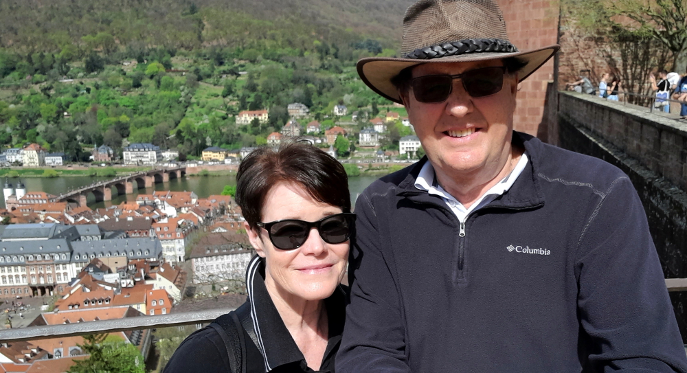
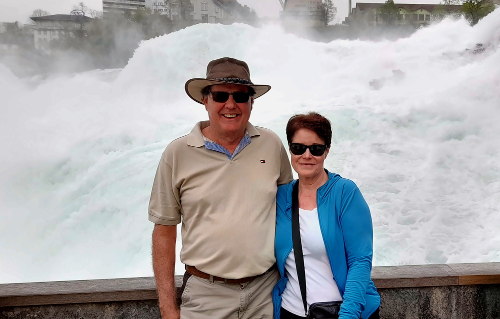
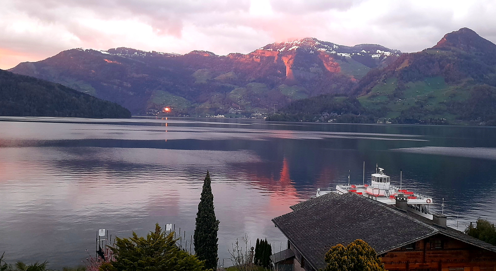
Tag Archives: history

Northern France for 2 weeks.

7 May, 2024

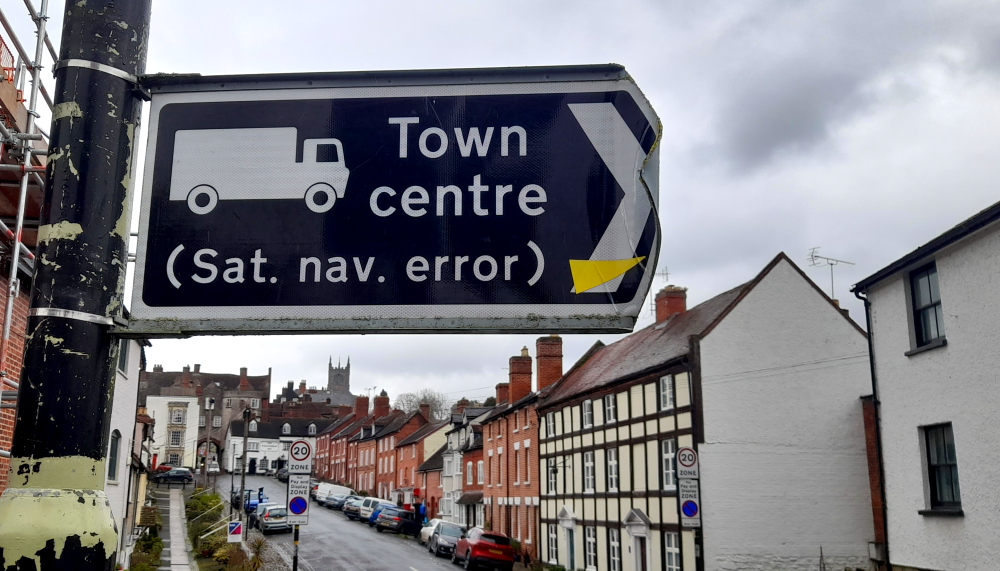
For the next two weeks we are gradually heading back to the UK before we sell the car and fly on to our last leg of this 2-year tour of Europe. During this penultimate section we will stay in Nancy, France for 5 days then back to the Champagne region to meet up with our American friends, Becky and Jerry, for a week.

Crossing back into France from Switzerland at Saint-Louis.

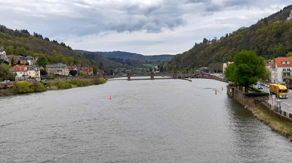
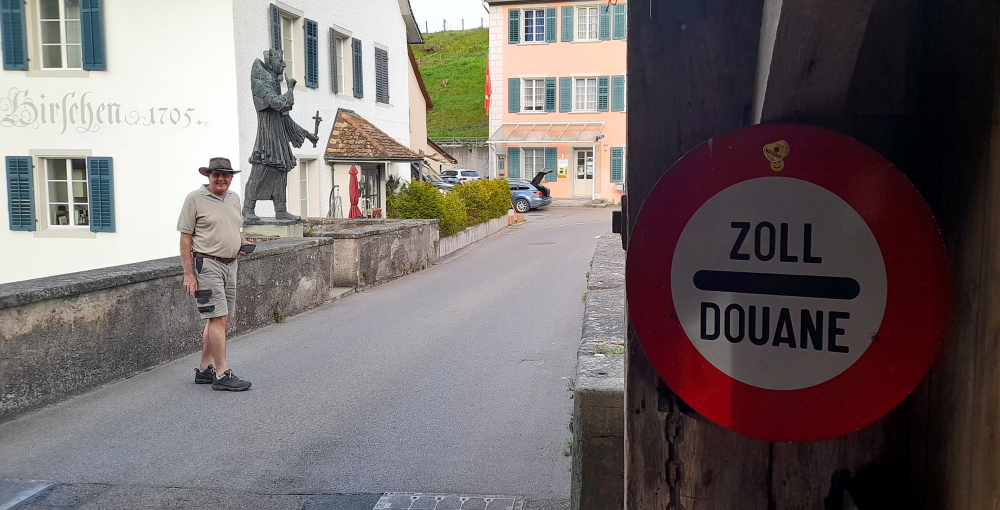
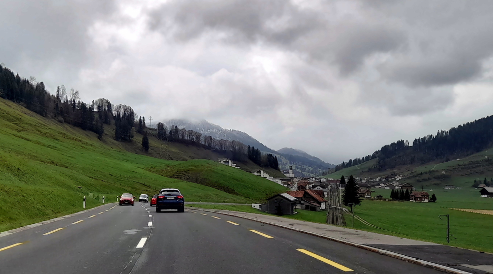
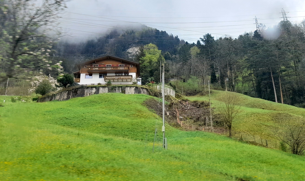
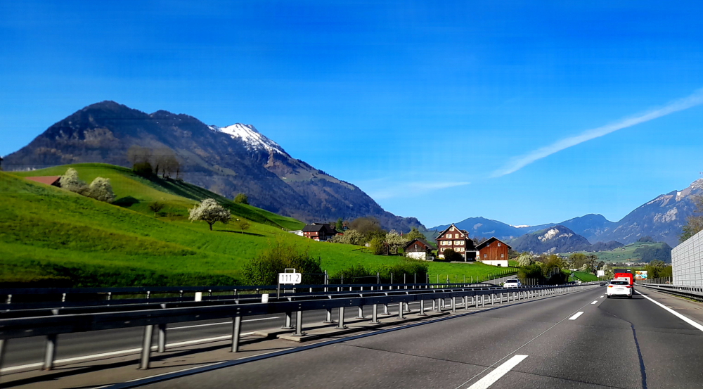
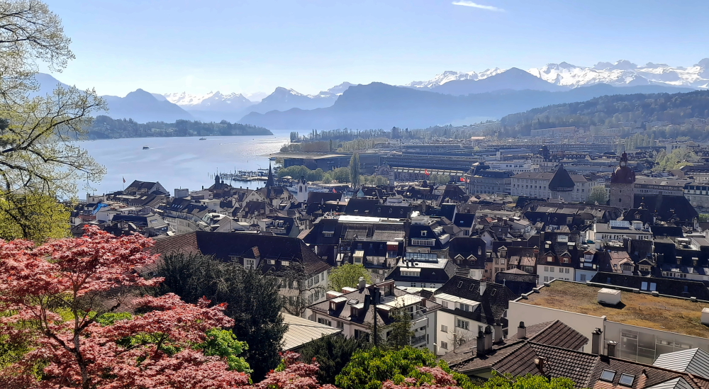
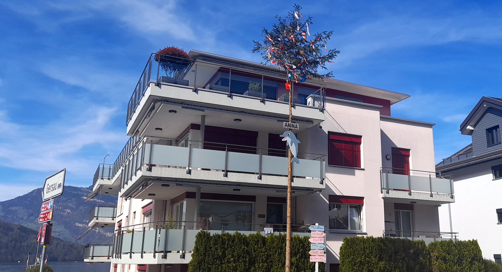
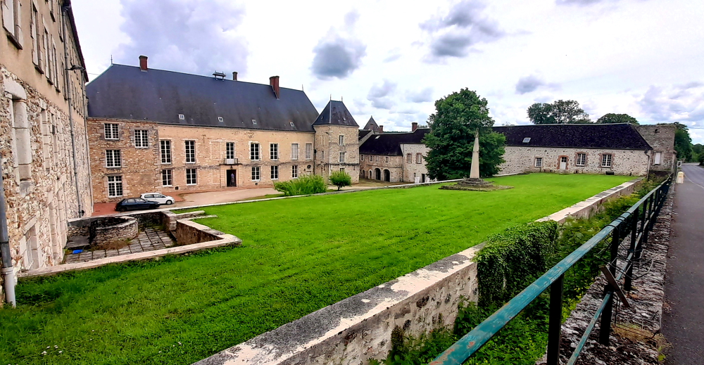
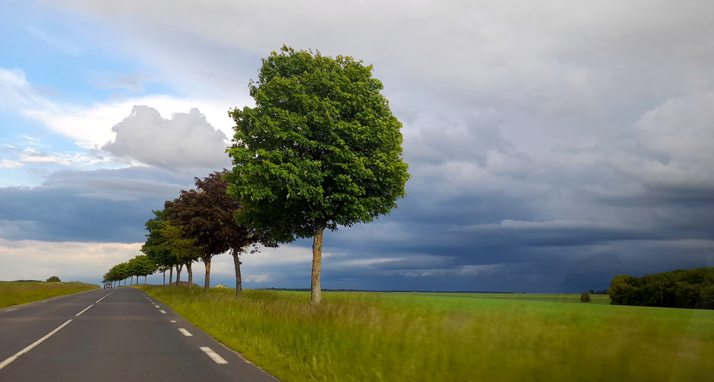
We drive through some verdant countryside and lovely villages that make up part of the Moselle valley and arrived in Nancy about 4 hours after leaving Bern.

On the way to Nancy, France.

We’re staying at a Mercure in the city centre and although it has seen better days its staff have been amazingly friendly and very welcoming.

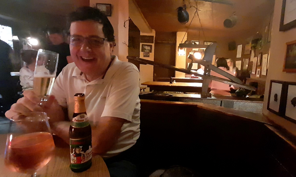
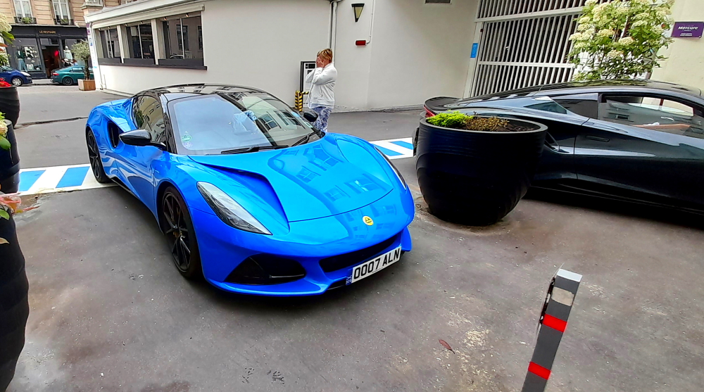
While we are having our welcome drinks at the bench that is the Bar-cum-Reception, 2 guys and their wives check in from the UK. They are taking their respective Lotuses for a spin having driven from Rotterdam this morning, overnighting Nancy, then heading onto Sorrento.

Overnighting Lotuses.

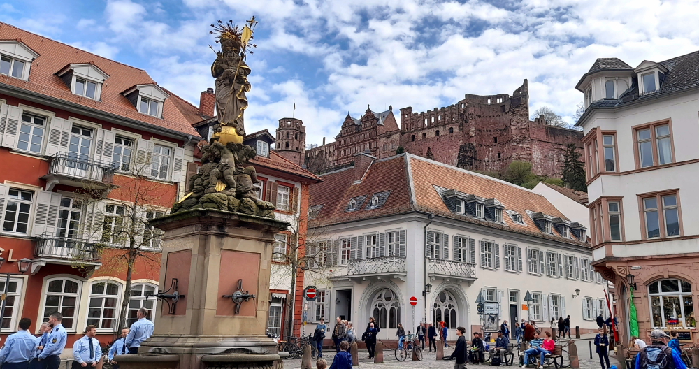
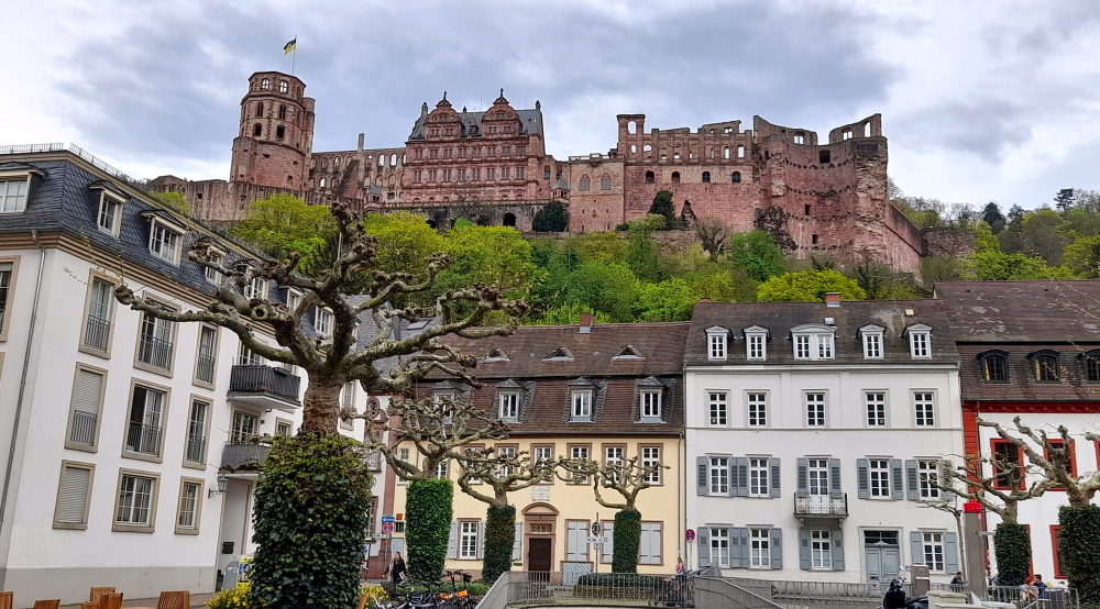
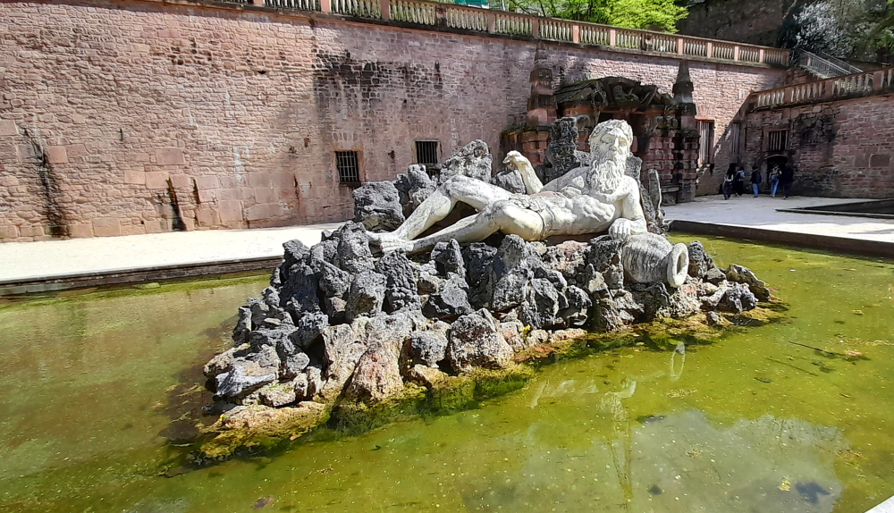
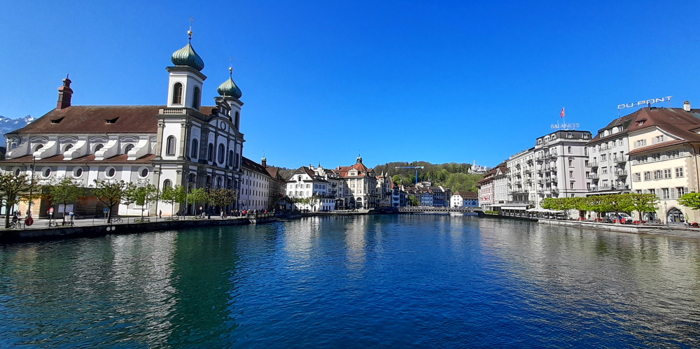
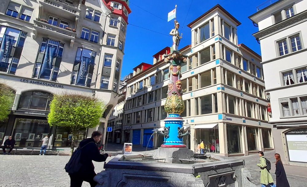
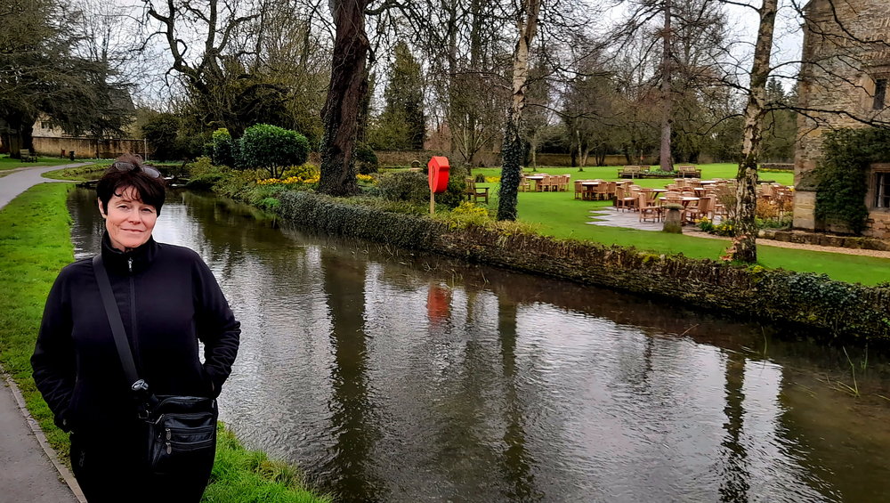
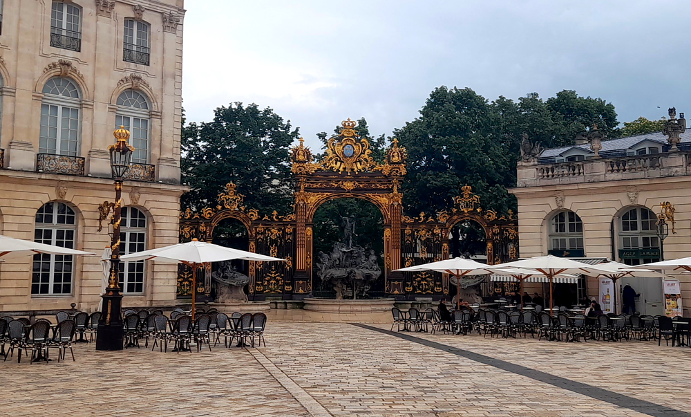
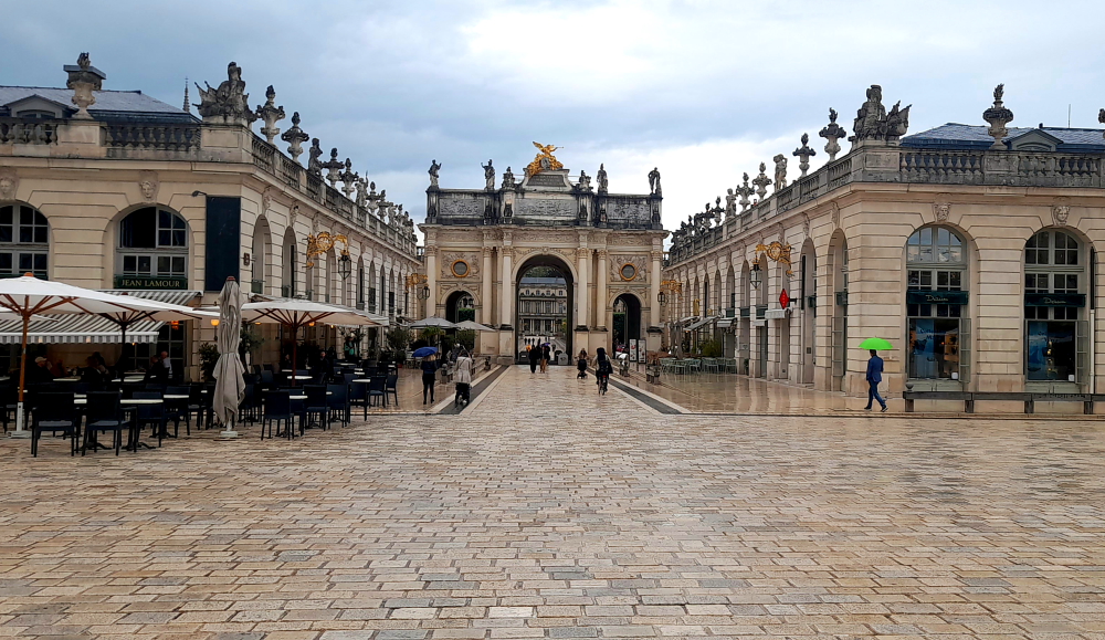
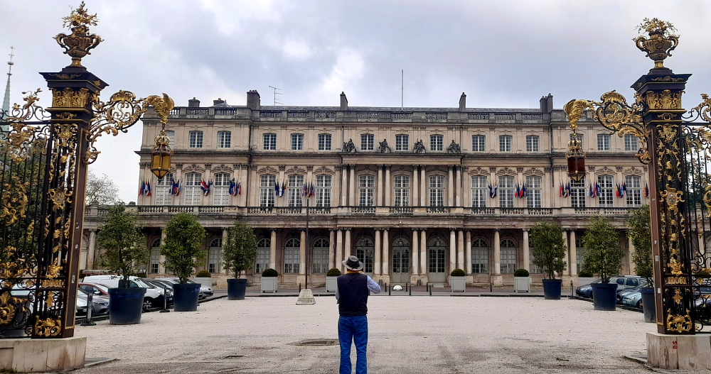
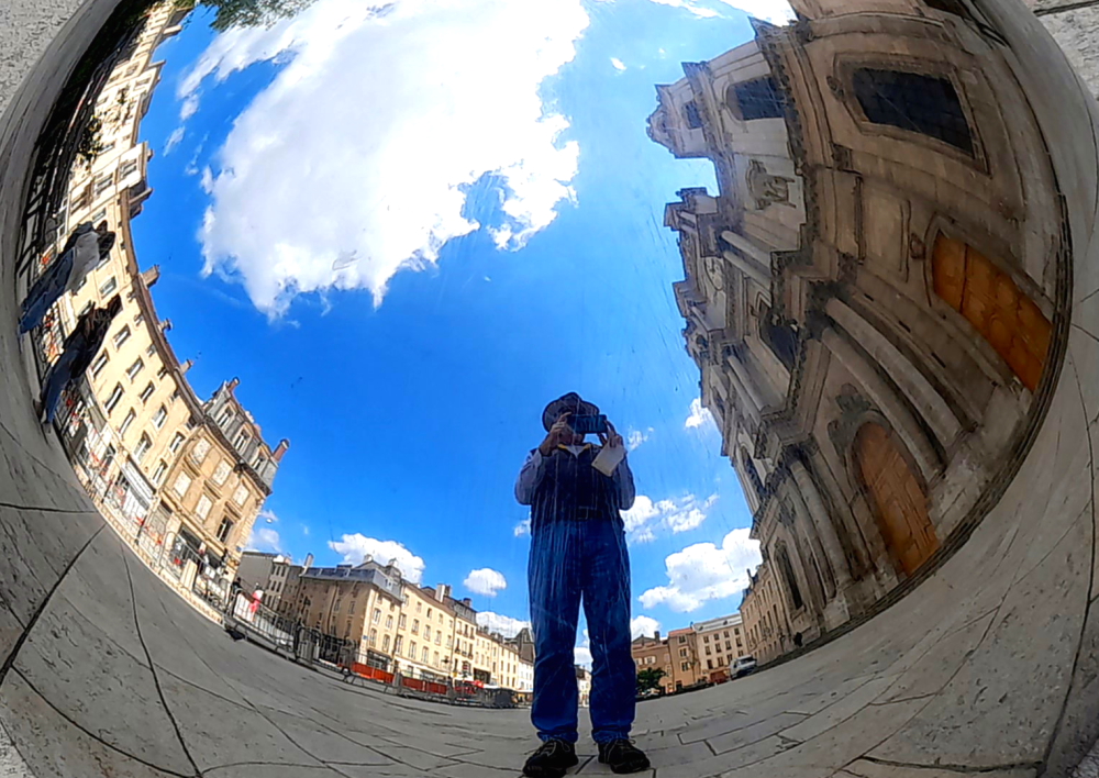
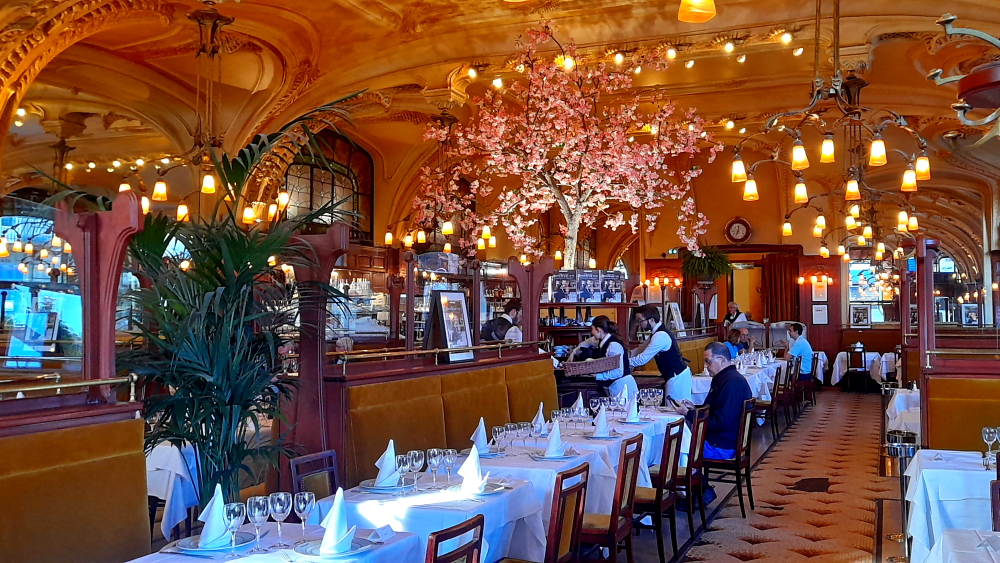
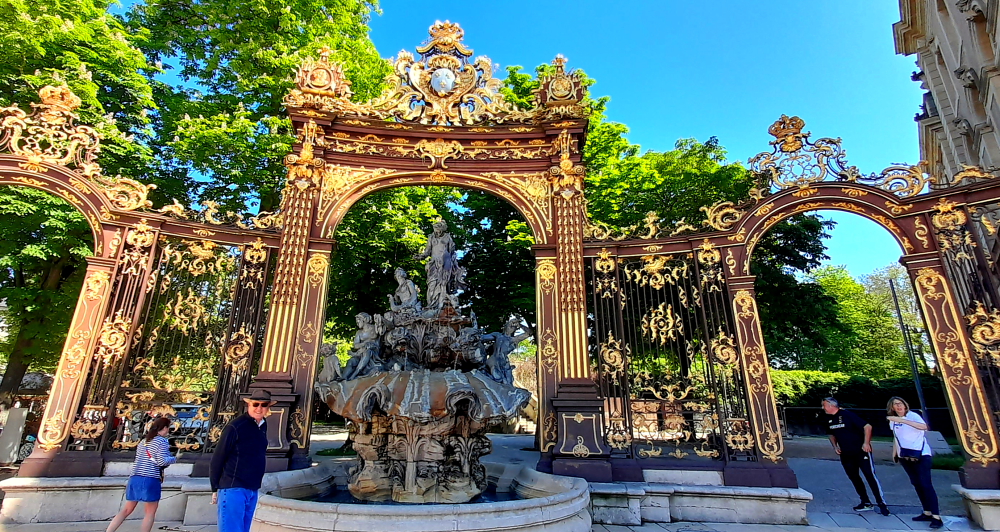
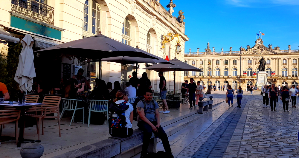
We decide to go out for a quick recce of the ‘hood’. Stanislav Square is a 2-minute walk away – and we are stunned by the opulence before us.

Rue Gambetta entrance to Place Stanislas, Nancy.

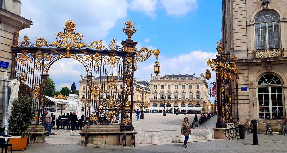
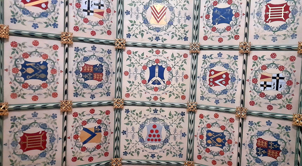
Everything is trimmed in sparkling gold – entrance ways, lamps, street lamps, building features … No wonder this 18th century royal square has been UNESCO listed since 1983.

Statue of Stanislas Leszczynski backdropped by the Town Hall.

The fountains flowed with wine in 1755 when Stanislaw Leszczynski inaugurated one of the finest squares in the world. Ever since, Nancy has been known as ‘the city with the golden gates’.

Place Stanislas entrance/exit leading to Musee des Beaux-Arts, Nancy.

The aim of the major urban development programme carried out by Stanislaw, the last duke of Lorraine, was to link Nancy’s old (Ville Vieille) and new (Ville Neuve) towns [nancy-tourisme.fr].

Porte Here, Place Stanislas, Nancy.

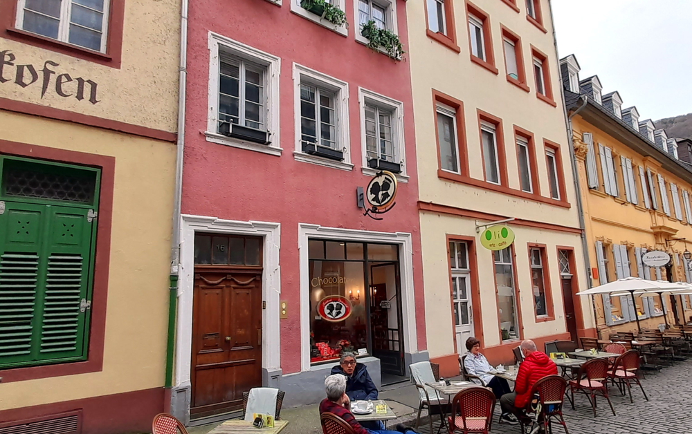
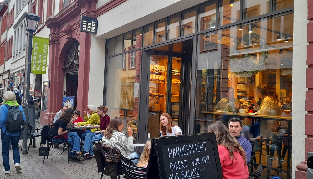
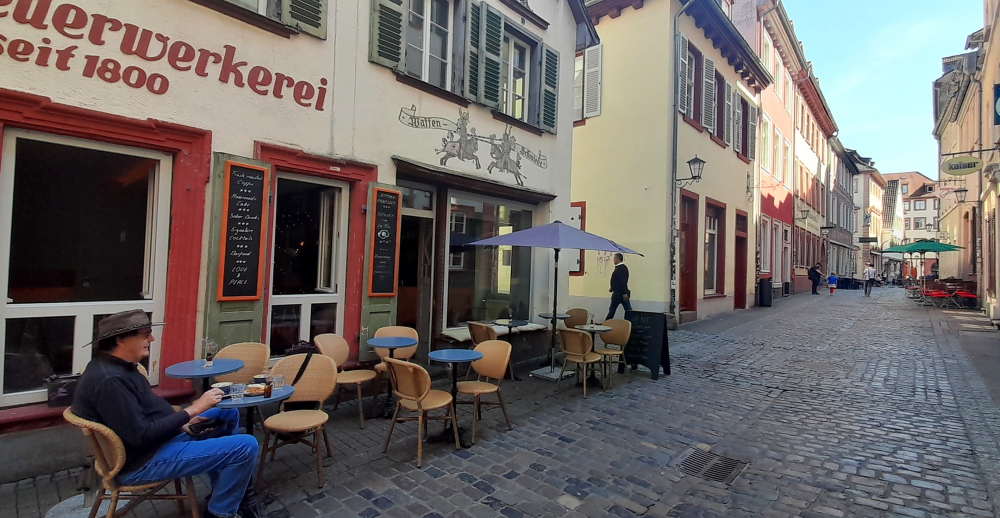
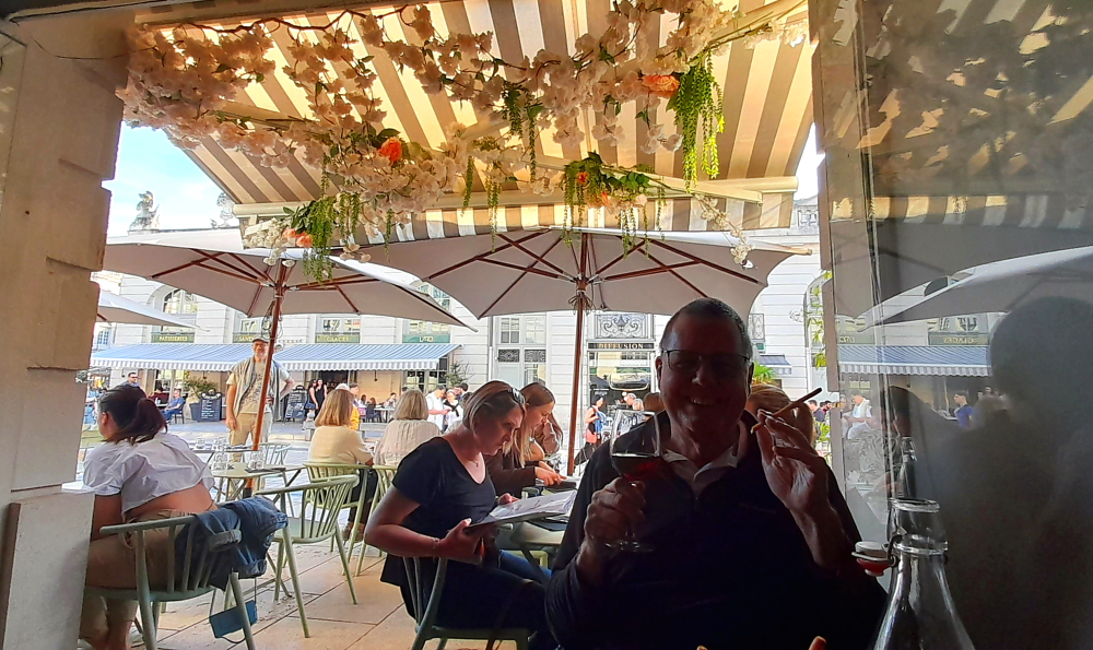
That’s enough sightseeing for today. As we are close to the Square there are lots of cafes, bars and restaurants nearby. But, as we are in France, most won’t open until 7:00 pm. Fortunately, we come across “Nagoya”, a Japanese restaurant, that is open and have a great meal there.

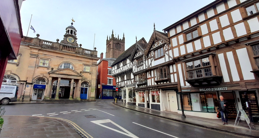
Tomorrow we’ll follow one of the 3 trails marked on the city map – the Historic Centre Trail.

8 May, 2024

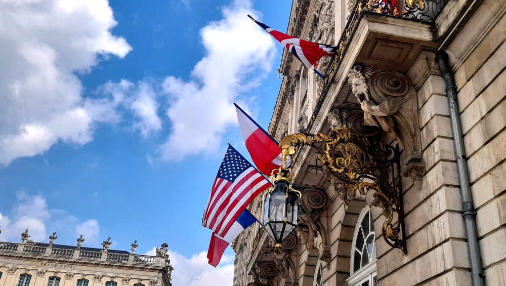
Today is a national holiday in France – VE Day, Victory in Europe Day – its 79th anniversary. It celebrates the formal acceptance by the Allies of WWII of Germany’s unconditional surrender of its armed forces on Tuesday, 8 May 1945 and it marked the official end of WWII in Europe in the Eastern Front.

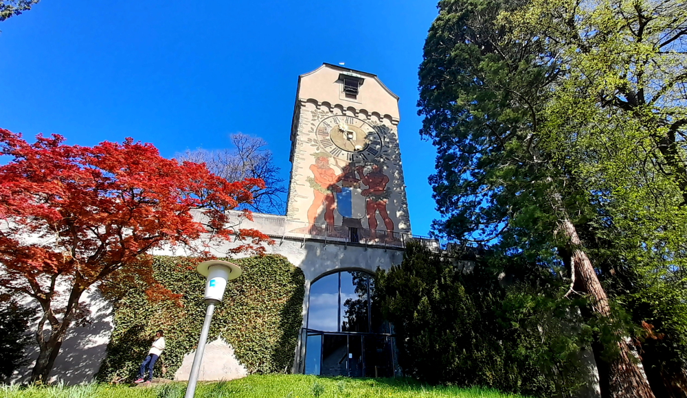
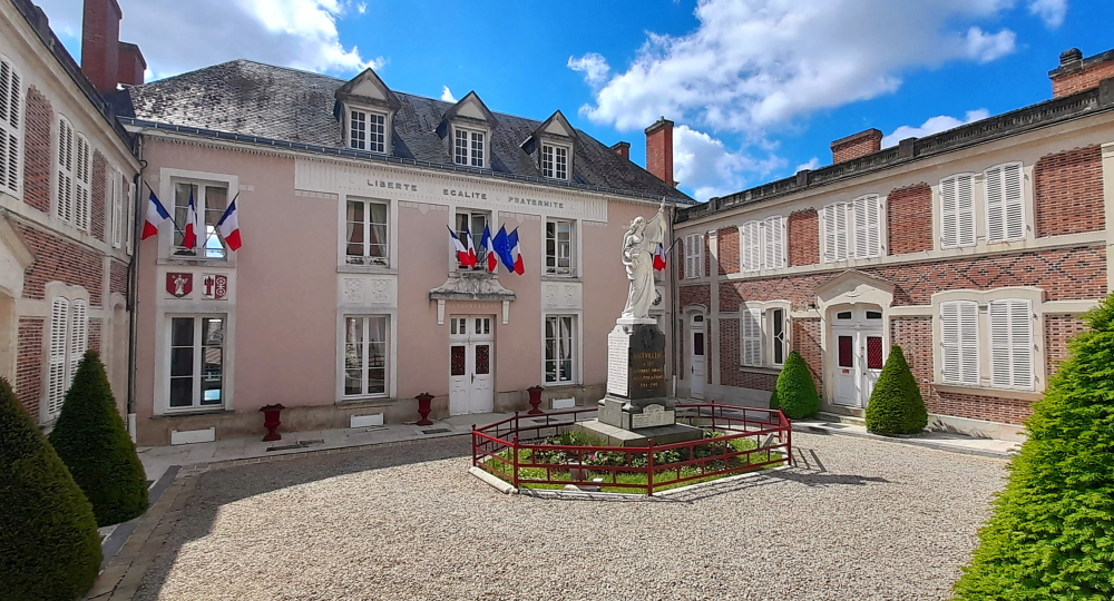
Apparently there are no formal celebrations today, just a day off. All that we see are 4 flags flying over the entrance to the Town Hall – one each for France, USA, Poland and Britain.

8 May flags at the Town Hall, Nancy.

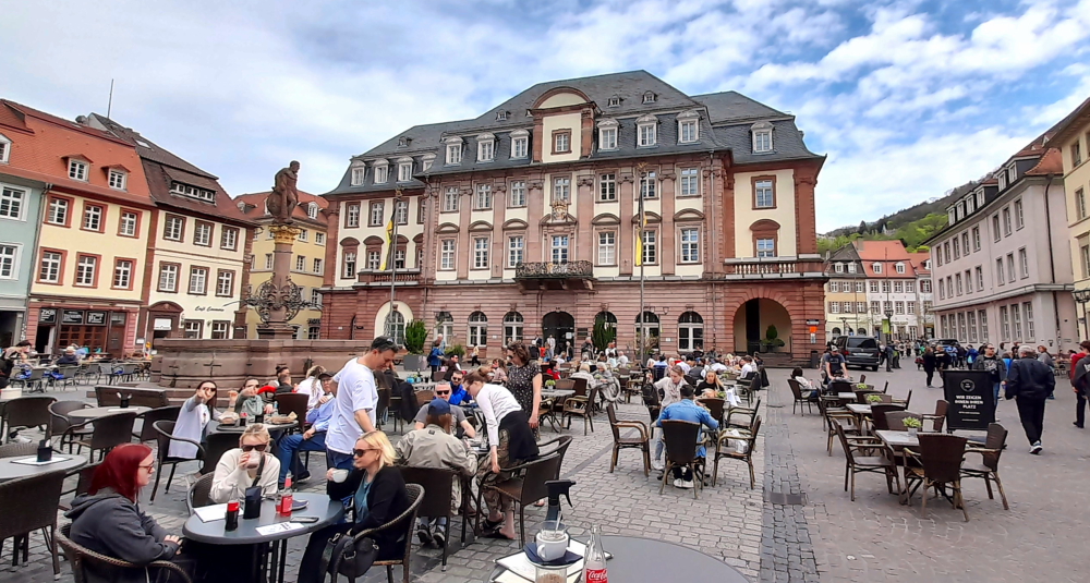
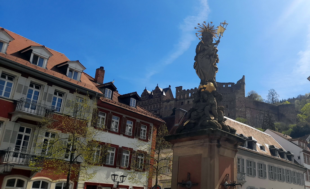
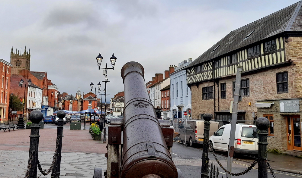
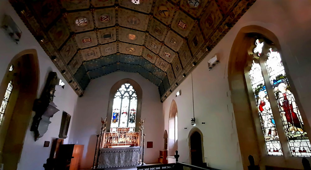
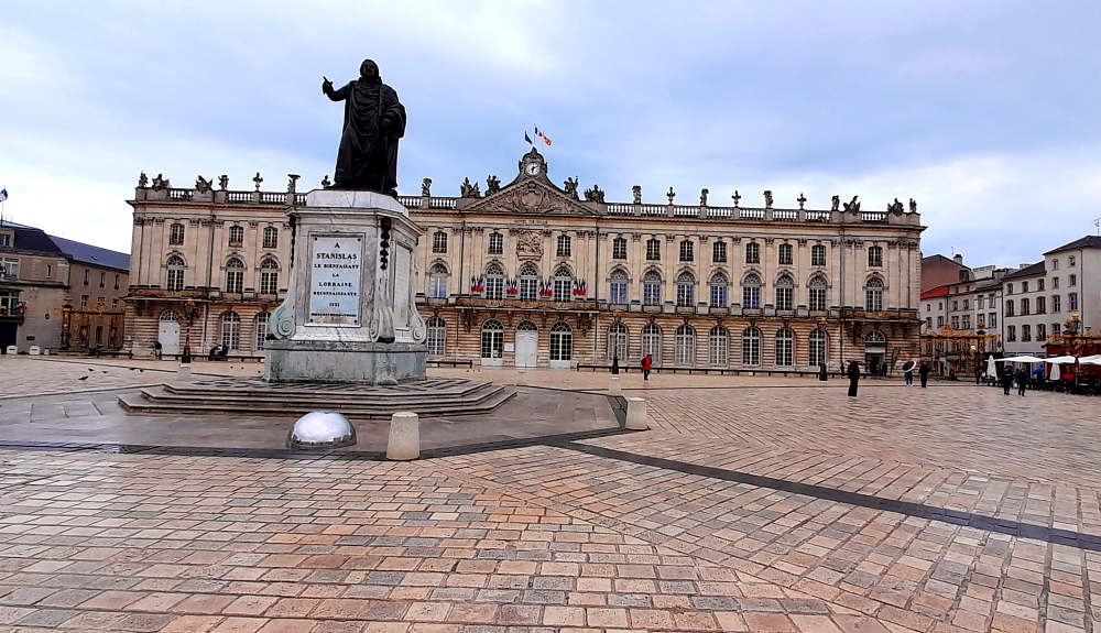
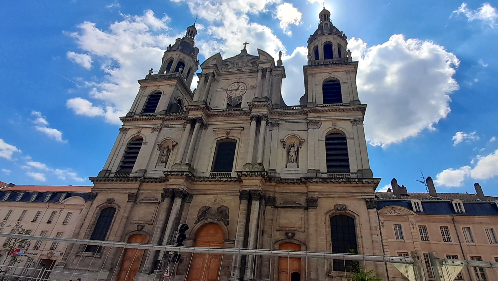
Our Historic Centre Trail starts at Place Stanislas. Stanislaw had this square built in honour of Louis XV, his son-in-law, and it’s still the jewel in Nancy’s crown. The square measures 106 by 124 metres.

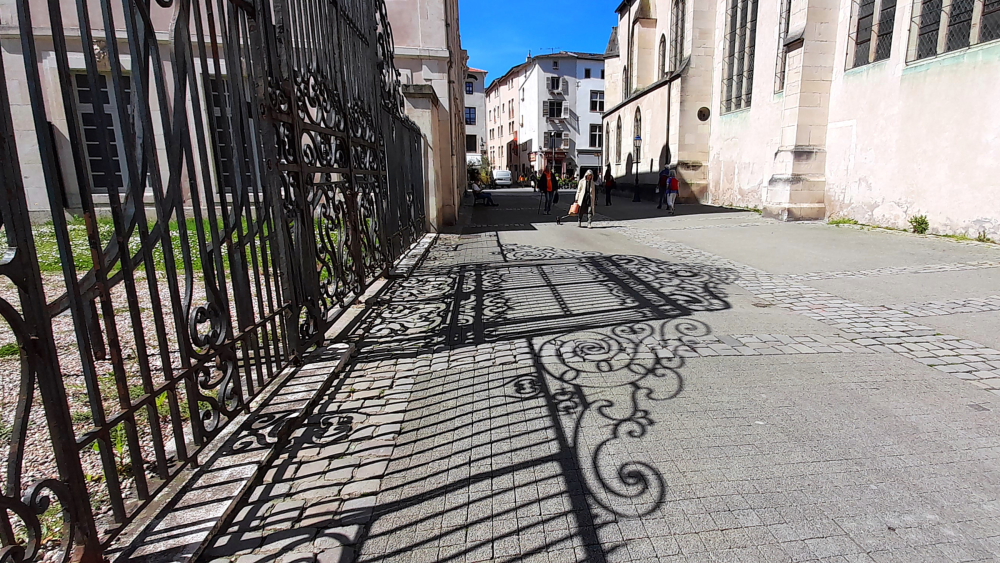
Crafted by Jean Lamour, the skilled locksmith in Stanisław Leszczyński’s court, the six gilded wrought-iron gates adorning the square’s entrances have bestowed upon Nancy the endearing epithet of the Golden Doors City or La Ville aux Portes d’Or [travelfranceonline.com].

Detail of one of the entrance gates to Place Stanislas.

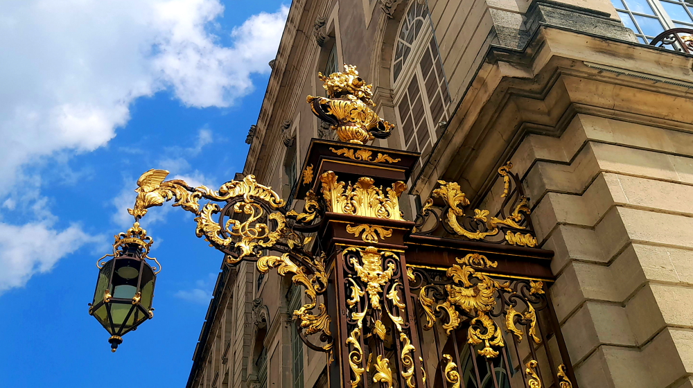
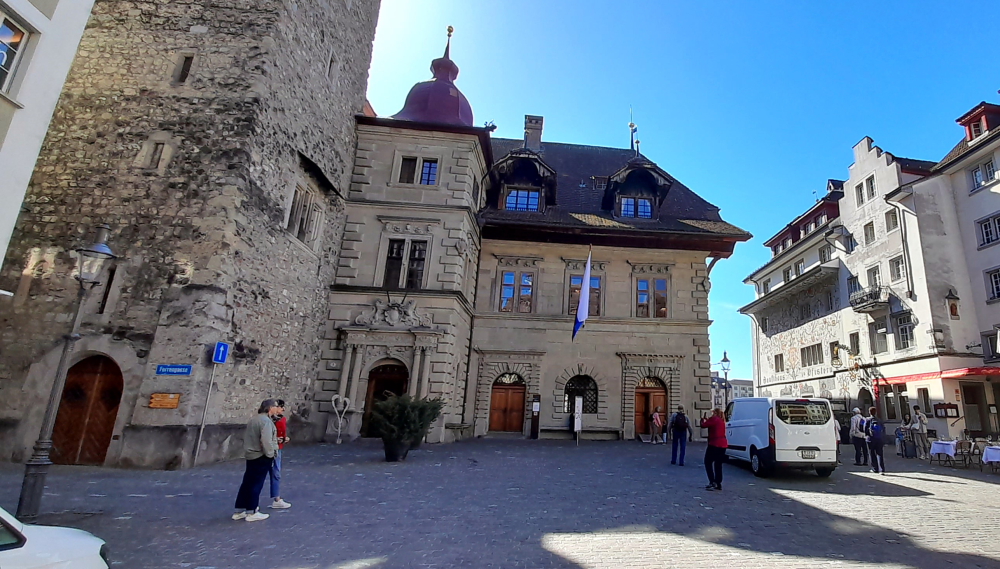
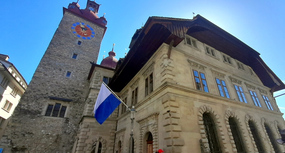
The City Hall occupies the whole of the south side of the square. The Lorraine Opera and the Grand Hôtel de la Reine are on the east side, opposite the Fine Arts Museum. To the north are two single-story buildings known as the Basses Faces. The classical architecture of the square is set off by the gilded wrought-iron gates created by Jean Lamour, and the ornate fountains [nancy-tourisme. fr].

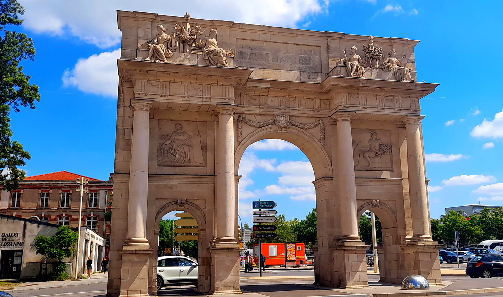
From the statue in the square’s centre we walk down Rue Here to the rather impressive Porte Here. Inspired by that of Septimius Severus of Rome, the triumphal arch glorifies the King of France Louis XV represented in portrait on a medallion at the top of the building. Called today “Arc Héré”, its name recalls the architect Stanislas to whom we owe this monument which was to form the link between the Place Royale (current Place Stanislas) and the Place de la Carrière.

Arc Here, Nancy.

An extension of Place Stanislas, the Place de la Carrière is, in fact, a medieval square, located in the old town and was used for horse training and tournaments. In the 18th century the Palais du Gouvernement was built for the intendant, or representative of the French Government.

Place de la Carriere, Nancy, with the Palais du Gouvernement in the distance.

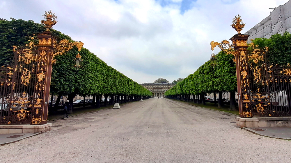
Forming a semi-circle, it closes off the far end of the square, completing the view from the City Hall. Stanislaw’s architect, Emmanuel Héré, remodeled all the façades of the square and built town houses in the corners. Four rows of trees run the whole length of the square, which is also decorated with small fountains featuring cherubs.

Palais du Gouvernement, Nancy.

Place de la Carrière marks the passage to the old town, and leads to the Palace of the Dukes of Lorraine [nancy-tourisme.fr].

Place Joseph Malval leading to the Basilica Saint-Epvre, Nancy.

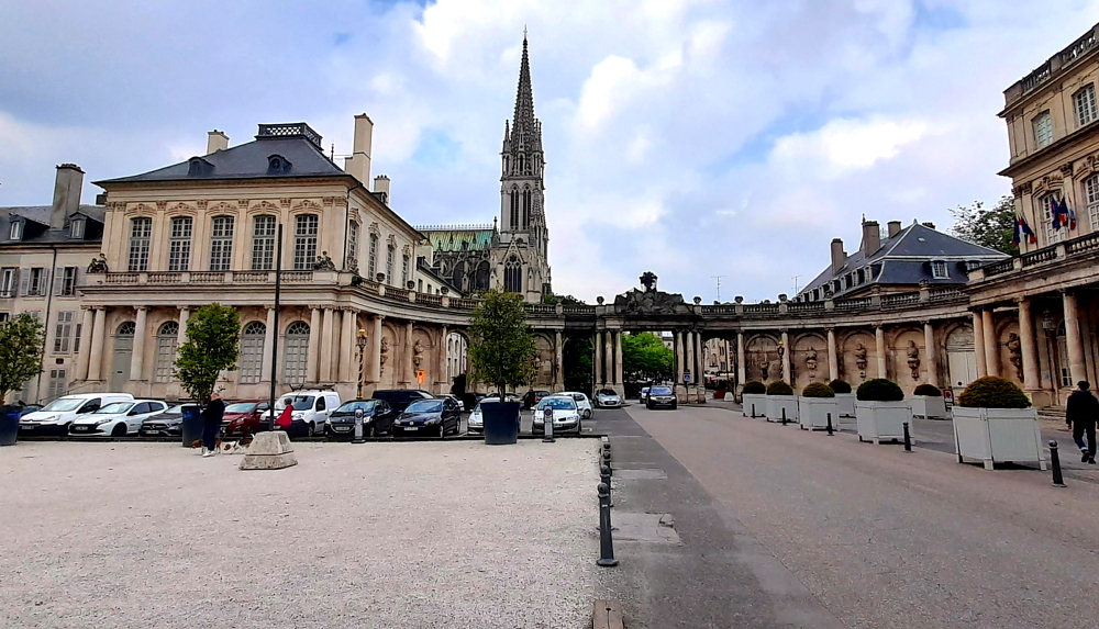
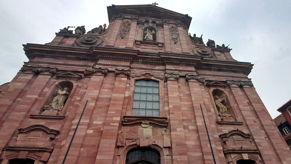
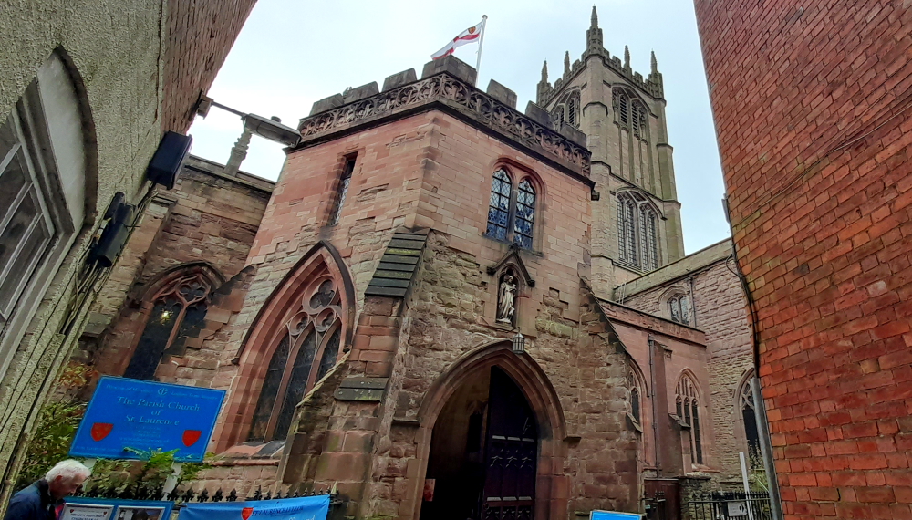
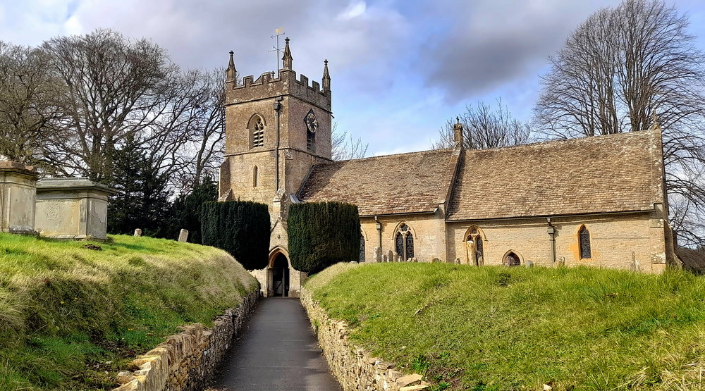
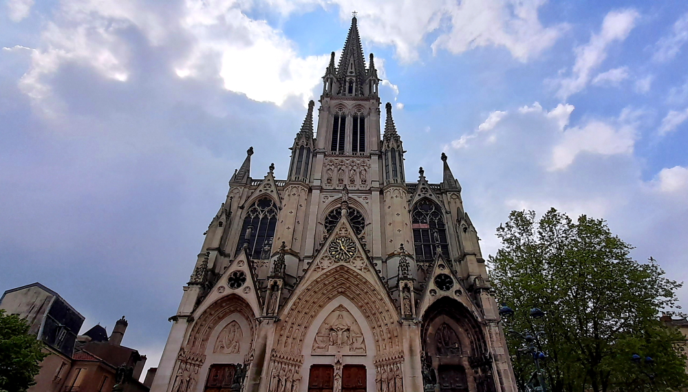
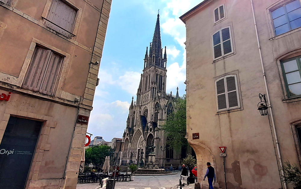
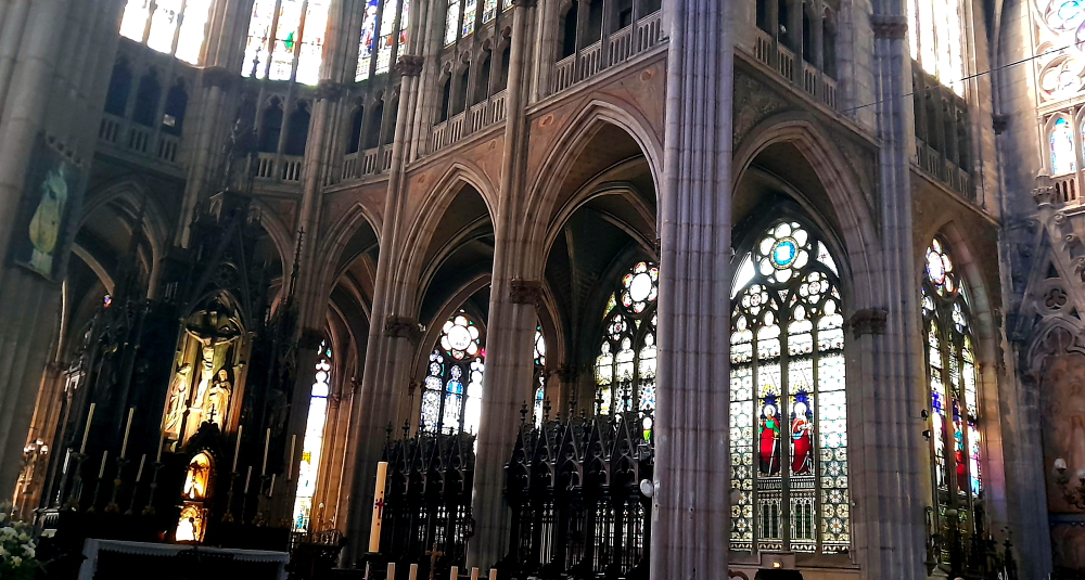
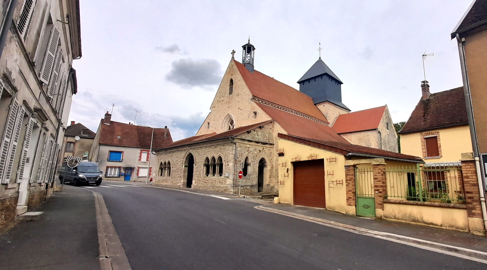
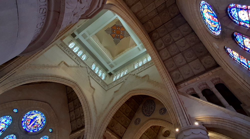
But first we walk past the Basilica Saint-Epvre, but unfortunately it’s closed today. The Saint Epvre basilica was built in the 19th century by Prosper Morey, Prix de Rome architect, in the neo-Gothic style. The work was carried out between 1864 and 1871 by numerous European workshops: glass roofs in Austria and Metz, woodwork in Bavaria, and bells cast in Budapest in particular [nancy-tourisme.fr].

Basilique Saint-Epvre, Nancy.

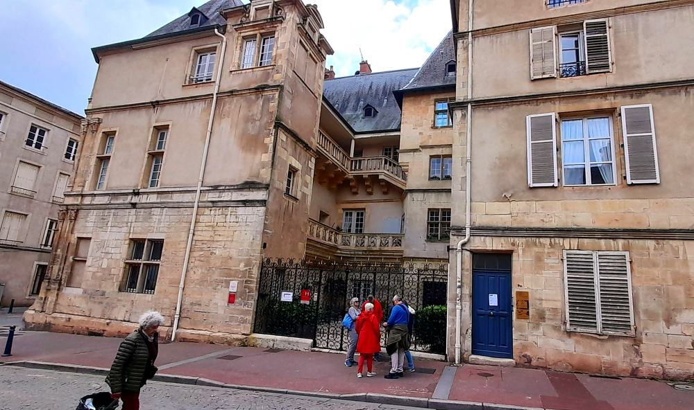
Also closed is the Palace of the Dukes of Lorraine (Palais Ducal), aka the Museum of Lorraine on Grande Rue, due to renovations.

Statue of Duke Antony of Lorraine, (16th c.) – Porterie, main gate, Palais Ducal, Nancy.

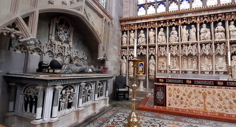
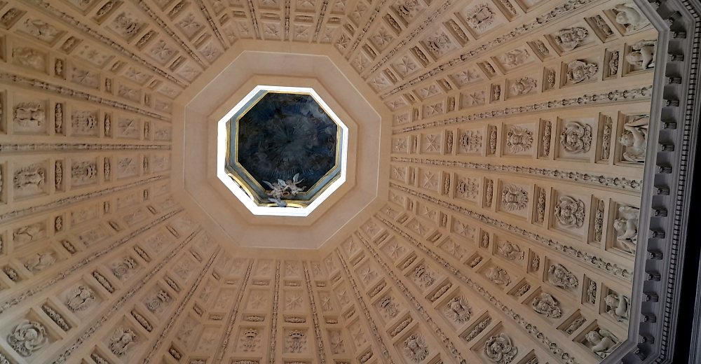
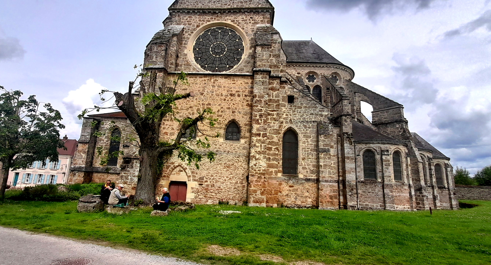
But, the nearby Church and Convent of the Cordeliers and its Funerary Chapel of the Dukes of Lorraine, is open. Today it is more a museum than a church.

Inside the Chapel of the Cordeliers, Nancy.

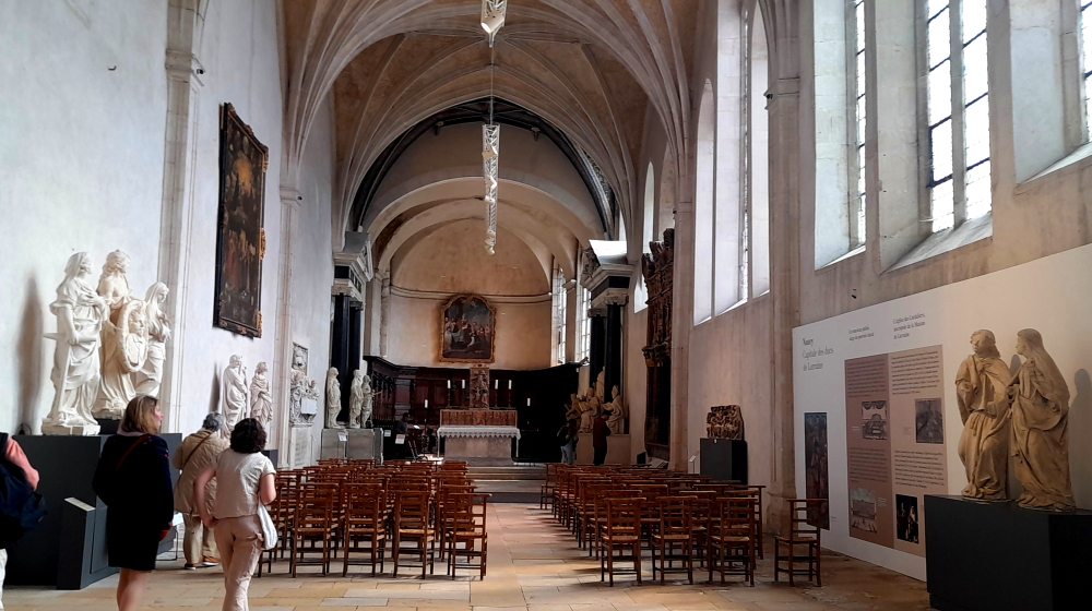
Eglise de Cordeliers is named after the Franciscan Order whose members wore a cord around their waist. It was built in the 15th century by order of Duke René II, following the Battle of Nancy of 1477. Lorraine’s Saint-Denis (burial place of some of France’s famous kings), in spite of incurring damage through the ages, it still has some remarkable tombs. The chapel, inspired by that of the Medici’s in Florence, is outstanding and belongs to the Lorraine museum [nancy-tourisme.fr].

Interior Funerary Chapel.

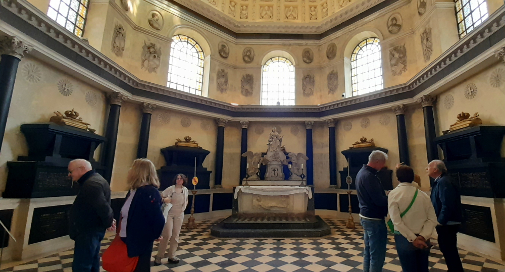
Unlike the Danish Royal Family who had individually-designed sarcophagi, each of these 5 is exactly the same.

Detail of the dome’s interior, the Funerary Chapel of the Dukes of Lorraine, Nancy.

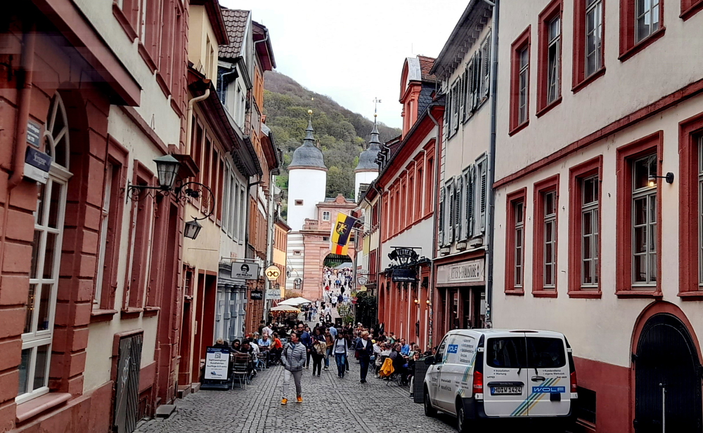
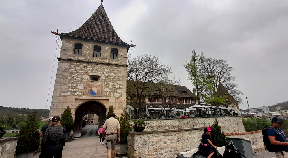
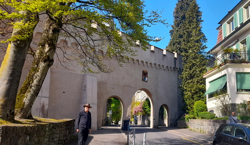
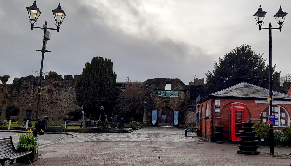
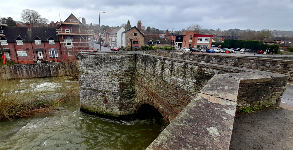
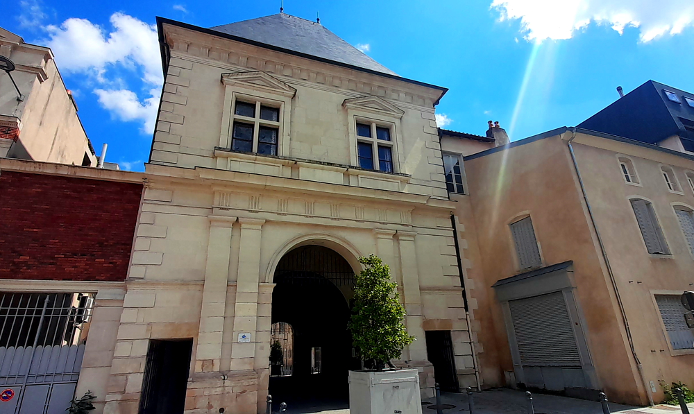
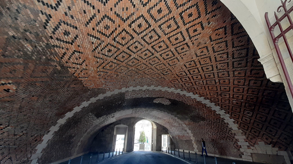
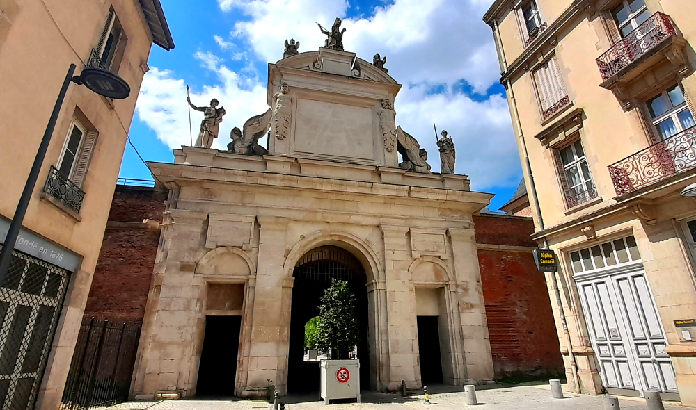
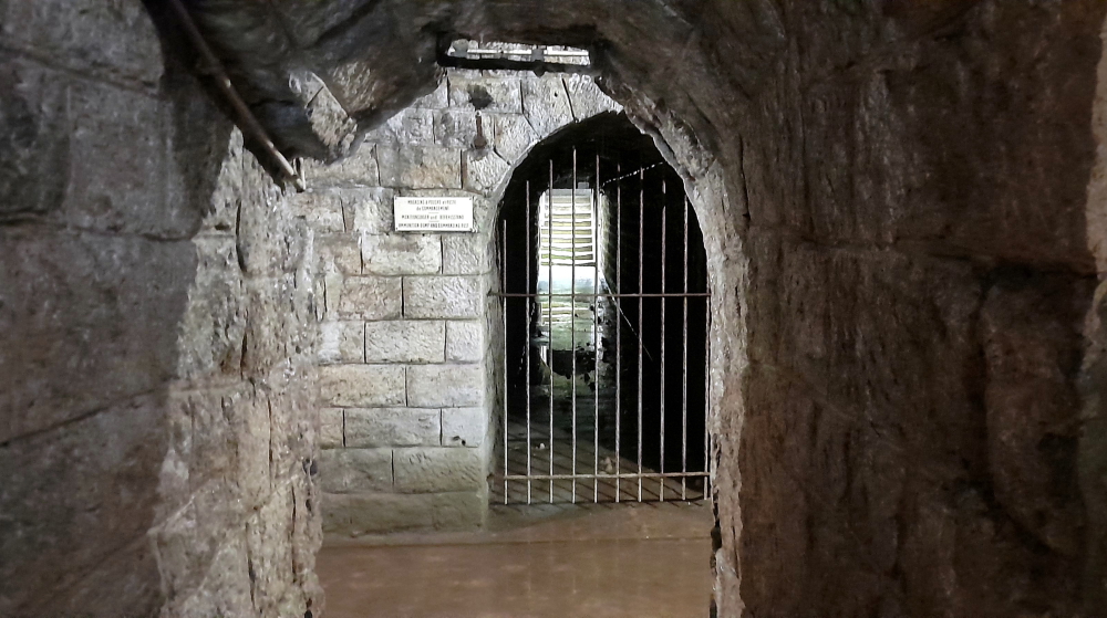
From here we continue down Grande Rue until we come to the superb Porte de la Craffe.

Porte de la Craffe, Nancy.

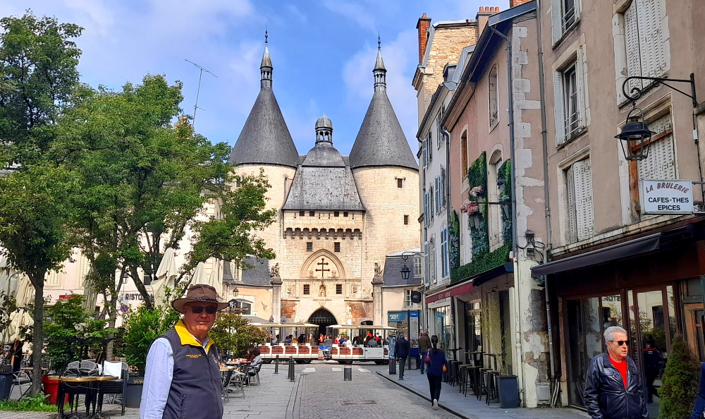
It is the oldest monument in the historic center of Nancy and the only vestige of the medieval fortifications. A symbol today of the Old Town district, it was built in the 14th and 15th centuries and its towers served as a prison until the 19th century. Its extensive brick and stone vault was restored in 2013 [nancy-tourisme. fr].

Hotel D’Haussonville, Nancy.

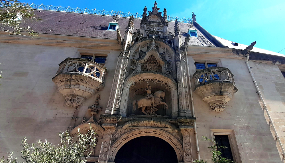
We partly retrace our steps until we come to the Hotel D’Haussonville. It was built between 1528 and 1543 by Jean d’Haussonville, Seneschal of Lorraine. A courtyard opens onto rue Monseigneur-Trouillet and has several ornate galleries, one of Gothic inspiration, the second Renaissance. This private mansion is one of the finest Renaissance examples in Nancy, along with the Palace of the Dukes of Lorraine and the Hôtel de Lillebonne. It was transformed into a 4-star hotel by Laurence and Jean-Claude Capelli in 2003 offering 3 rooms and 4 suites.

Place Saint-Epvre & its Basilica, Nancy.

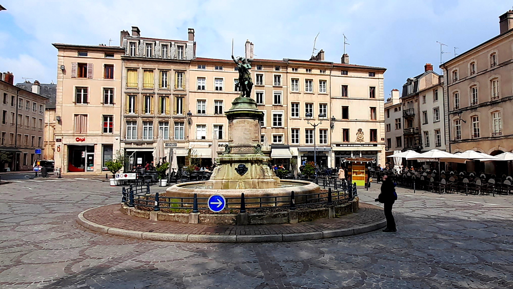
Continuing along Rue Monseigneur-Trouillet brings us to Place Saint-Epvre. A former market square, it is the main square of the Old Town district, known for its terraces and which owes its name to the basilica which borders it. At its centre is the statue of Duke René II, victorious during the Battle of Nancy.

Statue of Duke Rene II, Place Saint-Epvre, Nancy.

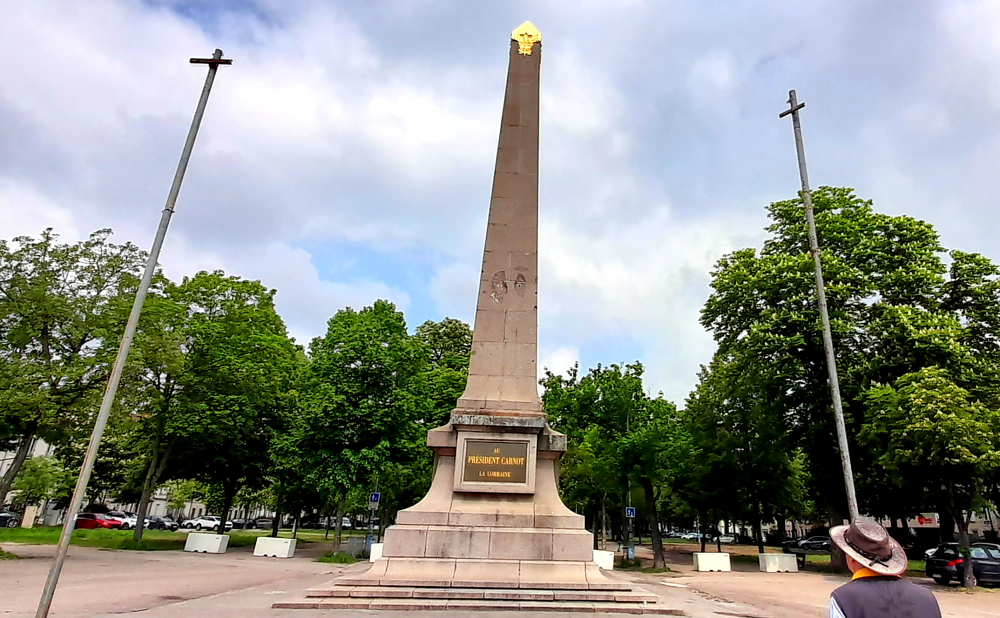
Walking SW we come to the Esplanade du Souvenir Francais (Esplanade of French Remembrance) and the gold-tipped Obelisque de Nancy at its southern end at Place Carnot. Also known as the Carnot monument, it was inaugurated in 1896, paying tribute to Sadi Carnot, President of the French Republic who was assassinated 2 years earlier by the anarchist Caserio.

Its construction was financed by public subscription – 28,000 people, as well as 865 municipalities of Lorraine, no less. Its ornaments were removed and melted down during WWII, as part of the mobilization of non-ferrous metals. In 2016, new enameled lava plaques were inaugurated. Like the originals, they are dedicated to President Carnot, Grand Duke Constantine of Russia, the city of Nancy and the three Lorraine departments of the time.

Obelisque de Nancy.

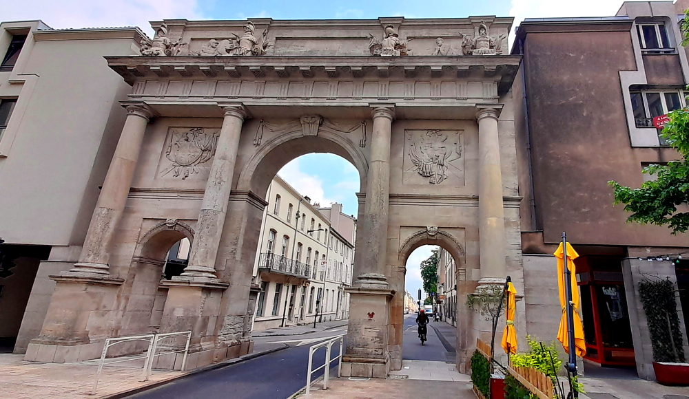
Next stop is another gate, Porte Stanislas. This gate, as well as the Sainte-Catherine gate, is part of Stanislas’s urban plan. It was built in Doric style by the architect Richard Mique in 1761 to replace an arch initially created by Emmanuel Héré [nancy-focus.com].

Porte Stanislas, 1752-1762.

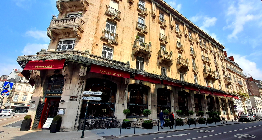
Just down the road on Rue Mazagran is the Brasserie L’Excelsior, one of the most famous examples of Art Nouveau in Nancy. The Art Deco extension and Jean Prouvé bannister combine very well with the décor of the main room which was inaugurated in 1911. The Excelsior was founded by Louis Moreau in order to create a luxury showcase for the beer of his brewery, the Brasserie de Vézelise [nancy-tourisme.fr].

Brasserie L’Excelsior, Nancy.

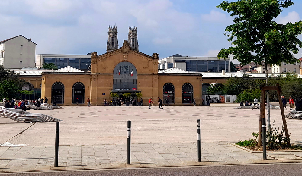
Across the road is the Nancy Train Station and behind it, the Église Saint-Léon de Nancy towers.

Gare de Nancy.

From here we return to the hotel. Not long after, Lynn decides to go out to see a number of other locations, the 1st of which is another gate, the Memorial Desilles, that is at the other end of Place Carot, where the obelisk is located.

Built between 1782 and 1785 at the request of Marshal de Stainville, commander of the province, in order to create an opening in the city’s granting wall in the direction of Metz, the Porte Désilles, then called Porte Saint-Louis, or Stainville , originally celebrated the engagement of King Louis XVI in the American War of Independence (1775-1783), as well as the economic and maritime prosperity that resulted from this alliance. It was the birth, on 22 October, 1781, of the Dauphin Louis Joseph of France, son of Louis XVI and descendant of the last Duke of Lorraine, who presided over the decision to build this monument.

A few years after its construction, in 1790, the Porte Saint-Louis was the scene of an event known as the Nancy Affair. The regiments then garrisoned in Nancy mutinied, because they no longer received their pay, and their revolt was severely repressed by the troops of the Marquis de Bouillé. During this fight, André Désilles, a 23-year-old lieutenant of Saint-Malo, intervened between the units and was seriously injured. He died the following October 17, his wounds having become infected. It was only in 1867 that the Saint-Louis gate took the name of Désilles, whose sacrifice became a symbol of union and devotion.

Memorial Desilles, Place de Luxembourg, Nancy.

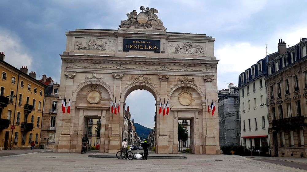
In 1976 the building became the Monument of Remembrance. The gate then became the city’s main place of commemoration and was consecrated as such by a ceremony which took place on the following November 25, in the presence of President Valéry Giscard d’Estaing.

Next on her list is the nearby Parc de la Pepiniere (Nursery Park). Located in the heart of the historic centre, the Park offers a haven of greenery with its 21 hectares of wooded areas and its rose garden.

Place de Nelson Mandela entrance to Parc de la Pepiniere, Nancy.

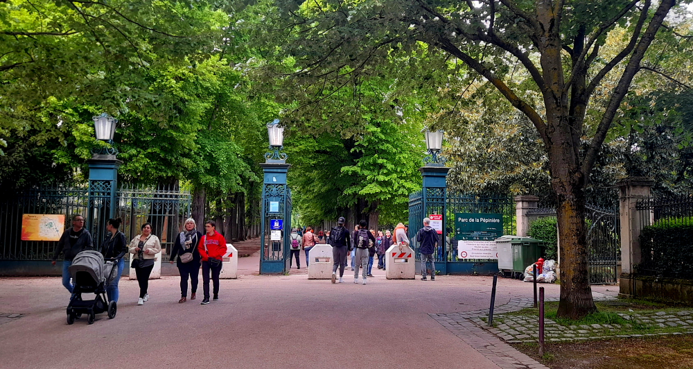
A former royal nursery founded by Stanislas on the site of the former ducal gardens and bastions of the Old Town, it was transformed into a public park in 1835 while retaining its initial layout. The park offers numerous leisure activities: an animal area, a mini golf course, a playground, a puppet theater, several restaurants, children’s rides, as well as numerous sports fields (football, basketball, pétanque, etc.)

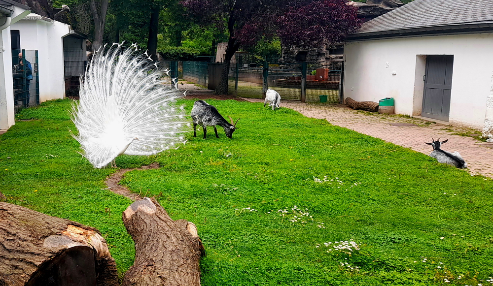
People who have been living in Nancy for decades remember the time when the animal enclosure used to be home to bears, lions, monkeys and kangaroos. Children loved giving dry bread to the deers and throwing peanuts to the bears. Exotic animals are no longer kept in the Pépinière, however many peacocks, ducks, white storks, swans, as well as donkeys and goats still wander around the park [frenchmoments.eu].

White peacock in the animal area of Parc de la Pepiniere, Nancy.

On the home stretch she calls by the statue of Jean d’Arc, located in the old town, Place La Fayette, an extension of Rue des Maréchaux. The most famous statue of Joan of Arc in Paris at Place des Pyramides is, in fact, a copy of that of Nancy installed in 1889.

Jean of Arc, Place La Fayette, Nancy.

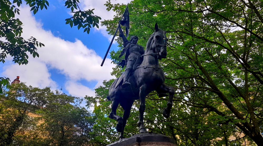
Another statue from the same mold flew the same year to Philadelphia and other replicas reached Lille, Compiègne, Saint-Etienne, Melbourne, Portland, New Orleans…In 1898, the sculptor Fremiet substituted his new statue, a replica of that of Nancy, for the old, discredited one at the Place des Pyramides in Paris.

Grand Cafe Foy, Nancy.

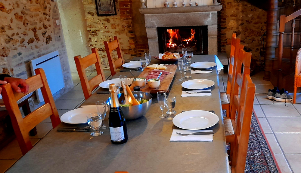
This evening Yoanna, one of the hotel receptionists, has booked us a table at the Grand Cafe Foy on the Place Stanislas. I have lamb shank and Lynn orders Quiche Lorraine (when in Rome…).

Interior centrepiece, Grand Cafe Foy, Nancy.

Plus we are very ably looked after by our waiter Eddy, well known by the staff at the Mercure. Delicious food and excellent, personalised service. It’s who you know!

9 May, 2024

Yesterday we walked the ‘orange’ Historic Centre trail. With today being another sunny day we plan to walk the ‘green’ Art Nouveau trail which is the longest of the 3.

Credit Lyonnais, Rue Saint-Jean, Nancy.

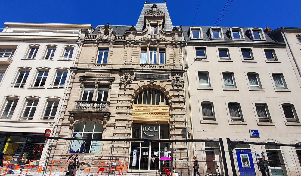
We start out in front of the Credit Lyonnais on Rue Saint-Jean. The feature of this building is its monumental glass roof covering 250 square metres. One of the masterpieces of the Nancy School painter and glassmaker, Jacques Gruber, it lets light into the foyer of the bank.
Clematis wind around the imitation metal structure reproduced on the glass. The ‘CL’ monogram appears at its centre, in reference to the bank’s name. Sadly, the bank is closed today as it is another holiday, Ascension Day, so we only get to see the building’s exterior.

At the far end of the street, opposite Place Andre Maginot, is BNP Paribas. Actually it’s the building of the Banque Charles Renauld that is remarkable, built between 1908 and 1910. Since 1985, it has been a BNP Paribas agency.

Banque Charles Renauld, Rue Saint-Jean, Nancy.

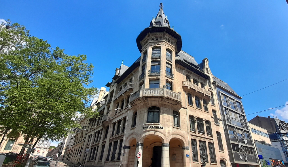
Charles Renauld, a financier originally from Rambervillers, and brother-in-law of Antonin Daum, became in 1881 co-owner of a bank founded in 1871. In July 1907, he decided to abandon his premises at 21 rue Saint-Dizier for an entirely new building, built in the Art Nouveau style.

Its architects are Émile André and Paul Charbonnier. The ironwork and furniture were made by Louis Majorelle, and the glass roofs by Jacques Grüber.

Chambre de Commerce et d’Industrie, from Rue Chanzy, Nancy.

250m away up Rue Chanzy is the Chambre de Commerce et d’Industrie Grand Nancy Metropole Meurthe-et-Moselle (!) building.

Chambre de Commerce et d’Industrie building from Rue Stanislas, Nancy.

One end of the building is visible from Rue Chanzy but once in Rue Stanislas, the full extent of the building is revealed, including the stained glass in the enormous ground-floor windows.

The next 2 sites, Brasserie L’Excelsior and the Cours Leopold/Place Carnot (obelisk) we’ve already seen so we give these a miss. But, by this time I’m getting bored so we abandon the other 5 Art Nouveau buildings and instead strike out across town towards the canal and walk part of the ‘blue’ trail, the Banks of the Meurthe River.

Walking in a westerly direction we arrive at Notre-Dame de l’Annonciation (Our Lady of the Annunciation) on Rue Saint-Georges, part of Nancy’s 18th century heritage.

Cathedral of Notre-Dame de l’Annonciation, Rue Saint-Georges, Nancy.

The work of architects Giovanni Betto, Jules Hardouin-Mansart and Germain Boffrand, it was built at the beginning of the 18th century, during the reigns of Dukes Léopold and Stanislas. It has a dome painted by Claude Jacquard, paintings from the Lorraine School of the 17th and 18th centuries, and a listed organ. First primatial, then cathedral, since the creation of a bishopric in Nancy in 1777.

Keeping myself entertained while Lynn is inside the Notre-Dame.

From here we continue down Rue Saint-Georges, onto Place Colonel Driant and at the beginning of Avenue de XX Corps is the understated facade of the Porte Saint-Georges. Its name pays homage to the protector of the city.

La Porte Saint-Georges, Av. de XX Corps, Nancy.

At the entrance a plaque reads: The Saint-Georges Gate was saved from demolition in 1878 thanks to the intervention of Victor Hugo. “All the cities of France would be proud of such a monument, I ask for its conservation.” Victor Hugo.

Unlike its facade, the inside vault is another matter with striking black diamond patterns in the red brickwork.

Interior vault of Porte Saint-Georges, Nancy.

And unlike its city facade, the ‘country’ facade has Saint-Georges represented on this side. Jean Richier and Simon Drouin are the two sculptors who worked on the remarkable decor of the building. Linked to the construction of the New Town, it was built between 1606 and 1619 in the Renaissance style. Its remarkable restoration dates from 2013 [nancy–tourisme-fr].

More ornate ‘country’ side of the door with St George on top.

In complete contrast, at the Avenue de XX Corps cross road with Quai Sainte-Catherine, just before the Canal, is a very modern building – an aparthotel constructed from scratch in September 2012 and operating in 2015.

Adajio Aparthotel, Av. de XX Corps, Nancy.

At the junction of Quai Saint-Catherine and Rue Saint-Catherine is the Porte Saint-Catherine. This gate, as well as the Stanislas Gate, is part of the urban plan envisaged by Stanislas Leszczyński. Initially the gate was much closer to Place Stanislas. In 1768, it was moved 300 metres beyond the Sainte-Catherine barracks when it was completed in order to include it in the city wall.

It was built in 1761, Doric style, by the architect Richard Mique who also built the Sainte-Catherine barracks nearby. The door is dedicated to Stanislas’ wife: Catherine Opalinska, mother of the Queen of France Marie Leszczyńska.

Port Saint-Catherine, Nancy.

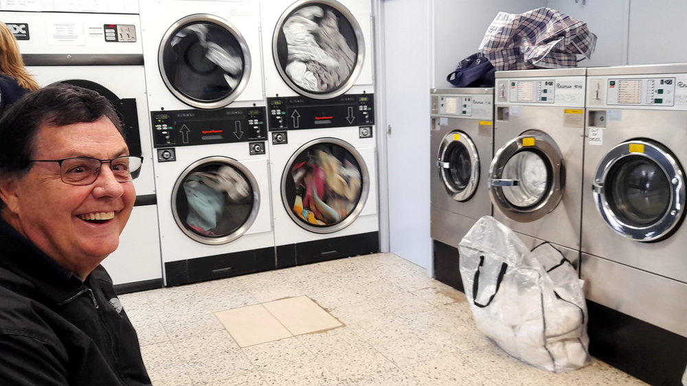
We spend part of the afternoon downsizing, reducing the 5, large open bags that have been floating around in the car boot to 1, repacking most into our suitcases from whence the contents came.

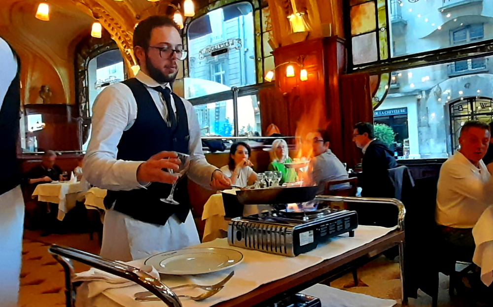
At 7:00 pm precisely we front up at the Brasserie L’Excelsior. Lucy, one of the hotel receptionists, kindly offered to book restaurants for us for the next 3 nights. We are enchanted by its beautiful Art Nouveau interior of elegant plaster work moldings inspired by ferns …

Brasserie L’Excelsior – Art Nouveau interior of fern-inspired moldings.

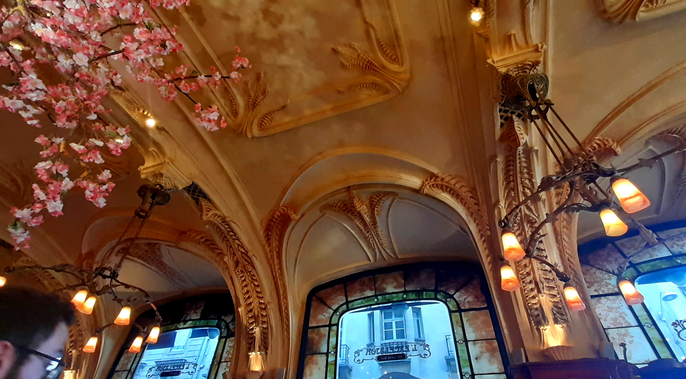
… and impressed by the excellent service provided by the army of waiters decked out in white shirts, black ties, vests and trousers, covered by long, white pinnies.

Brasserie L’Excelsior before the 8:00 pm scrum.

I order an entree of pate de foie gras and beef with bearnaise sauce and potatoes for mains – all delicious. Lynn orders salmon tagliatelle. We had been told by one of the Mercure staff about the Crepes Suzette here so Lynn orders some and we are treated to the waiter warming the crepes over a flame and dramatically setting them alight.

Flambe! Just don’t burn the artificial flowers on the ceiling.

Over the years various famous people have dined at the Brasserie, such as David Bowie. Lynn is sitting at a seat with the name “Arlette Gruss” who it turns out was a French circus artist and founder of the Arlette Gruss circus.

Arlette Gruss seat and memorial.

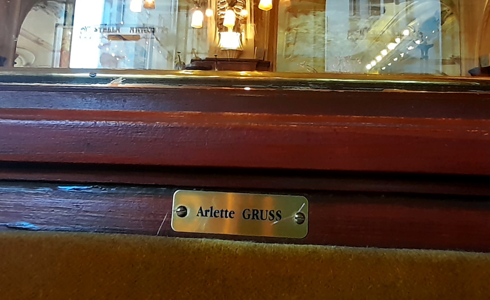
Having dabbled in all circus disciplines (trapeze and rope in particular), Arlette Gruss was best known for her panther tamer act. After the death of her father in 1985, she decided to create her own establishment, the Cirque Arlette Gruss. In 1995, she received the National Circus Grand Prix. She was also a knight of the Legion of Honor and a knight of Arts and Letters .

Featuring chandeliers designed by Majorelle and Daum, furniture by Majorelle and stained glass by Gruber, (i.e the usual Art Nouveau suspects) this is a brasserie like no other![nancy-tourisme.fr].

10 May, 2024

A brilliant sunny day with a top of 23 Deg. C. so around 11:00 am we head out and cross Place Stanislas to Parc de la Pepiniere via Place Nelson Mandela.

Fontaine Amphitrite, Place Stanislas, Nancy.

Our first stop is at the 1875 Mozart bandstand (Kiosque Mozart) in the Park. This circular structure, set in the English garden part of the Pépinière, was designed to accommodate musical bands performing outdoor concerts. It is still – but occasionally – in use today.

Kiosque Mozart, Parc de la Pepiniere, Nancy.

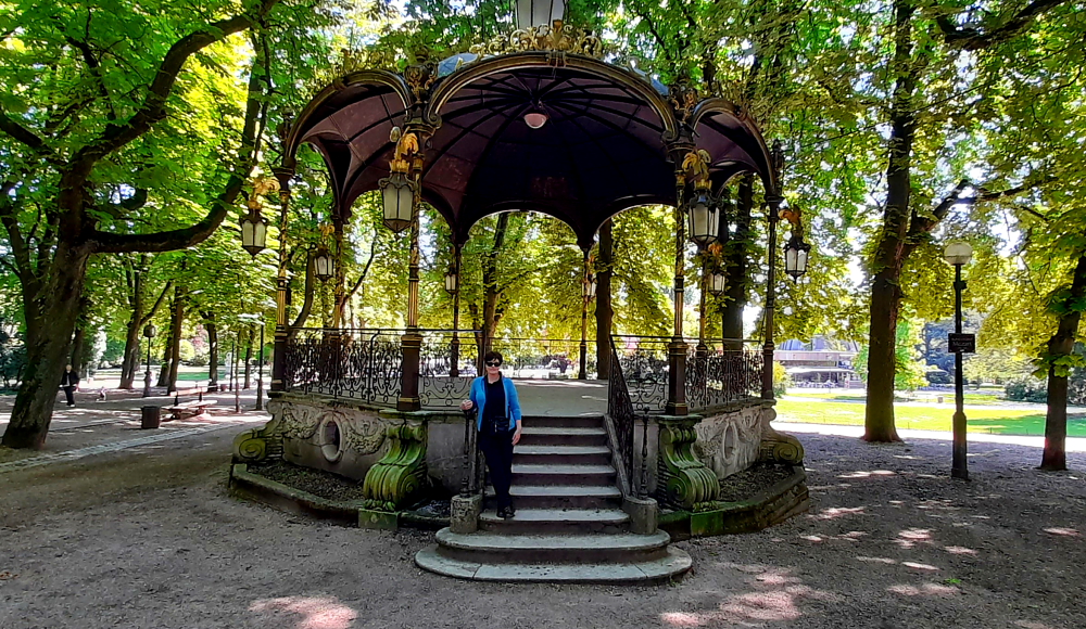
The bandstand singularly recalls some of the features of Place Stanislas’ railings, with its gold leaves and served as a model for other French towns’ bandstands [frenchmoments.eu].

White wisteria cascades, Rose Garden, Parc de la Pepiniere.

Nearby is the Park’s Rose Garden (Roseraie) which covers 2,000 m2 and was created in 1927 on the former site of the municipal greenhouses. Here there are 197 different varieties and 2,000 rose bushes [frenchmoments.eu].

Rose Garden, Parc de la Pepiniere.

Next to the Parc is the Jardin du Palais du Gouvernement. Just like the park we’ve just been walking through, this one needs some serious maintenance – unmown lawns, weeds, a large, circular fountain totally devoid of water. Such a contrast to the pristine Place Stanislas.

Musee Lorrain’s gilt-tipped spire viewed from Palais du Gouvernement Garden, Nancy.

What is also pristine are the spire and roof of the Musee Lorrain – tipped with gilt.

Musee Lorrain gates casting ornate, noon-day shadows onto Rue des Etats, Nancy,

Time for a cool beverage so we end up in Le Gavroche cafe on Rue Saint-Epvre where we both order cafes glaces (iced coffees).

“Iced coffees, Jim, but not as we know them!”

Hmm – espresso on ice heavily sugared and topped by a foam of indeterminate origin. Pass!

View from Le Gavroche cafe on Rue Saint-Epvre, Nancy.

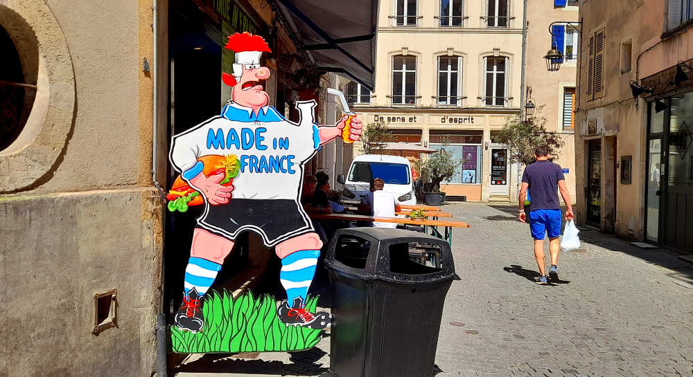
Next door is a restaurant called “Made in France”. Seems that at least some Frenchmen have a sense of humour!

Made in France Restaurant, Rue Saint-Epvre, Nancy.

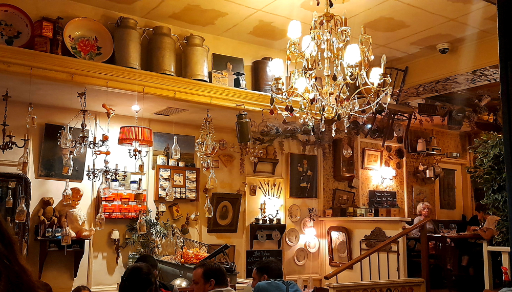
Tonight, Lucy has booked us into Le Bouche a Oreille (Word of Mouth), 2 minutes’ walk away from the hotel.

Le Bouche a Oreille, Rue des Carmes, Nancy.

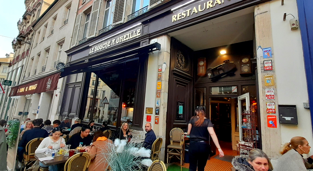
It’s a quirky place and known for its famous egg casserole to tartiflette and fondues.

Quirky interior full of memorabilia, Le Bouche a Oreille, Nancy.

We didn’t see one, single fondue on offer in Switzerland so we’ll have to revisit this popular dish from 1970s and 80s Australian cuisine.

Cauldron of searing hot cheese, my dear?

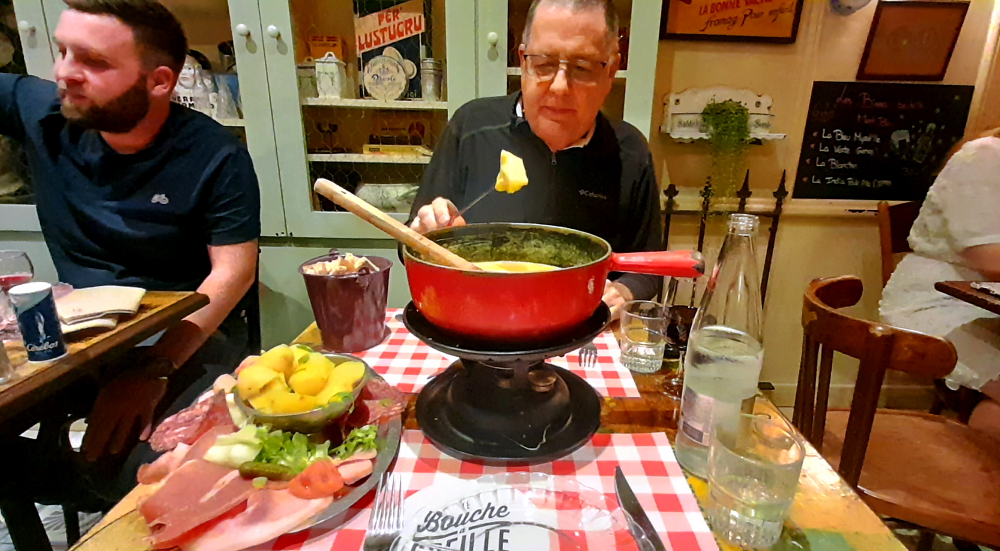
And we do! Interestingly, on the menu it says that the fondue is for 2 people but the price is Eu23/person. Why not just say, Eu46??

So, a large pot of searing hot cheese arrives and is placed on a gas warmer. Accompanying this pot is a small bucket of brown bread cubes together with a large platter of charcuterie, some weeds, and a small bowl of boiled potatoes. We really struggle to get even half way through all this. And probably not a good choice as the cheese is very salty and no doubt cholesterol laden – not a good combo for the Missus. No wonder we haven’t been tempted to eat one of these for over 40 years and we won’t be for at least another 40!

11 May, 2024

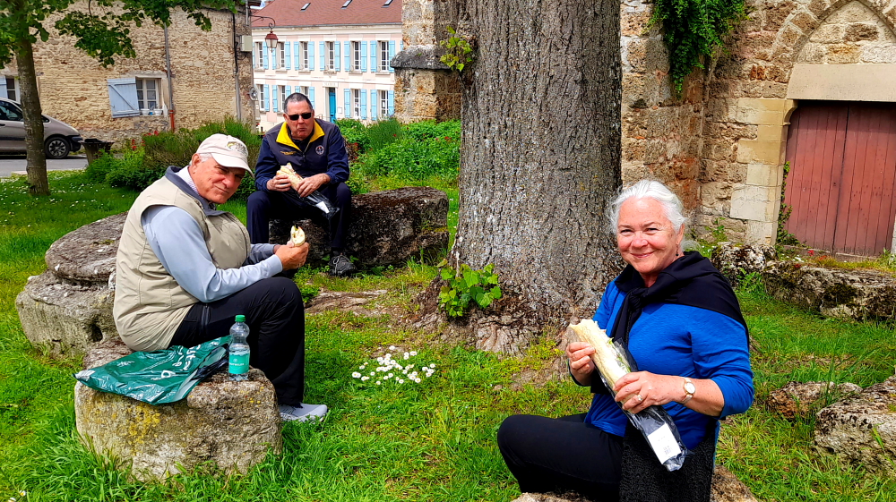
Today is our last day in Nancy so we decide to walk to “Ville Vieux” to make sure that we have seen all that there is to see, double back to the Central Market, repack, and finally dine at “Suzette et Gino” tonight.

Porte de la Citadelle, Nancy.

Beyond the magnificent Porte de la Craffe is the Porte de la Citadelle. Unlike all the other ‘portes’ in town, although this one is imposing from the outside, it hasn’t been refurbished so it’s looking a little sad and neglected.

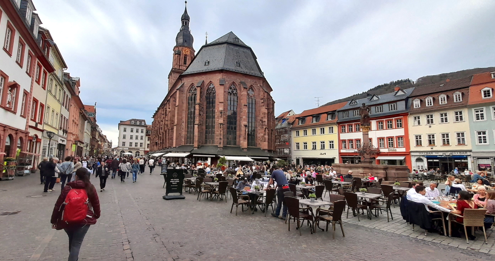
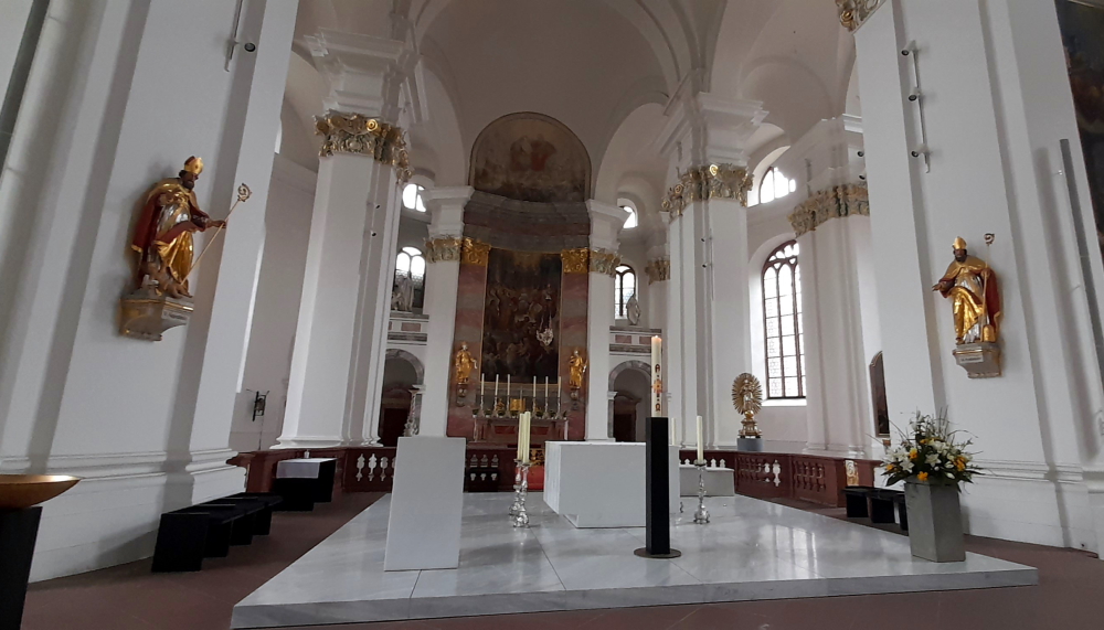
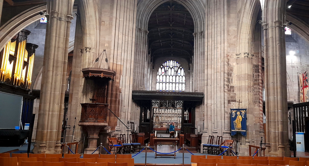
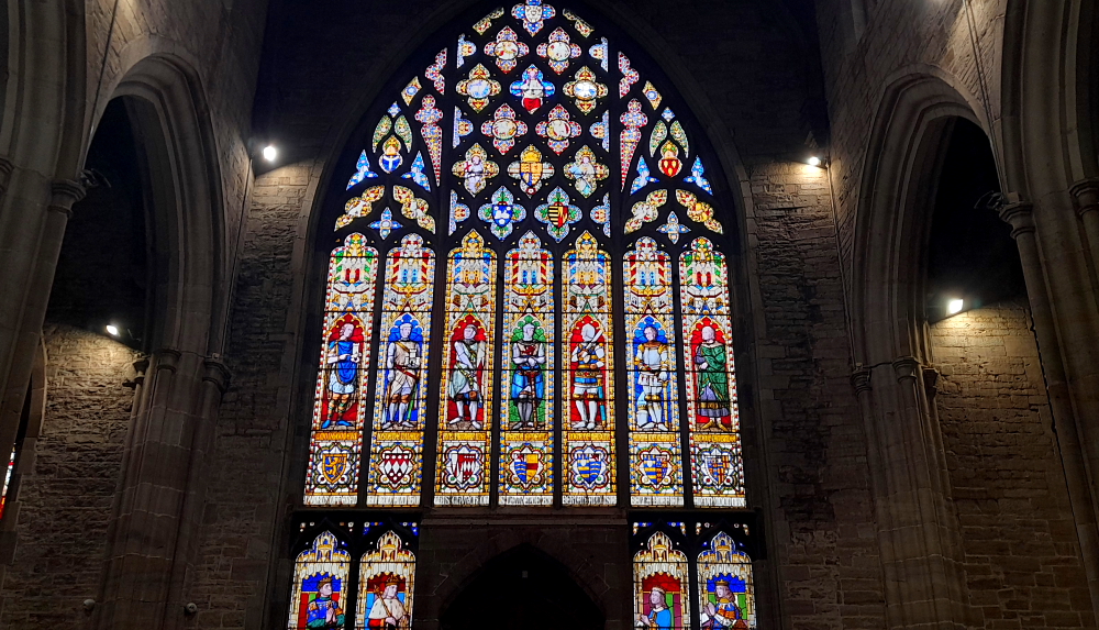
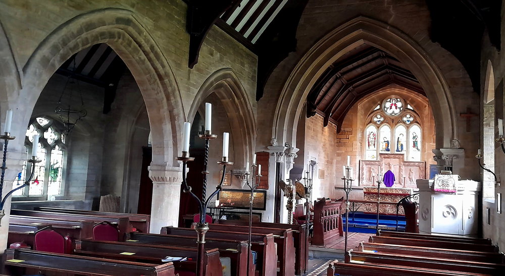
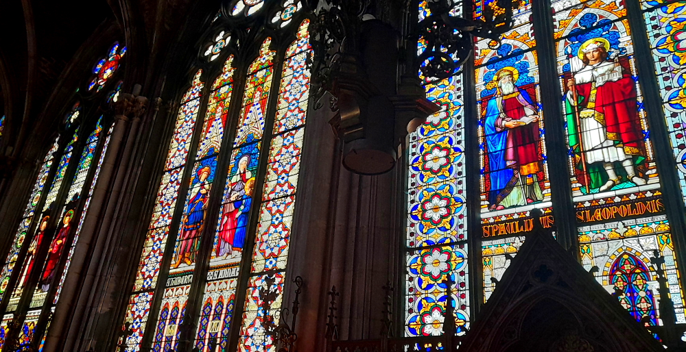
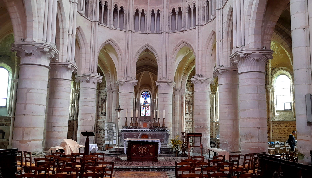
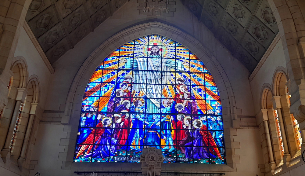
As we walk past the Basilica of Saint Epvre, we notice it’s open today so Lynn pops in, as she does.

Interior of Basilica of Saint Epvre, Nancy.

What she finds is a stunning vista of tall, colourful, stained-glass windows both at floor level and the galleries above which surround the entire internal space.

Stunning stained glass windows, Basilica of Saint Epvre, Nancy.

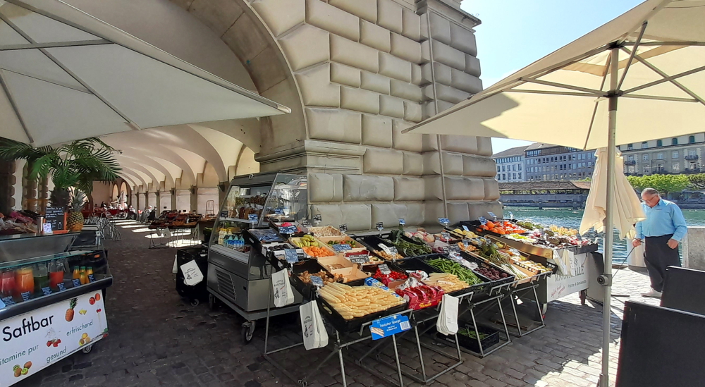
Arriving at the Central Market on Rue Saint-Dizier we find a typical metal building with glass windows along a raised roof and just about all the stands inside are operating and are busy with customers.

Boucherie & charcuterie stand, Central Market, Nancy.

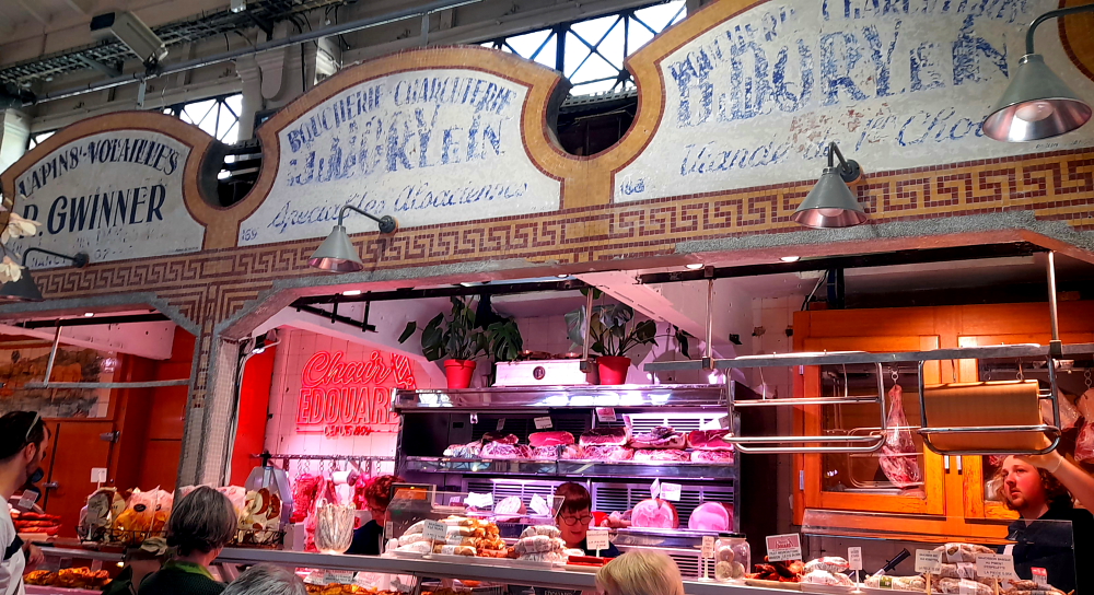
Nancy Central Market has some 65 stalls offering quality produce: fruit, vegetables, meat, fish, fine foods, local specialities, exotic goods, flowers, bookshops and more. It is an attractive U-shaped building dating from the 19th century. The central area (which locals call the central hall) has been covered with a glass roof [nancy-tourisme.fr].

Tantalising treats, Central Market, Nancy.

Following a break back at the hotel, we walk across Place Stanislas to Rue Here where we find “Suzette et Gino” billed as a traditional Italian restaurant, another of Lucy’s bookings for us.

More artificial flowers decking the deck, Suzette et Gino, Nancy.

When we arrive at the restaurant just before 7:00 pm when it opens the Rue Here is already heaving with al fresco diners at all the restaurants that line the street.

Outdoor seating at Suzette et Gino & Rue Here leading to Place Stanislas, Nancy.

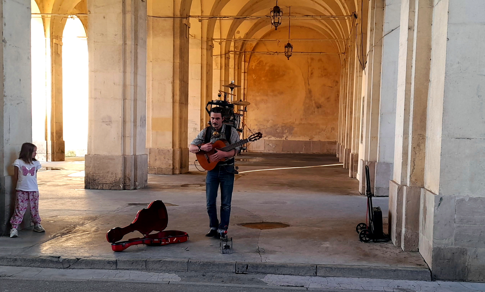
While Lynn’s out taking photos she hears a bit of a racket and ventures a few metres to Arc Here where a “one-man-band” is playing a tune.

One-man-band, Arc Here, Nancy.

After a delicious meal we cross back Place Stanislas to find a crowd of people milling about in front of a grand building – the Opera House. They’re attending a performance of “Where are you going like that?”

Opera National de Lorraine, Nancy.

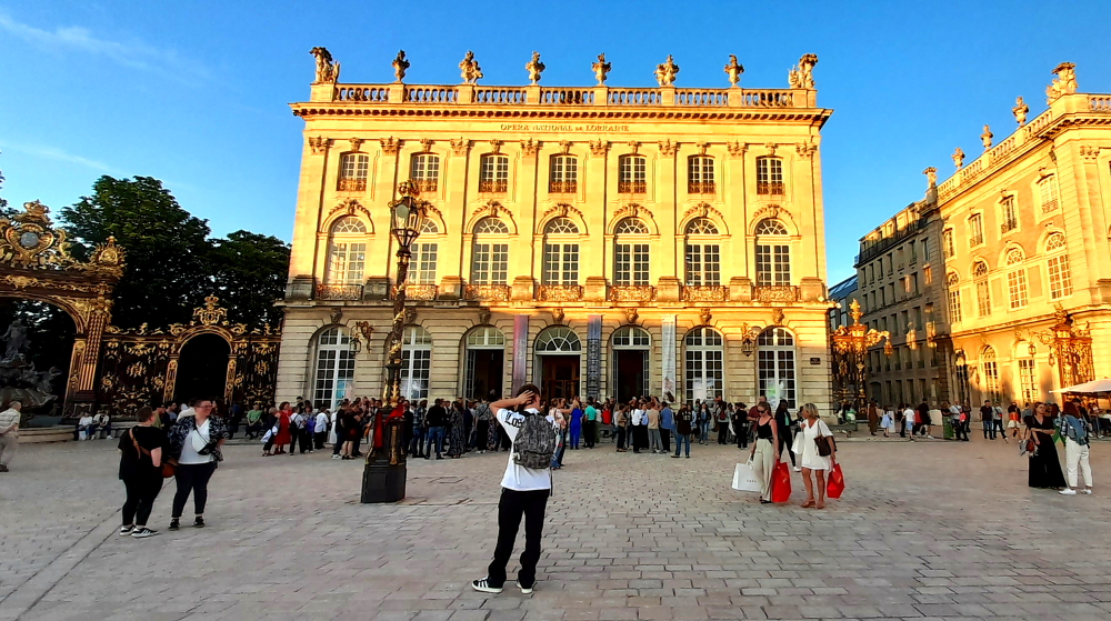
According to the Opera’s website the performance “combines the form of documentary theatre, the force of a symphony orchestra and free choreography. But in principle, it’s a rendezvous with all the question marks that dance within us. Because there are certain answers that await a question all their lives.” [opera-national-lorraine.fr]

12 May, 2024

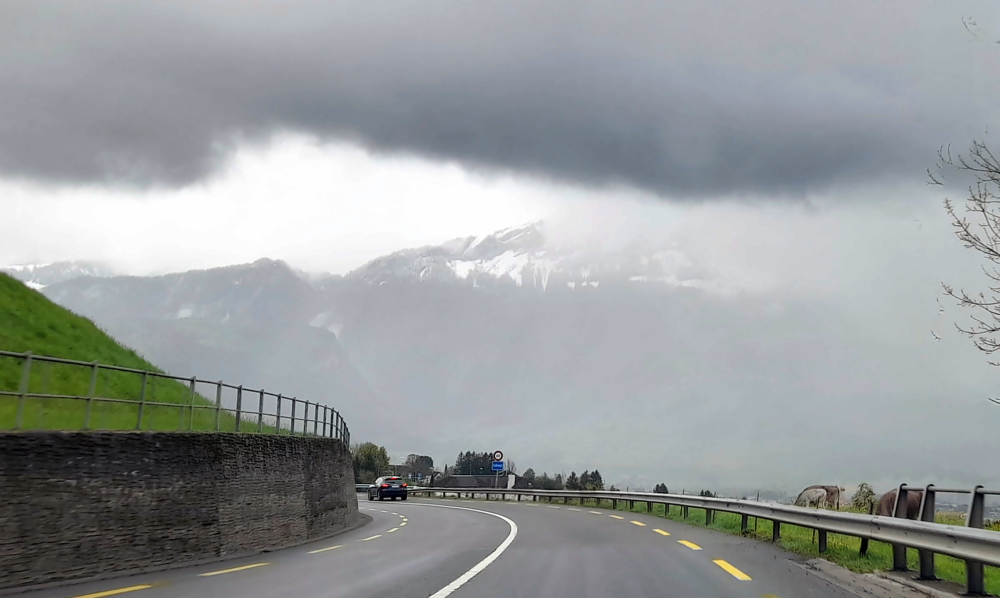
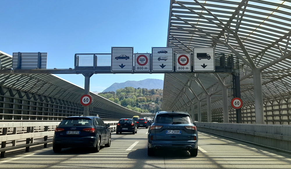
At 11:15 am when we depart it’s already 23 Deg. C. The 205km trip to Reims will take us about 2 hours 15 minutes. Thank goodness for the air conditioner!

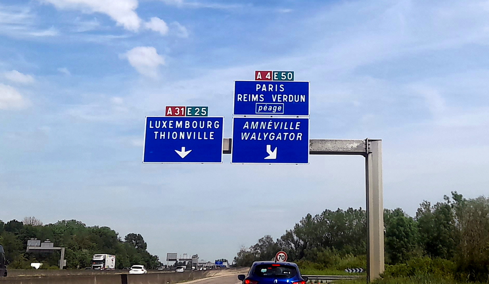
Initially, my trusty GPS takes us via the A31 towards Metz (we are heading north instead of west!), but just before Metz we turn west along the A4 to Reims.

On the road to Reims.

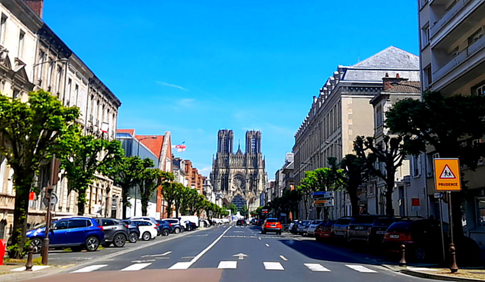
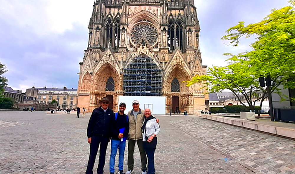
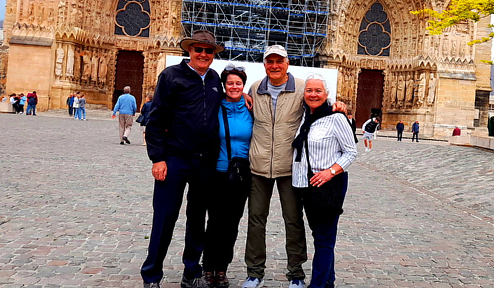
We arrive at our AirBnB apartment on Rue Libergier, which is a block from the Cathedrale Notre-Dame de Reims, around 1:45 pm. We park across the road and are met by Paolo who manages the apartment and he shows us the ropes after we drop our luggage inside.

Quickly we drive to the train station as Becky and Jerry, our Philly friends, have arrived from Paris and are waiting for us to collect them from in front of the station.

View of Cathedrale Notre-Dame de Reims from Rue Libergier.

Returning, we park around the corner in an underground car park and walk the short distance to the apartment where we all get settled in.

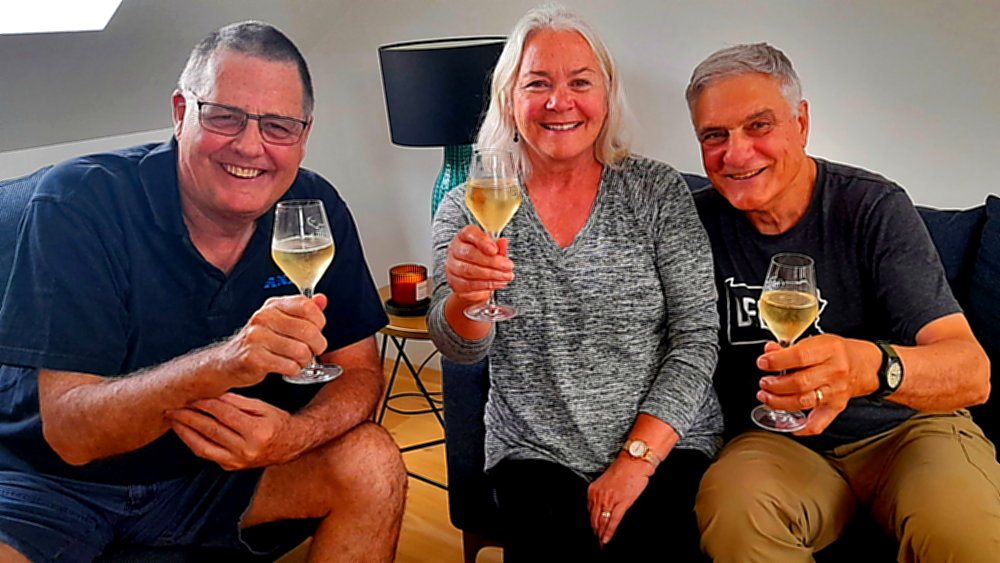
One of the “ropes” that Paolo showed us is a chilled bottle of champers, a Brut Blanc de Blancs, that his boss, the owner of the apartment, has kindly given to us from his vineyard – the Olivier Coutant champagne house. It seems that everyone in the Champagne region is a vintner!

Catching up 5 years later.

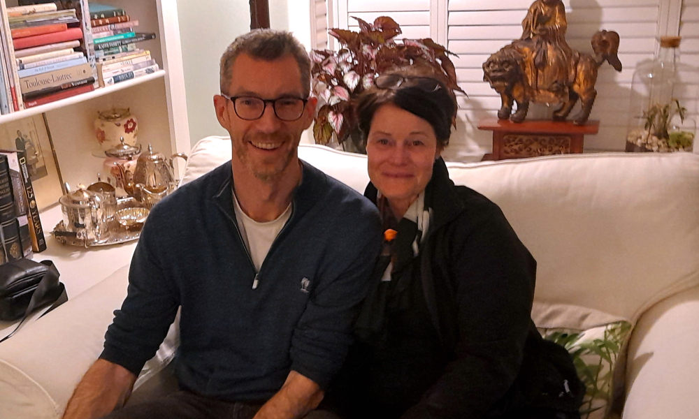
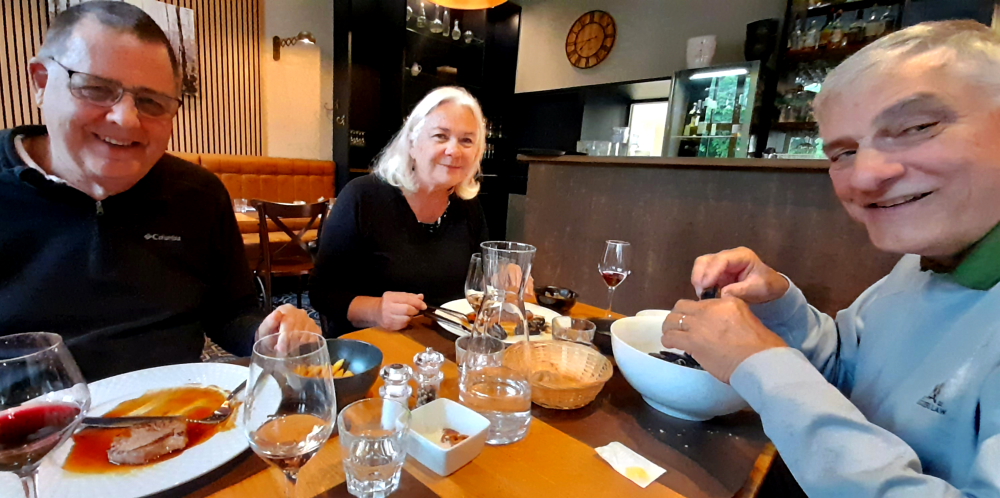
It’s great to see Becky and Jerry once again. We first met them in Lecce, Italy in an Irish Pub on St Patrick’s Day – as you do – in 2015. We stayed with them in Newtown Square, Pennsylvania in 2019 and they were our saviours in March 2020 when they let us leave our Malibu car on their condo driveway in San Diego when we had to abandon our USA travels thanks to COVID.

10 months ago after a Skype call together we made this AirBnB booking, and here we are!

13 May, 2024

At 7:30 am Lynn is out the door to visit the convenience store and boulangerie to buy a few breakfast items as the supermarket was closed yesterday, being a Sunday.

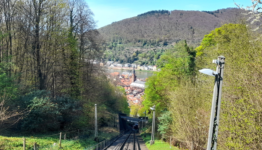
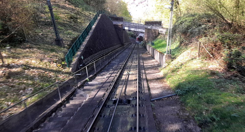
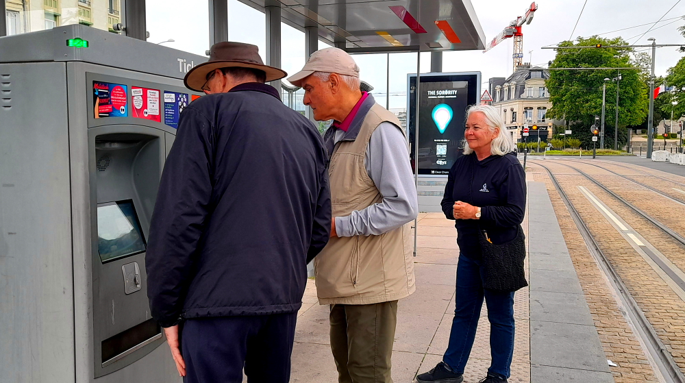
Some months ago she had re-connected with our GuruWalk guide, Rehman, and asked if he could lead another walk for us today for the 4 of us. So we catch the 9:40 tram from Opera-Cathedrale and ride the 5 minutes to Scheiter where we alight.

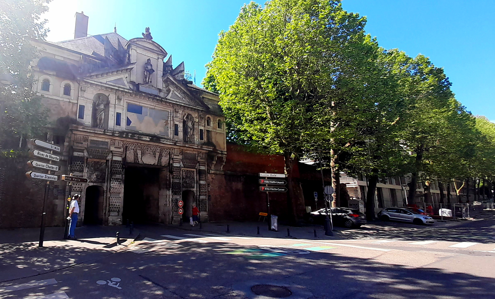
As we are some minutes early to meet him we walk over to La Porte de Mars which was under scaffolding and plastic when we were here 3 months ago.

La Porte de Mars, Reims.

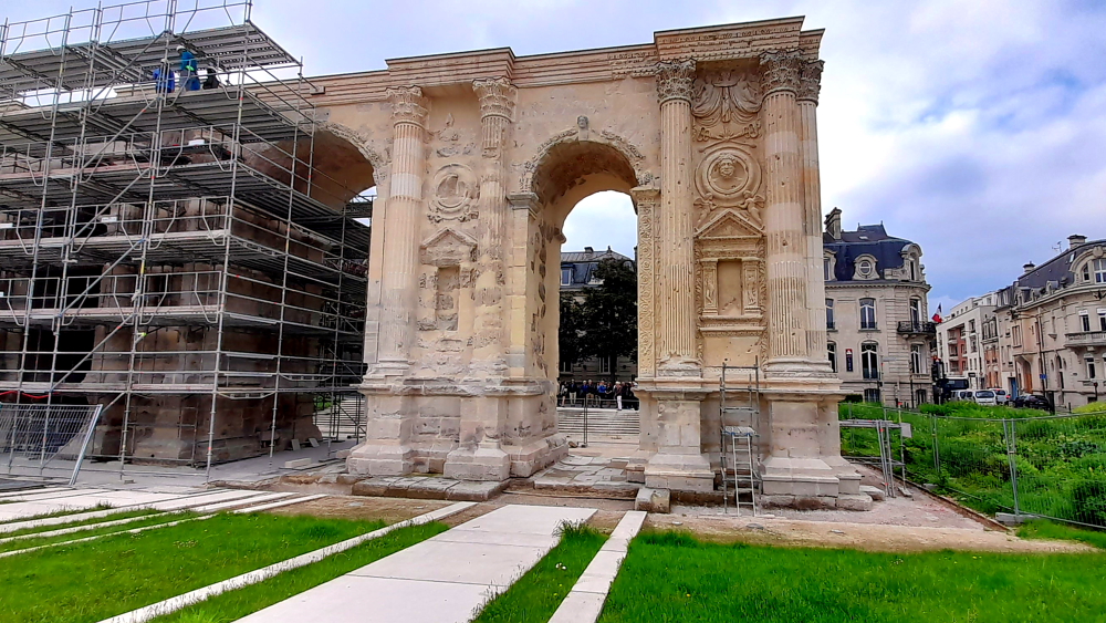
The Porte Mars is an ancient Roman arch dating from the early 3rd century AD, is the largest arch of the Roman world and one of the most impressive Roman monuments north of the Alps. Its name derives from a nearby temple dedicated to the god of war, Mars. At the time of its construction, the Porte Mars would have been one of four monumental arches erected as entrances to the Gallo-Roman settlement of Durocortorum (“round fortress”).

The Arch, relatively well preserved, stands 32 metres long and 13 metres high, but its height must have been equally impressive with its attic and the statue group on top which are no longer there.

The Porte Mars was included in the fortification wall of the late Roman Empire and, in 1228, in the wall of the castle of the Archbishops and served as a city gate until 1544. In 1854 the buildings around the arch were removed, bringing the arch into full view [followinghadrianphotography.com].

Demeure des Comtes de Champagne, Reims.

After meeting up with Rehman we walk down Rue de Tambour where we come to No. 25, the Demeure des Comtes de Champagne (Comtes de Champagne residence), the oldest civilian building in Reims (13th century) and although it has been remodelled several times, it retains all the features of a wealthy medieval building, with its ground floor arches and gallery on the first floor.

Today it’s the historic jewel of the Taittinger heritage, offering tastings and a shop!

Legend has it that it was the urban residence of the Comtes de Champagne, who used it in particular as a dwelling during royal coronations, at which time the cream of French nobility would gather across the city. During the Coronations, it was convenient for the great lords of the Court to lodge in the city. Only a very small few could stay at the Palace of Tau (Bishop’s Palace). So, these guests could spend a few weeks in private homes like this, the homes of the rich bourgeoisie.

With our tour guide in front of the Notre-Dame Cathedral, Reims.

This is supported by research in the city archives which revealed a document dated 1328 from during the Coronation of Philippe VI. It’s a register of the size of the ‘Sacres’ – a tax levied on the wealthiest inhabitants of Reims to finance the reception of the Court – and features this house, which at the time was owned by Pierre Le Châtelain who belonged to one of the great families of the Reims bourgeoisie, and whose fortune had been made through contact with the Archbishops of Reims [theinstantwhen.taittinger.fr].

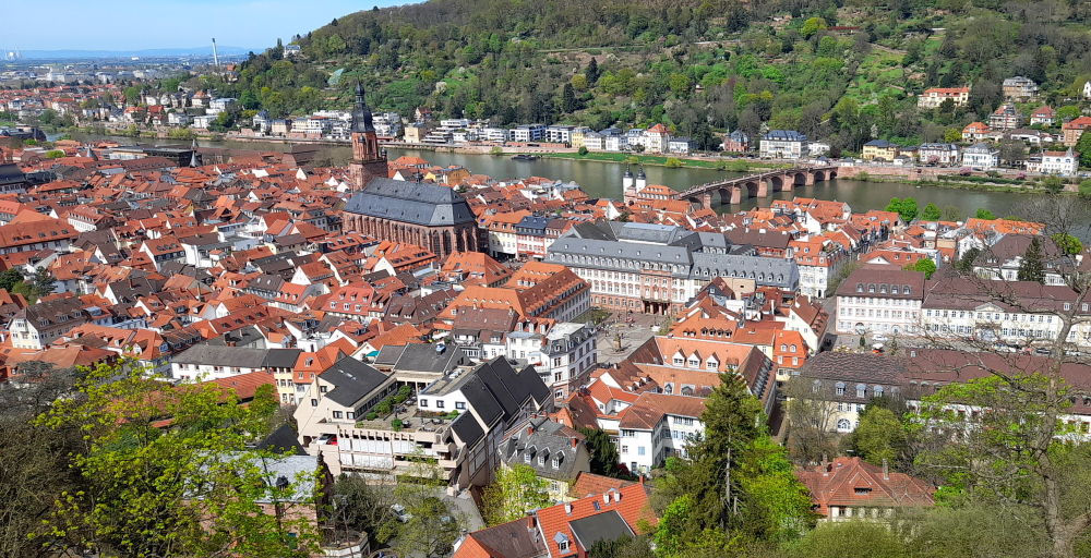
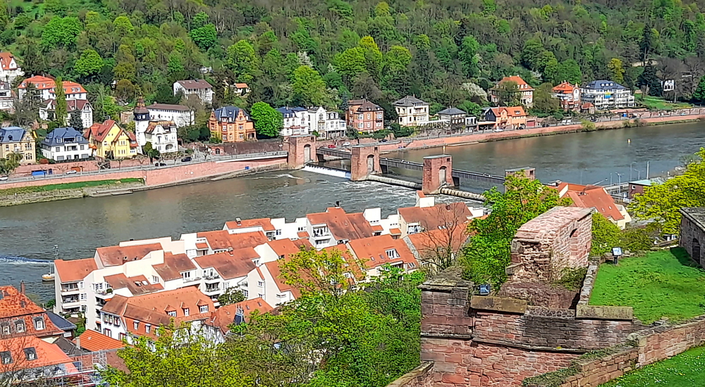
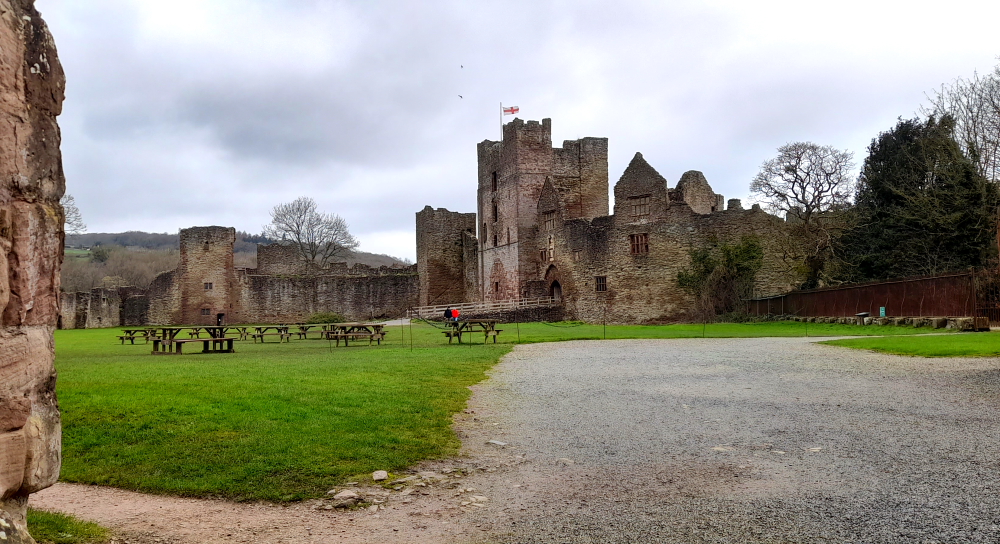
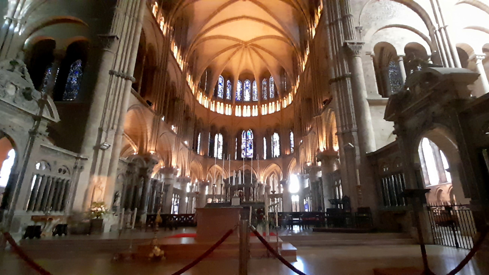
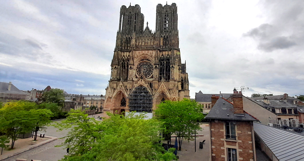
After visiting all the sites we saw on our tour on 4 February we arrive at the 13th century Cathedrale de Notre-Dame de Reims which today has scaffolding concealing its main entrance. Here we are reminded of the baptism of Clovis by Bishop Remi in 498 in front of a previous church which had been subsumed by this Cathedral.

Nothing like a private walking tour!

Before we return home we scurry about trying to find a shop that hasn’t closed for the usual 2-hour lunch break that sells champers (and a bottle of Bouzy red wine) and the famous Reims Rose Biscuits solely made for dunking in champagne. Success!

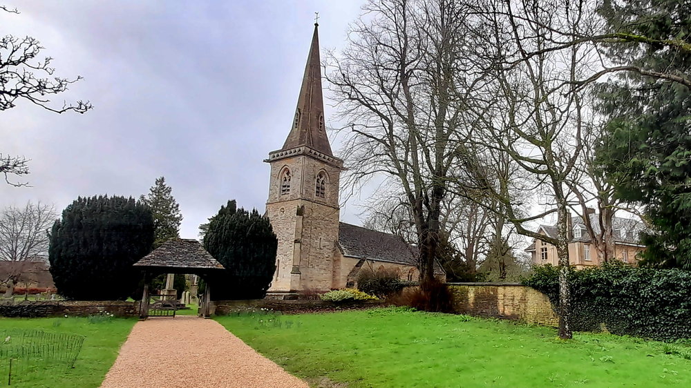
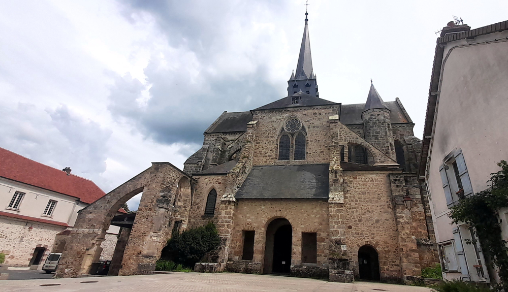
After lunch and a nanna nap we head out again at 3:30 pm to walk 20 minutes SE to the Basilica of Saint-Remi, named after the Bishop who baptised Clovis.

Basilica of Saint-Remi, Reims.

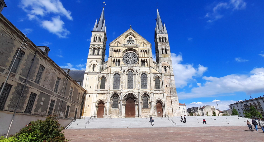
In Romanesque-Gothic style, it is one of the most remarkable achievements of Romanesque art in the North of France. 126 m long, it impresses with its depth and its feeling of intimacy.

Nave of Basilica of Saint-Remi, Reims.

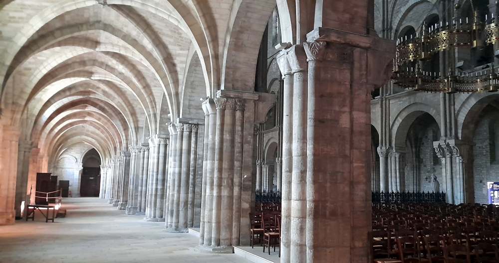
The sober Romanesque nave and the 4-story Gothic choir (end of the 12th century) make for an impressive ensemble of lightness and harmony. The facade was built at the same time as the choir.

Choir, altar & apse of Basilica of Saint-Remi, Reims.

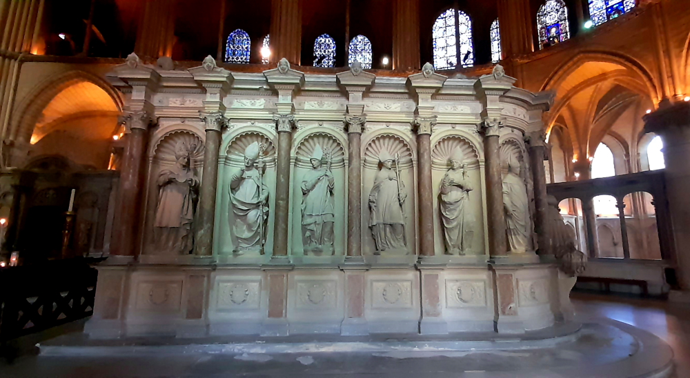
Built in the 11th century, the Basilica houses the relics of Saint-Remi. His tomb (1847) occupies the center of the choir [www-reims-fr].

Saint-Remi tomb, Choir, Basilica of Saint-Remi, Reims.

Earlier, Becky mentioned that last night their bed didn’t have a bottom sheet on it, only a mattress protector, so after letting Paolo know this he drops by at 7:00 pm to rectify the situation. Not only does he insist he makes the bed but he also offers us a superior bottle of champers from the Coutant vineyard in recompense for this “mistake”. We jokingly said that we’d try to find more “mistakes”!

Feeling knackered after all our walking today (11.3 km) we call into the bistro that is next door to our apartment, “Bistro des Anges”. What a find! Excellent food, wine and cocktails and a very genial owner/host – an angel indeed.

14 May, 2024

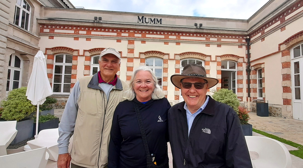
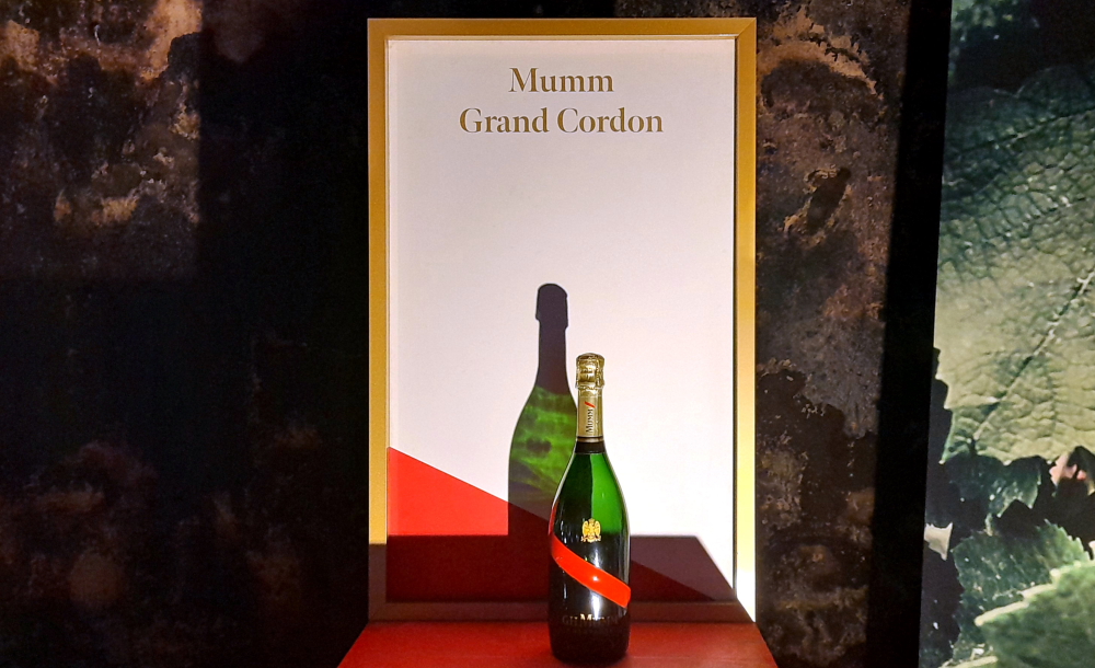
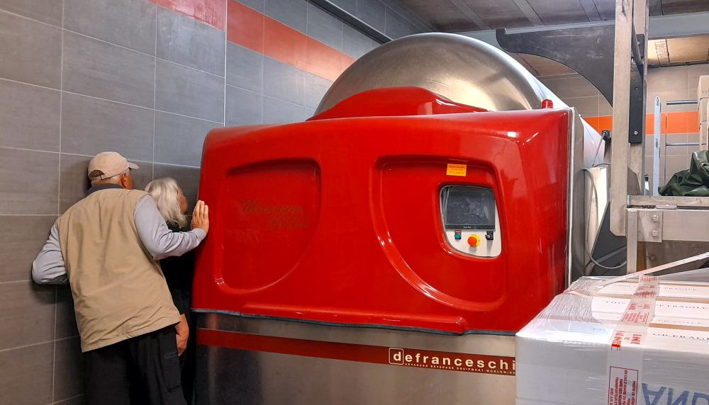
Some months ago I had booked a tour and tasting at Maison Mumm for the 4 of us. Once again we catch the tram to Schneiter then walk up the Rue du Champs de Mars to arrive for our 11:00 am tour.

GH Mumm & Cie, Rue du Champs de Mars, Reims.

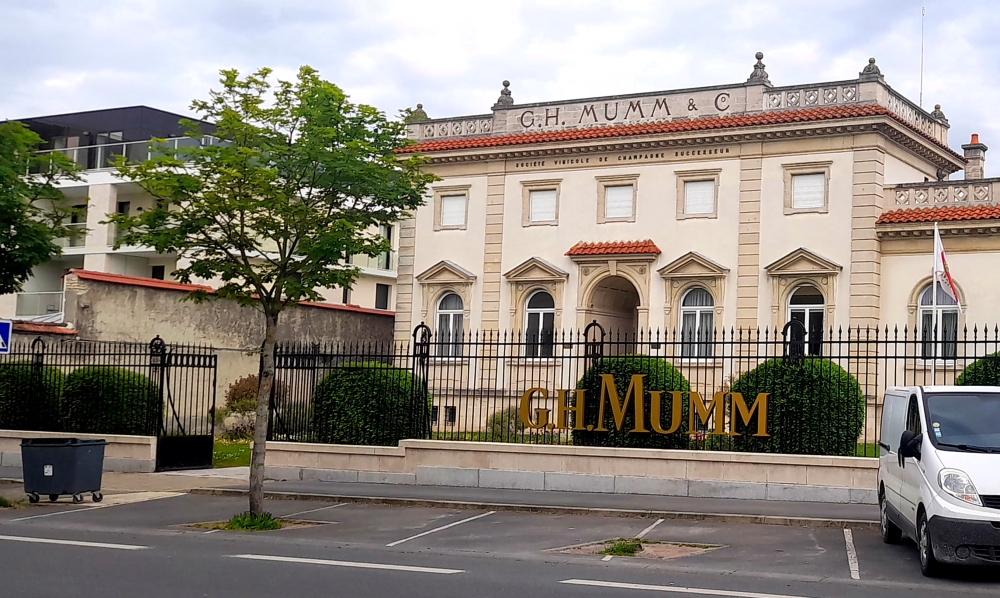
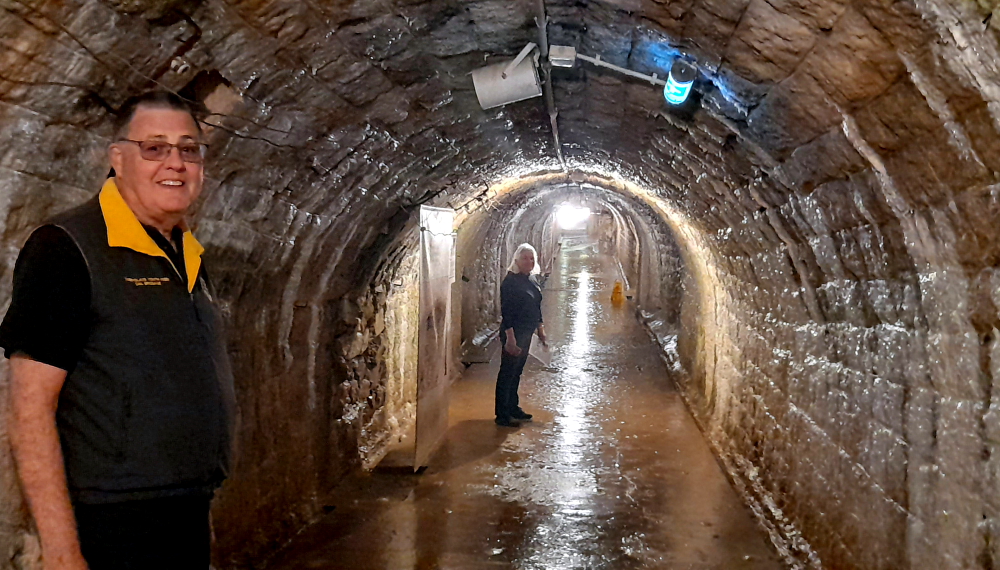
The Mumm estate is quite large, occupying both sides of the road with several classical buildings and extensive caves and galleries of bottled champagne below ground.

In the courtyard before the tour.

Spread across almost 25 km in the heart of the city the galleries of the Mumm cellars, built 14m underground and excavated over 70 years, are home to almost 200 years of history and expertise and house 25 million bottles.

Various sizes of champagne bottles.

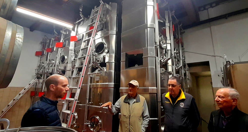
Eva, our guide, takes us down and through the various galleries explaining how champagne is made. Once they are filled, the champagne bottles are stored on their sides in Mumm’s cellars ready for aging.

Mumm caves, this one with champagne made from Bouzy village grapes.

Champagne must be aged for a minimum of 15 months but Mumm prefers to age champagne for much longer.

Yeast, riddling tables & disgorgement.

According to champagne specifications, a vintage champagne must be aged for a minimum of 3 years. At Mumm, aging lasts at least 5 years and can go up to 10-12 years for certain prestigious cuvees.

One of the galleries several kilometres long to transport the bottles.

Once aging has finished each champagne bottle is signed with the emblematic Mumm Red Sash on its paper label.

Except, created by English designer, Ross Lovegrove to mark 140 years of Mumm Cordon Rouge, the bottle is a technical feat that redesigns the champagne codes – a slimmer neck and understated lines emphasised by the indentation of the famous red sash directly in the glass – i.e. no paper label [mumm.com].

Mumm Grand Cordon – 140 year celebration bottle.

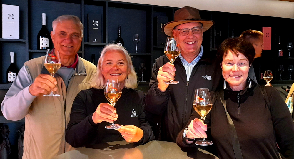
After an hour of walking the caves we emerge topside for a tasting of Mumm’s regular champers. Recommended to be served between 8°-10°C (46°-50°F) to help bring out the champagne’s full range of aromas and in a tulip-shaped white wine glass, with its wide girth tapering towards a narrow opening, that is best suited to champagne. This type of wine glass encourages the formation of bubbles and the release of aromas, concentrating them on the nose before tasting.

Opening a bottle involves holding the bottle at a 45 deg. angle, untwisting the wire, holding the cork and slowly rotating the base until the cork is released with, as Jerry noted, a “sigh” – never a pop!

Sante!

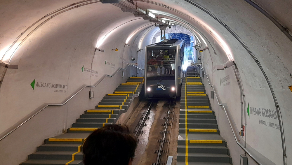
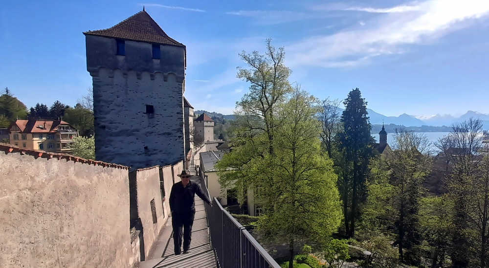
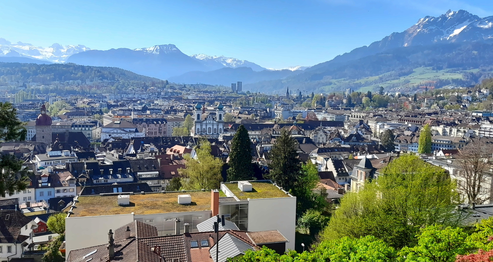
We catch the tram back to the Opera-Cathedrale stop then walk to the City Library which is located in front of the Cathedral.

“Where’s the button for English?”

Here our guide had told us that we could view the Cathedral from an elevated perspective.

View of the Cathedral from the 2nd floor of the City Library.

Later in the afternoon we revisit one of the tour’s sites, the Carnegie Library, a public library, which is open today.

Andrew Carnegie, a generous American benefactor, gave Rheims an Art Deco library via USD200,000 of funding. It was built in the period 1921-1927, under the direction of Rheims architect Max Sainsaulieu (1870-1953), and formally opened on 10 June 1928 in the presence of French president Gaston Doumergue and US ambassador Myron T Herrick.

Exquisite chandelier, Carnegie Library Dome, Reims.

This library was remarkable for the quality of its materials, the richness of its ornamentation, and a very practical approach to the layout of its spaces, something rare in France at that time – a strict distinction between public space, storage space and staff working space.

The architect called on the period’s great names in decorative arts such as Schwartz-Haumont (gold medallist at the 1925 Arts Déco Exhibition) for the wrought iron gates; Jacques Gruber to design the glazing and the bays in the reading room, and stained glass artist Jacques Simon (1890-1974) for the entrance hall’s exquisite chandelier.

Catalogue room.

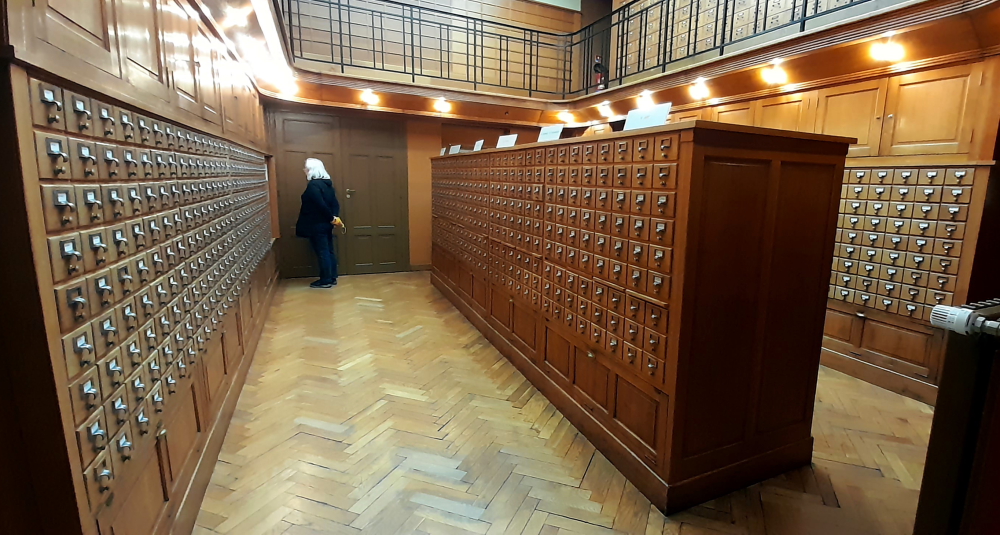
Spread across 5 levels, the collections’ storerooms have space for up to 9 linear kilometres of documents. Today, the Library is home to 400,000 documents, with 45 workspaces and reading rooms plus an exhibition hall, a 42-seat conference hall and a 30-seat lecture theatre [maisons-champagne.com…the-carnegie-library].

Reims’ street art.

Our final night in Reims is celebrated once again in the excellent Bistro des Anges.

15 May, 2024

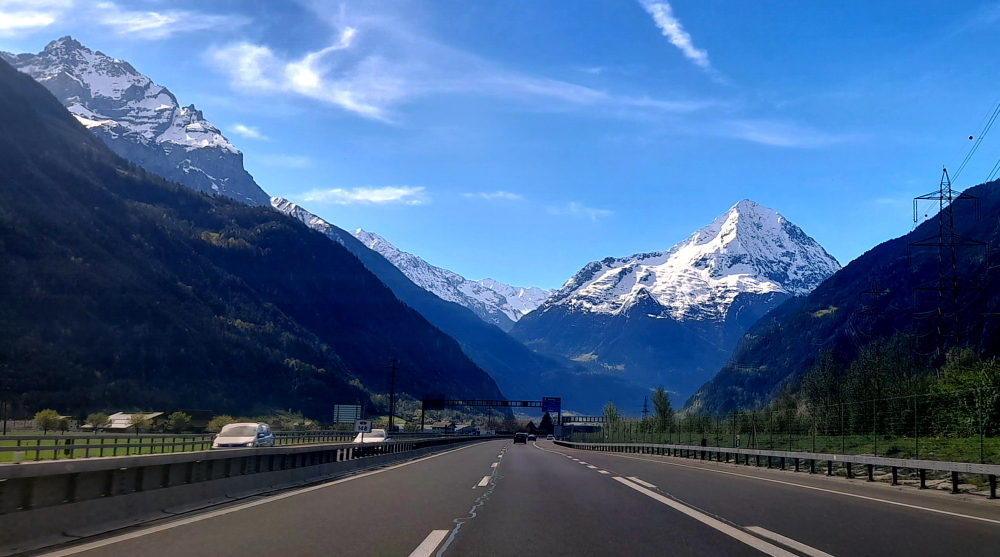
In his professional life Jerry was a high school history teacher. This interest has driven us – figuratively and literally – to the French city of Verdun, 128 km east of Reims on the A4.

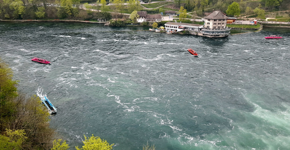
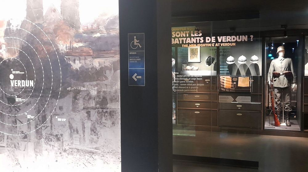
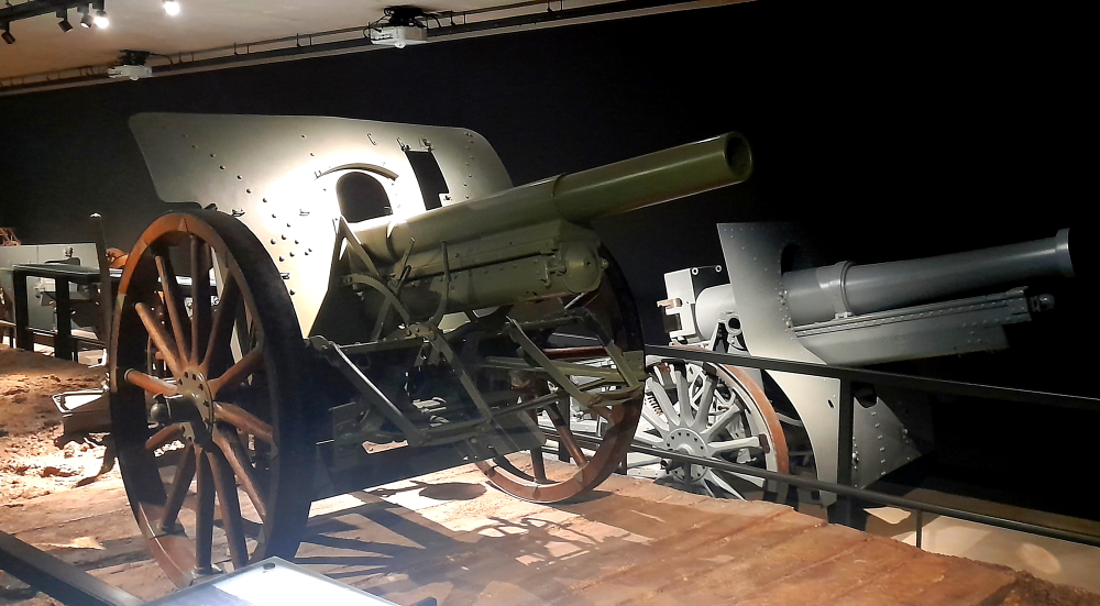
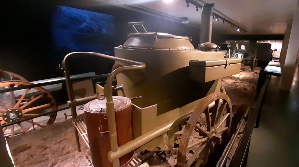
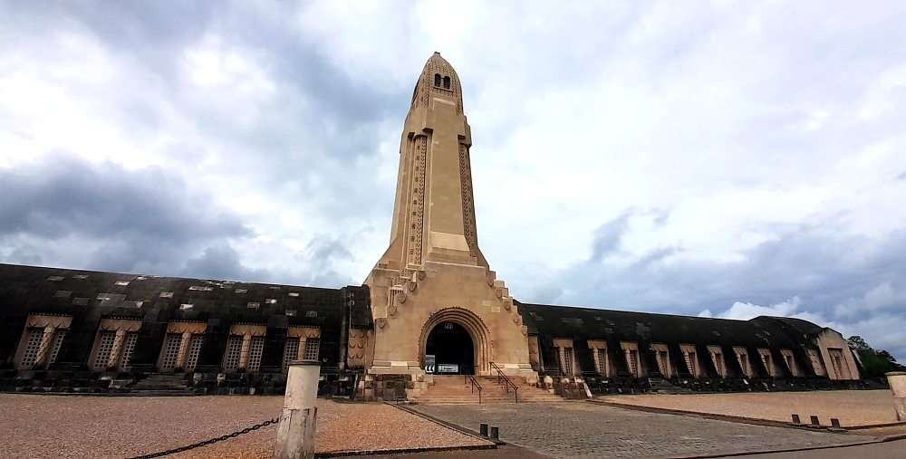
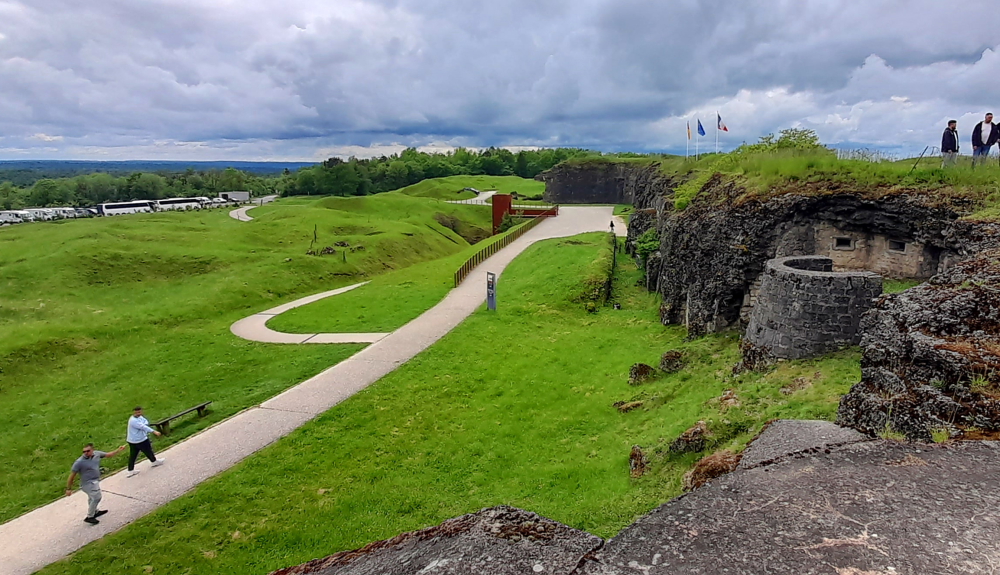
Specifically, we visit the museum known as the Memorial de Verdun Champ de Bataille, with immersive and interactive exhibits depicting the Battle of Verdun (302 days from February-December 1916).

Memorial de Verdun Champ de Bataille.

The Battle began on 21 February 1916 at 7.15 am when the German army began bombarding the forts and trenches with artillery fire for 10 hours. 1,200 guns smashed the French positions. Erich Von Falkenhayn, Commander-in-Chief of the German army, wanted to put an end to the trench warfare that had begun in the autumn of 1914 and get his troops moving again.

During the first few days, the Germans breached the French front lines and captured Fort Douaumont without a fight on 25 February 1916. The French High Command was anxious to retake the fort because of its dominant position high above the battlefield. Despite heavy shelling, the French infantrymen (known as “Poilus”) clung on to their positions and the Germans were unable to advance any further. General Pétain then took command of the troops. He was ordered to defend Verdun.

He increased the volume of traffic along the Bar-le-Duc to Verdun road, later known as the “Sacred Way”, the only route taking men and munitions up to the battlefield. In all, some 4,000 trucks, 2,000 cars, 800 ambulances, 200 buses and numerous vans passed along it.

Example of exhibits in the Verdun museum.

From 6 March 1916, the Germans also attacked on the left bank of the River Meuse yet despite furious fighting on Le Mort-Homme in March and April they were unable to breach the French front line. At the end of June, having taken Fort Vaux, they launched a massive attack which failed – but only just.

On 1 July, the British and French launched a major offensive on the Somme, relieving some of the pressure being put on the French troops by the Germans in Verdun. The Germans tried to capture the town one last time, on 11 and 12 July, but they failed again.

In the autumn of 1916, the French counter-attacked. On 24 October 1916, they recaptured Fort Douaumont and, a few days later, they entered Fort Vaux. It was empty – the Germans had already left. From 15 to 18 December, the French attacked again, retaking almost all the land they had lost since 21 February.

German artillery.

The 1916 battle ended after ten months of bitter fighting on 18 December. There were more than 700,000 victims – 305,000 killed and missing and approx. 400,000 wounded, at an average of 70,000 per month, with almost identical losses on both sides. Yet fighting continued around Verdun until 1918.

Almost three-quarters of the French army fought at Verdun in 1916. It was a Franco-German battle but it also involved colonial forces. The sheer scope and violence of the fighting here made it one of the major battles of WWI.

The United States did not declare its participation in the Great War until 1917, however some unofficial assistance from it was already being provided for the Allies by the start of Verdun. American volunteers played a significant role in the front line of the battle, performing as ambulance drivers, fighter pilots, soldiers and other duties [news.va.gov].

German field kitchen.

In fact, the Battle came to symbolise the Great War, a culmination of battlefield brutality. It summed up every aspect of the Great War and turned Verdun into the most iconic of all places of remembrance [memorial-verdun.fr].

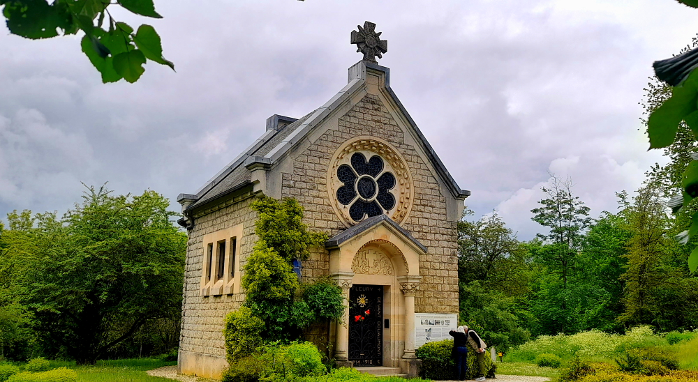
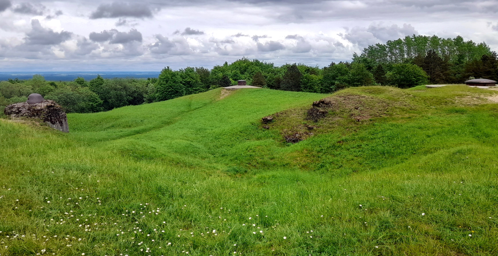
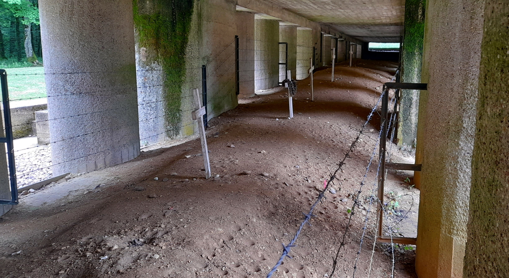
Exiting the Museum we walk to the nearby village – its remains, that is – of Fleury-Devant-Douaumont – village détruit. In the forests around the town of Verdun there are 8 other villages with this “village destroyed” categorisation.

There are remnants of some structures – a few stones in the ground & markers – but otherwise there is nothing, except a rebuilt chapel, with the statue of Our Lady of Europe draped in a blue flag with gold stars.

Our Lady of Europe.

Before WWI Fleury-devant-Douaumont was home to just over 400 inhabitants, who worked the land and forests or in the village itself.

Undulating land from bomb craters & markers for former village buildings.

As the Germans advanced, Fleury-devant-Douaumont was evacuated. Altogether, what remained of the village exchanged hands 16 times over the course of the battle. When it finally ended, the village was no more. It was in the Zone Rouge, declared a village that had ‘died for France.’ Nothing was left, but in honour of its sacrifice, it kept its legal status. The red-framed white signs still stand at the entrance and exit of Fleury-devant-Douaumont. It still has a mayor [www.elsewhere-journal.com].

Douaumont Ossuary.

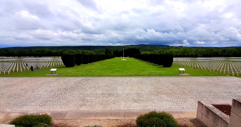
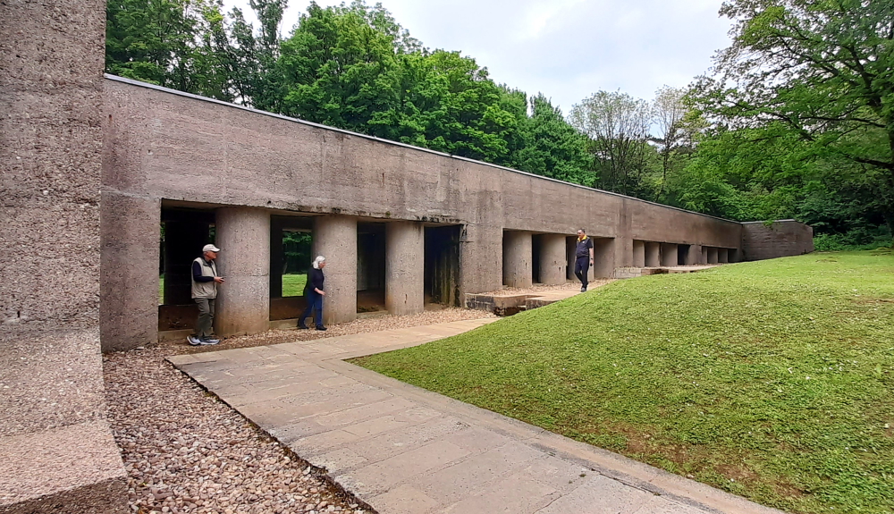
Nearby is the Douaumont Ossuary, a memorial containing the skeletal remains of at least 130,000 unidentified combatants of France and Germany. In front of the monument lies the largest single French military cemetery of WWI with 16,142 graves. It was inaugurated in 1923 by Verdun veteran André Maginot, who would later approve work on the Maginot Line. The ossuary was officially inaugurated on 7 August 1932 by French President Albert Lebrun.

16,142 graves.

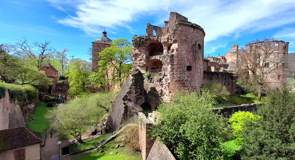
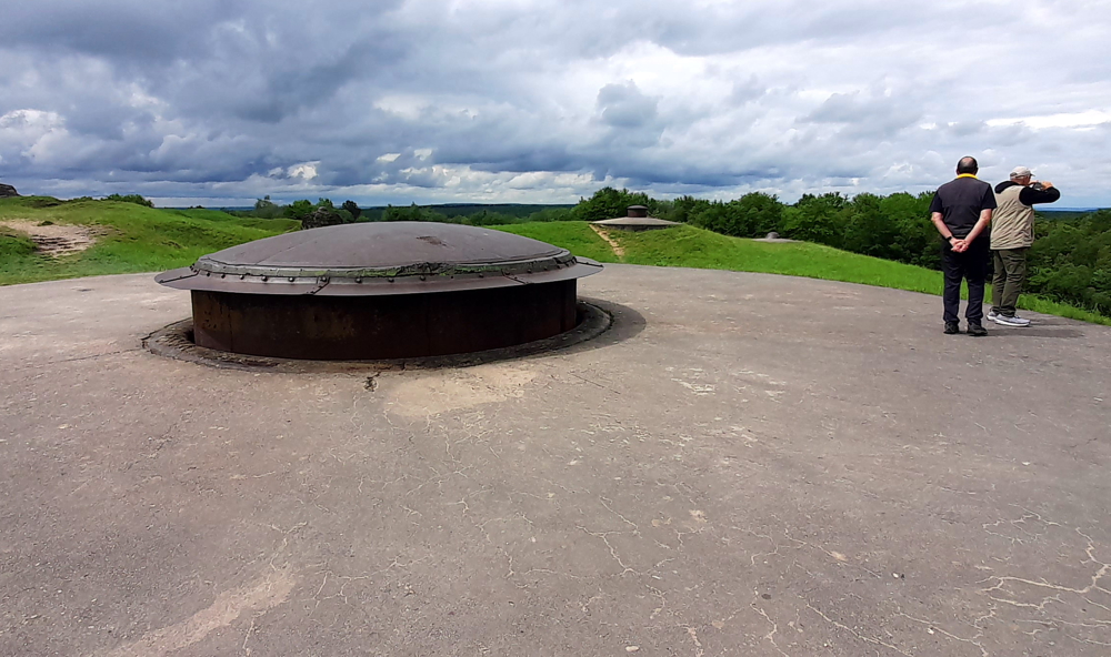
Close by is Fort Douaumont, a relic of WWI. It’s one of the most powerful works and symbols of the Battle of Verdun.

Entrance to Fort Douaumont.

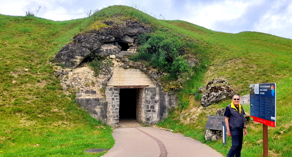
Built between 1884 and 1886, Fort Douaumont was a strategic location of the Battle of Verdun in 1916. Moreover, it is to this battle that it owes its fame.

Passageways within the Fort.

Overlooking the valley SW of Douaumont at an altitude of 400 metres, the fort has been classified as a historical monument since 1970.

The Galopin Gun Turret – 155 mm gun.

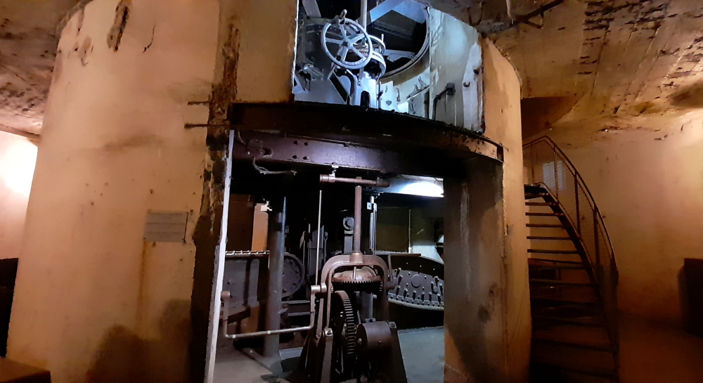
Its masonry construction was almost immediately obsolete because at that time new shells had the capacity to destroy masonry structures.

Yet another damp tunnel with calcite deposits.

That is why Fort Douaumont was covered with a thick layer of concrete in the most exposed and sensitive areas. Its efficiency and the resistance of its armament made it one of the most sturdy buildings in the entrenched camp of Verdun.

Top of the Fort showing gun emplacements.

On 21 February 1916, the Germans attacked Verdun. Fort Douaumont was a prime target: it received about 800 shells in 2 days. In a few days, the front line came dangerously close to the fort. 4 days after the beginning of the battle, it was in the hands of the German army. However, the French army fought to recapture the fort for 8 months by showering it with shells.

View of the Fort wall.

Finally, in October 1916, after 6 days of preparation and a particularly dense artillery deployment, an umpteenth attack succeeded in retaking the fort [landofmemory.eu].

Bomb craters surrounding the Fort.

Also nearby is the “Trench of Bayonets”. “To the memory of the French soldiers who sleep standing with rifle in hand in this trench – from their brothers in America.” This is the inscription in front of the Memorial.

The monument was financed by a wealthy American banker, George T. Rand, who was moved by the famous legend that the place inhabits. French soldiers were said to have died and were then buried, standing with weapons in hand, killed by enemy shells. The Bayonet Trench is one of the myths of WWI. It was classified as a historical monument in 1922 and considered a national memorial site in 2014 [landofmemory.eu].

Entrance to the Bayonet Trench Memorial with inscription.

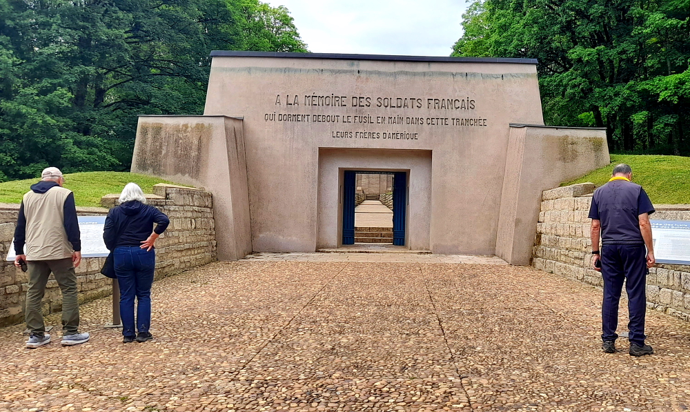
In June 1916, this entrenched position was a part of Fort Douaumont, which the Germans desperately wanted to take. On June 12, Germans unleashed a hailstorm of iron and lead upon French positions. The attack caught the French by surprise.

The 137th Regiment of French infantry was annihilated almost to the last man. Years after the war, French teams exploring the battlefield uncovered the first clues of the horrific fate of this regiment. One of the trenches was discovered completely filled in, with only a neat line of bayonets sticking out of the ground. The bayonets were still fixed to their rifles. A body was found next to each one. Under relentless bombardment, the soldiers had been effectively buried standing up, perhaps even while they were still alive.  Or so the story goes … [atlasobscura.com].

The actual trench protected by a concrete colonnade.

After the war, excavations led to the discovery of 21 bodies of French soldiers. 14 were identified and buried in the Fleury Cemetery before being moved to the Douaumont Ossuary. The other 7 bodies, which remain unknown, were reburied in the “Bayonet Trench.” [landofmemory.eu].

The Bayonet Trench with crosses replacing the bayonets.

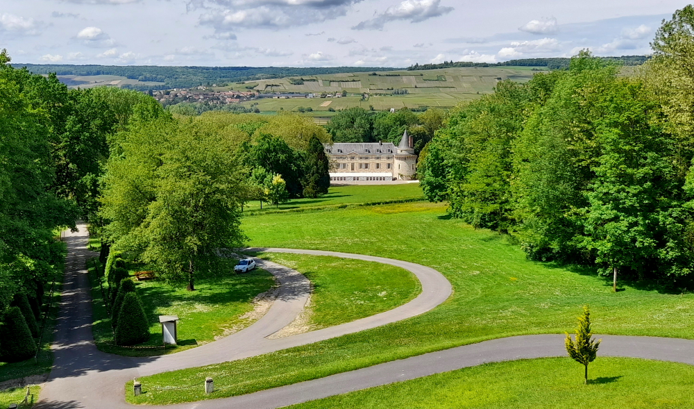
Around 4:00 pm we leave this part of France and head 1.5 hours SW to the Leclerc supermarket in Pierry, a suburb of Epernay, then drive the 30 minutes south to our next AirBnB accommodation in Baye (back into the Champagne region) which Becky and Jerry had booked, where we arrive around 7:00 pm.

Louis, the owner, meets us at the gite and while he shows Becky and Jerry around and explains the history of the family home (2 houses merged), we unload the car.

Our AirBnB gite in Baye, France.

After a lasagne and salad supper, in front of a lovely fire lit by Louis, we hit the sack.

16 May, 2024

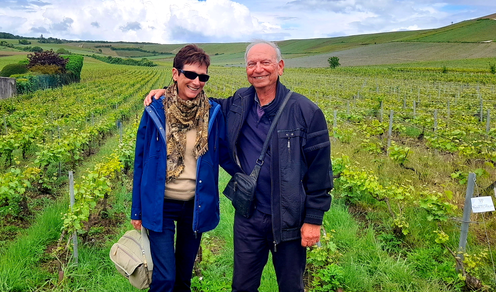
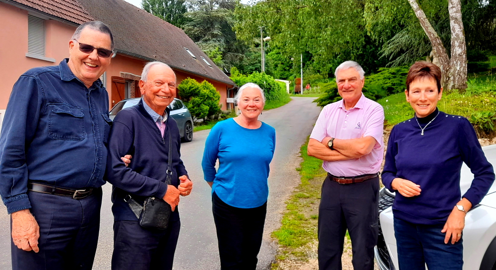
Another glorious day. This morning we are meeting up with Tony and Florence, friends of Becky and Jerry’s, who live in Provence. 10 weeks ago Becky introduced us to them via a Skype video call so we are looking forward to meeting them today. Flo has kindly organised a tour and wine tasting this morning, a restaurant lunch, an inspection of their vines and a river cruise this afternoon.

Countryside outside of Baye on the D951.

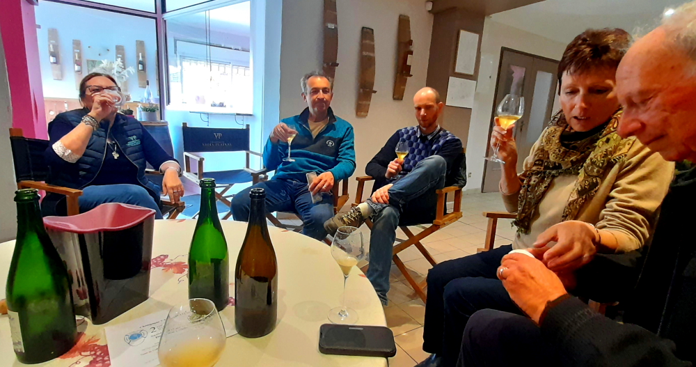
Tony is English and Florence is French, having been born and raised in Cumieres (Marne) which is where we are meeting them at 10:30 am at the Vadin-Plateau (VP) champagne house that buys the grapes from their 12 rows of vines that grow a couple of blocks away.

Vadin-Plateau (VP), Cumieres.

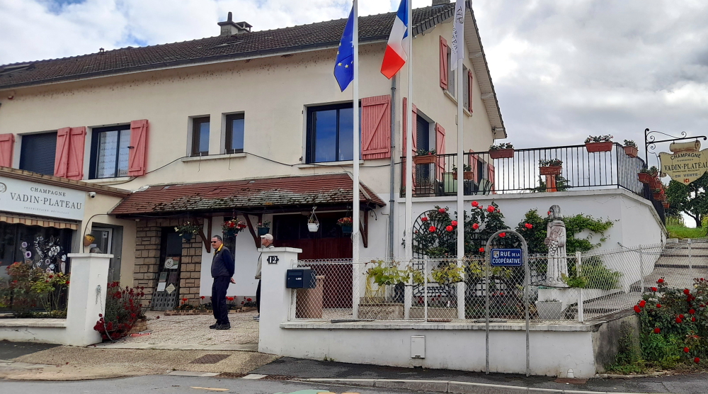
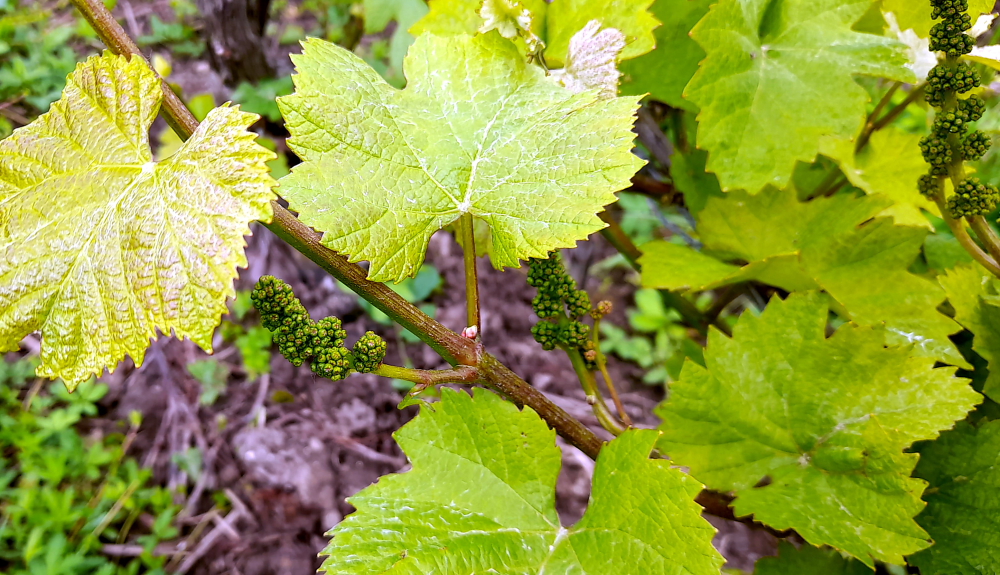
According to the Paris Wine Company website, Vadin-Plateau was founded in 1785 amongst the terroirs of 5 neighboring villages: Ay, Damery, Champillon, Hautvillers, and the home of the winery, Cumières. Since 2012, the 7-hectare estate, with vineyards spread over 100 different parcels in the fine Premier Cru of Cumières to the north of Epernay, has been committed to organic viticulture and has abstained from using herbicides for over two decades.

The wines produced at this domaine are not only typical of the region, but also highly personal, as each cuvée possesses a unique identity of its own. The Renaissance, its flagship 100% Pinot Meunier, is an embodiment of the Cumières’ grape. Along with the non-vintage cuvées, Renaissance and Intuition, Vadin-Plateau also produces an impressive selection of single-vintage, single-vineyard wines that reflect the distinct terroirs of the Cumières and Hautvillers parts of the estate, first released in 2018 [pariswinecompany.com/producer/vadin-plateau/].

This estate’s terroir (environmental factors, farming practices, habitat) is described as a Continental climate with Oceanic influence. Silty-sand, clay-limestone and limestone soils over a chalk bedrock. Mostly southern facing gentle slopes. 100-170m altitude. Its winegrowing/viticulture (cultivation and harvesting of grapes) is certified organic (Ecocert) and certified biodynamic – respecting the ecology, culture and tradition of a place.

The vigneron is the Vadin family with Muriel, and her daughter, Aurélie, running the estate since 2022. Bartholomew, who has been with them for about a year as their wine master, takes us on a tour with Flo taking on the role of occasional interpreter.

No feet involved in pressing 4000L of grapes these days!

Considering it’s such a small estate, there has been a massive investment in technology and equipment.

Stainless steel vats where fermentation process begins.

Working organically has helped to produce wines with purity, depth and resonance – champagnes that represent exceptional value for money which we can endorse, having purchased 2 bottles of their excellent Grande Reserve at Eu19.40 each.

Sampling the Carte Blanche & Aurelie champagnes with Muriel (L), Bartholomew (C) & Flo & Tony.

At 12:25 pm we sprint out the door as we have a 12:30 pm booking at Chez Max – a Restaurant traditionnel Français depuis 1946 passed down from father to son – in nearby Magenta, 10 minutes’ drive away.

Ordinary outside, extraordinary inside.

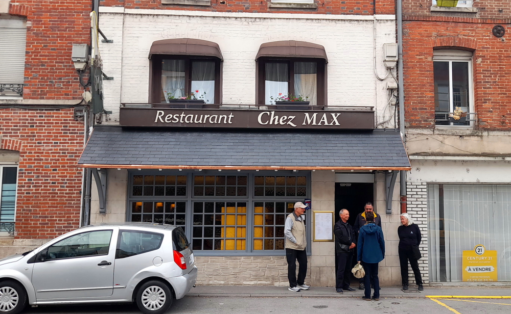
On arrival we are greeted warmly by the current “Max”, Monsieur Besnard. We all opt for the 3-course set menu at Eu26 which has at least 2 options each for entree, main and dessert, accompanied by a bottle of the restaurant’s own wine, an exquisite Geoffroy Cumieres Rouge – délicieux all round.

All boys together with “Max”.

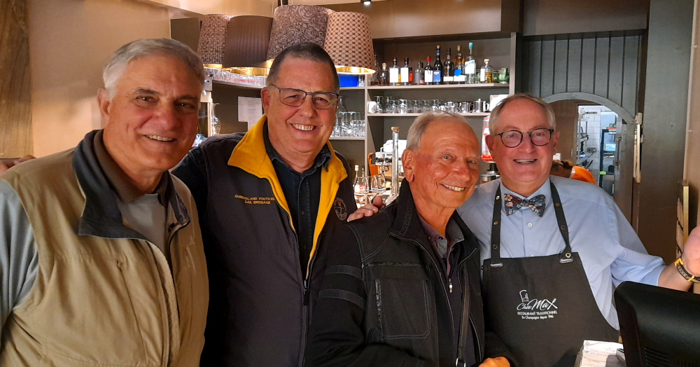
Turns out Monsieur Besnard has a daughter who lives in Newcastle, NSW, so I have a bit of a lively chat with him, in English thank goodness, about his travels through Oz over the years.

Proud owners, Flo & Tony, in front of their vines.

Several hours later we leave and drive by Florence and Tony’s 12 rows of vines on Avenue du General Leclerc in Ay on our way to the boat cruise.

Sprigs of tiny, tiny grapes.

That’s the thing about owning vines in the Champagne region, they are usually inherited and rarely, if ever, for sale.

Vineyards under a threatening sky on Le Pre Gariot, next to the Marne River.

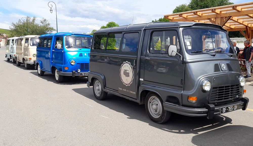
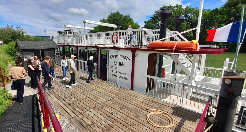
With 15 minutes to spare we arrive at the quai where the Champagne Vallee Bateau berths to find a small convoy of retro Citroen vans already parked.

Not a Syrena amongst them.

Once on board we discover that a large group of tipsy Poles has taken over the main, inside deck and are happily serenading each other. As there is no room for us, we go topside which is drenched in rather hot sunshine.

Walk those planks!

We grab some chairs, strip off unnecessary jackets and sunbathe while we wait for the cruise to commence.

Verdant countryside dotted with tiny white vans.

Soon we have a guide who gives us a commentary in English, that is until the Poles decide they, too, want some sunshine, pour onto the top deck and begin singing once again, drowning out the commentator.

Tour de Castellane, Epernay peeking above the Pont d’Epernay.

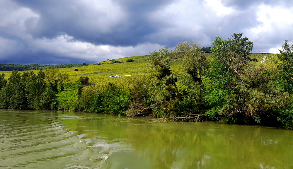
She soon tells them to “shush” and we get to enjoy a quiet cruise taking in the surrounding undulating green countryside which is dotted with what look like toy white vans while vineyard workers tie, weed, rake and spray.

Heading downstream back to the berth at Cumieres.

Apparently there are 18 locks on the 518 km Marne River, one of which, No. 15, we pass by as we cruise upstream until we reach the Epernay Bridge where we turn around.

River view of Cumieres village with Champagne Marizy tower.

The sun is blazing hot, then it clouds over and a cool breeze springs up. Constantly there is the threat that we’ll be drenched by a thunder storm but the only drenching we get is an internal one when Flo and Tony produce yet another bottle of chilled champagne and 6 flutes. Cheers!

Metal sculpture of man tending vines, Quai de la Marne, Cumieres.

1.5 hours later we dock at the quai then drive back to Vardin-Plateau where we sample yet another bottle of bubbles before we collect our wine orders from Muriel – 6 boxes of champers for Tony and Flo and 1 small box of 2 bottles for us – and say our farewells to Muriel. Their boxes we place in our cavernous car boot as their small one is full of suitcases.

Tony & Flo’s champagne order.

En route to Baye we all stop at the Leclerc supermarket at Dizy for tonight’s dinner supplies then, with Tony following us, we drive back to the gite at Baye where they will stay overnight.

“Champagne, anyone?”

Simple fare is soon laid out on the dining table: cold cuts, cheese, salad and baguette followed by abricot tartin in front of a comforting fire laid by our resident pyromaniac, Jerry. Did I mention yet another bottle of champagne?

After such a hectic but fabulous day full of bubbles, food and laughter it’s an early night for all.

17 May, 2024

Sadly, Flo and Tony need to leave us around 10:00 am on their way to visit family. After reorganising their car boot we transfer all their boxed champagne to theirs and off they go with a cheery wave.

“Au revoir!”

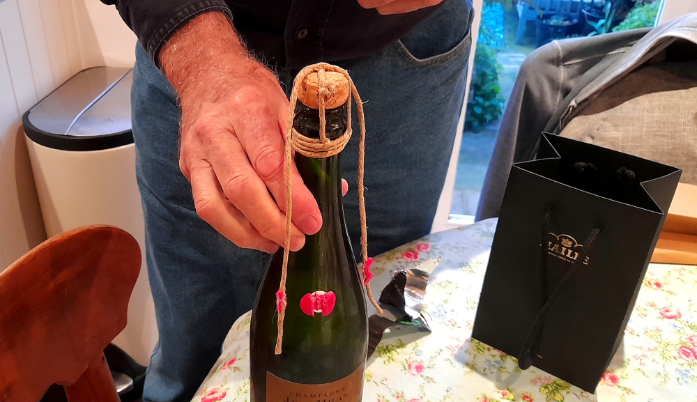
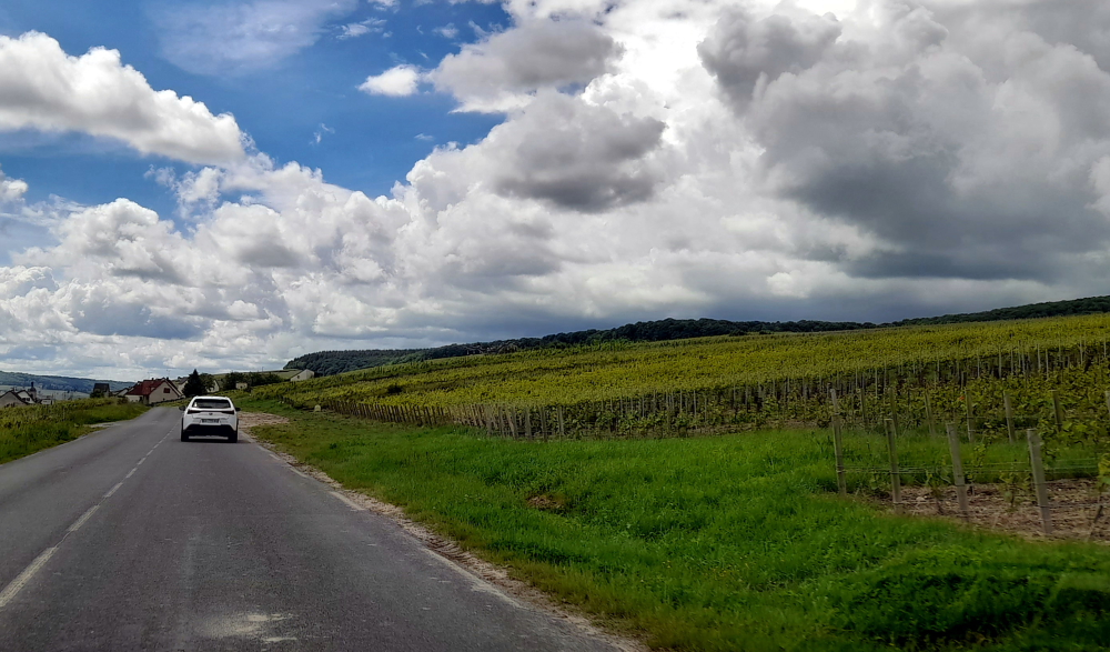
At this point we had a vague plan for the rest of the day. I want to buy another bottle of Grande Reserve champagne from Jean Milan in Oger, with its traditional string and wax seal, to share with Becky and Jerry. When we check the cellar door’s opening times it’s 11:30 am. It closes at noon for the mandatory 2-hour lunch break so we grab our kit and jump in the car for the 25-minute drive to Oger.

En route to Oger passing 2 spraying machines.

With 5 minutes to spare I make my purchase. From here we drive the rest of the Orange Champagne Trail via Cuis to Morangis then to the Saint Martin Church perched on the hill at the northern end of Chavot Courcourt.

To vary our return to Baye we see that Abbatiale Saint-Pierre d’Orbais has been highlighted as an attraction on the map so after calling in at Leclerc at nearby Pierry for sandwiches we take the D11 to the picturesque village of Orbais-l’Abbaye.

Arboured entry to the village of Orbais-l’Abbaye.

We park in the square in front of the Abbey and find some discarded stone slabs at one side beneath a tree and tuck into our al fresco lunch.

View of the abbey church from Place Jean d’Orbais.

The Benedictine abbey at Orbais was founded at the end of the 7th century by Saint Réol. The St. Pierre-St. Paul church was built at the end of the 12th century and early 13th century by Jean d’Orbais, one of the architects of the Cathedral of Reims.

Al fresco dining at Orbais-l’Abbaye.

The abbey church had a length of 78 m with 8 bays of nave, 2 of which remain today.

Can’t beat a French baguette for lunch!

The façade has 2 towers similar to those of the Basilica Saint-Rémi de Reims and the choir an ambulatory with 5 radiating chapels.

Altar within the St Pierre-St Paul Church, Orbais-l’Abbaye.

There is also stained glass windows of the 12 century, funerary slabs from the 14th and 15th centuries, a baptismal font from the 16th century, glazed tiles from the 15th century and impressive choir stalls with decorated misericords.

15th century glazed tiles, St Pierre-St Paul Church, Obais-l’Abbaye.

Whenever we drive north from Baye we always drive through the cross roads at the hamlet of Champaubert. This time we stop to discover the purpose of the commemorative column here, the Battle of Champaubert, one of Napoleon’s counter-offensive victories over the allied armies (the Army of Silesia led by Blucher) on 10 February 1814 during the Campaign of France.

Colonne de Champaubert, Champaubert.

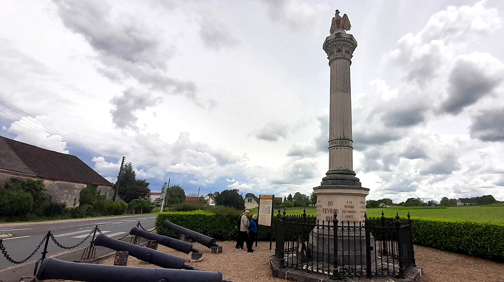
Although a fund was started in 1839, the column was not actually built until 1865-67 according to the design of architects Louis Visconti (responsible for the Emperor’s tomb at the Invalides in Paris) and de Bigault de Granrut. 9 January 1867 it was topped with the imperial eagle and in June Emperor Napoleon III made a gift of the 8 cannon that now surround it.

We arrive back at Baye mid-afternoon where Becky purchases another bottle of champers, a Cuvee Traditional Reserve for Eu18.30, from the local vintner, Champagne Yves Jacques.

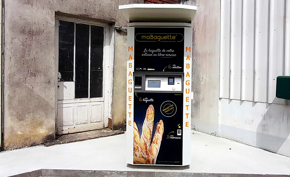
Opposite the 1 and only boulangerie in town (open 7:30 am-1:00 pm and 4:00-7:30 pm) is an interesting vending machine – for baguettes. Obviously a stop-gap for when the boulangerie is closed. We had seen something similar in Reims for 3-minute pizzas but it looks like the baguettes are already baked and ready to go. Don’t stand between a Frenchman and his daily, fresh baguettes!

“Who will buy my fresh baguettes – plain or traditional?”

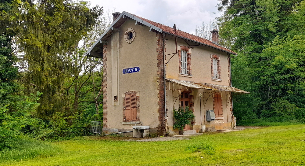
While we 3 rest, Lynn heads out to walk into Baye. She goes via La Gare which features a disused railway station building with no sign of a railway track anywhere near it.

Disused Baye train station building.

Walking up La Cote de Saint-Roch which is bordered both sides by woods she is taken by the amount of loud and varied birdsong, something she sorely misses in the concrete “wood” that is the Brisbane CBD.

This road brings her to the eastern view of Le Foyer de Charité de Baye (Baye Charity Home), a religious retreat for followers of the Catholic faith.

Part of Le Foyer de Charité de Baye featuring its 12th century chapel.

Previously, it was the Chateau de Baye. Tradition has it that Saint Alpin was born here in the 5th century. Lords of Baye are known from the 11th century but there are no documents to trace the establishment of this castle. However, there must have been a castle on this location because, at that time, Baye was one of the large baronies of the County of Champagne.

Rather, its history commences at the beginning of the 13th century as shown by the chapel, probably built between 1205 and 1220, by Simon I of Châteauvillain. The chapel is mentioned in the will of Alix de Luzy, his wife, written in 1270. This chapel is known for its stained glass windows dating from the 13th century.

Over the centuries the castle’s ownership was inherited via marriages and family transfers and the sale of the barony of Baye.

View of Le Foyer de Charité de Baye from Grande Rue.

In the 19th century, the Berthelot de Baye family became particularly interested in the administration of the estate. Around 1859, the castle farm was rebuilt by the Parisian architect Claude Parent. In 1950, the dilapidated castle became practically uninhabitable. It was donated by Miss Yolande Berthelot de Baye to the Foyers de charité and has since been repaired and transformed. The Saint-Alpin chapel of the castle is the only element that has remained intact for 800 years and was classified as an historic monument since 1923.

In September 1914 the chateau was the general HQ of General Otto von Emmich, commanding the 10th German Corps.

Courtyard of Le Foyer de Charité de Baye.

Walking north along Grande Rue there is an intriguing street sign: “Rue de la Font Poisson” and sure enough, half way up that road is a large water trough that probably had fish in it, back in the day.

La Font Poisson, Baye.

Each time we drive through Baye we are struck by the lack of people about – the place seems to be totally deserted.

A major building is the Catholic Church of Saint-Pierre-et-Saint-Paul de Baye, with an imposing porch gallery. The church has been closed since 1999 after storms damaged the roof. Renovation commenced in 2018.

Church of Saint-Pierre-et-Saint-Paul de Baye, Grande Rue, Baye.

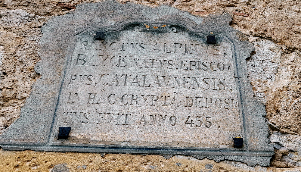
Walking around to the opposite side of the church is a small door. Above it, inscribed in stone, is a plaque in Latin: The Holy Alpinus Baye, Bishop of Catalonia, was buried in this crypt in the year 455.” So, born in the chapel in the Chateau de Baye and buried in the crypt of another church just up the road.

Sign indicating the burial place of Saint-Alpin.

At the corner of the church is Rue des Ecoles where Lynn walks towards its intersection with La Cote de Saint-Roch. She passes by a derelict-looking buiding whose door is open.

Non-descript building with a secret.

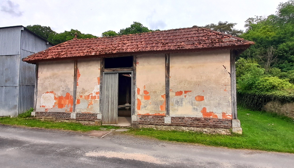
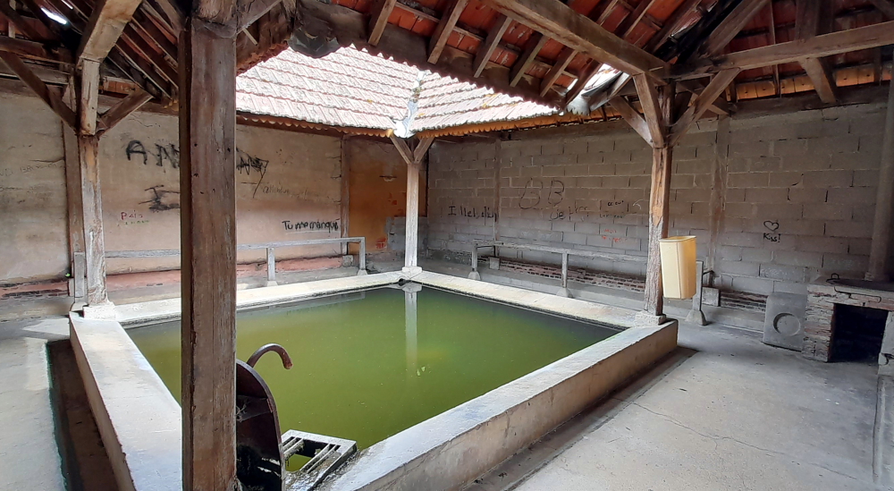
Inside looks like a disused wash house with a copper in the corner and slime green, still water in the trough.

Disused wash house?

After a supper of cold roast chicken, tricolore salad and fruit flan Lynn suggests we have a couple of games of dominoes.

“What a lot of tiles you have, Robert.”

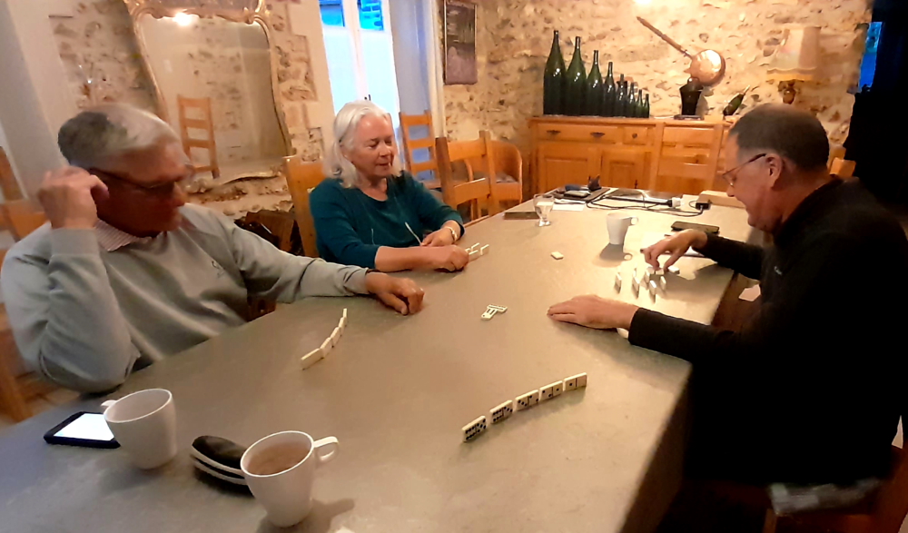
The 1st game is won by Becky with yours truly last, but I get my revenge by winning the 2nd game.

18 May, 2024

For our last full day in the Champagne region we’ve elected to drive to Hautvillers, north of Epernay, then to drive part of the Maroon Champagne Trail through Venteuil, Cuchery and Reuil to Vandieres, then cross the Marne to visit the Memorial des Batailles de la Marne in Dormans.

Aloft is Epernay’s giant Avenue de Champagne tethered balloon.

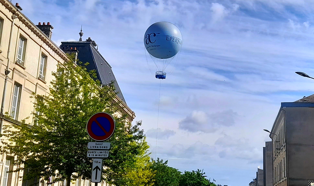
As we approach Epernay we see that its tethered giant helium-filled balloon, located at the town end of the Avenue de Champagne, is in operation today. It flies up to 150 metres from the ground where views over the town and the surrounding UNESCO World Heritage vineyards can be seen.

One of Hautvillers’ many ironwork signs.

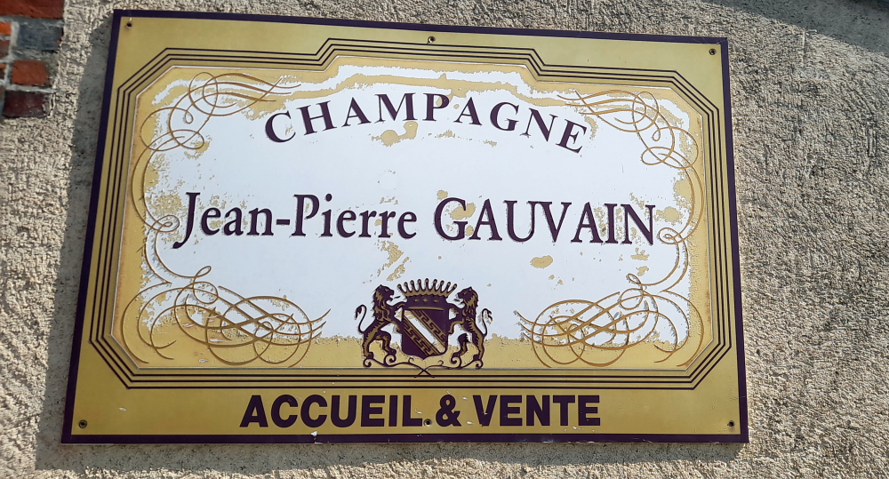
The reason for our trip to Hautvillers is to show Jerry and Becky the tomb of Dom Perignon which is in the Abbey Church of Saint-Sindulphe, next door to the former Benedictine Saint-Pierre Abbey of Hautvillers (now the private property of Moet & Chandon) and to walk through the village on this gorgeous, sunny day to see the different ironwork signs that are on display outside numerous buildings.

Old-style sign for Jean-Pierre Gauvain champagne house, Hautvillers.

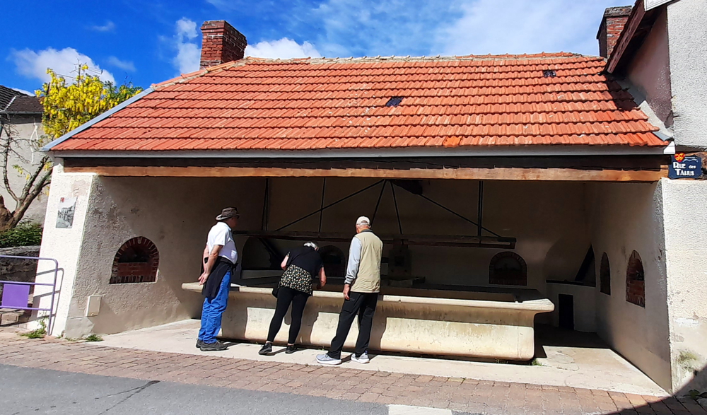
Around the corner from Gauvain’s is Place de la Fontaine where we find just that, a public wash house for communal laundry with a copper in each back corner and a rectangle of wooden drying rails above the large trough.

Communal laundry building, Hautvillers.

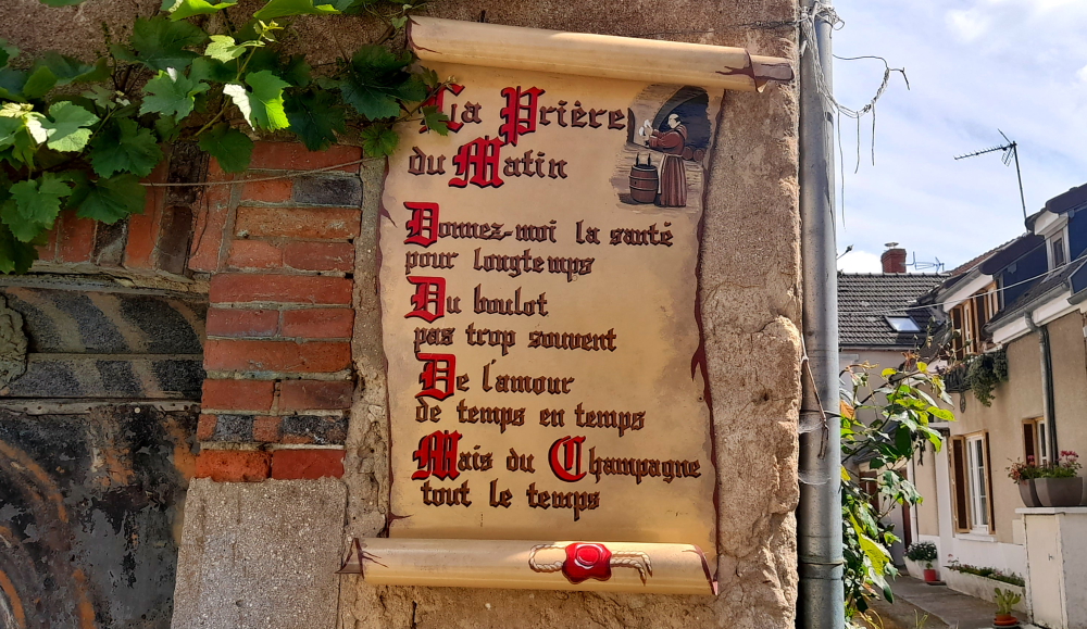
Displayed on a nearby wall is a morning prayer, seemingly endorsed by the monks of yore: “Give me health for a long time. Work not too often. Love from time to time. But Champagne all the time.” We’ll drink to that!

Unique Morning Prayer, Hautvillers.

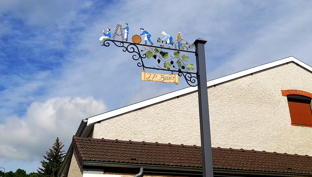
The display of ironwork signs is a tradition that dates back to the Middle Ages when more than 80% of the popuation could not read.

Vine pruner, Hautvillers.

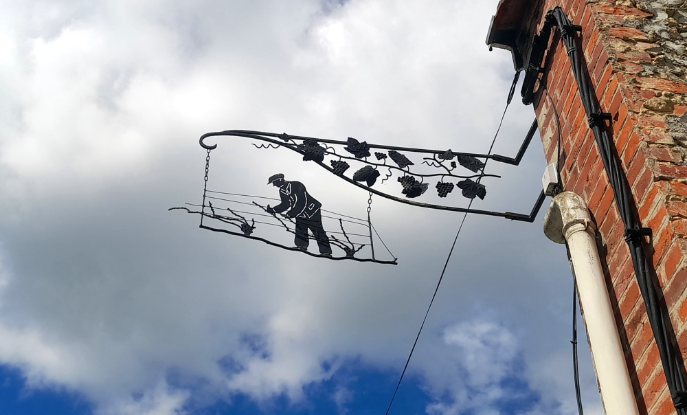
The shopkeepers of the time had devised this simple means of communication to inform their customers of their trade.

An unusual “hoarding”, Hautvillers.

In 1962 the mayor of Hautvillers wanted to revive this tradition. Today, the village has more than 140 signs representing not only the trade, but also the passion or the origin of its inhabitants.

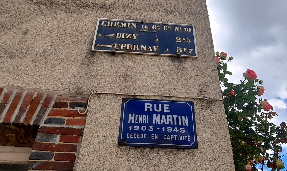
The village has also retained its now vintage street signs: some to honour a person (such as Henri Martin); others are old directional and distance signs such as Dizy a 2 k 5 (2.5 km).

Is this the way to Amerillo, err Epernay?

Hautvillers is also a very pretty hillside village with beautiful and impressive buildngs that accommodate champagne houses, restaurants, cafes, bars, boutiques and its public buildings.

Town Hall, Hautvillers.

Being a hillside town also affords perfect panoramic views.

View at the end of Rue de la Font Gillet, Hautvillers.

Such as an informal one at the end of Rue de la Font Gillet, or more formal ones from the Belvedere Dom Perignon that include the historic hillsides of Champagne, the Marne Valley and Epernay.

View of the Marne Valley from Belvedere Dom Perignon, Hautvillers..

As we wend our way along the Champagne Trail we catch a tiny boulangerie/patisserie just before it shuts at 1:00 pm where the Leggieris buy filled baguettes, savoury pastries, espressos and a small bottle of local beer called “Pain de Minuit” that has been brewed from stale, leftover bread. It’s catch phrase printed on the cap is: “No Pain (de Minuit), No Beer”.

A few steps away is a square on Rue du Chateau with a large picnic bench where we tuck in while admiring the ingenuity of the various winery-related sculptures that dot the square, all made out of the metal caps that sit between a champagne cork and its metal cage.

Lunch at Venteuil square with a metal-cap barrel in the background.

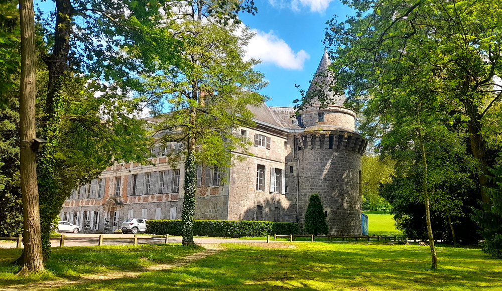
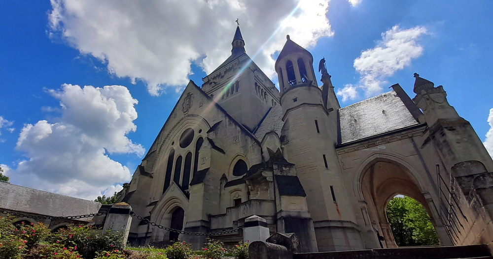
By 2:00 pm we arrive at the Battles of the Marne Memorial in Dormans, a fitting conclusion to our visit to the Verdun Memorial/Museum a couple of days ago. Built between 1921 and 1931 to a design by architects Marcel and Closson, the Dormans Memorial commemorates the victories won in the Marne between 1914 and 1918 and is located on a hill behind the Chateau de Dormans.

Chateau de Dormans.

When the plan to erect a large monument to remember all of the battles in Marne was confirmed, this site was chosen by Marshal Foch as a place that represented both battles. The building was made possible thanks to an association founded by Madame de la Rochefoucauld in 1919, overseen by the Cardinal of Reims and the Bishop of Châlons.

A vast park with a chateau was purchased, and the first brick laid on 18 July 1920. The construction was funded by numerous donations, in particular those collected by ‘national subscription’ in 1929 dubbed “four monuments day”.

Battles of the Marne Memorial, Parc du Chateau de Dormans.

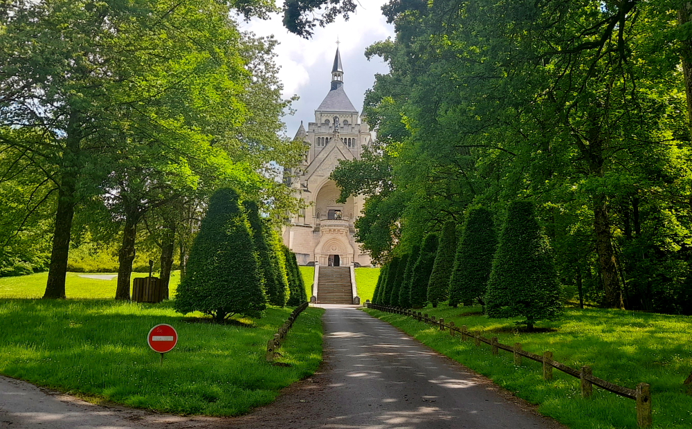
A monumental staircase leads to a large square with a sundial and a viewpoint indicator that shows the names of the Marne Valley villages where the Battle of 1918 was fought.

Crypt, Battles of the Marne Memorial, Dormans.

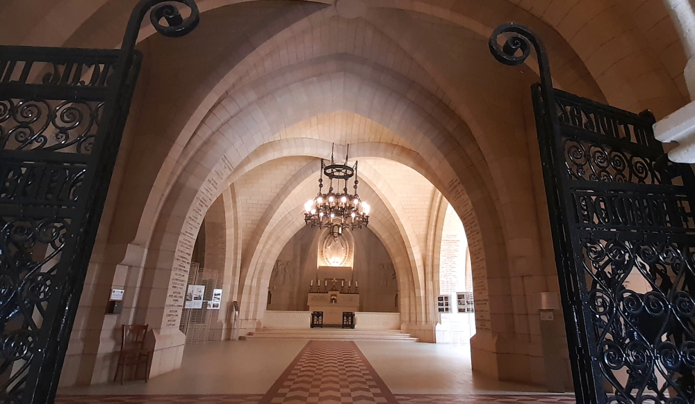
The square leads to a crypt that is overlooked by the church that has a bell tower and 2 towers.

Church, Battles of the Marne Memorial, Dormans.

The inside of the chapel is entirely dedicated to the glory of the “soldiers, the army and the fatherland”.

Chapel, Battles of the Marne Memorial, Dormans.

The stained-glass window in the choir represents Christ welcoming a soldier to symbolise all those who died during the Great War, presented to him by Joan of Arc and St Michael. On each side, angels intercede in his favour.

The four columns standing on the crypt’s vaulted bases are decorated with sculptures depicting the 4 great invasions of France by the Huns, the Arabs, the English and the Germans, which were all contained (the Catalunian Plains in 451, Poitiers in 732, Orleans in 1429 and Dormans 1914-1918).

Stained-glass window with Christ, Joan of Arc & St Michael.

The 52-metre tower houses several bells, the largest weighing 304 kg. Beside the chapel is a cloister attached to the ossuary. A medallion features the effigies of marshals Foch and Joffree, the 2 victors of the battles of the Marne, while the names of all the soldiers who fought in the battles are engraved in the wall plaques.

Inside the ossuary, the remains of 1,332 French soldiers who fell between 1914 and 1918 are held in 130 coffins; only 11 of these men were identified. Every year since 1993, during the Armistice commemorations, an official ceremony is held in the ossuary where a wreath given by the French President is laid by a delegate from the Elysée Palace [www-cheminsdememoire-gouv-fr].

View of the Dormans Chateau & its park from the church’s balcony.

Right! Time to drive home. We’re all looking forward to a chilled drink and a rest before we head out to dinner. Just as I do a hill start and turn onto a road to exit the town, we hear a brief grating sound. Lynn and I say in unison, “That didn’t sound good!” A short distance later I pull over and open the bonnet. Revving the engine produces a horrid, grating metallic sound.

That bloody car air conditioner compressor clutch has failed – AGAIN! It lasted a total of 3 weeks and 4 days since it was replaced. Well, we’ll just have to resort to car air conditioning that our parents used – turn the fan on high and open all the windows!

Chateau de Montmort, Montmort-Lucy.

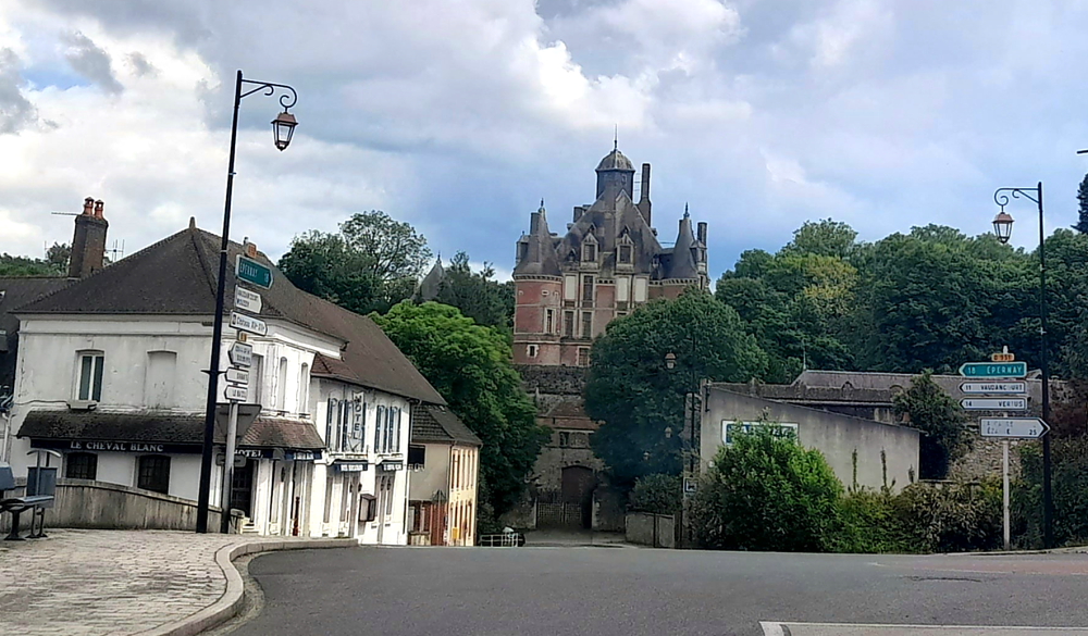
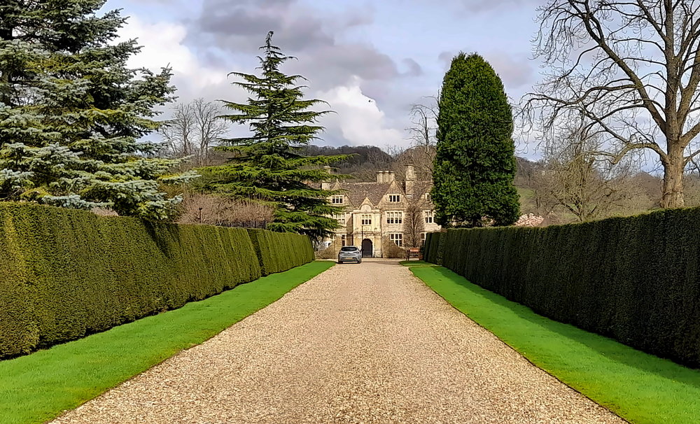
On the drive home we pass through Montmort-Lucy once again. This time we remember to take a photo of its impressive chateau that dominates the village.

At 5:45 pm we drive to the village of Etoges which is 10 km away. Thunderstorms are threatening at the end of the day.

D933 between Champaubert & Etoges.

Etoges also has its own chateau, now a boutique hotel, which is next door to L’Atelier d’Etoges Brasserie, one of our host’s restaurant recommendations.

Chateau d’Etoges.

When we arrive at 6:00 pm only us and another car are parked. 30 minutes later the place is packed.

Celebratory dinner at L’Atelier d’Etoges.

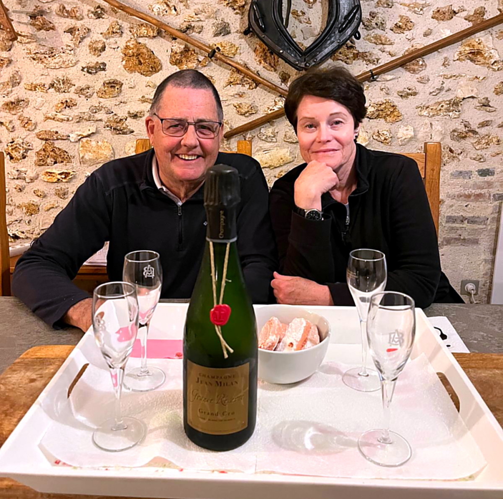
When we get home we open our final bottle of champers, the Jean Milan Grand Cru, to toast the great week of Champagne experiences that we’ve shared and especially to toast our enduring friendship with the Leggieris.

About to open the beautiful bottle of Jean Milan Grand Cru.

It has been a wonderful week catching up with friends and meeting new ones. We have definitely drunk more champagne this week than ever before in a single week. Next week we are on the wagon before we head to Estonia, Latvia & Lithuania which will be our last leg of this two year Grande Tour of Europe.

A true story.

19 May, 2024

We’re all packed and out the door of the gite by 9:40 am. It’s 16 Deg. C and raining. I refuel at Pierry then take the A4 from the outskirts of Reims towards Paris, turning off to follow signs to Paris Charles de Gaulle Airport which is NE of Paris.

This airport is a nightmare with roads going in every direction to service a multitude of terminals. We’re a bit startled when we see a plane taxiing along an elevated roadway right in front of us. Anyway, we need Terminal 2C where the Sheraton Hotel is located, hoving into view like a ship in the middle of the roadway.

Fond farewells to Becky & Jerry.

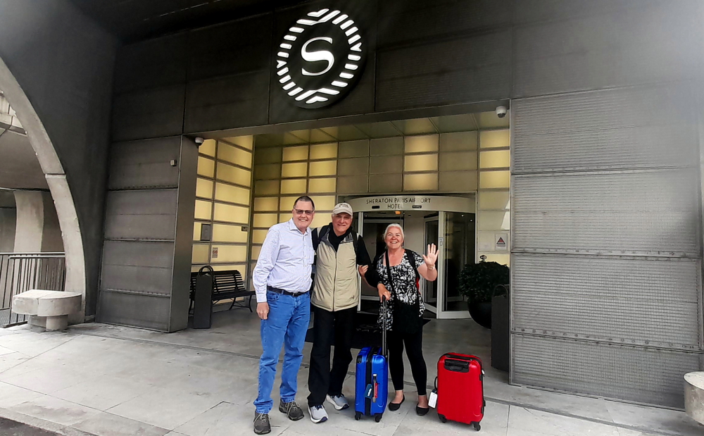
More by good luck than design we choose the correct entrance to the Sheraton parking from a number of other parking entrances side by side and drop off our Philly friends at the hotel’s entrance.

Long hugs and au revoirs with hopes of catching up again when we hit California to finish off our COVID-ravaged USA trip of southern national parks, we skidaddle as we only get 10 minutes’ free parking.

It’s now 11:50 am and by taking the A1/A26 we should arrive in Calais around 2:30 pm. At 12:30 pm we cross over the Somme, it’s finally sunny and 20 degrees.

Bang on 2:30 pm we pull into the car park of an Ibis Hotel. It’s very basic but more than adequate for our overnight stay and offers surprisingly good snacks via its bistro service. Just as well as there ain’t any restaurants nearby!

20 May, 2024

Hoping to get an earlier LeShuttle train than our booked one at 12:18, we leave at 9:55 am (13 Deg. C) and drive to Coquelles, refuel, then proceed to check in. Compared to the past couple of times that we’ve used LeShuttle we’re in a queue of cars. Summer must be fast approaching.

Although our rearview mirror hangar says the 11:18 train we’re loaded onto the 10:48. Unlike previoulsy, we’re directed to park on the ground-floor level of the train carriage and end up being the only car in that carriage. Which is all very well until we’re into the journey when we feel the car rocking violently side to side.

This is worse than a ferry crossing! Getting out of the car we find that the train carriage itself is not rocking as much as the car which is going crazy. Inside the car it was just like riding the bucking bronco machine in a Rockhampton pub. Must be those new springs I had fitted to the car before its MOT last October!

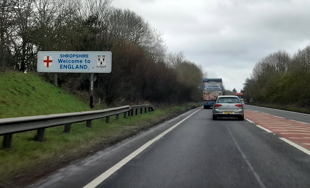
35 minutes later we detrain, driving into sunshine and 16 degrees. On both the M25 and M3 we’re delayed by non-existant road works. We’d forgotten about these. Welcome back to England! But the splash of purple rhododendrons on both sides of the A322 is stunning.

Just before 3:00 pm we pull up in front of the Premier Inn, take most items out of the car, check in and after a very confusing conversation with the receptionist as to how to pay for parking we drop off all our luggage in the room and hurry back to the car as we are parked on a double yellow. Around the corner is the multistorey where we park and pay at the ground-floor kiosk.

There is a hotel restaurant so at 6:00 pm we present ourselves to find that there is a different receptionist on duty. We finally have a lucid and informed conversation with her, organise a free ticket for overnight parking and extend tomorrow’s until 10:00 am – all via an identical kiosk in reception.

Surprisingly for a Premier Inn, the food is excellent, then we crash out for a good night’s sleep.

Heidelberg to Tortona via Switzerland.

5 April, 2024

After a quiet morning we walk a few steps to the bus stop and get the 1:00 pm No. 33 bus that goes right to the Rathaus stop in the Old Town where we need to get off.

Lynn tells me that she last visited Heidelberg in June 1985. What she remembers is: the Old Bridge with its ‘salt and pepper’ towers; discovering that footpaths in town are divided into a pedestrian lane and bicycle lane and make sure you don’t walk in the wrong one (DING-DING!), and attempting to watch an episode of ‘Bonanza’ on TV that was dubbed in German with Lorne Greene’s gracious and melodious voice replaced with a harsh, guttural one, more akin to Hoss’s!

Kornmarkt with Heidelberg Castle on the hill.

We are booked on a 2:00 pm GuruWalk and need to meet in front of the Rathaus in Marktplaz. As we arrive 30 minutes early we go for a quick wander. Yesterday, we arrived in rain and 13 Deg. C. Today it’s due to be 26 and tomorrow 27!

Rathaus in Marktplaz.

By the time 2:00 pm arrives, it has clouded over and a cold breeze has arrived. Unlike our guide – “look for a guy with a moustache” – but we find the rest of our party: Catherine, French but lives in Germany and Johanne and her husband from Canada who now live in Israel.

Steingasse off Markplatz leading to the Old Bridge (Alte Brucke) over the Neckar River.

We all thought we had been communicating with our guide, Henry, a Brit who has lived in Heidelberg for 12 years, but turns out our guide today is Viktor, from Siberia, who is undertaking his PhD in this university town of Heidelberg.

Our first stop is outside the Heiliggeistkirche on Marktplatz. founding year 1398. Ludwig III laid the foundation for the later famous Palatine Library, the Biblioteca Palatina, by having the first books placed in the galleries of this church. During the reign of Louis V (1508-1544), when the most important palace buildings were also being constructed, the tower continued to be built and completed.

In the course of the Reformation, the church changed several times between Lutheran and Reformed-Calvinist denominations. In 1563, the Heidelberg Catechism emerged as the Reformed confession. With the 30 Year War and the conquest of Heidelberg by Catholic troops, the city, and the church became Catholic for many years, and as spoils of war, Pope Gregory XV had the Biblioteca Palatina brought to Rome in 1623.

Marktplaz & the rear of the Church of the Holy Spirit (Heiliggeistkirche).

In the course of the Palatine-Orléans War of Succession, the church was severely damaged in 1693. Only the one tombstone of the Elector Ruprecht II, the founder of the church, is preserved. Of the once 5000 books and 3524 manuscripts, only 885 made it back to Heidelberg in 1816, all the rest remained in the Vatican.

In the following two centuries, both Catholics and Protestants laid claim to the church in equal measure, so that, separated by a dividing wall, Catholic mass was celebrated in the chancel and Protestant services in the nave. 1936 an agreement was reached with the Catholic Church whereby the church passed entirely into the possession of the Protestant Church in Baden [heidelberg-marketing.de].

The Jesuit Church

From the Marktplatz our next stop is the Jesuit Church (Jesuitenkirche). During the 16th century Heidelberg was the centre of a tug-of-war between Lutherans, Calvanists, Catholics and Protestants. The construction of the Jesuit Church began in 1712, and was built in several phases, the last one adding the tower from 1866 – 1872.

Inside the church.

The baroque furnishings are no longer preserved today but the altar painting by the Kaulbach student Andreas Müller has been. The Elector Frederick the Victorious is buried in a crypt in the northeast corner of the church.

University of Heidelberg building near the Jesuit Church.

To the east of the church is the entrance to the former Jesuit college. Originally, the facilities of the Jesuits comprised a grammar school (today the Philosophical Seminary) and the Carolinum seminar, which is now used by the university administration. The church is home to the Museum of Ecclesiastical Arts (Museum für sakrale Kunst und Liturgie) [heidelberg-marketing.de].

Vikor & the Jesuit College/garden next to the Jesuit Church.

From here we walk to Karlsplatz (Karls Square) where we are treated to an unobstructed view of Heidelberg Castle. Named after Grand Duke Karl Friedrich of Baden, the square extends over the area of the Franciscan monastery, which was demolished in 1803.

Not only home to the Heidelberg Academy of Sciences and the Palais Boisserée, the Square is also home to two of Heidelberg’s oldest and best-known student pubs and several fraternity houses. Generations of fraternity students have been guests at the “Zum Seppl” inn, built in 1634, and the “Zum Roten Ochsen,” built right next door in 1703 [heidelberg-marketing.de].

Karlplatz.

Walking towards the river we walk past the ‘salt and pepper’ pillars of the Old Bridge (which we return to after the tour) to Chocolaterie Knösel on Haspelgasse. Established in 1863, it soon became a popular meeting place among Heidelberg’s residents, male students and the young ladies attending Heidelberg’s finishing school whose governesses and chaperones were never far away.

Chocolaterie Knösel on Haspelgasse.

These secret longings did not go unnoticed by the chocolatier, Fridolin Knösel. One day he created a particularly delicious chocolate delight, which he impishly called the ‘Studentenkuss’. Given as a present, it was such an exquisite, gallant token of affection that not even the chaperones could object [heidelbergerstudentenkuss.de].

A short walk from here we arrive at Universitätsplatz where there is a plaque dedicated to Martin Luther. Heidelberg University played a leading part in Medieval Scholasticism, Renaissance humanism, the German Reformation, and in the subsequent conflict between Lutheranism and Calvinism during the 15th and 16th centuries.

Plaque commemorating Martin Luther’s Heidelberg Disputation, 1518.

In April 1518, a few months after proclaiming his 95 Theses, Martin Luther was received in Heidelberg, to defend them.

Tower at the University’s History Department.

He was invited to introduce his theology at the tri-annual meeting of his Augustinian Hermits order in Heidelberg. The Heidelberg Disputation took place on April 26, 1518, in the lecture hall of the liberal arts faculty at the University.

Zeit Fur Brot on Hauptstrasse – best cinnamon buns in town!

Walking up Hauptstrasse towards Marktplatz our final stop is in front of Hotel Ritter. The historic town house Zum Ritter Sankt Georg (Knight St. George) was built in the year 1592 by the cloth merchant Carolus (Charles) Belier and served as an inn already 300 years ago. It is one of the few buildings to survive the War of Succession not to mention numerous fires. Standing across from the Church of the Holy Spirit, it was built in the style of the late Renaissance. It is named after the sculpture at the top.

Hotel Ritter.

From here we head to the river and the iconic Alte Brucke.

View from the bridge towards the Old Town.

The Karl Theodor Bridge, commonly known as the Old Bridge (Alte Brücke), is an arch bridge in Heidelberg that crosses the Neckar river.

View of Heidelberg Castle from the bridge.

It connects the Old City with the eastern part of the Neuenheim district of the city on the opposite bank.

View towards the Neuenheim district on the opposite bank.

The current bridge, made of Neckar sandstone and the ninth built on the site, was erected 1786-1788 by Elector Charles Theodore, and is one of the best-known landmarks and tourist destinations in Heidelberg.

Neckar River view upstream towards weir.

A medieval bridge gate is on the side of the old town, and was originally part of the town wall. Baroque tower helmets were added as part of the erection of the stone bridge in 1788.

View downstream towards the Theodor-Heuss-Brucke.

By this time we are absolutely famished so we make a beeline for Zeit Fur Brot on Hauptstrasse for a cinnamon bun each.

Cinnamon buns – one with walnuts, the other with apples.

Then catch the No. 33 bus back to the Aparthotel.

6 April, 2024

Another 27 Deg. C. day today so around 10:30 am we catch the No. 22 tram that terminates at Bismarkplatz where we swing by a Deutsche Bank ATM before promenading along the Hauptstrasse to the Old Town.

Exotic tulips near Bismarkplatz.

Lynn has a hair appointment at noon and as it’s 11:30 am we stop for some excellent ‘kaffee und kuchen’ at La Fee cafe, near Marktplaz. It’s a nice haven from the busy cafes and heaving Hauptstrasse just one block over.

La Fee cafe on Untere Strasse.

During the 30 minutes that Lynn is under the scissors, I wander over to Station Kornmarkt to find out how to procure tickets for the funicular to Heidelberg Castle.

Kornmarkt-Madonna.

The beauty of buying the funicular tickets is that it’s for the return trip, it includes access to 2 museums within the castle and I can buy it from an English-speaking ticket machine with a credit card and without having to wait in a queue. Result!

Funicular car arriving at Station Kornmarkt.

As soon as Lynn arrives we walk through the barriers and within a couple of minutes a car arrives. The Heidelberger Bergbahn funicular railway runs from Kornmakt to the summit of the Königstuhl via the castle. We get off at the Castle stop.

View of the Old Town from the Castle’s western wall.

Needless to say the Castle and its grounds are busy and by the time we leave some 3 hours later it’s absolutely heaving.

View of the Neckar River & the Old Bridge (Alte Brucke).

Towards the entrance to the Castle is the Elizabeth Tower (Elisabethentor). Built in 1615 by the French engineer and garden architect Salomon de Caus in the style of a Roman triumphal arch, and renovated in 1951.

Elisabethentor.

Built in only 1 night by Kurfurst Friedrich V (1610-19) for his spouse Elisabeth Stuart as a birthday present, originally integrated in the ornamental garden on the raised bulwark, the “Stuckgarten”.

Castle inner courtyard.

The castle is a mix of styles from Gothic to Renaissance. Prince Elector Ruprecht III (1398–1410) erected the first building in the inner courtyard as a royal residence.

View from the Castle Balcony.

In the 16th and 17th centuries, the Prince Electors added two palace buildings and turned the fortress into a castle.

View towards the weir on the Neckar River.

The two dominant buildings at the eastern and northern side of the courtyard were erected during the rule of Ottheinrich (1556–1559) and Friedrich IV (1583–1610). Under Friedrich V (1613–1619), the main building of the west side was erected, the so-called “English Building”.

Prince-Elector Friedrich V had the Hortus Palatinus, a representative palace garden, installed between 1616 and 1619. Grottoes, ornate beds, intimate garden alcoves, and “magical machines” were planned across staggered terraces, for the pleasure of courtly society. However, today, it is uncertain how many of the plans were implemented. In the western area of the palace grounds, old fortifications gave way to the garden. The Artillery Garden was built here as a walled-in, private pleasure garden for Electress Elizabeth.

Gesprenger Turm blown up during the Palatinate War of Succession in 1693.

The castle and its garden were destroyed several times during the Thirty Years’ War and the Palatine War of Succession. As Prince Elector Karl Theodor tried to restore the castle, lightning struck in 1764, and ended all attempts at rebuilding.

View of the castle from the Scheffelterrasse.

Later on, the castle was misused as a quarry; stones from the castle were taken to build new houses in Heidelberg. This was stopped in 1800 by Count Charles de Graimberg, who then began the process of preserving the castle.

Old Bridge view from the end of the Scheffelterrasse.

The castle is surrounded by a park, Schlossgarten, where the famous poet Johann von Goethe once walked. A bronze bust next to a large, stone bench are in his honour.

Father Rhein (Vater Rhein) sculpture in front of Large Grotto (Grosse Grotte).

At 2:45 pm we join the queue to get back onto the funicular to ascend 1 more stop to the Molkenkur station.

View from the funicular from Molkenkur Station.

From there, one of the oldest electrically-operated mountain railroads continues to the King’s Chair (Konigstuhl), the highest point in the city, at an altitude of over 550 metres. But, the waiting time to get this train is over an hour so we stay in the car and ride it back down to Kornmarkt Station.

Steep descent to Schloss Station.

One of Viktor’s restaurant recommendations is the “Schnitzelbank” on Bauamtsgasse, a 10-minute walk towards Bismarkplatz. Excellent choice!

It turns out to be a hole-in-the-wall tavern. A small, rustic wine bar steeped in history, established in 1882 as a cooper’s workshop that made barrels for the local winemakers then became a bar in 1900. Indoors it’s very snug with a few former wooden workbenches for tables to share and old workshop tools for decoration. It offers authentic dishes from Baden and the Pfalz region. Outdoors there are a few tables on the pavement. Besides kitchen staff who we don’t see but hear above banging away at schnitzels, it’s run by 2 great guys who work in an impossibly small serving area with a dumb-waiter and a dishwasher.

A cooling, crackling, Rose.

We opt for the cool interior after walking around in the sun the past few hours. As it’s around 3.30 pm we get a table to ourselves and indulge our taste buds with delicious classic schnitzel dishes accompanied by salad, potatoes and noodles, washed down by a chilled pils and a semi-dry rose.

When I ask my standard question to one of the waiters whether there is WiFi, he chuckles and says, “Sorry. You’re here to eat, drink and talk!”

Wooden workbenches & old tools decorate this small tavern.

Time to walk back to Bismarkplaz and catch a No. 22 tram to the Aparthotel. While Lynn goes to the local Alnatura supermarket I put on a couple of loads of laundry. Long story short, the hotel’s guest laundry is busy (including a hotel guest who doesn’t understand the WeWash app and tries to highjack our washing machine, mid-wash!) and by the time the tumble dryer finishes its 2.5 hour cycle (!) it’s midnight.

7 April 2024

Another sunny, 24 Deg. C. day. Thanks to the late night we have a late start to the day which is taken up with ironing, packing and catching up on 2 days of blog.

Tomorrow we drive 275 km over 3 hours to a self-catering holiday home in Altenburg, Germany which is just down the road from Rheinfall, Switzerland, for a couple of days.

8 April, 2024

By the time we hit the road at 11:00 am it has clouded over but it’s 26 Deg. C. Originally we were going to take the 5, 8, 81 roads past Stuttgart to the Swiss border but just before we are to take the 8, I get a traffic notification that there is a 17-minute tailback so we continue on the 5.

Road sign to CH – Switzerland.

The GPS ends up taking us to Freiburg im Breisgau, over some hills to join the 81 just outside of the border – an extra 60 km and an extra hour. Which is why I love German autobahns with no speed limits. Got the Insignia up to 161 kph!

In the meantime it starts to rain and I discover that the left windscreen wiper blade is disintegrating. Now, it would have been useful to have found this out yesterday as our hotel was directly over the road from an Opel dealership!

Swiss border near Thayngen, Switzerland.

Although there are plenty of Swiss border guards at the barrier the booths are unmanned so we drive through and stop immediately at a cash point to purchase our mandatory highway vignette for Eu40 and stick it on the windscreen. They are valid for 14 months from 1 December of the preceding year through to 31 January of the following year – i.e. ours will expire on 31/01/2025.

Turnoff to Rheinfall.

Also, our original plan in staying at Altenburg for 2 days was to visit the awesome Rheinfall but as the weather forecast is to change tomorrow to over 90% rain and the temperature to drop from 26 Deg. C to 14, we decide to call in on our way.

Laufen Castle entrance to the Falls.

When I was last here around 2005 it was free to view this amazing natural phenomenon. Now, it’s CHF5 for parking and CHF5 each to go through the turnstile!

Boats embark from the opposite side of the river & travel to the base of the falls.

And, last time there were no boats. Now there are several that embark from the opposite side of the river and either motor to the base of the falls or one will actually drop you off at the rocky outcrop mid-stream.

Rocky outcrop in the middle of the Rhine River & Falls but sports a Swiss flag.

Honestly, this place is becoming just like the Niagra Falls’ experience, but with smaller boats!

Commencement of the falls.

The Rhine Falls, formerly also called Grosser Laufen, located 4 km SW below the city of Schaffhausen, is one of the 3 largest waterfalls in Europe.

Falls with the town of Neuhausen on the opposite bank.

The others are The Sarpsfossen in Norway, which is equally high, and the Dettifoss in Iceland, which is twice as high. The Sarpsfossen has an average of 577 m³/s with more water, while the Dettifossen only has about half as much water.

Fischetz – the highest of the viewpoints.

The reason we are here today is because we gave the one in Norway a miss as it was too far off our route to view it, when we could so easily come here.

Middle viewpoint with Fischetz viewpoint just visible above it.

The Rhine Falls is 23 metres high and 150 metres wide. The scour in the impact zone is 13 metres deep.

Kanzeli – the lowest viewpoint – a protruding platform over the rapids.

At average water levels in the Rhine, 373 cubic metres of water per second fall over the rocks in the Rhine Falls (average summer discharge: around 600 m³/s). The highest flow rate was measured in 1965 at 1250 cubic metres, the lowest flow rate was in 1921 at 95 cubic metres/second. The outflow was similarly low in 1880, 1913 and 1953. In 2013 it was visited by 1,300,000 visitors.

On Kanzeli platform – behind you!!!

After a quick stop at a nearby supermarket we drive the 10 minutes’ to our accommodation in Altenburg. This involves crossing back into Germany at a small, semi-derelict, closed border control building at a rural T-junction.

Schellenberg 2, Altenburg.

It turns out that our small cottage, adjacent to the owners’ house (to the right) is also attached to a much larger, and old-style farmhouse at the rear which has a yard. In this small community, there are a number of older-style, large farmhouses, interspersed with smaller, newer dwellings.

Rhine River – upstream.

And the Rhine River is just a 5-minute walk away, so after a quick unpack we head out the door, walk part way down Trottenberg (street), then take a small downhill path past people’s grassy backyards until we arrive at the shoreline.

Rhine River – downstream with covered bridge in the distance.

It’s difficult to imagine that we are downstream from the turbulent waters of the Falls, as the water is almost at a standstill. So still and clear that we can easily see the vegetation on the bottom.

Small weir.

Part of the reason for the water’s stillness is a small weir between where we arrived at the shoreline and the covered bridge further downstream.

Zollbrucke to town of Rheinau.

When we arrive at the bridge we discover it’s the border between Germany and Switzerland, again. Switzerland is on the other side with the border actually running down the middle of the river.

The Rheinau-Altenburg Rhine Bridge.

The Rheinau–Altenburg Rhine Bridge is a road bridge that spans the High Rhine and the border between Switzerland and Germany. The covered wooden bridge is designed for one lane and is one of the rare pile bridges today.

Wooden interior of the bridge.

The first references to a Rhine bridge near Rheinau date from the year 1247 and it was documented in 1324. The narrow, covered wooden bridge with four to five pile bays was mentioned in a purchase agreement in 1355 by the Rheinau abbot Heinrich V. von Aitlingen and initially served the Rheinau monastery as a connection to its lands on the northern side of the Rhine.

From 1444 to 1799 the bridge was subjected to damage during numerous wars. Between 1804 and 1806, Blasius Balteschwiler built the current oak structure on behalf of the Canton of Zurich for 6,600 guilders. Major repairs were carried out in 1885, 1918-1930 and 1954 with extensive repair work costing 2 million francs in 1988.

Swiss side with bronze statue of patron saint, Saint Nepomuk replacing the 1732-1872 sandstone one.

As we are retracing our steps I see a flurry of bubbles hit the river’s surface which to me indicate there are divers below. Sure enough, it is a dive site due to little current, high visibility and the canyons and sinkholes in the Rhine.

Beavers???

On the map we see that we can take the shoreline path past our entry point to a path that joins Trottenberg. We pass by a tree that has been felled into the river by what appears to be by axe, except there are teeth marks on the trunk! Beavers?? And apparently there are, along the Rhine between Lake Constance and Basel and we are halfway along that route.

Huck Finn – sans fishing rod.

At the point where the track joins Trottenberg there is a space where several long, streamlined canoes are stored by the shore. Here we wash the soles of our boots from the muddy patches we’ve walked through. It is just so quiet and peaceful sitting here on the decking.

9 April, 2024

No rain yet, but it’s 9 Deg. C. outside. Brrr!

Yesterday, when driving along the road from the supermarket to our accommodation, we saw the Falls from the other side of the river and the imposing Laufen Castle above on the Zurich side. So we pop out over the border to get a photo this morning.

Laufen Castle above the Falls.

Unfortunately, there are no places to park to take a shot on Nohlstrasse, so I have to park briefly in a private car park while Lynn scampers about trying to capture the scene – hindered by a railway line, traffic, trees and overhead cables.

Interestingly, as we drive back to Altenburg, past the closed, old border post, there’s a black van filled with border guards parked out front!

View of the Castle & Falls further downstream.

We spend the rest of the day catching up the blog and getting organised for our drive tomorrow which will take us further south into central Switzerland to Beckenried on Lake Lucerne.

10 April, 2024

Today’s trip is around 120 km that should take us about 1.5 hours. At 10:00 am when we depart it’s sunny and 10 Deg. C. We have at least 2 stops on the way: 1 to refuel and the other to purchase new windscreen wipers. But, before then, 12 minutes later we cross back into Switzerland at Rafz-Solgen.

Getting new windscreen wiper blades fitted at Glattbrugg.

The A51 takes us around Zurich airport and about an hour after our departure I find a small servo that has an even smaller auto workshop attached in Glattbrugg. For CHF50 we get new, flexible blades and the guy even fits them for us. Hoorah! (Incidentally, turns out to be a good price as they would have cost the same in Australia, but unfitted!)

Driving through the suburbs of Zurich.

I want to avoid the direct route to our next destination as it will take us through Lucerne.

Driving alongside Lake Zurich (Zurichsee) near Thalwil.

Instead, we take the 3 road SE that hugs Lake Zurich past Thalwil, where we stayed in 2012 when we visited Meg, Nev and the kids, until Wollerau where we take the 8 south across the hills. It’s now raining but the new wiper blades are working a treat.

Steep, green slopes & snow-covered hills.

The landscape changes to steep, green hills with snow-capped hills looming in the distance. It’s now 5 Deg.

Road near Seewen.

In need of a pit stop, we cut down to Seewen on the shores of Lauerzersee (Lake Lauerz).

Dramatic geology at Seewen on Lauerzersee.

Soon after, having driven through the 1.1 km Mosi Tunnel that bypasses Ingenbohl, we are driving on the A2 that hugs the shoreline of the southern branch of the next lake, Lake Lucerne.

Axenstrasse, Lake Lucerne.

Along this part of the shoreline, on Axenstrasse, we are driving either through short tunnels or under massive concrete overhangs with impressive mountainous views across the lake.

Typical dwellings & landscape near Sisikon, Lake Lucerne.

Finally, at Fluelen, at the bottom end of the lake, we see a sign to our destination, Beckenried.

Sign to Beckenried at Fluelen.

From here we drive NW up the lake, through the 17 km Seelisberg Tunnel, to our lakeside hotel at Beckenried Neiderdorf and arrive around 1:00 pm – in sparkling sunshine!

A refreshing drink while we wait for check-in.

While we wait for our room to be ready we take advantage of the hotel’s terrace and its gorgeous views over the lake. About an hour later we move in, unpack and have a cuppa with chilled milk from our cold bag (no minibar in our room) which we’ve located on the balcony. With the balcony out of the sun, cold overnight temperatures and the freezing balcony tiles it’s up to the task!

Our DIY fridge.

Around 4:00 pm we decide to walk the 20 minutes into the village of Beckenried to check it out and also the bus and ferry transportation options into Lucerne.

Ermitage – public park in Beckenried.

The town is full of both traditional, wooden shingle or carved wooden houses and ugly, newer tiled ones.

One of the more traditional dwellings in Beckenried.

At Beckenried village there is the terminal for the passenger ferry that goes to Lucerne, whereas next door to our hotel is the car ferry that crosses the lake.

View NE up the lake towards Ingenbohl.

Our original plan was to take the passenger ferry to Lucerne and return for a day trip. After our inquiries today we discover that it would cost us CHF64 each and a total of 2.5 hours. To take the bus and connect to the train in Stans would cost us CHF20 each and 2.5 hours.

The passenger ferry to Lucerne.

Taking the car has won out as it will cost us CHF8 for 3 hours’ parking, CHF8 for fuel and 45 minutes. That’s CHF128 v CHF40 v CHF16 or, the Ozzie equivalent of AUD215 v AUD68 v AUD26. Obviously the Swiss have no interest in promoting cheap, public transport! Perhaps they could meet their zero emissions targets but promoting public transport.

Across the road from the passenger ferry terminal is St Heinrich’s Church. A first chapel (Heinrich’s patron saint) is mentioned as early as 1323. Today’s church was constructed by Niklaus Purtschert in 1792-1807. Inside it has baroque features reminiscent of the Catholic churches that Lynn saw in Austria.

Katholische Kirche St. Heinrich, Beckenried (photo by Phyllis Taylor).

As the above photo by Phyllis Taylor (uploaded to fineartamerica.com on 26/07/2019) conveys both the beauty of the church and the town far better than our meager street shot and only possible from a boat, we’ve used it instead.

Altar, St. Heinrich Church.

An interesting fact that she mentions is that the church has its own boathouse on the lake!

The town also has a cable car that travels up the mountain called Klewenalp which is behind the town. Sadly, it’s closed for maintenance until May.

Street view of our Hotel Seerauch, with modern extension at the rear.

We get back to the hotel around 5:00 pm then head to its restaurant an hour later.

View from our balcony with car ferry about to dock.

Glad we don’t plan on eating here every night. Lynn has consomme (CHF13 – AUD22) and I have a small chicken breast (CHF32 – AUD54). We avoid alcohol and have a carafe of tap water instead – even that cost CHF2.50 (AUD4.20). What a joke!

Sunset across the lake.

Fortunately, the colours of sunset make up for it – priceless!

11 April, 2024

Although a top of 15 Deg. C. and sunshine is forecast for today we decide we’ll have a rest day to enjoy the gorgeous view and will drive into Lucerne tomorrow as it’s due to be sunny and 19.

Alarmingly, we sit and watch the snow on the opposite hillsides melt before our very eyes!

Hotel pier.

After a late breakfast we walk down to the piers in front of the hotel.

Mt Pilatus – view from the shoreline.

Here we get a better view of the mountain towards the west which is Mt Pilatus. The mountain is composed of several peaks, the highest (2,128.5 m) is named Tomlishorn. During the summer, the “Golden Round Trip” — a popular route for tourists — involves riding a boat from Lucerne across its lake to Alpnachstad, ascending on the cogwheel railway, descending on the aerial cableways and panorama gondolas, and catching a bus back to Lucerne. I hate to think what that would cost! Luckily we couldn’t do it this time of year, anyway.

Mt Pilatus – up close & personal, from the hotel.

Tonight we are going to try a small, Swiss restaurant for dinner which is over the road from the hotel – Restaurant Schafli. Hopefully it will have more realistic prices or we might be on a diet of pizza for the next few days. As it turns out it has a very limited menu – tonight it’s serving a toasted cheese and ham sandwich and a small, cold meat and cheese platter. Together with a small, local beer and glass of rose cost us Eu50 (A$90) cash!

12 April, 2024

It’s 14 Deg. C. and 9:30 am as we drive out of the hotel car park on our 20-minute drive into Lucerne.

Driving on the A2 towaards Lucerne.

Why are we visiting Lucerne? So that Lynn can see the Kapellbrucke (Chapel Bridge) which captured her imagination in the 1960s when she was about 9 or 10 years old when she first saw a Peter Stuyvesant advert before a Saturday matinee at the Regent cinema in her hometown of Albury.

Mt Pilatus – with much less snow than yesterday!

She has a vivid memory of the advert that showed a group of beautiful people, enjoying a jetset lifestyle, arriving on Lake Lucerne and the bridge was in the background. She said to her mother who was sitting next to her: “Wow! Where is that?” to which her mother replied: “Somewhere in Switzerland, I think.”

Despite the advert’s impact, over the past 55 or so years she has not resorted to “… Peter Stuyvesant, your international passport to smoking pleasure” – rather she has enjoyed many years of traveling pleasure thanks to her own passports!

Multi-story bike park near the Bahnhof.

Lynn has chosen 4 sites for us to visit today: the Lion monument, the Musegg Wall, the Old Town and the Chapel Bridge.

Carved out of rock, “Dying Lion of Lucerne” commemorates the heroism in 1792 of hundreds of Swiss soldiers serving King Louis XVI who died attempting to protect his Tuileries Palace in Paris during the French revolution.

Carl Pfyffer von Altishofen (1771-1840) who was a young Swiss Guard’s officer witnessed events of the French Revolution but was on furlough in Lucerne during the insurrection of 10 August 1792. Creating a monument to his fallen comrades that day became his life’s purpose. Designed in Rome by Danish artist Bertel Thorvaldsen and carved in the rock face of a former quarry by stonemason Lukas Ahorn from Constance, in 1821 he saw the work completed.

Mark Twain has described this monument as: “…the saddest and most moving pieces of rock in the world”. [The Official Lucerne City Guide].

“Dying Lion of Lucerne”.

10 minutes’ walk SW brings us to the Musegg Wall. With its 9 towers it forms part of Lucerne’s historic fortifications.

The Musegg Wall.

We enter via the Schirmer Tower. Dating from 1420 it was last restored in 1995 after being partially destroyed by fire the previous year.

Musegg Wall & the Pulver Tower.

Walking along the Wall past the Pulver Tower we come to the Zyt Tower – the clock tower.

Zyt Tower – side view.

From the city wall to the right we have a commanding view of the mountains to the south of Lucerne plus the Old and New Towns.

Mt Pilatus (R) & Urner Alps (L).

And to the left the Water Tower that is part of the Chapel Bridge, the Bahnhof and the beginning of Lake Lucerne.

View over the Bahnhof and Lake Lucerne.

Walking as far as we can on the city wall we come to the Wacht (Watch) Tower. The medieval tower replaced by the Wacht Twer was being used to store 350 hundredweight of gunpowder when it was hit by lightning on 30 July 1701. The town’s fire wardens relocated to the Wacht from the Luegisland Tower in 1768.

Wacht Tower.

Retracing our steps we enter the Zyt Tower. This tower was erected in 1403 for defensive and timekeeping purposes.

A clock mechanism in the Zyt Tower.

At the time, it accommodated the oldest public clock in existence. The clock turret once rose alone above the battlements until 1408 when it was incorporated within the tower’s newly-created attic floor.

Another clock mechanism on the ground floor of the Zyt Tower.

The clock mechanism was replaced in 1535. This clock has the privilege of chiming the hour 1 minute before all the other clocks in the town – which we can attest to when we exited the tower at 2 minutes to 11 o’clock.

Zyt Tower – front view.

Straight downhill from here we enter the Old Town and the Kornmarkt 7 minutes later. Here at the Kornmarkt, in the middle of the Old Town near the Reuss River, is the Rathaus where photos of a small wedding are taking place.

Rathaus on Kornmarkt.

The Italian architect and master builder Anton Isenmann built the structure between 1602 and 1606 in the Italian Renaissance style. The grain chute is on the ground floor. It used to be a department store and is now used for exhibitions and concerts.

On the 1st floor is the Parliament Hall with two monumental paintings by painters Melchior Wyrsch and Josef Reinhart. The coffered ceiling, paneling and 18th century oven give this room its character. The Conference Hall is in the empiric style, built by Josef Singer. Today, civil weddings are primarily celebrated here.

Rathaus & Tower.

The Old Chancellery of Renward Cysats is located on the upper floor of the medieval family tower, while the New Chancellery, built in the Italian Baroque style, is located between the town hall and the tower. The wide, drawn-down roof is a Bernese farmhouse roof. In the attic is a dovecote, built in 2003 [luzern-com].

Market stalls in Rathaus colonnade next to Reuss River.

Adjacent to the Rathaus is the Rathaussteg Bridge, a narrow pedestrian bridge which crosses over the Reuss River next to the Chapel Bridge.

Reuss River view upstream from the Rathaussteg Bridge.

Finally, THE iconic bridge and its Water Tower – or as Lynn knows it as, the Peter Stuyvesant bridge.

View of Chapel Bridge & Water Tower from Rathaussteg Bridge.

Built around 1300 – before the Chapel Bridge – the octagonal tower stands in the middle of the Reuss River.

The Bridge dog-legs across the River.

It served as a fortification and lookout post and was a cornerstone of the defenses.

View of the Bridge & Tower from the southern bank.

Over the ensuing years it was used to store the town’s archives and treasure, and it even saw use as a prison and torture chamber. Over 34 m in height, this Lucerne landmark is Switzerland’s most-photographed monument.

Ttriangular painting in bridge’s gables.

The Chapel Bridge is the oldest and, at 204.7 m, the 2nd longest roofed timber bridge in Europe. It was built around 1365 as a battlement and links the Old Town and “New Town” which are separated by the Reuss. The bridge’s gables feature triangular paintings depicting important scenes from Swiss history.

View from the bridge towards the Zur-Gilgen Tower on the northern bank.

On 18 August 1993 the bridge fell victim to a blaze, which as blamed on a carelessly discarded cigarette. “Appropriate” says Lynn, “given the Peter Stuyvesant connection!”

View of eastern side of the bridge from northern bank back-dropped by Mt Pilatus.

The conflagration destroyed a large part of the structure including 78 of the 111 famous pictures. Swiftly rebuilt and restored it was inaugurated and reopened to pedestrians on 14 April 1994.

View of western side of the bridge from Rosengartplatz on the northern bank.

Across Rosengartplatz and through an alleyway next to Peterskapelle is another marketplace, Kapellplatz. Here, at the entrance to Lucerne’s Old Town stands the Fritschi fountain with its colourful column. The fountain features a bannerman atop a pillar adorned with multiple carnival masks, among them those of Fritschi and his spouse. Water pours into the fountain’s base from four jester masks. Designed by the architect August von Rhyn, the fountain was unveiled on October 14, 1918.

Fritschi Fountain in Kapellplatz.

The Fritschi fountain holds significance in Lucerne’s annual carnival celebrations, the roots of which stretch back to the 15th century. The Fritschi parade starts Carnival Season whereby a life-sized straw effigy of Fritschi is paraded through the city in the company of various guilds and clubs. The procession is led by drummers and pipers, trailed by soldiers donning substantial beards and armor. This parade commemorates both the onset of the Lenten Season and a historic military triumph.

View from Seebrucke where the river joins Lake Lucerne.

The car park is a short, 3 minute walk from here. We’ve been away for 1 hour and 45 minutes.

Lynn’s former employer, Credit Suisse, now owned by UBS.

Driving back to the hotel we can see that snow that is on the lee side of hills on this side of Lake Lucerne still have snow, unlike their counterparts on the opposite side of the Lake.

Driving south on the A2 towards Beckenried.

We’re back just after noon. All up, our return trip to Lucerne has cost us less than we thought – about CHF7 (A$12) compared to CHF 128 (A$215) by ferry.

Around 4:30 pm we walk into Beckenried to the bakery/eatery opposite the ferry terminal and pick up a couple of salads and apple strudels which we’ll have for dinner, sitting out on our balcony watching the sun set.

13 April, 2024

A bright and sunny 26 Deg. C today. So, another lazy day catching up the blog and soaking up the lakeside view. Around 4:00 pm we walk into town to the pizzeria.

On our way we pass by several houses that have notices outside indicating that they each have had a new arrival to the household – signs with the baby’s name, date of birth, even weight! One house has taken the novel approach of decorating a very tall fir tree in their front yard for baby Anina. So what looks like a Christmas tree is, in fact, a Baby tree. Actually, I suppose they are the same thing!

No, it’s not a Christmas tree – it’s a Baby tree.

Next door to the cable car station is Pizzeria Klewen. On Sundays it’s open from 10:30 am which is why we are here at 4.30 pm and have the place to ourselves. We order a 10″ pizza each which is the perfect size and take in the views down to the lake, the surrounding neighbourhood and up the hill.

Traditional Italian pizza, traditional Swiss houses.

Tomorrow we have a 3 hour 15 minute drive to Tortona in Italy.

14 April, 2024

Another 26 Deg. C. day in Beckenried as we depart the hotel at 10:15 am while it’s still only 15. When we arrive in Tortona around 1:30 pm it should be 28.

As soon as we turn onto the A2 that runs past Beckenried the car GPS informs me that we have 170 km before we turn off.

View of Mt Bristen (3073m) from the A2 near Erstfeld – 20 km before Gotthard Tunnel.

About 30 minutes later we are stopped on the freeway – for a set of traffic lights on red. Turns out this is the beginning of the Gotthard Tunnel – all 17 km of it – that passes under the mountains from Goschenen to Airolo. When we enter the tunnel it’s 20 Deg. C. but driving through it the outside temp. gets to 31!

Which is when we realise that the car’s air conditioning system isn’t bloody working! The same air conditioner that we had fixed back in October 2022, a couple of weeks after we bought the car. We resort to driving with the windows down.

Heading towards the Italian border.

When we emerge from the tunnel on the other side of the Alps, the landscape has taken on a distinct Italian look and feel, such as ‘Uscita’ for exit instead of ‘Ausfahrt’ and ‘Benvenuto’ instead of ‘Willkomen’ – even though the border is still another hour (111 km) away.

Approaching the Italian border near Chiasso.

Finally, the border hoves into view – thanks to the tailback that has formed. At the barrier the fast lane becomes the slow lane as it’s that lane that the border police are stopping cars. The lane that we are in continues unhindered.

From here on the A9 then A7 it takes us 1 hour 15 minutes to bypass Milan and Pavia, and pay 3 Italian tolls totaling Eu11, to arrive at our gorgeous Art Deco guest house on Castle Hill in Tortona. Like our last visit to Italy back in 2014 it costs more for tolls than it does for fuel.

Casa Cuniolo Guest House, Tortona.

Cuniolo house was built in 1936 on the grounds of Castle Tortona alongside the Royal Gate. The surrounding Castle Park, overlooking the centre of Tortona, is built on the old fortress that dates back to Roman times but which has had many transformations over the centuries from Barbarossa and Spanish rule to Napoleon.

Our 2nd-floor bedroom’s balcony.

It was built by Giuseppe Cuniolo to be used as a home for the family of his son, the painter Gigi Cuniolo (1903-1976), a Piedmontese exponent of 20th century landscape painting.

And our terrace.

We have a large room on the 2nd floor, with a large bathroom, a small balcony and a large terrace facing opposite aspects.

After we unpack I check under the bonnet and conclude that it is possibly the air conditioner’s compressor or its clutch that is the problem, so not a cheap fix. Tomorrow I’ll have to get our host to phone the Opel dealer in La Spezia, where we are next staying for a week, to check the car in.

And we soon realise we are back on Italian time for dinner – nothing opens before 7:30 pm where we are booked at a local trattoria, some 15 minutes’ walk down the hill.

The tratt isn’t very elegant and has a very limited menu but I order the house special which turns out to be a massive 30cm schnitzel and Lynn just orders a couple of vegetable side dishes. We also ordered a half bottle of very nice red wine. I could only manage half of my schnitzel so it will be lunch for tomorrow. At least the price for dinner was a little more realistic than we experienced in Switzerland. Our total bill was EU 36.00 (A$60).

Gigantic House Special.

Two Weeks in England.

12 March, 2024

We leave Llanrwst, Wales at 10:00 am for our 147km drive to Ludlow, Shropshire, England, about a 2-hour drive. It’s sunny and the air has lost its chill as it’s 12 Deg. C.

Our route takes us along the A5 through Corwen where we see a rather fearsome, life-size bronze statue of a knight on a steed, Owain Glyndwr (1359-1415) which is opposite the pub that bears his name. He had a home in Carrog, near Corwen, back in the day.

Also known as Owain ap Gruffydd he was a Welsh leader who led a long and fierce war of independence which he hoped would end English rule in Wales during the late Middle Ages. He formed the first Welsh parliament and is believed to be the last native-born leader to unite Wales in a common cause. He was the self-proclaimed Prince of Wales with a reign lasting from 1400-1415.

Owain Glyndwr.

We also pass signs for the Pontcysyllte Aqueduct, a navigable aqueduct that carries the Llangollen Canal across the River Dee in the Vale of Llangollen in northeast Wales.

The 18-arched stone and cast iron structure is for narrowboats and was completed in 1805 having taken ten years to design and build. It is 12 feet (3.7 metres) wide and is the longest aqueduct in Great Britain as well as the highest canal aqueduct in the world.

Pontcysyllte Aqueduct.

Soon after we arrive at a roundabout that by turning right we continue on the A5 towards Shewsbury. Going left we would end up in Wrexham which has achieved recent fame thanks to actor Ryan Reynolds and his mate, Rob McElhenney, buying its football club. We turn right.

Wrexham or Shrewsbury?

2 minutes later we cross the River Ceiriog and enter England once again. Bypassing Shrewsbury we take the A49.

Wales-English border.

It isn’t until we are virtually at Ludlow that we finally see a sign for it as you need to take the B4361 off the A49 to get there.

Fortunately, our hosts had agreed to an early check in so after shopping at the nearby Tesco we arrive at ‘Charlie’s Cottage’ in Lower Corve Street at 1:45 pm.

Charlie’s Cottage, Ludlow (the one with the pale blue door).

And what a delightful, cozy cottage it is, too. A Grade II* listed building built about 1650 and retains many of its original features – sloping beams, old brick fireplaces and the sloping floor in the main bedroom – not to mention the care and attention to its exquisite decor. Plus it’s functional and I don’t have to ‘duck or grouse’ at all!

After unpacking we take an exploratory walk up the street. Ludlow is a thriving medieval market town and an architectural gem. The historic town centre and the 11th century Ludlow Castle are situated on a cliff above the River Teme and are surrounded by the south Shropshire countryside and the Welsh Marches.

The Feathers Hotel, Ludlow.

First of its architectural gems we come across is The Feathers Hotel. Built in 1619 by an ambitious attorney called Rees Jones, who moved to Ludlow to pursue his career at the ‘Council of the Marches’, the building was converted into a hotel by his grandson 50 years later and has been welcoming guests since 1670.

The Feathers’ famous half-timbered Tudor façade is adorned with carved wooden motifs of the Prince of Wales’ three feathers emblem, which gives the hotel its name. Guests have stepped through The Feathers’ original studded plank front door, which survives to this day, and enjoyed food, drink, rest and relaxation within its Jacobean interior for over 400 years. [Feathers website].

Around the corner is Ye Olde Bull Ring Tavern. The area where the Corve Street track once turned into the early trading market was given the name of The Bull Ring, due to the fact that livestock was bought and sold there in an early version of a cattle market.

Built around 1365 on the former site of a cattle market, the buildings grew into houses and a pub. The original tavern is the central twin gable roofs. In the 18th century the house with the twin left gable roofs was an ale store, a shop. The shop at the right was, in 1905, Woodhouse Chemist, later bought by Boots; now a book shop. Mr Woodhouse had been Mayor in 1909 when the Princess of Wales, later Queen Mary, came to Ludlow and her patronage of his shop – the local tale is that she bought a toothbrush – entitled him to display the royal coat of arms.

Ye Olde Bull Ring Tavern.

Nikolaus Pevsner in his 1958 book ‘The Buildings of England: Shropshire,’ said, “they make up the longest continuous Elizabethan and Jacobean timber-framed frontages in Ludlow.”

Further along is The Buttercross, now the Ludlow Museum. The building is prominently located within the historic walled town of Ludlow, forming a key focal point at the head of Broad Street. The Buttercross occupies the main approach to the town centre from the south, forming a pivotal point on the junction of Broad and High Streets that leads from Ludford Bridge via Broadgate to the Ludlow Castle gates. {Welcome to Ludlow].

View through The Buttercross building down Broad Street to Broadgate.

Walking along High Street we pass several pubs, passageways and the market square that leads to Ludlow Castle – a ruined medieval fortification. The castle was probably founded by Walter de Lacy after the Norman conquest and was one of the first stone castles to be built in England. Throughout history its owners were Geoffrey de Geneville (1250s), Roger Mortimer (1351), and Richard, Duke of York (1425). When Richard’s son, Edward IV, seized the throne in 1461 it passed into the ownership of the Crown.

Ludlow Castle ruins.

Ludlow Castle was chosen as the seat of the Council of Wales and the Marches, effectively acting as the capital of Wales. The Castle was held by the Royalists during the English Civil War of the 1640s, until it was besieged and taken by a Parliamentarian army in 1646. Henry, 1st Earl of Powis, leased the property from the Crown in 1772 while his brother-in-law, Edward, 1st Earl of Powis bought the castle outright in 1811. In the 21st century it is still owned by the Earl of Powis and operated as a tourist attraction.

Ludlow market square.

Returning to the Buttercross, we pass by the Assembly Rooms until we reach Broad Street which we walk down.

The Buttercross, St Laurence’s Church and retail shops on Broad Street.

Broad Street, perhaps the finest street in Ludlow, has a variety of terraced town houses from Tudor to Georgian eras, many with heritage listings and several sporting blue plaques. It also has The Angel pub, an inn since at least 1555. In 1822 the Aurora coach went from this pub to London – in 27 hours!

Elegant Georgian terraced town houses in Broad Street.

At the bottom of Broad Street is The Broad Gate, the only survivor of Ludlow’s 7 medieval gateways.

The Broad Gate.

The 13th century drum towers and portcullis arch survive.

Reverse side of Broad Gate and drum tower.

13 March, 2024

As it’s supposed to be raining later today we take off back up the A49 for 11km to Stokesay Castle. Needless to say, it starts raining immediately we start driving.

Rather than a castle, per se, Stokesay Castle is one of the finest surviving fortified manor houses in England, situated at Stokesay, north of Ludlow.
The castle was never intended to be a serious military fortification. Originally designed as a prestigious, secure, comfortable home, the castle has changed very little since the 13th century, and is a rare, surviving example of a near complete set of medieval buildings.

Stokesay Castle from the churchyard.

It was largely built in its present form in the late 13th century by Laurence of Ludlow, on the earlier castle founded by its original owners the de Lacy family, then passed to their de Verdun heirs, who retained feudal overlordship of Stokesay until at least 1317.

Laurence ‘of’ Ludlow was one of the leading wool merchants in England, who intended it to form a secure private house and generate income as a commercial estate. Laurence’s descendants continued to own the castle until the 16th century, when it passed through various private owners. By the time of the outbreak of the First English Civil War in 1642, Stokesay was owned by William Craven, 1st Earl of Craven (1608–1697), a supporter of King Charles I. After the Royalist war effort collapsed in 1645, Parliamentary forces besieged the castle in June and quickly forced its garrison to surrender. Parliament ordered the property to be slighted, but only minor damage was done to the walls, allowing Stokesay to continue to be used as a house by the Baldwyn family until the end of the 17th century.

Restoration work was carried out in the 1830s and 1850s by William Craven, the second Earl of Craven. In 1869 the Craven estate, then heavily in debt, was sold to the wealthy industrialist John Derby Allcroft who paid for extensive restoration during the 1870s.

Architecturally, the castle has an entrance way through a 17th-century timber and plaster gatehouse.

Gatehouse fronting the manor house and South Tower.

It’s surrounded by a walled, moated enclosure.

View of the Great Hall, North Tower and moated enclosure from the courtyard.

Inside, the courtyard faces a stone hall and solar block, protected by two stone towers.

View of the South Tower, Solar Block and Great Hall from the courtyard.

The hall features a 13th-century wooden-beamed ceiling and staircase, and 17th-century carved figures ornament the gatehouse and the solar block.

Great Hall with wooden-beamed ceiling.

Up the worn, wooden staircase at the end of the Great Hall is access to the North Tower and a spacious room. It features a simple wooden-beamed ceiling similar to the great hall’s, a large fireplace with a wooden canopy and dual-aspect views through diamond-shaped Italian glass and lead light windows. Tapestries would have hung on the walls.

Spacious room with wooden-beamed ceiling.

By contrast, the room in the Solar Block as decorated by the Baldwyn family some 400 years later in the 17th century is highly decorated with wood panelling, a plaster ceiling and an outstanding Jacobean fireplace overmantel which would have been painted in vivid colours at the time.

Jacobean fireplace overmantel.

At the top of the North Tower are the parapets …

North Tower parapets.

… with commanding views of the surrounding Shropshire countryside …

View from parapets towards Ludlow.

… and a bird’s eye view of the castle’s buildings.

View of castle buildings from the parpets.

The castle became a popular location for tourists and artists, and was formally opened to paying visitors in 1908.

Church & North Tower from the moat.

Allcroft’s descendants fell into financial difficulties during the early 20th century, and had difficulty covering the costs of maintaining Stokesay. In 1986 Jewell Magnus-Allcroft finally agreed to place Stokesay Castle into the guardianship of English Heritage, and the castle was left to the organisation on her death in 1992. English Heritage carried out extensive restoration of the castle in the late 1980s. In the 21st century, Stokesay Castle continues to be operated as a tourist attraction.

The Feathers’ illumination.

Returning from dining at The George Inn on Castle Street this evening, as the town descended into twilight, its buildings became illuminated, some of them showing off their colourful stained glass..

14 March, 2024

According to the weather forecast there is a brief window of ‘no rain’ between 11:00 am and 1:00 pm today so we venture out to see Ludlow Castle, the River Teme and Whitcliffe Common.

Market stalls in Market Square.

Previously we had arrived at the Market Square too late in the day to see the markets, but not today. Lots of local produce on sale.

Floral stall at the market.

At the top end of Market Square is Ludlow Castle. Walter de Lacy, a trusted member of the household of William fitzOsbern, arrived in England with the conquering army of William the Conqueror in 1066.

FitzOsbern was rewarded for his loyal part in William’s victory with an Earldom over the lands of Hereford and planned to keep his new acquisition secure by developing a string of castles along the border of England and Wales.

Walter de Lacy was granted the manor of Stanton, which contained the site of present day Ludlow. Walter’s sons, Roger and Hugh, built the earliest surviving parts of the Castle that can still be seen today, and the de Lacy family retained the lordship until the end of the 13th century.

View of the Castle from the Outer Gatehouse on Castle Square.

1473-1483 Ludlow Castle was the home of Prince Edward (known as one of the ’Princes in the Tower’). He was in residence here when he learned of the death of his father, Edward IV, and assumed the title of King Edward V.

Prince Arthur (eldest son of Henry VII) spent a few months at Ludlow with his wife Catherine of Aragon before his death here on 2 April 1502. Catherine went on to marry Arthur’s brother, who became Henry VIII and their daughter, Mary, spent three winters at the castle between 1525 and 1528.

Throughout the 16th and 17th centuries, Ludlow Castle was held by the Crown, except for a brief time during the Civil War and the Commonwealth.

View through the Outer Gatehouse down Market Square.

The castle held great status as the centre of administration for the shires of the Marches and for Wales. The Council of the Marches was set up by Edward IV when he sent his son Edward, Prince of Wales, to live at Ludlow in 1473. It became responsible for the government of Wales and the border counties. For over a century Ludlow was seen as the capital of Wales and its courts were kept busy hearing criminal, civil and ecclesiastical cases. The result was a surge in construction at the castle to house the judges. Although primarily an administration hub, the castle had many features of an Elizabethan stately home. The Council was dissolved in 1641 but was revived with fewer powers from 1660 until its abolition in 1689.

Further along the Castle wall we walk through an entrance to the Castle Walk, between an outer and inner wall that leads us to the riverside. Here there is an old sluice gate that used to regulate flows into the River Teme.

Old sluice gate on the River Teme.

Taking the riverside path we walk under the stone Dinham Bridge, the work of Shrewsbury mason and contractor, John Straphen, who completed it in 1823.

Dinham Bridge over the River Teme.

In 1646 the town was besieged by a Parliamentary force and the castle was surrendered after negotiation. The castle was abandoned after 1689 when the Council of the Marches was dissolved and power was centralised in London. The townspeople looted the castle for useful materials and it soon became a ruin.

View of Ludlow Castle from Dinham Bridge.

In the 1760s the Government considered demolishing the castle, a costly exercise, so instead it was leased to the Earl of Powis in 1771. The castle began to attract visitors as part of the new tourism movement concentrating on the Picturesque style, and as part of this, walks were set out around the castle.

The Earl of Powis bought the castle in 1811 and it is now owned by the Trustees of the Powis Castle Estate on behalf of the family. [Ludlow Castle website].

Castle view from the opposite river bank.

Walking across the bridge we arrive at Whitcliffe Common and take the stairs and path to the top of the hill.

Here there are panoramic views of the Castle, Church, town and surrounding Shropshire countryside.

View of Ludlow town from Whitcliffe Common lookout.

Thanks to all the rain we’ve had the paths are a tad boggy.

Beating a path in the mud.

After walking down the hill we join The Bread Walk (workers were paid in bread so they didn’t squander their wages on booze) that overlooks the river until it meets Ludford Corner. Turning left we walk over the town’s second, but famous, bridge, Ludford Bridge.

Known as the Battle/Rout of Ludford Bridge which occurred on 12 October 1459 during the War of the Roses. A combined Yorkist force under the command of Richard, Duke of York, the Earl of Salisbury and the Earl of Warwick was routed by the Royal army after the Yorkists’ Calais garrison switched sides making a battle for the Yorkists futile. As a consequence of the battle, York, Salisbury and Warwick fled into exile in the dead of night although their army was pardoned the following day.

With the three strongest Yorkists out of the country it appeared that King Henry VI was once again secure in his position. However, the Yorkist faction regrouped very quickly and attacked in force in 1460 and 1461. [Schoolshistory.org.uk].

Ludford Bridge.

On the other side we are met by this rather interesting street sign at the corner of Lower Broad Street and Temeside.

Not sure exactly what the sat. nav. error is.

We walk up Lower Broad Street to Broad Gate and the Wheatsheaf Inn which is built onto the old town wall. We’re having dinner here tonight.

View of Broad Gate & the Wheatsheaf Inn from Lower Broad Street.

Broad Street leads uphill to the Buttercross and nearby at the corner of Market Square and Harp Lane is the Harp Lane Deli which has an amazing variety of tempting goodies. Pity Brisbane hasn’t one of these delectable shops in town!

Tantalising interior of the Harp Lane Deli.

I’ve built up a thirst after all that hill walking so we stop in at the Rose and Crown, the entrance of which is through a large wooden door and courtyard off Church Street.

The bar at the Rose and Crown.

A large sign over the front door states that the deeds of the inn date from 1102 and recorded as the Rose and Crown since the 13th century – one of the ancient public houses in England plying its trade continually as an inn for over 600 years.

We certainly appreciate that its interior is quirky with unmatched wood paneling creating nooks and crannies, rather than the Feathers Inn which has modernised its interior.

As we are in Church Street we slip through a laneway named Callens and into St Laurence’s Church. What a revelation!

St Laurence’s Church.

Now, I’m not a church visitor, I leave that to Lynn, but I must say this church is in outstanding condition thanks to the efforts of the Palmers’ Guild and others through the centuries and The Conservation Trust for St Laurence’s Church today.

St Laurence was one of the seven deacons of Rome who assisted the Bishop of Rome (the Pope). He was placed in charge of the administration of Church goods and care for the poor. For undertaking this duty, Laurence is regarded as one of the first archivists of the Church and is the patron saint of librarians.

Due to an act of defiance whereby instead of handing over the riches of the church to the authorities, he instead presented the poor to whom he referred to as ‘the riches of the church’. This act of defiance led to his martyrdom on 10 August 258. The traditional account of his death says that he was roasted on a gridiron, which has become his symbol [stlaurences.org.uk].

View of the Chancel.

The parish church was established as a place of worship in association with the founding of Ludlow by the Normans in the late 11th century. It is situated atop the hill around which the medieval town developed. The church was rebuilt in the year 1199 and has had several later additions and modifications.

Carved wooden detail of choir stalls.

The tower is 48 metres high to the top of the pinnacles and commands expansive views of the town and surrounding countryside. Notable features include an extensive set of misericords in the choir stalls as well as fine stained glass windows.

Prince Arthur (1486-1502) was the eldest son and heir of King Henry VII. In 1492 he became Prince of Wales and spent some time at Ludlow Castle as head of the Council of the Marches.

In November 1501 Arthur made an arranged marriage with Catherine of Aragon. They came to Ludlow Castle several months later but on 2 April 1502 he died of sweating sickness.

His ‘heart’ (euphemism for bowels!) was buried at St Laurence’s. 3 weeks later, with much pageantry, a funeral service was held after which the body was taken in procession to Worcester Cathedral, 33 miles away, where a chantry chapel marks his grave.

Stone placed in the Chancel.

Another feature of the church is the ornate carved altar screen and the beautifully preserved 16th century tombs of Council of Marches nobles – here Sir Robert Townshend, Knight Chief Justice of the Council of Wales and Chester and Dame Alice, his wife (1555).

Sir Robert Townshend & Dame Alice tomb adjacent to ornate altar screen.

Elsewhere Edmund Walter, also a Chief Justice (1592) and an ornate wall-mounted monument with 3 coats of arms to “the Right Honorable Syr Henrye Sydney, Knight of the most Noble Order of the Garter, Lorde President of the Councell of Wales and the Ladye Marye daughter of ye famous Duke of Northumberland who died in Ludlow Castle” (1574).

View from the Choir towards the West window.

The stone tracery of the West window dates from the remodelling of the church in the second quarter of the 15th century, but the glass is 19th century. The artist was Thomas Willement, the ‘Father of Victorian Stained Glass’. The figures in the 11 main panels are connected with Ludlow’s history, 7 of whom were Lords of Ludlow.

West window.

The other remarkable feature of the church are the 3 modern additions that do not detract from the sacred space within this edifice: the Icon Coffee Shop, the Gift Shop and an informal seating area with leather settees, not to mention the church is a venue for recitals and concerts – a church dedicated to serving its community.

15 March, 2024

After breakfast while I’m sorting the photos for the blog, Lynn decides to venture into town once more to discover parts we have missed. In particular, Mill Street which runs between the Ludlow Assembly Rooms and the Castle Lodge Buttery. Here resides the Guild Hall, a 15th century timber structure remodelled in red brick in 1768, which housed the Ludlow Magistrates’ Court. In 2012 Ludlow Town Council took up residence and the chamber now used for council meetings.

Guildhall & adjacent Coach House.

Built around 1410 by the influential religious guild of Palmers (pilgrims to the Holy Land) who supported St Laurence’s Church and sold in 1552 to the town for civil use, is notable for being the only known aisled hall in Ludlow. Despite extensive 18th century refurbishments, the hall retains its original 15th century roof.

Mill Street ends at the old town walls and the site of what was Mill Gate.

Turning right onto Camp Lane follows the town wall which joins the street named Dinham. On this street is Dinham House, an 18th century town house used by the Knights of Downton, the Johnes of Croft Castle and the Earls of Powis.

Dinham House (centre).

Apparently Lucien Bonaparte, brother of, was a prisoner here in 1811.

Further up the road is Dinham Hall, built in 1792 by Samuel Nash, agent of Richard Payne Knight of Downton Castle – and currently for sale! At No. 2 Dinham – the half-timbered house on the left in above photo – a blue plaque states: “‘Newly built’ in 1656 after burning in the Civil War.”

The Fish Feast at The Corner House restaurant on the Bull Ring is the venue for dinner tonight. I order a sea bream which is just delicious and perfectly cooked – not a sentiment I usually make about English cuisine!

16 March, 2024

After checking out at 10:15 am we drive directly to Lower Slaughter for a 4-night stay at The Slaughters Country Inn which takes about 1.5 hours to cover the 108km. The Slaughters (Upper and Lower) are between Stow-on-the-Wold to the north and Bourton-on-the-Water to the south in the Cotswolds.

The name ‘slaughter’ makes it sound like the villages have a dark history. But it’s a mispronunciation of the Old English word ‘slothre’ which means muddy or miry place, and came about due to the River Eye which flows through both villages.

The view of the hotel grounds from our room.

We arrive at 12:45 pm but check-in isn’t until 3. Fortunately our room becomes available around 1:30 pm so after a quick unpack we pull up the chairs and settle in to watch the final 3 matches of the 6 Nations Rugby tournament that start at 2:15 pm. In particular, the exciting Ireland v Scotland game which Ireland finally wins 17-13 and retains its Championship crown for another 2 years.

17 March, 2024

It’s such a nice, sunny morning that after breakfast we wander around the village of Lower Slaughter.

Entrance to The Slaughters Country Inn.

Through the village and in front of the Inn runs the River Eye, its waters quite shallow and crystal clear.

River Eye in front of the Inn.

Across the road from the Inn is the Lower Slaughters Manor, now an hotel. It is known that a manor house stood on the site before the Conquest, even as early as 1004 A.D. In 1443, the Manor became a convent housing nuns from the order of Syon, the order being granted the land during this period. The Manor was returned to the crown in 1603 and in 1611 was granted to Sir George Whitmore, High Sheriff of Gloucestershire. It remained in his family until 1964 when it became a hotel. The property was purchased by Andrew Brownsword Hotels, who also own The Slaughters Country Inn, in 2011 and renamed The Slaughters Manor House [slaughtersmanor.co.uk].

The Slaughters Manor House.

Next door to the Manor House is St Mary’s Church which was built in the Norman and then the Decorated style. It was rebuilt in the Victorian era in the Decorated Gothic style.

St Mary’s Church.

Like the village, the church is in immaculate condition and features interior arches.

Interior of St Mary’s Church, Lower Slaughter.

Walking along the river path in the direction of Upper Slaughter we come to The Old Mill on the edge of the river.

The Old Mill with intact wooden water wheel.

In April last year it was announced that the mill, a popular Cotswolds’ attraction and which also housed a museum, gift and craft shop and cafe was to close 2 months later after 35 years. Many have stopped to take photographs of the water wheel at the mill, which was built in the 19th century and was last used commercially in 1958. The site is one of the reasons why the village has in the past been named as the prettiest in the UK [gloucestershirelive.co.uk].

Row of honey-coloured stone cottages opposite the Lower Slaughter Hall.

When we return to the Inn about 30 minutes later the sun has broken through again so we have a coffee on the terrace.

Terrace for coffee. Our room is the 2nd-floor gabled window behind Lynn.

The Inn is located on an area formerly known as Washbourne’s Place which took its name from the family who owned it in 1470. The building was originally divided into three farm-workers cottages with a stable block.

Sun-lit hotel grounds viewed from the terrace.

In the early 1920’s the cottages were converted into a large private house before it became an Eton cramming school. The boy’s assembly and dining room was located in what is now the Inn’s bar area and Westbury, one of the Superior bedrooms, used to be the location of the Headmaster’s office. The barn building was a recreation area, with the upper floor covered by a large model railway.

View of the terrace from the pond.

After its school days Washbourne’s Place reverted once again to private ownership and in 1988, the house opened as a hotel, known as Washbourne Court. In 2011 the Brownsword family bought the hotel and reinvented the property as a traditional country inn, renaming it The Slaughters Country Inn [theslaughtersinn.co.uk].

Lynn with Igor & Tania in front of The Old Mill.

Today, Lynn has invited her friends, Tania and Igor, who have graciously driven from their home in Princes Risborough, Buckinghamshire to join us for Sunday Lunch at The Inn.

Tania & Lynn in front of the Manor House.

Lynn and Tania first met when Lynn lead a project at a Barclays office around the corner from Pall Mall, London in 1999 where Tania worked in IT and they’ve remained firm friends. They last saw each other at Lynn’s farewell bash in April 2010 and have stayed in touch since. After a delightful lunch in the restaurant catching up and coffee on the terrace where we discuss Russia – their homeland which they left years ago – the 4 of us wander around the village in warm sunshine before they depart. Perhaps we will next see them in Brisbane?

18 March, 2024

An amazing top of 15 Deg. C. is predicted today with little chance of rain so we don our boots and jackets and walk the Warden’s Way to Bourton-on-the-Water – about 30 minutes to walk the 2.4km.

Today is Monday and, as we enter town around 11:30 am in mid-March, the town is already starting to heave with visitors and cars vying for parking spots.

One of the first places we come across is the The Duke of Wellington pub on Sherborne Street. This is where I stayed for several days during winter in about 1984. In contrast to today, there was snow on the ground and very quiet with few tourists.

The Duke of Wellington pub.

From here we take the path along the River Windrush that bisects the town. At the Sherborne Street bridge the river runs between a bakery and the Motoring Museum – complete with a Mini made from grass.

The Motoring Museum at Bourton-on-the-Water.

Walking to Bourton this morning it was evident that Spring is just around the corner – the increased volume and variety of birdsong, spring blooms and leaf buds on bare branches – such as the willow near the Sherborne Street bridge.

Willow with spring foliage on the River Windrush.

Unfortunately, large swathes of grass have become trampled and muddy at the river’s edge on the upper reaches, so there are incidents of red and white tape cordoning off areas – a bit of an eye sore.

Downstream view.

But lower downstream the scenery is quite picturesque with a variety of stone bridges and houses.

View upstream.

Retracing our steps on the other side of the river, walking along the High Street, there is a filigree town sign.

Bourton town sign.

Of course, the Poms being their eccentric selves, demands a gesture – in this case a crocheted cover topped with a rodent ensemble for the Royal Mail post box!

Crazy crochet!

The past few weeks in Wales we’ve seen lots of magnolia trees with tiny buds. Here they are finally in full bloom.

Magnificent magnolias.

RIght, that’s Bourton done. Time to retrace our steps to Lower Slaughter. The Avenue passes by St Lawrence’s Church and tomb stones.

St Lawrence’s Church.

There has been a church on this site since 709 AD. The church also has a list of Rectors dating back to 1291. Like St Laurence’s Church in Ludlow, the interior space has been reconfigured to meet the current needs of the community in addition to its pews.

Altar, ceiling and stained glass within St Lawrence’s Church.

Besides the small, ornate altar screen, the church’s ceiling is decorated with heraldic devices. 8 of those are listed on a board including that of Queen Elizabeth I, sometime Patron of the Living; The Diocese of Worcester to which the Parish belonged before 1540 and that of Gloucester to which the Parish has been since that date; Wadham College, Oxford, the present Patron; Evesham Abbey, the Abbot of which was Lord of the Manor of Bourton until the Dissolution; and 2 other Lords of the Manor Sir Thomas Edmunds (one-time Lord) and Lord Chandos described as Lord of the Manor and although this seems to imply the current Lord, it may in fact refer to the 1650s!

Heraldic devices decorating the church’s ceiling.

And just a ‘friendly’ reminder that we are using a public footpath that is bordered by rural properties – a sign that dogs and sheep don’t mix.

Friendly reminder!

Back at The Inn the afternoon has become overcast and colder. With the forecast tomorrow for rain we plan to drive into Stow-on-the-Wold for a look-see then further north onto Moreton-in-Marsh, some 7.5 miles away from Slaughter, to spend some time in what is the nearest laundromat.

19 March, 2024

After a 10-minute drive north we arrive at Moreton-in-Marsh and parking the car nearby we head to The Laundrette on New Road.

The Laundrette.

It’s a busy little place with 2 ladies in attendance to either do your laundry for you or to assist DIYers like us – “I’ll have 20 pounds’ worth of 1 pound coins, please!” – as there’s no credit card reader in sight.

That’s about right.

The laundromat is relatively expensive but our next laundry isn’t for another 9 days in Dunkirk.

Laundry time at Moreton-in-Marsh.

While our 3 loads of washing are swishing away we turn the corner onto the High Street to check out the Tuesday market.

Flat cap stall at the markets.

1.5 hours later we are out the door with our clothes washed, dried and folded and my wallet GBP18 lighter, we jump in the car for our return journey. We deviate to drive through Stow-in-the-Wold. We pass by the Market Cross but nary a parking spot to be found.

Back at The Inn, Lynn starts on my ironing but is soon interrupted by the housekeeper who arrives to clean our room. We take our leave and walk to see what’s at Upper Slaughter, savouring the 16 Deg. C. temperature along the way.

Walking up the Becky Hill road we pass by the impressive Upper Slaughter Manor House.

Upper Slaughter Manor House.

At the edge of the village is a small hill upon which sits Saint Peter’s Church. Like St Lawrence’s Church in Bourton, this church once belonged to Evesham Abbey and although it dates to the 12th century there are numerous 19th century modifications made to look much older.

St Peter’s Church, Upper Slaughter.

Its interior has a similar layout to St Mary’s Church in Lower Slaughter. What is different are the very simple, but nonetheless beautiful, painted panels on the altar, with the painted motif repeated on each organ pipe.

Alter of St Peter’s Church, Upper Slaughter.

Down the hill we come across the Lords of the Manor Hotel & Restaurant which is next door to the Upper Slaughter Manor House but separated by a fence.

Our Cotswolds tip: Don’t stay in the congested and crowded destinations of Stow and Bourton. Rather, stay at one of the Slaughters and relax in serene countryside pampered in affordable luxury. Using one of the Slaughters as a base, get to really enjoy the Cotswolds’ countryside by taking the easy walks to Stow and Bourton, saving yourself the hassle of trying to find non-existent parking spots.

Lords of the Manor Hotel & Restaurant.

At this point we decide to return to Lower Slaughter via the Warden’s Way which will involve walking across muddy fields and along a muddy path.

The Warden’s Way trail.

The path soon converges with the River Eye which we discover is actually privately owned – well, the canal part at least – according to a prominent waterside sign.

“Private water”.

It appears that the river has 2 branches, the small stream itself and a branch which was diverted to become the wider canal that now cascades past a sluice gate and the wooden wheel at the Old Mill.

Canal above the Old Mill.

Bordering the river on either side are honey-coloured, stone cottages. The cottages on the Mill side of the river are lower and several sport a metal plate that is kept in place by 2 side runners. These metal plates are ‘flood gates’ to prevent flood water from seeping in under the door.

Flood mitigation, English style.

Honey ham and smoked salmon baguettes are just the ticket for a light bar meal this evening before we head upstairs to pack an overnight bag ready for our trip to Richmond in the morning for a 2-night stay.

20 March, 2024

It’s 14 Deg. C. when we drive out of the hotel’s car park at 10:45 am. It should take us about 1 hour 45 minutes to drive the 140km to Richmond, so arriving around 12:30 pm at Susie and Paul’s. We take the A424 through the beautiful, ancient market town of Burford then the A40 around Oxford. At 11:30 am when we join the M40 the sun shines through and the temperature nudges up a degree.

About 20 minutes later we grind to a halt at the back of a very long traffic jam on the M40. Fortunately, this occurs just before the A40 slip road to High Wycombe, which we slowly make our way over to and exit the motorway. As we are now driving through towns our progress is hampered by following lorries on narrow roads, people parked on double yellow lines, pedestrian crossings, traffic lights etc. We phone Paul to let him know we have been delayed and won’t be arriving any time soon.

Stopped and stranded on the M40.

At Loudwater, on the other side of High Wycombe, we chance that the M40 is clear, which it is, so we join it once again. Finally we arrive at Lorne Road at 1:20 pm – the traffic jam and diversion costing us 50 minutes!

By 3:00 pm the sun is shining and it’s 18 Deg. C. so we decide a walk is in order. We cross Richmond Green, onto Cholmondeley Walk along the River Thames, under Richmond Bridge, up Terrace Gardens then back home, in time to meet Colin (their miniature dachshund) who has been away on a play day.

Where the Towpath meets Richmond Bridge.

This evening we are dining at The White Horse pub which is Susie and Paul’s “local”. Beforehand, Lynn’s friend Mary, who lives in Ealing, will be joining us at the house for drinks. They first met in 1990 when they both worked for BP Oil (UK) at Hemel Hempstead and last saw each other just before Lynn left the UK in April 2010.

Old-style string vs wire closure.

To celebrate, we pop the cork on the 2nd bottle of champers we purchased at the cellar door at Jean Milan in the Champagne Region. Interestingly, its cork is secured by string which has been stuck to the bottle by a red, wax seal. The champers is divine – a subtle hint of apricot with tiny bubbles.

Pre-dinner champers.

Lynn had booked our table at the pub several months ago so imagine our surprise when we arrive to learn that Wednesday night is “Quiz Night”, starting tonight!

We had planned on sharing a quiet dinner to catch up but given the layout of the pub it will be impossible to compete with the Quiz Master on the microphone for the next couple of hours so we decide to enter the quiz and quickly call ourselves “Colin’s Crew”.

Great minds winning the Pub Quiz.

3 hours later of cryptic, audio and visual questions – including both Susie and Paul each winning the 2 free drinks rounds – Colin’s Crew is declared the winner with a total of 65.5 points and awarded a GBP50 bar tab voucher. Needless to say, it was the input of the 3 Poms that won the day.

Let’s do this again in 14 years’ time!

We plan to use the GBP50 voucher tomorrow night when we return yet again for dinner.

21 March, 2024

While Susie is at the gym this morning we decide to go out for coffee, taking Colin with us for the walk. Our “coffee run” turns into a 3-hour walk thanks to Colin’s tiny legs.

Cool dude with cute canine.

We start out by reversing our walk from yesterday, walking to Richmond Hill and into the Terrace Gardens to the Holyhock Cafe for coffee.

Terrace Gardens.

From here down to the river and walking upstream along the towpath to the Ham House Ferry Terminal.

Two men & a dog.

“Ferry Terminal” is perhaps a tad overstated – it’s a small clearing with a couple of brick steps on the river bank where a tinny pulls in before crossing back across the river. GBP2/adult. Dogs free, of course!

Colin enjoying a rest at the mid-point of our walk.

Walking back up the other side of the river we cross over Richmond Bridge.

Crossing back over Richmond Bridge.

And walk up Hill Rise to The Vineyard then home.

Old-style florist shop on Hill Rise.

For ease and convenience (and damned fine food and wine) we’re booked into The White Horse again for dinner where we use last night’s voucher to cover our bar tab. This time to meet up with another friend and former colleague of Lynn’s, Richard, who lives in nearby Wimbledon.

16 years’ worth of catching up in 4 hours.

Their paths diverged in 2008 when Lynn started working at Credit Suisse but they kept in touch and here they are catching up some 16 years later.

22 March, 2024

At 9:00 am we say farewell to Susie and Colin who are getting the train to High Street Kensington where Susie works 2 days a week. We have a leisurely breakfast with Paul then say farewell to him as we drive from Richmond to Greenwich via the South Circular.

Along the way, at Lewisham, we pass by the church that we are going to visit tomorrow as part of my family tree research.

Parish Church of St Mary the Virgin, Lewisham.

What should have taken 40 minutes to drive the 26km to the Novotel Greenwich takes an hour 15 minutes thanks to the tortuous route that the South Circular takes along suburban streets.

After parking the car and having a coffee our room is ready so we unpack and catch up on the past 3 days before we head out to the local Chinese.

23 March, 2024

Our task today is to trace my Great Great grandparents – George Till and his wife Mary Lambert Hawkins. We found George’s birthplace of Beals Oak Farm, Wenbash Lane, South Wadhurst in East Sussex back in November 2022. And that he had lived in Little Snape, Wadhurst, East Sussex in 1851 while Mary had lived in High Street, Ticehurst, East Sussex that same census year.

Records state that they were married in the Parish Church of St Mary the Virgin in High Street, Lewisham on 5 August 1867. So we jump on the DLR next door to our hotel at Greenwich and walk some 20 minutes from the DLR station at Lewisham to arrive at the church.

Lewisham DLR station.

St Mary’s Church has stood on this spot for about a thousand years. The present church stands on the site of previous parish churches dating back probably to the 10th century when the whole of Lewisham was owned and administered by the Abbey of St Peter’s, Ghent in Flanders. The tower of the present church was built 1471-1512 and is the oldest structure in Lewisham. Restoration work was carried out on it in 1907.

The present church was built 1774-1777 and then restored and re-ordered in 1881. At the time of my great great grandparents’ wedding the interior was plain and austere: a ceiling hiding the roof structure, high dark oak box pews, slender iron pillars supporting the galleries, a western gallery and organ, a 3-decker pulpit and a plain, wooden altar in a small rounded apse at the east end.

Inside St Mary’s Church, Lewisham.

In 1881 new building work took place creating the present interior which became Victorian in style. The apse was taken down and the present chancel built.

In 1931 as part of the church’s 1,000-birthday festival, a chapel to Our Lady was created under the north gallery.

The 1995-96 re-ordering was the first major work to be carried out since 1881 with considerable repair, restoration and modernisation. Together with the 2016 Re-roofing project, all culminating in the church we see today.

Help from Rev. Steve Hall, the current vicar.

As it’s such a fine day today and we know that the DLR is running we decide to carry on with the family research we were going to do tomorrow. So we catch the DLR from Lewisham to Bank.

Canary Wharf DLR station where Lynn used to alight when she worked at Canary Wharf.

Rather than take the train to Aldgate we opt to walk through the streets of London.

Royal Exchange Building at Bank.

Here we walk past some familiar landmarks such as the Royal Exchange where Lynn had her farewell bash in 2010.

Lloyds of London Insurance building.

As well as taking in the changes that have occurred since Lynn left in 2010.

The Gherkin.

On our way to Duke’s Place, Aldgate we pass by an Austin 7.

An Austin 7 parked in downtown London.

At the corner of Duke’s Place and St James’s Passage there is supposed to be a plaque marking the site of the Great Synagogue from 1690-1941. After much searching the surrounding area I finally find it high up on a wall of a modern building.

Plaque re. Great Synagogue, Duke’s Place, 1690-1941.

Joseph Hart, my 4 times great grandfather was born in Duke’s Place on 25 September 1791 and was married to Esther Garcia at the Great Synagogue on 2 May 1810.

Original Police telephone box in adjacent Aldgate Square to Duke’s Place.

Walking to Aldgate East station we take the District Line, getting off at Stepney Green. Here we are in search of the cemetery where Joseph Hart was buried.

We find the Mile End (Jewish) Ashkenazi Old Cemetery, Alderney Road, Bethnal Green which is adjacent to the modern Mile End campus of the Queen Mary University. Unfortunately, it is completely walled with sole access via a small wooden door with a keypad but burials had stopped around 1770.

Queens’ Building, Queen Mary University, Mile End Campus.

Further along Mile End Road we pass by the stately Queens’ Building of the Queen Mary University. It turns out there is another cemetery to the right of, and behind, this building which we will need to check out on Monday.

Brokesley Street, formerly Lincoln Street, London with view of Canary Wharf towers in the distance.

Our last task is to find the house in which Joseph died in on 5 May 1884 at 73 Lincoln Street, London (renamed Brokesley Street, Mile End) so we walk several more blocks up Mile End Road until we find that street.

73 Brokesley (formerly Lincoln) Street, Mile End.

Time to head home so we walk a further couple of blocks until we reach the Bow Church DLR station. En route we pass by what appears to be an old telephone box now housing an ATM machine, complete with graffiti. This is the third one we’ve seen today during our travels.

I bet Superman was surprised when he went to change in this phone booth!

We have a short wait for a DLR to arrive. Although it terminates at Canary Wharf all we need to do is move to the opposite platform to catch the DLR to Lewisham, alighting at Greenwich.

Bow Church DLR Station.

We’re hardly home when we notice storm clouds heading our way. 15 minutes later sunshine turns to hail.

View of a storm coming from our hotel window. The Shard is centre.

It quickly passes by and sunshine returns.

Passing storm. 02 Arena centre & Cutty Sark masts to right of 02.

Exiting the Greenwich DLR station earlier we discover Davy’s Wine Vaults next door which is where we return to for dinner. The Wine Merchants and Shippers were established in 1870 supplying “Claret, Champagne, Hock and Burgundy. Port (the most noted Vintages) Sherry and Madeira.” Today’s complex of Wine Shop and Vaults reflects its heritage with historic memorabilia and a quaint floor layout including some small, one-off private dining rooms.

Private dining room.

When we get into the lift there is an ad hoc sign taped to the wall in small print that says, “If you can return a spare key card to reception you will be rewarded with either a free drink or free parking.” 5 minutes later we are rewarded with a GBP50 refund on our GBP100 parking fee. Bonus!

As we’ve finished most of the family tree research and tomorrow’s weather is due to be fine, we’ll take the day off to wander around Greenwich.

24 March, 2024

About 11:30 am we walk up Greenwich High Road to King William Walk then into Greenwich Park.

Greenwich High Street with view to Cutty Sark.

At 13 Deg. C. there are lots of people about in cafes and walking in the Park mostly with baby carriages and/or dogs.

Royal Observatory view of Queen’s House & Colonnade backdropped by Canary Wharf towers.

Up the hill at the Royal Observatory we pass by a set of instruments that designated Public Standards of Length and I straddle the Greenwich/Prime Meridian – a standard longitudinal point at 0 Deg.

British measurements.

Plus another measurement mechanism – for time. As the industrial world came into shape, trains, factories and global businesses could use Greenwich Mean Time as a universal measure of time, meaning that the timings of journeys, transactions and production periods could be standardised across the whole planet. On the outer wall of the Observatory is the Shepherd Gate Clock which has an unusual 24-hour display.

Shepherd Gate Clock – Greenwich Mean Time.

From the Observatory we walk down the hill past a row of ancient trees, including the Queen Elizabeth’s Oak, thought to have been planted in the 12th century with traditions linked to Queen Elizabeth 1 and King Henry VIII.

Ancient trees.

Next to this oak, another English oak was planted by Prince Philip in 1992 to commemorate 40 years of the reign of Queen Elizabeth II.

Colonnade linking Queen’s House with the National Maritime Museum.

At the bottom of the hill is Queen’s House, a former royal residence built between 1616 and 1635. It was built near the now demolished Greenwich Palace, a few miles downriver from the City of London.

View of the Royal Observatory from Queen’s House Colonnade.

Across the road is the main campus of the University of Greenwich, at the Old Royal Naval College. The Old Royal Naval College are buildings that serve as the architectural centrepiece of Maritime Greenwich, a World Heritage Site.

View of University of Greenwich from Queen’s House.

The buildings were originally constructed to serve as Greenwich Hospital, designed by Christopher Wren, and built between 1696 and 1712.

View of Queen’s House from the University of Greenwich.

The hospital closed in 1869 and so between 1873 and 1998 the buildings were used as a training establishment for the Royal Naval College, Greenwich.

King William Court, University of Greenwich.

This was originally the site of Bella Court, built by Humphrey, Duke of Gloucester, and subsequently renamed Palace of Placentia by Margaret of Anjou upon its confiscation. Rebuilt by Henry VII, it was thenceforth more commonly known as Greenwich Palace.

The Grand Square, University of Greenwich.

As such, it was the birthplace of Tudor monarchs Henry VIII, Mary I, and Elizabeth I, and reputedly the favourite palace of Henry VIII. The palace fell into disrepair during the English Civil War. With the exception of the incomplete John Webb building, the palace was finally demolished in 1694.

Stone marking the site of Greenwich Palace.

Near the Greenwich Pier is the rotunda that houses the staircase and lift to access the Greenwich Foot Tunnel which passes under the River Thames connecting the south bank with the Isle of Dogs at Millwall.

Tile-lined Greenwich Foot Tunnel.

The tunnel was designed by civil engineer Sir Alexander Binnie for London County Council and constructed by contractor John Cochrane & Co. The project started in June 1899 and the tunnel opened on 4 August 1902. The tunnel replaced an expensive and sometimes unreliable ferry service allowing workers living south of the Thames to reach their workplaces in the London docks and shipyards in or near the Isle of Dogs. Its creation owed much to the efforts of working-class politician Will Crooks, who had worked in the docks and, after chairing the LCC’s Bridges Committee responsible for the tunnel, later served as Labour MP for Woolwich.

Northern rotunda with view of Cutty Sark across the Thames.

The cast-iron tunnel is 1,215 feet (370.2 m) long, 50 feet (15.2 m) deep and has an internal diameter of about 9 feet (2.74 m). The cast-iron rings are coated with concrete and surfaced with some 200,000 white glazed tiles.

Riverside view of the University of Greenwich.

The northern end was damaged by bombs during WWII and repairs included a thick steel and concrete inner lining that substantially reduces the diameter for a short distance. The northern shaft staircase has 87 steps; the southern one has 100.

Site of WWII bomb damage & tunnel repair.

Retracing our steps we emerge next to the Cutty Sark. Since we both visited it years ago, its hull is now encircled by a transparent shell which protects it and also provides visitors the opportunity to view the hull from below.

Cutty Sark was built exclusively for the China tea trade. Tea had been enjoyed in Asia for centuries, but it did not reach Britain until the 1650s. Initially hailed for its medicinal qualities, tea was mainly enjoyed by the wealthy. But by the early 19th century working families were consuming it twice daily. It was also huge business, with over 28 million kilograms imported in 1869 alone.

A fashion developed among Victorians for consuming the first tea to be unloaded in London. This spurred the ‘great tea races’ and a spirit of intense competition: get home first and you could command huge prices. That’s why, as a clipper ship, Cutty Sark was designed to be fast.

On its maiden voyage, the ship departed London on 15 February 1870, bound for Shanghai. On this outward voyage the ship carried a general cargo, including wine, spirits and beer and manufactured goods. After successfully reaching China on 31 May, the ship was loaded with 1,305,812 lbs of tea. After only 25 days in port in Shanghai the ship sped back to London, arriving on 13 October the same year [Royal Museums Greenwich].

The Cutty Sark.

Walking back to the hotel we pass by Greenwich Market, a pretty 19th-century covered market selling unique gifts and knick-knacks, which is absolutely heaving this afternoon.

Greenwich Market.

25 March, 2024

Today, Lynn has arranged to meet up with another friend and former colleague, Dr Elizabeth Shepherd, who is Professor of Archives and Records Management and Head of Department at University College London (UCL) and currently on sabbatical writing her 3rd book, this time about the role of women archivists in recent history.

Wilkins Building & Main Quad, UCL.

Elizabeth joined the Department of Information Studies (as it is now known) at UCL in 1992. They met in 1993 when Lynn was organising, on behalf of the International Records Management Trust, a team of consultants to visit The Gambia on an Overseas Development Agency trip to advise The Gambian Government and its civil servants on archives and records management in government. Both were consultants on that trip.

Catch-up coffee in the Houseman Room, UCL.

Their association continued when Lynn undertook her MSc at UCL during 1995-97. Elizabeth employed Lynn as a Research Assistant then later for a semester as a Lecturer in Records Management to undergrad. students, both part-time positions.

Lynn’s most recent collaboration with Elizabeth was on 12 March 2020 when she participated in the Department’s centenary exhibition “Geographies of Information” as an alumni interviewee – https://www.ucl.ac.uk/information-studies/geographies-information

It truly was about ‘geographies’ as the interviewer, an MA student, was in London on a Skype call to Lynn in Northern Ireland as we’d just arrived from our trip to Iceland and were about to return to the USA to continue our travels there, only to fly home to Australia from San Diego a week later on 19 March due to COVID.

Flaxman Gallery, UCL Library.

Elizabeth took us on a brief tour of the campus including the Library, the Jeremy Bentham booth, the Henry Morley building where the Department used to be located to Foster Court, its current location.

I learnt that the ‘mannequin’ of Jeremy Bentham displayed below is framed around his skeleton and that his head is actually an artifact in a box in the UCL Archives. Weird, or what!

The strange “auto-icon” of Jeremy Bentham, founder of UCL.

As we have 2 hours before we need to meet up with another friend of Lynn’s, we decide to take the Tube to Mile End to check out the Jewish cemetery, the Novo Cemetery, located within the grounds of Queen Mary University, the one we missed on Saturday.

In 1657 with the encouragement of Oliver Cromwell, then Head of State, Jews were allowed to return to England after an absence of over 350 years. Many who arrived were descendants of families that had fled persecution in Spain and Portugal. Upon arrival in London they founded a synagogue in the City of London (at Duke’s Place) and acquired a burial ground (the Velho) in Mile End, at an adjacent site, on the now Alderney Road, which was used from 1696 as a cemetery by London’s growing Ashkenazi (Eastern European Jewish) community.

By the beginning of the 18th century, the Velho was nearly full. Plans were made for a second, much larger Sephardi burial ground nearby. In 1726, about 400 metres to the east of the Velho, another former orchard, was leased by the Sephardi community.

The first burials at the Novo (new) cemetery took place in 1733. Over the next 150 years, most Sephardi burials in London took place here. By the middle of the 19th century, another expansion became necessary, and in 1855 a further 1.7 acres were added to the east, between the pre-existing cemetery and the Regent’s Canal. Those buried here include the comic actor David Belasco, alias David James (1839-93); Joseph Elmaleh (1809-86), chief rabbi of Mogador and Austrian consul in Morocco, and several members of the prestigious Montefiore family.

By the end of the century, London’s more affluent Sephardim had moved away from the City and East End and, in 1897 the Novo was effectively superseded by a new Sephardi burial ground at Hoop Lane in Golders Green. The north-eastern part of the Novo remained open for adult burials until 1906.

Standing next to a couple of Hart tombstones in The Novo Cemetery, Mile End.

Here amongst the Montefiores, da Costas and Belascos I find a couple of Hart and Garcia tombstones, but not the ones we are specifically searching for – Joseph Hart buried 1884 and his wife, Esther nee Garcia, buried 1853.

Back on the Tube we arrive at 33 King William Street, Wells Fargo’s London HQ, with 15 minutes to spare. Unfortunately, we discover that Lynn’s friend, Masaki, has had to work at home today due to childcare issues, so we continue to Greenwich.

We dine at the local Pizza Express and I have to say that both their pizzas and wine offerings aren’t half bad and are reasonably priced.

26 March, 2024

There’s the off-chance that Masaki may be able to make it to Greenwich today. In the meantime we catch up with the blog and get organised for our trip to catch LeShuttle from Folkestone tomorrow and our upcoming 7.5 week trip through Luxembourg, southern Germany, Switzerland, NW Italy, and France.