Category Archives: Switzerland

8 days in Switzerland.

29 April, 2024

62% chance of rain and a top of 19 Deg. C. has been forecast today so we’re out the door by 11:00 am and walk across the road and through the Balexert Shopping Centre opposite to the tram station.

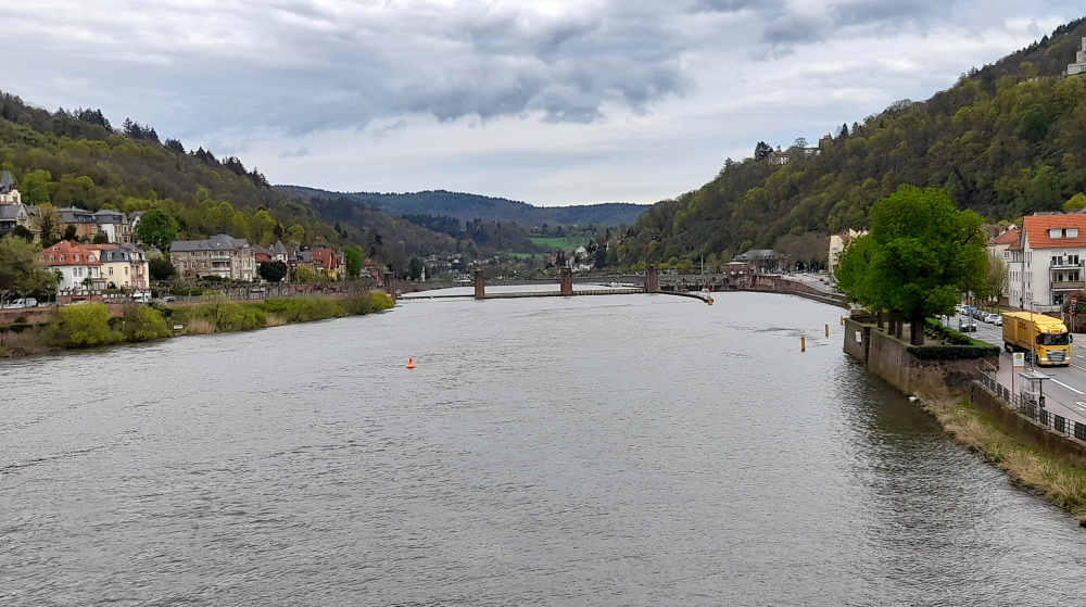
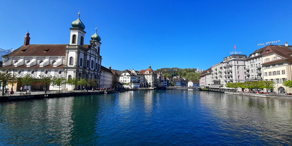
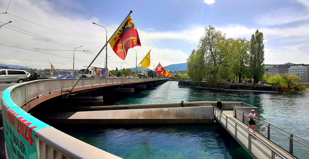
A No. 14 tram arrives almost immediately and deposits us at the Bel-Air station on an islet in the middle of the Rhone River that bisects Geneva. For many years this islet was the only checkpoint on the route linking northern and southern Europe, thanks to its bridge (Pont de I’lle) that spanned the two river banks. A commemorative plaque tells us that Julius Caesar had this bridge destroyed in 58 BC, which is when Geneva enters into the history books. Following its reconstruction, the city became a major European trade centre. [myswitzerland.com].

View from the hotel’s 6th floor.

A short walk from Bel-Air we find Quai F for the No. 2 bus to take us to Vollandes which is a block or so away from the lake’s foreshore and the Jet d’Eau.

Jet d’Eau on Lake Geneva (Lac Leman in French).

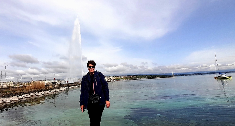
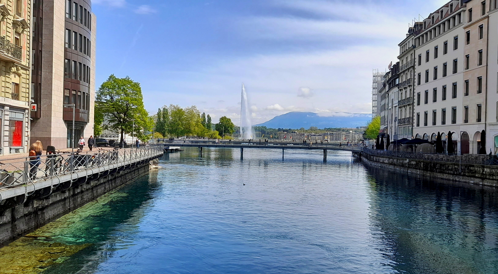
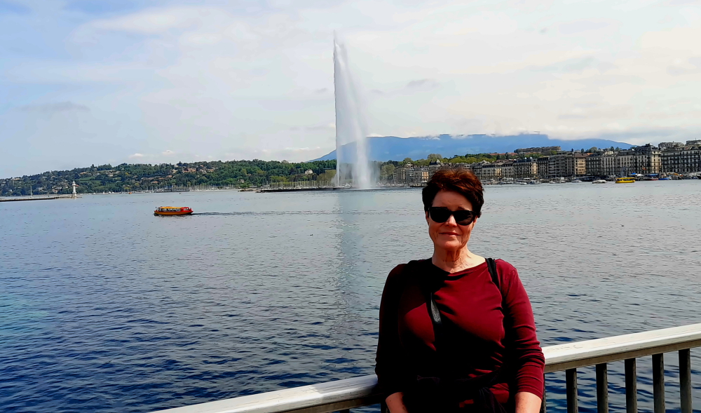
Located at the very heart of the harbour area, the Jet d’Eau is the emblem of the City of Geneva and its main tourist attraction.

1 of the fleet of 8 Belle Epoque paddle streamers cruising Lac Leman.

In 1891, the City of Geneva decided to promote the Jet d’Eau to the position of tourist attraction by installing it at the end of the Eaux-vives pier at the heart of the bay. The Jet d’Eau has been illuminated on a regular basis since 1930.

View of the jet from its jetty.

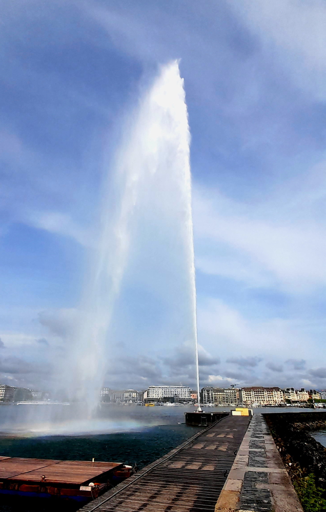
Projecting half a cubic metre of water per second 140 metres into the air requires two powerful water pumps weighing more than 16 tonnes in total and supplied with some 2,400 volts, generating almost 1,000 kilowatts of power. The water, drawn from a circular basin, is pushed towards the outlet nozzle where it reaches a speed of 200 km/h. [www.geneve.ch].

Definitely need ‘wets’ to ward off the jet’s spray.

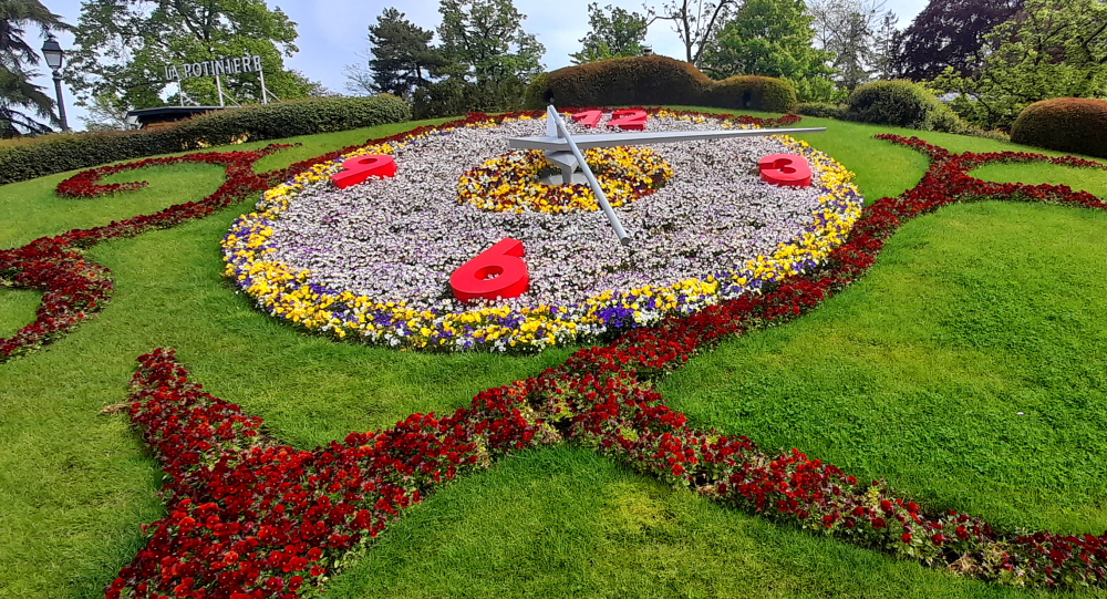
Back on the foreshore it’s only a short walk to the Parc Jardin Anglais and its botanical timekeeper – the floral clock (Horloge fleurie). Lynn remembers taking a photo of this in June 1985 on her coach tour through Western Europe.

The clock was created for the first time in 1955 and contains about 12,000 flowers (currently pansies) and plants. The floral arrangements change according to the season. The flower clock is not only decorative, it also tells the time with Swiss precision – the time being transmitted by satellite. The seconds-hand is 2.5 metres long, the world’s longest. [www.geneve.com].

Geneva’s Floral Clock.

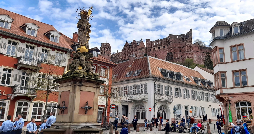
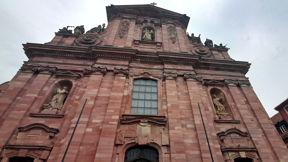
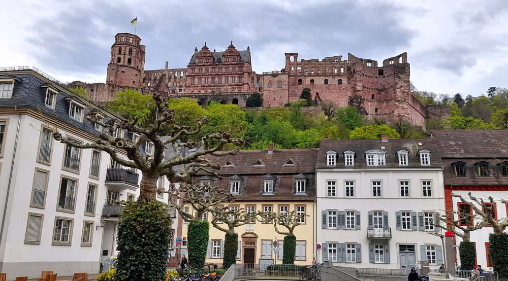
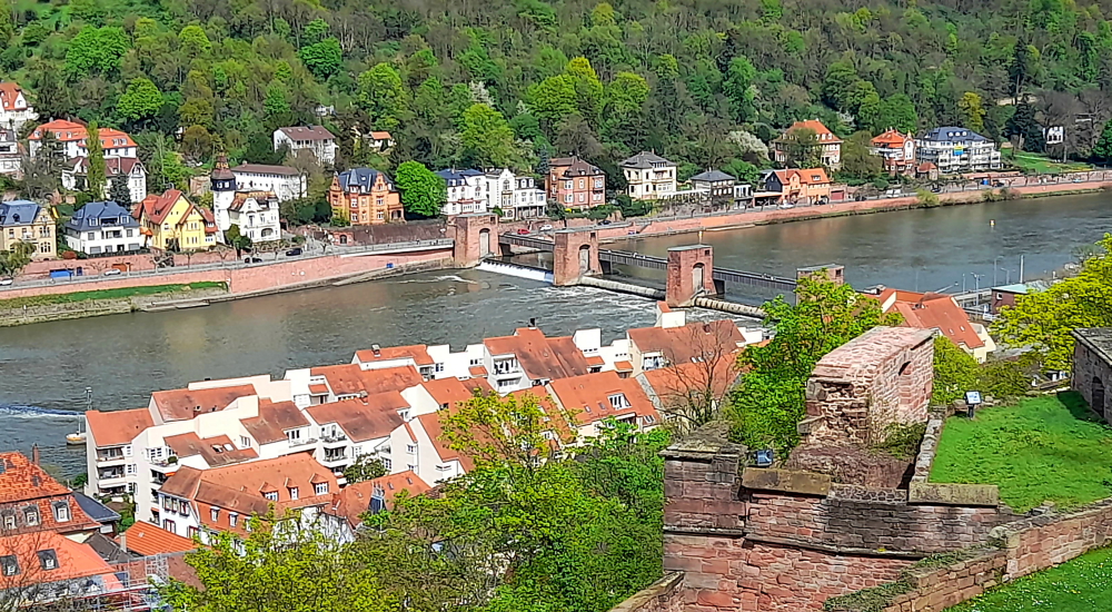
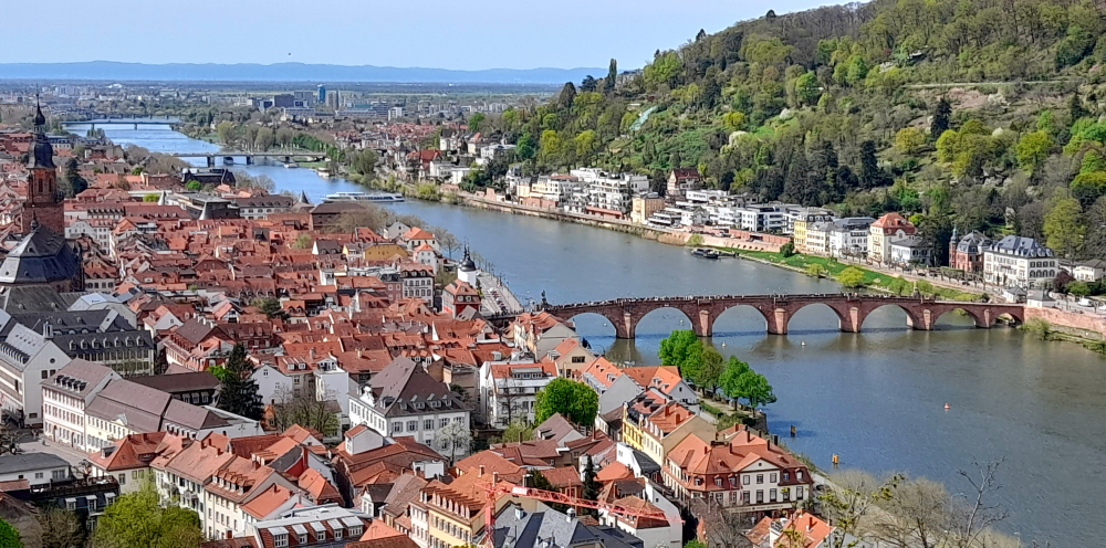
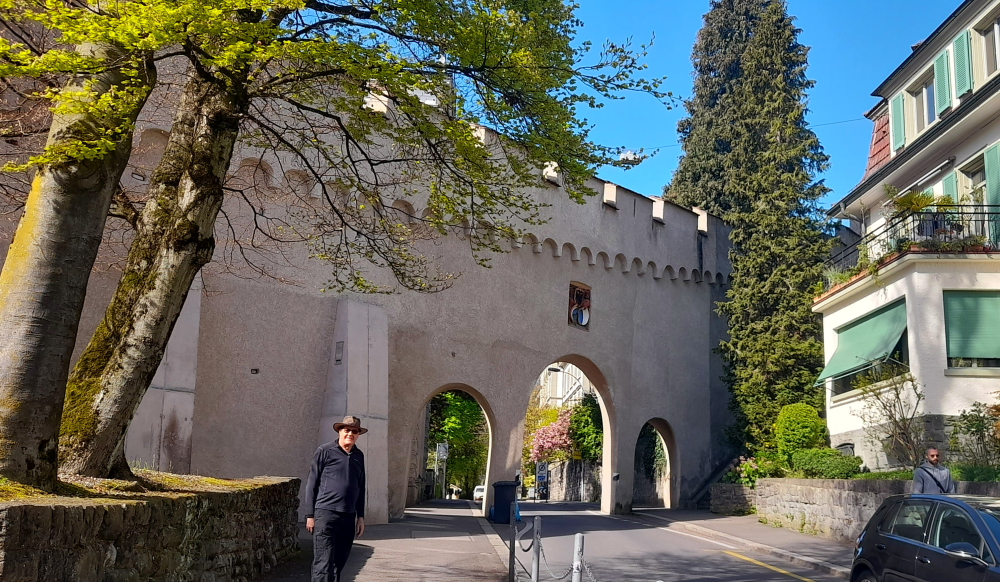
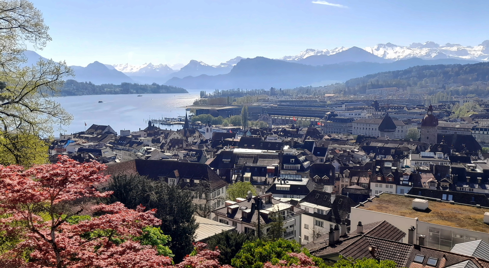
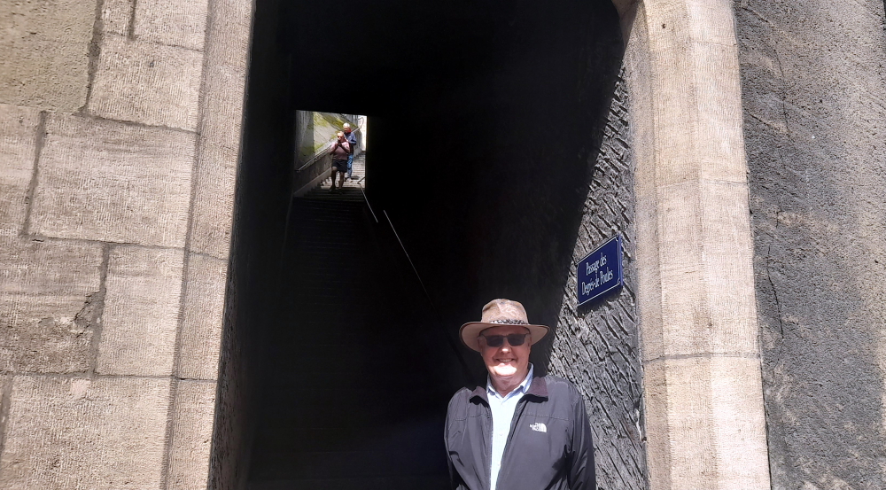
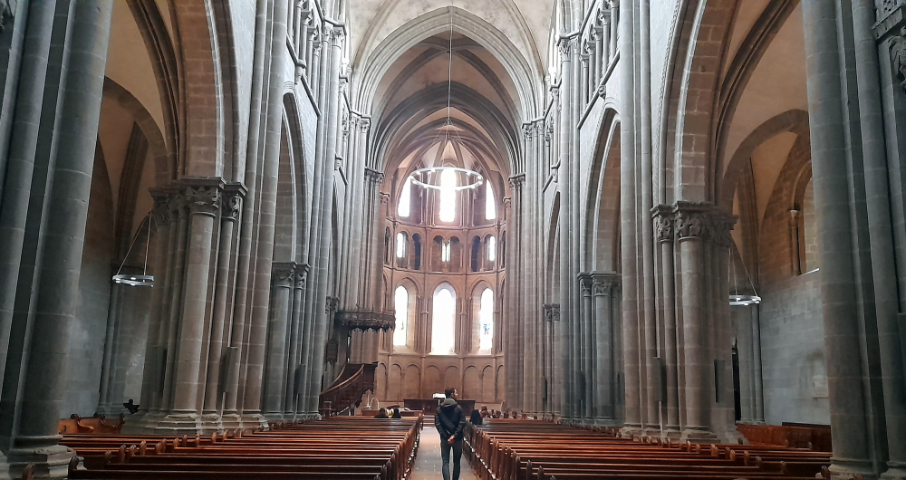
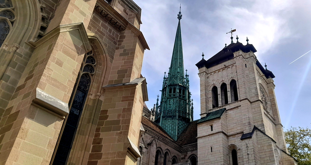
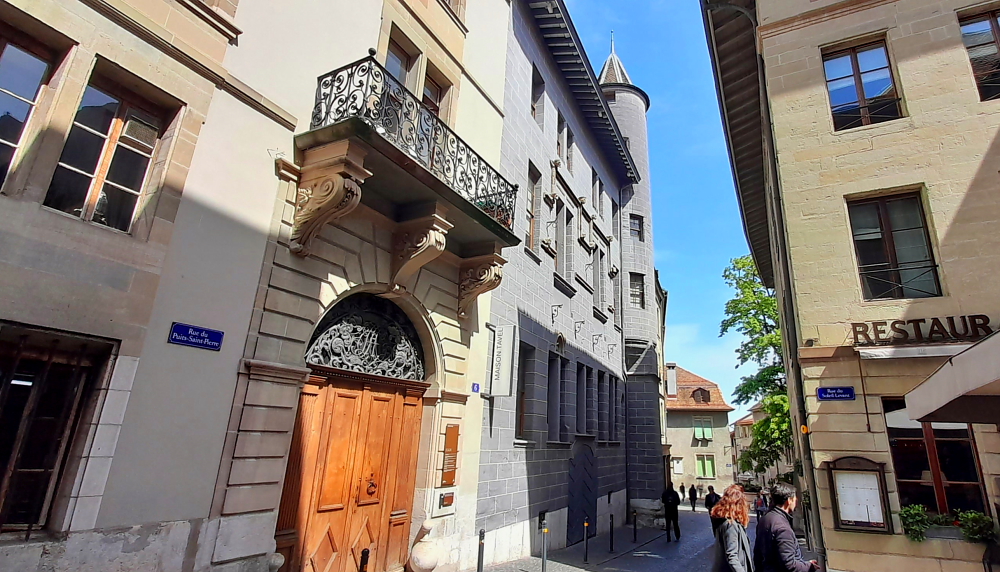
Our next destination is up a small hill in the Old Town – the Cathedral of St Peter – which we access via a steep stairway, Passage des Degres-de Poules (Passage of the Degrees of Chickens?!).

Chicken No.1 in the Passage des Degres-de Poules to the Cathedral.

The first phase of the cathedral’s construction started in 1160 and lasted for almost a century. Restored and rebuilt on numerous occasions, in particular following fires, it now blends Romanesque, Gothic and Neoclassical styles.

With the Reformation, the cathedral was emptied of any ornament in the mid-16th century. The painted decorations were erased and only the stained glass was spared. Its medieval facade was replaced by the current Neoclassical facade in the mid-18th century.

Interior of the St Peter’s Cathedral, Geneva.

Some 157 steps lead to the top of the north tower, offering stunning views over the city and the lake. In very fine weather, you can even see Mont Blanc. [www.geneve.ch].

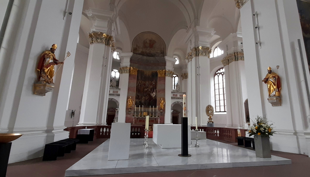
The archaeological site of the cathedral is exceptionally rich. It is one of the most significant sites north of the Alps. The visit begins in the 3rd century B.C. and finishes with the construction of the current cathedral in the 12th century. Hidden under Saint-Pierre cathedral are the ruins of previous churches. The earliest date back to the end of the 4th century.

The largest of the nine bells was hoisted into the north tower in 1407. It is called “La Clémence” and weighs six tonnes, plus 20 bells comprise its carillon.

Chapel of the Maccabees.

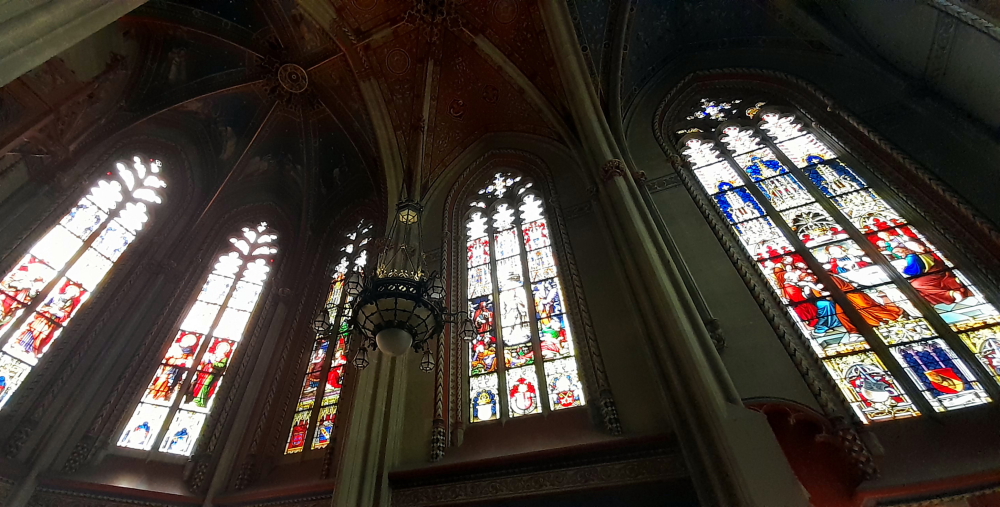
Upon entering the Cathedral, to the right is a door to the Chapel of the Maccabees. The Maccabees were a priestly family of Jewish rebel warriors (not a hamburger franchisee) who organized a successful rebellion against the Seleucid ruler Antiochus IV and reconsecrated the defiled Temple of Jerusalem (2nd century BC).

This chapel (or the Notre-Dame collegial chapel) was built between 1400 and 1405 in a flamboyant Gothic style for Jean de Brogny, a cardinal under Pope Clement VII (Robert of Geneva) to house his tomb and that of family members. During the Reformation, the chapel was subdivided into floors, converted into a salt store and was then used by the Academy from 1670. It was restored in the 19th century in a neo-Gothic style. The chancel vault was redecorated with the celestial chorus theme according to the exact layout of the original frescoes.

“Jeremie” by Rodo.

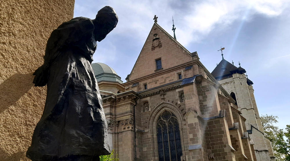
Outside the Cathedral is a sculpture entitled “Jeremie” by one of the finest-ever Swiss sculptors, Auguste de Niederhäusern, better known as Rodo. Born in Vevey of a Bernese family, Rodo studied in Geneva. But he produced most of his best work in Paris, where he collaborated with and enjoyed the backing of Rodin. Jérémie (the Old Testament prophet, Jeremiah) is considered Rodo’s greatest work, shortly after completing the plaster version he died. The statue was placed in 1939 at the present location. [www.swissinfo.ch].

St Peter’s Cathedral spire, Geneva.

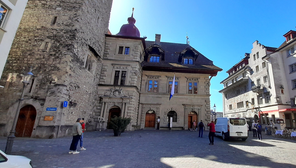
A block away is the Hotel de Ville and its flag-decked street.

Hotel de Ville on Rue de L’Hotel-de-Ville.

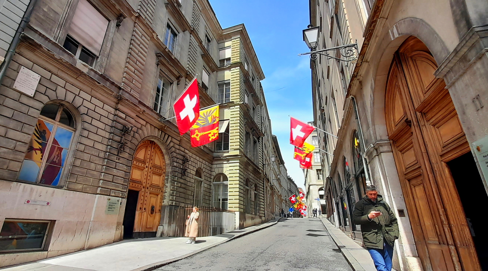
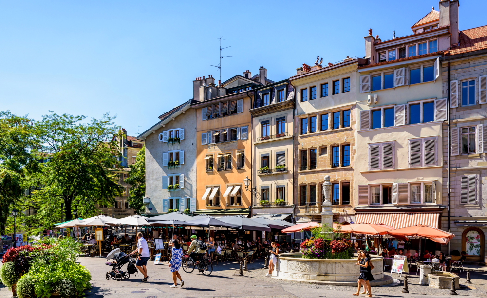
Rue de L’Hotel-de-Ville leads to Place du Bourg-de-Four at the very heart of Geneva’s Old Town. Even in the past, roads leading to Geneva led inevitably to the Place du Bourg-de-Four whose market has been of major importance since the 9th century. Over time, house heights were raised to accommodate Protestant refugees from all over Europe.

Place du Bourg-de-Four.

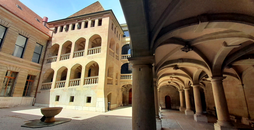
Retracing our steps back up Town Hall Street we walk past an interesting government building and courtyard which houses the offices of the Grand Counsel, State Counsel and Chancelry of the Republic and Canton of Geneva.

Courtyard of Republic & Canton of Geneva government building.

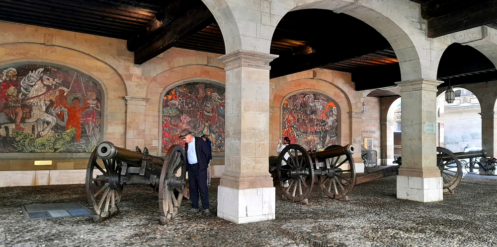
Across the road is a building housing a number of canon. The plaque states that “Two of these canon were among the artillery material of Geneva requisitioned by the Austrians in February 1814 and moved to Vienna. Following a personal initiative of the Lieutenant of Geneva, Joseph Pinon (1775-1839), these canon and other guns were restored to the Republic at the beginning of 1815.”

Canon all cast in 1725.

And across the road from this building is the Maison Tavel museum. A remarkable example of medieval civil architecture in Switzerland, it has also been the Museum of Urban History and Daily Life since 1986 through its permanent exhibition detailing Geneva’s past. It houses the Relief Magnin, the largest historical relief in Switzerland, which gives the visitor a general view of Geneva before the destruction of its fortifications in 1850.

An exceptional heritage building, it is the oldest private residence in Geneva. Destroyed by a fire in 1334, which spared only the cellars, the rebuilt house acquired the character of a fortified house with its turrets, and of an urban palace with a façade decorated with sculpted heads. In 1979, excavations brought to light the remains of an 11th century tower and a huge 17th century cistern for collecting rainwater.[institutions.ville-geneve.ch].

Maison Toval.

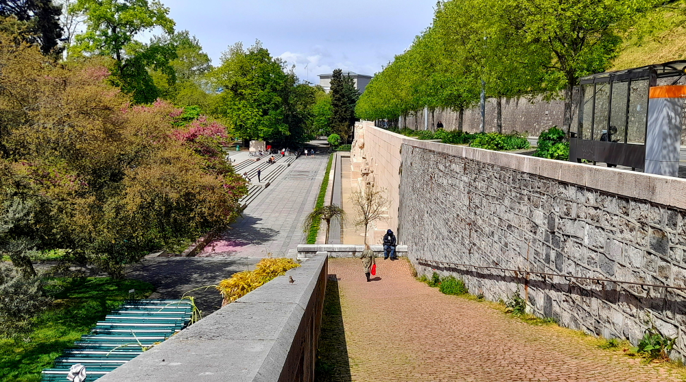
Rotating 90 degrees left, the road ends at Promenade de la Traille, an elevated park with panoramic city views. Immediately below it is Parc des Bastions which features the Reformation Wall.

Light-coloured Reformation Wall.

The International Monument to the Reformation, usually known as the Reformation Wall, was inaugurated in 1909 in Geneva. Key individuals, events, and documents of the Protestant Reformation are depicted there in statues and bas-reliefs.

Centrepiece – 4x 5m tall statues of Calvinism’s main proponents – William Farel, John Calvin, Theodore Beza & John Knox.

The Wall is in the grounds of the University of Geneva, which was founded by John Calvin, and was built to commemorate the 400th anniversary of Calvin’s birth and the 350th anniversary of the university’s establishment. It is built into the old city walls, and the monument’s location there is designed to represent the integral importance of the fortifications, and therefore of the city of Geneva, to the Reformation.

A jacarandah tree in Switzerland?!

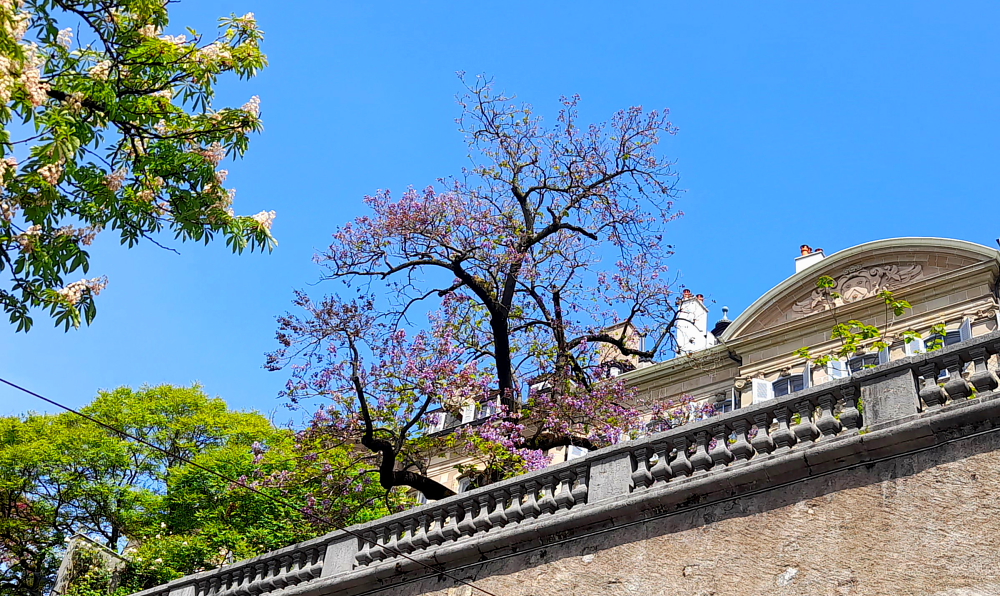
Descending the Rampe de la Treille to Place de Neuve we recognise an unexpected old friend – a jacarandah tree!

Place de Neuve is home to the General Dufour statue, inaugurated in 1884, and the Grand Theatre de Geneve. General Dufour, Swiss soldier, engineer, cartographer and statesman served under Napoleon I and held the Swiss office of General four times in his career, firstly in 1847 when he led the Swiss Confederation forces to victory against the Sonderbund. In 1864 Dufour presided over the First Geneva Convention which established the International Red Cross.

Grand Theatre (L), General Dufour (C) & Rath Museum (R).

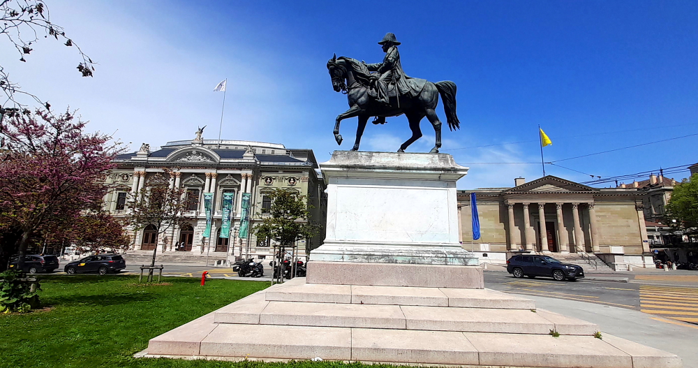
The Grand Théâtre is the city’s main opera house. It presents around a hundred ballet , operas and classical music concerts per year.

In 1862 the idea of ​​building a large theater was born, but only became possible in 1873 thanks to the inheritance of Duke Charles II of Brunswick and the donation of 3,000 m2 of land by the ‘State of Geneva’. The prestigious building, inspired by the Opéra Garnier in Paris, has a capacity of 1,300 seats and opens its doors on 2 October 1879 with the representation of Guillaume Tell by Rossini. The Grand Théâtre quickly became the largest structure of its type in French-speaking Switzerland.

Geneva’s version of Vietnam Telecom.

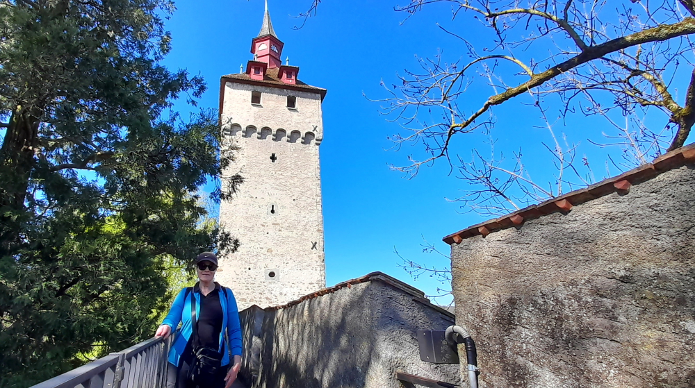
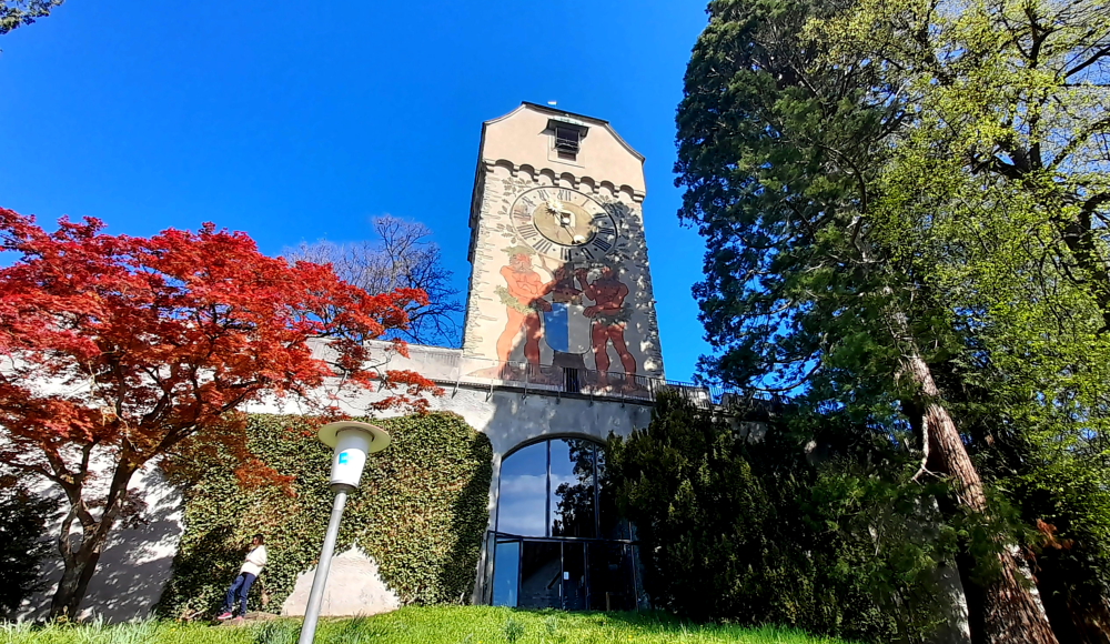
We walk back to the Bel-Air station and notice a clock tower. In the 13th century a fortified castle was built here of which only the tower, Tour de I’lle, now remains.

Tour de I’lle & Berthelier statue, Bel-Air station.

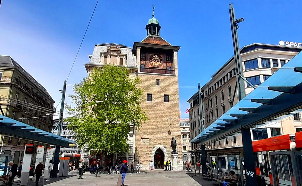
Near the tower’s doorway is a statue of Philibert Herthelier erected in 1909. Philibert Berthelier (c. 1465-1519), often known just as Berthelier, was a Genevan patriot, and an uncompromising enemy of the Duke of Savoy in his ambition to control Geneva. The accompanying memorial plaque states that he was beheaded for defending the freedoms of his homeland.

View of the Lake & Jet d’Eau from Bel-Air station.

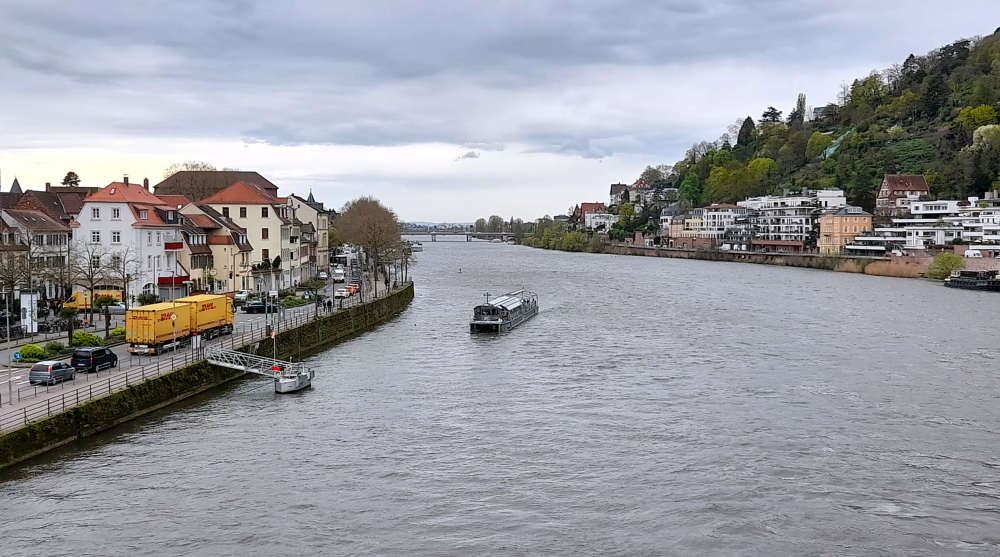
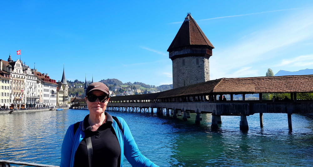
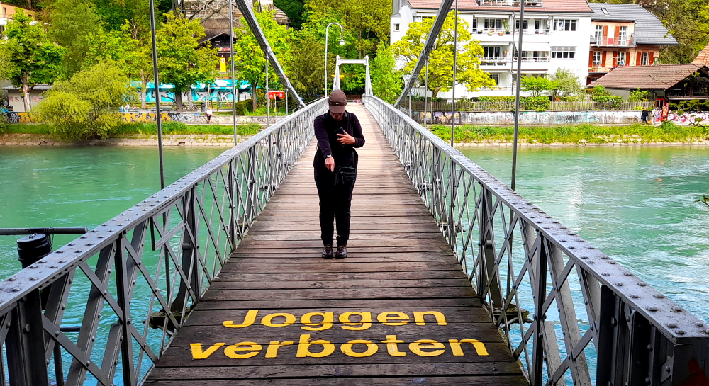
From here we cross the bridge linking the islet to the bank at Quai Bezanson-Hugues and walk to the pedestrian bridge, Pont des Bergues, that crosses back over the river to Quai des Bergues on the opposite bank.

View of Pont de la Machine (exhibition & trade centre) from Pont des Bergues.

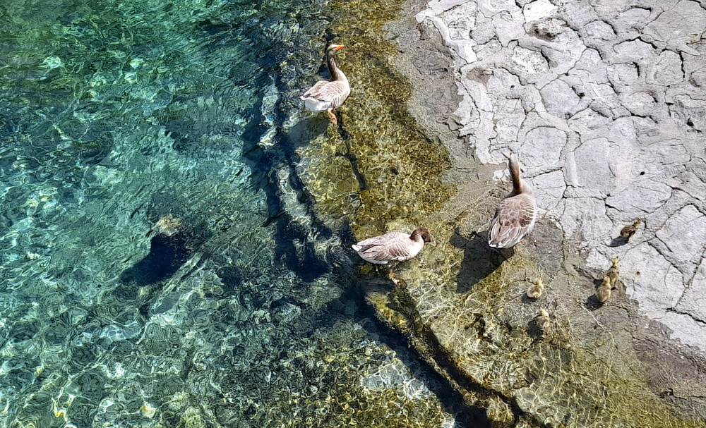
Near Ile Rousseau we come across 3 geese and 5 golden, fluffy goslings swimming in the crystal-clear waters of the Rhone.

Which one of you goslings is named Ryan?

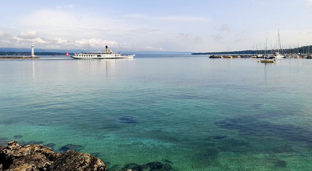
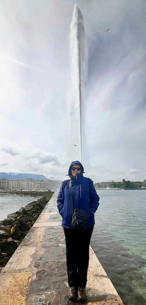
Once on the opposite bank we walk along Quai des Bergues, under the Pont du Mont Blanc, to the Mont-Blanc paddle steamer terminal.

View of Ile Rousseau from the cnr of Quai des Bergues & Pont du Mont Blanc.

Where, would you believe, there is a completely different view of the water jet (not really).

Yet another view of the water jet.

We jump on a No. 14 tram once again that returns us to our starting point.

Bendy tram – like travelling inside a snake.

And not a drop of rain all day – except for the water jet spray. Hope it’s the same tomorrow for our return trip to town.

30 April, 2024

Although the forecast was for a better day today, 21 Deg. C and 43% chance of rain, it turns out to be quite disappointing with overcast skies and a bit of a haze.

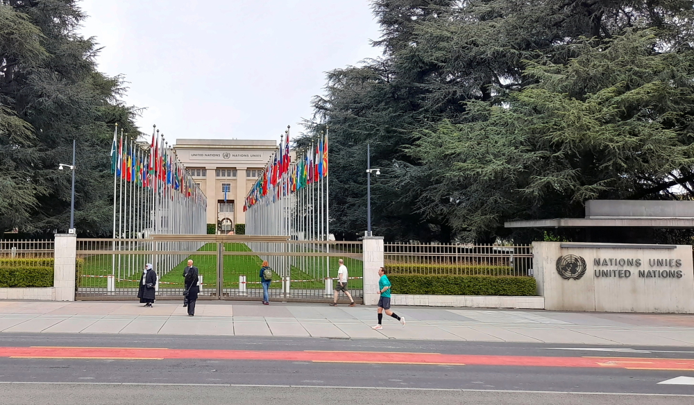
Today we are visiting the temple to watchmaking – the Patek Phillipe Museum in town. It doesn’t open until 2:00 pm so around noon, en route, we take the No. 14 tram to Servette and change to a No. 11 bus to Nations where the United Nations complex is located in Ariana Park. The Palais des Nations, an outstanding example of 20th century architecture, is formerly the headquarters of the League of Nations.

But it appears that we need a ticket to enter the grounds (we also wanted to see if we could catch a glimpse of a snowy Mont Blanc across the lake) so instead we catch a No. 15 tram direct to Plainpalais station where we walk across the extensive, crushed red-granite area of Plaine de Plainpalais to the Museum.

UN Complex, Ariana Park, Geneva.

I wasn’t aware that there was such a museum but when Lynn was researching things to see and do in Geneva she came across it. Knowing my love of Patek Phillipe watches she insisted this was one museum that we needed to visit.

Patek Phillipe Museum, Geneva.

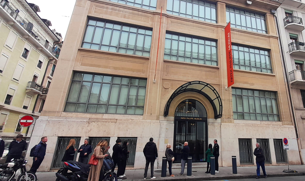
Inaugurated in November 2001, the Patek Philippe Museum was created by Philippe Stern, honorary president of the Geneva manufacture, whose passion built up one of today’s most extraordinary and prestigious horological collections.

Antiques Collection – portable mechanical clocks, 16th century, Germany.

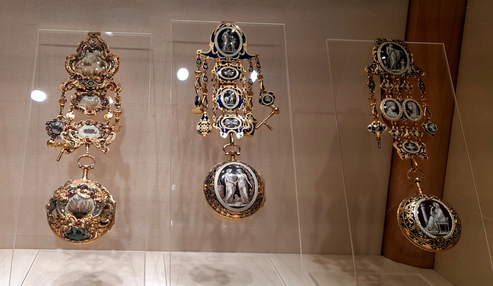
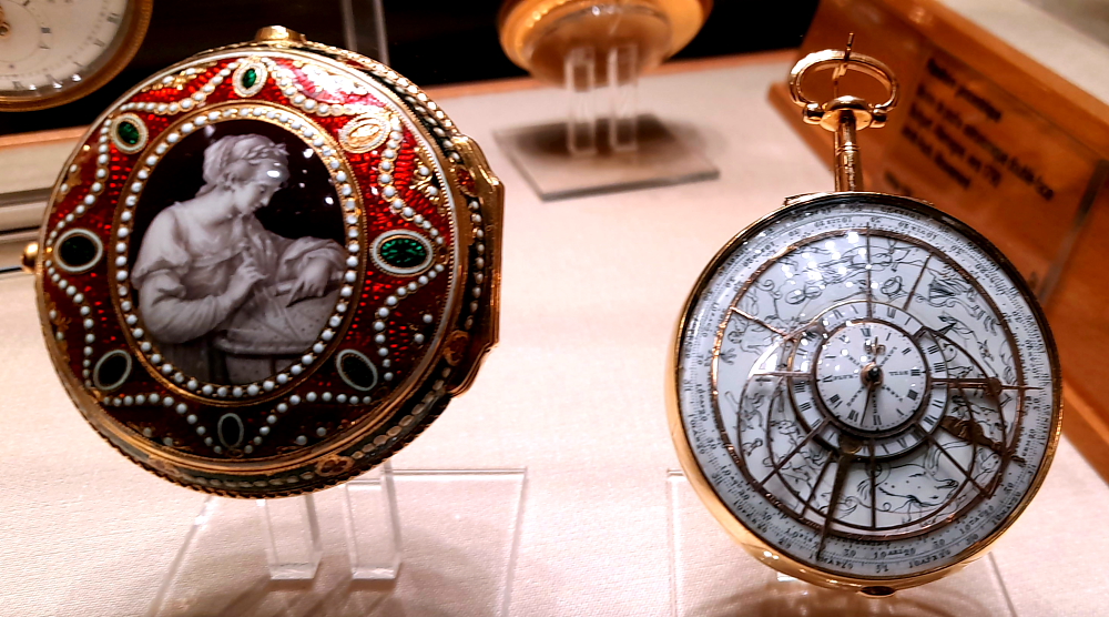
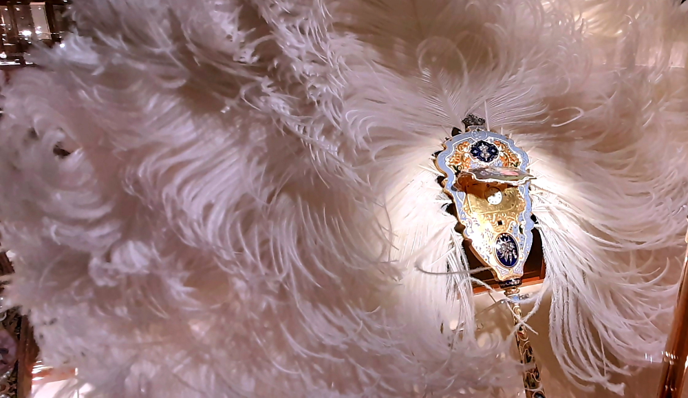
Some 2,500 watches, automata, precious objects and portrait miniatures on enamel showcase 5 centuries of Genevan, Swiss and European horological art, as well as Patek Philippe’s production since 1839. The museum also has a library with over 8,000 publications on time and time measurement [www.patek.com].

Antiques Collection – enameling using religious, landscape or here, mythological scenes (Germany, c. 1670).

Rather than a museum devoted to a single brand, the Museum displays 5 centuries of horological heritage of designing and building movements, as well as the significance for all the decorative arts traditionally associated with watchmaking – engraving, enameling, gemsetting, guilloché work etc.

Antiques Collection – pocket watches with chatelaines.

Just like Swiss clockwork the Museum opens its doors bang on 2:00 pm where we purchase our 2x CHF10 tickets, collect our audio guides and scale the stairs to the 3rd floor which is houses the archives and library. Here, unexpectedly, amongst large, weighty and beautiful gold-leaf and leather-bound tomes, we discover a copy of the children’s book, ‘Pooh’s First Clock’!

Antiques Collection – decorative telescopes with clocks, London c. 1775.

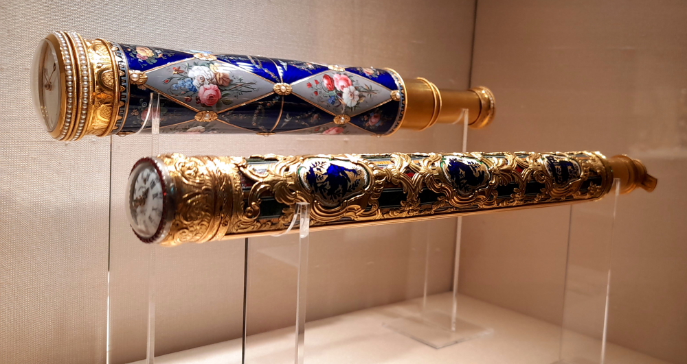
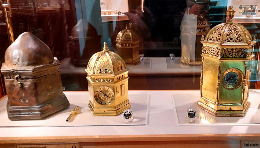
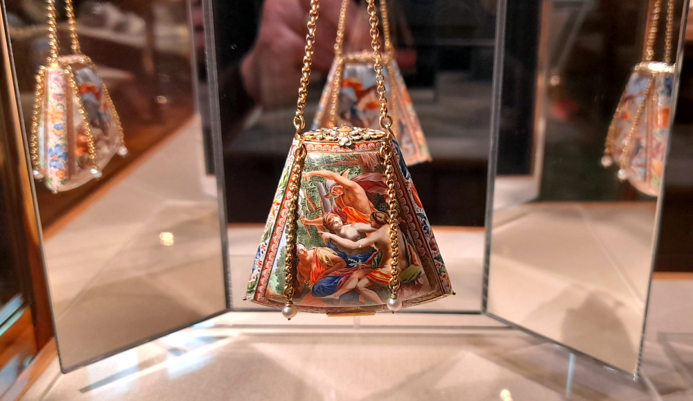
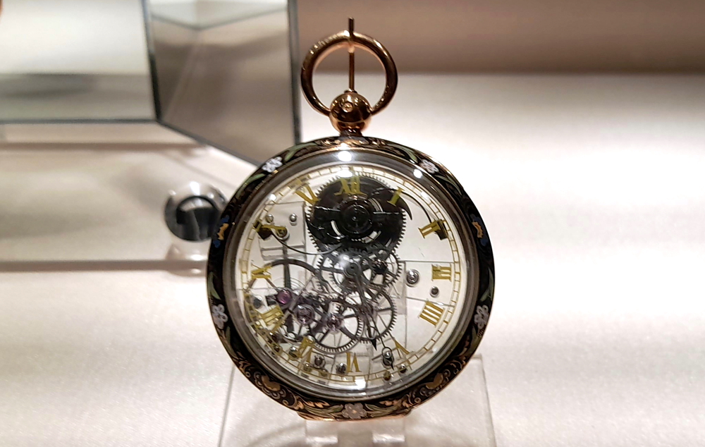
Then to the 2nd floor which has the Antiques Collection, a presentation of Genevese, Swiss and European watches and enamels dating from the 16th to the early 19th century, including a great number of masterpieces that have left their mark on the history of horology.

Antiques Collection – tactile pocket watch sold to Lucien Bonaparte on 21/06/1801,

Clocks took various decorative forms, attached to a finger ring by a chain, chained to belts (chatelaines), as pendants and brooches long before they became pocket and wrist watches, and were even housed in unusual objects. Early watches were depicted in portrait art, worn by wealthy patrons, from as early as the 1500s.

Antiques Collection – Astrolabe, London, 1778.

“Watches were baubles, toys and curiosities of the elite, which they could use to entertain friends and guests, flaunt their wealth and show off their education by understanding these new and complicated portable mechanical pieces.” [revolutionwatch.com]

Antiques Collection – Ostrich feather fan with hidden clock, Geneva, 1845.

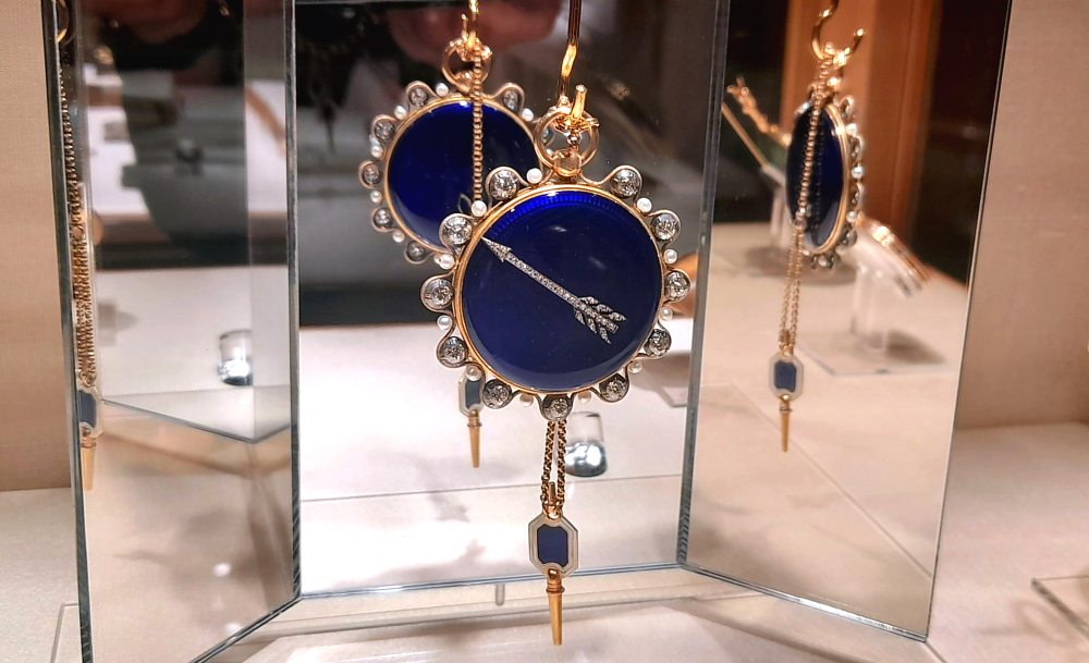
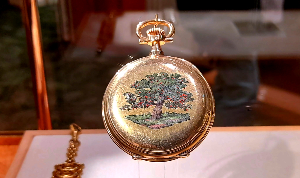
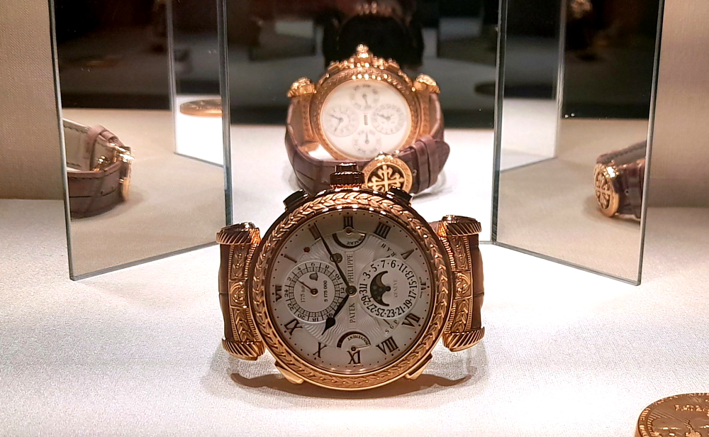
Lastly, we arrive at the 1st floor to view the Patek Phillipe Collection.

Antiques Collection – pocket watch with transparent, rock crystal casing, Paris, c 1830.

This Collection is a showcase of watches designed and created by Patek Philippe since its foundation in 1839 up to the present day, testifying to more than 175 years of creativity in the production of pocket watches and wristwatches – from bespoke creations for Royalty to innovative technology.

Patek Phillipe Collection – pocket watch of Johann Strauss Jnr, Patek, Phillippe & Cie, 1892.

Both collections are ingenious and spell-binding (I wonder what the collections are worth?), although the location of some of the numbered display cases could have been a bit more logical!

Patek Phillipe Collection – 175th Anniversary Grand Master Chime, 2014 – 1 of only 7 watches created for the anniversary.

Unbelievably, we leave the Museum at its 6:00 pm closing time – 4 hours later! Never done that before.

Enjoying our free drinks on the Novotel’s terrace.

Back at the Novotel we ‘take the weight off’ and enjoy our free, welcome drinks on the outdoor terrace.

1 May, 2024

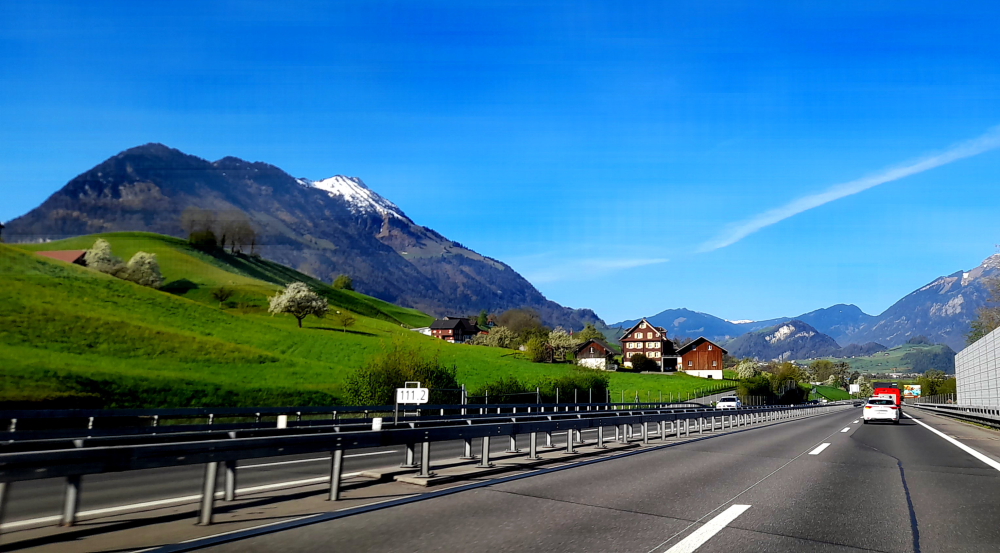
Our destination is Hilterfingen, near Thun (pronounced ‘Toon’) around 190 km and 2 hours 15 minutes drive via the northern route around Lake Geneva and through Lausanne.

Swiss/French border, Anieres.

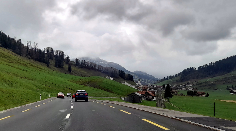
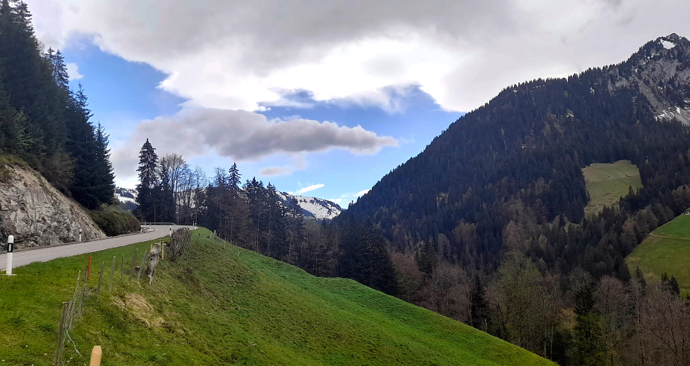
But today we’ll take the picturesque southern route stopping at the medieval village of Yvoire (France), Montreux (Switzerland) at the far end of the lake then via the Jaun Pass to Thun which will be closer to a 4-hour drive.

One of the fortified gates, Yvoire.

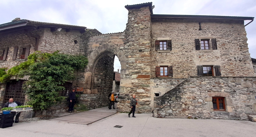
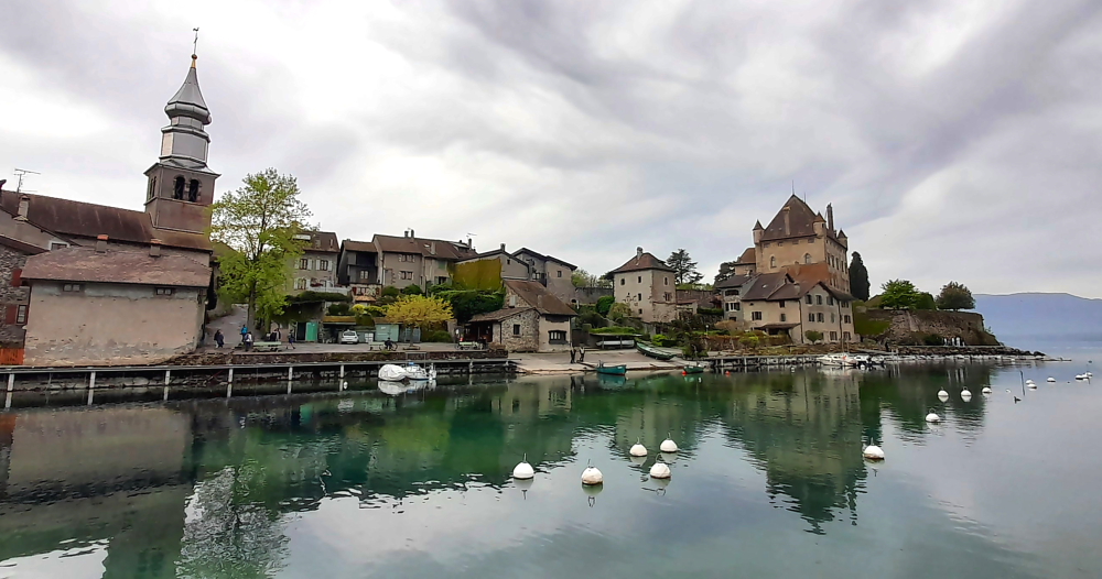
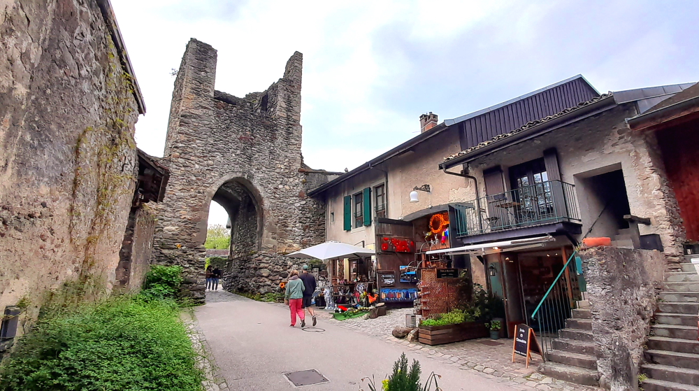
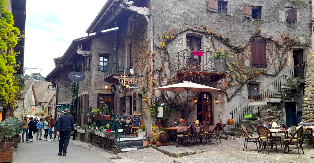
Yvoire is a medieval town built in the early 14th century so boasts 700 years of history. Located on the French shore of Lake Geneva and between Geneva and Evian, the village of Yvoire is nicknamed the “gem of the lake” and is classified among the “Most Beautiful Villages in France” [[yvoire-france.com].

Stone house displaying harvesting implements – rake, basket & scythe.

Yvoire’s written history goes back to 1306 and a time when Lake Geneva castles played an important role in protecting the strategic trade routes through the Alps and along the lake. However, changing trade routes pushed Yvoire into decline and relative obscurity since the 16th century.

Saint-Pancrace Church, Yvoire.

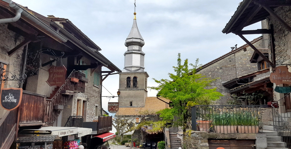
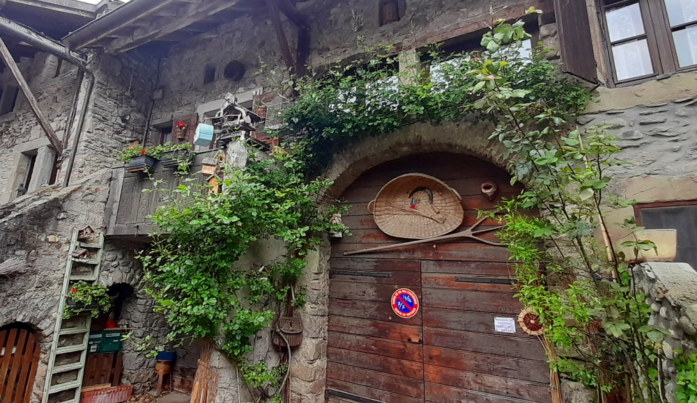
The village and its walls are built of stone, has narrow streets and is perched on a hill that hugs the shoreline. The first thing we notice is the silver metallic bell tower of the local church.

Interior of Saint-Pancrace Church.

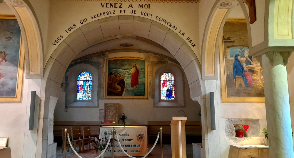
The Saint-Pancrace Church of Yvoire is a Catholic church dedicated to Saint Pancrace, who suffered martyrdom in Rome in the 3rd century. The church probably dates back to the 11th century and was transformed several times.

View of the church & castle from the harbour wall.

The current bell tower built between 1856-1858 belongs to the line of bell towers that characterize the Savoyard religious architecture of the late 19th century. In 1989 the bell tower was restored by covering it with stainless steel to avoid rusting [www.france-voyage.com].

Chateau d’Yvoire.

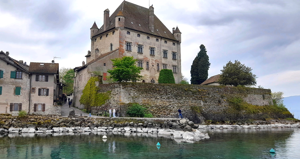
Yvoire Castle (Chateau d’Yvoire) was built in the early 14th century by Amadeus V, Count of Savoy. From 1306 he fortified the entire village as it was situated on a strategic location on a point between the “small lake” and the “large lake” that form Lake Geneva. For half a century, the village of Yvoire had an important military role, which earned certain freedoms for its inhabitants in 1324.

View of the mountains at the end of the Lake from Yvoire’s harbour wall.

During the 16th century, from 1536 to 1591, the region was occupied by forces of the independent city of Bern, who were allies of the French and the independent city of Geneva. During this occupation the village lost its ramparts and military role. Yvoire Castle was burnt and remained roofless for 350 years.

View of the Chateau from the Yvoire Pontoon.

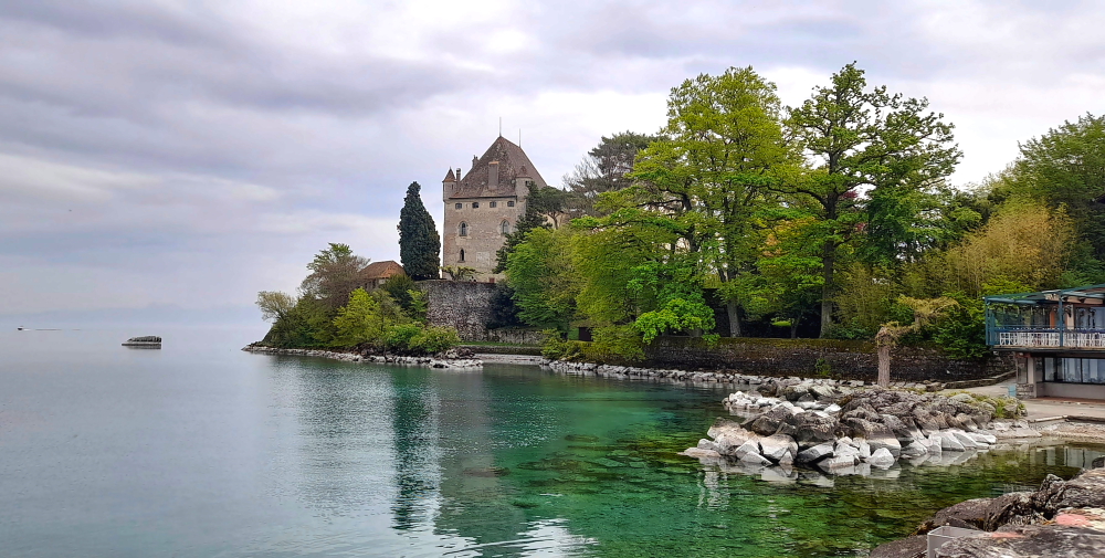
In 1655 the castle was acquired by the d’Yvoire family. Between 1919 and 1939 they had the castle restored and gave it a new roof and 4 corner turrets. At present Yvoire Castle is private property and cannot be visited.

Another fortified gate, Yvoire.

What the photos DON’T show you are the clouds of midgees that fill the air by the lake. Not the tiny Scottish ones, but big suckers.

Village square, Yvoire.

We continue along the D1005 and pass through the very attractive spa town of Evian-les-Bains which boasts a large casino, luxury hotels and marinas.

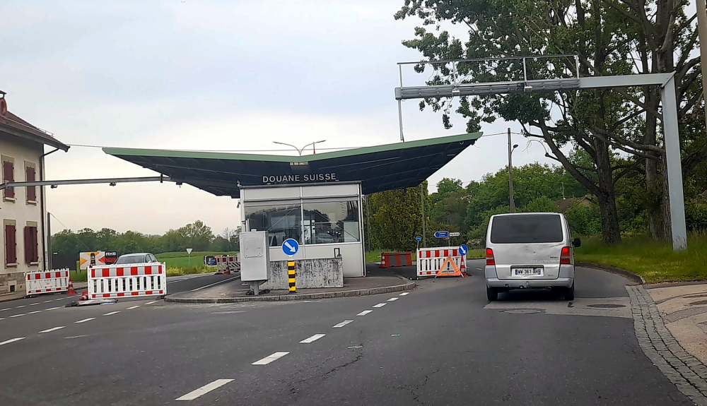
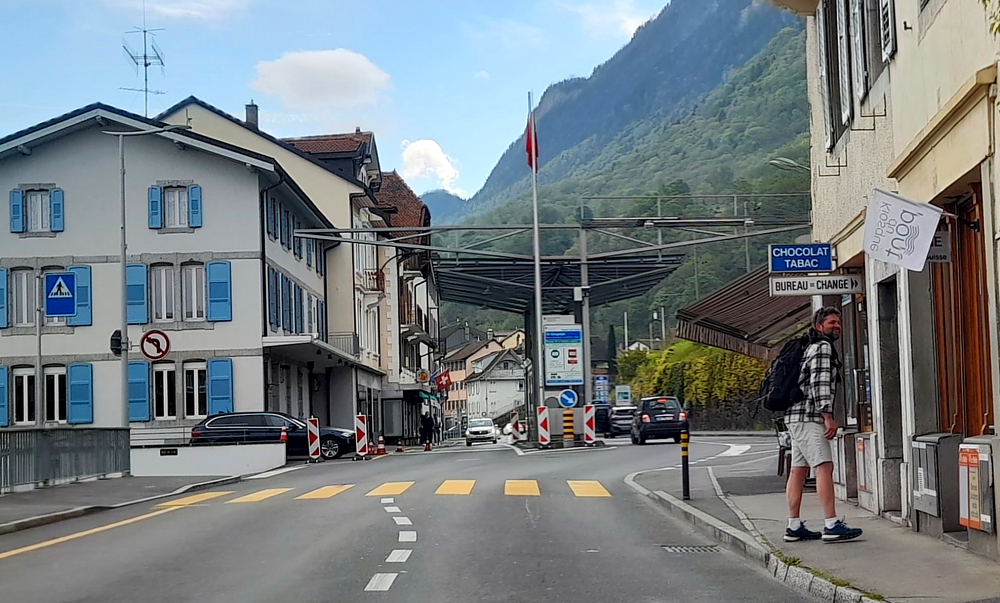
20 minutes later we arrive at Saint-Gingolph where the French/Swiss border is.

French/Swiss border at Saint-Gingolph.

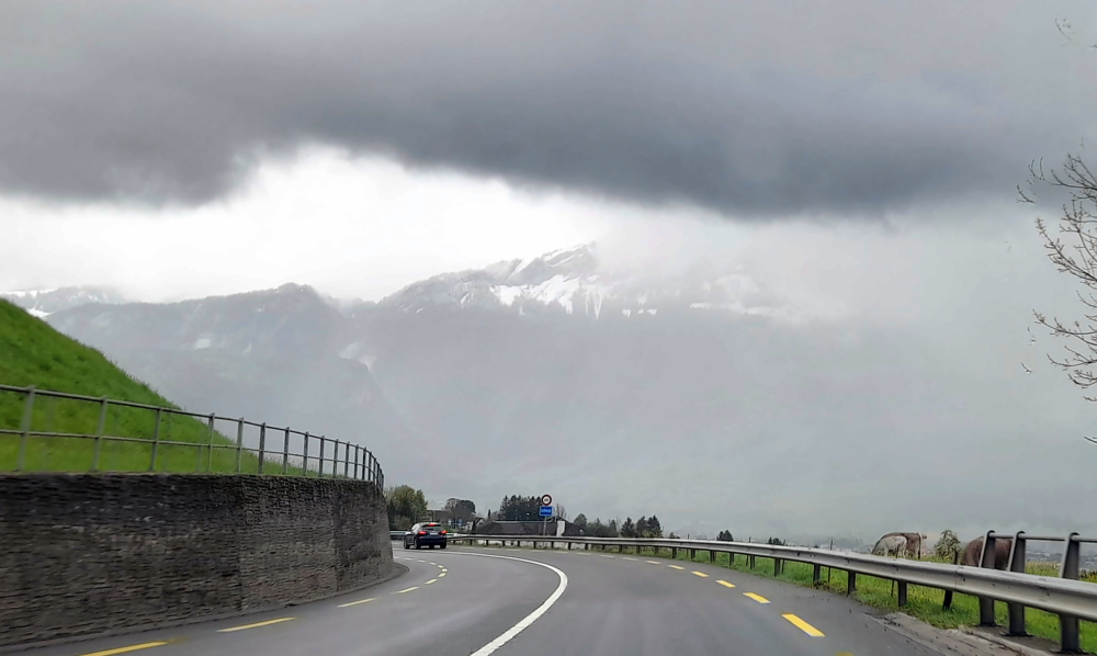
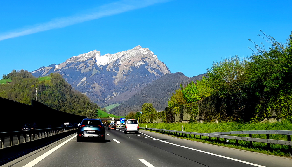
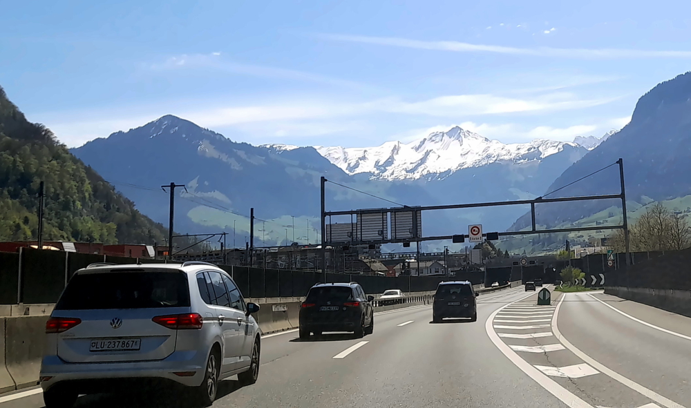
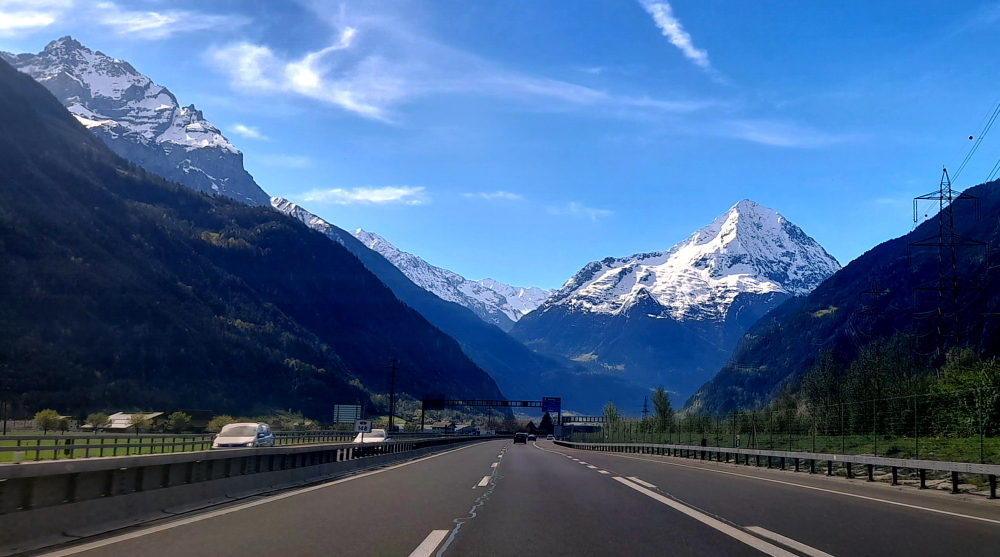
Along this route we are spoilt for choice of snow-clad alps to view.

Mountain range behind Montreux.

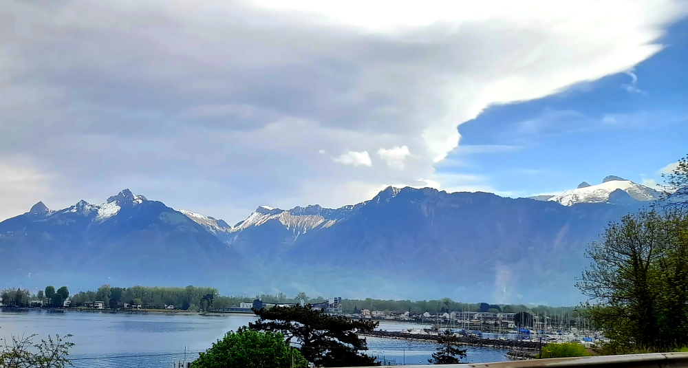
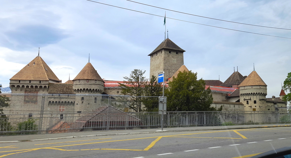
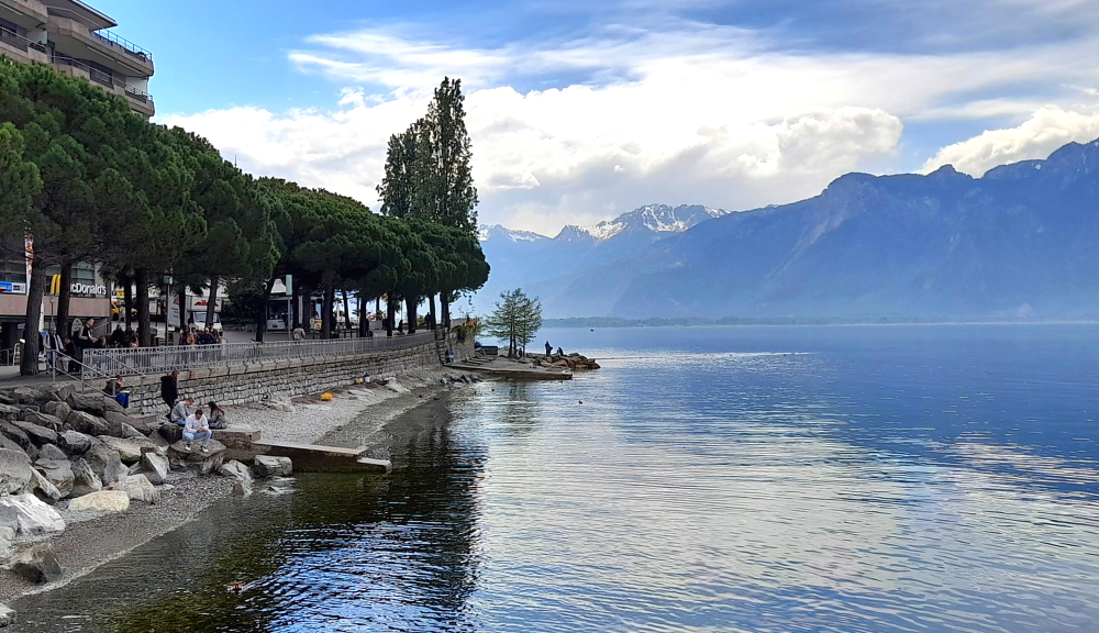
Approaching Montreux it looks to us like a more picturesque version of Monte-Carlo with a lake view and surrounded by mountains. We pass by the Chillon Castle. It’s located on a rock on the banks of Lake Geneva. For nearly 4 centuries Chillon was the residence and profitable toll station of the Counts of Savoy.

For hundreds of years the passage of ships on Lake Geneva and the important land route to the St. Bernhard Pass was controlled from this island. Chillon belonged to the Counts of Savoy from the 12th to the 16th century, when the inhabitants of Bern conquered the castle.

View of Chillon Castle from the A9.

Now, the reason we’re stopping in at Montreux is to see the statue of Freddy Mercury on the shores of Lake Geneva.

Freddie Mercury statue from the car park exit on Quai de la Rouvenaz, Montreux.

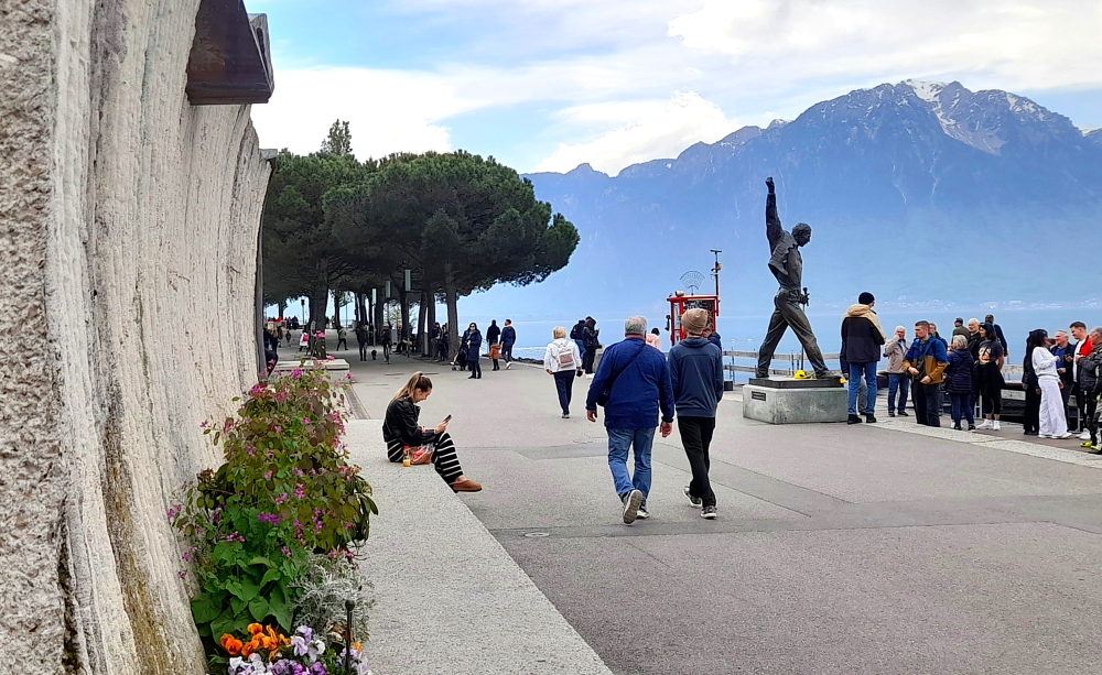
We first became aware of the statue when we watched a ‘Queen’ documentary a couple of years ago. When we were putting together our Swiss itinerary Lynn reminded me that we needed to stop here as she knows my penchant for Queen tracks and, in particular, my appreciation of Freddie’s extraordinary voice range.

Freddie Mercury, Lover of Life – Singer of Songs 1946-1991.

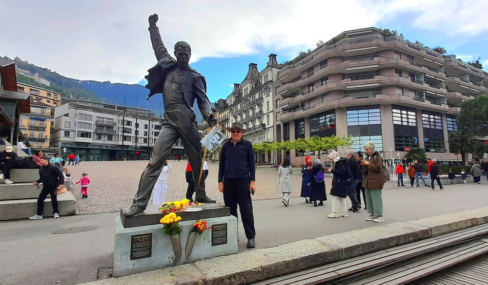
“If you want peace of mind, come to Montreux”, said Freddie Mercury (1946-1991). As well as living in Montreux, he also recorded 6 albums here with Queen, including the final album “Made in Heaven”. Both stages of recording, before and after Mercury’s death, were completed at the band’s Montreux studio, Mountain Recording Studio, which Queen acquired in 1978. In memory of his presence, Freddie Mercury’s bronze statue has stood on the lakeside promenade since 1996 [www.montreuxriviera.com].

Gorgeous lake & mountain views from the promenade, Montreux.

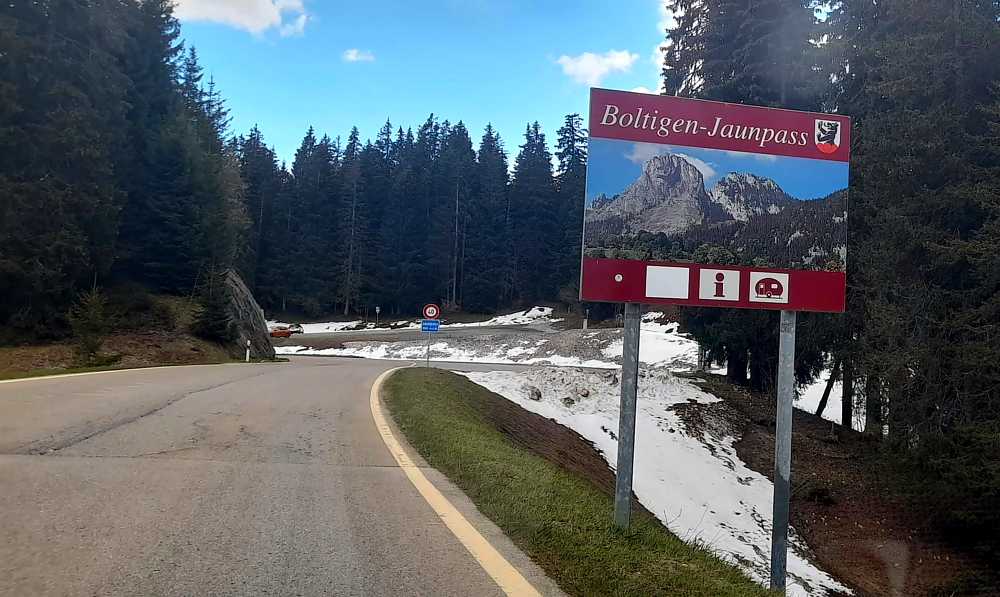
20 minutes later we leave the car park and take the A12 towards Bern then branch off onto the H189 and through the Gruyere Pays-d’Enhaut Regional Nature Park to the Jaun Pass.

Alpine pastures & buttercups, Im Fang, Dorf.

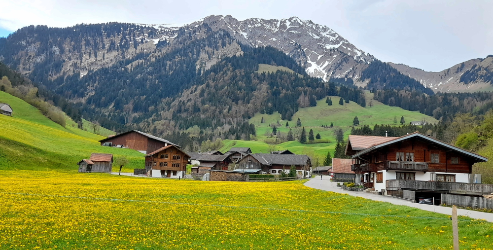
As we drive along this road we see folk out building fences and the traditional summer past time in rural Switzerland of hand-cutting grass, usually on a precipitous slope.

Bucolic Swiss rural scene on the road to the Jaun Pass.

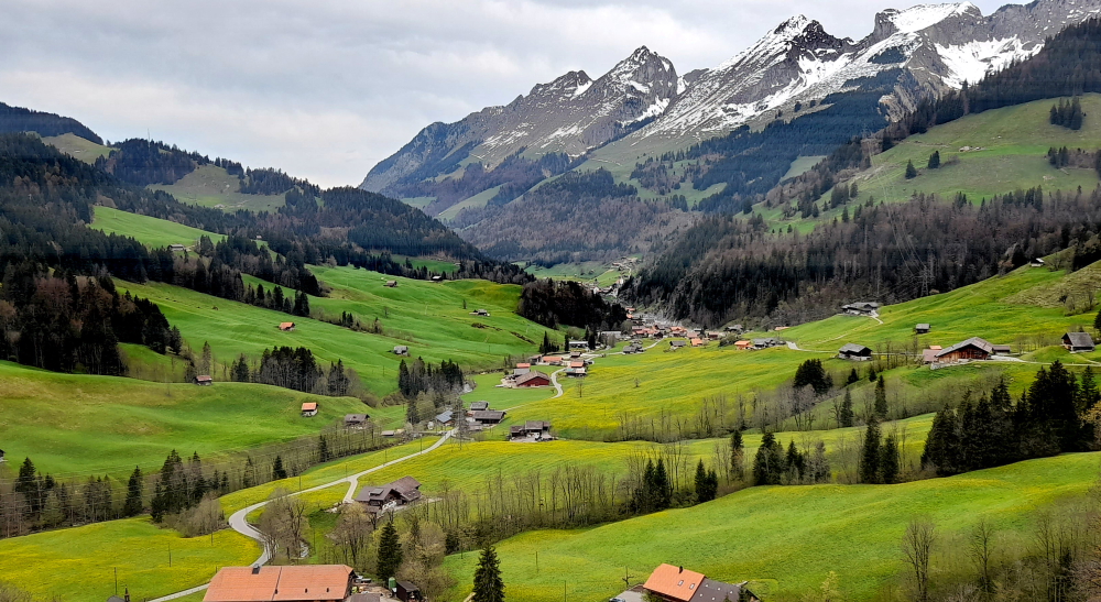
The Jaun Pass (elev. 1509m) is a high mountain pass located in the canton of Bern in the Swiss Alps. It links Charmey and Jaun in the canton of Fribourg with Reidenbach (part of the municipality of Boltigen) also in the canton of Bern. Given the pass road was completed in 1878, today it’s in fantastic condition, not a pothole in sight, although it does narrow from a dual to single lane road towards the top.

Around this corner is the pass.

Interestingly, Jaun is the only German-speaking municipality in the district of Gruyère. It was first mentioned in 1228 as Balavarda, then in 1397 as Youn.

Snow still about at 1509m.

As of December 2020 its population was 633. In 2000 most of the population spoke German (621 or 89.5%) as their 1st language, French as the 2nd most common (68 or 9.8%) and, surprisingly, Serbo-Croatian the third (2 or 0.3%).

View from the other side of the Pass.

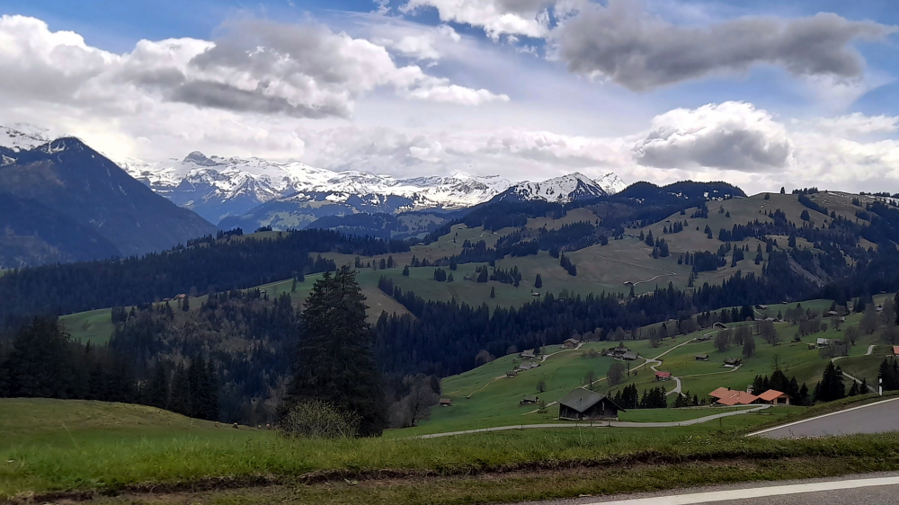
Driving down the other side, at the hamlet of Eschihalten, we see a field of cows – with bells on – and I mean, big bells.

“The hills are alive with the sound of (cow bells).”

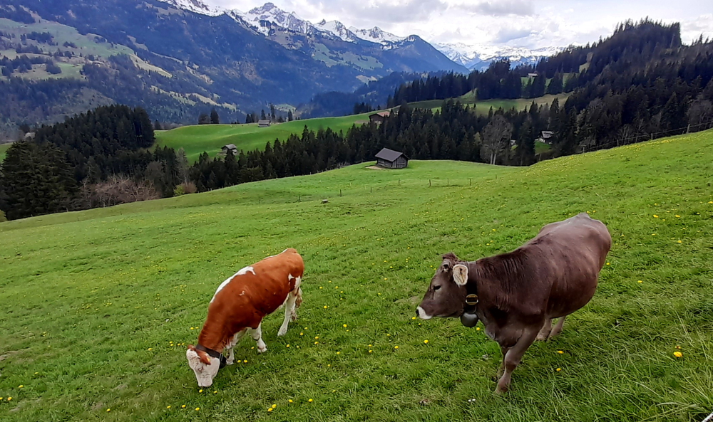
To live here it must be comforting, or not, to have the background ‘melody’ of cow bells that rattle every time a cow moves.

View from Eschihalten to the valley town of Boltigen.

One thing that’s for sure, I couldn’t put up with this putrid smell of fresh cow dung 24/7!

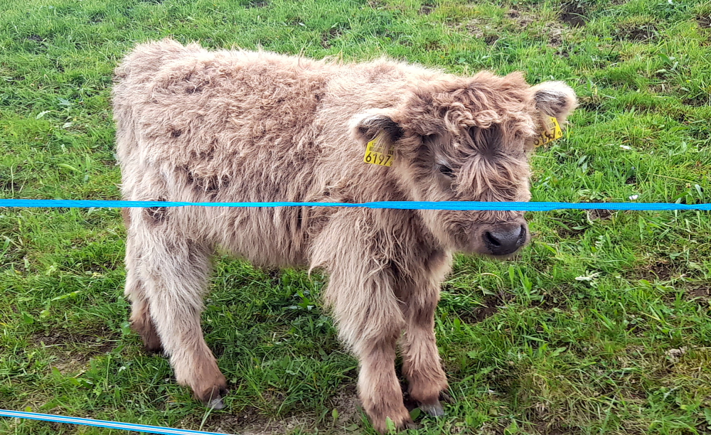
Further down the hill we come across a herd of Scottish Highland cattle – with a couple of minime’s in the mix.

How cute am I!

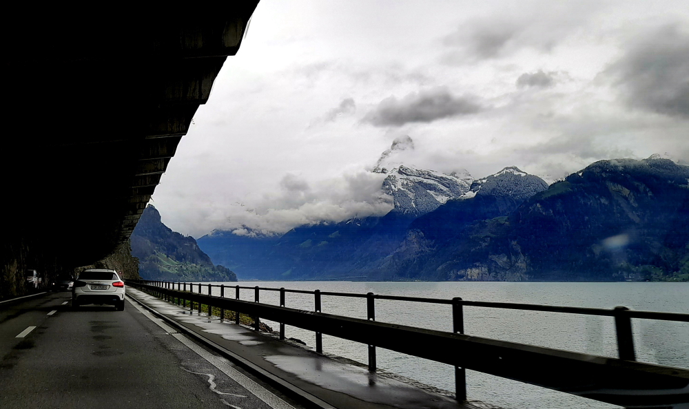
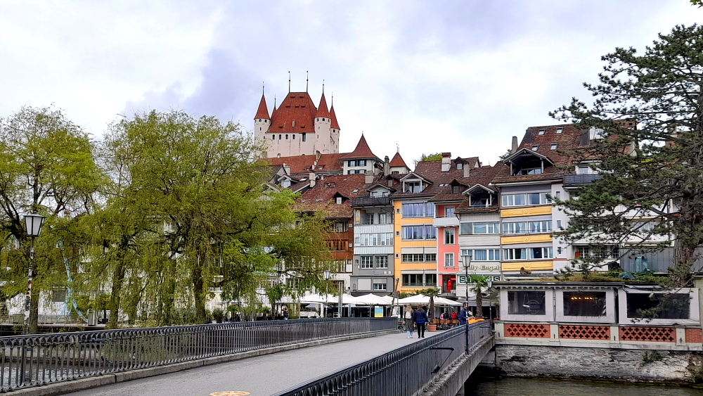
Before Boltigen we join the A11 then just before Spiez on Thunersee (Lake Thun) we turn left onto the A6 and drive through Thun.

Traditional carved wooden houses in Boltigen.

As usual, we are delayed by road works while we are driving through Thun. It’s further complicated by the fact that we need to cross over 2 bridges as part of the town is is located on a small island in the middle of the River Aare.

Balliz, Thun.

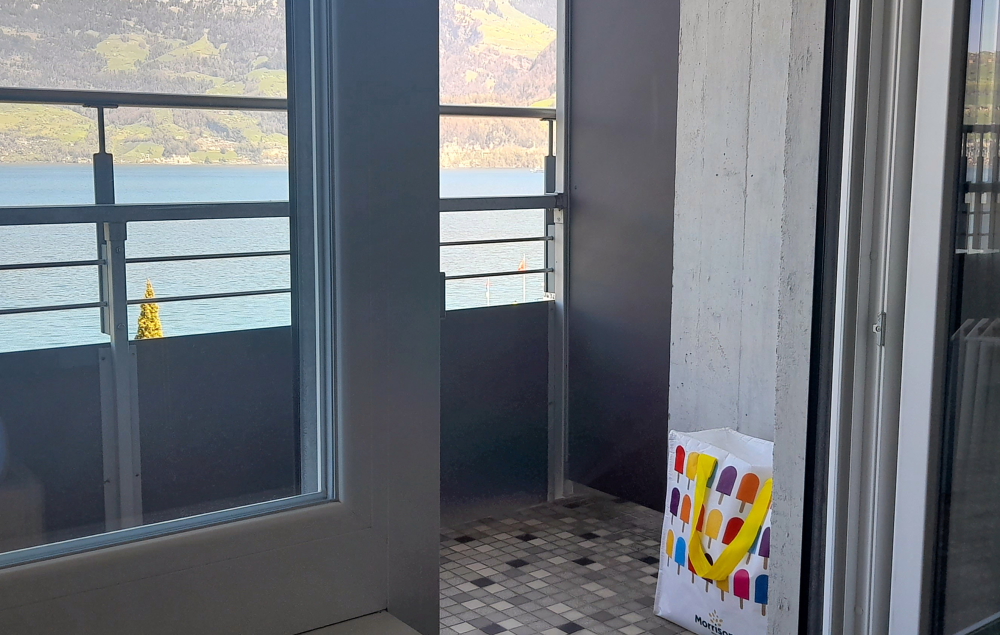
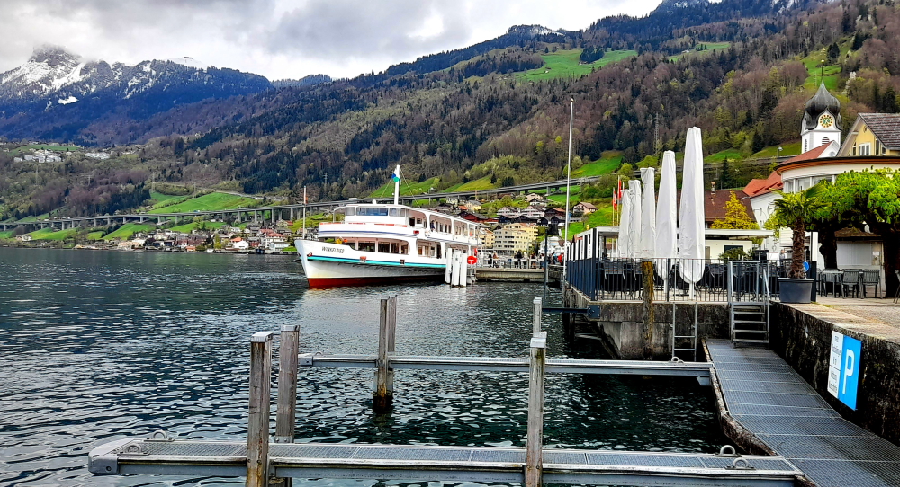
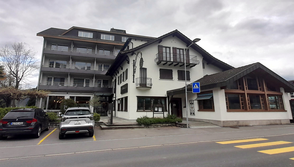
Around 3:30 pm we arrive at the Hotel Bellevue au Lac where we need to check in.

Hotel Bellevue au Lac – sister hotel next door.

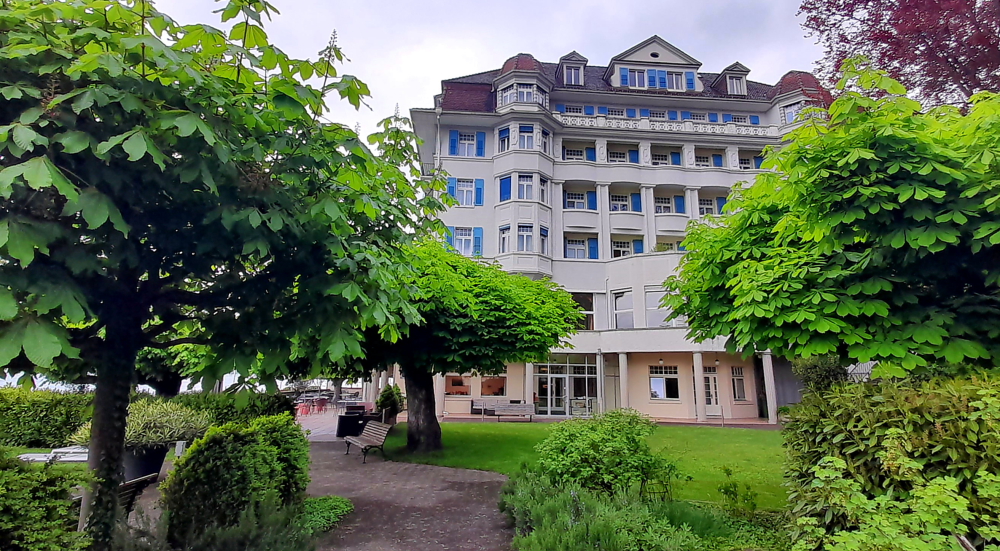
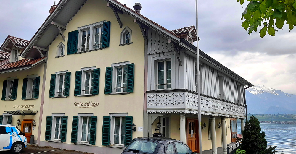
We are staying in its sister hotel next door, the Stella del Lago.

Stella del Lago.

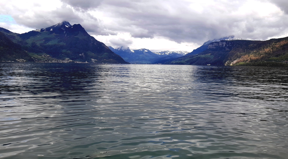
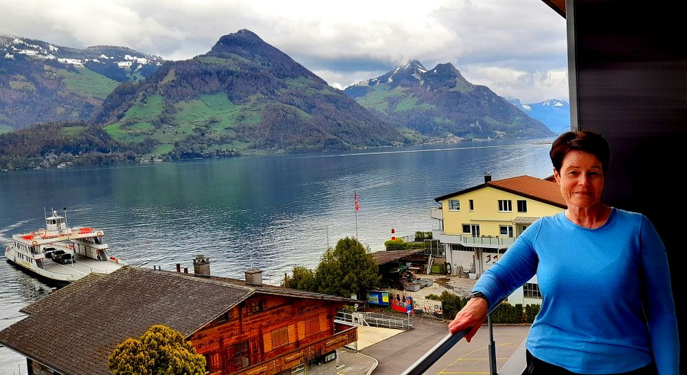
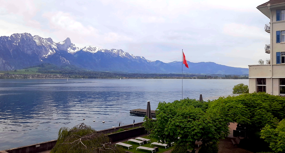
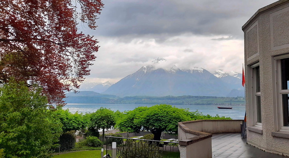
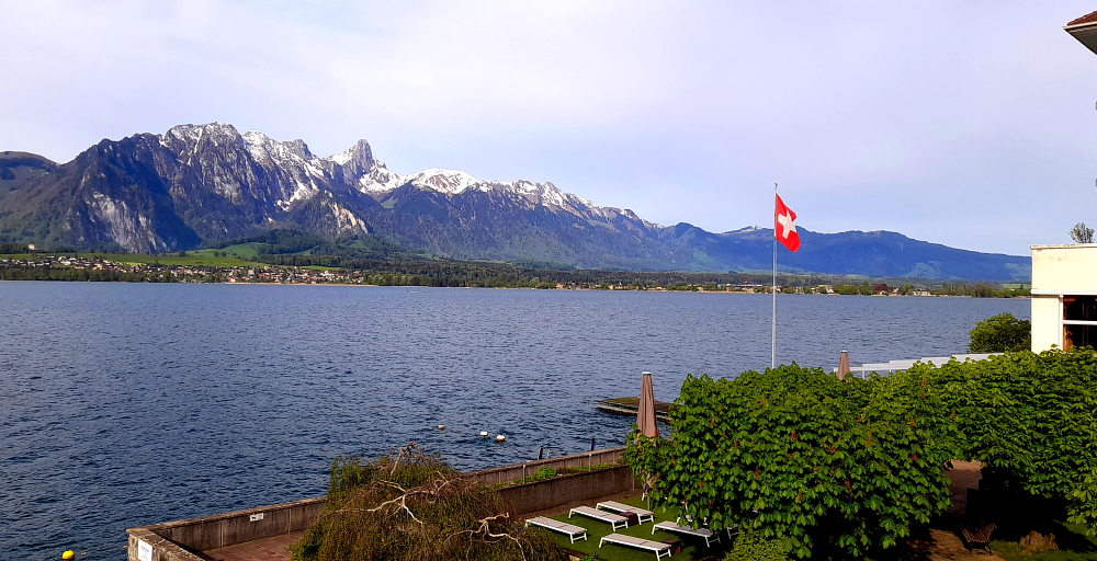
But the view from our room is stunning …

SE view of Thunersee from our terrace.

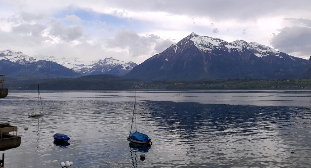
… both of the lake and the range of mountains in front of us.

NW view of Thunersee from our terrace.

Unfortunately, the Stella del Lago has seen better days. Its interior would have been considered opulent in the 1980s but a tad run down now. Looks like the hotel management is investing all its dosh in the sister hotel next door.

Wooden fretwork on hotel balcony.

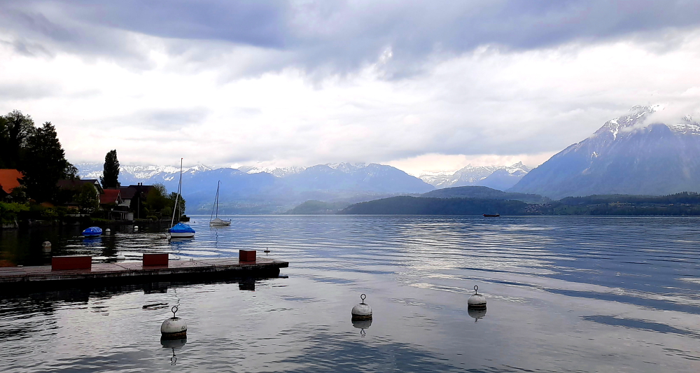
Not to worry, after we unpack we sit out on the terrace with a glass of red and soak up the sun and the view as the next 2 days there’s a strong chance of rain.

Evo Italian Restaurant.

There is an excellent Italian restaurant across the road where we go for dinner as the hotel restaurant is closed tonight. Of course it is. Scaloppine for me, lemon-infused tagliatelle with scallops for Lynn and a bottle of water served in Murano glass tumblers. Not bad for CHF63 or AUD105 – NOT!!

Before bed we watch the documentary about Lucille Ball and Desi Arnaz, mainly narrated by their daughter, Lucy. What a remarkable woman for her time and the enduring legacy of their film studio, Desilu Studios initially run by Desi, which produced such great shows as “Hogan’s Heros” and “Mission Impossible”, both favourites of mine.

2 May, 2024

When we last saw the 1969 Bond movie “On Her Majesty’s Secret Service” we had wondered where on earth that spectacular station in the sky existed. Turned out to be Jungfraujoch (at 3,454m/11,333′) in the Bernese Alps.

When we arrived yesterday Lynn posed the question: “Are we or aren’t we?” in her usual shorthand lingo. She had already researched the logistics. It was now up to the weather (no point going if it’s a white out) and the cost.

Although we both want to experience it, we decide against it as the cost is crazy money. For the 3 trains from Interlaken to Grindelwald to Eigergletscher to Jungfraujoch return for the 2 of us would total CHF600 or AUD1,000 and that doesn’t include parking at Interlaken. Besides, the weather forecast for Thursday and Friday is snow at Jungfraujoch with tomorrow’s temperature at -3 and Friday’s at -6.

Tranquil lake view from the Hotel Bellevue.

Today’s temperature is about 7 Deg. C lower than yesterday’s.

Low clouds over the distant Alps where Jungfraujoch is located.

Although it starts out as an overcast morning, by afternoon it’s bucketing down. Just as well we decided on a day in to catch up on 2 busy blog days.

View of Kirche Hilterfingen & Hotel Bellevue from Staatsstrasse.

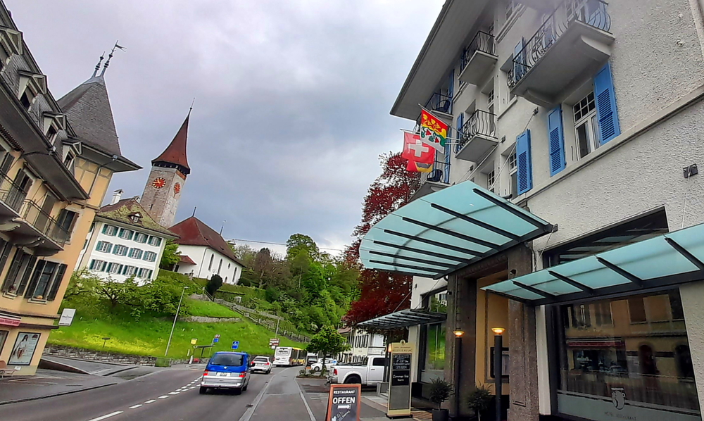
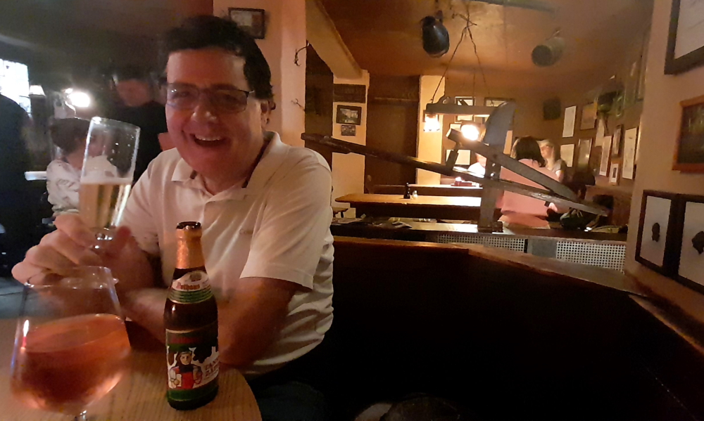
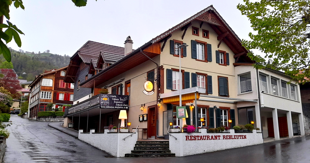
By 7:00 pm it’s time to walk the 12 minutes to the next village of Oberhof to the Restaurant Rebleuten, a bit like a Swiss pub.

Just a small local beer. Not bad..

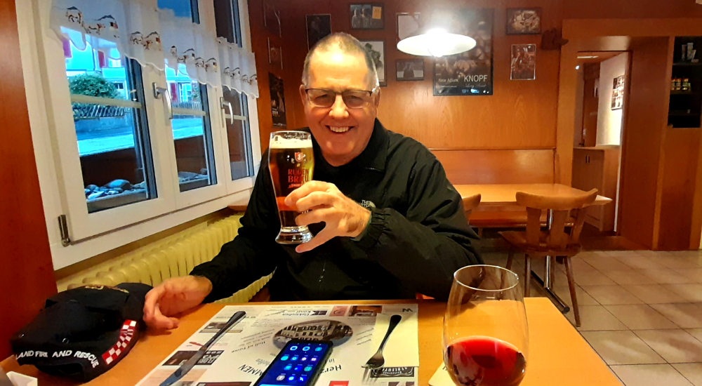
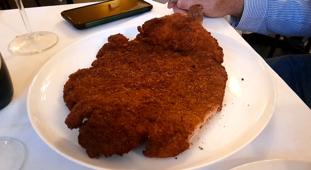
I order a 30cl glass of lager (CHF 4.20); Lynn a 10cl glass of pinot noir (CHF5.00), and we both order the breaded pork schnitzel with veggies (surprisingly, a nicely-cooked turnip) and fries (2x CHF26=CHF52). Total – CHF61.20 (AUD102). Slightly better value than last night with bigger portions and booze.

Restaurant Rebleuten, Oberhof.

As for the trip to Jungfraujoch – tonight Lynn Googles the BBC’s “Great Continental Railway Journeys Switzerland” hosted by Michael Portillo in 2012. Here we get to view the journey he made in summer and the stunning views from the Sphinx Observatory. So, we get our trip to Jungfraujoch – just virtually and vicariously – and without a nip of frostbite and a dose of bankruptcy!

3 April, 2024

I truly hate it when hotels accept pets. There are 2 small dogs at breakfast this morning. 1 off its leash, that shake themselves with hair, fleas and dander flying into the air. Both are hand-fed tidbits by their owners at the table.

Then owners, without washing or sanitising their hands after handling and feeding these pets, proceed to the buffet and handle the implements, even putting their hands on the towels that protect the bread for slicing. Just imagine dog saliva on the implements and those towels and the bacteria, worms and whatever else that then get distributed around the place and into the mouths of unsuspecting non-pet people! Urrrrggghh!

Worse than little kids let run riot around the buffet handling all the food then coughing and sneezing all over the buffet because their noses and mouths are right at table height!

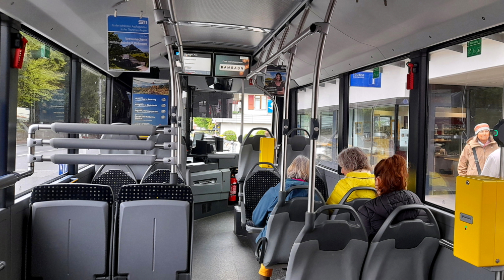
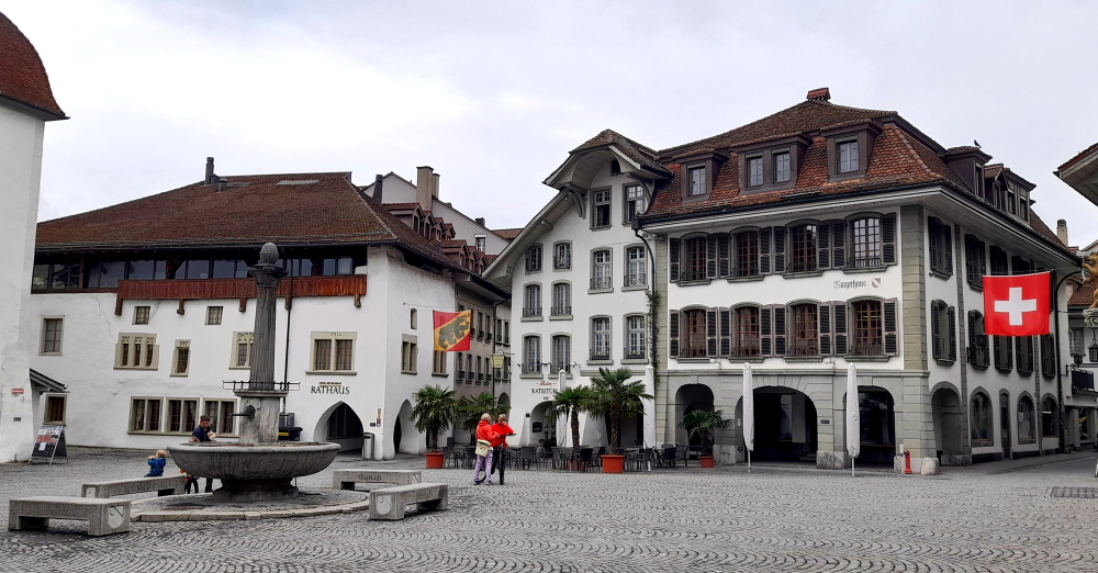
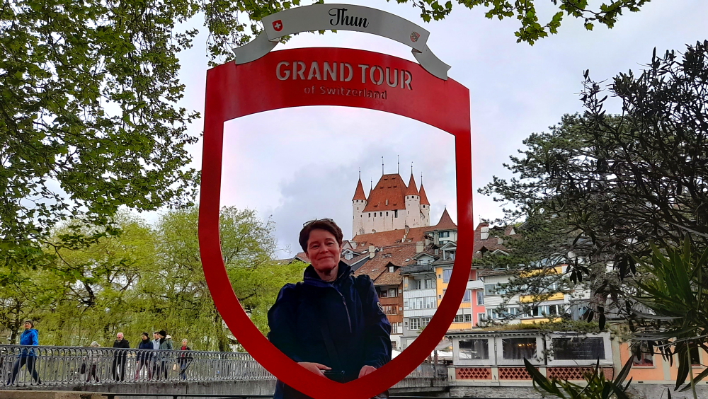
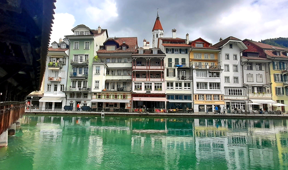
Another day of 12 Deg. C and less rain forecast for today so we walk over the road and catch the 10:11 am No. 21 bus into Thun. Again, we qualify for a Swiss tourist card, in this case the Panorama Card, which gives us free bus transport.

No. 21 Bus to Thun.

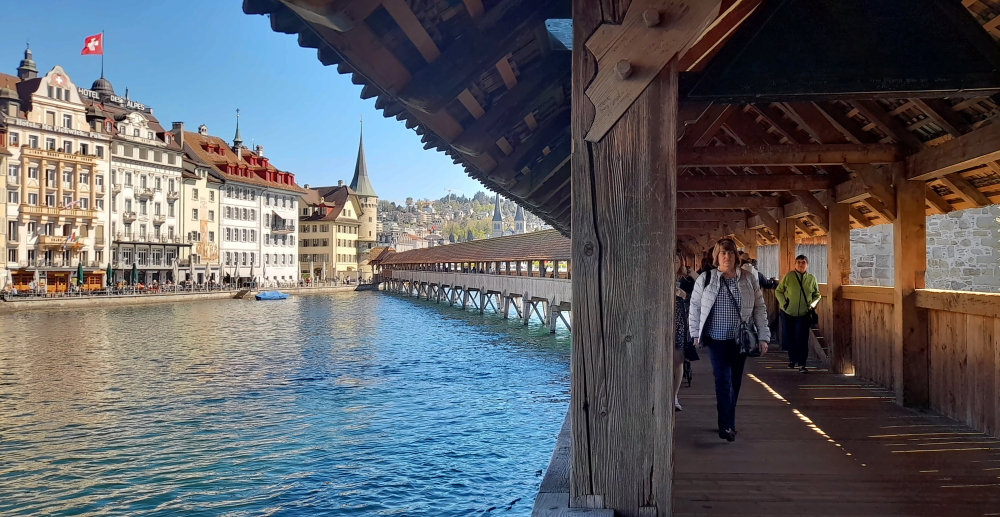
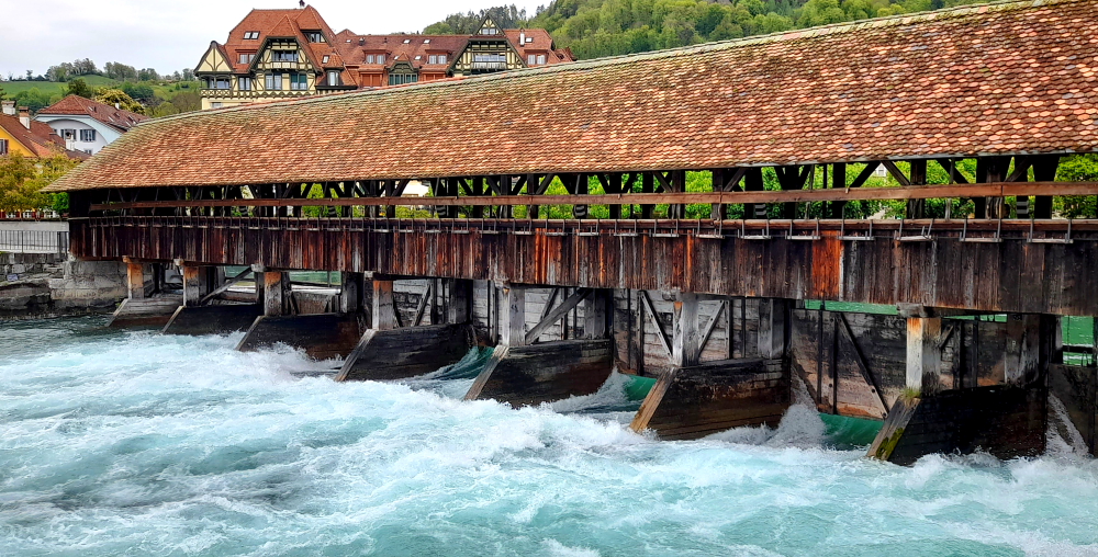
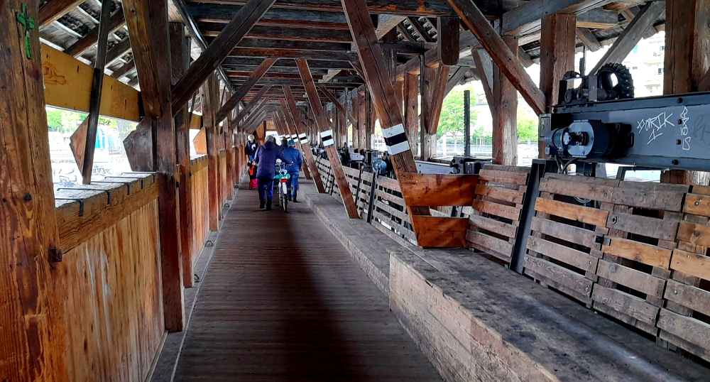
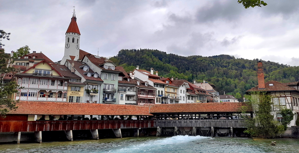
About 10 minutes later we alight at the penultimate stop called Balliz on the islet then cross the bridge (Bahnhofbrucke) and walk up Scherzligweg to the Obere Schleuse wooden bridge/upper lock.

Rhomberg Schmuck AG on the islet in the Aare River.

In front of us is another delightful wooden, covered bridge that we associate with Switzerland.

Scherzligschleuse wooden bridge/upper lock.

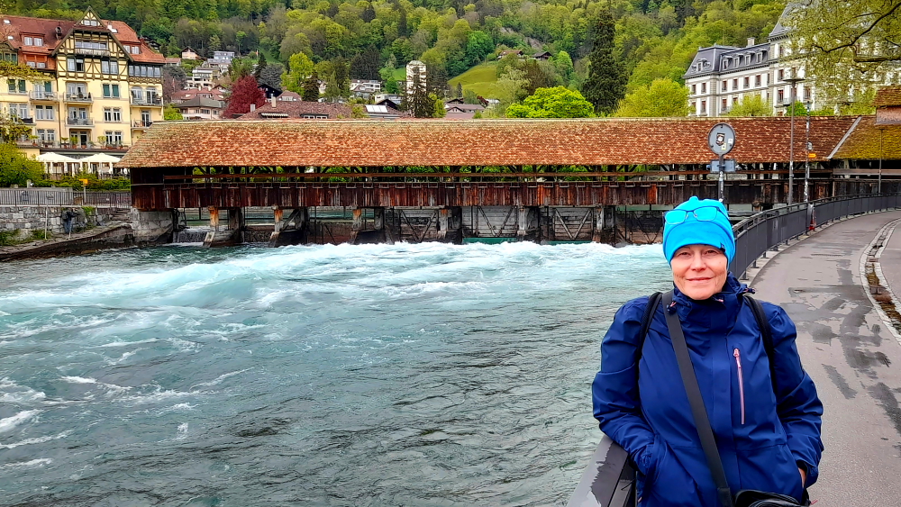
The Scherzligschleuse is the upper lock in Thun. It was built in 1726 in place of the cross dam from 1720 at the junction of the Inner Aare with the city moat and rebuilt in 1818. The lock serves to regulate the Outer Aare.

Scherzligschleuse, Thun.

It was not until 1714 that an island emerged from the Bällizquartier through the discharge of the Kander into Lake Thun.

Wooden interior of bridge with lock mechanisms.

As a result, the city moat became the second arm of the Aare, called the “Outer Aare”. After a complete renovation in 1978, only the superstructure remains.

Inner Aare with view down the lake from the Göttibachsteg bridge.

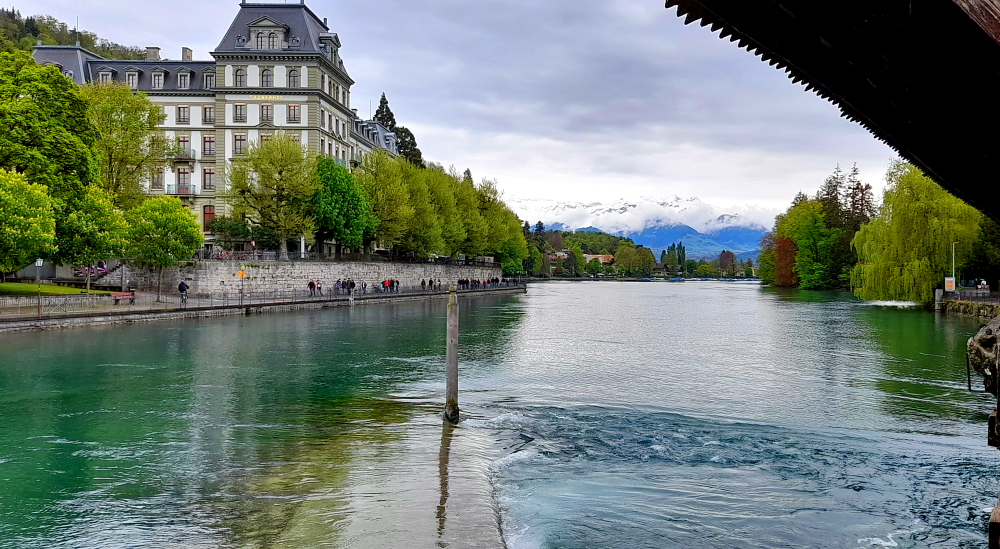
The upper and lower locks serve as a control mechanism, power generation and flood protection.

Stadtkirche, Thun.

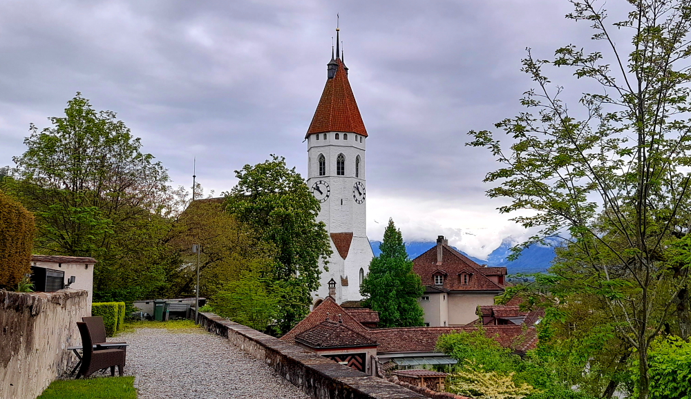
From here we cross the 2nd bridge this time over the Inner Aare to the Aare Quay where we pick up the ‘red route’ on the tourist map and make our way to the City Church (Stadkirche) via the Risgassli staircase and through the Castle Gate.

Interior of City Church.

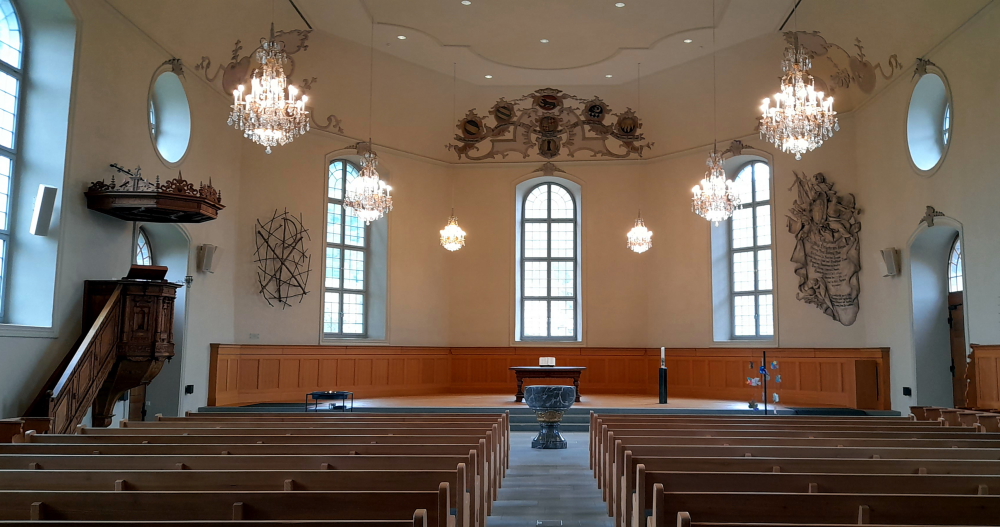
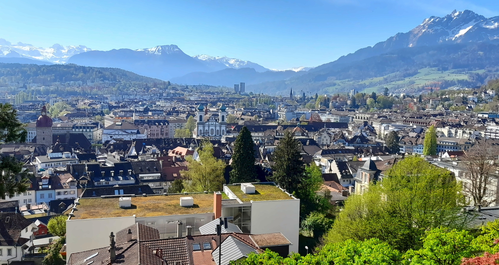
The Church’s exterior is quite plain with a clock face on its tower. Inside, it is even plainer. But the Church’s square provides a panoramic view over the town and lake.

View of Thun & Thunersee from the Stadtkirche.

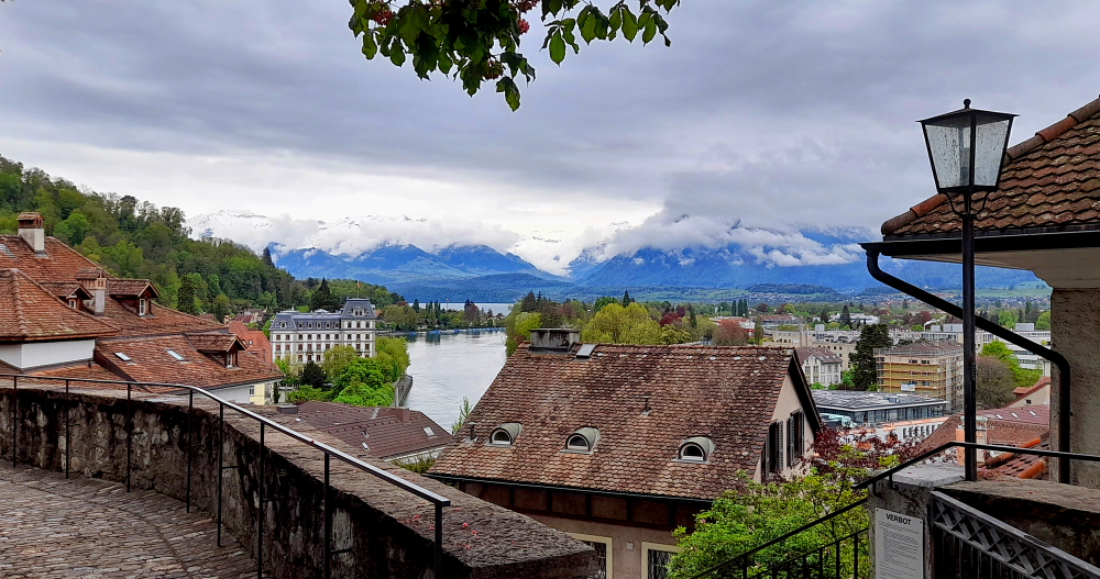
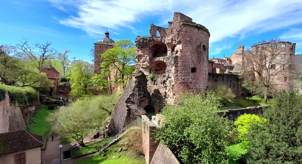
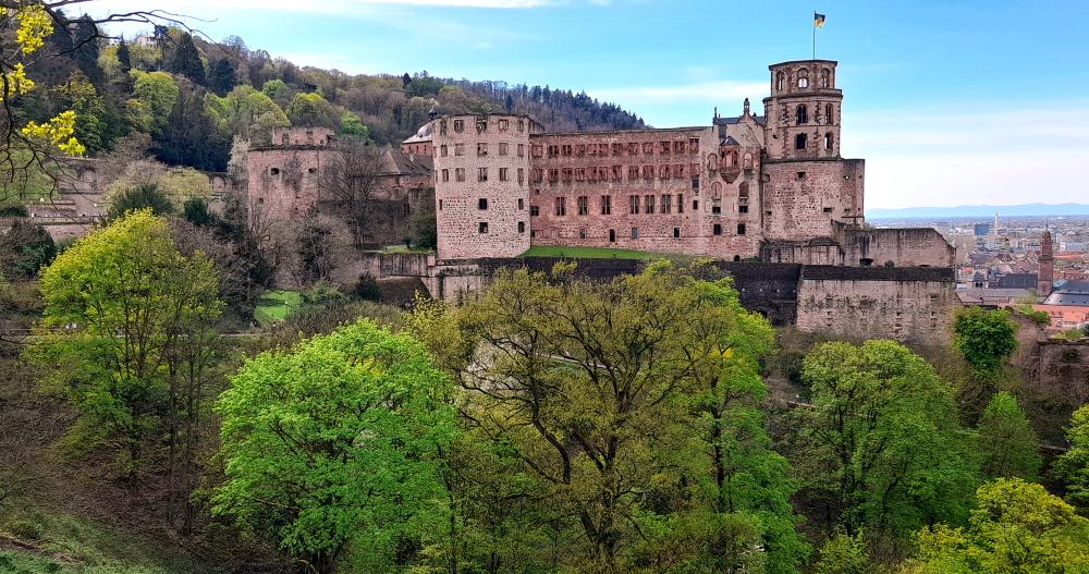
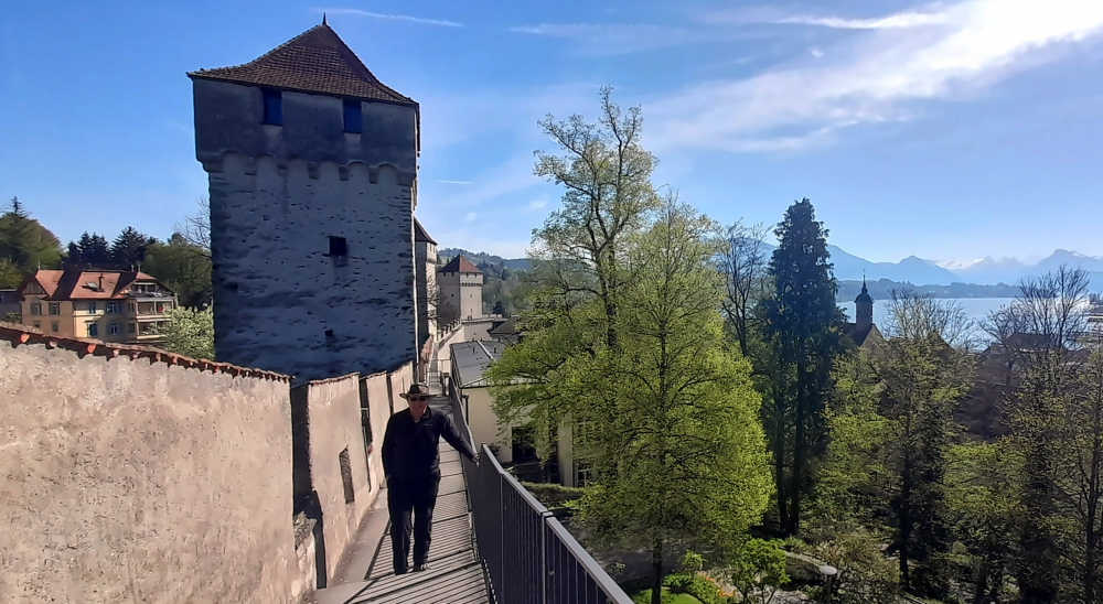
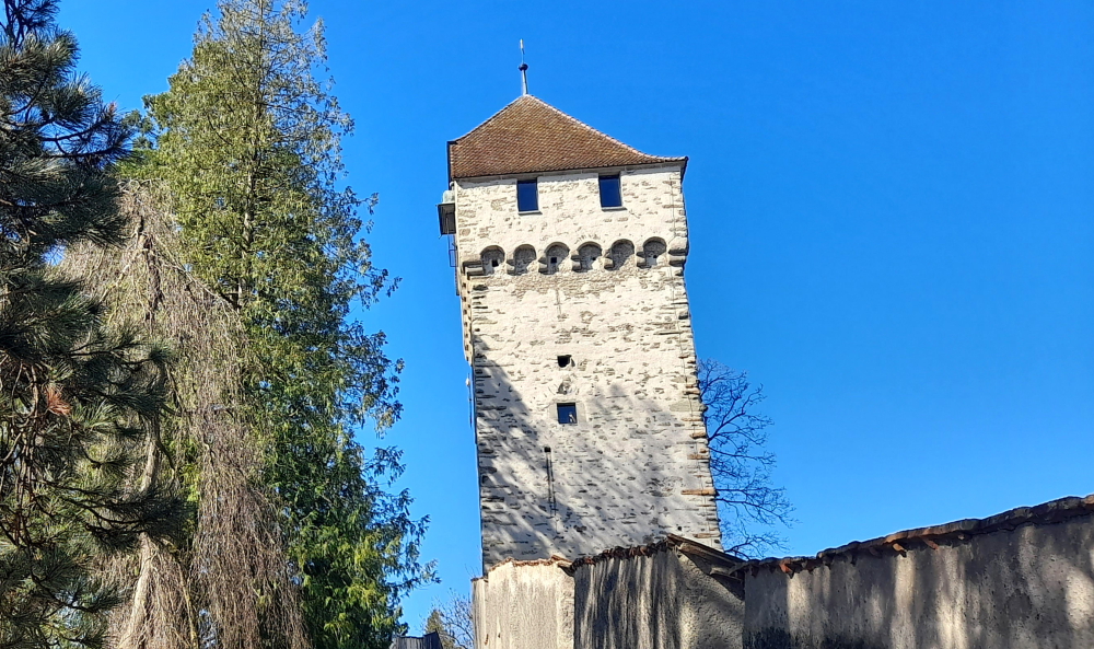
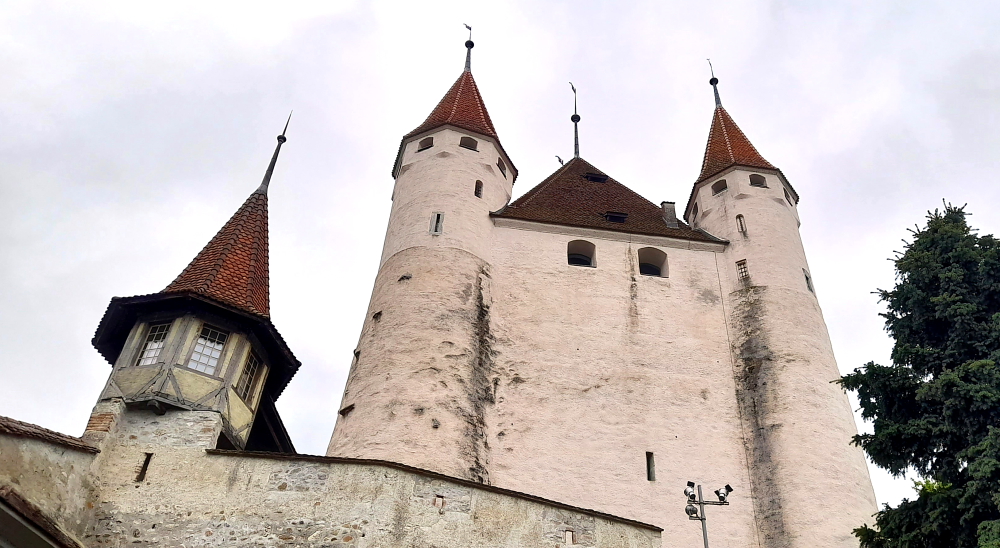
Continuing onto Schlossberg we arrive at Schloss Tun, a picturesque, hilltop donjon built around 1200 by the Dukes of Zährigen.

The present day castle with its adjoining buildings was originally a fortress. There was a stately home with a residential building and a curtain wall already in the 12th century. The Dukes of Zähringen did not intend to live here as they had a residence built in Burgdorf. Yet, it is with this imposing tower that they could leave a sign of their power over the region and the local trading paths.

Old wooden guard towers.

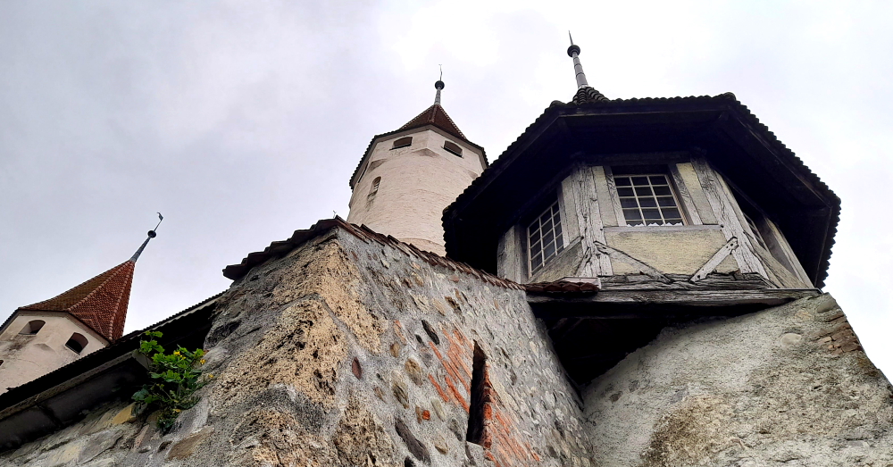
The donjon is unsuitable as a permanent residence as it is actually a single 14-metre high room, which is now called the Grand Hall. In its time an imposing place of representation, today one of the best-preserved representation halls of the Middle Ages.

Since the 12th century, Thun Castle with its adjoining buildings was the domicile of Thun nobility and was always reconstructed to suit their use. No building changes were taken during the time of the Dukes of Kyburg, yet there were many changes under the long reign of Berne up to 2006. Since the 17th century, there had also been a prison under the roof of the donjon. In 1886 the Canton of Berne erected the new regional prison on the castle wall.

In 2010, after 800 years of public possession, the city of Thun sold the property of the former castle area with the exception of the donjon leasehold. Midyear 2014 a conference and training centre were opened including a boutique hotel and a restaurant [schlossthun.ch].

View of the Schloss from outside its wall.

We walk downthill along Untere Hauptgasse until we come to Rathausplatz.

View of Rathausplatz from Untere Haptgasse.

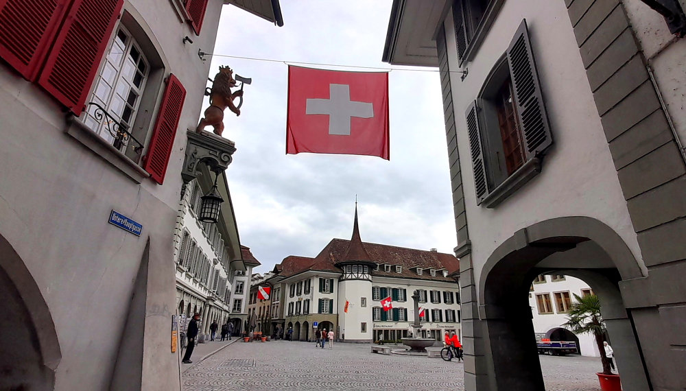
This square stands at the heart of the old town. Enclosed by many historic buildings, the square provides the setting for festivities and events and Saturday morning produce markets.

Rathausplatz where Saturday morning food markets are held.

From here, the square also commands views of Thun Castle.

View of Thun Castle from Rathausplatz.

The town hall (Rathaus) was built around 1500.

Town Hall (Rathaus) on left.

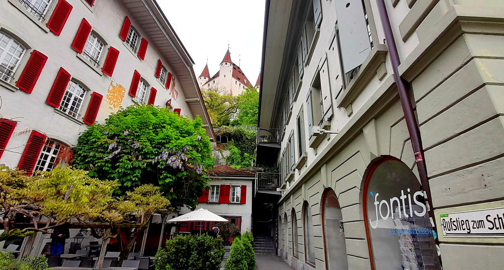
Walking along Rathausquai we cross the Kuhbrücke and walk down Balliz. The River Aare flows past on both sides of central Thun, forming a genuine “shopping island”. Known as “Balliz”, this shopping street has practically everything from well-known fashion outlets to more traditional stores and popular weekly markets on Wednesdays and Saturdays.

View of the Castle from Mühlebrüggli bridge.

Turning left onto Muhlegassli we come to the river bank of the Inner Aare and a viewpoint.

Souvenir of Thun.

From the Mühlebrüggli bridge is also a view of the 2nd covered, wooden bridge across the Aare – the Lower Lock Bridge and Mill Lock (Untere Schleuse Brücke und Mühleschleuse).

View of Lower Lock Bridge and Mill Lock from Mühlebrüggli bridge.

Crossing over the Mühlebrüggli bridge we walk through Muhleplatz, known locally as “Muli”, a lively square of local restaurants, cafes and bars.

Obere Hauptgasse is in the next block. This street is known for its distinctive shops and boutiques and characterised by unique raised pavements lined with shops above shops at street level. This architectural feature that makes this part of the old town an interesting experience.

Raised pavements of Obere Hauptgasse.

At the end of Obere Hauptgasse we turn right then right again onto Aarequai and stop for a coffee seated on the pavement. Here we strike up a conversation with a fellow patron – a Swiss woman who had lived for 30 years in the USA, now lives in Bern and has a daughter and son-in-law who live in Port Hedland, Western Australia. She’s even been to Brisbane!

View of coffee shop with red & white striped awning (C) on Aarequai.

Crossing back over the Inner Aare through the wooden Untere Schleuse Brücke we visit a Co-op supermarket to purchase supplies for dinner tonight then catch the 12:50 pm No. 21 bus from the Freienhof bus stop back to our Hilterfingen Kirche stop where we arrive at 1:00 pm.

Sitting on our terrace in the sun we have a bite to eat then update the blog. Around 3:00 pm the lake is hit by waves of passing showers.

Tomorrow we are moving on to Bern, but it is only a 30-minute drive from here. Check-out from here is at 11:00 am and check-in not until 3:00 pm in Bern. To fill in time, we’ll probably drive to Interlaken along the northern shore of Lake Thun then up to Grindelwald and back. Taking the southern shore of Lake Thun we should arrive in Bern around 3 hours later.

4 May, 2024

A brilliant sunny day with not a cloud obscuring any of the mountain peaks across the lake. We end up leaving at 10:40 am in 11 Deg. C ‘heat’ and drive towards Interlaken which is only a 30-minute drive away.

Not a cloud obscuring the peaks.

Upon arrival near the Schloss we are inundated with colourful, swirling forms above us – about 10 paragliders are zooming off the hill above and are circling above the town, to land a short distance way.

Schloss Chapel.

Castle Park and the former Augustinian double monastery are located here. The former monastery was first mentioned in a document in 1133. After the Reformation around 1525, the entire monastery property passed to the state of Bern and was converted into a hospital. The church tower dates back to the early 14th century and its chapel from 1452. It also has a Gothic cloister and courtyard. In 1748, today’s castle was built on the site of the former monastery as the seat of the Bernese bailiff. Today it is the seat of the Interlaken-Oberhasli governor’s office and has been completely renovated since 2009 [interlaken.ch].

Interlaken Schloss

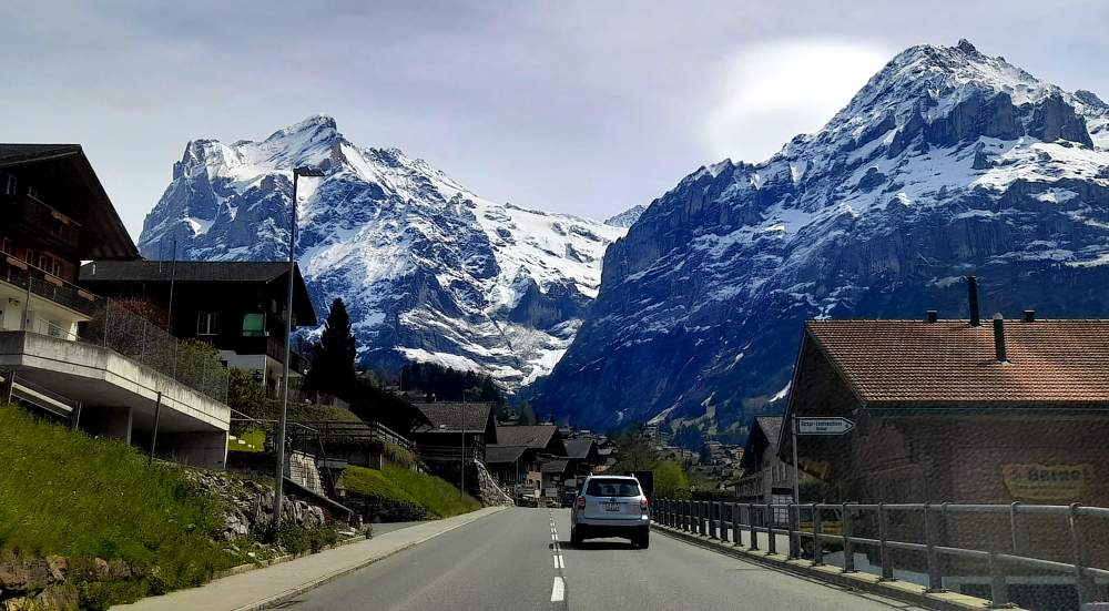
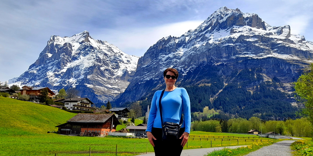
At 11:30 am we drive towards Grindelwald, 25 minutes away.

Road to Grindelwald with view of Jungfrau.

The Jungfrau at 4,158 meters (13,642 ft) is one of the main summits of the Bernese Alps, located between the northern canton of Bern and the southern canton of Valais, halfway between Interlaken and Fiesch. Together with the Eiger and Mönch, the Jungfrau forms a massive wall of mountains overlooking the Bernese Oberland and the Swiss Plateau, one of the most distinctive sights of the Swiss Alps.

Vertical rock lift alongside the 221.

The summit was first reached on August 3, 1811, by the Meyer brothers of Aarau and two chamois hunters from Valais. The ascent followed a long expedition over the glaciers and high passes of the Bernese Alps. It was not until 1865 that a more direct route on the northern side was opened.

Driving into Grindelwald.

The construction of the Jungfrau Railway in the early 20th century, which connects Kleine Scheidegg to the Jungfraujoch, the saddle between the Mönch and the Jungfrau, made the area one of the most-visited places in the Alps. Along with the Aletsch Glacier to the south, the Jungfrau is part of the Jungfrau-Aletsch area, which was declared a World Heritage Site in 2001.

Glacier Canyon (Gletscherschlucht)

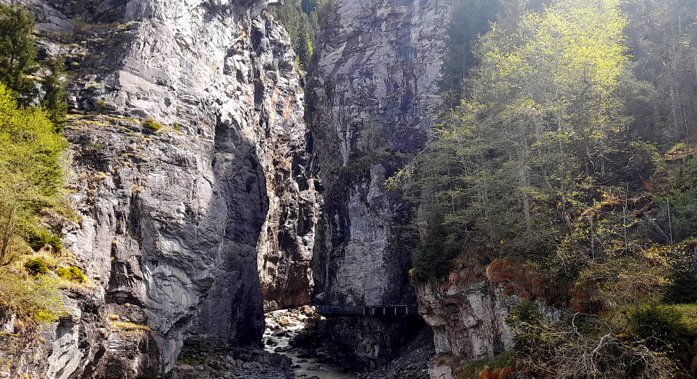
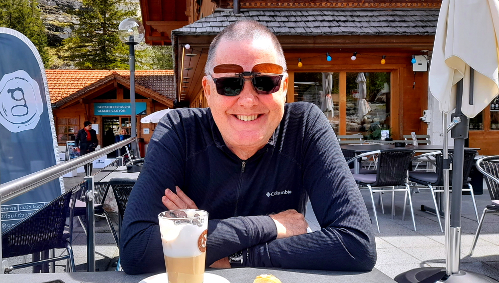
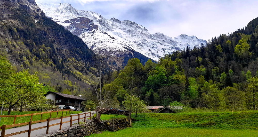
We drive through the small town of Grindelwald, passing the train and the cable car that goes to Jungfraujoch, to where the road ends at Glacier Canyon at the base of the mountains guarded by a hotel, cafe and paid entrance to the canyon.

Soaking up the sun on the cafe’s terrace.

After basking in the 17 degrees sunshine with a coffee, we drive back to the Y junction at Gundlischwand and turn left onto the 222 which goes through Lauterbrunnen to Stechelberg at the end of the valley.

Peaks behind Grindelwald.

Lauterbrunnen turns out to be a very busy town with lots of hotels, restaurants, cafes and teeming with tourists.

Staubbachfall at Lauterbrunnen.

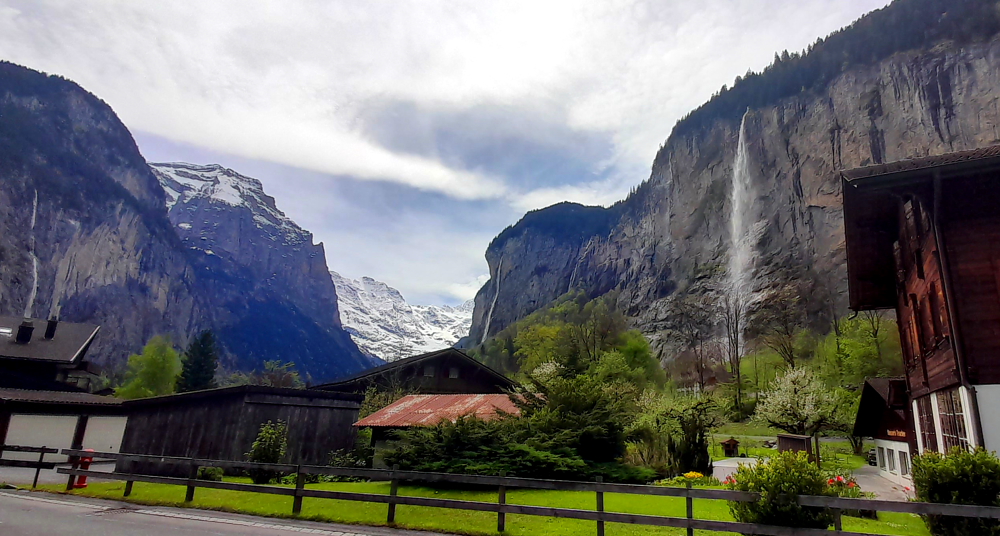
The main attraction is Staubbachfall which cascades dramatically from an escarpment above the town and can be viewed from most places around town.

Murrenbachfall near Stchelberg.

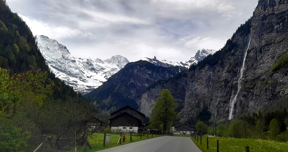
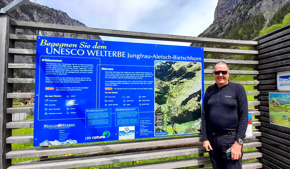
Stechelberg is a small village in Switzerland located at the base of the Schwarzmönch mountain in the Bernese Alps.

Schwarzmonch mountain behind Stechelberg village.

A pretty, tranquil village, Stechelberg is the starting point for 9 themed trails in the adjoining UNESCO World Heritage nature reserve. Tranquil until we suddenly hear a series of loud bangs reverberating around the valley, compliments of the nearby quarry.

UNESCO World Heritage area at Stechelberg.

It’s 1:30 pm so time to head off to Bern where we arrive at the aparthotel near the Wankdorf (true!) train station around 2:45 pm.

Next stop, Bern.

Fortunately there is an intercom at the front door and an onsite concierge which negates the dreaded self-checkin process. We meet him at the apartment on the 5th floor and he takes us through the apartment’s features, most of which is tech-based.

A remote control for both sets of curtains and lights, including mood lighting. Another for the TV which is a picture on the door of the cupboard that opens to reveal the kitchen sink, stove top and microwave above a small fridge, crockery cupboard and cutlery drawer. Another to raise and lower the height of the kitchen table cum desk. Yet another for the Japanese-style toilet which doubles as a bidet, but the toilet lid is activated by a motion sensor which means the toilet lid comically and annoyingly keeps opening and shutting itself any time you venture anywhere near the bathroom door!

Unfortunately, when the tech fails to work you’re a bit stuck. Turns out the sheer curtains sensor is broken so we can’t shut those; the integrated boiling water to the kitchen tap in lieu of a kettle is also broken (need to microwave cups of water for tea); the remote terminal to pay our city tax by card also fails; the digital thermostat on the central heating also doesn’t work so I have to turn it off manually before we roast and finally, the WiFi hot spot at the underground garage has disappeared so after 2 sprints up the ramp to the front door intercom by Lynn, the concierge opens the door remotely for us. He promises us that people will be here tomorrow to fix these things.

As it’s Saturday the supermarket will close at 5:00 pm so we deliver our luggage to the apartment (thank goodness the lift works!) and quickly walk out the door for a 12-minute walk over the railway tracks and through a residential area to the local Migros supermarket, purchasing meals for tonight and tomorrow night as everything will be closed on Sunday.

Unpacked, Lynn says: “So where’s the washing machine and dryer that are listed in the room description?” Apparently at the end of Floors 3 & 4 in a cupboard and as they are right outside the doors of the 2 end apartments can only be used between 8:00 am and 10:00 pm.

One load washed and in the dryer and another loaded in the washing machine, both machines indicate that they won’t be finished until 10:15 pm. Oops! I return to the machines at 9:55 pm to find that the drying has finished and the washing hasn’t but the machine has turned off and I can’t unlock the door. That load of washing ends up being held hostage overnight.

Bed, finally, but not before a farcical performance, witnessed by an amused wife, as I try repeatedly to close the drapes and turn off the lights using the remote which is embarrassing as I consider myself tech savvy. You can imagine – drapes closed, lights still on. Mood lighting on as drapes open. Drapes close then reopen, ad nauseam. The Wife takes control of the control and within a couple of attempts the drapes are closed and it’s lights out.

5 April, 2024

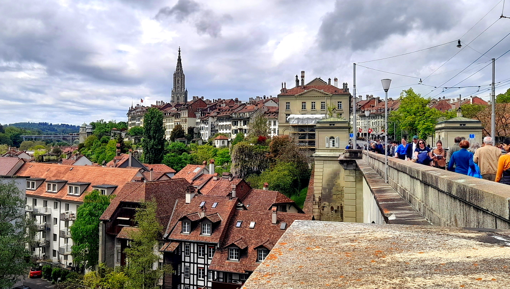
Today we’ll do our own walking tour through the UNESCO site of the Old Town of Bern. Bern has been the capital city, or officially known as the “federal city” of Switzerland since 28 November 1848 when the National Council and the Council of States elected Bern as the federal seat of Switzerland.

Although it’s overcast it’s warm as we walk 5 minutes to the Markuskirche bus stop to catch the No. 20 bus which terminates at the Bern train station. Again, we have fee bus tickets thanks to the bernwelcome app which the concierge activated for us when we checked in.

Bang on 11:26 am the bus arrives and whisks us into town arriving at the station 8 minutes later. Today Lynn has a list of places to see in the Old Town of Bern, the first of which is the Prison Tower at the end of Spitalgasse where it joins Marktgasse.

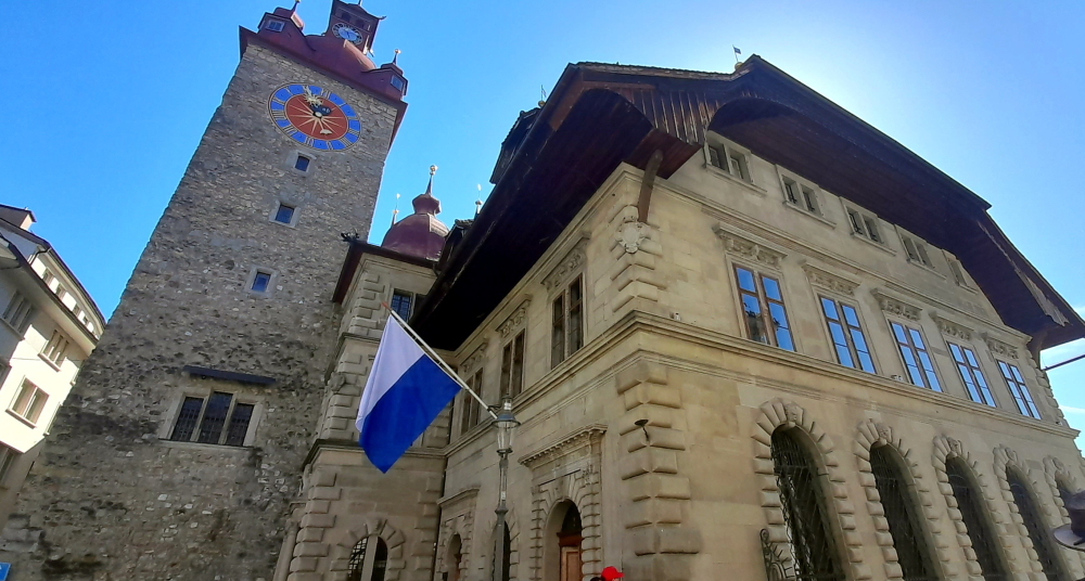
Built in 1256 it was initially a defence tower and Bern’s city gate, but when the city expanded in the 14th century, its use changed. After the devastating fire in 1405, Käfigturm took over the functions of the destroyed Zytglogge (Clock Tower) and, from then on, served as a prison. In the rooms of the tower, suspects were interrogated and locked up [bern.com].

Prison Tower (Kafigturm) on Spitalgasse, Bern.

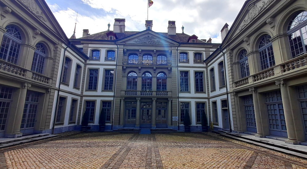
Turning right at the tower we walk into the Bundesplatz and see its impressive Parliament Building, also referred to as the Federal Palace. Built between 1894 and 1902 according to plans by architect Hans Wilhelm Auer and officially inaugurated by the United Federal Assembly on 1 April 1902. The Parliament Building stands between the Federal Palace’s West Wing (built 1852–1857) and East Wing (built 1888–1892).

Federal Palace in Bundesplatz.

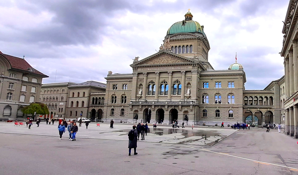
95% of the materials used were sourced from within Switzerland, symbolically to illustrate the cultural and material diversity of the country and of its people. Inside the building is beautifully decorated with stained glass, murals and statues [parliament.ch].

View of the Aare River from the terrace behind the Parliament Building.

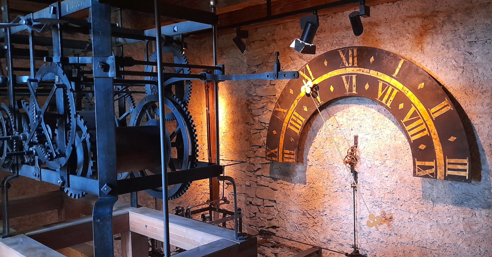
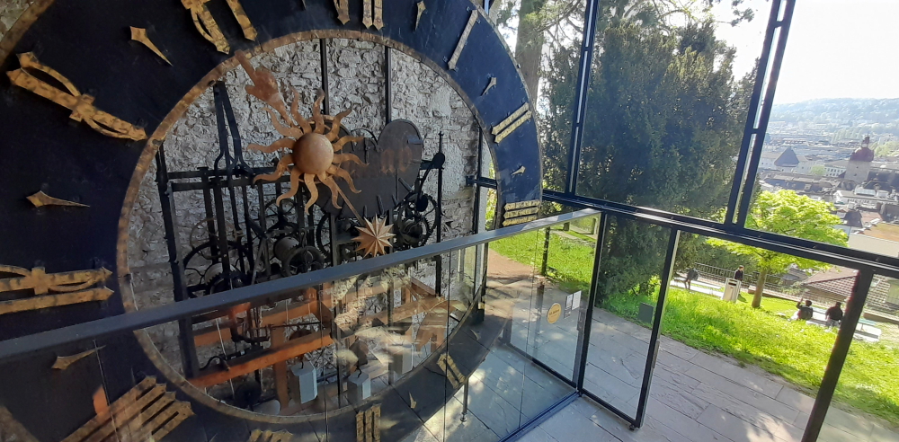
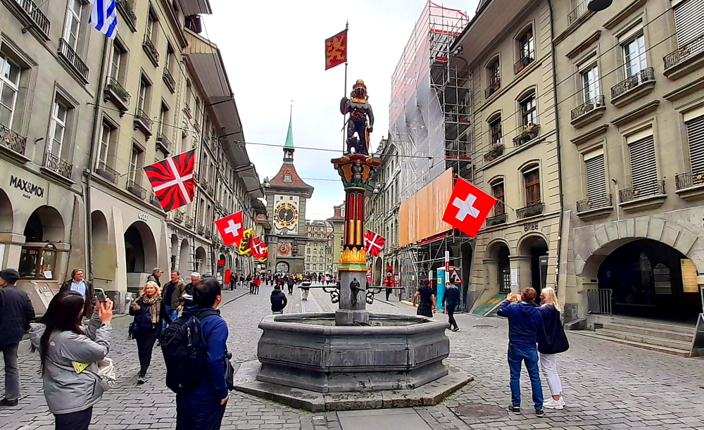
Walking along the terrace we rejoin Marktgasse at the Zytglogge – the Clock Tower. First, a fortified guard tower, then a prison, a lookout and fire observation tower, and finally a clock tower. As Bern continued to grow and expand its city limits, the former guard tower gradually found itself closer and closer to the city center. After the devastating fire of 1405, the structure was rebuilt and given a new identity now known as the Zytglogge (Clock Tower).

The tower was also an authoritative building for other matters in the capital city – official travel times were measured from the Clock Tower and marked on stones along the cantonal roads; ancient length measurements of cubit and fathom (still marked today in the tower entrance as meter and double meter) served as the reference length and for official checks.

The Clock Tower (Zytglogge), Bern.

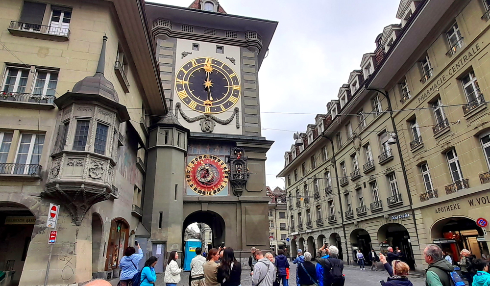
The tower’s outstanding features are the astrolabium – an astronomical calendar clock – and the musical mechanism installed in 1530. Right before the clock strikes the hour a crowing rooster announces the start of an entertaining spectacle. Bears dance their hourly routine, a jester jokingly signals the hour too early, the quarter-hour chimes are heard, and Chronos, the god of time, turns his hourglass over. The golden figure of Hans von Thann finally strikes the hour in time with Chronos’ swinging scepter [www.bern.com].

All of this we witness at 12 noon.

Early street art adorning a building opposite the Clock Tower.

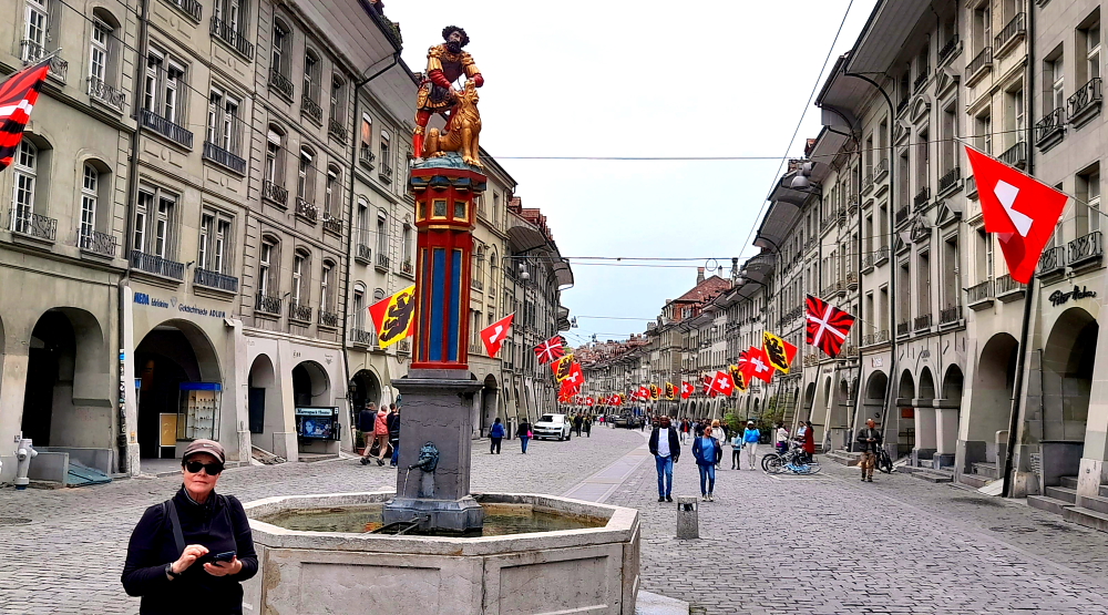
The street from here is Kramgasse which is beflagged, cobble-stoned, bordered by 3-storied buildings on either side with porticoes on the ground floor and has several of the ubiquitous, highly-decorated fountains along it. A notable one, the “Child Eating Fountain” is around the corner.

Kramgasse.

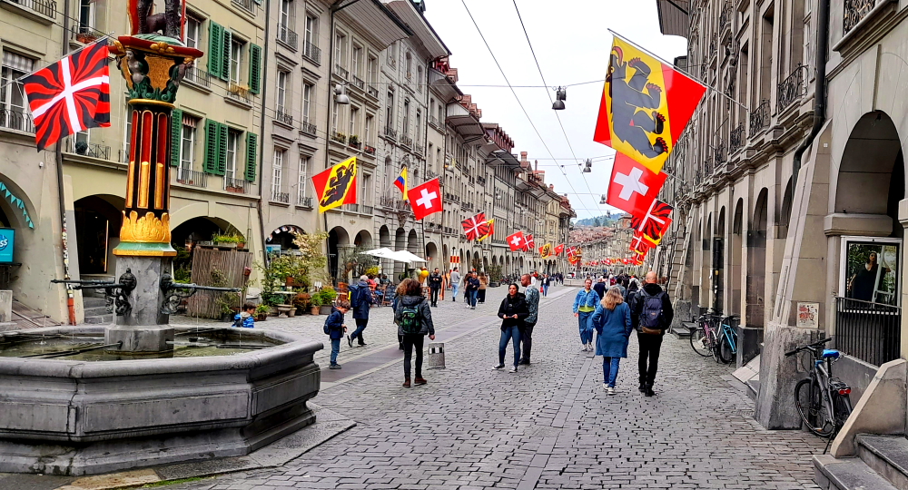
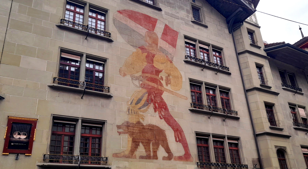
One of these fountains on Kramgasse, the Warrior Bear fountain, is a tribute to the founding family of Bern (the House of Zähringen). The bear is dressed in a knight’s chain mail, helmet and is holding a flag.

One of many highly decorated fountains in Bern Old Town.

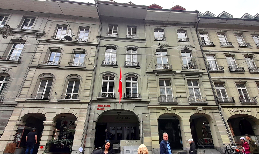
Also on this street is the house where Albert Einstein lived and wrote his fundamental treatise on the theory of relativity during 1903-1905.

Einstein Haus, 2nd Floor, Kramgasse 49.

The Samson Fountain recounts a scene from the Book of Judges in which Samson kills a lion [daydreamtourist.com].

The Samson about to slit the throat of a lion Fountain.

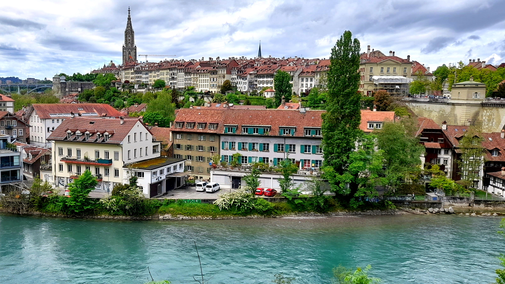
Cutting through Munstergasschen, a narrow passageway accessed from the portico, we arrive at Munsterplatz and the Bern Cathedral. The Bern Münster Cathedral of St. Vincent is the most impressive late-Gothic building in the city and the largest and most important late medieval church in Switzerland. From this highest church tower in Switzerland can be admired the magnificent view over the city and of the snow-covered mountains of the Bernese Oberland.

Bern Minister & Steeple.

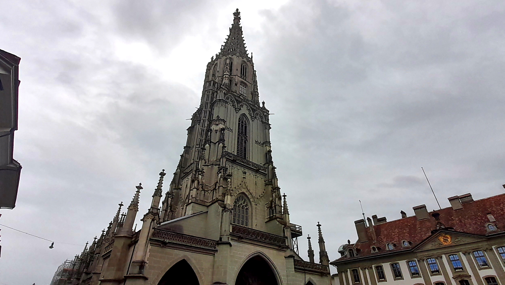
Construction started in 1421 with builders working on this masterpiece over successive generations. The steeple was only completed in 1893. An outstanding feature is the main portal, a depiction of the Last Judgment – the only image that was spared destruction during the Reformation [myswitzerland.com].

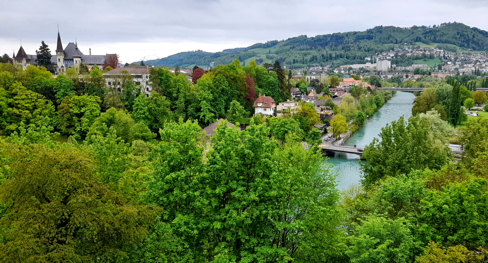
At the far side of the cathedral is the Munsterplattform, a formal garden, which overlooks the Aare and the gardens of the town mansions that also face the Aare.

Junkerngasse 47, City Council & Mayor’s Offices.

One such house is Junkerngasse 47. Commissioned by Avoyer Hieronymus von Erlach at the age of 78, it wasn’t until after his death in 1748 that the house was completed by his son. Exceptional permission was needed for its construction. The garden/residential wing’s main salons overlook an imposing garden terrace and the Aare. In 1821 the house passed to the City of Bern and today houses the city council and mayor’s offices. During 1721-46 von Erlach was mayor of Bern.

View downstream of the Nydeggkirche & Aare River from the Nydeggbrucke.

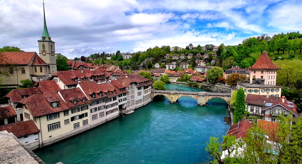
Junkerngasse becomes Nydeggstalden which crosses the Aare at the Nydeggbrucke (bridge).

View back to the Old Town & Minster spire from the Nydeggbrucke.

Which brings us to, on the other side, the Barengraben – the Bear Pit. The “Mutzen” – Bjork, Finn, Ursina and Berna – live exclusively in the park on the slopes of the Aare, with a view of Bern’s UNESCO-listed old town. The approximately 5,000 square metre area extends from the former bear pit down to the banks of the Aare accessed via stairs.

View of the Old Town from the Bear Pit.

The relationship between the city of Bern and its heraldic animal has a very long tradition. It is said to have been a bear that the founder of the city, Duke Berchtold V of Zähringen, was the first animal to kill here and to which, according to legend, the new city owes its name.

The Bernese chronicler Valerius Anshelm reported in 1513 how the Bernese returned victorious from the Battle of Novara with the conquered flags and a live bear as spoils of war in their triumphal procession. The bear was kept in the city moat in front of the cage tower. The first bear pit remained on what is still called Bärenplatz today until it was moved due to traffic to the city gates in 1764. From there the bears were moved again in 1857 to the lower end of the old town, to the location where the Bear Park is still located today [tierpark–bern-ch.].

2 sleepying inmates of the Barengraben.

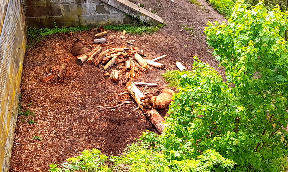
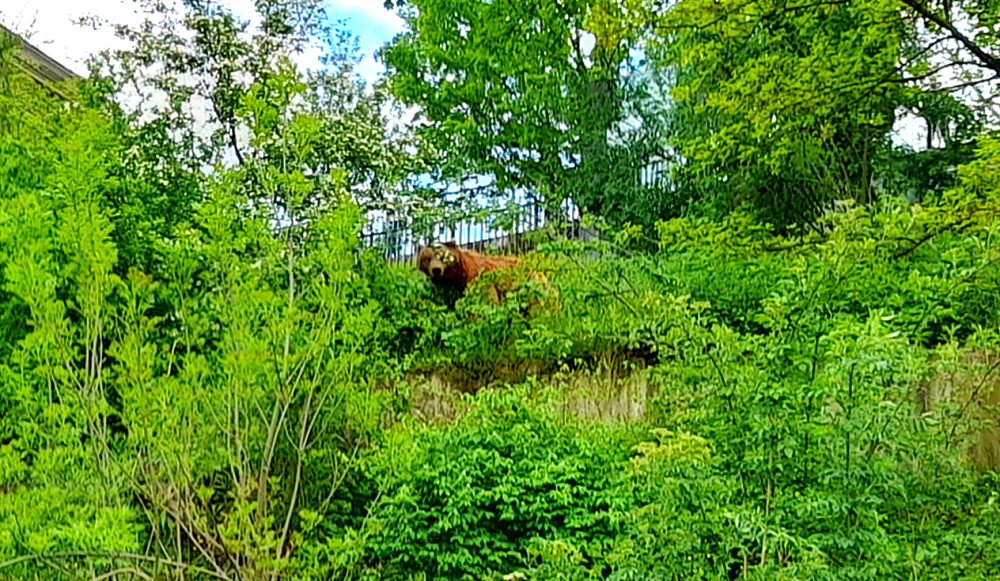
At first we see 2 brown bears asleep by some logs then after we walk down the stairs, another bear that was down there has scarpered back up the slope so we only get to see it fleetingly amongst the foliage, except for when it turns its back and we get a full view as the bear moons the crowds below.

“There’s a bear in there”.

The path from the lower level of the Bear Pit takes us under the high Nydeggbrucke around to the older, lower, Untertorbrucke, where we cross back to the other side to walk along the river path to the bridge.

RIver path with view of the high Kornhausbrucke.

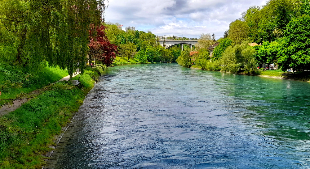
Fortunately, besides Kornhaubrucke, there is also a low-level pedestrian bridge beneath it. Looking up river we see a bevy of bikini-clad women immersing themselves in this glacial river. Not swimming, mind, just squatting in the water at the river’s edge.

Even strolling on this bridge makes it undulate.

The reason we are here is to walk the short distance to the Botanical Gardens. After a leisurely choc shake at the cafe, sitting in the 24 degrees sunshine, Lynn makes a beeline for No. 1 on the map, the Alpine garden towards the top of the hill.

The Alpine Garden, Bern Botanic Gardens.

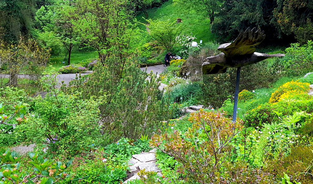
Specifically, No. 1d, the Swiss Alps, only to find that, disappointingly, there is not one, single, eidelweisse in sight!

Turning right at the exit from the Gardens places us on Nordring and up the road to the Gewerbeschule bus stop where 2 minutes later we catch the No. 20 back home.

A relaxing afternoon and dinner in followed by our continued viewing of the TV series “The Marvelous Mrs Maisel”, about a Jewish female stand-up comic in late 1950’s USA, which is interrupted from time to time by flashes of lightning and lightning bolts out the window.

Again, at bedtime, I do my repeat performance with the remote. Again, 2 seconds later, the wife has it sorted!

6 May, 2024

Rain and 13 Deg. C today, perfect for catching up the past 2 days of blog, when we are interrupted by the doorbell and the arrival of 2x hot water plumbers to fix the boiling water mechanism on the kitchen tap. Tick. Still waiting for the guy to fix the remote for the sheer curtains, though.

5:00 pm finds us waiting outside the front door of Il Profeta Italian restaurant that is 2 blocks away. The restaurant is open early and the food is pretty good however it is still at Swiss prices.

Tomorrow we depart Switzerland and head back in to France. We are staying in Nancy, France for 5 days to relax at the Mecure near the old town centre. Neither of us has been to Nancy so we have no idea what to expect.

Heidelberg to Tortona via Switzerland.

5 April, 2024

After a quiet morning we walk a few steps to the bus stop and get the 1:00 pm No. 33 bus that goes right to the Rathaus stop in the Old Town where we need to get off.

Lynn tells me that she last visited Heidelberg in June 1985. What she remembers is: the Old Bridge with its ‘salt and pepper’ towers; discovering that footpaths in town are divided into a pedestrian lane and bicycle lane and make sure you don’t walk in the wrong one (DING-DING!), and attempting to watch an episode of ‘Bonanza’ on TV that was dubbed in German with Lorne Greene’s gracious and melodious voice replaced with a harsh, guttural one, more akin to Hoss’s!

Kornmarkt with Heidelberg Castle on the hill.

We are booked on a 2:00 pm GuruWalk and need to meet in front of the Rathaus in Marktplaz. As we arrive 30 minutes early we go for a quick wander. Yesterday, we arrived in rain and 13 Deg. C. Today it’s due to be 26 and tomorrow 27!

Rathaus in Marktplaz.

By the time 2:00 pm arrives, it has clouded over and a cold breeze has arrived. Unlike our guide – “look for a guy with a moustache” – but we find the rest of our party: Catherine, French but lives in Germany and Johanne and her husband from Canada who now live in Israel.

Steingasse off Markplatz leading to the Old Bridge (Alte Brucke) over the Neckar River.

We all thought we had been communicating with our guide, Henry, a Brit who has lived in Heidelberg for 12 years, but turns out our guide today is Viktor, from Siberia, who is undertaking his PhD in this university town of Heidelberg.

Our first stop is outside the Heiliggeistkirche on Marktplatz. founding year 1398. Ludwig III laid the foundation for the later famous Palatine Library, the Biblioteca Palatina, by having the first books placed in the galleries of this church. During the reign of Louis V (1508-1544), when the most important palace buildings were also being constructed, the tower continued to be built and completed.

In the course of the Reformation, the church changed several times between Lutheran and Reformed-Calvinist denominations. In 1563, the Heidelberg Catechism emerged as the Reformed confession. With the 30 Year War and the conquest of Heidelberg by Catholic troops, the city, and the church became Catholic for many years, and as spoils of war, Pope Gregory XV had the Biblioteca Palatina brought to Rome in 1623.

Marktplaz & the rear of the Church of the Holy Spirit (Heiliggeistkirche).

In the course of the Palatine-Orléans War of Succession, the church was severely damaged in 1693. Only the one tombstone of the Elector Ruprecht II, the founder of the church, is preserved. Of the once 5000 books and 3524 manuscripts, only 885 made it back to Heidelberg in 1816, all the rest remained in the Vatican.

In the following two centuries, both Catholics and Protestants laid claim to the church in equal measure, so that, separated by a dividing wall, Catholic mass was celebrated in the chancel and Protestant services in the nave. 1936 an agreement was reached with the Catholic Church whereby the church passed entirely into the possession of the Protestant Church in Baden [heidelberg-marketing.de].

The Jesuit Church

From the Marktplatz our next stop is the Jesuit Church (Jesuitenkirche). During the 16th century Heidelberg was the centre of a tug-of-war between Lutherans, Calvanists, Catholics and Protestants. The construction of the Jesuit Church began in 1712, and was built in several phases, the last one adding the tower from 1866 – 1872.

Inside the church.

The baroque furnishings are no longer preserved today but the altar painting by the Kaulbach student Andreas Müller has been. The Elector Frederick the Victorious is buried in a crypt in the northeast corner of the church.

University of Heidelberg building near the Jesuit Church.

To the east of the church is the entrance to the former Jesuit college. Originally, the facilities of the Jesuits comprised a grammar school (today the Philosophical Seminary) and the Carolinum seminar, which is now used by the university administration. The church is home to the Museum of Ecclesiastical Arts (Museum für sakrale Kunst und Liturgie) [heidelberg-marketing.de].

Vikor & the Jesuit College/garden next to the Jesuit Church.

From here we walk to Karlsplatz (Karls Square) where we are treated to an unobstructed view of Heidelberg Castle. Named after Grand Duke Karl Friedrich of Baden, the square extends over the area of the Franciscan monastery, which was demolished in 1803.

Not only home to the Heidelberg Academy of Sciences and the Palais Boisserée, the Square is also home to two of Heidelberg’s oldest and best-known student pubs and several fraternity houses. Generations of fraternity students have been guests at the “Zum Seppl” inn, built in 1634, and the “Zum Roten Ochsen,” built right next door in 1703 [heidelberg-marketing.de].

Karlplatz.

Walking towards the river we walk past the ‘salt and pepper’ pillars of the Old Bridge (which we return to after the tour) to Chocolaterie Knösel on Haspelgasse. Established in 1863, it soon became a popular meeting place among Heidelberg’s residents, male students and the young ladies attending Heidelberg’s finishing school whose governesses and chaperones were never far away.

Chocolaterie Knösel on Haspelgasse.

These secret longings did not go unnoticed by the chocolatier, Fridolin Knösel. One day he created a particularly delicious chocolate delight, which he impishly called the ‘Studentenkuss’. Given as a present, it was such an exquisite, gallant token of affection that not even the chaperones could object [heidelbergerstudentenkuss.de].

A short walk from here we arrive at Universitätsplatz where there is a plaque dedicated to Martin Luther. Heidelberg University played a leading part in Medieval Scholasticism, Renaissance humanism, the German Reformation, and in the subsequent conflict between Lutheranism and Calvinism during the 15th and 16th centuries.

Plaque commemorating Martin Luther’s Heidelberg Disputation, 1518.

In April 1518, a few months after proclaiming his 95 Theses, Martin Luther was received in Heidelberg, to defend them.

Tower at the University’s History Department.

He was invited to introduce his theology at the tri-annual meeting of his Augustinian Hermits order in Heidelberg. The Heidelberg Disputation took place on April 26, 1518, in the lecture hall of the liberal arts faculty at the University.

Zeit Fur Brot on Hauptstrasse – best cinnamon buns in town!

Walking up Hauptstrasse towards Marktplatz our final stop is in front of Hotel Ritter. The historic town house Zum Ritter Sankt Georg (Knight St. George) was built in the year 1592 by the cloth merchant Carolus (Charles) Belier and served as an inn already 300 years ago. It is one of the few buildings to survive the War of Succession not to mention numerous fires. Standing across from the Church of the Holy Spirit, it was built in the style of the late Renaissance. It is named after the sculpture at the top.

Hotel Ritter.

From here we head to the river and the iconic Alte Brucke.

View from the bridge towards the Old Town.

The Karl Theodor Bridge, commonly known as the Old Bridge (Alte Brücke), is an arch bridge in Heidelberg that crosses the Neckar river.

View of Heidelberg Castle from the bridge.

It connects the Old City with the eastern part of the Neuenheim district of the city on the opposite bank.

View towards the Neuenheim district on the opposite bank.

The current bridge, made of Neckar sandstone and the ninth built on the site, was erected 1786-1788 by Elector Charles Theodore, and is one of the best-known landmarks and tourist destinations in Heidelberg.

Neckar River view upstream towards weir.

A medieval bridge gate is on the side of the old town, and was originally part of the town wall. Baroque tower helmets were added as part of the erection of the stone bridge in 1788.

View downstream towards the Theodor-Heuss-Brucke.

By this time we are absolutely famished so we make a beeline for Zeit Fur Brot on Hauptstrasse for a cinnamon bun each.

Cinnamon buns – one with walnuts, the other with apples.

Then catch the No. 33 bus back to the Aparthotel.

6 April, 2024

Another 27 Deg. C. day today so around 10:30 am we catch the No. 22 tram that terminates at Bismarkplatz where we swing by a Deutsche Bank ATM before promenading along the Hauptstrasse to the Old Town.

Exotic tulips near Bismarkplatz.

Lynn has a hair appointment at noon and as it’s 11:30 am we stop for some excellent ‘kaffee und kuchen’ at La Fee cafe, near Marktplaz. It’s a nice haven from the busy cafes and heaving Hauptstrasse just one block over.

La Fee cafe on Untere Strasse.

During the 30 minutes that Lynn is under the scissors, I wander over to Station Kornmarkt to find out how to procure tickets for the funicular to Heidelberg Castle.

Kornmarkt-Madonna.

The beauty of buying the funicular tickets is that it’s for the return trip, it includes access to 2 museums within the castle and I can buy it from an English-speaking ticket machine with a credit card and without having to wait in a queue. Result!

Funicular car arriving at Station Kornmarkt.

As soon as Lynn arrives we walk through the barriers and within a couple of minutes a car arrives. The Heidelberger Bergbahn funicular railway runs from Kornmakt to the summit of the Königstuhl via the castle. We get off at the Castle stop.

View of the Old Town from the Castle’s western wall.

Needless to say the Castle and its grounds are busy and by the time we leave some 3 hours later it’s absolutely heaving.

View of the Neckar River & the Old Bridge (Alte Brucke).

Towards the entrance to the Castle is the Elizabeth Tower (Elisabethentor). Built in 1615 by the French engineer and garden architect Salomon de Caus in the style of a Roman triumphal arch, and renovated in 1951.

Elisabethentor.

Built in only 1 night by Kurfurst Friedrich V (1610-19) for his spouse Elisabeth Stuart as a birthday present, originally integrated in the ornamental garden on the raised bulwark, the “Stuckgarten”.

Castle inner courtyard.

The castle is a mix of styles from Gothic to Renaissance. Prince Elector Ruprecht III (1398–1410) erected the first building in the inner courtyard as a royal residence.

View from the Castle Balcony.

In the 16th and 17th centuries, the Prince Electors added two palace buildings and turned the fortress into a castle.

View towards the weir on the Neckar River.

The two dominant buildings at the eastern and northern side of the courtyard were erected during the rule of Ottheinrich (1556–1559) and Friedrich IV (1583–1610). Under Friedrich V (1613–1619), the main building of the west side was erected, the so-called “English Building”.

Prince-Elector Friedrich V had the Hortus Palatinus, a representative palace garden, installed between 1616 and 1619. Grottoes, ornate beds, intimate garden alcoves, and “magical machines” were planned across staggered terraces, for the pleasure of courtly society. However, today, it is uncertain how many of the plans were implemented. In the western area of the palace grounds, old fortifications gave way to the garden. The Artillery Garden was built here as a walled-in, private pleasure garden for Electress Elizabeth.

Gesprenger Turm blown up during the Palatinate War of Succession in 1693.

The castle and its garden were destroyed several times during the Thirty Years’ War and the Palatine War of Succession. As Prince Elector Karl Theodor tried to restore the castle, lightning struck in 1764, and ended all attempts at rebuilding.

View of the castle from the Scheffelterrasse.

Later on, the castle was misused as a quarry; stones from the castle were taken to build new houses in Heidelberg. This was stopped in 1800 by Count Charles de Graimberg, who then began the process of preserving the castle.

Old Bridge view from the end of the Scheffelterrasse.

The castle is surrounded by a park, Schlossgarten, where the famous poet Johann von Goethe once walked. A bronze bust next to a large, stone bench are in his honour.

Father Rhein (Vater Rhein) sculpture in front of Large Grotto (Grosse Grotte).

At 2:45 pm we join the queue to get back onto the funicular to ascend 1 more stop to the Molkenkur station.

View from the funicular from Molkenkur Station.

From there, one of the oldest electrically-operated mountain railroads continues to the King’s Chair (Konigstuhl), the highest point in the city, at an altitude of over 550 metres. But, the waiting time to get this train is over an hour so we stay in the car and ride it back down to Kornmarkt Station.

Steep descent to Schloss Station.

One of Viktor’s restaurant recommendations is the “Schnitzelbank” on Bauamtsgasse, a 10-minute walk towards Bismarkplatz. Excellent choice!

It turns out to be a hole-in-the-wall tavern. A small, rustic wine bar steeped in history, established in 1882 as a cooper’s workshop that made barrels for the local winemakers then became a bar in 1900. Indoors it’s very snug with a few former wooden workbenches for tables to share and old workshop tools for decoration. It offers authentic dishes from Baden and the Pfalz region. Outdoors there are a few tables on the pavement. Besides kitchen staff who we don’t see but hear above banging away at schnitzels, it’s run by 2 great guys who work in an impossibly small serving area with a dumb-waiter and a dishwasher.

A cooling, crackling, Rose.

We opt for the cool interior after walking around in the sun the past few hours. As it’s around 3.30 pm we get a table to ourselves and indulge our taste buds with delicious classic schnitzel dishes accompanied by salad, potatoes and noodles, washed down by a chilled pils and a semi-dry rose.

When I ask my standard question to one of the waiters whether there is WiFi, he chuckles and says, “Sorry. You’re here to eat, drink and talk!”

Wooden workbenches & old tools decorate this small tavern.

Time to walk back to Bismarkplaz and catch a No. 22 tram to the Aparthotel. While Lynn goes to the local Alnatura supermarket I put on a couple of loads of laundry. Long story short, the hotel’s guest laundry is busy (including a hotel guest who doesn’t understand the WeWash app and tries to highjack our washing machine, mid-wash!) and by the time the tumble dryer finishes its 2.5 hour cycle (!) it’s midnight.

7 April 2024

Another sunny, 24 Deg. C. day. Thanks to the late night we have a late start to the day which is taken up with ironing, packing and catching up on 2 days of blog.

Tomorrow we drive 275 km over 3 hours to a self-catering holiday home in Altenburg, Germany which is just down the road from Rheinfall, Switzerland, for a couple of days.

8 April, 2024

By the time we hit the road at 11:00 am it has clouded over but it’s 26 Deg. C. Originally we were going to take the 5, 8, 81 roads past Stuttgart to the Swiss border but just before we are to take the 8, I get a traffic notification that there is a 17-minute tailback so we continue on the 5.

Road sign to CH – Switzerland.

The GPS ends up taking us to Freiburg im Breisgau, over some hills to join the 81 just outside of the border – an extra 60 km and an extra hour. Which is why I love German autobahns with no speed limits. Got the Insignia up to 161 kph!

In the meantime it starts to rain and I discover that the left windscreen wiper blade is disintegrating. Now, it would have been useful to have found this out yesterday as our hotel was directly over the road from an Opel dealership!

Swiss border near Thayngen, Switzerland.

Although there are plenty of Swiss border guards at the barrier the booths are unmanned so we drive through and stop immediately at a cash point to purchase our mandatory highway vignette for Eu40 and stick it on the windscreen. They are valid for 14 months from 1 December of the preceding year through to 31 January of the following year – i.e. ours will expire on 31/01/2025.

Turnoff to Rheinfall.

Also, our original plan in staying at Altenburg for 2 days was to visit the awesome Rheinfall but as the weather forecast is to change tomorrow to over 90% rain and the temperature to drop from 26 Deg. C to 14, we decide to call in on our way.

Laufen Castle entrance to the Falls.

When I was last here around 2005 it was free to view this amazing natural phenomenon. Now, it’s CHF5 for parking and CHF5 each to go through the turnstile!

Boats embark from the opposite side of the river & travel to the base of the falls.

And, last time there were no boats. Now there are several that embark from the opposite side of the river and either motor to the base of the falls or one will actually drop you off at the rocky outcrop mid-stream.

Rocky outcrop in the middle of the Rhine River & Falls but sports a Swiss flag.

Honestly, this place is becoming just like the Niagra Falls’ experience, but with smaller boats!

Commencement of the falls.

The Rhine Falls, formerly also called Grosser Laufen, located 4 km SW below the city of Schaffhausen, is one of the 3 largest waterfalls in Europe.

Falls with the town of Neuhausen on the opposite bank.

The others are The Sarpsfossen in Norway, which is equally high, and the Dettifoss in Iceland, which is twice as high. The Sarpsfossen has an average of 577 m³/s with more water, while the Dettifossen only has about half as much water.

Fischetz – the highest of the viewpoints.

The reason we are here today is because we gave the one in Norway a miss as it was too far off our route to view it, when we could so easily come here.

Middle viewpoint with Fischetz viewpoint just visible above it.

The Rhine Falls is 23 metres high and 150 metres wide. The scour in the impact zone is 13 metres deep.

Kanzeli – the lowest viewpoint – a protruding platform over the rapids.

At average water levels in the Rhine, 373 cubic metres of water per second fall over the rocks in the Rhine Falls (average summer discharge: around 600 m³/s). The highest flow rate was measured in 1965 at 1250 cubic metres, the lowest flow rate was in 1921 at 95 cubic metres/second. The outflow was similarly low in 1880, 1913 and 1953. In 2013 it was visited by 1,300,000 visitors.

On Kanzeli platform – behind you!!!

After a quick stop at a nearby supermarket we drive the 10 minutes’ to our accommodation in Altenburg. This involves crossing back into Germany at a small, semi-derelict, closed border control building at a rural T-junction.

Schellenberg 2, Altenburg.

It turns out that our small cottage, adjacent to the owners’ house (to the right) is also attached to a much larger, and old-style farmhouse at the rear which has a yard. In this small community, there are a number of older-style, large farmhouses, interspersed with smaller, newer dwellings.

Rhine River – upstream.

And the Rhine River is just a 5-minute walk away, so after a quick unpack we head out the door, walk part way down Trottenberg (street), then take a small downhill path past people’s grassy backyards until we arrive at the shoreline.

Rhine River – downstream with covered bridge in the distance.

It’s difficult to imagine that we are downstream from the turbulent waters of the Falls, as the water is almost at a standstill. So still and clear that we can easily see the vegetation on the bottom.

Small weir.

Part of the reason for the water’s stillness is a small weir between where we arrived at the shoreline and the covered bridge further downstream.

Zollbrucke to town of Rheinau.

When we arrive at the bridge we discover it’s the border between Germany and Switzerland, again. Switzerland is on the other side with the border actually running down the middle of the river.

The Rheinau-Altenburg Rhine Bridge.

The Rheinau–Altenburg Rhine Bridge is a road bridge that spans the High Rhine and the border between Switzerland and Germany. The covered wooden bridge is designed for one lane and is one of the rare pile bridges today.

Wooden interior of the bridge.

The first references to a Rhine bridge near Rheinau date from the year 1247 and it was documented in 1324. The narrow, covered wooden bridge with four to five pile bays was mentioned in a purchase agreement in 1355 by the Rheinau abbot Heinrich V. von Aitlingen and initially served the Rheinau monastery as a connection to its lands on the northern side of the Rhine.

From 1444 to 1799 the bridge was subjected to damage during numerous wars. Between 1804 and 1806, Blasius Balteschwiler built the current oak structure on behalf of the Canton of Zurich for 6,600 guilders. Major repairs were carried out in 1885, 1918-1930 and 1954 with extensive repair work costing 2 million francs in 1988.

Swiss side with bronze statue of patron saint, Saint Nepomuk replacing the 1732-1872 sandstone one.

As we are retracing our steps I see a flurry of bubbles hit the river’s surface which to me indicate there are divers below. Sure enough, it is a dive site due to little current, high visibility and the canyons and sinkholes in the Rhine.

Beavers???

On the map we see that we can take the shoreline path past our entry point to a path that joins Trottenberg. We pass by a tree that has been felled into the river by what appears to be by axe, except there are teeth marks on the trunk! Beavers?? And apparently there are, along the Rhine between Lake Constance and Basel and we are halfway along that route.

Huck Finn – sans fishing rod.

At the point where the track joins Trottenberg there is a space where several long, streamlined canoes are stored by the shore. Here we wash the soles of our boots from the muddy patches we’ve walked through. It is just so quiet and peaceful sitting here on the decking.

9 April, 2024

No rain yet, but it’s 9 Deg. C. outside. Brrr!

Yesterday, when driving along the road from the supermarket to our accommodation, we saw the Falls from the other side of the river and the imposing Laufen Castle above on the Zurich side. So we pop out over the border to get a photo this morning.

Laufen Castle above the Falls.

Unfortunately, there are no places to park to take a shot on Nohlstrasse, so I have to park briefly in a private car park while Lynn scampers about trying to capture the scene – hindered by a railway line, traffic, trees and overhead cables.

Interestingly, as we drive back to Altenburg, past the closed, old border post, there’s a black van filled with border guards parked out front!

View of the Castle & Falls further downstream.

We spend the rest of the day catching up the blog and getting organised for our drive tomorrow which will take us further south into central Switzerland to Beckenried on Lake Lucerne.

10 April, 2024

Today’s trip is around 120 km that should take us about 1.5 hours. At 10:00 am when we depart it’s sunny and 10 Deg. C. We have at least 2 stops on the way: 1 to refuel and the other to purchase new windscreen wipers. But, before then, 12 minutes later we cross back into Switzerland at Rafz-Solgen.

Getting new windscreen wiper blades fitted at Glattbrugg.

The A51 takes us around Zurich airport and about an hour after our departure I find a small servo that has an even smaller auto workshop attached in Glattbrugg. For CHF50 we get new, flexible blades and the guy even fits them for us. Hoorah! (Incidentally, turns out to be a good price as they would have cost the same in Australia, but unfitted!)

Driving through the suburbs of Zurich.

I want to avoid the direct route to our next destination as it will take us through Lucerne.

Driving alongside Lake Zurich (Zurichsee) near Thalwil.

Instead, we take the 3 road SE that hugs Lake Zurich past Thalwil, where we stayed in 2012 when we visited Meg, Nev and the kids, until Wollerau where we take the 8 south across the hills. It’s now raining but the new wiper blades are working a treat.

Steep, green slopes & snow-covered hills.

The landscape changes to steep, green hills with snow-capped hills looming in the distance. It’s now 5 Deg.

Road near Seewen.

In need of a pit stop, we cut down to Seewen on the shores of Lauerzersee (Lake Lauerz).

Dramatic geology at Seewen on Lauerzersee.

Soon after, having driven through the 1.1 km Mosi Tunnel that bypasses Ingenbohl, we are driving on the A2 that hugs the shoreline of the southern branch of the next lake, Lake Lucerne.

Axenstrasse, Lake Lucerne.

Along this part of the shoreline, on Axenstrasse, we are driving either through short tunnels or under massive concrete overhangs with impressive mountainous views across the lake.

Typical dwellings & landscape near Sisikon, Lake Lucerne.

Finally, at Fluelen, at the bottom end of the lake, we see a sign to our destination, Beckenried.

Sign to Beckenried at Fluelen.

From here we drive NW up the lake, through the 17 km Seelisberg Tunnel, to our lakeside hotel at Beckenried Neiderdorf and arrive around 1:00 pm – in sparkling sunshine!

A refreshing drink while we wait for check-in.

While we wait for our room to be ready we take advantage of the hotel’s terrace and its gorgeous views over the lake. About an hour later we move in, unpack and have a cuppa with chilled milk from our cold bag (no minibar in our room) which we’ve located on the balcony. With the balcony out of the sun, cold overnight temperatures and the freezing balcony tiles it’s up to the task!

Our DIY fridge.

Around 4:00 pm we decide to walk the 20 minutes into the village of Beckenried to check it out and also the bus and ferry transportation options into Lucerne.

Ermitage – public park in Beckenried.

The town is full of both traditional, wooden shingle or carved wooden houses and ugly, newer tiled ones.

One of the more traditional dwellings in Beckenried.

At Beckenried village there is the terminal for the passenger ferry that goes to Lucerne, whereas next door to our hotel is the car ferry that crosses the lake.

View NE up the lake towards Ingenbohl.

Our original plan was to take the passenger ferry to Lucerne and return for a day trip. After our inquiries today we discover that it would cost us CHF64 each and a total of 2.5 hours. To take the bus and connect to the train in Stans would cost us CHF20 each and 2.5 hours.

The passenger ferry to Lucerne.

Taking the car has won out as it will cost us CHF8 for 3 hours’ parking, CHF8 for fuel and 45 minutes. That’s CHF128 v CHF40 v CHF16 or, the Ozzie equivalent of AUD215 v AUD68 v AUD26. Obviously the Swiss have no interest in promoting cheap, public transport! Perhaps they could meet their zero emissions targets but promoting public transport.

Across the road from the passenger ferry terminal is St Heinrich’s Church. A first chapel (Heinrich’s patron saint) is mentioned as early as 1323. Today’s church was constructed by Niklaus Purtschert in 1792-1807. Inside it has baroque features reminiscent of the Catholic churches that Lynn saw in Austria.

Katholische Kirche St. Heinrich, Beckenried (photo by Phyllis Taylor).

As the above photo by Phyllis Taylor (uploaded to fineartamerica.com on 26/07/2019) conveys both the beauty of the church and the town far better than our meager street shot and only possible from a boat, we’ve used it instead.

Altar, St. Heinrich Church.

An interesting fact that she mentions is that the church has its own boathouse on the lake!

The town also has a cable car that travels up the mountain called Klewenalp which is behind the town. Sadly, it’s closed for maintenance until May.

Street view of our Hotel Seerauch, with modern extension at the rear.

We get back to the hotel around 5:00 pm then head to its restaurant an hour later.

View from our balcony with car ferry about to dock.

Glad we don’t plan on eating here every night. Lynn has consomme (CHF13 – AUD22) and I have a small chicken breast (CHF32 – AUD54). We avoid alcohol and have a carafe of tap water instead – even that cost CHF2.50 (AUD4.20). What a joke!

Sunset across the lake.

Fortunately, the colours of sunset make up for it – priceless!

11 April, 2024

Although a top of 15 Deg. C. and sunshine is forecast for today we decide we’ll have a rest day to enjoy the gorgeous view and will drive into Lucerne tomorrow as it’s due to be sunny and 19.

Alarmingly, we sit and watch the snow on the opposite hillsides melt before our very eyes!

Hotel pier.

After a late breakfast we walk down to the piers in front of the hotel.

Mt Pilatus – view from the shoreline.

Here we get a better view of the mountain towards the west which is Mt Pilatus. The mountain is composed of several peaks, the highest (2,128.5 m) is named Tomlishorn. During the summer, the “Golden Round Trip” — a popular route for tourists — involves riding a boat from Lucerne across its lake to Alpnachstad, ascending on the cogwheel railway, descending on the aerial cableways and panorama gondolas, and catching a bus back to Lucerne. I hate to think what that would cost! Luckily we couldn’t do it this time of year, anyway.

Mt Pilatus – up close & personal, from the hotel.

Tonight we are going to try a small, Swiss restaurant for dinner which is over the road from the hotel – Restaurant Schafli. Hopefully it will have more realistic prices or we might be on a diet of pizza for the next few days. As it turns out it has a very limited menu – tonight it’s serving a toasted cheese and ham sandwich and a small, cold meat and cheese platter. Together with a small, local beer and glass of rose cost us Eu50 (A$90) cash!

12 April, 2024

It’s 14 Deg. C. and 9:30 am as we drive out of the hotel car park on our 20-minute drive into Lucerne.

Driving on the A2 towaards Lucerne.

Why are we visiting Lucerne? So that Lynn can see the Kapellbrucke (Chapel Bridge) which captured her imagination in the 1960s when she was about 9 or 10 years old when she first saw a Peter Stuyvesant advert before a Saturday matinee at the Regent cinema in her hometown of Albury.

Mt Pilatus – with much less snow than yesterday!

She has a vivid memory of the advert that showed a group of beautiful people, enjoying a jetset lifestyle, arriving on Lake Lucerne and the bridge was in the background. She said to her mother who was sitting next to her: “Wow! Where is that?” to which her mother replied: “Somewhere in Switzerland, I think.”

Despite the advert’s impact, over the past 55 or so years she has not resorted to “… Peter Stuyvesant, your international passport to smoking pleasure” – rather she has enjoyed many years of traveling pleasure thanks to her own passports!

Multi-story bike park near the Bahnhof.

Lynn has chosen 4 sites for us to visit today: the Lion monument, the Musegg Wall, the Old Town and the Chapel Bridge.

Carved out of rock, “Dying Lion of Lucerne” commemorates the heroism in 1792 of hundreds of Swiss soldiers serving King Louis XVI who died attempting to protect his Tuileries Palace in Paris during the French revolution.

Carl Pfyffer von Altishofen (1771-1840) who was a young Swiss Guard’s officer witnessed events of the French Revolution but was on furlough in Lucerne during the insurrection of 10 August 1792. Creating a monument to his fallen comrades that day became his life’s purpose. Designed in Rome by Danish artist Bertel Thorvaldsen and carved in the rock face of a former quarry by stonemason Lukas Ahorn from Constance, in 1821 he saw the work completed.

Mark Twain has described this monument as: “…the saddest and most moving pieces of rock in the world”. [The Official Lucerne City Guide].

“Dying Lion of Lucerne”.

10 minutes’ walk SW brings us to the Musegg Wall. With its 9 towers it forms part of Lucerne’s historic fortifications.

The Musegg Wall.

We enter via the Schirmer Tower. Dating from 1420 it was last restored in 1995 after being partially destroyed by fire the previous year.

Musegg Wall & the Pulver Tower.

Walking along the Wall past the Pulver Tower we come to the Zyt Tower – the clock tower.

Zyt Tower – side view.

From the city wall to the right we have a commanding view of the mountains to the south of Lucerne plus the Old and New Towns.

Mt Pilatus (R) & Urner Alps (L).

And to the left the Water Tower that is part of the Chapel Bridge, the Bahnhof and the beginning of Lake Lucerne.

View over the Bahnhof and Lake Lucerne.

Walking as far as we can on the city wall we come to the Wacht (Watch) Tower. The medieval tower replaced by the Wacht Twer was being used to store 350 hundredweight of gunpowder when it was hit by lightning on 30 July 1701. The town’s fire wardens relocated to the Wacht from the Luegisland Tower in 1768.

Wacht Tower.

Retracing our steps we enter the Zyt Tower. This tower was erected in 1403 for defensive and timekeeping purposes.

A clock mechanism in the Zyt Tower.

At the time, it accommodated the oldest public clock in existence. The clock turret once rose alone above the battlements until 1408 when it was incorporated within the tower’s newly-created attic floor.

Another clock mechanism on the ground floor of the Zyt Tower.

The clock mechanism was replaced in 1535. This clock has the privilege of chiming the hour 1 minute before all the other clocks in the town – which we can attest to when we exited the tower at 2 minutes to 11 o’clock.

Zyt Tower – front view.

Straight downhill from here we enter the Old Town and the Kornmarkt 7 minutes later. Here at the Kornmarkt, in the middle of the Old Town near the Reuss River, is the Rathaus where photos of a small wedding are taking place.

Rathaus on Kornmarkt.

The Italian architect and master builder Anton Isenmann built the structure between 1602 and 1606 in the Italian Renaissance style. The grain chute is on the ground floor. It used to be a department store and is now used for exhibitions and concerts.

On the 1st floor is the Parliament Hall with two monumental paintings by painters Melchior Wyrsch and Josef Reinhart. The coffered ceiling, paneling and 18th century oven give this room its character. The Conference Hall is in the empiric style, built by Josef Singer. Today, civil weddings are primarily celebrated here.

Rathaus & Tower.

The Old Chancellery of Renward Cysats is located on the upper floor of the medieval family tower, while the New Chancellery, built in the Italian Baroque style, is located between the town hall and the tower. The wide, drawn-down roof is a Bernese farmhouse roof. In the attic is a dovecote, built in 2003 [luzern-com].

Market stalls in Rathaus colonnade next to Reuss River.

Adjacent to the Rathaus is the Rathaussteg Bridge, a narrow pedestrian bridge which crosses over the Reuss River next to the Chapel Bridge.

Reuss River view upstream from the Rathaussteg Bridge.

Finally, THE iconic bridge and its Water Tower – or as Lynn knows it as, the Peter Stuyvesant bridge.

View of Chapel Bridge & Water Tower from Rathaussteg Bridge.

Built around 1300 – before the Chapel Bridge – the octagonal tower stands in the middle of the Reuss River.

The Bridge dog-legs across the River.

It served as a fortification and lookout post and was a cornerstone of the defenses.

View of the Bridge & Tower from the southern bank.

Over the ensuing years it was used to store the town’s archives and treasure, and it even saw use as a prison and torture chamber. Over 34 m in height, this Lucerne landmark is Switzerland’s most-photographed monument.

Ttriangular painting in bridge’s gables.

The Chapel Bridge is the oldest and, at 204.7 m, the 2nd longest roofed timber bridge in Europe. It was built around 1365 as a battlement and links the Old Town and “New Town” which are separated by the Reuss. The bridge’s gables feature triangular paintings depicting important scenes from Swiss history.

View from the bridge towards the Zur-Gilgen Tower on the northern bank.

On 18 August 1993 the bridge fell victim to a blaze, which as blamed on a carelessly discarded cigarette. “Appropriate” says Lynn, “given the Peter Stuyvesant connection!”

View of eastern side of the bridge from northern bank back-dropped by Mt Pilatus.

The conflagration destroyed a large part of the structure including 78 of the 111 famous pictures. Swiftly rebuilt and restored it was inaugurated and reopened to pedestrians on 14 April 1994.

View of western side of the bridge from Rosengartplatz on the northern bank.

Across Rosengartplatz and through an alleyway next to Peterskapelle is another marketplace, Kapellplatz. Here, at the entrance to Lucerne’s Old Town stands the Fritschi fountain with its colourful column. The fountain features a bannerman atop a pillar adorned with multiple carnival masks, among them those of Fritschi and his spouse. Water pours into the fountain’s base from four jester masks. Designed by the architect August von Rhyn, the fountain was unveiled on October 14, 1918.

Fritschi Fountain in Kapellplatz.

The Fritschi fountain holds significance in Lucerne’s annual carnival celebrations, the roots of which stretch back to the 15th century. The Fritschi parade starts Carnival Season whereby a life-sized straw effigy of Fritschi is paraded through the city in the company of various guilds and clubs. The procession is led by drummers and pipers, trailed by soldiers donning substantial beards and armor. This parade commemorates both the onset of the Lenten Season and a historic military triumph.

View from Seebrucke where the river joins Lake Lucerne.

The car park is a short, 3 minute walk from here. We’ve been away for 1 hour and 45 minutes.

Lynn’s former employer, Credit Suisse, now owned by UBS.

Driving back to the hotel we can see that snow that is on the lee side of hills on this side of Lake Lucerne still have snow, unlike their counterparts on the opposite side of the Lake.

Driving south on the A2 towards Beckenried.

We’re back just after noon. All up, our return trip to Lucerne has cost us less than we thought – about CHF7 (A$12) compared to CHF 128 (A$215) by ferry.

Around 4:30 pm we walk into Beckenried to the bakery/eatery opposite the ferry terminal and pick up a couple of salads and apple strudels which we’ll have for dinner, sitting out on our balcony watching the sun set.

13 April, 2024

A bright and sunny 26 Deg. C today. So, another lazy day catching up the blog and soaking up the lakeside view. Around 4:00 pm we walk into town to the pizzeria.

On our way we pass by several houses that have notices outside indicating that they each have had a new arrival to the household – signs with the baby’s name, date of birth, even weight! One house has taken the novel approach of decorating a very tall fir tree in their front yard for baby Anina. So what looks like a Christmas tree is, in fact, a Baby tree. Actually, I suppose they are the same thing!

No, it’s not a Christmas tree – it’s a Baby tree.

Next door to the cable car station is Pizzeria Klewen. On Sundays it’s open from 10:30 am which is why we are here at 4.30 pm and have the place to ourselves. We order a 10″ pizza each which is the perfect size and take in the views down to the lake, the surrounding neighbourhood and up the hill.

Traditional Italian pizza, traditional Swiss houses.

Tomorrow we have a 3 hour 15 minute drive to Tortona in Italy.

14 April, 2024

Another 26 Deg. C. day in Beckenried as we depart the hotel at 10:15 am while it’s still only 15. When we arrive in Tortona around 1:30 pm it should be 28.

As soon as we turn onto the A2 that runs past Beckenried the car GPS informs me that we have 170 km before we turn off.

View of Mt Bristen (3073m) from the A2 near Erstfeld – 20 km before Gotthard Tunnel.

About 30 minutes later we are stopped on the freeway – for a set of traffic lights on red. Turns out this is the beginning of the Gotthard Tunnel – all 17 km of it – that passes under the mountains from Goschenen to Airolo. When we enter the tunnel it’s 20 Deg. C. but driving through it the outside temp. gets to 31!

Which is when we realise that the car’s air conditioning system isn’t bloody working! The same air conditioner that we had fixed back in October 2022, a couple of weeks after we bought the car. We resort to driving with the windows down.

Heading towards the Italian border.

When we emerge from the tunnel on the other side of the Alps, the landscape has taken on a distinct Italian look and feel, such as ‘Uscita’ for exit instead of ‘Ausfahrt’ and ‘Benvenuto’ instead of ‘Willkomen’ – even though the border is still another hour (111 km) away.

Approaching the Italian border near Chiasso.

Finally, the border hoves into view – thanks to the tailback that has formed. At the barrier the fast lane becomes the slow lane as it’s that lane that the border police are stopping cars. The lane that we are in continues unhindered.

From here on the A9 then A7 it takes us 1 hour 15 minutes to bypass Milan and Pavia, and pay 3 Italian tolls totaling Eu11, to arrive at our gorgeous Art Deco guest house on Castle Hill in Tortona. Like our last visit to Italy back in 2014 it costs more for tolls than it does for fuel.

Casa Cuniolo Guest House, Tortona.

Cuniolo house was built in 1936 on the grounds of Castle Tortona alongside the Royal Gate. The surrounding Castle Park, overlooking the centre of Tortona, is built on the old fortress that dates back to Roman times but which has had many transformations over the centuries from Barbarossa and Spanish rule to Napoleon.

Our 2nd-floor bedroom’s balcony.

It was built by Giuseppe Cuniolo to be used as a home for the family of his son, the painter Gigi Cuniolo (1903-1976), a Piedmontese exponent of 20th century landscape painting.

And our terrace.

We have a large room on the 2nd floor, with a large bathroom, a small balcony and a large terrace facing opposite aspects.

After we unpack I check under the bonnet and conclude that it is possibly the air conditioner’s compressor or its clutch that is the problem, so not a cheap fix. Tomorrow I’ll have to get our host to phone the Opel dealer in La Spezia, where we are next staying for a week, to check the car in.

And we soon realise we are back on Italian time for dinner – nothing opens before 7:30 pm where we are booked at a local trattoria, some 15 minutes’ walk down the hill.

The tratt isn’t very elegant and has a very limited menu but I order the house special which turns out to be a massive 30cm schnitzel and Lynn just orders a couple of vegetable side dishes. We also ordered a half bottle of very nice red wine. I could only manage half of my schnitzel so it will be lunch for tomorrow. At least the price for dinner was a little more realistic than we experienced in Switzerland. Our total bill was EU 36.00 (A$60).

Gigantic House Special.