
2 June, 2023
After paying for 3 hours’ parking, at noon we collect the car from the public car park and head out for a couple of hours to visit the Bodin Church, the lookout at Linken at West Rønvikfjell and the tide change at Saltstraumen Straits.
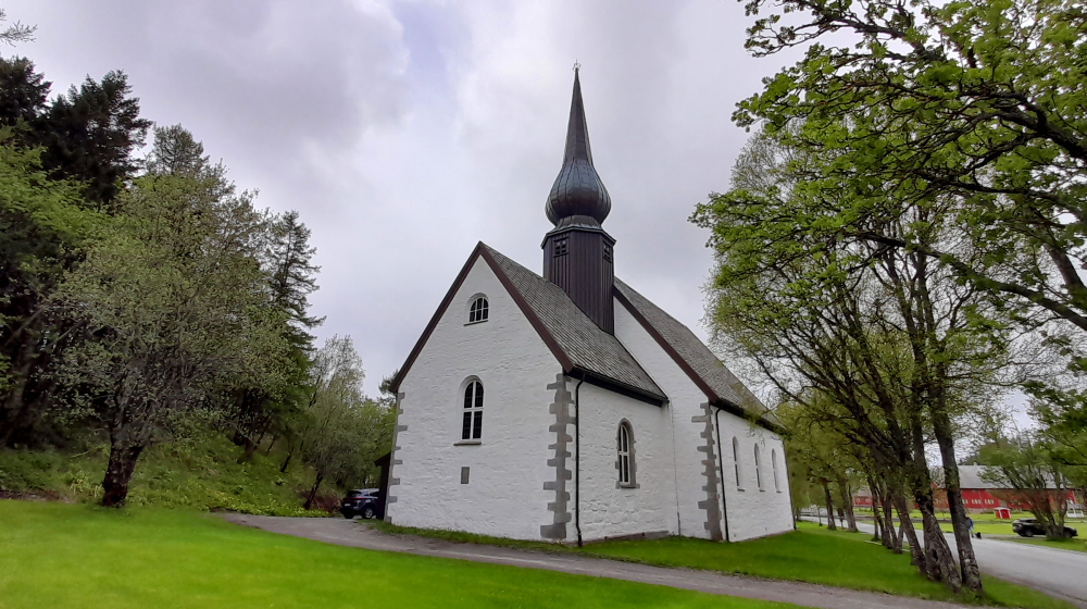
The nearby Bodin Church served Bodo and surrounding area for quite some time before a church was built in the town and eventually the cathedral. The white, stone church was built in a long church style around the year 1240. In 1785, a transept was built. In 1894, the old portion of the medieval church was dismantled and rebuilt in the same style. Today, the church is characterized largely by an interior from the 17th and 18th centuries.
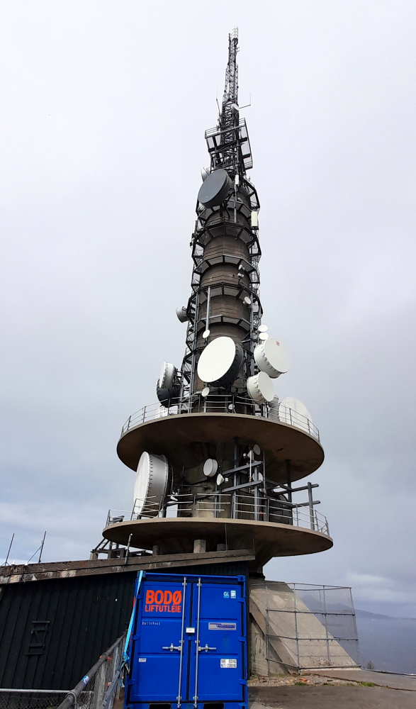
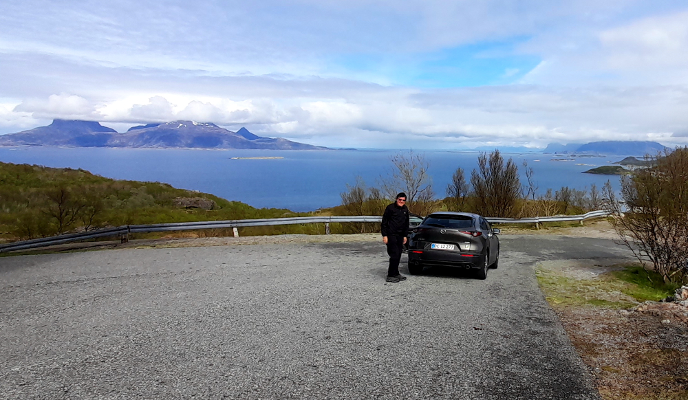
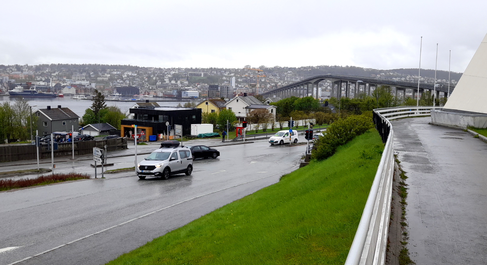
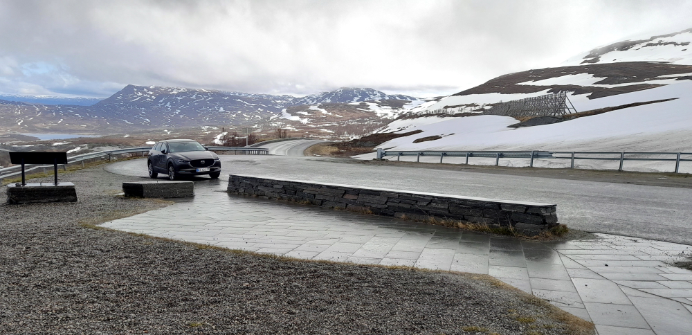
After going through several tolls in town we drive up a steep, narrow road to a telecomms tower called ‘The Link’ at West Rønvikfjell.
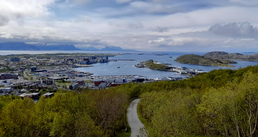
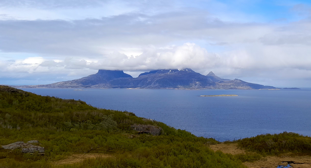
On one side of the hilltop we have great views over the city and its harbour.
On the other side we had great views towards Landegode, Lofoten and Steigen.
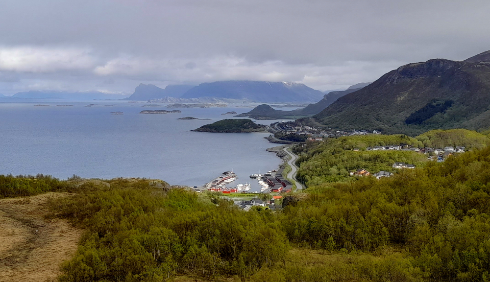
In the distance some low clouds sit on the snow line of the outlying islands of Landegode.
The narrow road to the Telecomms tower is quite steep and starting to break up. It would be a difficult drive up in the winter but this time of year we are met by a number of hikers out walking their dogs.
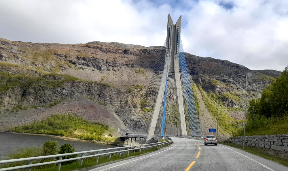
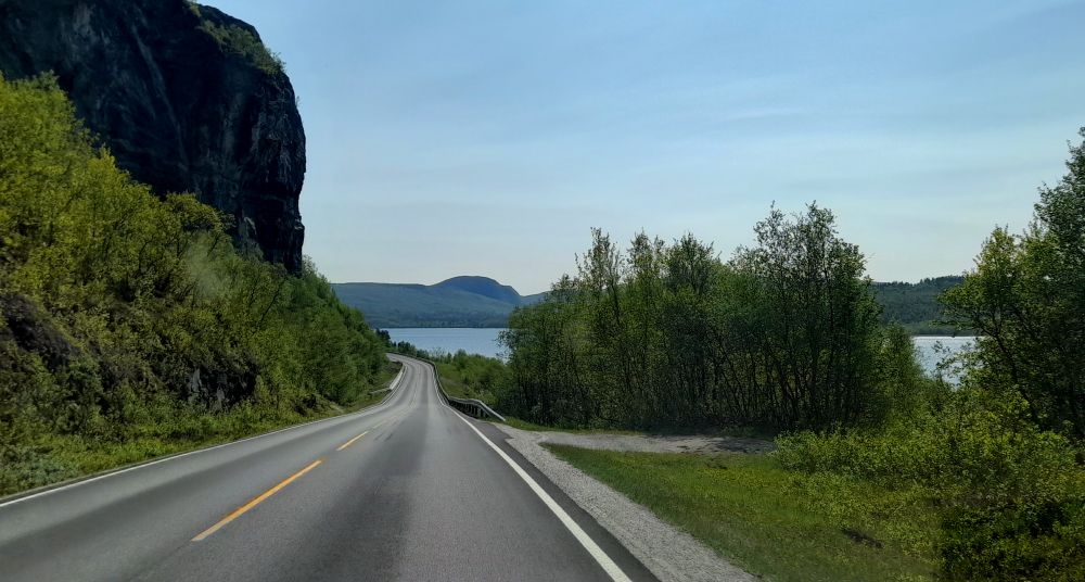
Back through town again and onto the 80 to the junction with the 17 where we drive alongside Saltfjorden then park adjacent to the Salstraumen Bridge 30 minutes later at 1:30 pm.
As it was high tide at 11:56 am and low tide is due at 6:12 pm we are about 1.5 hours too early to see the full effect of the changing tide so we take a short walk to the lovely Saltstraumen Hotel where we have a leisurely brew enjoying the ambience and the view of the distant snow-streaked peaks.
After our break we head back to the bridge. It is cold and a little windy out. Lynn wants to take photos from the top of the bridge but I have no intention of being on a high bridge in this weather. I will take my photos down and close to the water.
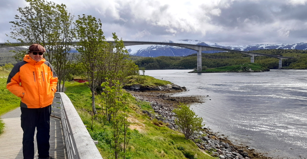
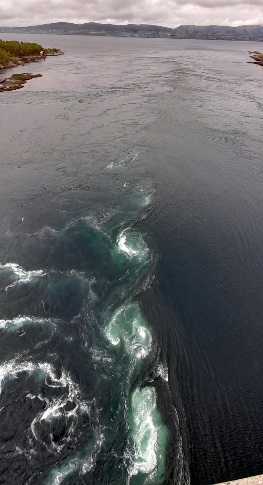
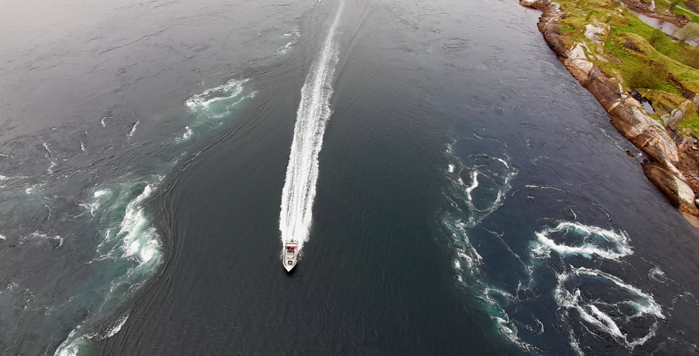
Sure enough, when we approach the base of the bridge at 3:00 pm we can see the turbulence begin between the 2 fjords of Skjerstadfjorden and Saltenfjorden.
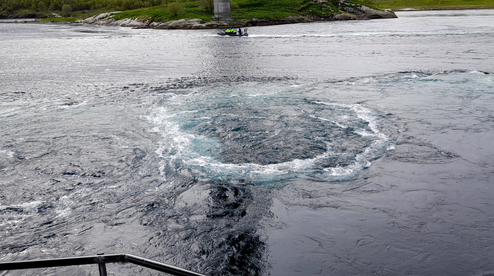
Four times a day, a huge volume of water forces its way through the 150-metre narrow strait in Saltstraumen, making enormous whirlpools that swirl between the fjords.
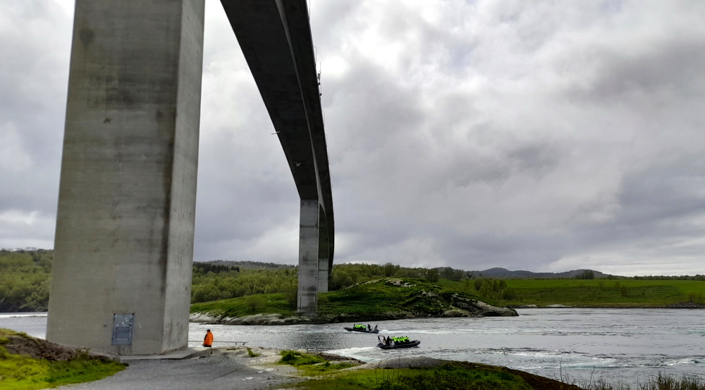
Apparently 400 million cubic metres of seawater cross the narrow strait moving at an impressive 13 kilometres per hour on average. It is reputedly the world’s strongest tidal current.
I managed to get some pretty good video footage of the run out tide but Lynn gets a bird’s-eye view of the torrent.
A local boating company takes passengers on RIBs through the straits to experience the maelstrom ‘up close and personal’.
Time to head back to Bodo. Unbelievably at 15:45 pm there is a long line of traffic heading out of town causing traffic jams on the multiple roundabouts on the 80.
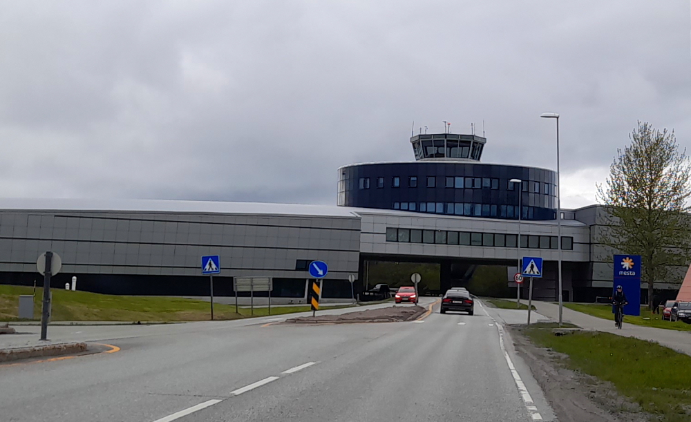
Oddly, the control tower for the Bodo Airport straddles the main road, the 80, into town. Possibly due to lack of space as the runway is to the immediate left of the tower, running parallel to the 80 on one side and the fjord foreshore on the other at the tip of the Bodo peninsula.
Tomorrow we are driving about 5 hours north to Narvic so the plan is to head off by about 10:00 am. That means feeding the parking meter again in the morning for an hour’s worth of parking. I truly believe that the Scandinavians hate cars and think that the people should either stay at home or take public transport to work. There isn’t a free parking car space in the entire town of Bodo.
3 June, 2023
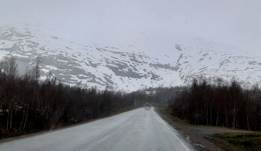
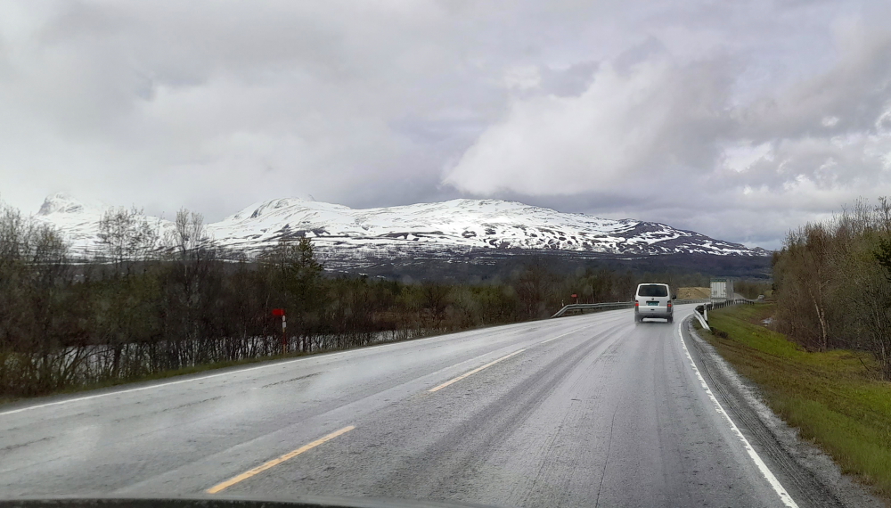
It’s 6 Deg. C and raining when we depart Bodo at 9:45 am to drive the 304 kms to Narvik. We leave the 80 at Fauske and head roughly NE on the E6 once again.
For the first 2 hours of driving the landscape is dominated by tunnels, lakes, narrow valleys with rapid streams and snow on the ground to the point where we are confronted by this bleak landscape.
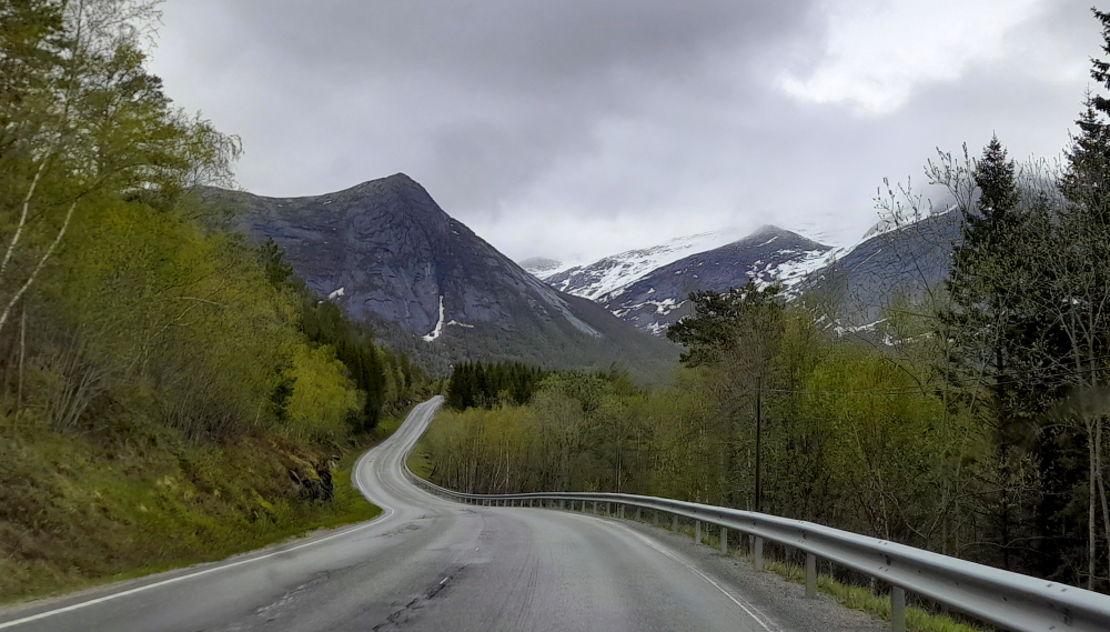
Then the scenery changes to massive, bare rocky outcrops, with great slabs of rock having been hewn away by tons of ice flows over aeons.
The outside temperatures regularly drop to below 4 Deg C and the road gets quite slippery.
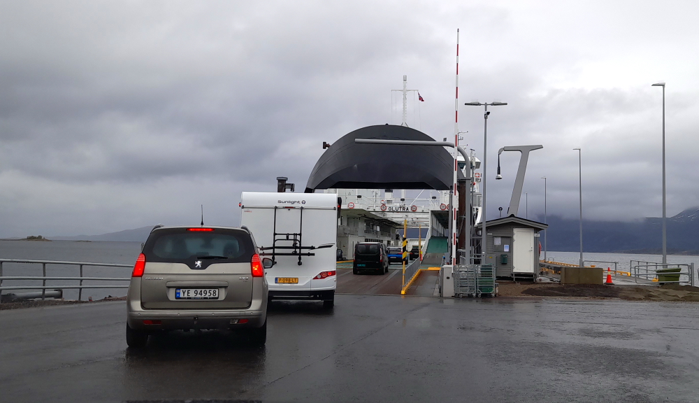
At 12:55 pm we arrive at the Bogness ferry terminal, 3 minutes earlier than our usual. Right on midday the ferry departs, crossing Tysfjorden for Skarberget where we dock 30 minutes later when we, and 10 other vehicles, disembark.
From Skarberget we drive across a couple of peninsulas, joined by the Kjerringstaumen Bridge.
After skirting the Ofotfjord’s shoreline we cross the Beisfjord Bridge and arrive at Narvik.
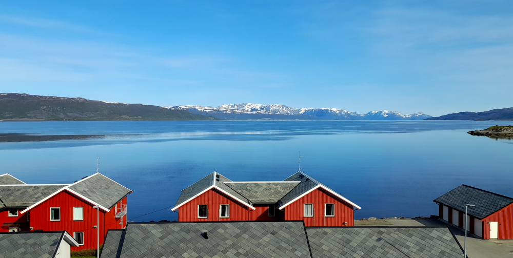
We’re staying in a holiday home which has an amazing view of the fjord from its lounge window. We quickly unpack and drive to the station 2 minutes away to check details about our Arctic Train trip tomorrow.
There doesn’t seem to be a ticket office at the station so we go into the cafe to enquire. As luck would have it, the waitress we speak to, Rita, will be the conductor on the train tomorrow.
Nearby is a shopping centre so we call into its Extra supermarket and buy supplies for the next 3 days of self-catering.
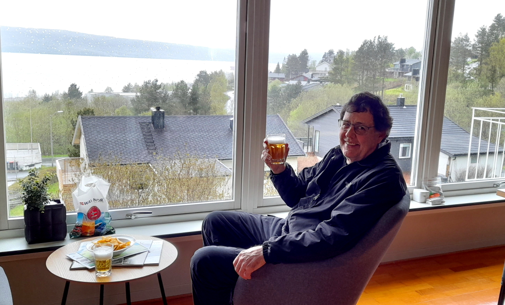
Time for a beer while enjoying the view before we return to the railway station cafe for dinner.
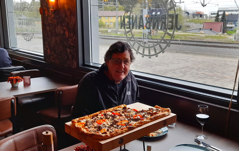
I wasn’t all that fussed by the Norweigan fare on offer so I talk Lynn into sharing a reindeer meat pizza – not realising just how big the pizza would be!
Netflix is on offer at the accommodation so I flix through the menu and come across a movie entitled “Kampen om Narvik” – the battle for Narvik.
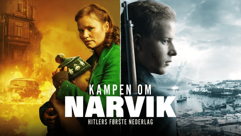
The Battles of Narvik were fought from 9 April to 8 June 1940, as a naval battle in the Ofotfjord and as a land battle in the mountains surrounding Narvik as part of the Norwegian Campaign of WWII.
The two-month land campaign was fought between Norwegian, French, British and Polish troops against German mountain troops, shipwrecked Kriegsmarine sailors and German paratroopers. Although defeated at sea off Narvik, losing control of the town and being pushed back towards the Swedish border, the Germans eventually prevailed because of the Allied evacuation from Norway in June 1940 following the Battle of France.
Narvik provided an ice-free harbour in the North Atlantic for iron ore transported by rail from Kiruna in Sweden. Both sides in the war had an interest in securing this iron supply for themselves and denying it to the enemy, thereby setting the stage for one of the biggest battles since the Invasion of Poland.
So we watch ‘Narvik’ in Narvik with the fjord featured in the movie right outside our window. Most of the film’s dialogue is in English with French subtitles, but we really have to concentrate when German is spoken (with French subtitles) or written script is in Norwegian (with French subtitles). Needless to say we get the gist.
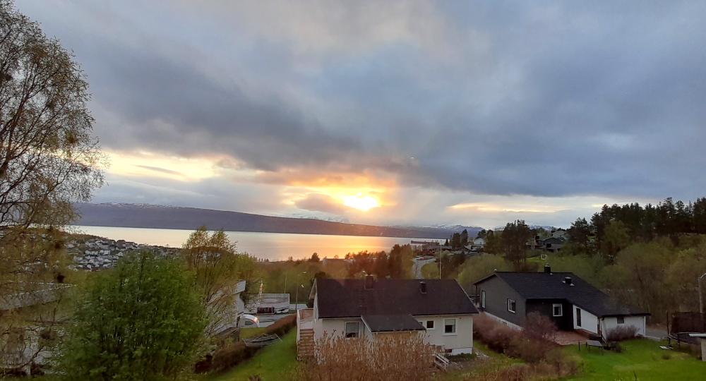
Lynn takes a photo of the sun from the lounge window at 10:45 pm and tracks it to the right side of the fjord at 00:00 but it is obscured by cloud. 11 minutes later it appears above the fjord again!
4 June, 2023
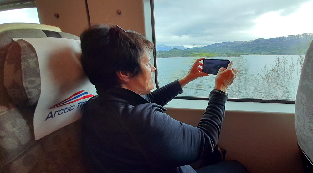
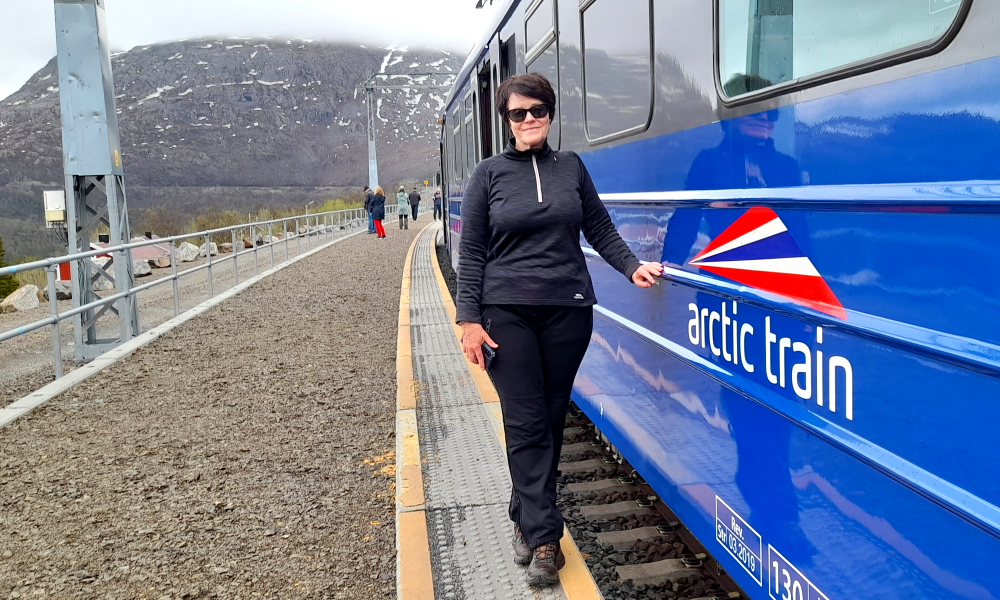
Thank goodness for self-catering and the chance to have a lie-in! It has rained overnight but clear when we drive to the station at 10:45 am for a coffee in the station cafe before we get on the Arctic Train.
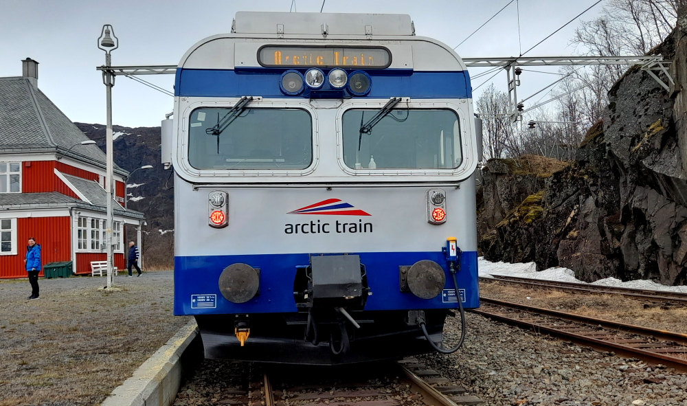
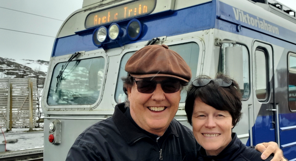
Bang on 11:40 am the train departs on time. The only warning we get is a PA announcement: ‘Doors closing’, and they do and we’re off.
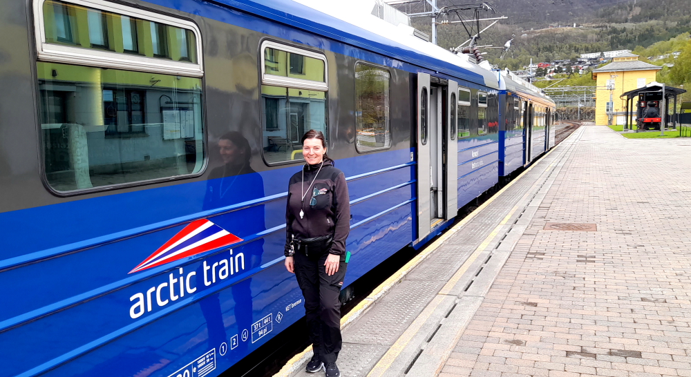
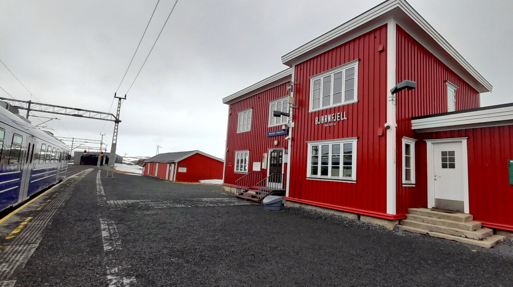
The train runs on the Ofototen Line which opened in July 1903. Today it won’t go to Kiruna in Sweden as it’s too early in the season. Rather we are going to Bjornfjell 36.7 kms away just before the Swedish border with short stops at Rombak, Katterat and Sosterbekk.
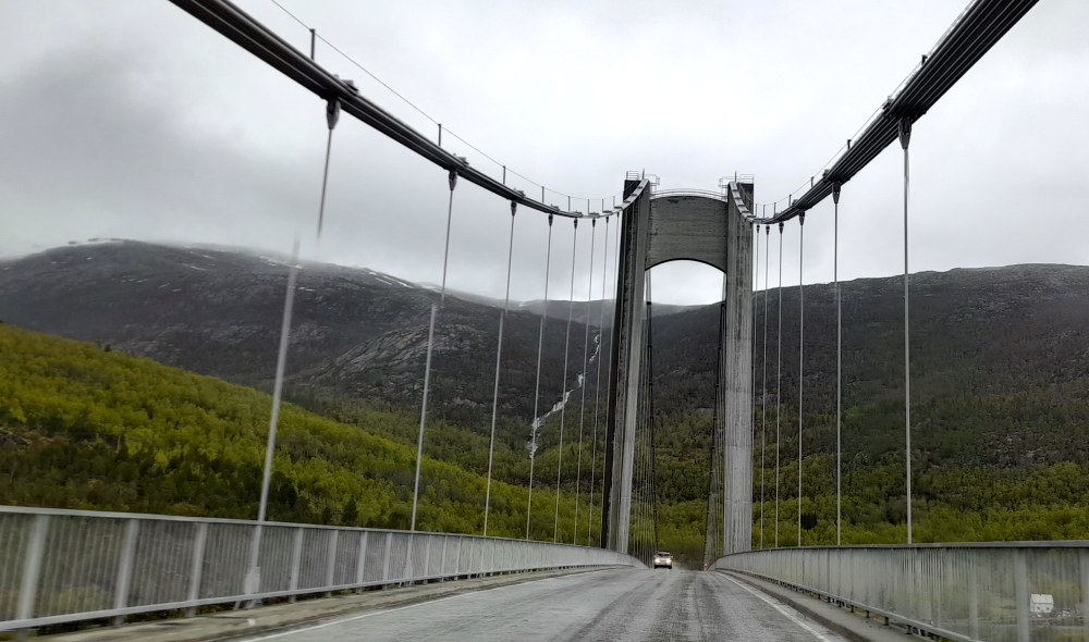
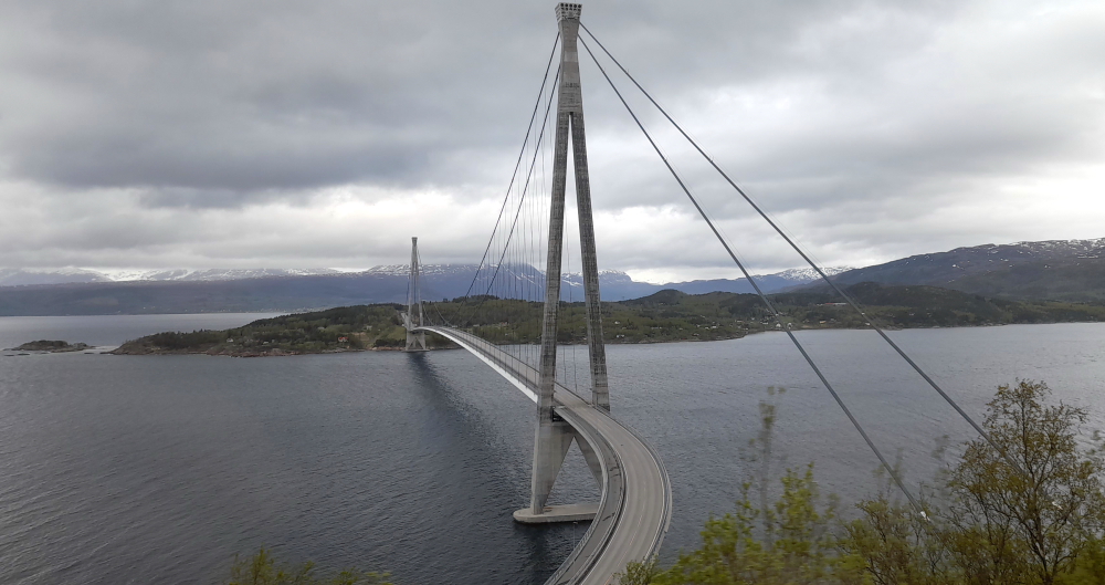
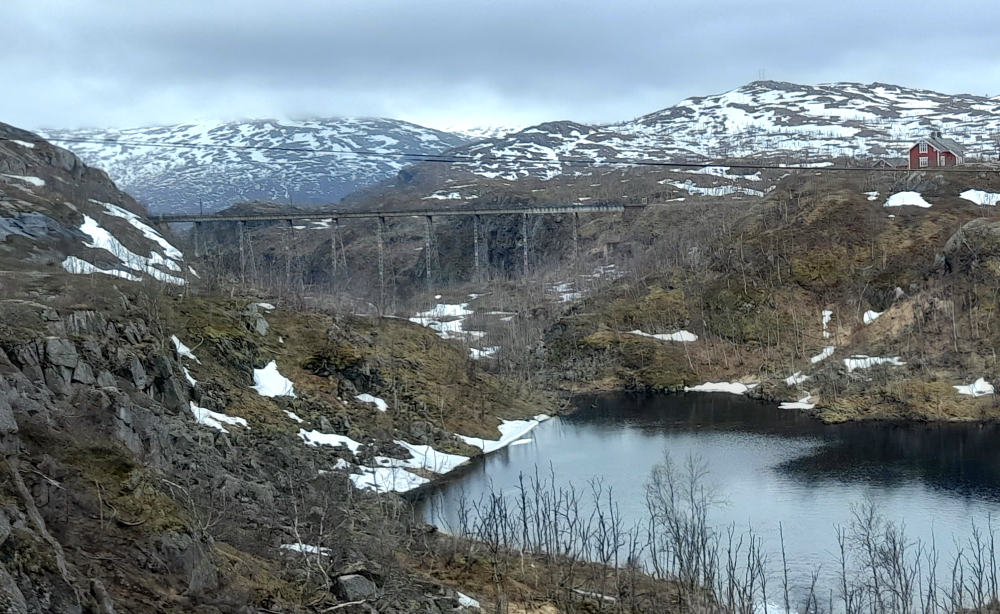
Immediately leaving Narvik we pass the Halogalands Bridge, a suspension bridge with the second-longest bridge span in Norway which crosses the Rombaksfjorden. Construction began in 2013 and completed in 2018.
Shortly afterwards we spy a moose just below the railway track but as it doesn’t move or even flinch an inch as we pass by we laugh it off as a stuffed moose put there for the tourist trains.
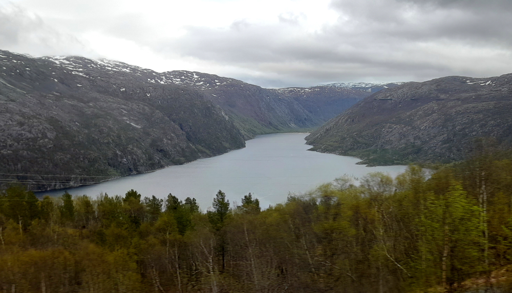
The train continues along the edge of Rombaksfjorden, an offshoot of the main Ofotfjorden.
Our first stop 20 minutes later at noon is at Rombak.
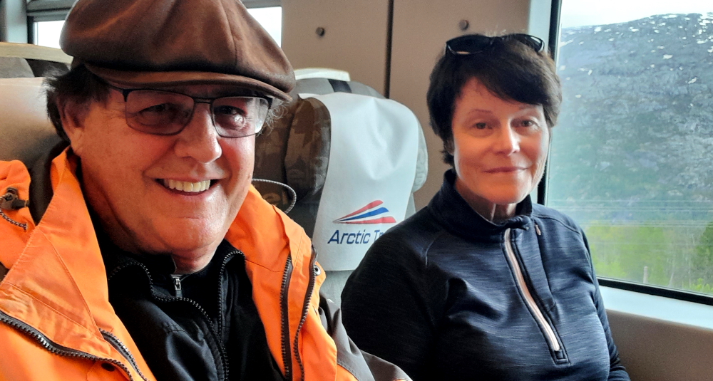
I remembered to bring the selfie stick with us today – the one we bought in Singapore 9 months ago – so I’m going to go mad with it.
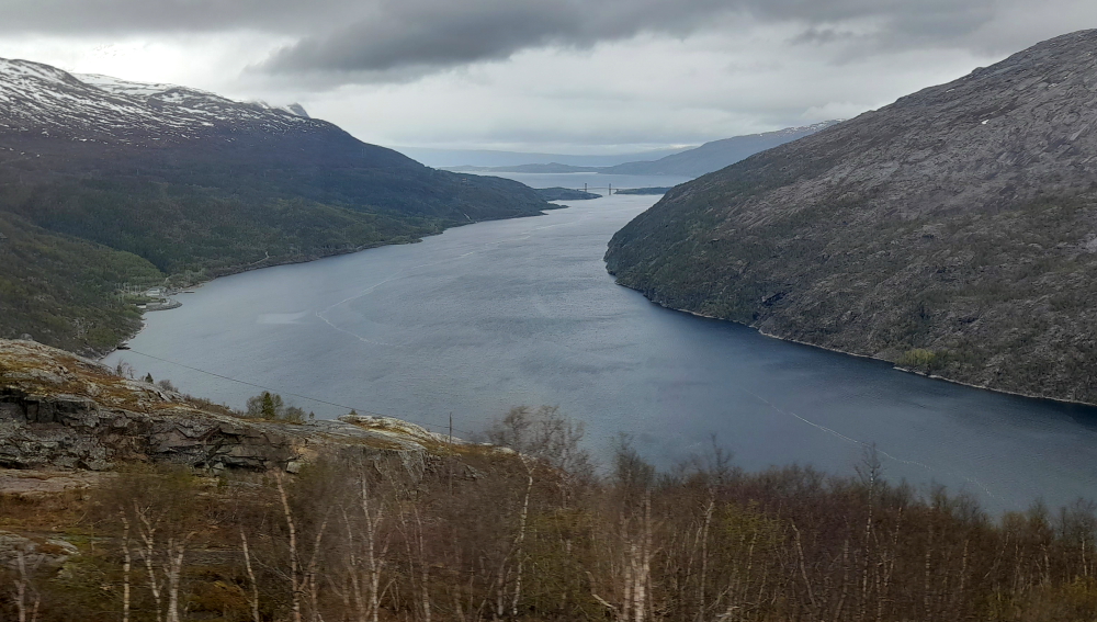
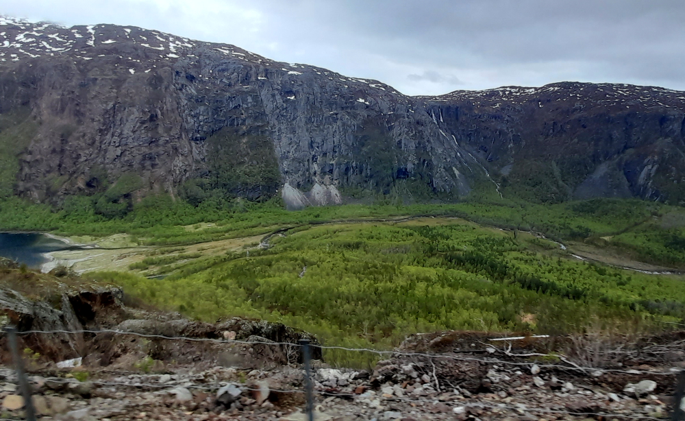
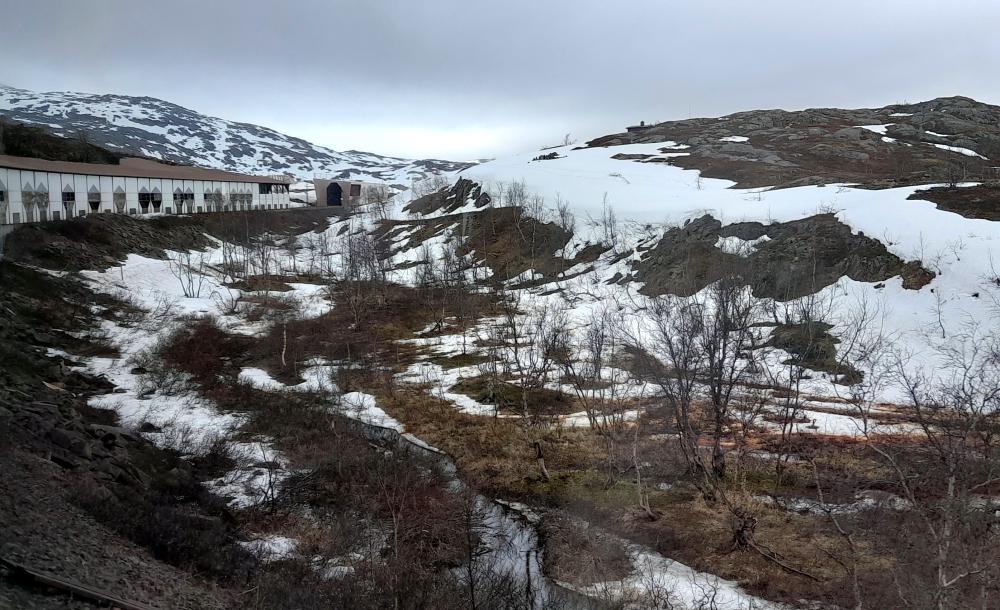
The fjord comes to an end at the delta of the Rombakselva river.
Unlike the map which indicates water at this point, there is an alluvial river plain between the mountainous sides of the valley.
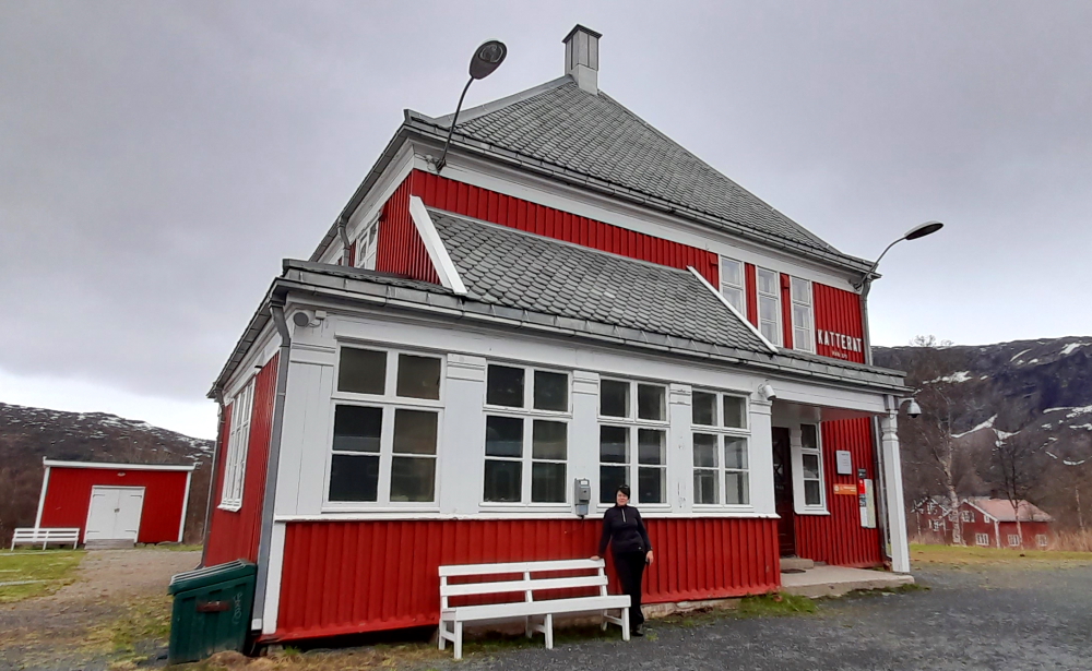
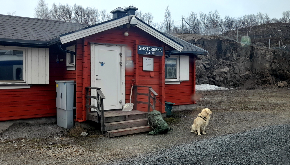
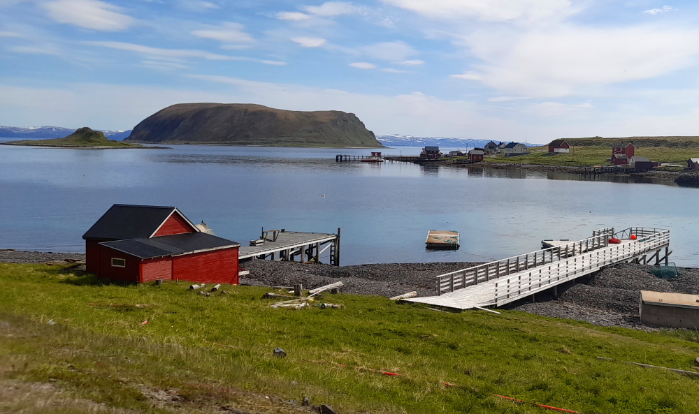
Katterat is our next stop, 15 minutes later where we find a small community of red wooden buildings with white trim and grey, scalloped, wooden tiled roofs.
During the 10-minute trip between Katterat and Sosterbekk, we pass the tall, iron bridge that featured in last night’s ‘Narvik’ movie – the one the Norwegians tried to demolish with dynamite.
We stop briefly at Sosterbekk to drop off some supplies on the platform.
5 minutes later we arrive at our final destination, Bjornfjell.
We are due to leave after 10 minutes but that stretches to 25 minutes. Apparently the ore train that passed us at the platform going back towards Narvik developed problems so we have to wait until they fix it.
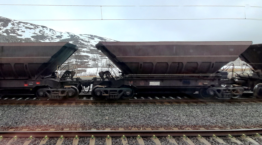
Speaking of iron ore, the total tonnage of goods on the Ofoten Line annually is 23 million tons – no doubt most of that being iron ore.
As we probably won’t get to see another moose, we diligently watch out the window for the stuffed moose so we can take its photo. But do you think we can see it?? Blow me down, it must have been a real moose after all!!!
5 June, 2023
Another very wet and cold day in Narvik. The plan this morning is to head down to the bank to see if we can pay our Norway Road Toll invoice over the counter then to check out a few of the city tourist sights.
We are having a problem paying our toll invoice as it keeps being returned to us. Unlike Australia the Norwegians don’t make it easy to pay bills online. We can’t pay online with a Debit or Credit card but the invoice does have a bank deposit slip attached. However, at the bank you can’t actually pay the invoice over the counter unless you have an account with the bank. I think that the cold weather freezes the Norwegians’ brains. They seem to find the most difficult way to do things in this country.
Lynn has a couple of things that she wants to see but they have little interest to me. I head back to the shopping mall where we parked the car and wait for her out of the cold before we buy some more supplies including a couple of bottles of Australian wine for which we pay three times the Australian price. Tell me again why people live in this country?
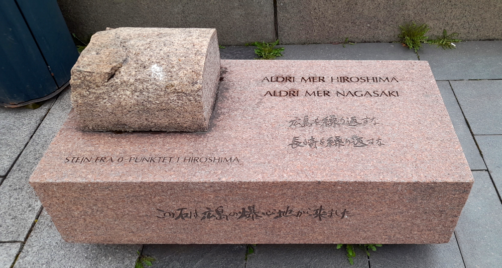
In front of the Radhaus is the Hiroshima Stone. In 2005, Hiroshima’s mayor, Tadatoshi Akiba, took the initiative for the worldwide organization “mayors for peace”, and Narvik was one of the municipalities that signed up. Akiba presented Narvik with a stone from the so-called ground zero Hiroshima and was unveiled on 6 August 2006 in connection with the new monument “Peace is a promise of the future”. Both monuments are located on Rådhusplassen in Narvik.
We retire to the apartment for the evening, enjoying a glass of red in front of the picture window watching the midnight sun traverse the sky.

6 June, 2023
Our trip to Tromso today is 232 kms and should take us about 3.5 hours. We head out just before 11:00 am in 7 Deg. C overcast weather.
We follow the E6 over the Halogalands bridge which we saw from the Arctic Train. 12 minutes later, on the outskirts of Bjerkvik-Rahkka, we see a lone reindeer buck, complete with fuzzy rack, grazing at the edge of the road in a field.
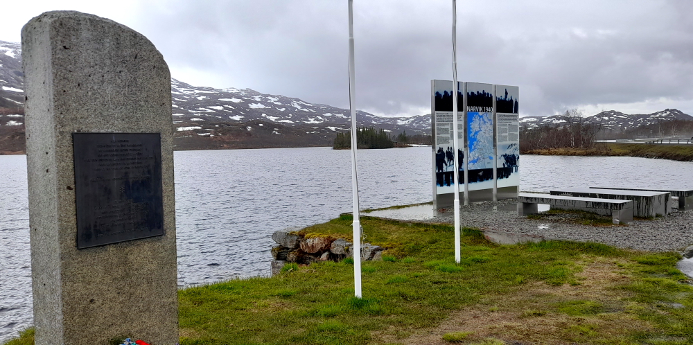
Just before the village of Ose, we stop at a Battle of Narvik monument that is on the shore of Storvatnet. War History Sites is a project initiated by Norwegian Army Force Command in order to commemorate the war actions that took place in the areas around Narvik and the soldiers who participated in the war during two months in the spring of 1940.
The six monuments and information boards are erected on sites being viewpoints for arenas where particularly hard fightings between the Norwegian and allied forces and nazi-Germany took place: Skjomnes, Bjørnfjell, Bjerkvik (Herjangen), Øse, Lapphaugen and Bardufoss.
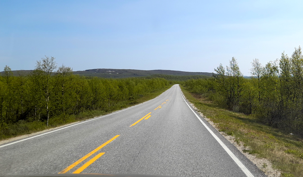
Today’s landscape is pretty much the same as the last leg except for the E6 becoming a single lane, country road. The cold and rain definitely continues and peeking through misty clouds we get tantalizing glimpses of massive, jagged, snow-covered mountain peaks.
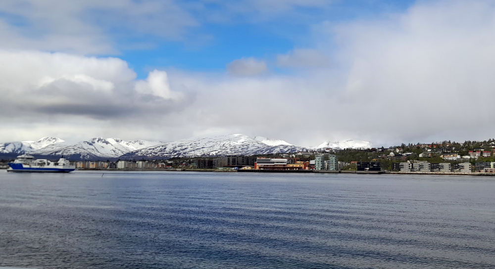
At Vollan we turn left off the E6 and onto the E8 which skirts an arm of the fjord that Tromso, and its island, Tromsoya, is on.
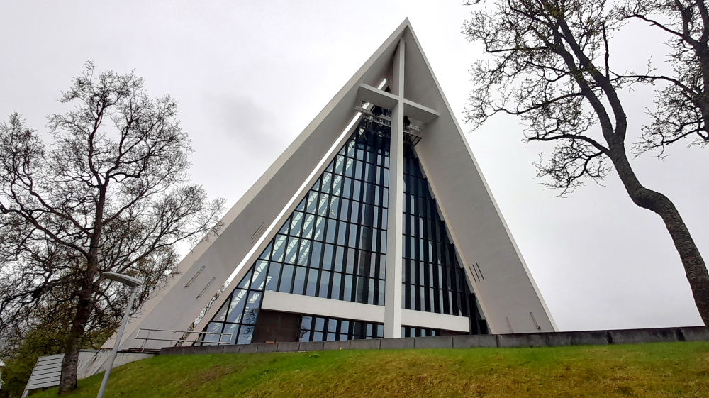
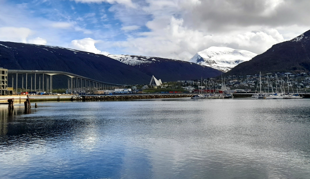
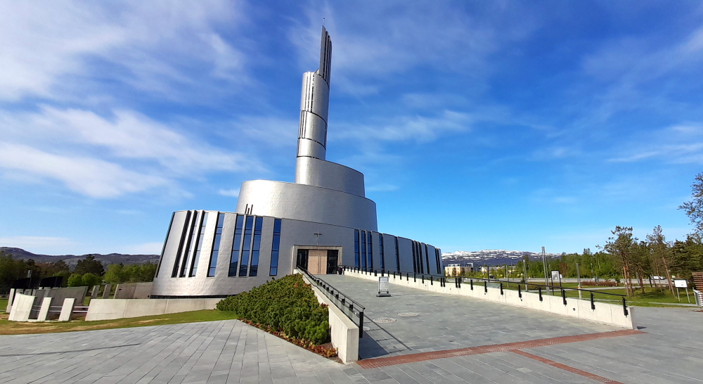
On approach to the bridge that takes us to the island is the Arctic Cathedral. Tromsdalen Church, also called the Arctic Cathedral, was inaugurated on 19 November 1965. The architect, Jan Inge Hovig, created a sailing landmark that can be seen from the Tromsø Sound, from the bridge and during landing by plane. The 11 aluminium-coated concrete slabs on each side of the roof give the cathedral its shape.
The main entrance in the west wall is surrounded by a large glass facade with a prominent cross.
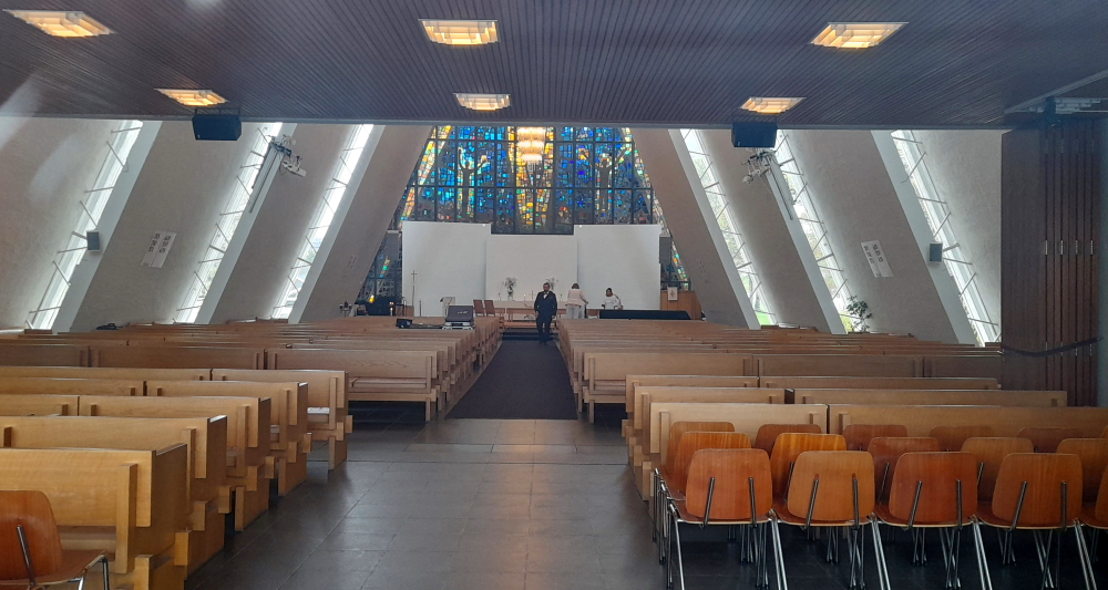
The east wall’s glass mosaic, created by artist Victor Sparre, first appeared in 1972. It depicts God’s hand from which emanate three luminous rays; one through Jesus, one through woman and one through man.
From the front of the Cathedral is a commanding view of the Tromso Bridge and the town of Tromso on its own island.
After unpacking at the Enter Viking Apartments we discover that the apartment we’ve been allocated doesn’t have a dishwasher, as advertised, so we call into Reception and they offer us a free upgrade to a 2-bedroom ‘luxury’ apartment around the corner.
Just as well, as the original apartment is a bit scruffy, on the 3rd floor via a wooden, external staircase and is a bit of a fire hazard. The new apartment is on the ground floor, better laid out and with better appliances but we wouldn’t go as far as saying that it represents a ‘luxury’ apartment. Looks like it has been a DIY refurb. We’re rapidly changing our original perception that Norway is a sophisticated country – more like 3rd world!
7 June, 2023
Sunshine! Time to check out the town and visit the Polar Museum.
En route we visit the statue of Roald Amundsen, Norwegian polar explorer, nearby.
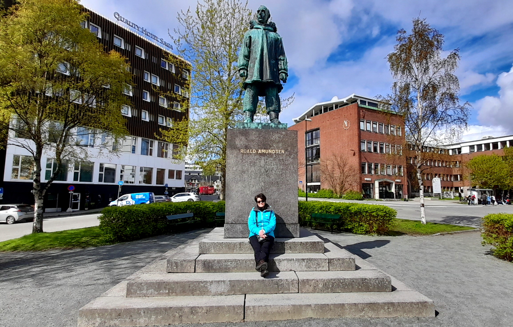
His statue looks towards the harbour.
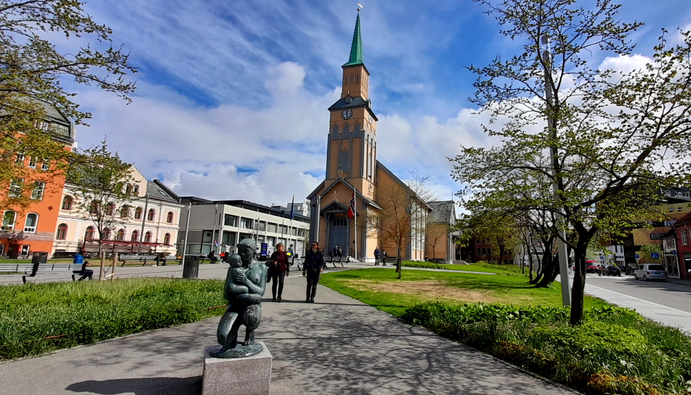
Across the road from Amundsen’s statue is the Tromso Cathedral. This cathedral is notable since it is the only Norwegian cathedral made of wood. The yellow, wooden cathedral was built in a long church format and the Gothic Revival style in 1861 by the architect Christian Heinrich Grosch. It is probably the northernmost Protestant cathedral in the world.
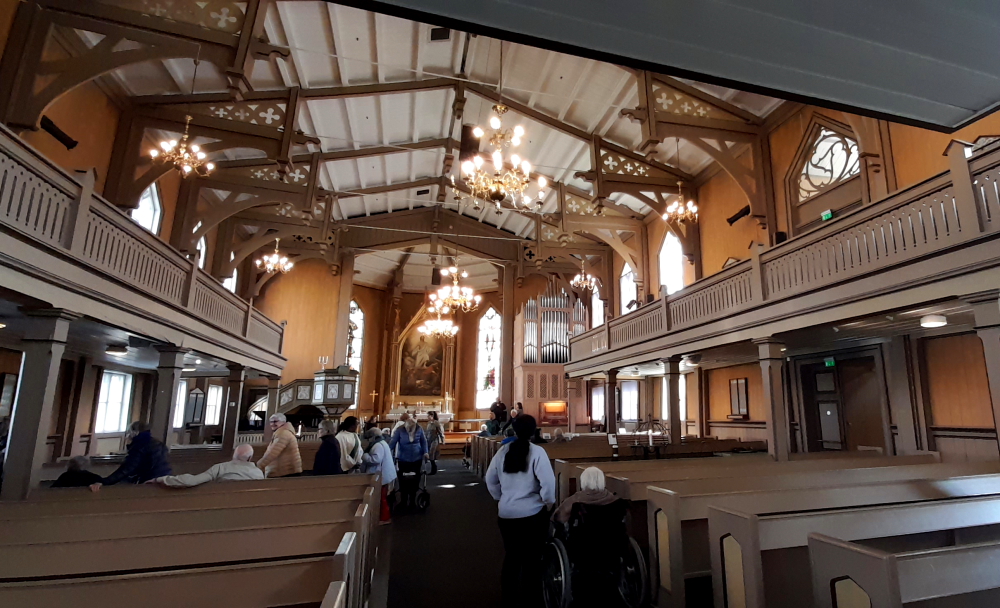
The cathedral interior is dominated by the altar with a copy of the painting Resurrection by the noted artist Adolph Tidemand. Stained glass windows in the front of the church, designed by Gustav Vigeland, were installed in 1960.
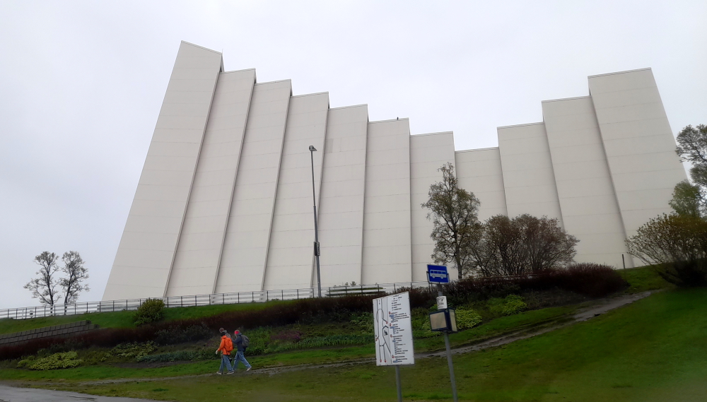
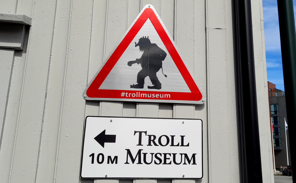
Walking around the harbour front to the Polar Museum we pass by another enigmatic museum.
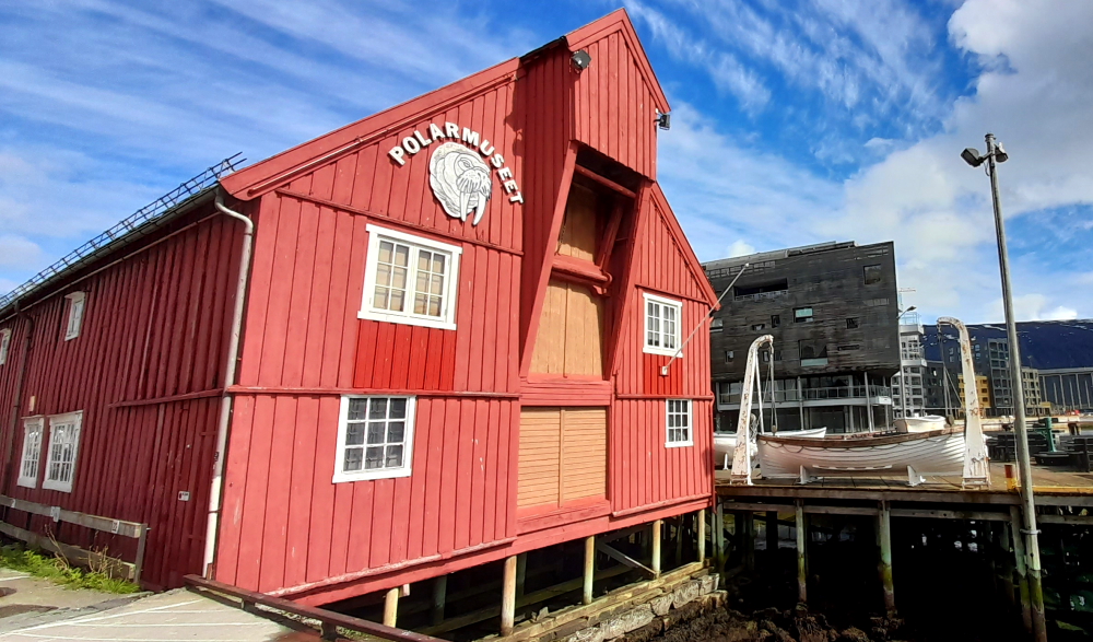
Finally we arrive at the Polar Museum which charges a modest NOK50 for seniors, A$14.50 for the 2 of us, and we arrive just in time for a guided tour.
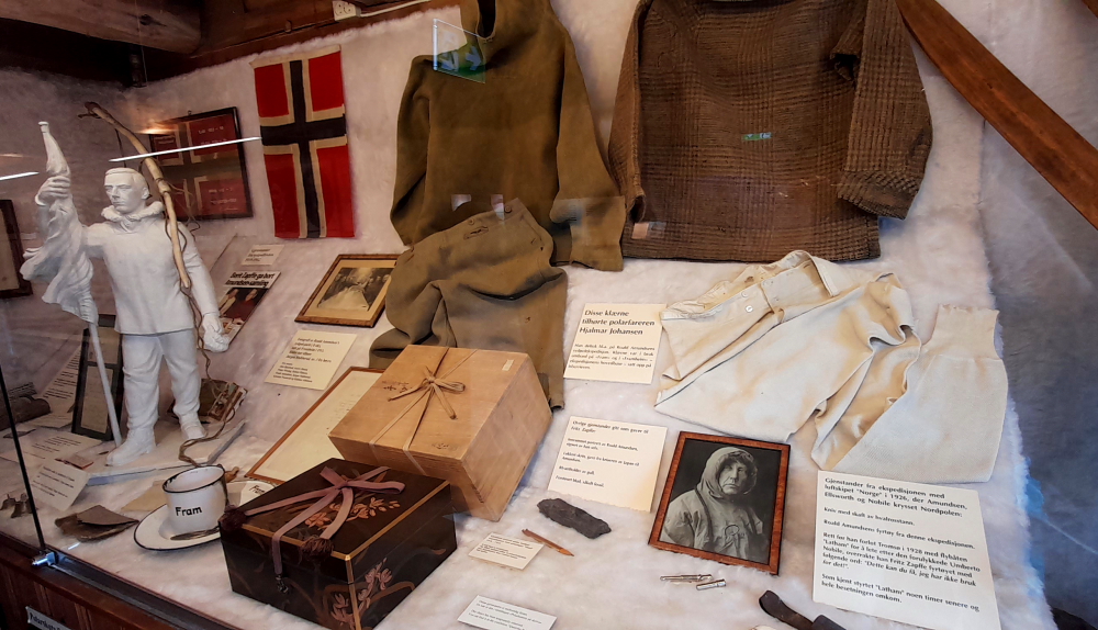
The museum is arranged according to theme – trapping in the Arctic; seal, walrus and polar bear hunting; Henry Rudi and Wanny Woldstad; Arctic aircraft; Roald Amundsen and Fridtjof Nansen.
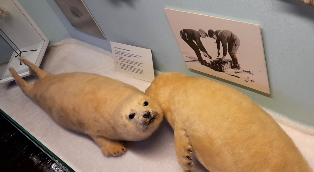
The Armundsen collection represents his life and various expeditions to the Northwest Passage, South and North Poles and rescue mission on the “Latham” flying boat where he went missing.
Roald Engelbregt Gravning Amundsen; (16 July 1872 – c. 18 June 1928) was a Norwegian explorer of polar regions. He was a key figure of the period known as the Heroic Age of Antarctic Exploration.
Born in Borge, Østfold, Norway, Amundsen began his career as a polar explorer as first mate on Adrien de Gerlache’s Belgian Antarctic Expedition of 1897–1899. From 1903 to 1906, he led the first expedition to successfully traverse the Northwest Passage on the sloop “Gjøa”. In 1909, Amundsen began planning for a South Pole expedition. He left Norway in June 1910 on the ship “Fram” and reached Antarctica in January 1911. His party established a camp at the Bay of Whales and a series of supply depots on the Barrier (now known as the Ross Ice Shelf) before setting out for the pole in October. The party of five, led by Amundsen, became the first to successfully reach the South Pole on 14 December 1911.
Following a failed attempt in 1918 to reach the North Pole by traversing the Northeast Passage on the ship “Maud”, Amundsen began planning for an aerial expedition instead. On 12 May 1926, Amundsen and 15 other men in the airship “Norge” became the first explorers verified to have reached the North Pole. Amundsen disappeared in June 1928 while flying on a rescue mission for the airship “Italia” in the Arctic. The search for his remains, which have not been found, was called off in September of that year.
On our way to the Olhallan pub we walk past a barber’s shop and I finally stop prevaricating and stride into the shop for a “No. 2 all over” some 6 months after the last No. 2 I had done in Spain. Then it cost me Euro8. Today, $A31, only $A4 more than I would normally pay at home. Result!
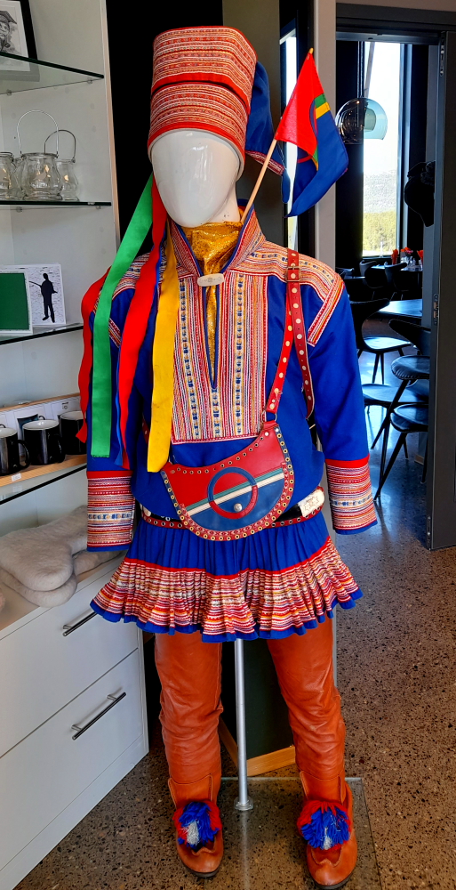
At the end of the street is a Sami Shop which we noticed earlier in the day. As we are now in Northern Norway we are approaching Sami territory.
The Sami people live in four countries: Norway, Sweden, Finland and Russia. The total population in these four countries is estimated at approx. 80,000, of whom around half live in Norway. Slightly under half of these people talk Sami. The Sami language is a member of the Uralic linguistic group along with languages such as Finnish, Estonian and Hungarian.
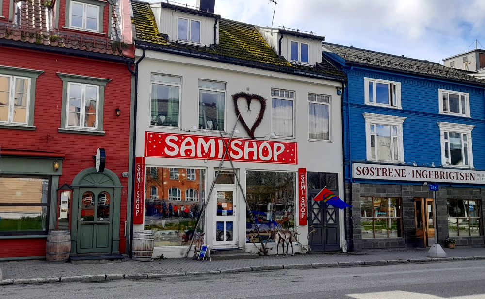
Around 2,600 Sami people in Norway make their living from herding reindeer, and the majority of the region of Northern Norway is actually used for raising reindeer. Traditionally, most Sami people have supported themselves through fishing, livestock farming, and hunting, along the coast, on the fjords and alongside the large rivers farther inland.
The reason we are on our way to the Olhallan pub is that one of the Polar Museum’s rooms is dedicated to Henri Rudi (1889-1970), “King of the Polar Bear”. From Tromso, he was one of Norway’s best-known trappers. From 1908-1948 he shot and trapped 713 polar bears. He was also a popular figure at the Olhallen pub.
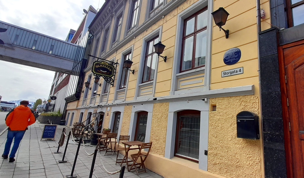
Mack’s brewpub Ølhallen opened in 1928 and is the oldest pub in Tromsø. Referred to simply as “The Hall” in its younger years it was known as a place of sanctuary and at the time was teeming with fishermen, farmers, and townspeople.
One of the walls inside the pub is dedicated to Rudi which we came here to see. While here, we decide to imbibe – a Mack pilsner for me and a Gamel Opland Aquavit for Lynn after which she declares that Aquavit is her new ‘go to’ beverage.
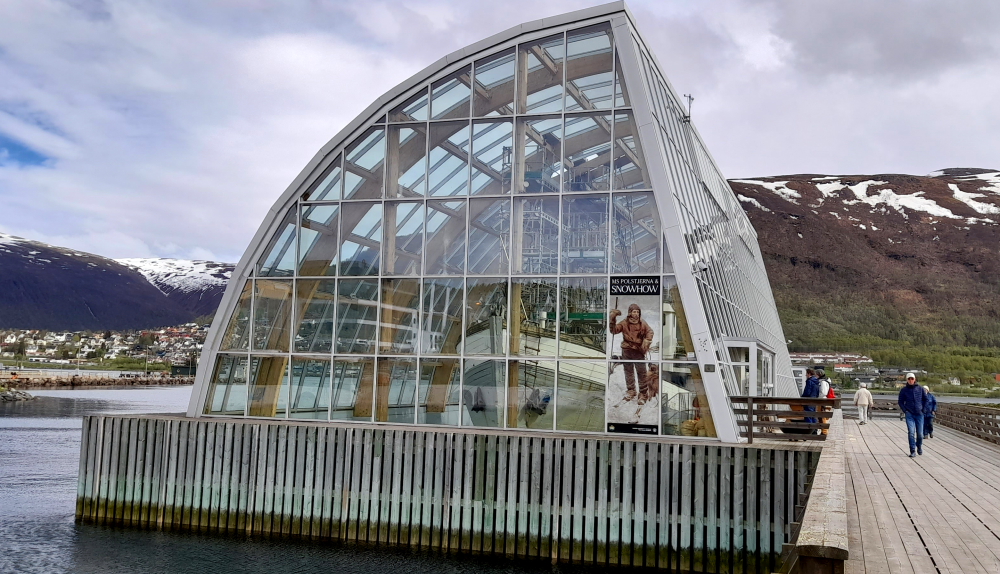
Close by to the Olhallan is the M/S Polstjerna, Norway’s best-preserved a sealing ship. The Polstjerna is owned by the Tromso University Museum, and since 2004 it been exhibited in a dry dock in a conservation building near Polaria in Tromso.
The vessel was built and launched at Moen’s shipyard near Risor in the spring of 1949. The ship had 33 fishing seasons and harvested close to 100,000 seals from the West Ice and East Ice, before its final season in 1981. It was then purchased by the Arctic Society (Arktisk Forening) and later transferred to the University Museum. The building that houses the dry-docked ship was designed by the Per Knudsen architectural firm, which won a architectural competition for the facility.
Unfortunately this museum is closed over the summer for maintenance. Pretty much like most of Norway!
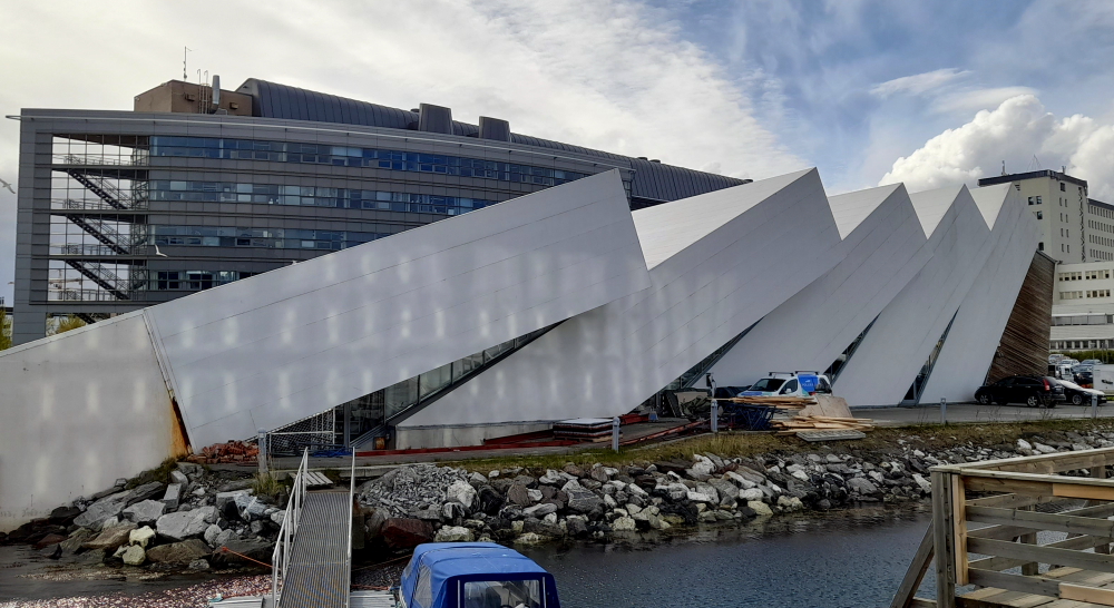
Next door is Polaria, the world’s most northerly aquarium. Rather than a mainly scientific aquarium Polaria, which opened in May 1998, is designed to be an educational experience, with particular emphasis on displays for children.
The building itself is also worthy of note. Its striking design represents ice floes that have been pressed up on land by the rough seas of the Arctic or pressure ridges. This piece of modern architecture echoes the Arctic Cathedral across the harbour on the mainland.
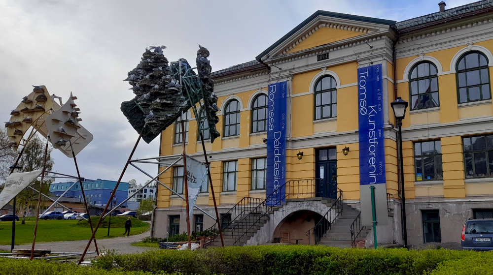
Up a slight rise from Polaris and in front of a museum building is “Kyrkkja Park Hotell” – mobile kittiwake hotels – essentially 3 tripods and at each apex, 3 steeply-angled sheets of metal with ‘ledges’ and some vegetation arranged on them and seem to have an ‘arty’ vibe about them. Surprisingly, most ‘ledges’ are occupied by pairs of noisy gulls.
Krykkjer are gulls that nest in flocks. Their natural habitat is in rock cliffs on the coast. Due to environmental changes, terns move into urban areas, where they find safe surroundings to nest and raise their young. In recent years, many pairs have nested at the Tromsø art association. The nesting causes smell and damage to the building. To avoid nesting on the building, “hotels” have been built.
If the Musèparken project is a success, the mobile hotels will be used elsewhere in the city. The project is a collaboration between Tromsø municipality, AT Plan and Architecture, the Norwegian Institute for Natural Sciences (NINA), Tromsø art association and, of course, the artists Lawrence Malstaf and Kåre Grundvåg.
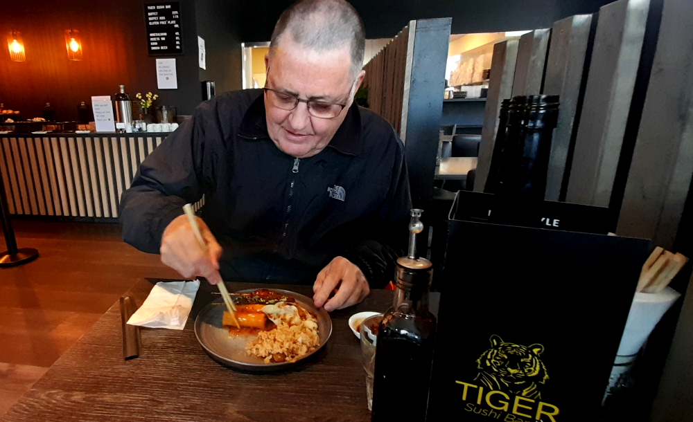
Tonight we’re going to treat ourselves to the sushi buffet at the ‘Tiger Sushi Bar’ on Gronnegata. A$33 each for all you can eat sushi – not a bad deal for Norway.
8 June, 2023
Although it is reasonable weather (for this part of Norway) outside we have heaps to do today. It is washing day and I am working on converting the last couple of months of the blog to a word document (Volume 17 of our travels). Lynn is busy planning the next week’s activities and she still has the task of planning our Christmas travels.
Tomorrow we are driving further north to Alta which is our second-last drive north before we start heading south again to warmer weather.
9 June, 2023
According to Lynn’s MapsMe app our trip today will be 379 kms and will take about 5.5 hours, so departing at 10.35 am we should arrive around 4:05pm. The MapsMe route takes us via the E8 and E6 skirting the edge of waterways most of the way, totally ferry free.
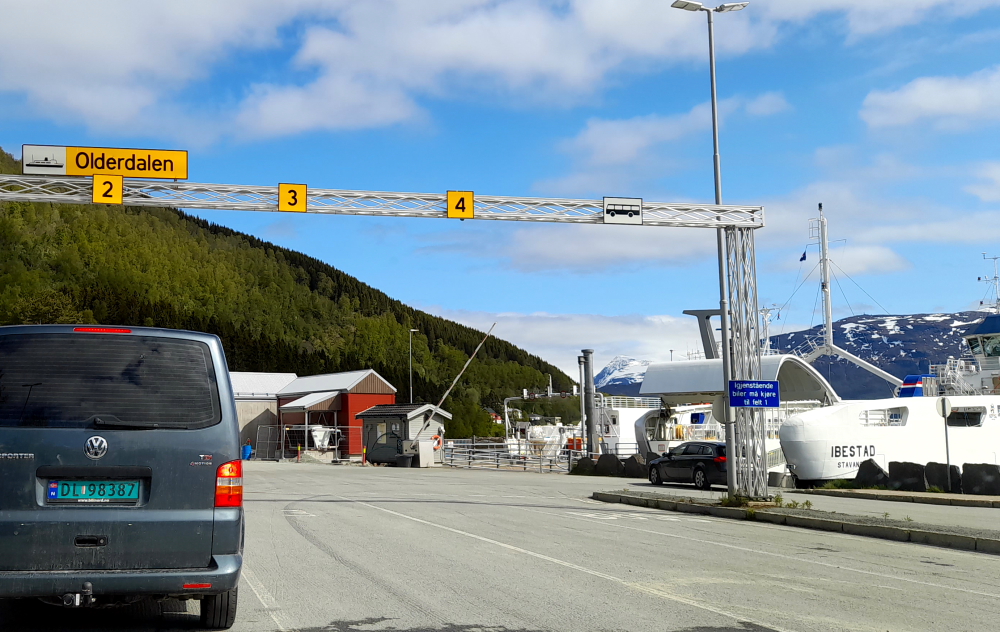
But when I put Alta’s co-ordinates into the car GPS we’re due to arrive at that time but the kms are about 100 short! Curious. The answer comes 25 minutes later when the car GPS takes us onto the 91 to Breivikeidet to take the ferry to Svensby.
This time we arrive some 20 minutes before it is due to depart at 11:45 am and sit in the second queue. Luckily we arrived now as after this ferry the next one isn’t until 1:00 pm and hourly after that.
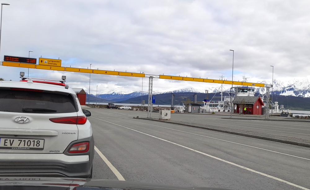
About a 25 minute ferry ride and we disembark at Svensby for the 15 minute drive alongside Ullsfjord to Lyngseidet to catch another ferry to Olderdalen.
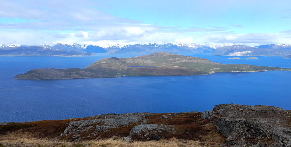
Needless to say the scenery is stunning on this sunny day with towering, rocky, snow-streaked mountains lining the opposite shore.
Toblerone mountains everywhere!
This time the next ferry is unloading its vehicles as we arrive 5 minutes before departure time. Likewise, after this voyage the ferry will only run on an hourly basis today.
And just like that we shave 100 kms off today’s journey.
At Olderdalen we rejoin the E6 and drive along Kafjord which is connected to the sea.
Before we enter the Ailegastunnelen the landscape has become quite sparse, rocky and snow covered. When we emerge from the tunnel we are in a different environment: snow and misty clouds on one side of the road and water and clear skies on the other. No wonder there is a designated lookout spot here.
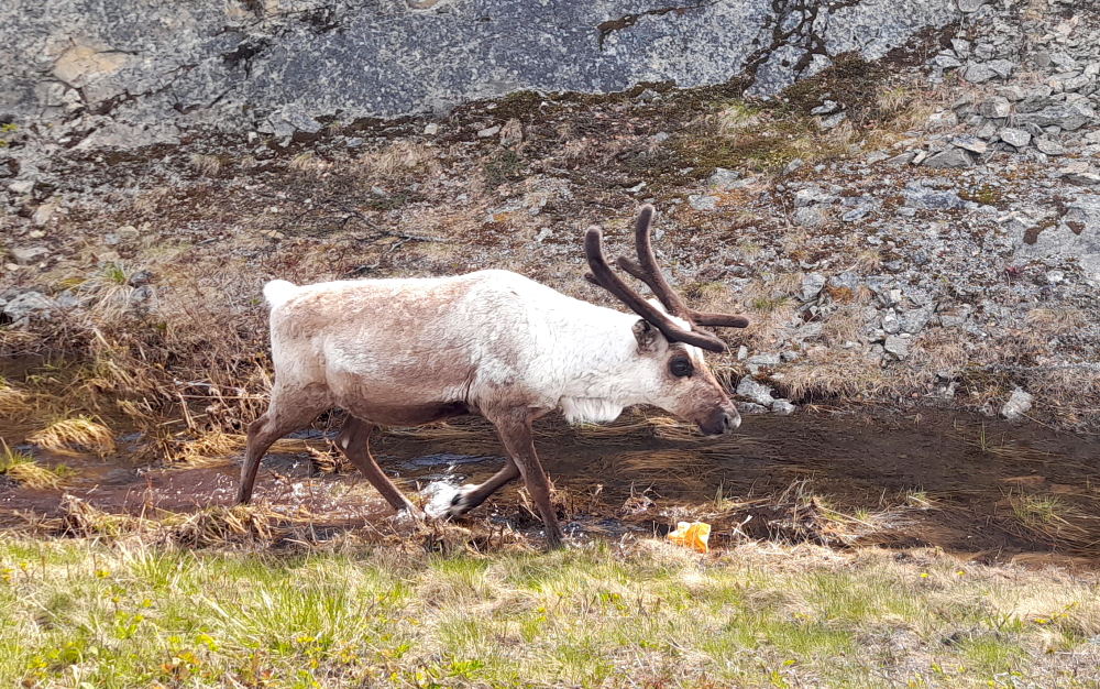
We then descend to sea level and pass through forested areas. And lo and behold – wild reindeer. First one cautiously crossing the road who did look both ways before it crossed….
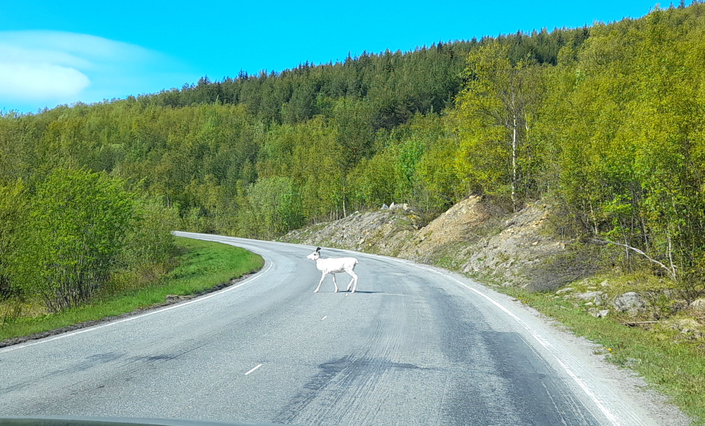
…definitely reindeer here…
…then lots of them.

As we cross the bridge just before Kvenvik we only have 10 minutes’ driving left before we arrive at the Guesthouse we’ve booked for the next 2 nights.
During the day Lynn accessed the Booking.com app on her phone to check the facilities at tonight’s accommodation only to find, alarmingly, that none of our bookings, which we can usually access offline, are showing. In fact, it looks like Booking.com has no bookings for us at all – all 6 months of them!
So it was chaotic when we arrive at the Guesthouse to find that reception is closed and a typed note stuck to the front door saying to refer to the message/email that we would have received for the door code to get into the building and the room allocated to us.
Nada! And from the small group of weary travellers we encounter at the 2nd door they’ve not had any message either. It also didn’t help that ringing the 2 phone numbers provided, both went unanswered.
Finally, the receptionist turns up and we move into our cosy room with a stunning view of the sea and surrounding snow-streaked mountains. It appears that as of today, Booking.com no longer offers its information offline. All our bookings reappeared once we logged onto the Internet.
By 9:00 pm I’m in bed and asleep – totally exhausted.
10 June, 2023
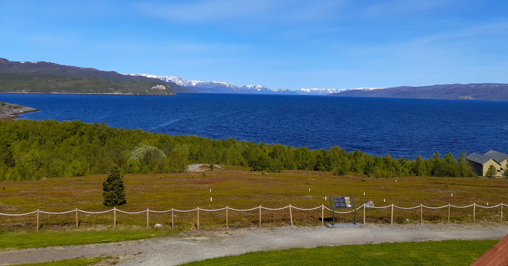
A stunningly beautiful day – sunny, slight cool breeze and 10 Deg. C with an expected top of 16. A heatwave for this latitude! And a stunning buffet breakfast to match! Truly, one of the best breakfasts we’ve had in Scandinavia by an independent.
Downtown Alta is located just below the 70th latitude and is closer to the North Pole than it is to much of Central Europe and the British Isles. In spite of its high latitude the local climate is seldom severely cold thanks to Gulf Stream moderation in the prevailing wind. As a result of its shielded position leading to mild summers, the coastal areas of the municipality are warm enough for forests. Due to Norway curving above its Nordic neighbours, Alta is located further east than almost all of Sweden and much of southern Finland.
Our sightseeing today starts at the Northern Lights Cathedral in town. Unfortunately, not open on weekends. During 2009-2013 this modern church was built in a circular style and constructed of concrete and wood with an external cladding of titanium sheets. The central feature is its large spiral with belfry and interior artwork by Peter Brandes.
The cathedral is the result of an architectural competition launched in 2001 and was designed by Schmidt Hammer Lassen Architects in collaboration with architect Kolbjørn Jenssen of Link Arkitektur. It was consecrated in 2013 with the Crown Princess Mette Marit in attendance. Prior to the opening of this church, the main church for the parish was the historic Alta Church.
Alta is also famous for its World Heritage Rock Art Centre at Hjemmeluft.
Founded in the 1960s and 70s and included on UNESCO’s World Heritage list in 1985, it features rock carvings, rock paintings and prehistoric settlements connected with rock art. There are about 6,000 figures ranging from 2,000 to 7,000 years old.
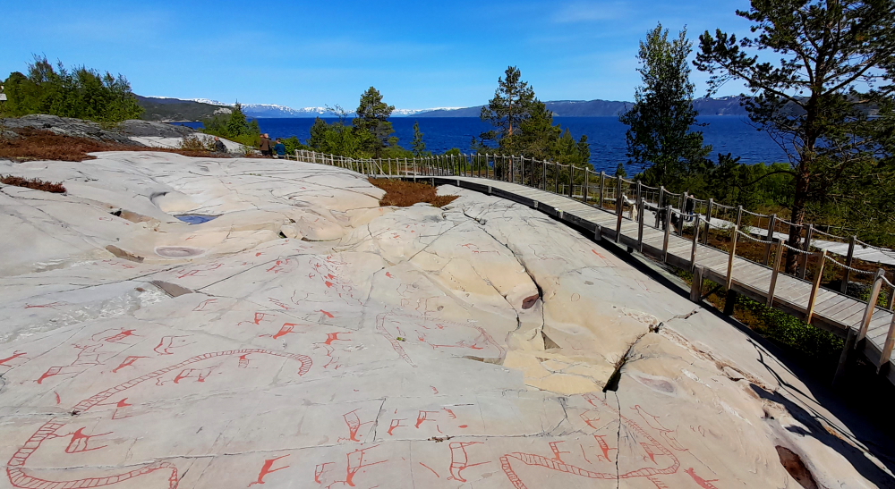
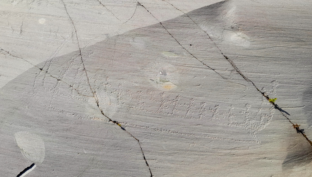
The rock art here is the largest known collection of rock carvings in Northern Europe made by hunter-gatherers. Initially museum staff outlined the carvings in red paint to make them easier to see but the paint is gradually being removed to bring them back to their original state. Low-angled light makes it easier to see the carvings. And it’s much easier to see the painted ones, I can tell you!
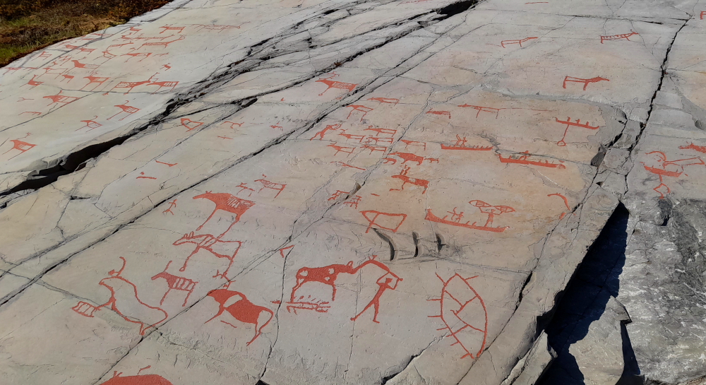
A rock carving is a figure which is carved, polished or chipped into a stone or bedrock outcrop using a hammer made of stone or antler and a chisel made from hard stone. They are often based upon real models: animals, objects or people. Rock carvings have 2 meanings, either they represent a concrete situation, or they have a symbolic meaning.
The most common pictures are of animals, especially reindeer and moose. But there are also other animals such as bear, birds and fish plus fishing nets, spears and boats as well as people in a variety of activities. Most of the figures are relatively small, between 20 and 40 cm high. Some are relatively naturalistic, others more geometric and stylized.
As we are in Arctic Norway we are going for a Sami eating experience for dinner tonight at Sami Siida. There are 2 options: the restaurant or the Laavupub. A laavu is a conical tent similar to a Native American one with a central fire pit. We opt for the restaurant which turns out to have its own fire pit, too.
Reindeer is what Sami do, so Lynn opts for Bidu, long-cooked meat (turns out to be reindeer stew) surprisingly served with syrup bread (fresh raisin bread with butter) and I go for the Stezan (schnitzel) – breaded ground meat. Both are very nice but the meat is lacking the flavour that beef or lamb provide.
11 June, 2023
Time to drive to our northern-most stop at Honningsvag. We leave Alta just before 11:00 am under a cloudy but sunny sky and 17 Deg. C and immediately take the E6 NE once again.
The rocky outcrops covered in conifer forests that feature on the way out of Alta are soon replaced by a desolate-looking landscape with snow patches, boggy soil, yellow grass streams and small lakes.
Occasionally, we come across a weatherboard house or hut, or clusters of buildings that are unkempt compared with their counterparts in southern Norway with most of them having covered snow mobiles parked at their front doors.
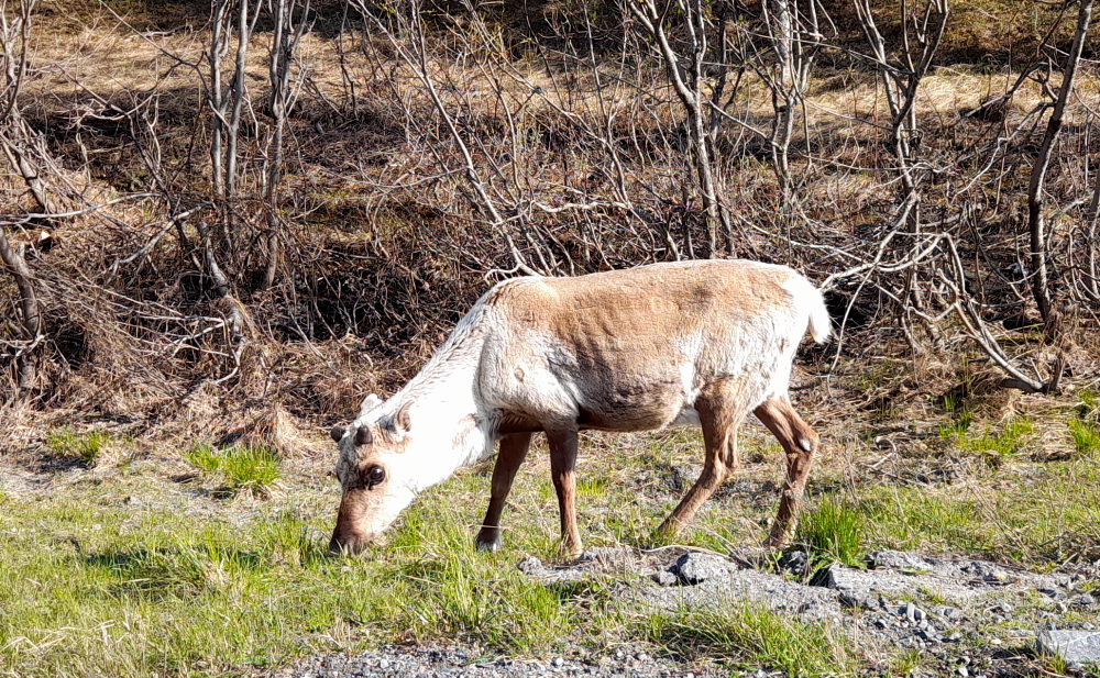
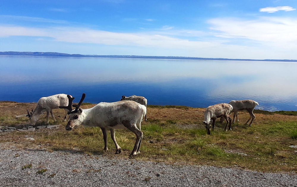
And there are more reindeer up here and evidence of Sami communities.
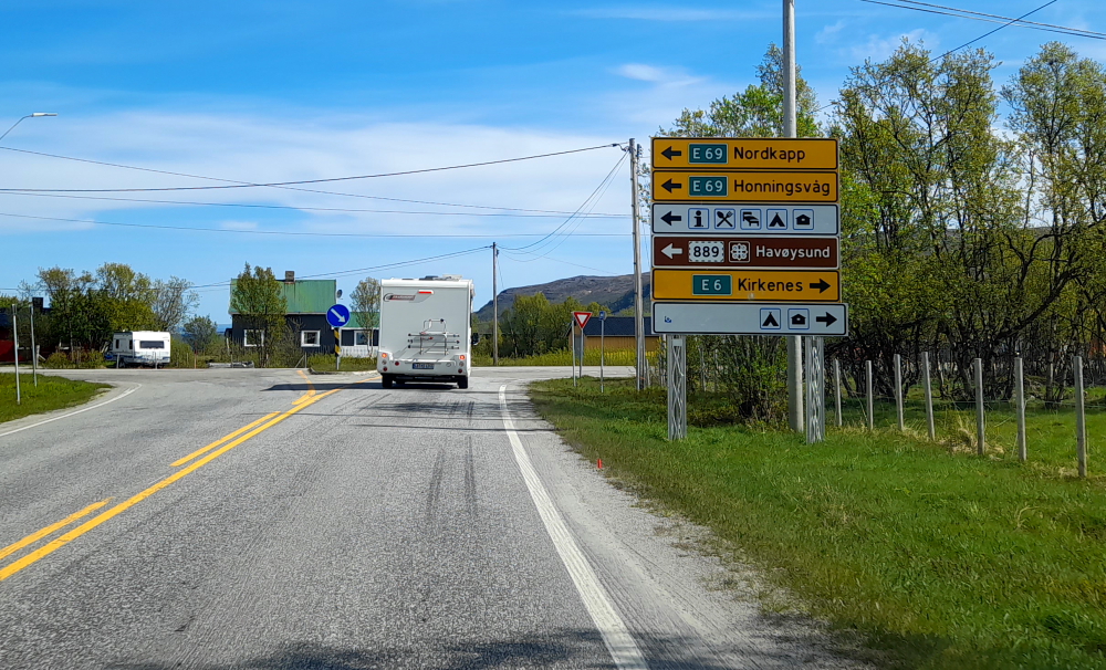
After the desolate highlands we descend to sea level and come to a T-junction at the town of Olderfjord which is at the head of Porsangerfjorden. We turn left onto the E69 to Honningsvag. We’ll be coming back to this junction in a couple of days’ time when we start to travel south and re-take the E6 here to Karasjok.
Would you believe it’s 19 Deg. C!
The E69 follows the western shoreline of Porsangerfjorden.
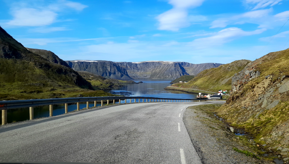
After driving through the 4 km-long Nordkapptunnelen which links the island of Mageroya to the Norwegian mainland, we pass by one of the 5 fishing villages on the island – Sarnes.
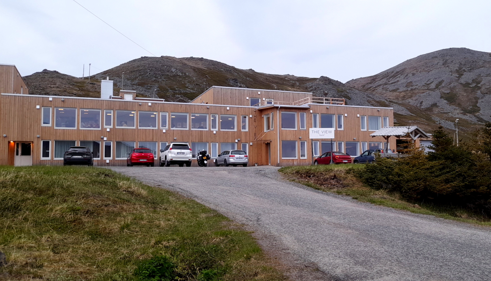
We arrive at The View hotel, Honningsvag around 2:30 pm.
As soon as we drop our bags we head out to explore Mageroya – its famous North Cape (Nordkapp) and 3 of its fishing villages.
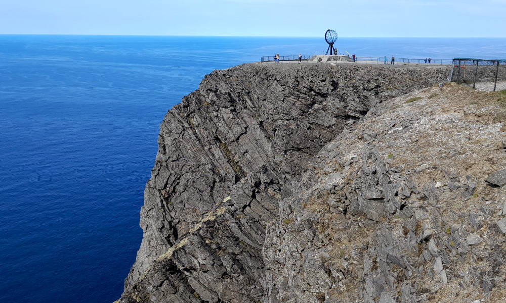
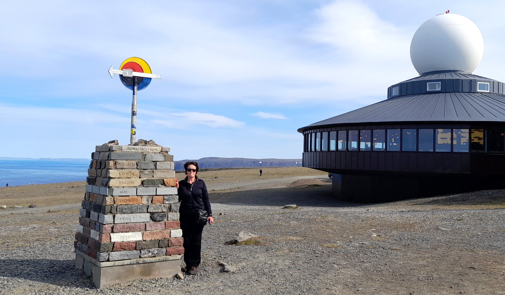
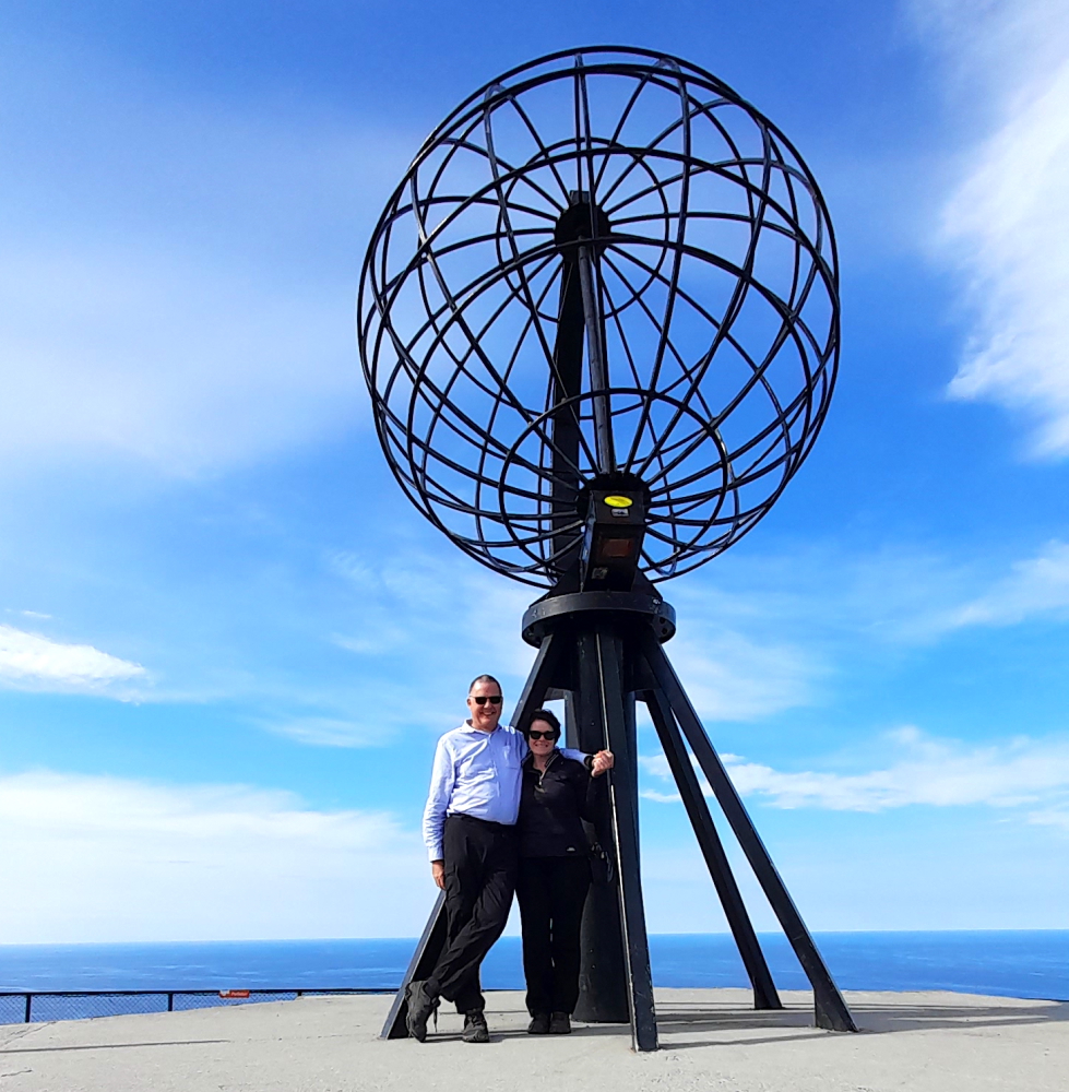
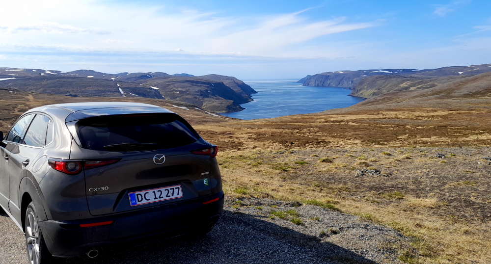
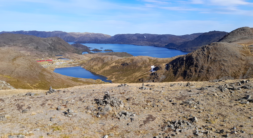
A 30-minute drive NNW on the E69 brings us to North Cape which makes it the northernmost point in Europe that can be accessed by car and makes the E69 the northernmost public road in Europe.
The plateau is a popular tourist attraction with c. 280,000 visitors annually. The cape includes a 307 metre high cliff (1,007 ft) with a large plateau on top, where visitors, weather permitting, can watch the midnight sun and views of the Barents Sea to the north.
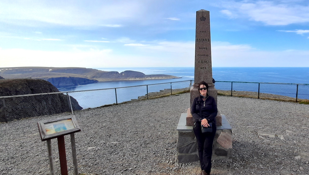
There are also several monuments and artwork located here including: a monument commemorating King Oscar II of Norway and Sweden’s visit to Nordkapp on 2 July 1873; The Globe; North Cape Milestone and ‘Children of the Earth’.
So many degrees – 18 Deg C at 71 Deg N – heatwave!
Each year in June, The Children of the Earth Prize is awarded during a public ceremony at North Cape, Norway. The prize currently amounts to 150,000 Norwegian kroner (NOK), equal to about 15,500 euros or 17,500 US dollars. The prize is presented to an individual or a project which, over time, has demonstrated compassion and ability to help children that suffer somewhere in the world. Anyone may nominate candidates for this prize.
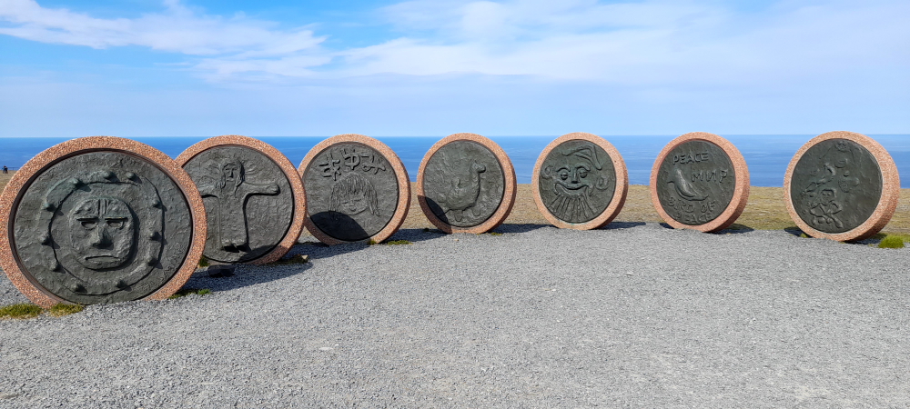
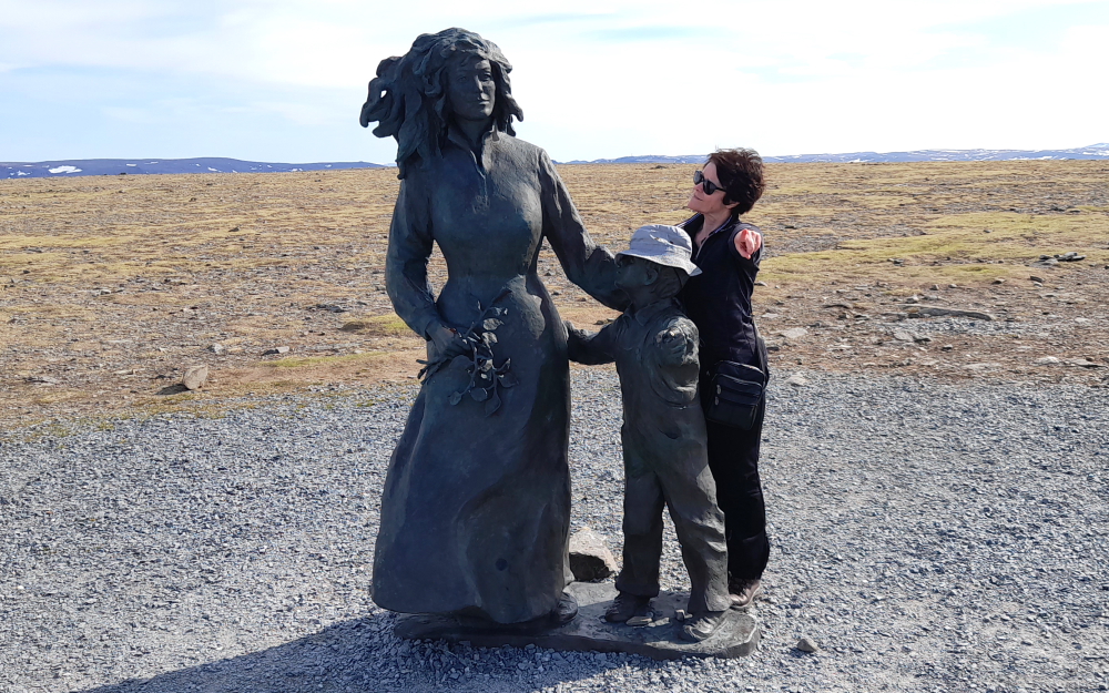
The second part of the sculpture, a woman and child, which faces the discs.
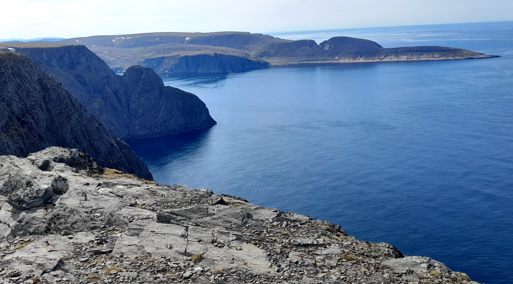
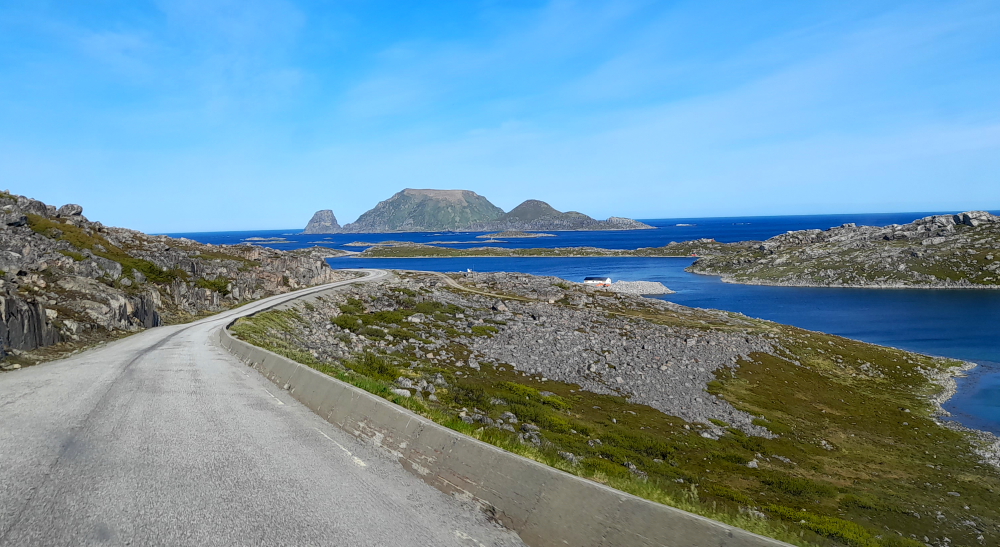
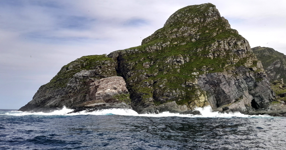
In this gorgeous weather when leaving NordKapp we get a great view of Storstappen, a rocky outcrop that Lynn will visit tomorrow to see puffins.
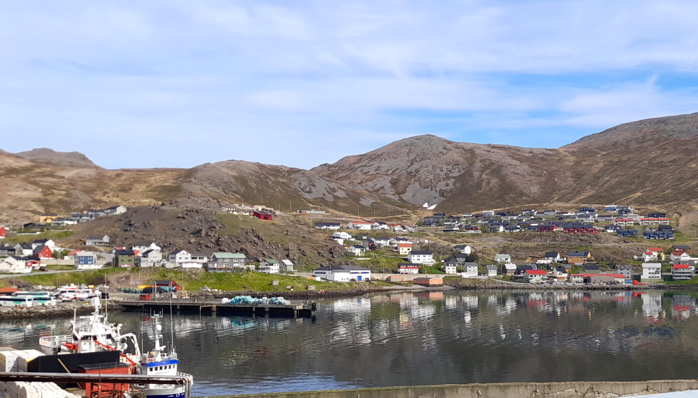
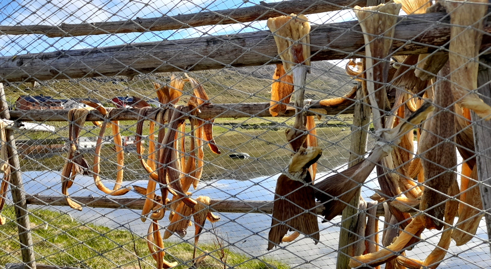
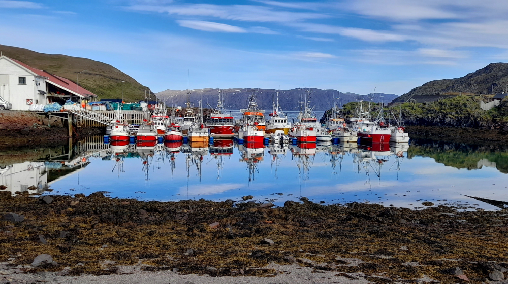
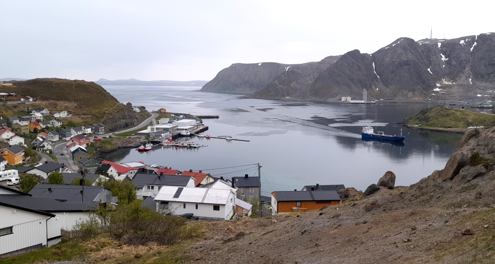
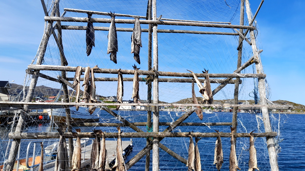
On our way back to the hotel we call into Skarsvag, the northernmost active fishing village in the world.
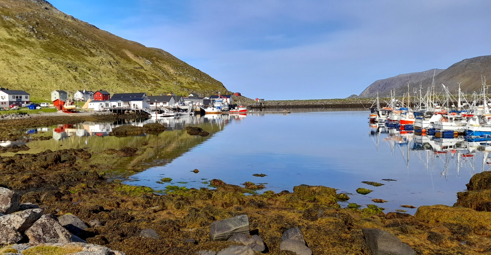
Where we first see the practice of air drying fish in the great outdoors – and our first swarms of mosquitoes.
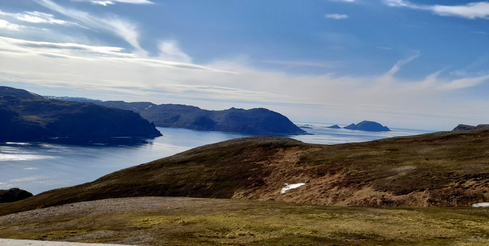
Driving back towards Honningsvag offers some scenic views.
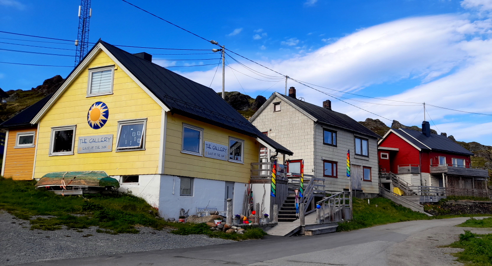
The next fishing village we visit is Kamoyvaer.
The information sheet the hotel gave us described Kamoyvaer as “no shops, a small art gallery normally open when we have cruise ships”.
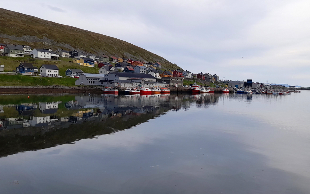
Last for today we visit Nordvagen – “closest to Honningsvag, no restaurants or shops”. Also “not much character at all” should be added to the description.
It’s 5:20 pm by the time we return to the hotel, just enough time to unpack before our 6:00 pm buffet dinner.
12 June, 2023
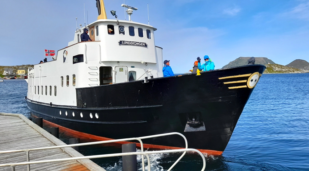
Several days ago Lynn studiously checked the weather for Honningsvag to determine which day would be best for a boat trip to view puffins (a bucket list item). Today is that day. She was planning on taking the 11:45am-1:15pm tour. Just after breakfast she gets a message from the company that they have an extra tour operating at 11:00 am so she grabs her stuff and we fly out the door as it’s a 30 minute drive to Gjesvaer (the 5th fishing village on the island) and she needs to be there 20 minutes beforehand to purchase her ticket priced at NOK950 (A$138).
We arrive at the tour company’s office/jetty at 10:30 am. On the jetty is another fish-drying frame.
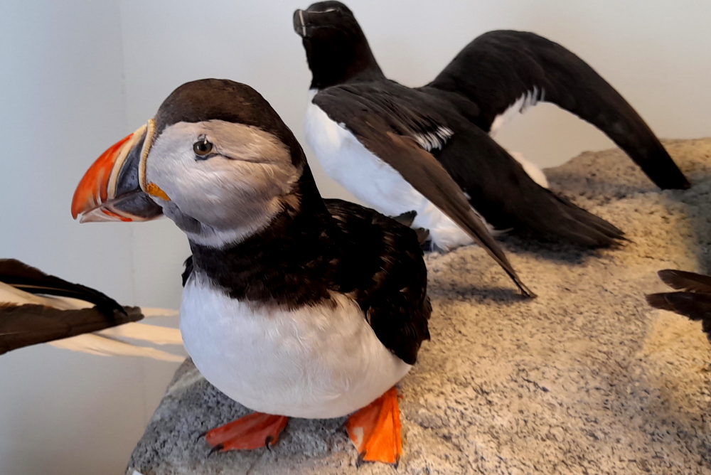
Inside the office is a coffee shop, gift shop and a display of stuffed birds that will be seen on the tour.
Lynn, and a busload of tourists, jump on the ‘Lundekongen’ and putter out of the bay on calm waters. She opts for the bow so that she has a better view of the puffins on the water.
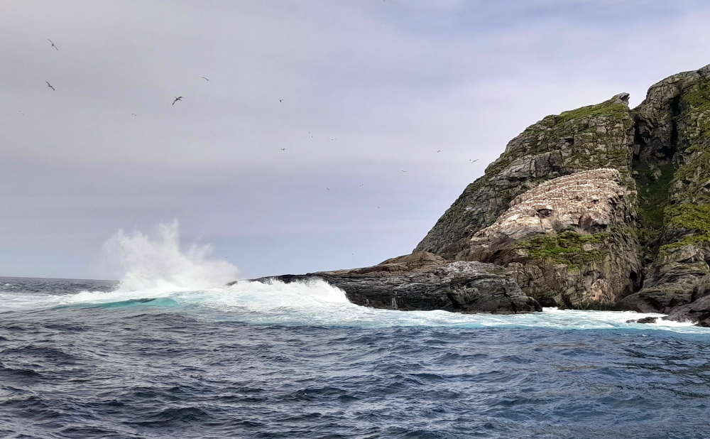
As the boat leaves the protection of the small archipelago, the waves get rougher. At the tip of the outcrop below, the bow drops into 10′ deep troughs.
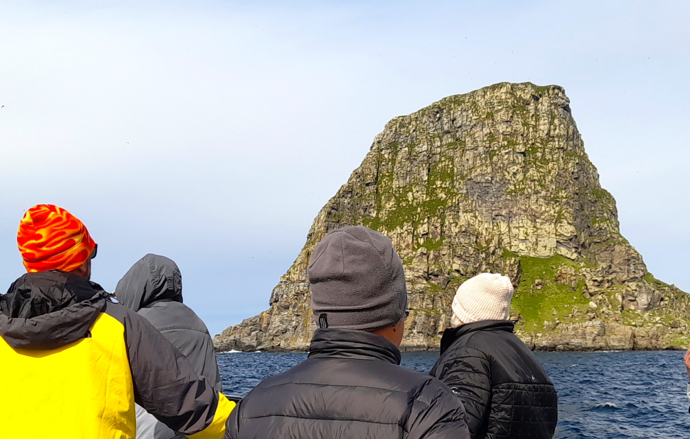
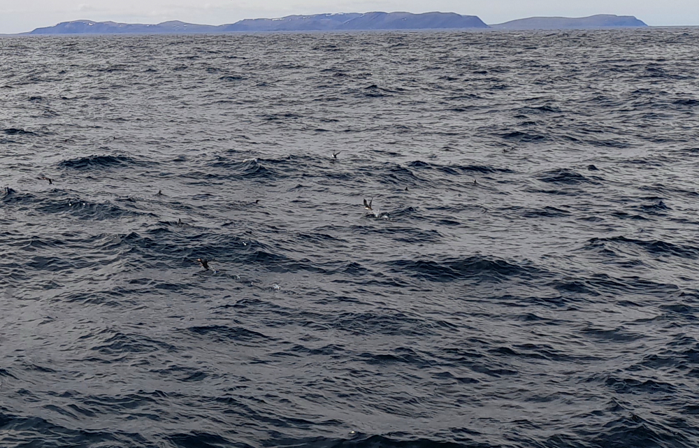
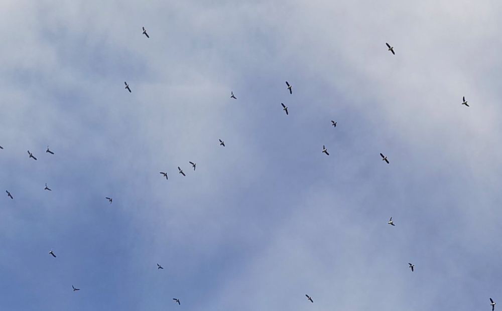
Fortunately, the boat provides binoculars for its passengers. Although it is easy to watch the dozen eagles soaring above the outcrop without them, the birds are truly magnificent magnified.
Turning the boat around, there they are – millions of puffins on the water as far as the eye can see. Well, lots and lots of black dots on the water, that is!
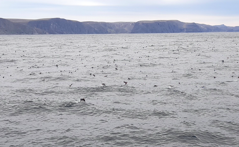
This is where the binoculars are invaluable as the camera on her mobile phone just can’t capture their cuteness.
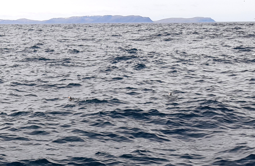
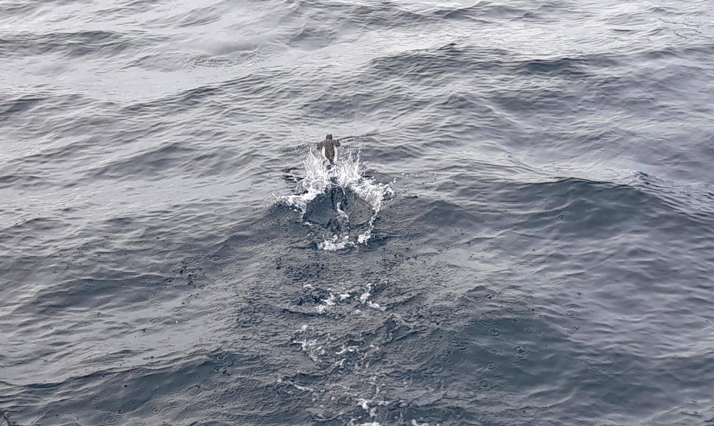
As the boat comes up behind them they swim away, constantly looking over their shoulders and either fly off, often dragging their butts in the water, or they dive.
Norway is home to 30% of the world’s Atlantic Puffin population. This is the smallest species of puffin and is also known as the Arctic Puffin. These cute birds are distinguished by bright-colored mosaic-like beaks.
Puffins begin arriving on the island in March, but the peak season is in May. The breeding season comes to its end in August.
Storstappen is a breeding site for a variety of sea birds besides white-tailed eagles and puffins such as razorbills, cormorants, kittywakes, gannets and guillemots. Once breeding season is over every bird leaves – there is no bird life here until breeding season returns the following year.
Puffins prefer to live on the sea and might be found ashore only during their breeding season. However, the baby puffins or pufflings are carefully hidden in the ground holes to protect them from predators, so it is practically impossible to observe the chicks.
Although this boat trip is billed as a bird safari, a seal decides to get in on the act.
100 minutes later, the boat docks. Another bucket list item ticked off. Just as well she went this morning as dark clouds are gathering as we drive back to town.
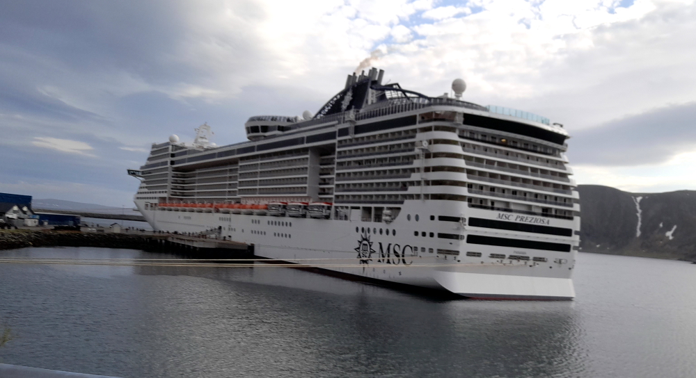
We get a bit of a surprise as we crest the hill as we are confronted by the large bow view of the ‘Queen Victoria’ which is docked at the cruise terminal this afternoon.
We get an even bigger surprise when we drive into town for dinner this evening as we are confronted by the stern view of an even bigger cruise ship – the MSC Preziosa – which has replaced the ‘Queen Victoria’.
13 June, 2023
Tomorrow we start heading south for the first time in a month and a half. It is blowing a gale this morning and driving rain so we spend the day catching up on the usual things like the blog etc. All a bit dull but these things have to be done. I also do some research into how we are going to get home in a year’s time. This may seem a bit premature but we would like to take a cruise at least part of the way home through the Suez Canal but they seem to book out nearly a year in advance.
At 5.30 pm we venture out to the car to drive into town for dinner. It’s 6 Deg. C, real feel 1 Deg. Bbbrrrrr!
14 June, 2023
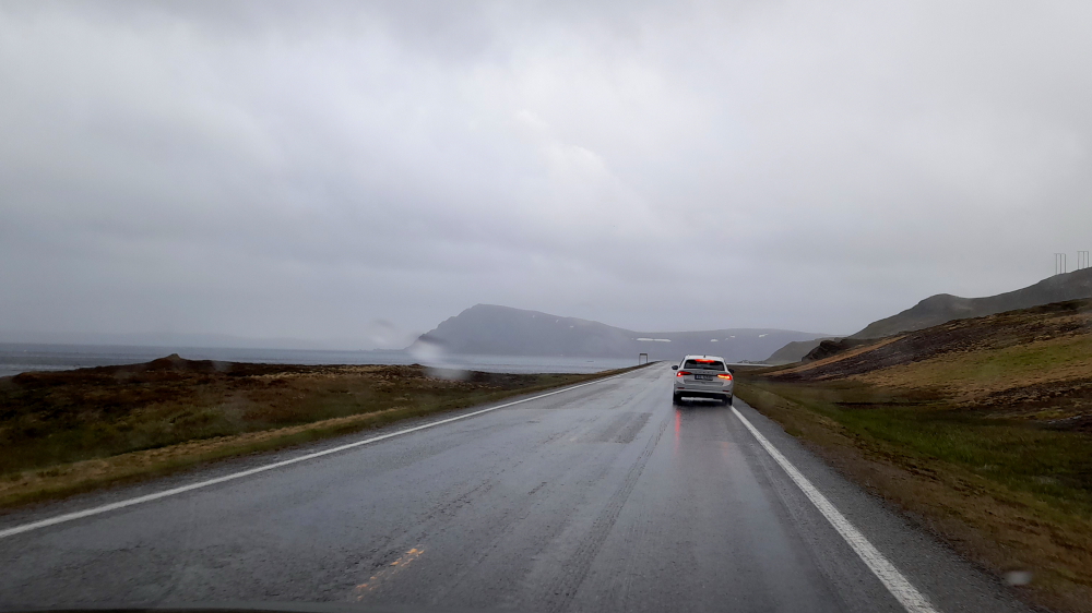
Today’s weather has convinced us that our planned route south is the correct one. It’s raining heavily, 7 Deg. C and winds are predicted to top 53 kph. It’s blowing a gale as we drive out of town making steering the car a tad difficult.
Still, I would rather be in the car. Pity the poor cyclists we see travelling in the opposite direction, trying to not only make head way but also to prevent their bikes from blowing over and even heavy motorcycles are having a hard time riding in a straight line. Side on to the wind our wiper blades are being blown off the windscreen. Sure glad we don’t cycle (poor bastards). That’s God getting even with them when they run over pedestrains on the footpath in the city and ride past traffic at traffic lights then hold up tax paying car drivers.
Our trip to Karasjok today will be 235 kms, taking approx. 3.5 hours so we should be checking in around 2:00 pm. To date we’ve put 5,237.5 kms on the Mazda Cx-30 odometre.
We will be retracing our route to Olderfjord where we will continue straight on, back on the E6 southwards to the end of Porsangerfjorden and beyond.
As we approach the head of the fjord and are in the lee of the hills covered with forests, the weather changes dramatically to sunny skies, little wind and it’s 16 Deg. C.
The road from Lakselv to Karasjok is across boggy land interspersed with a myriad of small and large lakes.
At Porsangmoen we pass by a military base with some green-painted, lightweight tanks and a string of white-covered skidoos. Next thing we know we see signs that we are about to drive through a military area – and a very pretty area it is, too.
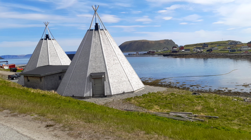
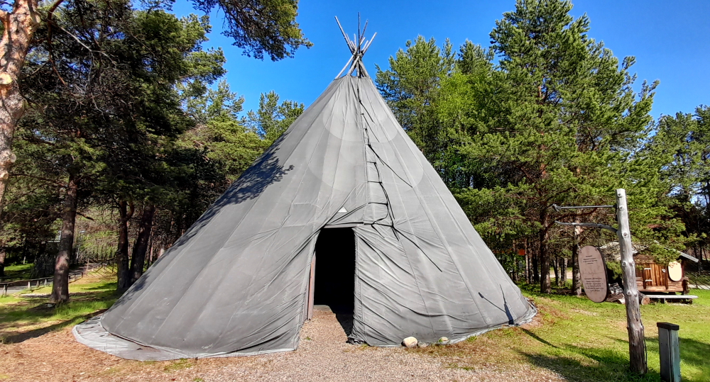
We leave the lakes behind and drive across a plain covered in shrubbery before we arrive at our destination on the banks of the Karsjohka River: Karasjohka – the capital of Sapmi – the Sami people’s own name for their traditional territory.
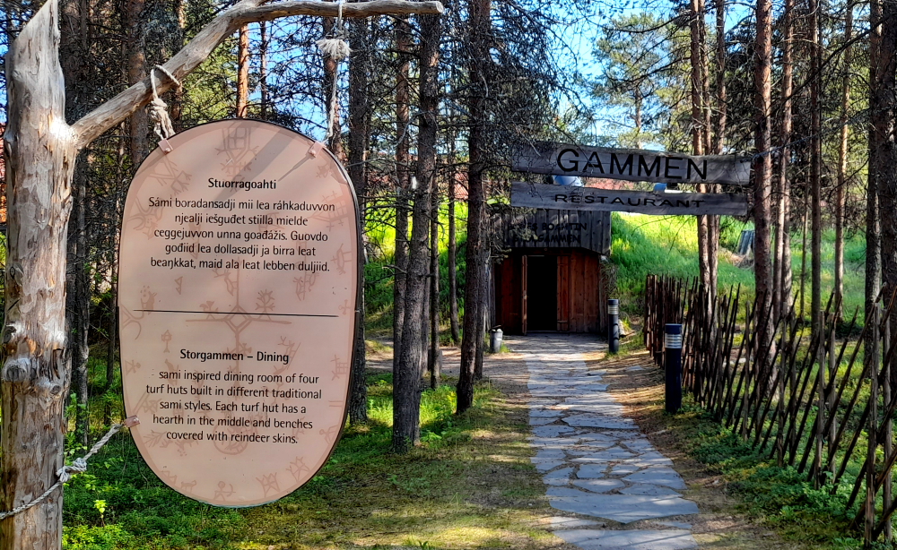
Fortunately for us, the Scandic Hotel is located next door to two of the Sami features in town: Sapmi Park and their restaurant Storgammen which becomes the hotel’s restaurant in the summer. It’s built into an earthen mound and has metal chimneys protruding from the top.
After checking out the timber-lined interior of the restaurant we wander around Sampi Park which includes several structures native to Samis.
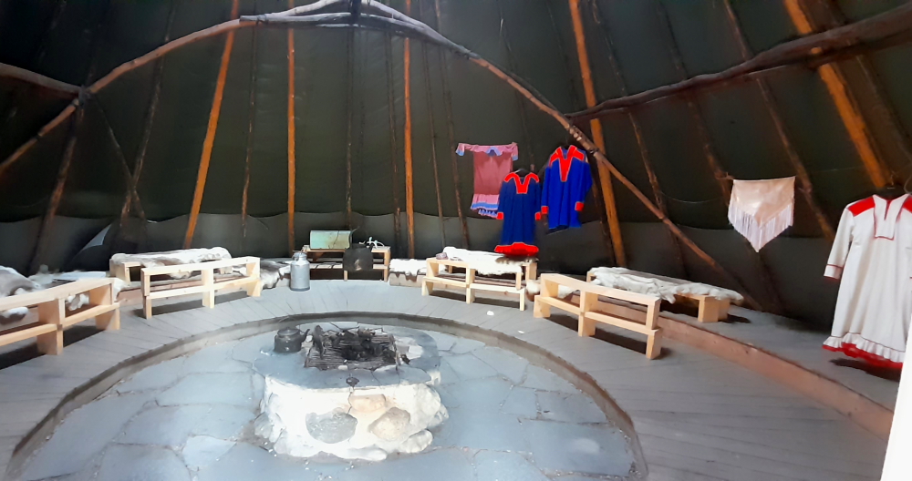
The most prominent structure is a tent like the ones used by Native Americans – the family laavi. It is a modern large goahti with the tent constructed in the same manner as the traditional goahti.
Inside, the ground around the central fire pit is often covered with slates.
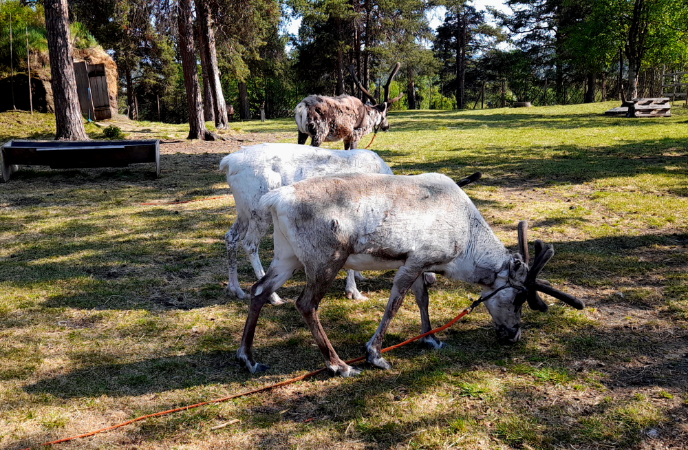
Nearby is a paddock for 3 reindeer.
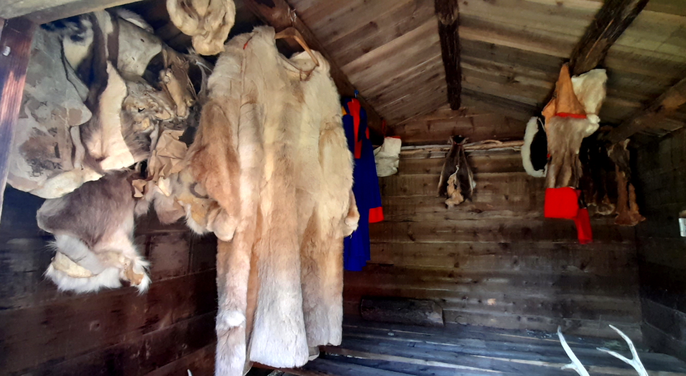
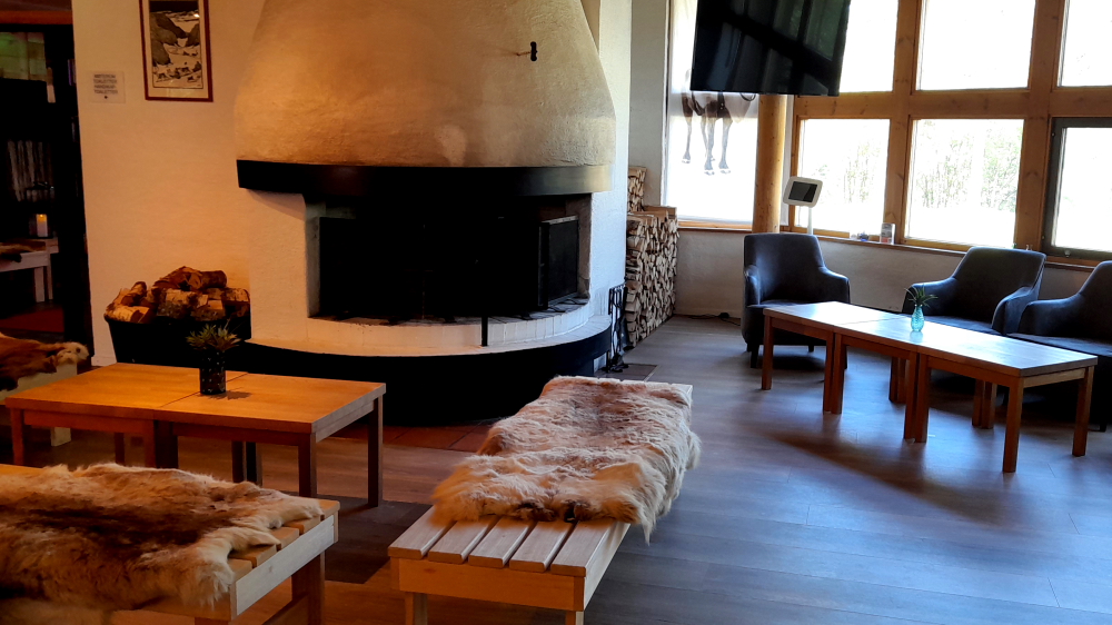
Even the lounge area of the hotel has hints of Sami with its fire, log pile and reindeer skins on wooden benches.
It takes all of 5 minutes to drive around the town. We’re only 15 minutes’ drive from the Finnish border which is further down the river.
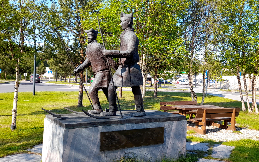
One item of interest in the town is a 2012 sculpture by Aage Gaup of 2 Sami skiiers in a small park. It commemorates Ole Nilsen Ravna and Samuel Johansen Balto, members of Fridtjof Nansen’s expedition across Greenland in 1888. Fridtjof Nansen, together with five companions, became the first to cross Greenland’s inland. They spent six weeks skiing across the ice cap from east to west and had to spend the winter 1888-89 at Godthaab (Nuuk) on the west coast before they could get a ship back to Norway.
Balto (1861-1921) was born in Karasjok and belonged to the river Sami who live there. He had a background as a forest worker, reindeer herder and fisherman when, as a 27-year-old, he joined Fridtjof Nansen on skis across Greenland. Nansen wanted two mountain Sami with him who were good skiers and experienced in the mountains. Ole Nilsen Ravna and Samuel Balto were engaged for the trip, Balto despite the fact that he was not a mountaineer and Ravna despite being an ‘old man’.
Ravna (1841-1906) was a Northern Saami adventurer, explorer and reindeer herder. When Ravna was forty-six years old, he became a member of the Greenland expedition and was awarded a silver medal for his membership in this expedition.
At 6:00 pm we enter the Sami-inspired dining room of four turf huts built in different traditional Sami styles. Each turf hut has a hearth in the middle and benches covered with reindeer skins. Ahh, the evocative smell of wood smoke.
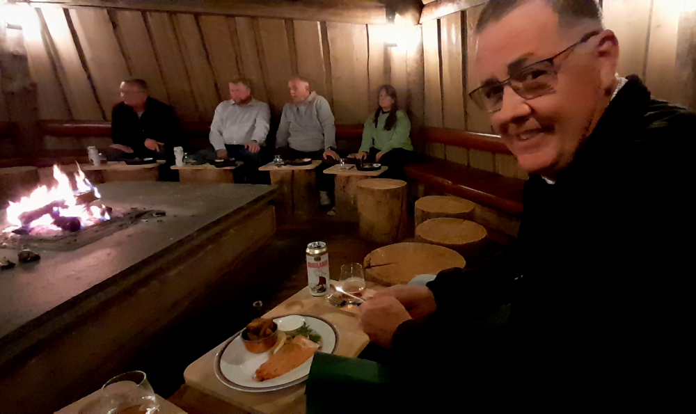
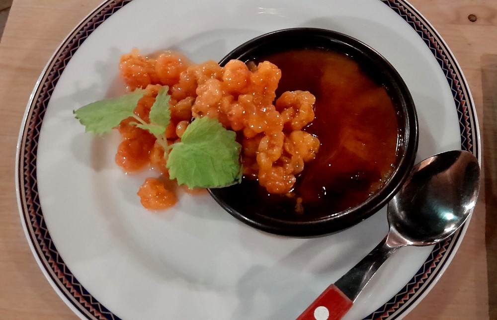
We both choose the salmon for mains and Lynn has the brown cheese brulee with cloudberries for dessert. Delicious all round!
While dining, a party of 5 people sat opposite us. We started chatting, as you do, and discovered that they are Greeks (and a Swiss), who live SW of Thessaloniki in Zagori and own Zagori Suites, a luxury suites and apartments hotel. It’s always great to meet fellow travellers, to exchange experiences and stories and, after exchanging business cards, (yes, those last century, funny little bits of cardboard), hopefully we’ll meet again sometime after inviting each other to come visit.
15 June, 2023
It’s half-past June already and hard to believe that we’ve been on the road for almost 9 months now.
Although it’s bright and sunny today, and as we’ve ‘done’ Karasjok, we need to knuckle down and sort out our Christmas plans.
Although we found a few possible places to spend the Christmas period, nothing really inspired us. We usually find that some days are diamonds and some days are stone. This one was stone so it is best to abandon the search today and wait for some inspiration over the next few days. Christmas is off season in Europe so a few days won’t hurt.
However, trying to get a reasonable feed in this down does hurt. Other than spending more on dinner, than we did on the hotel stay last night, our only other option is a cafe that served up meatball buffet with some form of boiled-to-death vegetables. It was almost inedible. At least we are heading to Finland tomorrow and hopefully as we move south the food may improve. Dinner tonight made McDonald’s taste like a gourmet dinner!
Tonight is our last night in Norway. To sum up Norway I would have to say that it is one of few third world countries where you can drink the water. Although the scenery can be spectacular, everything is super expensive, the food will “force diet” you, things are often done the hardest way possible, they hate anyone that uses a car or tries to park a car (including EVs). Road tolls are everywhere even on badly maintained backroads. Their banking system is archaic, GST is 25% and even professional tradesmen produce the quality workmanship of a DYI beginner. Plumbing doesn’t work, power points are located as an afterthought, square timber work is unheard of and duvets only come in single size and showers are so small that you can’t lift your arms up to wash your hair. And don’t get me started on the weather….. Perhaps that is the problem. Perhaps living here will eventually freeze your brain.
