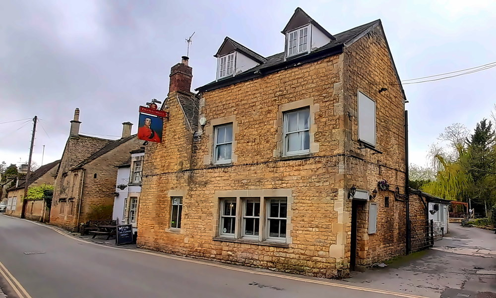
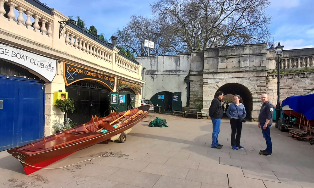
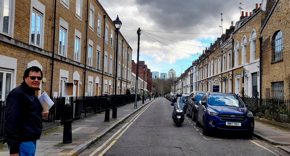
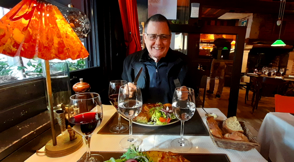
A red-letter day today – will we sell the car this morning??
After a hearty breakfast we drive back to Stuart and Alexander’s Waves car wash situated in the nearby Tesco car park. I’d booked it in for 10:30 am but we arrive around 9:45 hoping to get it done earlier. No luck. So we head to Costas till we’re contacted that the car is ready around 11:15.
Farewell old friend.
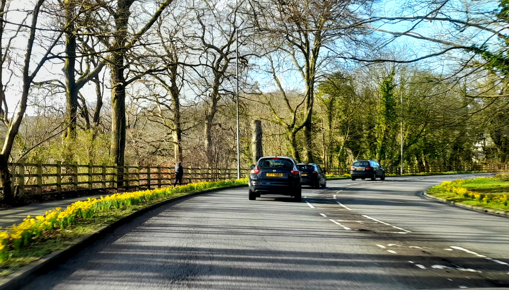
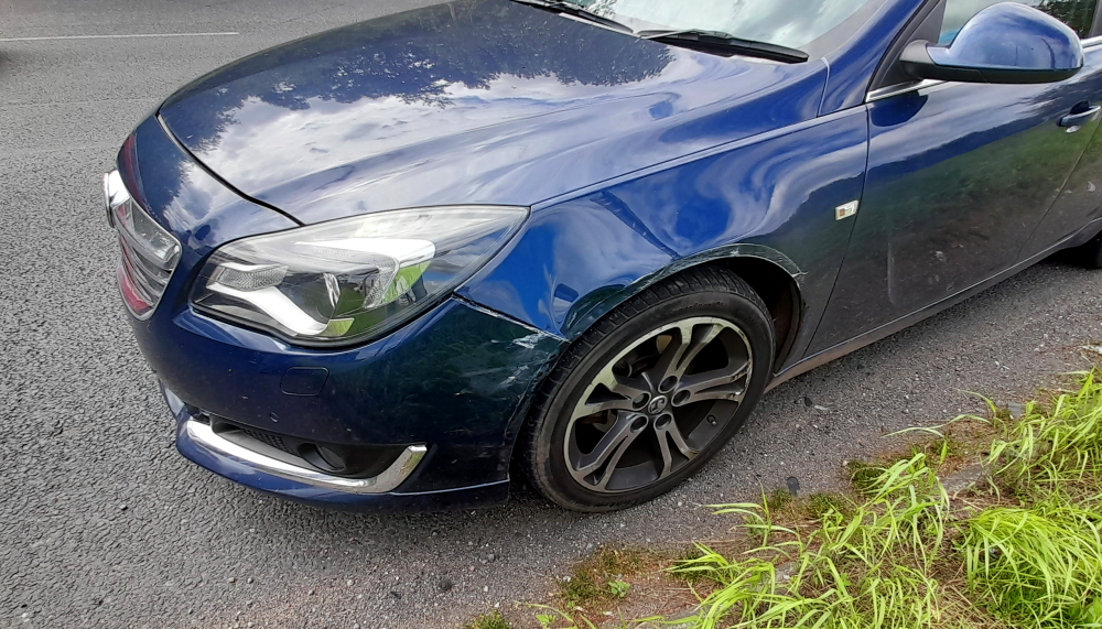
The Insignia cleans up well. It was nice to drive, had plenty of boot space for all our luggage but has not been a particularly reliable car – it probably had a hard life in Scotland before we bought it. Still, I find it hard to part with the car and I believe that we have improved the car since we bought it.
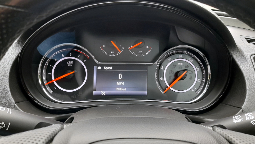
Over 20 months of ownership we drove the Insignia 13,500 miles (approx 21,600 km).
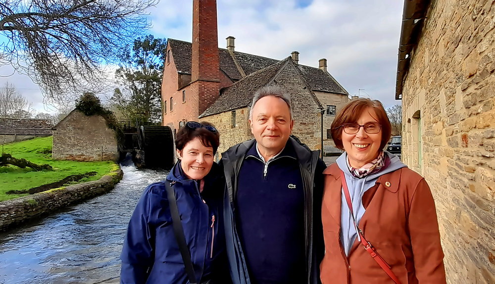
When we were staying with Barbaran and Stuart in Wokingham last February, Stuart suggested we contact their friend, Ian, to buy our car which, if successful, will be a god-send.
It should have been a 3-minute journey to Ian at Nirvana Car Sales in the Mulberry Business Park but it appears that works to the railway overpass is still ongoing (as it was 3 months ago in February) causing a long tailback extending as far as the Tesco roundabout, so we have to find an alternative route to cross the railway line to get to our destination.
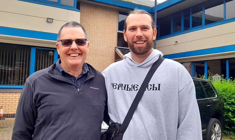
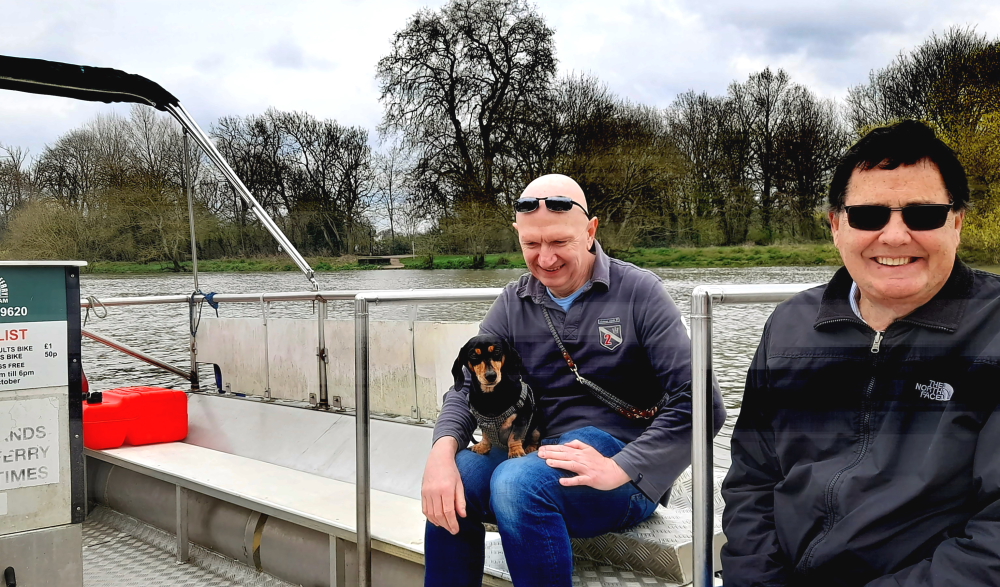
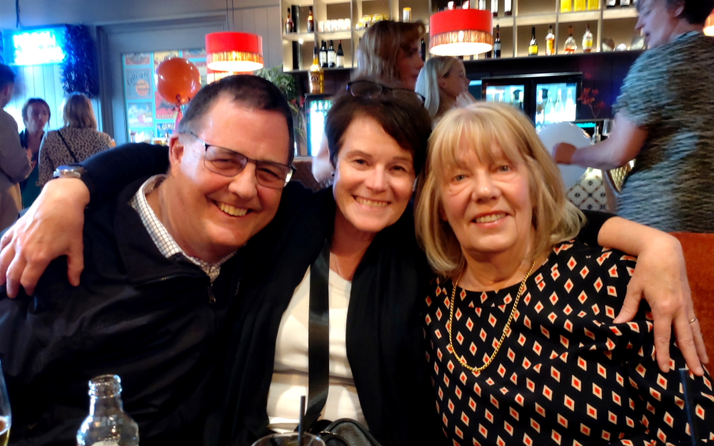
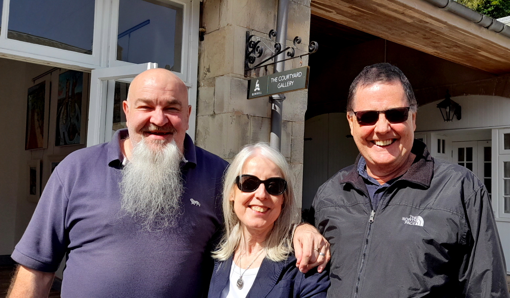
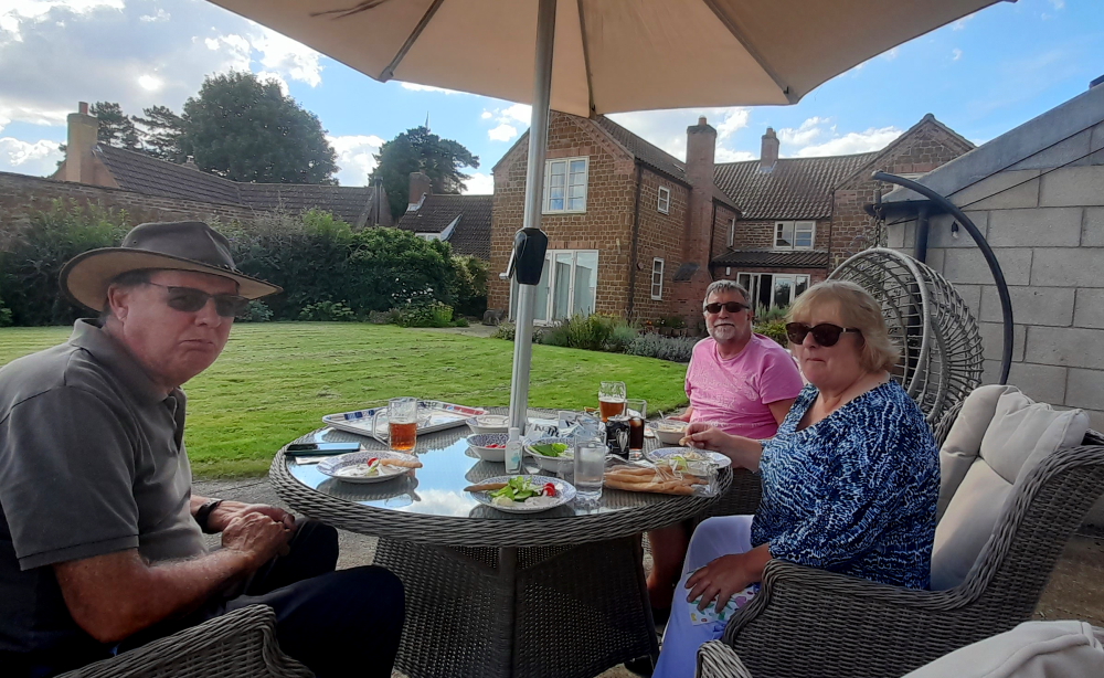
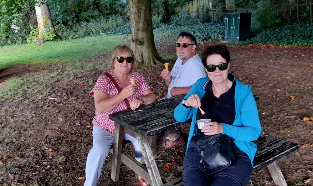
While waiting for Ian to arrive, another car pulls into the car park and Lynn recognises the driver as being Alexander, Barbaran and Stuart’s eldest son. (The last time she saw Alexander and his younger brother, Niall, was in Wokingham when they would have been in primary school.) We introduce ourselves and have a bit of a chat.
Meeting up with Alexander.
Ian arrives at about 12:15 pm and we have all the sales paperwork completed, ownership transferred and the money in our account within the hour. Ian is indeed a pleasure to deal with and he saves us having to muck about with using one of the online commercial wholesale car buyers.
What a relief!
It’s only a 20-minute walk back to the hotel where we cancel the car insurance. Nice to know that we’ll get refunds of car tax and the balance of the insurance premium within the next couple of weeks.
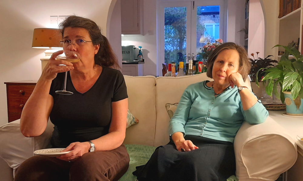
Lynn settles into an afternoon of starting to catch up on 10 days of blog. We crack our final bottle of chilled champers to celebrate the car sale and in readiness for our hour’s Zoom call at 4:30 pm with Vicki who is back in Nerja at the moment. Her daughter, Sasha, arrived yesterday from uni in Glasgow so we get to catch up with her, too.
22 May, 2024
Waking early, we have an early breakfast then head out into the drizzle to walk to the train station to suss it out for our journey on Monday. It’s only an 8-minute walk, it will be the nearside platform and we buy 2x one-way tickets to Richmond at GBP15.30 each.
The town centre looked interesting when we drove through it on Monday so we walk towards Market Place checking out restaurants and pubs for tonight and where Lynn finds a Specsavers to repair the lens that keeps popping out of her specs and books a haircut for 2:00 pm.
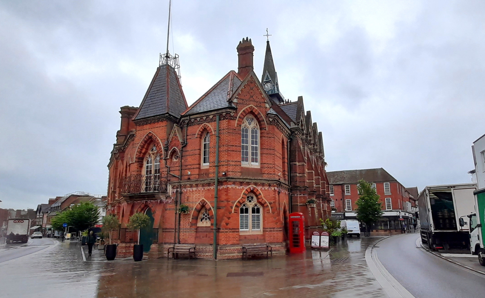
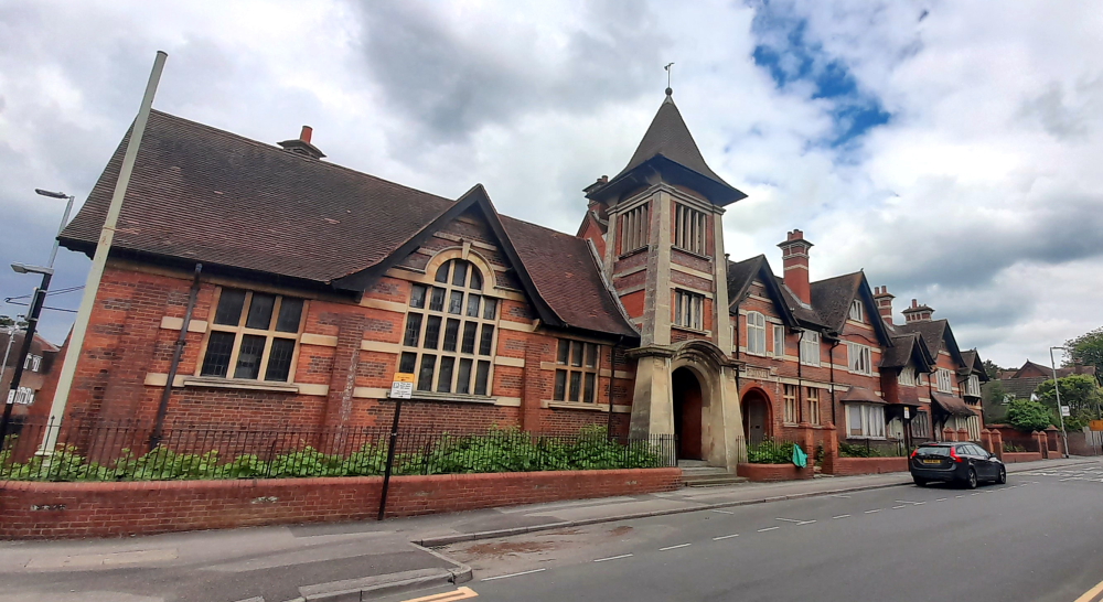
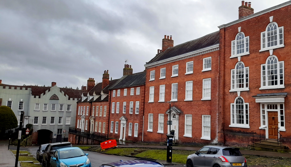
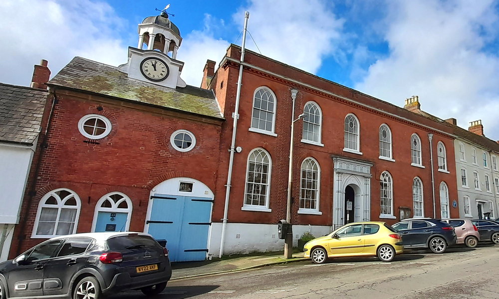
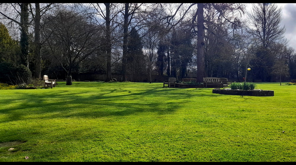
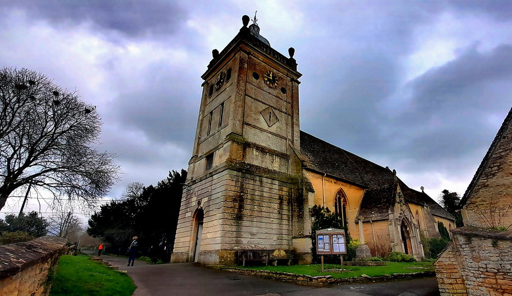
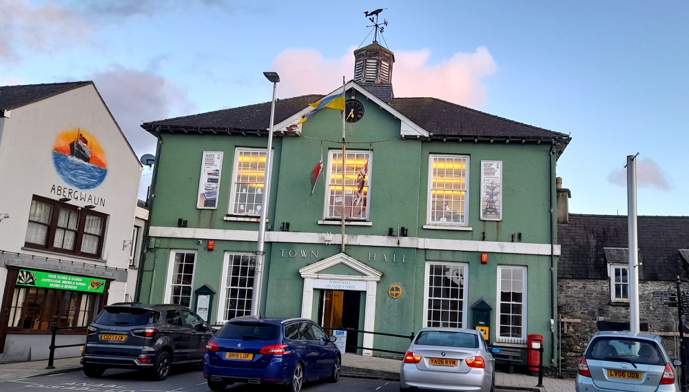
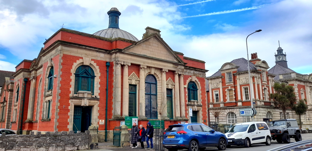
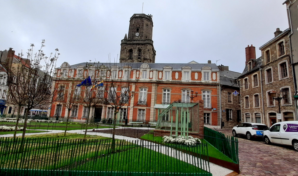
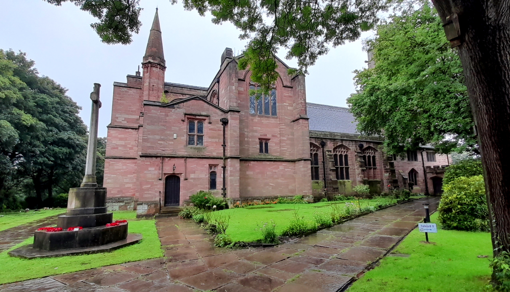
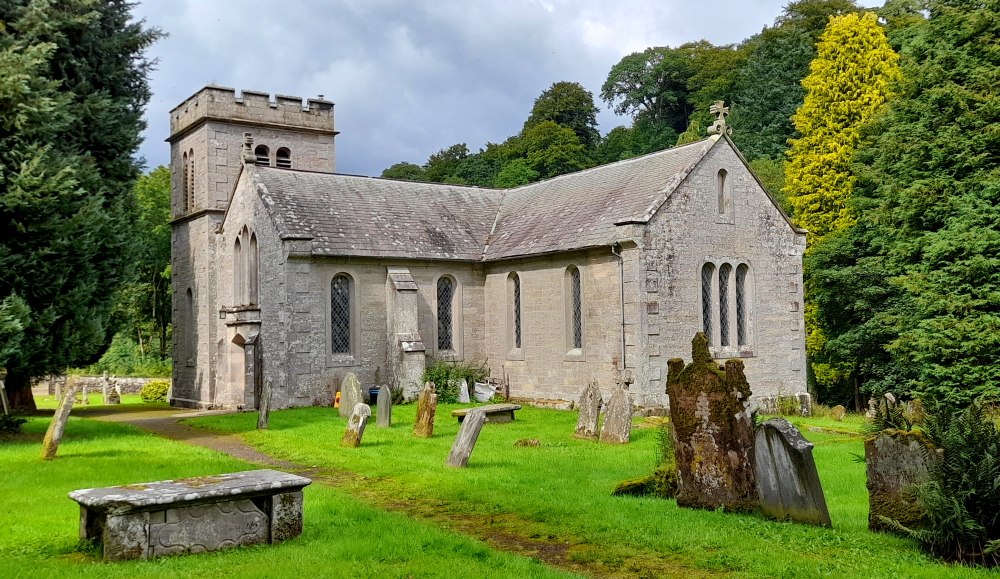
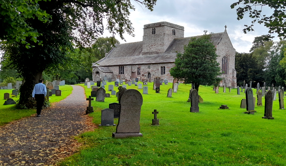
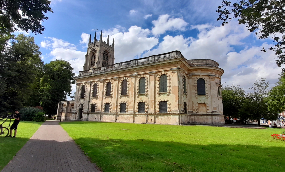
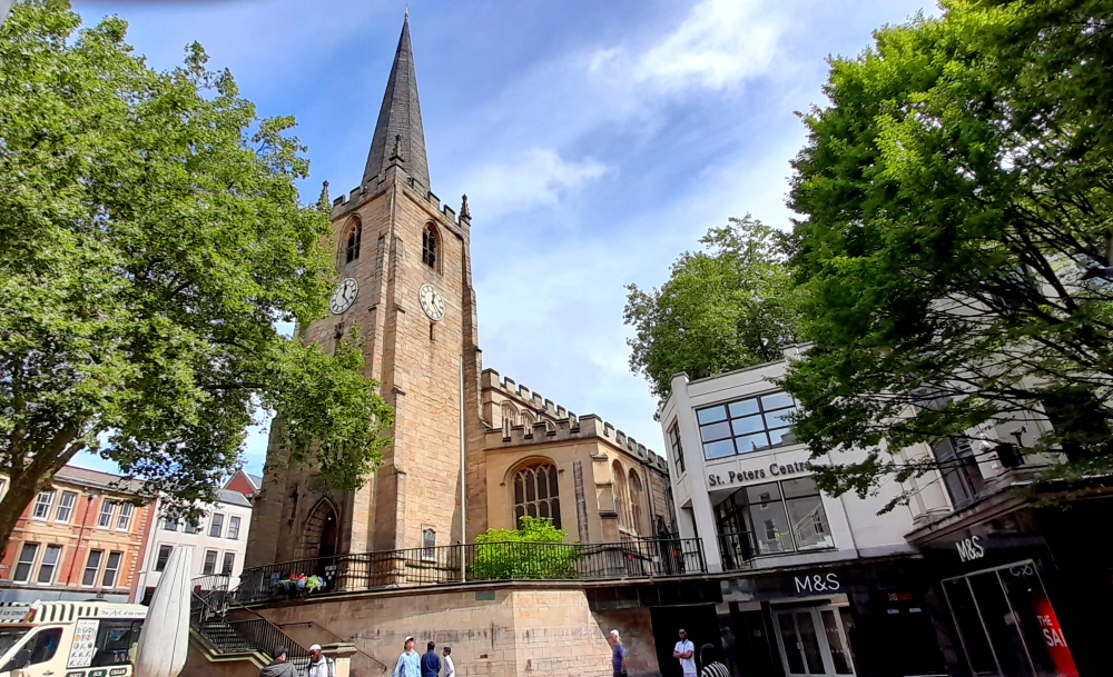
Wokingham Town Hall.
While she’s there I catch up on a couple of reviews, sort out the photos for the past 10 days and buy some more travel insurance for the last leg of our 2-year European Grand Tour.
23-26 May, 2024
Lynn has taken 2 full days to add her bits to the blog. It’s been at least 10 days since we updated the blog so it’s understandable. This week was put aside to sell the car, do some catching up on things, get our luggage downsized for our 1st flight since Poland and rest up before our final 2-month drive around Estonia, Latvia and Lithuania starting with our flight to Helsinki next Tuesday. Are we down to 23kg for our checked baggage?
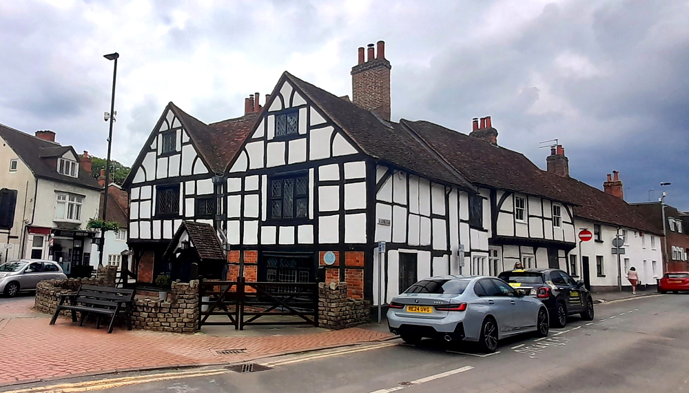
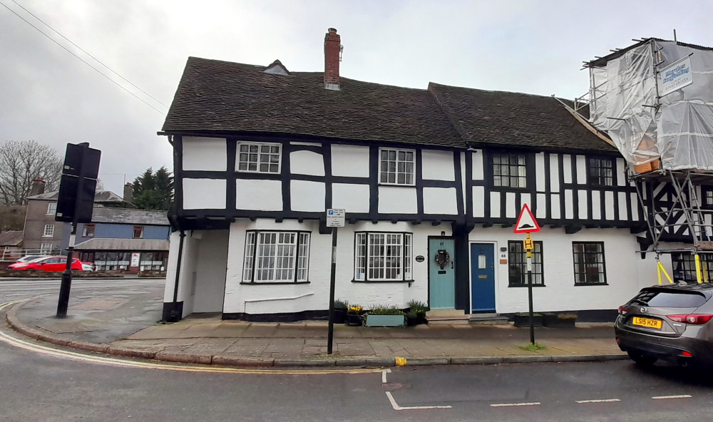
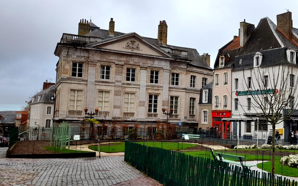
A Tudor House in Wokingham town centre.
On the 24th Lynn walks around Wokingham old town and the next day she resorts to buying 2 items of summer clothing after she checks out the weather forecast for Estonia and realises that summer temperatures will be in the high 20s at least during our next 2 months’ tour.
Former County Police Station, 1904, Wokingham.
Dinners this week have been almost exclusively at our hotel since the food is excellent and all at reasonable prices. We did, however, venture out to Rossini’s for Italian which was reasonable but no better than what Claudio has been cooking for us at the hotel.
27 May, 2024
Spring Bank Holiday today. We say goodbye to the Premier Inn staff who have been fabulous during our week stay here. We walk to Wokingham station, catch the 10:53 train to Richmond station.
The plan was to then catch the District Line to Turnham Green then swap to the Piccadilly Line to Heathrow Terminals 2&3.
A good plan but London Underground decided to close the District Line today without advising passengers on other lines. We therefore only find out that no underground trains are running from Richmond when we arrive. In any 1st world country buses would be substituted to go between the normal stops but this is the UK. We now have to take an overground train to Gunnersbury, then lug our suitcases up a long, high flight of stairs (too bad if you are in a wheel chair as there are no lifts) then find the rail replacement bus to Acton Town Station to rejoin the Piccadilly Line. So, instead of taking about 30 minutes from Richmond to London Heathrow it took us well over an hour. These guys couldn’t organise a piss up in a brewery. Why the hell would they close the District Line on a long weekend at the start of school holidays? Mental midgets.
At least the Hilton Garden Inn is right at the Terminal 2 exit. It also has a coin-operated laundry (but not a swipe credit/debit card payment). If there is a more difficult way to do things the Poms will find and choose that way.
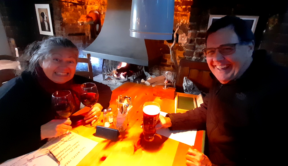
Paul and Susie are coming to the hotel this evening to meet us for drinks and dinner as it may be a few years before we see them again. I can’t see us heading to the UK again as I am all but over the traffic jams, the high costs, frustrating methodologies of the public service and general inefficiencies. The English make the French look civilised.
However, we have a lovely dinner and drinks with Paul and Susie and hopefully we have convinced them both to head over to Oz to stay with us for some time in the next couple of years.
Drinks then dinner at the Hilton, Terminal 2, Heathrow.
Our flight to Helsinki is scheduled for 10:20 am tomorrow. It will be interesting to see how the Poms can make a simple flight into a palava. It all may seem simple compared to what we find in Estonia, Latvia and Lithuania unless they have shaken off their old Soviet era ways.
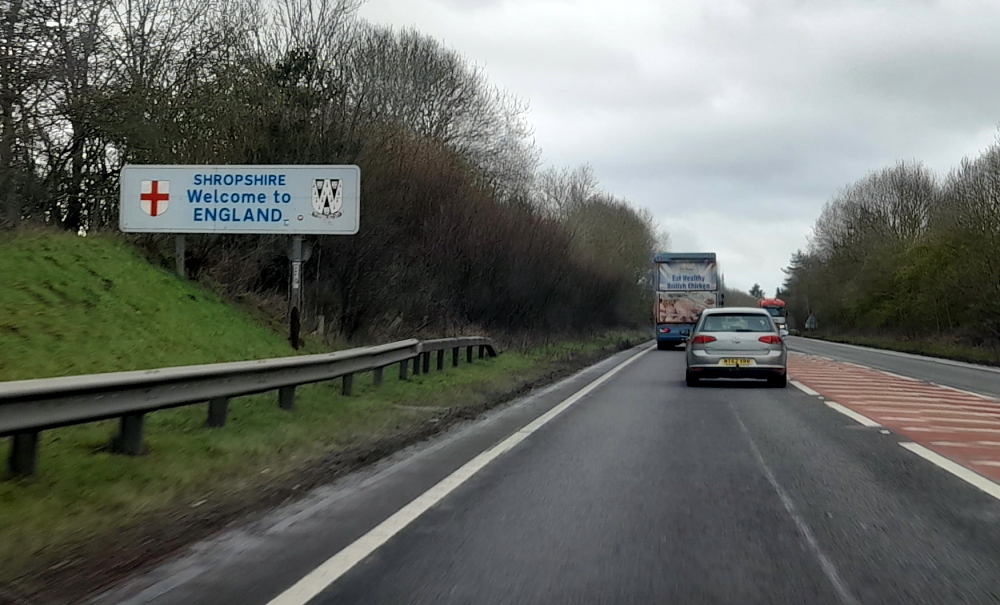
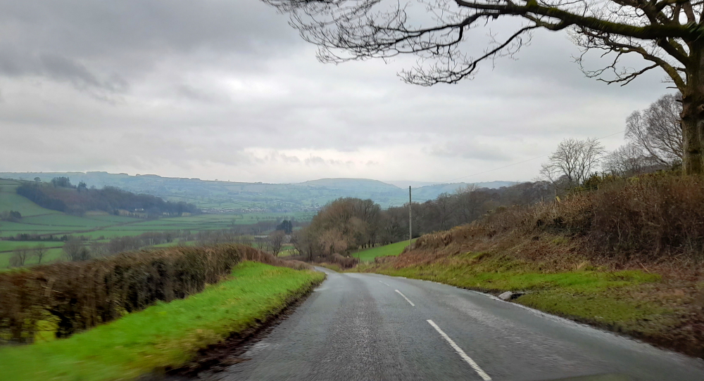
We leave Llanrwst, Wales at 10:00 am for our 147km drive to Ludlow, Shropshire, England, about a 2-hour drive. It’s sunny and the air has lost its chill as it’s 12 Deg. C.
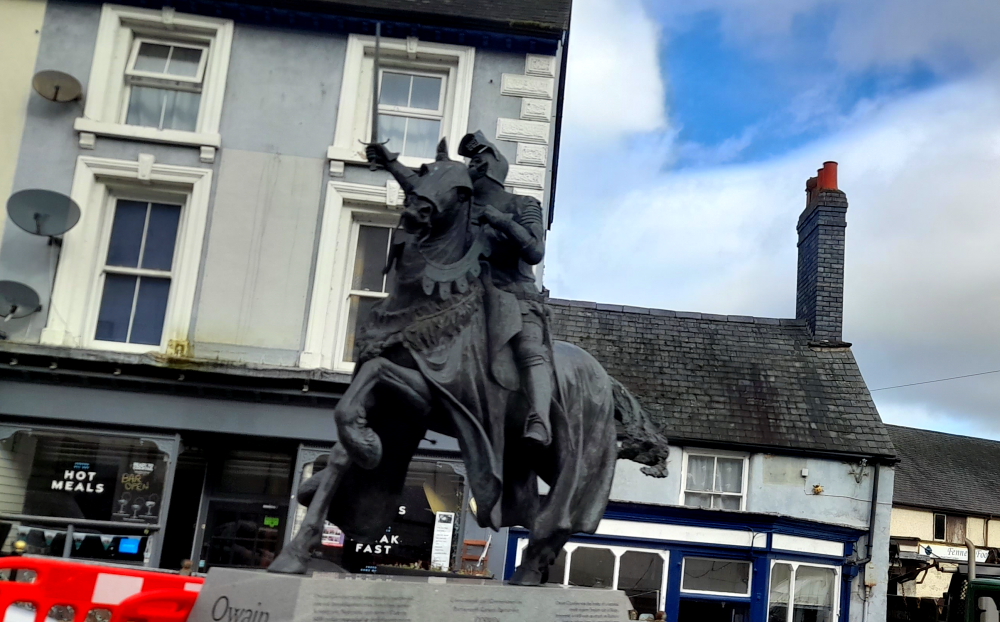
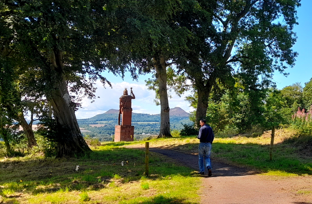
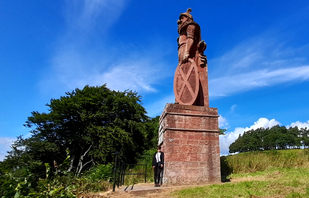
Our route takes us along the A5 through Corwen where we see a rather fearsome, life-size bronze statue of a knight on a steed, Owain Glyndwr (1359-1415) which is opposite the pub that bears his name. He had a home in Carrog, near Corwen, back in the day.
Also known as Owain ap Gruffydd he was a Welsh leader who led a long and fierce war of independence which he hoped would end English rule in Wales during the late Middle Ages. He formed the first Welsh parliament and is believed to be the last native-born leader to unite Wales in a common cause. He was the self-proclaimed Prince of Wales with a reign lasting from 1400-1415.
Owain Glyndwr.
We also pass signs for the Pontcysyllte Aqueduct, a navigable aqueduct that carries the Llangollen Canal across the River Dee in the Vale of Llangollen in northeast Wales.
The 18-arched stone and cast iron structure is for narrowboats and was completed in 1805 having taken ten years to design and build. It is 12 feet (3.7 metres) wide and is the longest aqueduct in Great Britain as well as the highest canal aqueduct in the world.
Pontcysyllte Aqueduct.
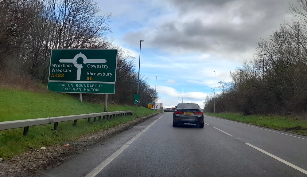
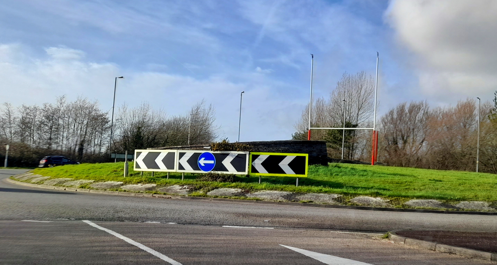
Soon after we arrive at a roundabout that by turning right we continue on the A5 towards Shewsbury. Going left we would end up in Wrexham which has achieved recent fame thanks to actor Ryan Reynolds and his mate, Rob McElhenney, buying its football club. We turn right.
Wrexham or Shrewsbury?
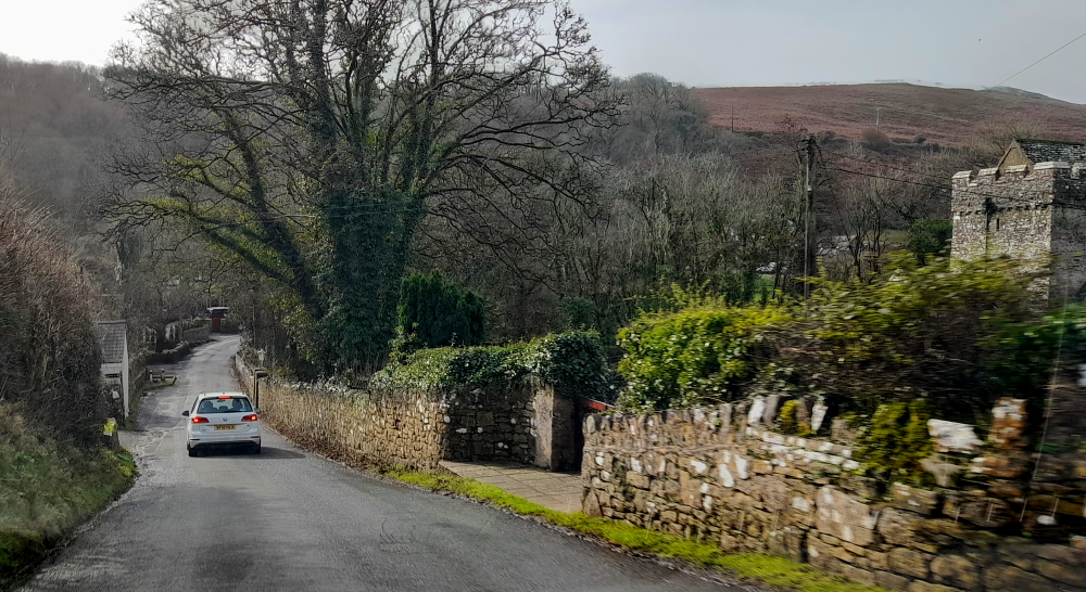
2 minutes later we cross the River Ceiriog and enter England once again. Bypassing Shrewsbury we take the A49.
Wales-English border.
It isn’t until we are virtually at Ludlow that we finally see a sign for it as you need to take the B4361 off the A49 to get there.
Fortunately, our hosts had agreed to an early check in so after shopping at the nearby Tesco we arrive at ‘Charlie’s Cottage’ in Lower Corve Street at 1:45 pm.
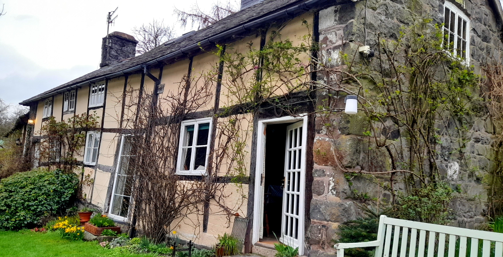
Charlie’s Cottage, Ludlow (the one with the pale blue door).
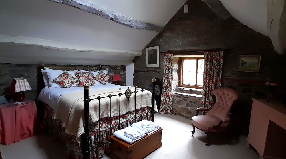
And what a delightful, cozy cottage it is, too. A Grade II* listed building built about 1650 and retains many of its original features – sloping beams, old brick fireplaces and the sloping floor in the main bedroom – not to mention the care and attention to its exquisite decor. Plus it’s functional and I don’t have to ‘duck or grouse’ at all!
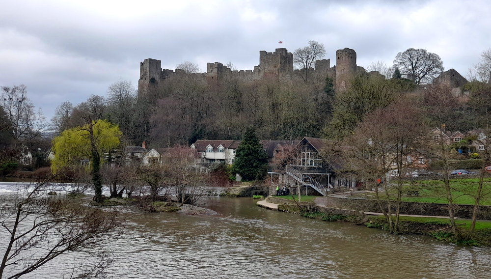
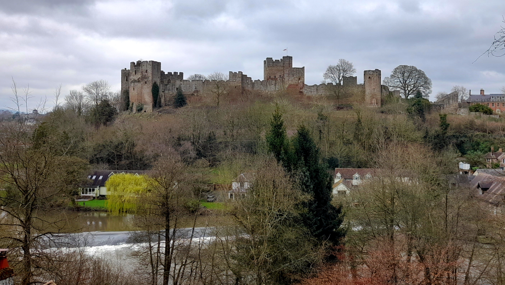
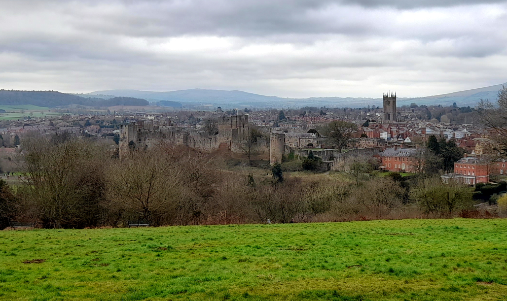
After unpacking we take an exploratory walk up the street. Ludlow is a thriving medieval market town and an architectural gem. The historic town centre and the 11th century Ludlow Castle are situated on a cliff above the River Teme and are surrounded by the south Shropshire countryside and the Welsh Marches.
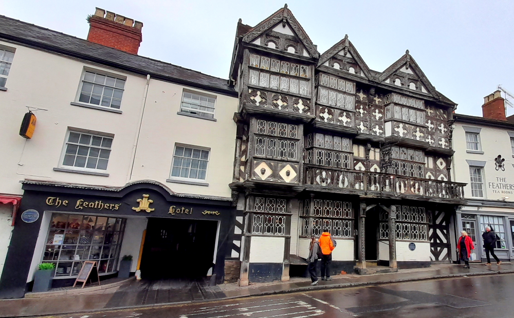
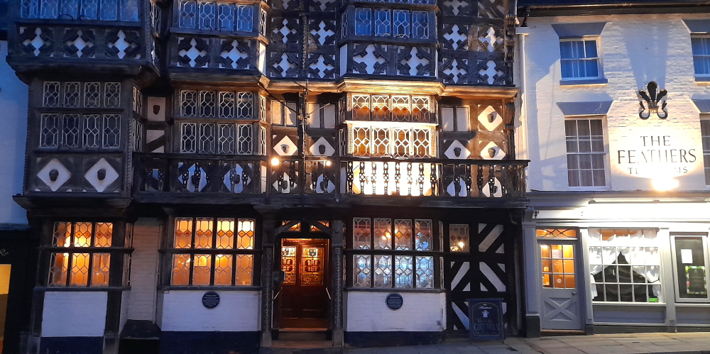
The Feathers Hotel, Ludlow.
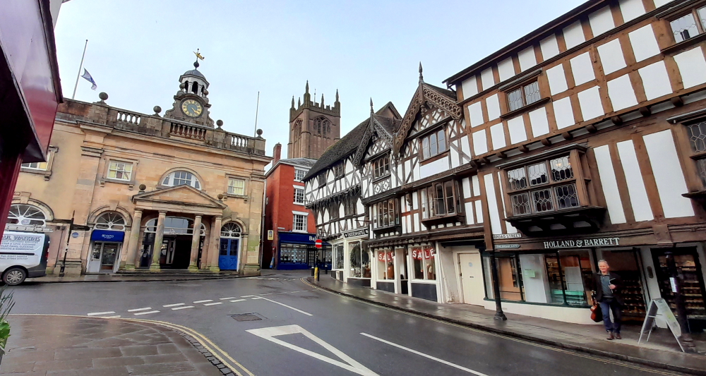
First of its architectural gems we come across is The Feathers Hotel. Built in 1619 by an ambitious attorney called Rees Jones, who moved to Ludlow to pursue his career at the ‘Council of the Marches’, the building was converted into a hotel by his grandson 50 years later and has been welcoming guests since 1670.
The Feathers’ famous half-timbered Tudor façade is adorned with carved wooden motifs of the Prince of Wales’ three feathers emblem, which gives the hotel its name. Guests have stepped through The Feathers’ original studded plank front door, which survives to this day, and enjoyed food, drink, rest and relaxation within its Jacobean interior for over 400 years. [Feathers website].
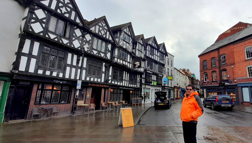
Around the corner is Ye Olde Bull Ring Tavern. The area where the Corve Street track once turned into the early trading market was given the name of The Bull Ring, due to the fact that livestock was bought and sold there in an early version of a cattle market.
Built around 1365 on the former site of a cattle market, the buildings grew into houses and a pub. The original tavern is the central twin gable roofs. In the 18th century the house with the twin left gable roofs was an ale store, a shop. The shop at the right was, in 1905, Woodhouse Chemist, later bought by Boots; now a book shop. Mr Woodhouse had been Mayor in 1909 when the Princess of Wales, later Queen Mary, came to Ludlow and her patronage of his shop – the local tale is that she bought a toothbrush – entitled him to display the royal coat of arms.
Ye Olde Bull Ring Tavern.
Nikolaus Pevsner in his 1958 book ‘The Buildings of England: Shropshire,’ said, “they make up the longest continuous Elizabethan and Jacobean timber-framed frontages in Ludlow.”
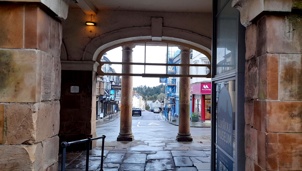
Further along is The Buttercross, now the Ludlow Museum. The building is prominently located within the historic walled town of Ludlow, forming a key focal point at the head of Broad Street. The Buttercross occupies the main approach to the town centre from the south, forming a pivotal point on the junction of Broad and High Streets that leads from Ludford Bridge via Broadgate to the Ludlow Castle gates. {Welcome to Ludlow].
View through The Buttercross building down Broad Street to Broadgate.
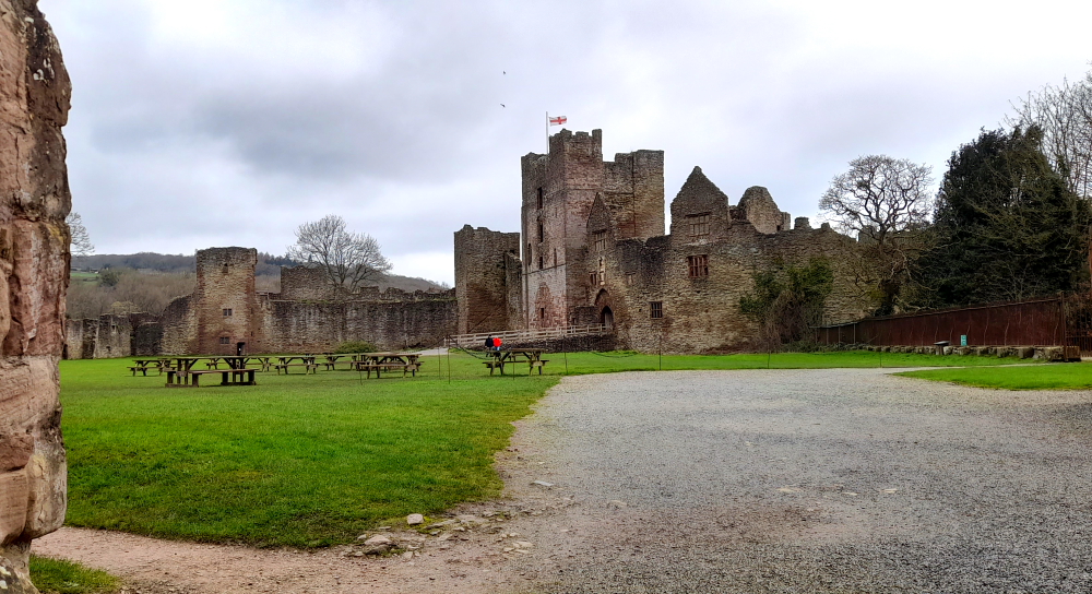
Walking along High Street we pass several pubs, passageways and the market square that leads to Ludlow Castle – a ruined medieval fortification. The castle was probably founded by Walter de Lacy after the Norman conquest and was one of the first stone castles to be built in England. Throughout history its owners were Geoffrey de Geneville (1250s), Roger Mortimer (1351), and Richard, Duke of York (1425). When Richard’s son, Edward IV, seized the throne in 1461 it passed into the ownership of the Crown.
Ludlow Castle ruins.
Ludlow Castle was chosen as the seat of the Council of Wales and the Marches, effectively acting as the capital of Wales. The Castle was held by the Royalists during the English Civil War of the 1640s, until it was besieged and taken by a Parliamentarian army in 1646. Henry, 1st Earl of Powis, leased the property from the Crown in 1772 while his brother-in-law, Edward, 1st Earl of Powis bought the castle outright in 1811. In the 21st century it is still owned by the Earl of Powis and operated as a tourist attraction.
Ludlow market square.
Returning to the Buttercross, we pass by the Assembly Rooms until we reach Broad Street which we walk down.
The Buttercross, St Laurence’s Church and retail shops on Broad Street.
Broad Street, perhaps the finest street in Ludlow, has a variety of terraced town houses from Tudor to Georgian eras, many with heritage listings and several sporting blue plaques. It also has The Angel pub, an inn since at least 1555. In 1822 the Aurora coach went from this pub to London – in 27 hours!
Elegant Georgian terraced town houses in Broad Street.
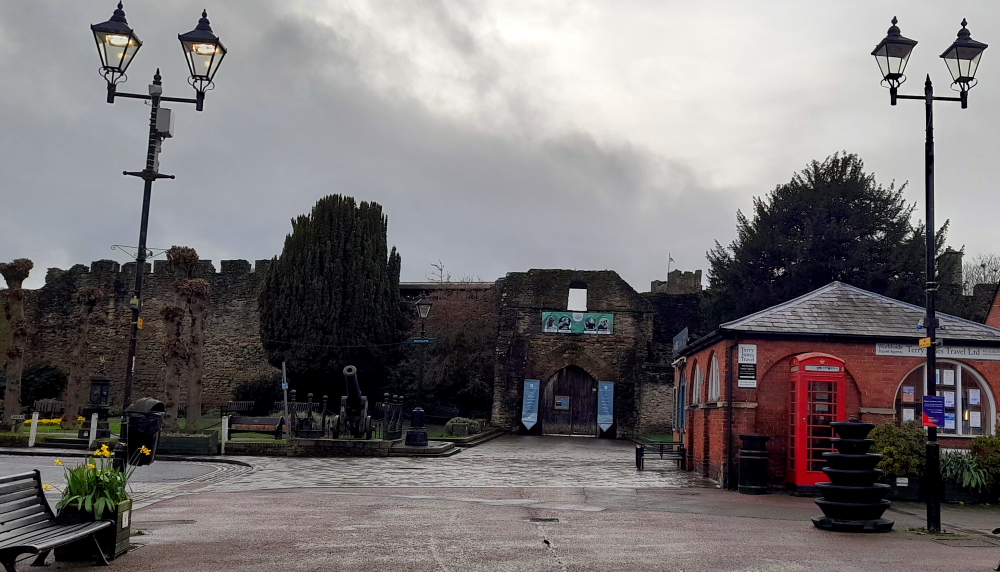
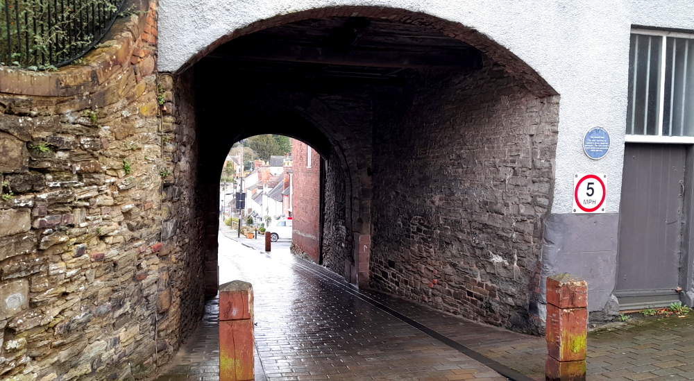
At the bottom of Broad Street is The Broad Gate, the only survivor of Ludlow’s 7 medieval gateways.
The Broad Gate.
The 13th century drum towers and portcullis arch survive.
Reverse side of Broad Gate and drum tower.
13 March, 2024
As it’s supposed to be raining later today we take off back up the A49 for 11km to Stokesay Castle. Needless to say, it starts raining immediately we start driving.
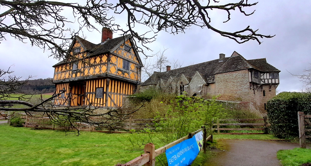
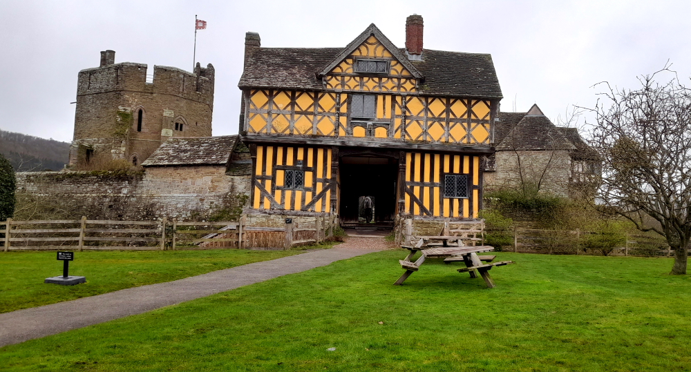
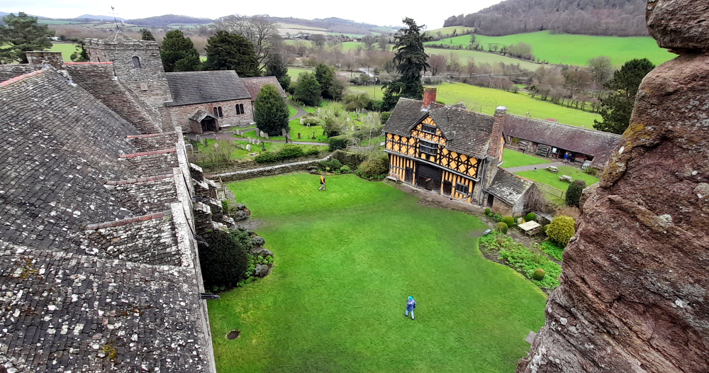
Rather than a castle, per se, Stokesay Castle is one of the finest surviving fortified manor houses in England, situated at Stokesay, north of Ludlow. The castle was never intended to be a serious military fortification. Originally designed as a prestigious, secure, comfortable home, the castle has changed very little since the 13th century, and is a rare, surviving example of a near complete set of medieval buildings.
Stokesay Castle from the churchyard.
It was largely built in its present form in the late 13th century by Laurence of Ludlow, on the earlier castle founded by its original owners the de Lacy family, then passed to their de Verdun heirs, who retained feudal overlordship of Stokesay until at least 1317.
Laurence ‘of’ Ludlow was one of the leading wool merchants in England, who intended it to form a secure private house and generate income as a commercial estate. Laurence’s descendants continued to own the castle until the 16th century, when it passed through various private owners. By the time of the outbreak of the First English Civil War in 1642, Stokesay was owned by William Craven, 1st Earl of Craven (1608–1697), a supporter of King Charles I. After the Royalist war effort collapsed in 1645, Parliamentary forces besieged the castle in June and quickly forced its garrison to surrender. Parliament ordered the property to be slighted, but only minor damage was done to the walls, allowing Stokesay to continue to be used as a house by the Baldwyn family until the end of the 17th century.
Restoration work was carried out in the 1830s and 1850s by William Craven, the second Earl of Craven. In 1869 the Craven estate, then heavily in debt, was sold to the wealthy industrialist John Derby Allcroft who paid for extensive restoration during the 1870s.
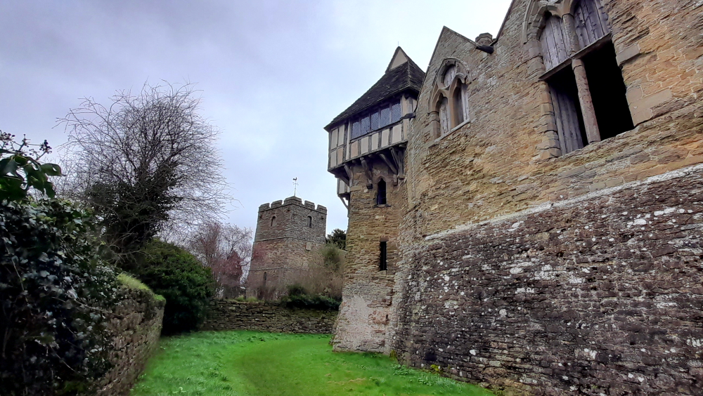
Architecturally, the castle has an entrance way through a 17th-century timber and plaster gatehouse.
Gatehouse fronting the manor house and South Tower.
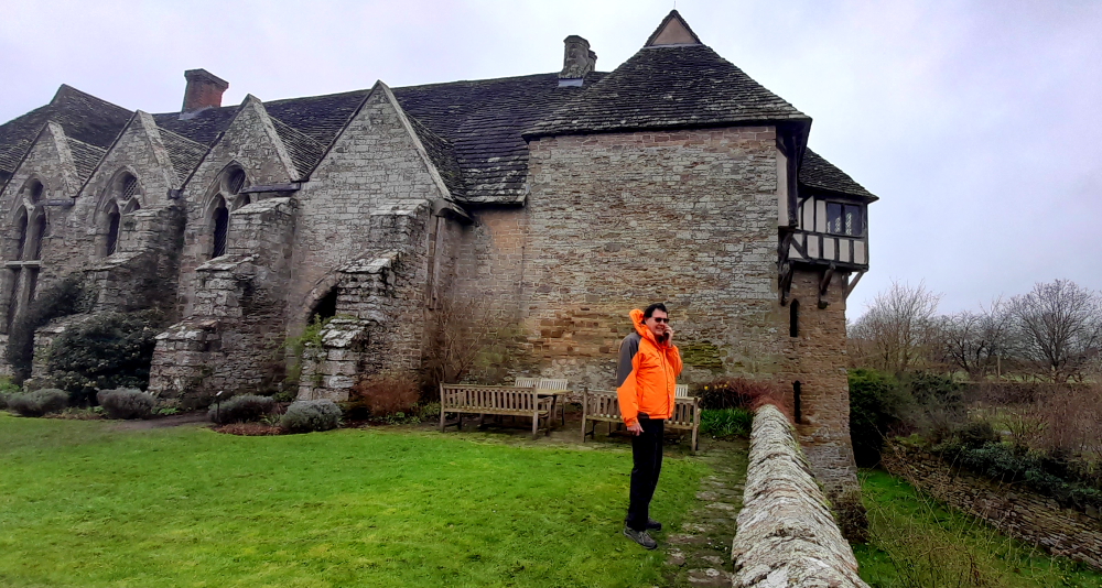
It’s surrounded by a walled, moated enclosure.
View of the Great Hall, North Tower and moated enclosure from the courtyard.
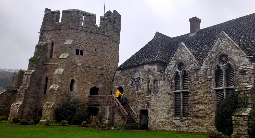
Inside, the courtyard faces a stone hall and solar block, protected by two stone towers.
View of the South Tower, Solar Block and Great Hall from the courtyard.
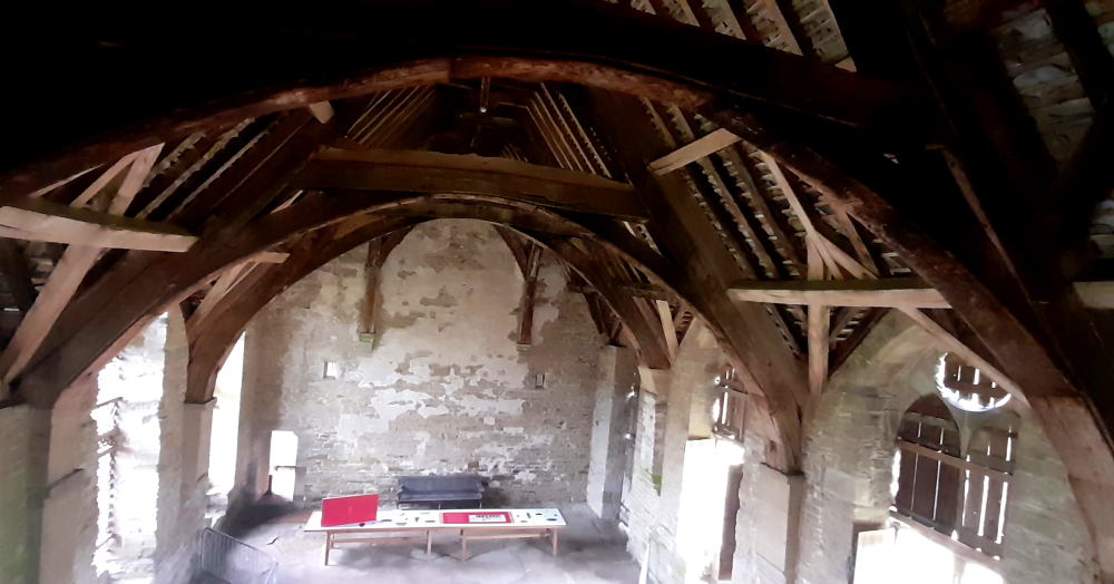
The hall features a 13th-century wooden-beamed ceiling and staircase, and 17th-century carved figures ornament the gatehouse and the solar block.
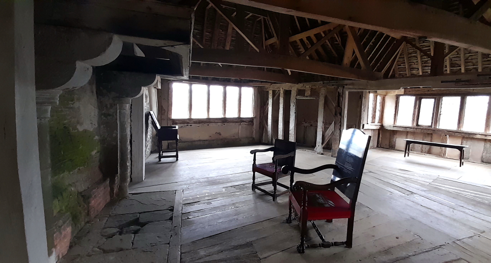
Great Hall with wooden-beamed ceiling.
Up the worn, wooden staircase at the end of the Great Hall is access to the North Tower and a spacious room. It features a simple wooden-beamed ceiling similar to the great hall’s, a large fireplace with a wooden canopy and dual-aspect views through diamond-shaped Italian glass and lead light windows. Tapestries would have hung on the walls.
Spacious room with wooden-beamed ceiling.
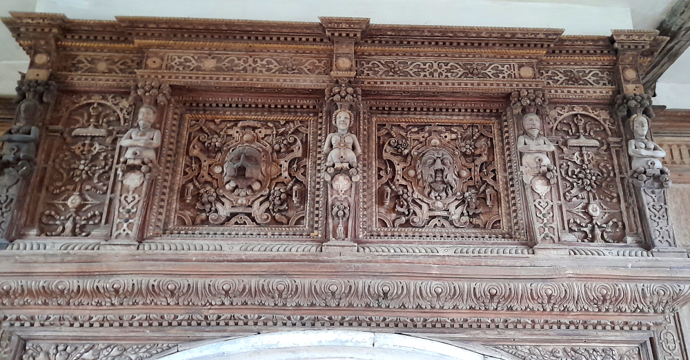
By contrast, the room in the Solar Block as decorated by the Baldwyn family some 400 years later in the 17th century is highly decorated with wood panelling, a plaster ceiling and an outstanding Jacobean fireplace overmantel which would have been painted in vivid colours at the time.
Jacobean fireplace overmantel.
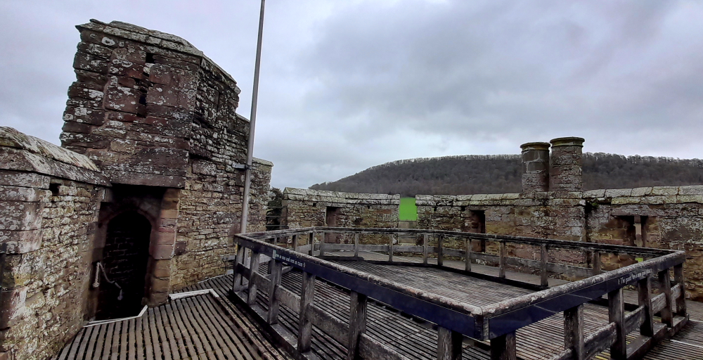
At the top of the North Tower are the parapets …
North Tower parapets.
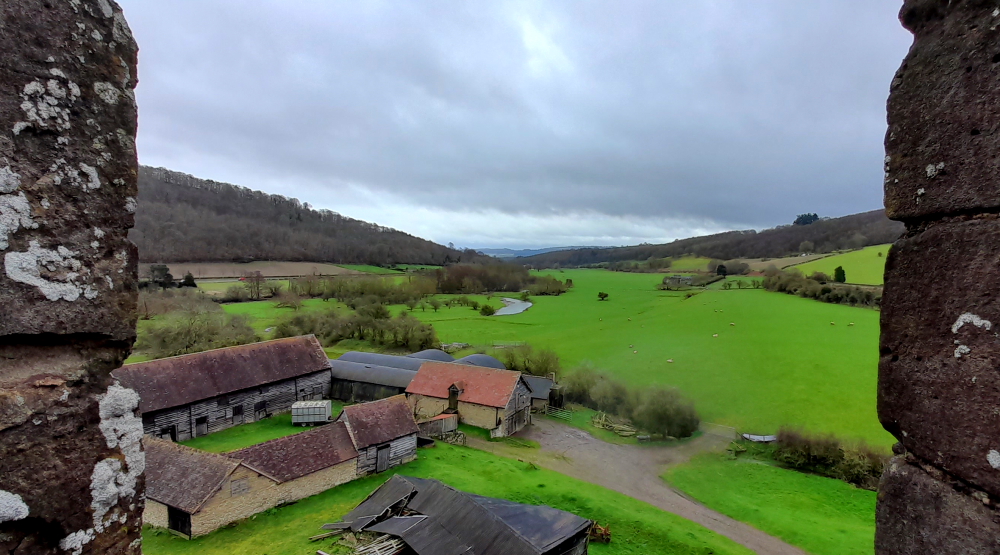
… with commanding views of the surrounding Shropshire countryside …
View from parapets towards Ludlow.
… and a bird’s eye view of the castle’s buildings.
View of castle buildings from the parpets.
The castle became a popular location for tourists and artists, and was formally opened to paying visitors in 1908.
Church & North Tower from the moat.
Allcroft’s descendants fell into financial difficulties during the early 20th century, and had difficulty covering the costs of maintaining Stokesay. In 1986 Jewell Magnus-Allcroft finally agreed to place Stokesay Castle into the guardianship of English Heritage, and the castle was left to the organisation on her death in 1992. English Heritage carried out extensive restoration of the castle in the late 1980s. In the 21st century, Stokesay Castle continues to be operated as a tourist attraction.
The Feathers’ illumination.
Returning from dining at The George Inn on Castle Street this evening, as the town descended into twilight, its buildings became illuminated, some of them showing off their colourful stained glass..
14 March, 2024
According to the weather forecast there is a brief window of ‘no rain’ between 11:00 am and 1:00 pm today so we venture out to see Ludlow Castle, the River Teme and Whitcliffe Common.
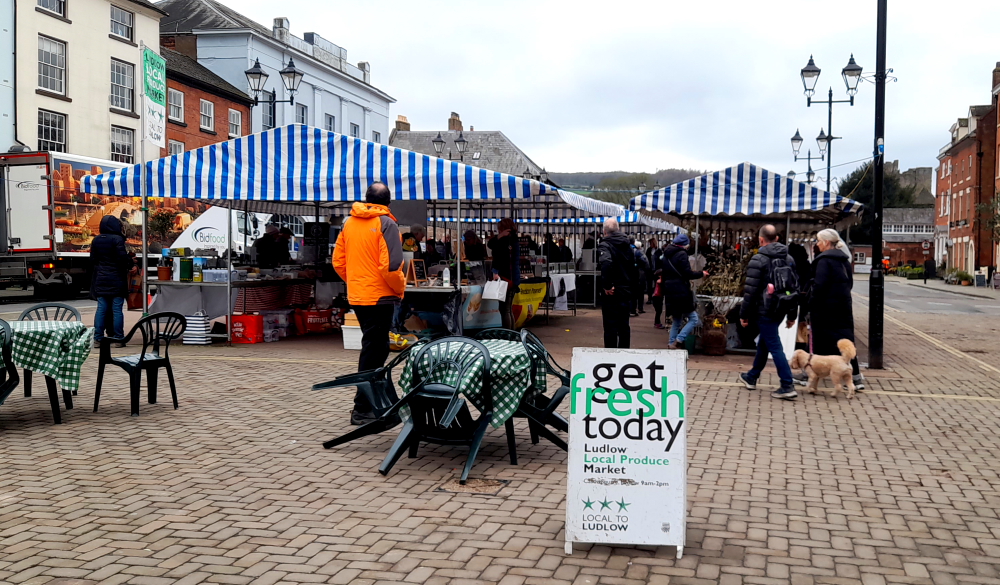
Market stalls in Market Square.
Previously we had arrived at the Market Square too late in the day to see the markets, but not today. Lots of local produce on sale.
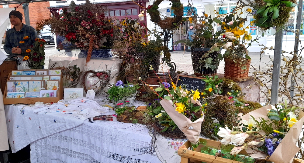
Floral stall at the market.
At the top end of Market Square is Ludlow Castle. Walter de Lacy, a trusted member of the household of William fitzOsbern, arrived in England with the conquering army of William the Conqueror in 1066.
FitzOsbern was rewarded for his loyal part in William’s victory with an Earldom over the lands of Hereford and planned to keep his new acquisition secure by developing a string of castles along the border of England and Wales.
Walter de Lacy was granted the manor of Stanton, which contained the site of present day Ludlow. Walter’s sons, Roger and Hugh, built the earliest surviving parts of the Castle that can still be seen today, and the de Lacy family retained the lordship until the end of the 13th century.
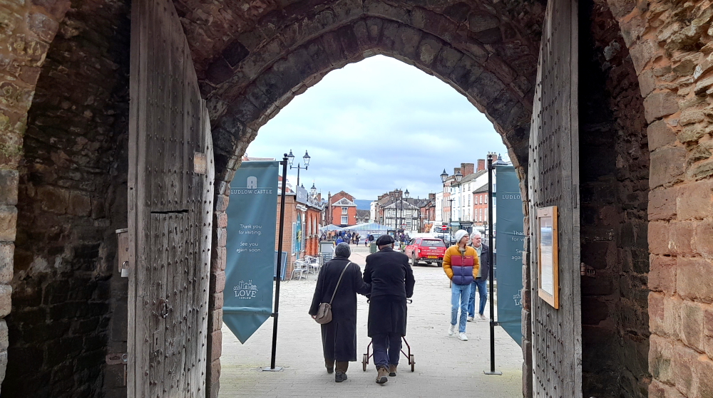
View of the Castle from the Outer Gatehouse on Castle Square.
1473-1483 Ludlow Castle was the home of Prince Edward (known as one of the ’Princes in the Tower’). He was in residence here when he learned of the death of his father, Edward IV, and assumed the title of King Edward V.
Prince Arthur (eldest son of Henry VII) spent a few months at Ludlow with his wife Catherine of Aragon before his death here on 2 April 1502. Catherine went on to marry Arthur’s brother, who became Henry VIII and their daughter, Mary, spent three winters at the castle between 1525 and 1528.
Throughout the 16th and 17th centuries, Ludlow Castle was held by the Crown, except for a brief time during the Civil War and the Commonwealth.
View through the Outer Gatehouse down Market Square.
The castle held great status as the centre of administration for the shires of the Marches and for Wales. The Council of the Marches was set up by Edward IV when he sent his son Edward, Prince of Wales, to live at Ludlow in 1473. It became responsible for the government of Wales and the border counties. For over a century Ludlow was seen as the capital of Wales and its courts were kept busy hearing criminal, civil and ecclesiastical cases. The result was a surge in construction at the castle to house the judges. Although primarily an administration hub, the castle had many features of an Elizabethan stately home. The Council was dissolved in 1641 but was revived with fewer powers from 1660 until its abolition in 1689.
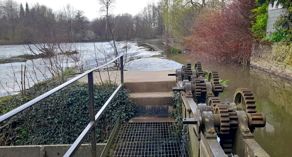
Further along the Castle wall we walk through an entrance to the Castle Walk, between an outer and inner wall that leads us to the riverside. Here there is an old sluice gate that used to regulate flows into the River Teme.
Old sluice gate on the River Teme.
Taking the riverside path we walk under the stone Dinham Bridge, the work of Shrewsbury mason and contractor, John Straphen, who completed it in 1823.
Dinham Bridge over the River Teme.
In 1646 the town was besieged by a Parliamentary force and the castle was surrendered after negotiation. The castle was abandoned after 1689 when the Council of the Marches was dissolved and power was centralised in London. The townspeople looted the castle for useful materials and it soon became a ruin.
View of Ludlow Castle from Dinham Bridge.
In the 1760s the Government considered demolishing the castle, a costly exercise, so instead it was leased to the Earl of Powis in 1771. The castle began to attract visitors as part of the new tourism movement concentrating on the Picturesque style, and as part of this, walks were set out around the castle.
The Earl of Powis bought the castle in 1811 and it is now owned by the Trustees of the Powis Castle Estate on behalf of the family. [Ludlow Castle website].
Castle view from the opposite river bank.
Walking across the bridge we arrive at Whitcliffe Common and take the stairs and path to the top of the hill.
Here there are panoramic views of the Castle, Church, town and surrounding Shropshire countryside.
View of Ludlow town from Whitcliffe Common lookout.
Thanks to all the rain we’ve had the paths are a tad boggy.
Beating a path in the mud.
After walking down the hill we join The Bread Walk (workers were paid in bread so they didn’t squander their wages on booze) that overlooks the river until it meets Ludford Corner. Turning left we walk over the town’s second, but famous, bridge, Ludford Bridge.
Known as the Battle/Rout of Ludford Bridge which occurred on 12 October 1459 during the War of the Roses. A combined Yorkist force under the command of Richard, Duke of York, the Earl of Salisbury and the Earl of Warwick was routed by the Royal army after the Yorkists’ Calais garrison switched sides making a battle for the Yorkists futile. As a consequence of the battle, York, Salisbury and Warwick fled into exile in the dead of night although their army was pardoned the following day.
With the three strongest Yorkists out of the country it appeared that King Henry VI was once again secure in his position. However, the Yorkist faction regrouped very quickly and attacked in force in 1460 and 1461. [Schoolshistory.org.uk].
Ludford Bridge.
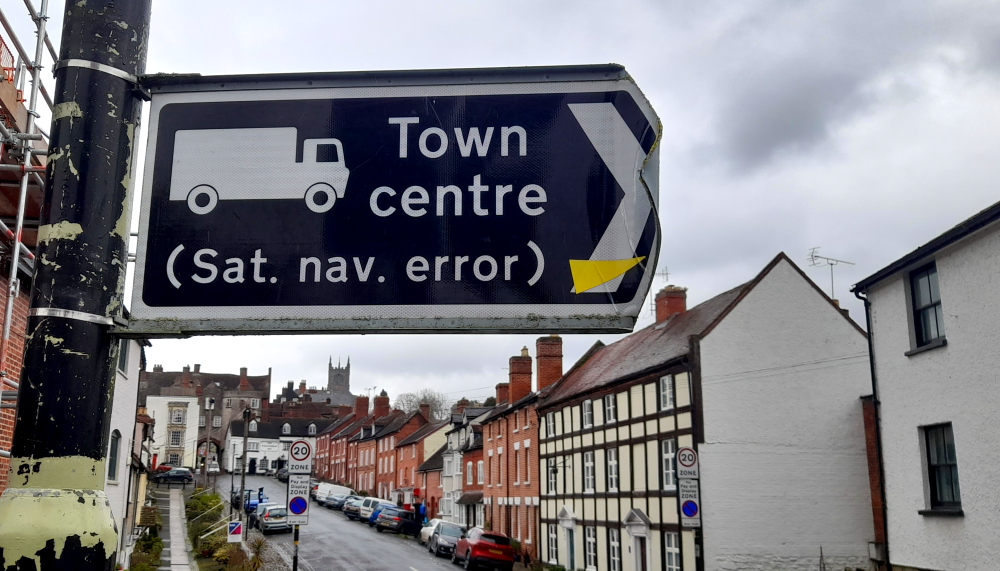
On the other side we are met by this rather interesting street sign at the corner of Lower Broad Street and Temeside.
Not sure exactly what the sat. nav. error is.
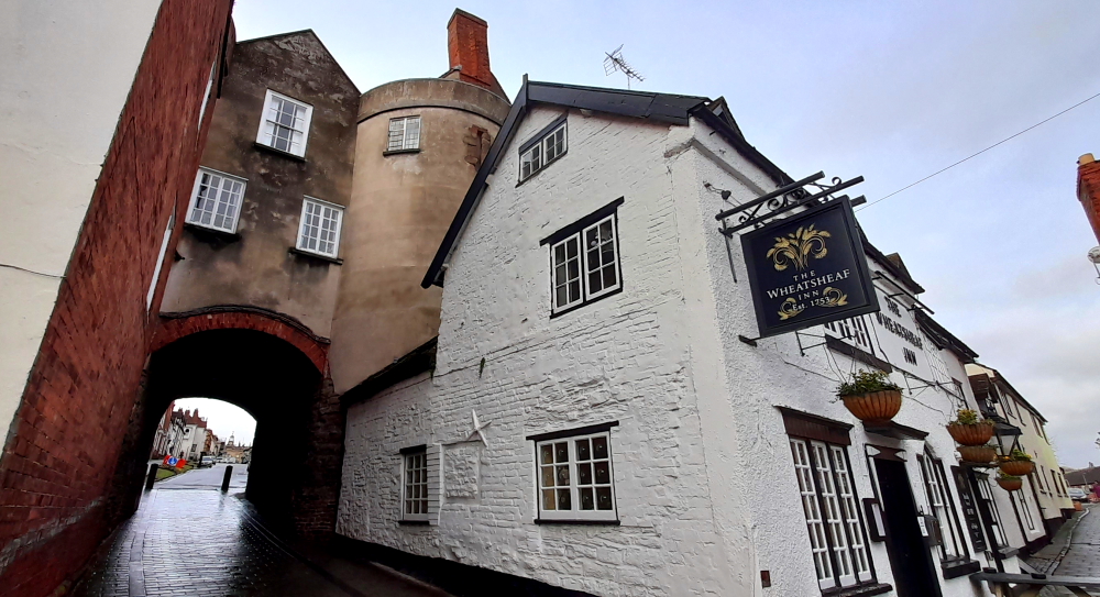
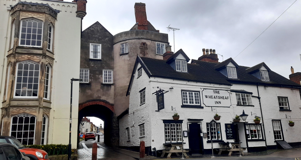
We walk up Lower Broad Street to Broad Gate and the Wheatsheaf Inn which is built onto the old town wall. We’re having dinner here tonight.
View of Broad Gate & the Wheatsheaf Inn from Lower Broad Street.
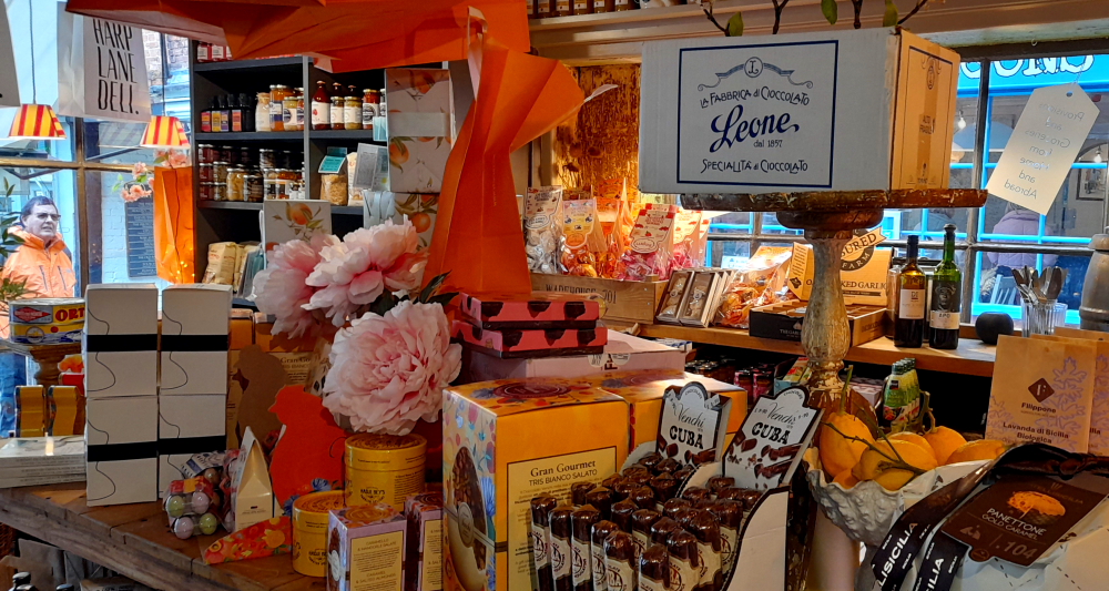
Broad Street leads uphill to the Buttercross and nearby at the corner of Market Square and Harp Lane is the Harp Lane Deli which has an amazing variety of tempting goodies. Pity Brisbane hasn’t one of these delectable shops in town!
Tantalising interior of the Harp Lane Deli.
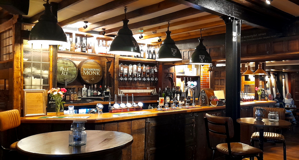
I’ve built up a thirst after all that hill walking so we stop in at the Rose and Crown, the entrance of which is through a large wooden door and courtyard off Church Street.
The bar at the Rose and Crown.
A large sign over the front door states that the deeds of the inn date from 1102 and recorded as the Rose and Crown since the 13th century – one of the ancient public houses in England plying its trade continually as an inn for over 600 years.
We certainly appreciate that its interior is quirky with unmatched wood paneling creating nooks and crannies, rather than the Feathers Inn which has modernised its interior.
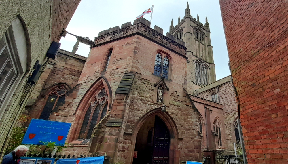
As we are in Church Street we slip through a laneway named Callens and into St Laurence’s Church. What a revelation!
St Laurence’s Church.
Now, I’m not a church visitor, I leave that to Lynn, but I must say this church is in outstanding condition thanks to the efforts of the Palmers’ Guild and others through the centuries and The Conservation Trust for St Laurence’s Church today.
St Laurence was one of the seven deacons of Rome who assisted the Bishop of Rome (the Pope). He was placed in charge of the administration of Church goods and care for the poor. For undertaking this duty, Laurence is regarded as one of the first archivists of the Church and is the patron saint of librarians.
Due to an act of defiance whereby instead of handing over the riches of the church to the authorities, he instead presented the poor to whom he referred to as ‘the riches of the church’. This act of defiance led to his martyrdom on 10 August 258. The traditional account of his death says that he was roasted on a gridiron, which has become his symbol [stlaurences.org.uk].
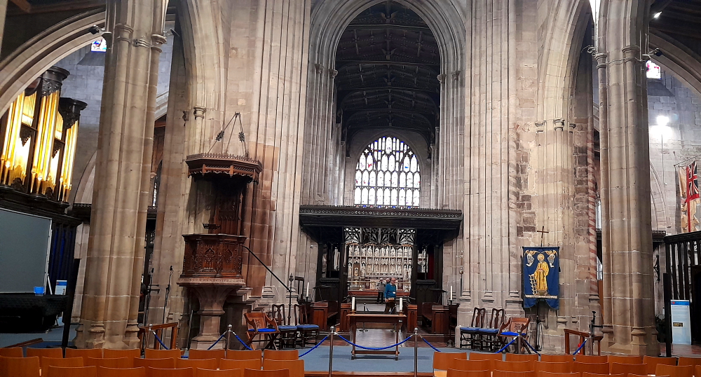
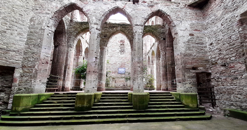
View of the Chancel.
The parish church was established as a place of worship in association with the founding of Ludlow by the Normans in the late 11th century. It is situated atop the hill around which the medieval town developed. The church was rebuilt in the year 1199 and has had several later additions and modifications.
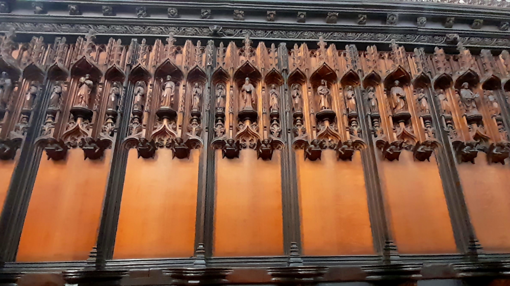
Carved wooden detail of choir stalls.
The tower is 48 metres high to the top of the pinnacles and commands expansive views of the town and surrounding countryside. Notable features include an extensive set of misericords in the choir stalls as well as fine stained glass windows.
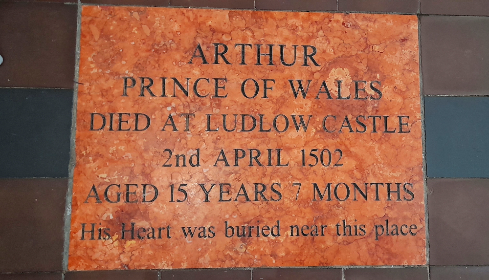
Prince Arthur (1486-1502) was the eldest son and heir of King Henry VII. In 1492 he became Prince of Wales and spent some time at Ludlow Castle as head of the Council of the Marches.
In November 1501 Arthur made an arranged marriage with Catherine of Aragon. They came to Ludlow Castle several months later but on 2 April 1502 he died of sweating sickness.
His ‘heart’ (euphemism for bowels!) was buried at St Laurence’s. 3 weeks later, with much pageantry, a funeral service was held after which the body was taken in procession to Worcester Cathedral, 33 miles away, where a chantry chapel marks his grave.
Stone placed in the Chancel.
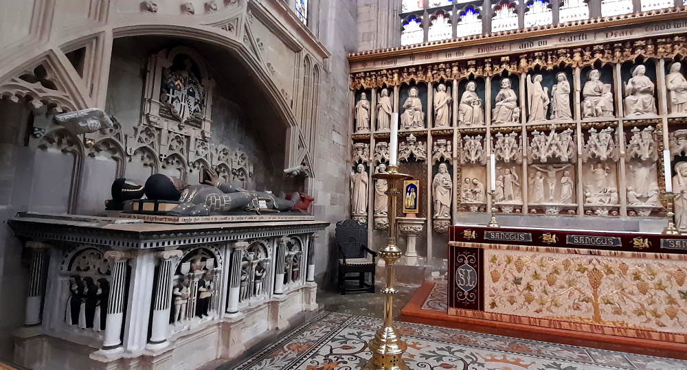
Another feature of the church is the ornate carved altar screen and the beautifully preserved 16th century tombs of Council of Marches nobles – here Sir Robert Townshend, Knight Chief Justice of the Council of Wales and Chester and Dame Alice, his wife (1555).
Sir Robert Townshend & Dame Alice tomb adjacent to ornate altar screen.
Elsewhere Edmund Walter, also a Chief Justice (1592) and an ornate wall-mounted monument with 3 coats of arms to “the Right Honorable Syr Henrye Sydney, Knight of the most Noble Order of the Garter, Lorde President of the Councell of Wales and the Ladye Marye daughter of ye famous Duke of Northumberland who died in Ludlow Castle” (1574).
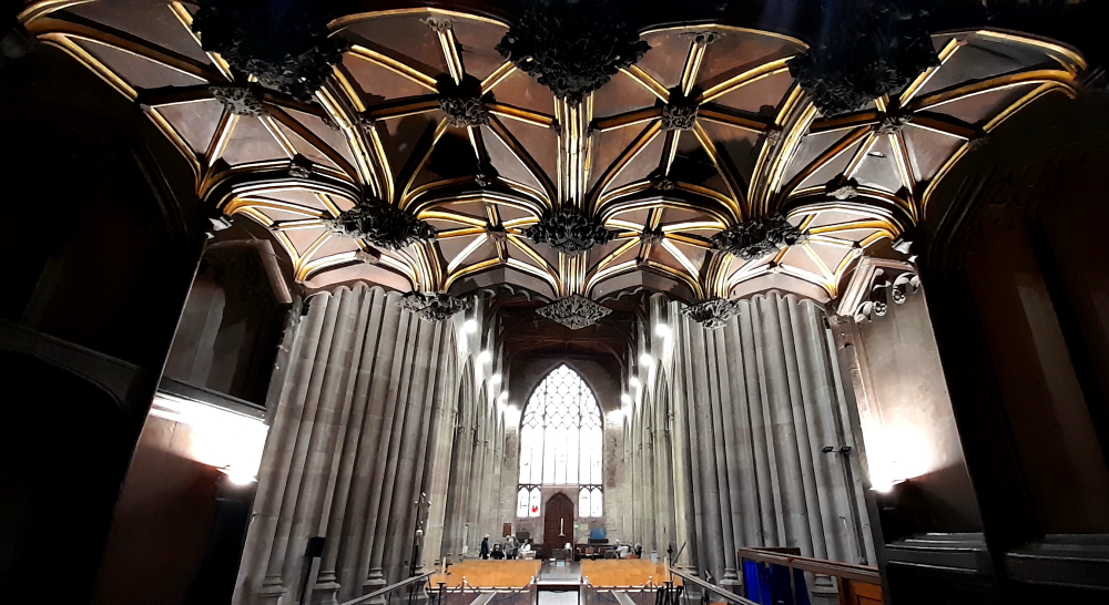
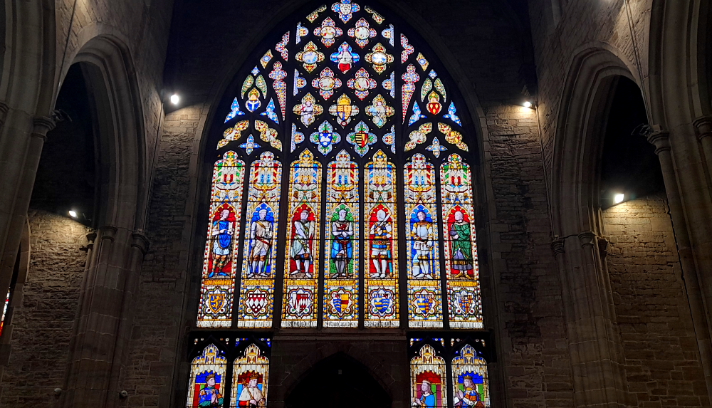
View from the Choir towards the West window.
The stone tracery of the West window dates from the remodelling of the church in the second quarter of the 15th century, but the glass is 19th century. The artist was Thomas Willement, the ‘Father of Victorian Stained Glass’. The figures in the 11 main panels are connected with Ludlow’s history, 7 of whom were Lords of Ludlow.
West window.
The other remarkable feature of the church are the 3 modern additions that do not detract from the sacred space within this edifice: the Icon Coffee Shop, the Gift Shop and an informal seating area with leather settees, not to mention the church is a venue for recitals and concerts – a church dedicated to serving its community.
15 March, 2024
After breakfast while I’m sorting the photos for the blog, Lynn decides to venture into town once more to discover parts we have missed. In particular, Mill Street which runs between the Ludlow Assembly Rooms and the Castle Lodge Buttery. Here resides the Guild Hall, a 15th century timber structure remodelled in red brick in 1768, which housed the Ludlow Magistrates’ Court. In 2012 Ludlow Town Council took up residence and the chamber now used for council meetings.
Guildhall & adjacent Coach House.
Built around 1410 by the influential religious guild of Palmers (pilgrims to the Holy Land) who supported St Laurence’s Church and sold in 1552 to the town for civil use, is notable for being the only known aisled hall in Ludlow. Despite extensive 18th century refurbishments, the hall retains its original 15th century roof.
Mill Street ends at the old town walls and the site of what was Mill Gate.
Turning right onto Camp Lane follows the town wall which joins the street named Dinham. On this street is Dinham House, an 18th century town house used by the Knights of Downton, the Johnes of Croft Castle and the Earls of Powis.
Dinham House (centre).
Apparently Lucien Bonaparte, brother of, was a prisoner here in 1811.
Further up the road is Dinham Hall, built in 1792 by Samuel Nash, agent of Richard Payne Knight of Downton Castle – and currently for sale! At No. 2 Dinham – the half-timbered house on the left in above photo – a blue plaque states: “‘Newly built’ in 1656 after burning in the Civil War.”
The Fish Feast at The Corner House restaurant on the Bull Ring is the venue for dinner tonight. I order a sea bream which is just delicious and perfectly cooked – not a sentiment I usually make about English cuisine!
16 March, 2024
After checking out at 10:15 am we drive directly to Lower Slaughter for a 4-night stay at The Slaughters Country Inn which takes about 1.5 hours to cover the 108km. The Slaughters (Upper and Lower) are between Stow-on-the-Wold to the north and Bourton-on-the-Water to the south in the Cotswolds.
The name ‘slaughter’ makes it sound like the villages have a dark history. But it’s a mispronunciation of the Old English word ‘slothre’ which means muddy or miry place, and came about due to the River Eye which flows through both villages.
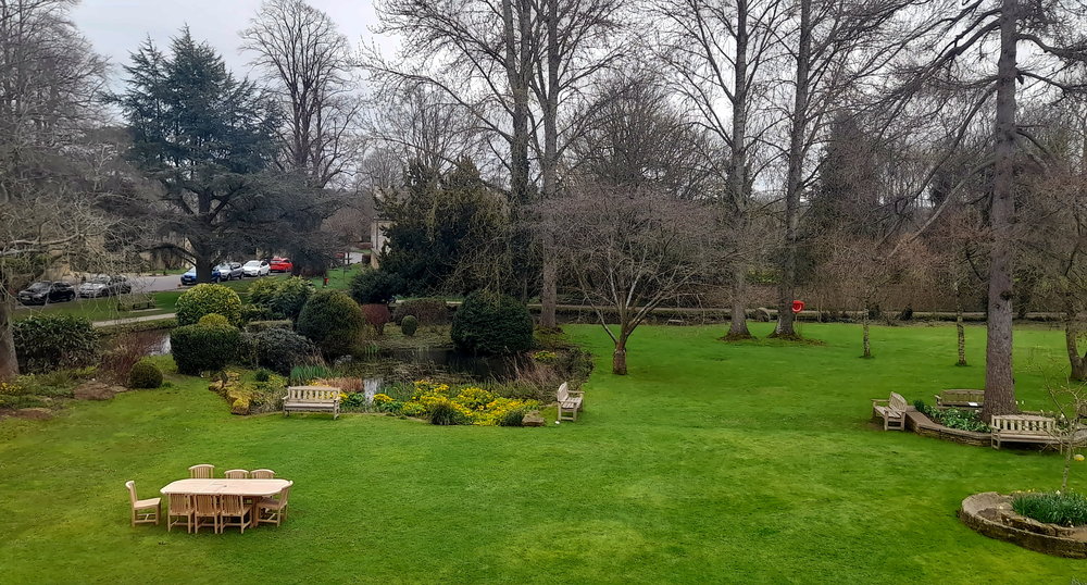
The view of the hotel grounds from our room.
We arrive at 12:45 pm but check-in isn’t until 3. Fortunately our room becomes available around 1:30 pm so after a quick unpack we pull up the chairs and settle in to watch the final 3 matches of the 6 Nations Rugby tournament that start at 2:15 pm. In particular, the exciting Ireland v Scotland game which Ireland finally wins 17-13 and retains its Championship crown for another 2 years.
17 March, 2024
It’s such a nice, sunny morning that after breakfast we wander around the village of Lower Slaughter.
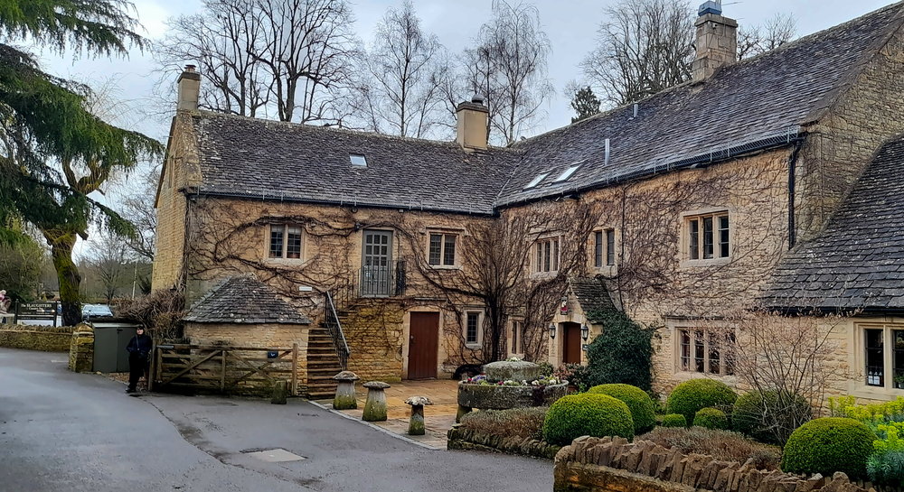
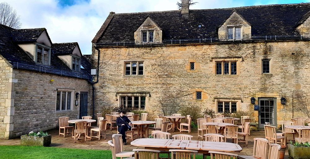
Entrance to The Slaughters Country Inn.
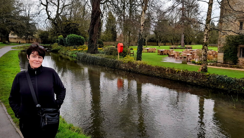
Through the village and in front of the Inn runs the River Eye, its waters quite shallow and crystal clear.
River Eye in front of the Inn.
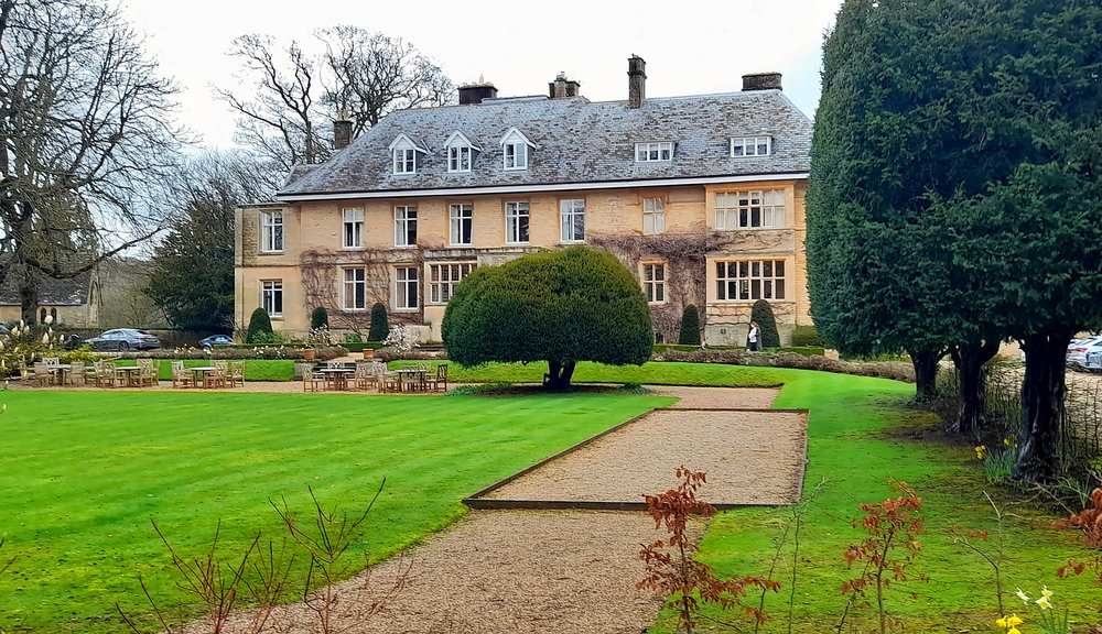
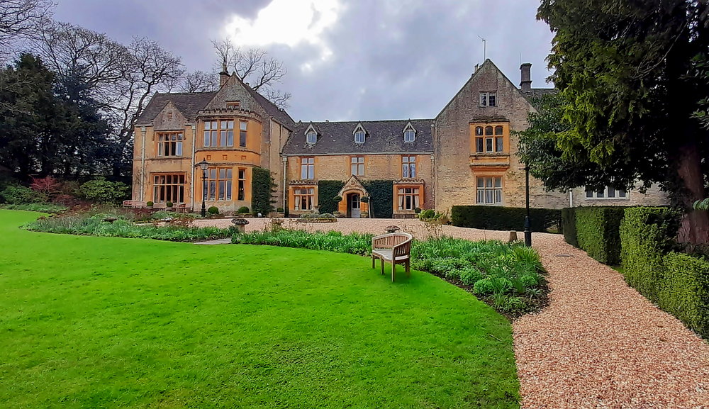
Across the road from the Inn is the Lower Slaughters Manor, now an hotel. It is known that a manor house stood on the site before the Conquest, even as early as 1004 A.D. In 1443, the Manor became a convent housing nuns from the order of Syon, the order being granted the land during this period. The Manor was returned to the crown in 1603 and in 1611 was granted to Sir George Whitmore, High Sheriff of Gloucestershire. It remained in his family until 1964 when it became a hotel. The property was purchased by Andrew Brownsword Hotels, who also own The Slaughters Country Inn, in 2011 and renamed The Slaughters Manor House [slaughtersmanor.co.uk].
The Slaughters Manor House.
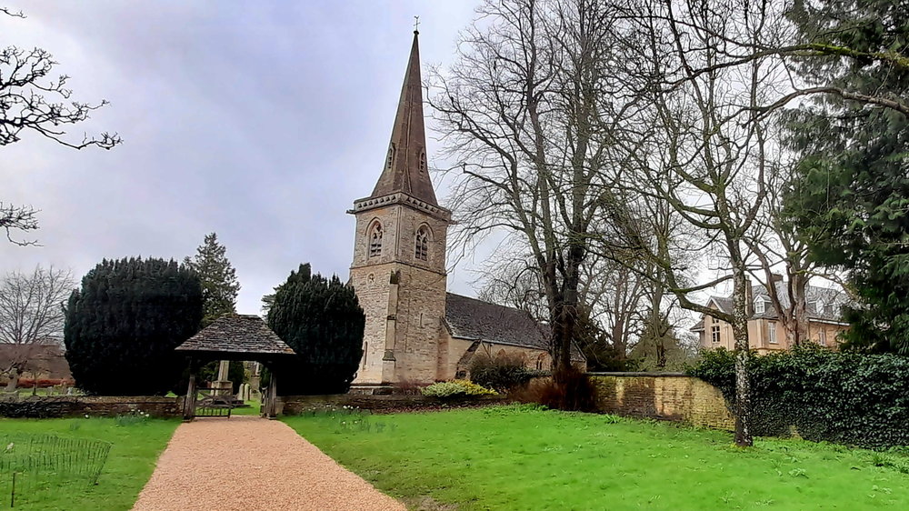
Next door to the Manor House is St Mary’s Church which was built in the Norman and then the Decorated style. It was rebuilt in the Victorian era in the Decorated Gothic style.
St Mary’s Church.
Like the village, the church is in immaculate condition and features interior arches.
Interior of St Mary’s Church, Lower Slaughter.
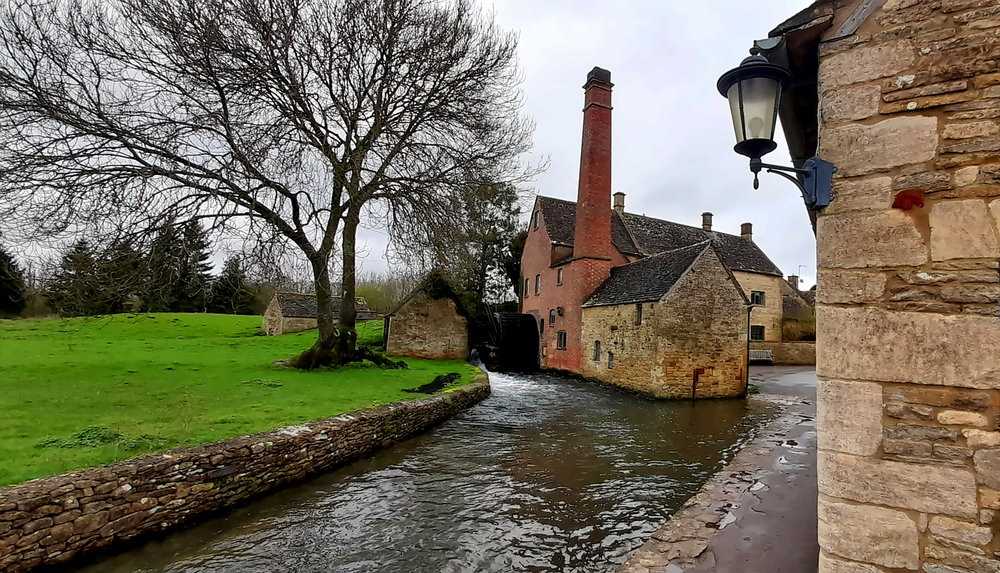
Walking along the river path in the direction of Upper Slaughter we come to The Old Mill on the edge of the river.
The Old Mill with intact wooden water wheel.
In April last year it was announced that the mill, a popular Cotswolds’ attraction and which also housed a museum, gift and craft shop and cafe was to close 2 months later after 35 years. Many have stopped to take photographs of the water wheel at the mill, which was built in the 19th century and was last used commercially in 1958. The site is one of the reasons why the village has in the past been named as the prettiest in the UK [gloucestershirelive.co.uk].
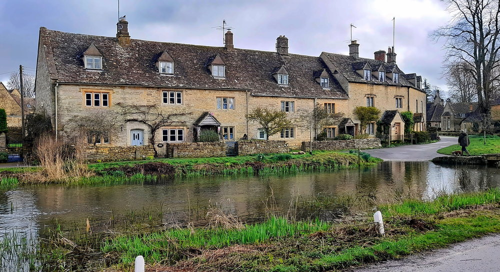
Row of honey-coloured stone cottages opposite the Lower Slaughter Hall.
When we return to the Inn about 30 minutes later the sun has broken through again so we have a coffee on the terrace.
Terrace for coffee. Our room is the 2nd-floor gabled window behind Lynn.
The Inn is located on an area formerly known as Washbourne’s Place which took its name from the family who owned it in 1470. The building was originally divided into three farm-workers cottages with a stable block.
Sun-lit hotel grounds viewed from the terrace.
In the early 1920’s the cottages were converted into a large private house before it became an Eton cramming school. The boy’s assembly and dining room was located in what is now the Inn’s bar area and Westbury, one of the Superior bedrooms, used to be the location of the Headmaster’s office. The barn building was a recreation area, with the upper floor covered by a large model railway.
View of the terrace from the pond.
After its school days Washbourne’s Place reverted once again to private ownership and in 1988, the house opened as a hotel, known as Washbourne Court. In 2011 the Brownsword family bought the hotel and reinvented the property as a traditional country inn, renaming it The Slaughters Country Inn [theslaughtersinn.co.uk].
Lynn with Igor & Tania in front of The Old Mill.
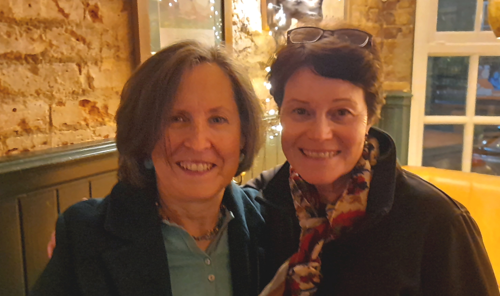
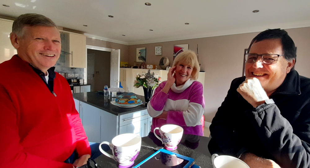
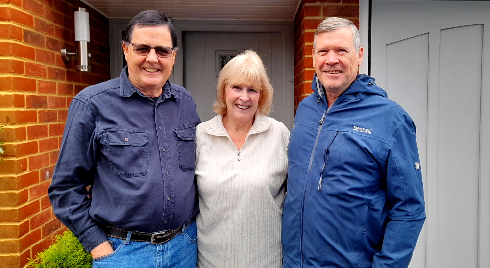
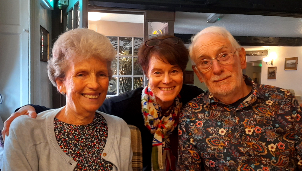
Today, Lynn has invited her friends, Tania and Igor, who have graciously driven from their home in Princes Risborough, Buckinghamshire to join us for Sunday Lunch at The Inn.
Tania & Lynn in front of the Manor House.
Lynn and Tania first met when Lynn lead a project at a Barclays office around the corner from Pall Mall, London in 1999 where Tania worked in IT and they’ve remained firm friends. They last saw each other at Lynn’s farewell bash in April 2010 and have stayed in touch since. After a delightful lunch in the restaurant catching up and coffee on the terrace where we discuss Russia – their homeland which they left years ago – the 4 of us wander around the village in warm sunshine before they depart. Perhaps we will next see them in Brisbane?
18 March, 2024
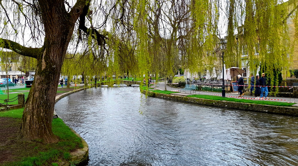
An amazing top of 15 Deg. C. is predicted today with little chance of rain so we don our boots and jackets and walk the Warden’s Way to Bourton-on-the-Water – about 30 minutes to walk the 2.4km.
Today is Monday and, as we enter town around 11:30 am in mid-March, the town is already starting to heave with visitors and cars vying for parking spots.
One of the first places we come across is the The Duke of Wellington pub on Sherborne Street. This is where I stayed for several days during winter in about 1984. In contrast to today, there was snow on the ground and very quiet with few tourists.
The Duke of Wellington pub.
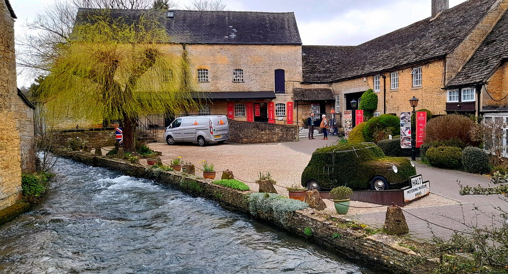
From here we take the path along the River Windrush that bisects the town. At the Sherborne Street bridge the river runs between a bakery and the Motoring Museum – complete with a Mini made from grass.
The Motoring Museum at Bourton-on-the-Water.
Walking to Bourton this morning it was evident that Spring is just around the corner – the increased volume and variety of birdsong, spring blooms and leaf buds on bare branches – such as the willow near the Sherborne Street bridge.
Willow with spring foliage on the River Windrush.
Unfortunately, large swathes of grass have become trampled and muddy at the river’s edge on the upper reaches, so there are incidents of red and white tape cordoning off areas – a bit of an eye sore.
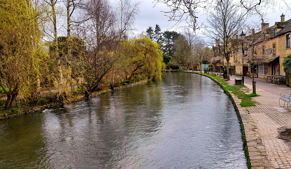
Downstream view.
But lower downstream the scenery is quite picturesque with a variety of stone bridges and houses.
View upstream.
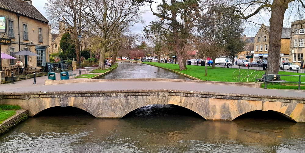
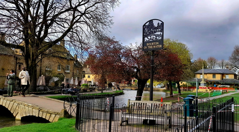
Retracing our steps on the other side of the river, walking along the High Street, there is a filigree town sign.
Bourton town sign.
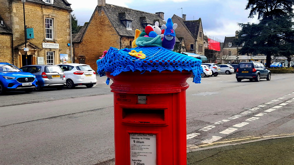
Of course, the Poms being their eccentric selves, demands a gesture – in this case a crocheted cover topped with a rodent ensemble for the Royal Mail post box!
Crazy crochet!
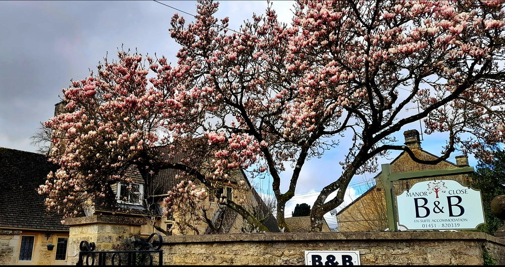
The past few weeks in Wales we’ve seen lots of magnolia trees with tiny buds. Here they are finally in full bloom.
Magnificent magnolias.
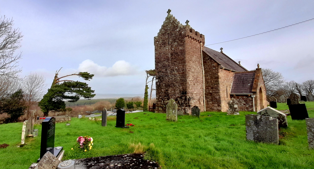
RIght, that’s Bourton done. Time to retrace our steps to Lower Slaughter. The Avenue passes by St Lawrence’s Church and tomb stones.
St Lawrence’s Church.
There has been a church on this site since 709 AD. The church also has a list of Rectors dating back to 1291. Like St Laurence’s Church in Ludlow, the interior space has been reconfigured to meet the current needs of the community in addition to its pews.
Altar, ceiling and stained glass within St Lawrence’s Church.
Besides the small, ornate altar screen, the church’s ceiling is decorated with heraldic devices. 8 of those are listed on a board including that of Queen Elizabeth I, sometime Patron of the Living; The Diocese of Worcester to which the Parish belonged before 1540 and that of Gloucester to which the Parish has been since that date; Wadham College, Oxford, the present Patron; Evesham Abbey, the Abbot of which was Lord of the Manor of Bourton until the Dissolution; and 2 other Lords of the Manor Sir Thomas Edmunds (one-time Lord) and Lord Chandos described as Lord of the Manor and although this seems to imply the current Lord, it may in fact refer to the 1650s!
Heraldic devices decorating the church’s ceiling.
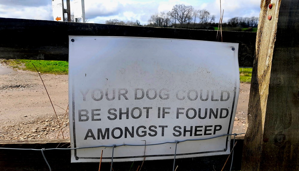
And just a ‘friendly’ reminder that we are using a public footpath that is bordered by rural properties – a sign that dogs and sheep don’t mix.
Friendly reminder!
Back at The Inn the afternoon has become overcast and colder. With the forecast tomorrow for rain we plan to drive into Stow-on-the-Wold for a look-see then further north onto Moreton-in-Marsh, some 7.5 miles away from Slaughter, to spend some time in what is the nearest laundromat.
19 March, 2024
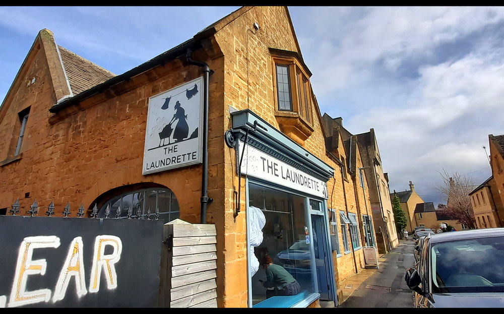
After a 10-minute drive north we arrive at Moreton-in-Marsh and parking the car nearby we head to The Laundrette on New Road.
The Laundrette.
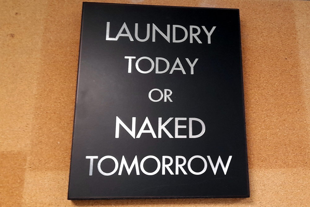
It’s a busy little place with 2 ladies in attendance to either do your laundry for you or to assist DIYers like us – “I’ll have 20 pounds’ worth of 1 pound coins, please!” – as there’s no credit card reader in sight.
That’s about right.
The laundromat is relatively expensive but our next laundry isn’t for another 9 days in Dunkirk.
Laundry time at Moreton-in-Marsh.
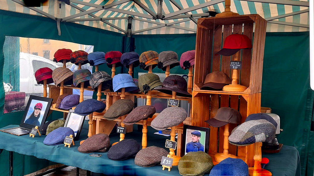
While our 3 loads of washing are swishing away we turn the corner onto the High Street to check out the Tuesday market.
Flat cap stall at the markets.
1.5 hours later we are out the door with our clothes washed, dried and folded and my wallet GBP18 lighter, we jump in the car for our return journey. We deviate to drive through Stow-in-the-Wold. We pass by the Market Cross but nary a parking spot to be found.
Back at The Inn, Lynn starts on my ironing but is soon interrupted by the housekeeper who arrives to clean our room. We take our leave and walk to see what’s at Upper Slaughter, savouring the 16 Deg. C. temperature along the way.
Walking up the Becky Hill road we pass by the impressive Upper Slaughter Manor House.
Upper Slaughter Manor House.
At the edge of the village is a small hill upon which sits Saint Peter’s Church. Like St Lawrence’s Church in Bourton, this church once belonged to Evesham Abbey and although it dates to the 12th century there are numerous 19th century modifications made to look much older.
St Peter’s Church, Upper Slaughter.
Its interior has a similar layout to St Mary’s Church in Lower Slaughter. What is different are the very simple, but nonetheless beautiful, painted panels on the altar, with the painted motif repeated on each organ pipe.
Alter of St Peter’s Church, Upper Slaughter.
Down the hill we come across the Lords of the Manor Hotel & Restaurant which is next door to the Upper Slaughter Manor House but separated by a fence.
Our Cotswolds tip: Don’t stay in the congested and crowded destinations of Stow and Bourton. Rather, stay at one of the Slaughters and relax in serene countryside pampered in affordable luxury. Using one of the Slaughters as a base, get to really enjoy the Cotswolds’ countryside by taking the easy walks to Stow and Bourton, saving yourself the hassle of trying to find non-existent parking spots.
Lords of the Manor Hotel & Restaurant.
At this point we decide to return to Lower Slaughter via the Warden’s Way which will involve walking across muddy fields and along a muddy path.
The Warden’s Way trail.
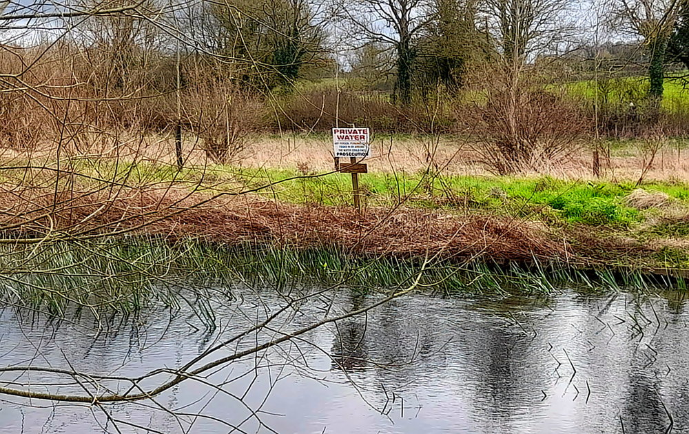
The path soon converges with the River Eye which we discover is actually privately owned – well, the canal part at least – according to a prominent waterside sign.
“Private water”.
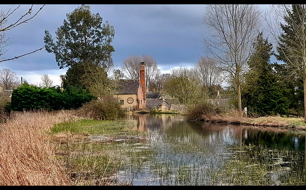
It appears that the river has 2 branches, the small stream itself and a branch which was diverted to become the wider canal that now cascades past a sluice gate and the wooden wheel at the Old Mill.
Canal above the Old Mill.
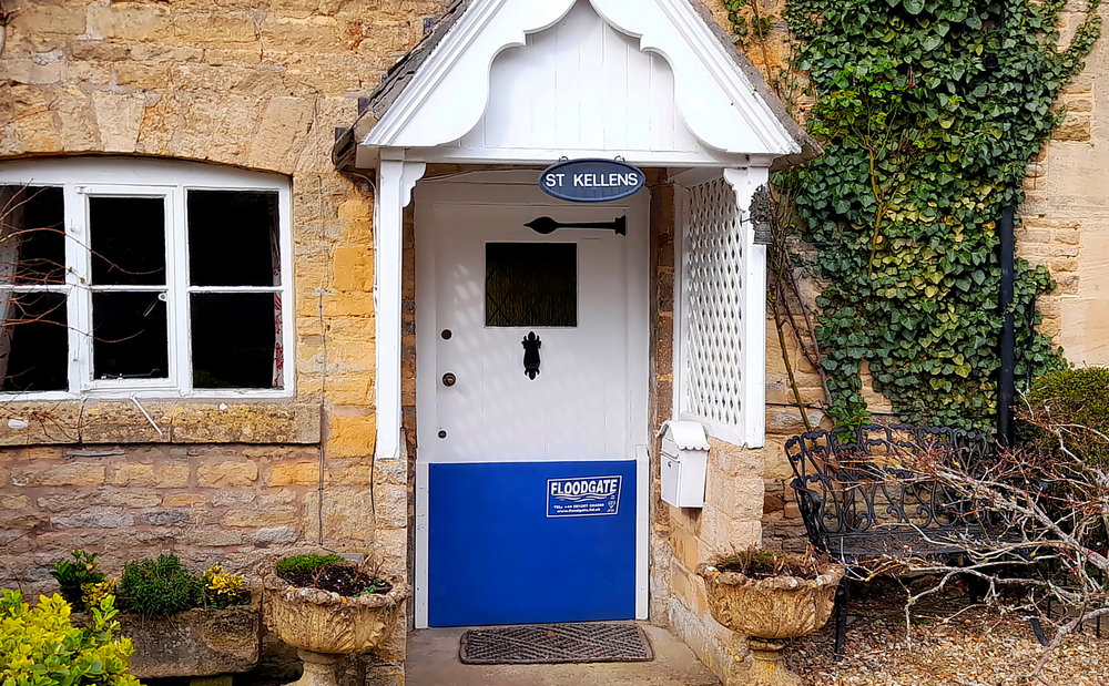
Bordering the river on either side are honey-coloured, stone cottages. The cottages on the Mill side of the river are lower and several sport a metal plate that is kept in place by 2 side runners. These metal plates are ‘flood gates’ to prevent flood water from seeping in under the door.
Flood mitigation, English style.
Honey ham and smoked salmon baguettes are just the ticket for a light bar meal this evening before we head upstairs to pack an overnight bag ready for our trip to Richmond in the morning for a 2-night stay.
20 March, 2024
It’s 14 Deg. C. when we drive out of the hotel’s car park at 10:45 am. It should take us about 1 hour 45 minutes to drive the 140km to Richmond, so arriving around 12:30 pm at Susie and Paul’s. We take the A424 through the beautiful, ancient market town of Burford then the A40 around Oxford. At 11:30 am when we join the M40 the sun shines through and the temperature nudges up a degree.
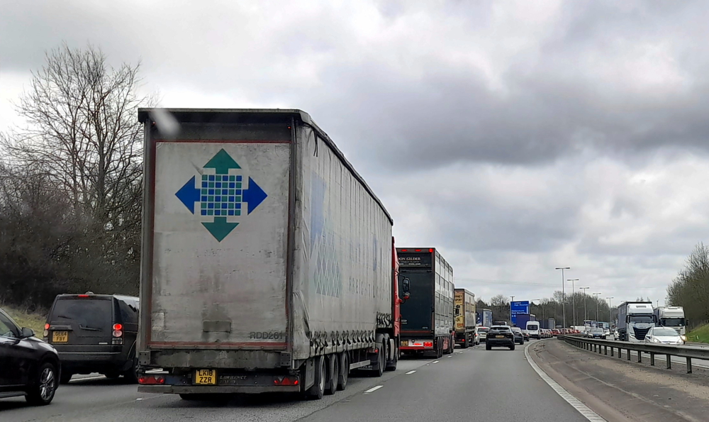
About 20 minutes later we grind to a halt at the back of a very long traffic jam on the M40. Fortunately, this occurs just before the A40 slip road to High Wycombe, which we slowly make our way over to and exit the motorway. As we are now driving through towns our progress is hampered by following lorries on narrow roads, people parked on double yellow lines, pedestrian crossings, traffic lights etc. We phone Paul to let him know we have been delayed and won’t be arriving any time soon.
Stopped and stranded on the M40.
At Loudwater, on the other side of High Wycombe, we chance that the M40 is clear, which it is, so we join it once again. Finally we arrive at Lorne Road at 1:20 pm – the traffic jam and diversion costing us 50 minutes!
By 3:00 pm the sun is shining and it’s 18 Deg. C. so we decide a walk is in order. We cross Richmond Green, onto Cholmondeley Walk along the River Thames, under Richmond Bridge, up Terrace Gardens then back home, in time to meet Colin (their miniature dachshund) who has been away on a play day.
Where the Towpath meets Richmond Bridge.
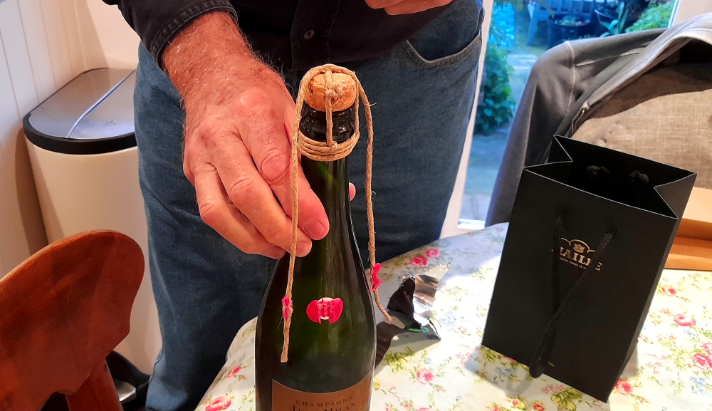
This evening we are dining at The White Horse pub which is Susie and Paul’s “local”. Beforehand, Lynn’s friend Mary, who lives in Ealing, will be joining us at the house for drinks. They first met in 1990 when they both worked for BP Oil (UK) at Hemel Hempstead and last saw each other just before Lynn left the UK in April 2010.
Old-style string vs wire closure.
To celebrate, we pop the cork on the 2nd bottle of champers we purchased at the cellar door at Jean Milan in the Champagne Region. Interestingly, its cork is secured by string which has been stuck to the bottle by a red, wax seal. The champers is divine – a subtle hint of apricot with tiny bubbles.
Pre-dinner champers.
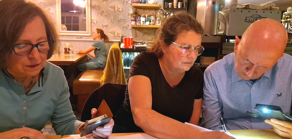
Lynn had booked our table at the pub several months ago so imagine our surprise when we arrive to learn that Wednesday night is “Quiz Night”, starting tonight!
We had planned on sharing a quiet dinner to catch up but given the layout of the pub it will be impossible to compete with the Quiz Master on the microphone for the next couple of hours so we decide to enter the quiz and quickly call ourselves “Colin’s Crew”.
Great minds winning the Pub Quiz.
3 hours later of cryptic, audio and visual questions – including both Susie and Paul each winning the 2 free drinks rounds – Colin’s Crew is declared the winner with a total of 65.5 points and awarded a GBP50 bar tab voucher. Needless to say, it was the input of the 3 Poms that won the day.
Let’s do this again in 14 years’ time!
We plan to use the GBP50 voucher tomorrow night when we return yet again for dinner.
21 March, 2024
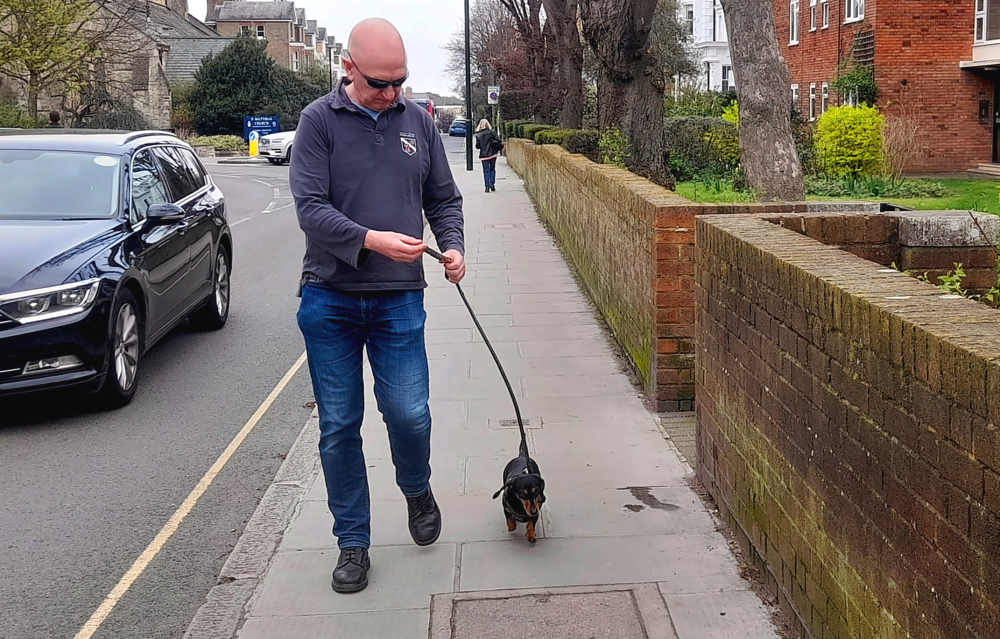
While Susie is at the gym this morning we decide to go out for coffee, taking Colin with us for the walk. Our “coffee run” turns into a 3-hour walk thanks to Colin’s tiny legs.
Cool dude with cute canine.
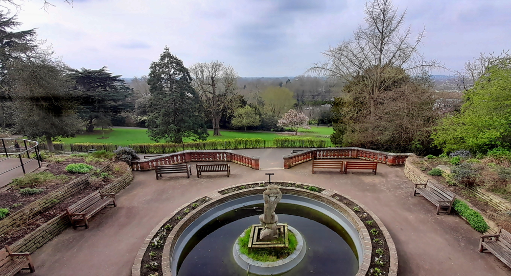
We start out by reversing our walk from yesterday, walking to Richmond Hill and into the Terrace Gardens to the Holyhock Cafe for coffee.
Terrace Gardens.
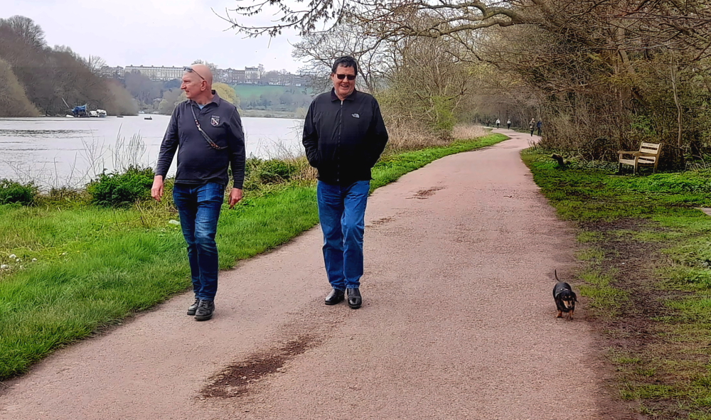
From here down to the river and walking upstream along the towpath to the Ham House Ferry Terminal.
Two men & a dog.
“Ferry Terminal” is perhaps a tad overstated – it’s a small clearing with a couple of brick steps on the river bank where a tinny pulls in before crossing back across the river. GBP2/adult. Dogs free, of course!
Colin enjoying a rest at the mid-point of our walk.
Walking back up the other side of the river we cross over Richmond Bridge.
Crossing back over Richmond Bridge.
And walk up Hill Rise to The Vineyard then home.
Old-style florist shop on Hill Rise.
For ease and convenience (and damned fine food and wine) we’re booked into The White Horse again for dinner where we use last night’s voucher to cover our bar tab. This time to meet up with another friend and former colleague of Lynn’s, Richard, who lives in nearby Wimbledon.
16 years’ worth of catching up in 4 hours.
Their paths diverged in 2008 when Lynn started working at Credit Suisse but they kept in touch and here they are catching up some 16 years later.
22 March, 2024
At 9:00 am we say farewell to Susie and Colin who are getting the train to High Street Kensington where Susie works 2 days a week. We have a leisurely breakfast with Paul then say farewell to him as we drive from Richmond to Greenwich via the South Circular.
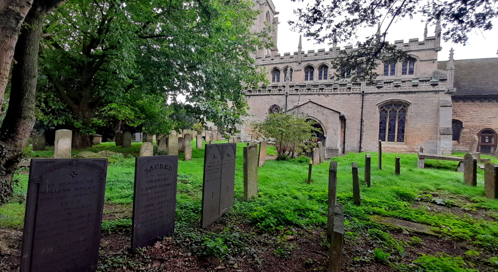
Along the way, at Lewisham, we pass by the church that we are going to visit tomorrow as part of my family tree research.
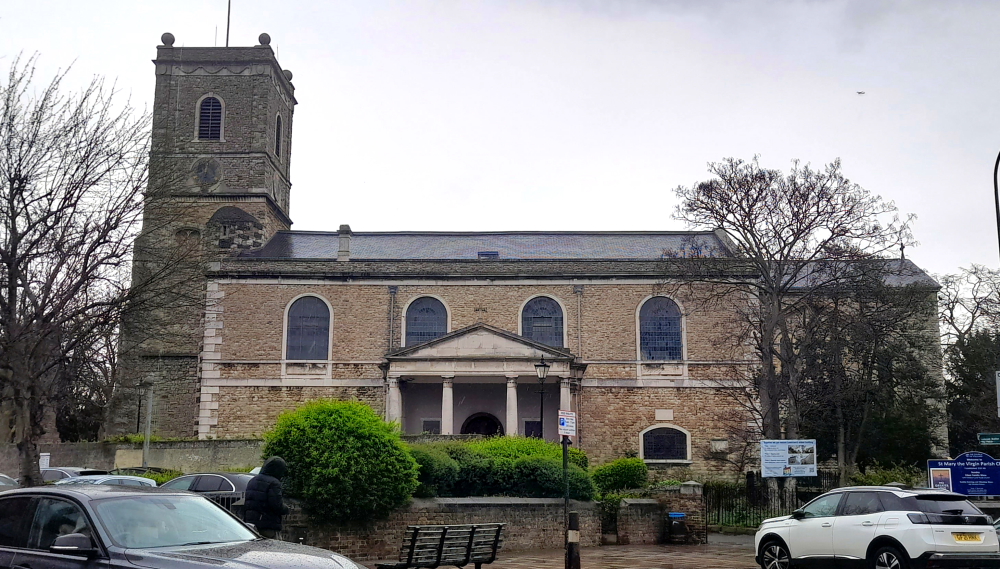
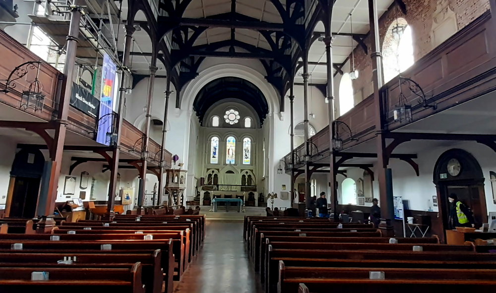
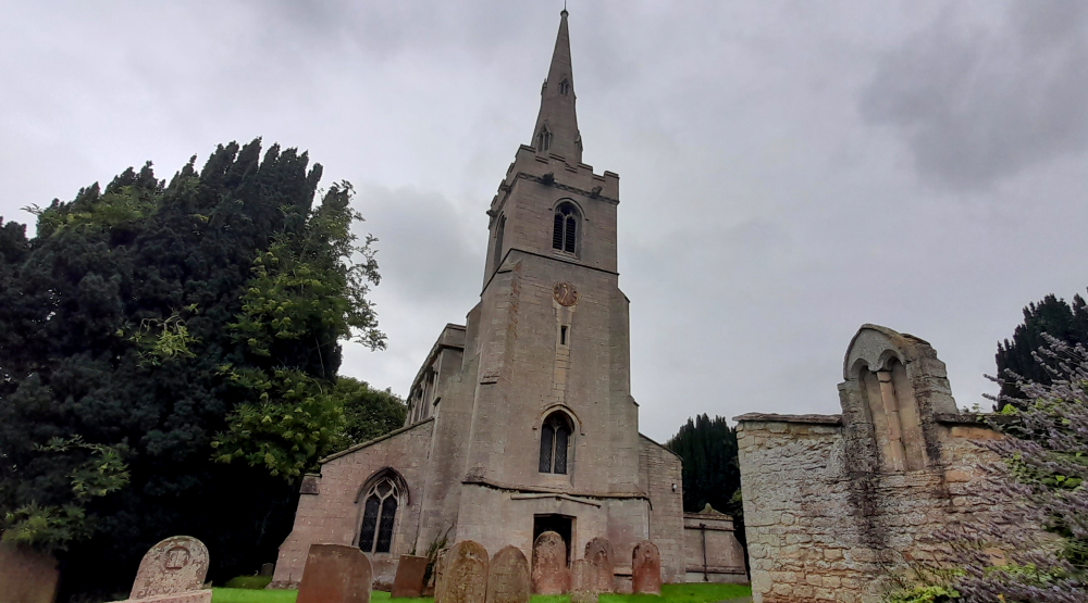
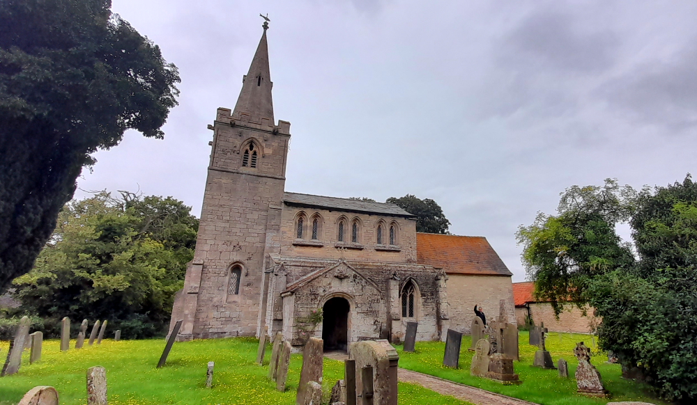
Parish Church of St Mary the Virgin, Lewisham.
What should have taken 40 minutes to drive the 26km to the Novotel Greenwich takes an hour 15 minutes thanks to the tortuous route that the South Circular takes along suburban streets.
After parking the car and having a coffee our room is ready so we unpack and catch up on the past 3 days before we head out to the local Chinese.
23 March, 2024
Our task today is to trace my Great Great grandparents – George Till and his wife Mary Lambert Hawkins. We found George’s birthplace of Beals Oak Farm, Wenbash Lane, South Wadhurst in East Sussex back in November 2022. And that he had lived in Little Snape, Wadhurst, East Sussex in 1851 while Mary had lived in High Street, Ticehurst, East Sussex that same census year.
Records state that they were married in the Parish Church of St Mary the Virgin in High Street, Lewisham on 5 August 1867. So we jump on the DLR next door to our hotel at Greenwich and walk some 20 minutes from the DLR station at Lewisham to arrive at the church.
Lewisham DLR station.
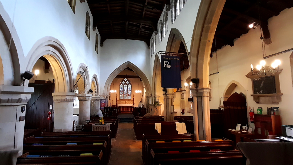
St Mary’s Church has stood on this spot for about a thousand years. The present church stands on the site of previous parish churches dating back probably to the 10th century when the whole of Lewisham was owned and administered by the Abbey of St Peter’s, Ghent in Flanders. The tower of the present church was built 1471-1512 and is the oldest structure in Lewisham. Restoration work was carried out on it in 1907.
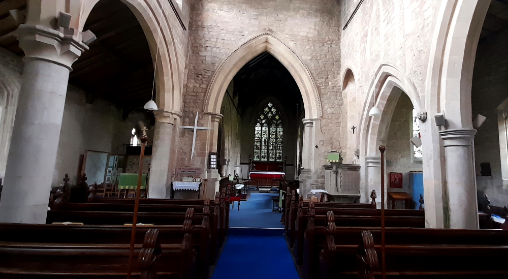
The present church was built 1774-1777 and then restored and re-ordered in 1881. At the time of my great great grandparents’ wedding the interior was plain and austere: a ceiling hiding the roof structure, high dark oak box pews, slender iron pillars supporting the galleries, a western gallery and organ, a 3-decker pulpit and a plain, wooden altar in a small rounded apse at the east end.
Inside St Mary’s Church, Lewisham.
In 1881 new building work took place creating the present interior which became Victorian in style. The apse was taken down and the present chancel built.
In 1931 as part of the church’s 1,000-birthday festival, a chapel to Our Lady was created under the north gallery.
The 1995-96 re-ordering was the first major work to be carried out since 1881 with considerable repair, restoration and modernisation. Together with the 2016 Re-roofing project, all culminating in the church we see today.
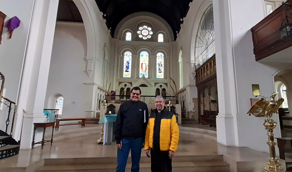
Help from Rev. Steve Hall, the current vicar.
As it’s such a fine day today and we know that the DLR is running we decide to carry on with the family research we were going to do tomorrow. So we catch the DLR from Lewisham to Bank.
Canary Wharf DLR station where Lynn used to alight when she worked at Canary Wharf.
Rather than take the train to Aldgate we opt to walk through the streets of London.
Royal Exchange Building at Bank.
Here we walk past some familiar landmarks such as the Royal Exchange where Lynn had her farewell bash in 2010.
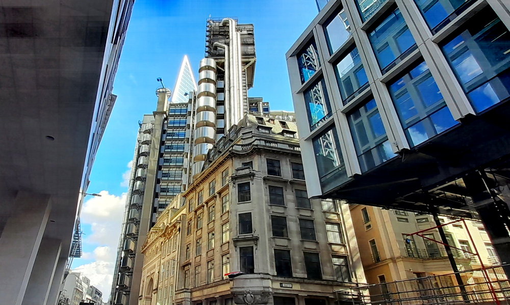
Lloyds of London Insurance building.
As well as taking in the changes that have occurred since Lynn left in 2010.
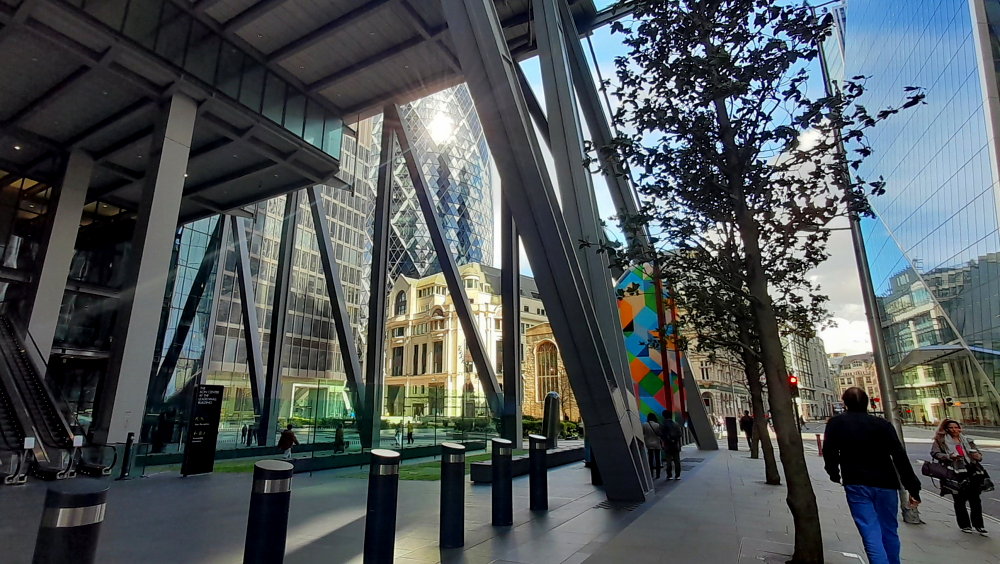
The Gherkin.
On our way to Duke’s Place, Aldgate we pass by an Austin 7.
An Austin 7 parked in downtown London.
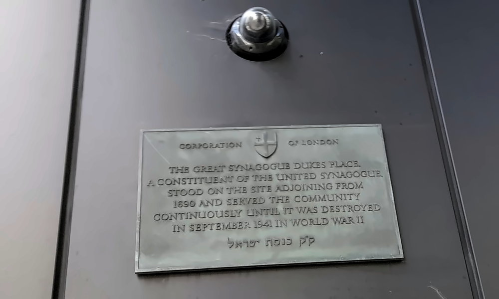
At the corner of Duke’s Place and St James’s Passage there is supposed to be a plaque marking the site of the Great Synagogue from 1690-1941. After much searching the surrounding area I finally find it high up on a wall of a modern building.
Plaque re. Great Synagogue, Duke’s Place, 1690-1941.
Joseph Hart, my 4 times great grandfather was born in Duke’s Place on 25 September 1791 and was married to Esther Garcia at the Great Synagogue on 2 May 1810.
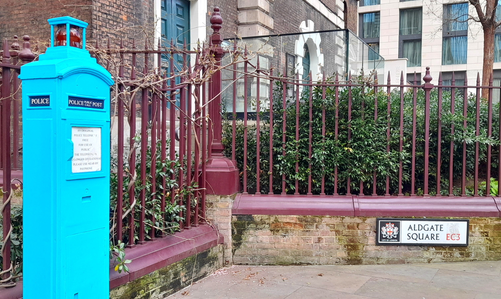
Original Police telephone box in adjacent Aldgate Square to Duke’s Place.
Walking to Aldgate East station we take the District Line, getting off at Stepney Green. Here we are in search of the cemetery where Joseph Hart was buried.
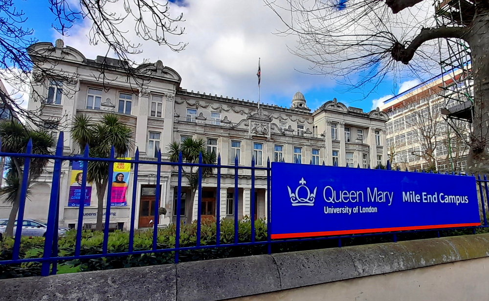
We find the Mile End (Jewish) Ashkenazi Old Cemetery, Alderney Road, Bethnal Green which is adjacent to the modern Mile End campus of the Queen Mary University. Unfortunately, it is completely walled with sole access via a small wooden door with a keypad but burials had stopped around 1770.
Queens’ Building, Queen Mary University, Mile End Campus.
Further along Mile End Road we pass by the stately Queens’ Building of the Queen Mary University. It turns out there is another cemetery to the right of, and behind, this building which we will need to check out on Monday.
Brokesley Street, formerly Lincoln Street, London with view of Canary Wharf towers in the distance.
Our last task is to find the house in which Joseph died in on 5 May 1884 at 73 Lincoln Street, London (renamed Brokesley Street, Mile End) so we walk several more blocks up Mile End Road until we find that street.
73 Brokesley (formerly Lincoln) Street, Mile End.
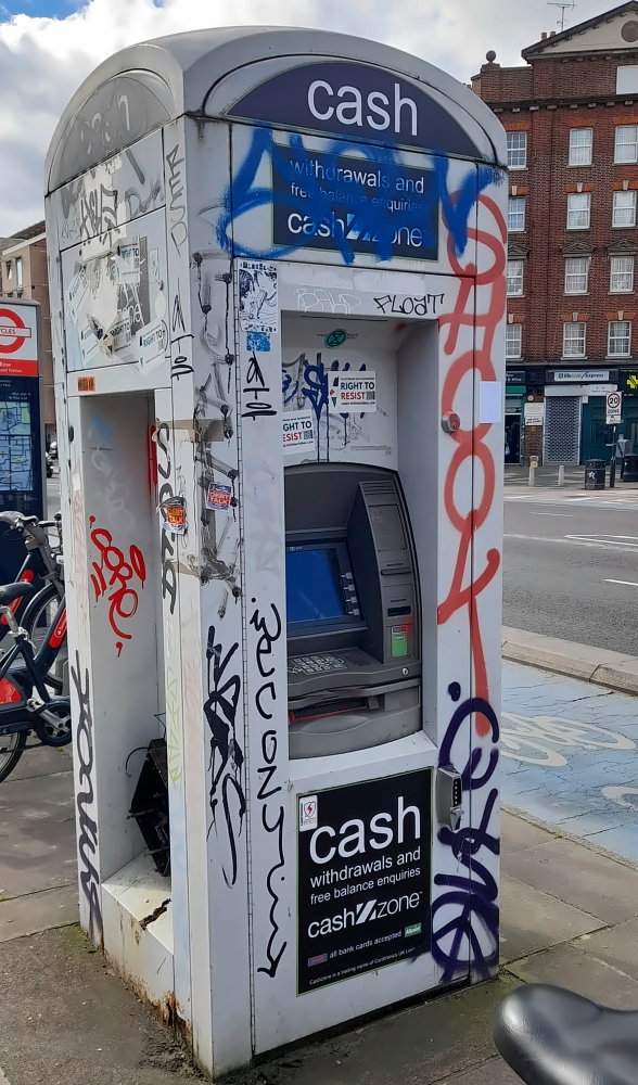
Time to head home so we walk a further couple of blocks until we reach the Bow Church DLR station. En route we pass by what appears to be an old telephone box now housing an ATM machine, complete with graffiti. This is the third one we’ve seen today during our travels.
I bet Superman was surprised when he went to change in this phone booth!
We have a short wait for a DLR to arrive. Although it terminates at Canary Wharf all we need to do is move to the opposite platform to catch the DLR to Lewisham, alighting at Greenwich.
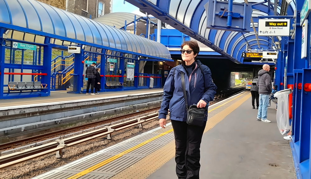
Bow Church DLR Station.
We’re hardly home when we notice storm clouds heading our way. 15 minutes later sunshine turns to hail.
View of a storm coming from our hotel window. The Shard is centre.
It quickly passes by and sunshine returns.
Passing storm. 02 Arena centre & Cutty Sark masts to right of 02.
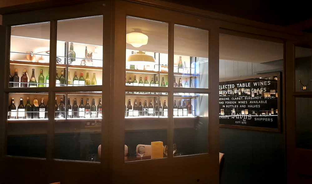
Exiting the Greenwich DLR station earlier we discover Davy’s Wine Vaults next door which is where we return to for dinner. The Wine Merchants and Shippers were established in 1870 supplying “Claret, Champagne, Hock and Burgundy. Port (the most noted Vintages) Sherry and Madeira.” Today’s complex of Wine Shop and Vaults reflects its heritage with historic memorabilia and a quaint floor layout including some small, one-off private dining rooms.
Private dining room.
When we get into the lift there is an ad hoc sign taped to the wall in small print that says, “If you can return a spare key card to reception you will be rewarded with either a free drink or free parking.” 5 minutes later we are rewarded with a GBP50 refund on our GBP100 parking fee. Bonus!
As we’ve finished most of the family tree research and tomorrow’s weather is due to be fine, we’ll take the day off to wander around Greenwich.
24 March, 2024
About 11:30 am we walk up Greenwich High Road to King William Walk then into Greenwich Park.
Greenwich High Street with view to Cutty Sark.
At 13 Deg. C. there are lots of people about in cafes and walking in the Park mostly with baby carriages and/or dogs.
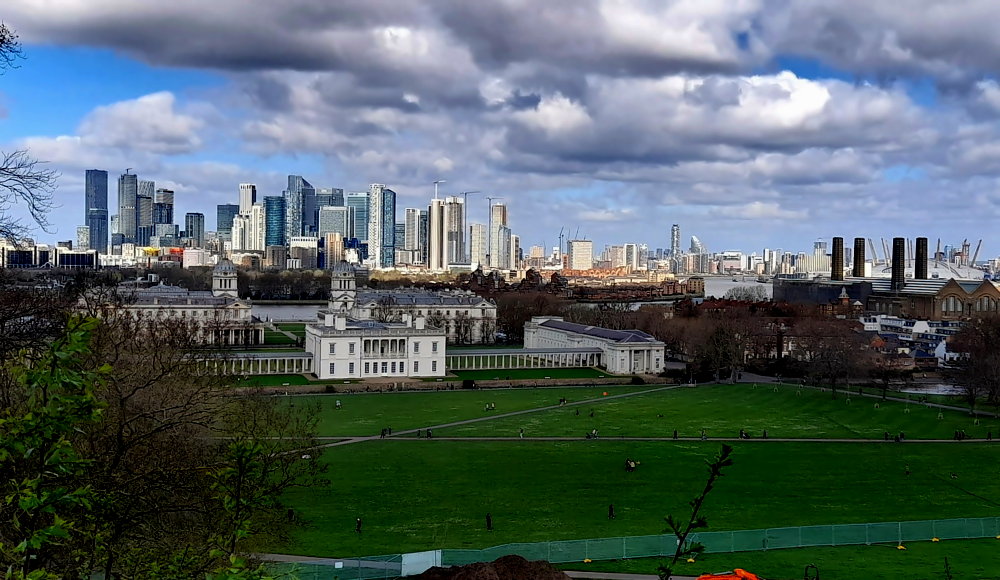
Royal Observatory view of Queen’s House & Colonnade backdropped by Canary Wharf towers.
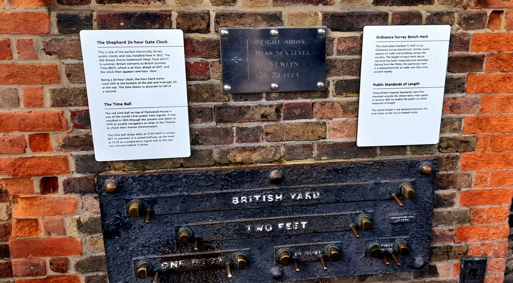
Up the hill at the Royal Observatory we pass by a set of instruments that designated Public Standards of Length and I straddle the Greenwich/Prime Meridian – a standard longitudinal point at 0 Deg.
British measurements.
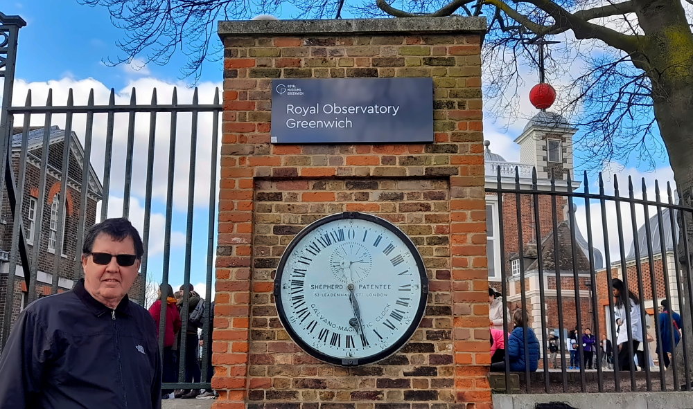
Plus another measurement mechanism – for time. As the industrial world came into shape, trains, factories and global businesses could use Greenwich Mean Time as a universal measure of time, meaning that the timings of journeys, transactions and production periods could be standardised across the whole planet. On the outer wall of the Observatory is the Shepherd Gate Clock which has an unusual 24-hour display.
Shepherd Gate Clock – Greenwich Mean Time.
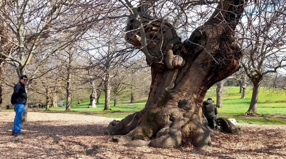
From the Observatory we walk down the hill past a row of ancient trees, including the Queen Elizabeth’s Oak, thought to have been planted in the 12th century with traditions linked to Queen Elizabeth 1 and King Henry VIII.
Ancient trees.
Next to this oak, another English oak was planted by Prince Philip in 1992 to commemorate 40 years of the reign of Queen Elizabeth II.
Colonnade linking Queen’s House with the National Maritime Museum.
At the bottom of the hill is Queen’s House, a former royal residence built between 1616 and 1635. It was built near the now demolished Greenwich Palace, a few miles downriver from the City of London.
View of the Royal Observatory from Queen’s House Colonnade.
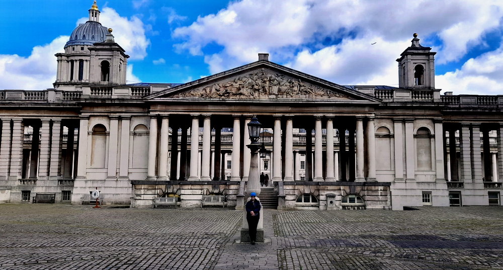
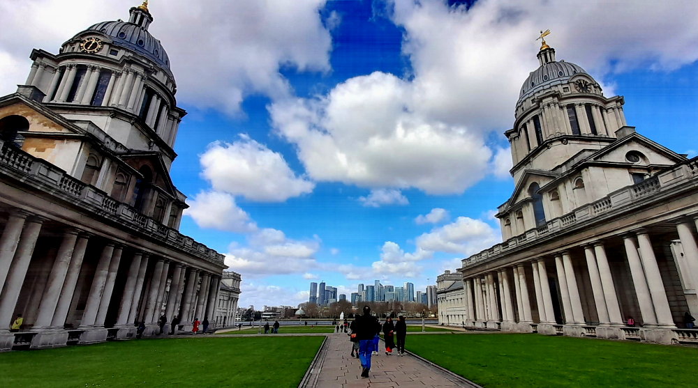
Across the road is the main campus of the University of Greenwich, at the Old Royal Naval College. The Old Royal Naval College are buildings that serve as the architectural centrepiece of Maritime Greenwich, a World Heritage Site.
View of University of Greenwich from Queen’s House.
The buildings were originally constructed to serve as Greenwich Hospital, designed by Christopher Wren, and built between 1696 and 1712.
View of Queen’s House from the University of Greenwich.
The hospital closed in 1869 and so between 1873 and 1998 the buildings were used as a training establishment for the Royal Naval College, Greenwich.
King William Court, University of Greenwich.
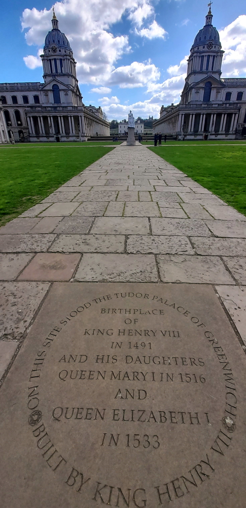
This was originally the site of Bella Court, built by Humphrey, Duke of Gloucester, and subsequently renamed Palace of Placentia by Margaret of Anjou upon its confiscation. Rebuilt by Henry VII, it was thenceforth more commonly known as Greenwich Palace.
The Grand Square, University of Greenwich.
As such, it was the birthplace of Tudor monarchs Henry VIII, Mary I, and Elizabeth I, and reputedly the favourite palace of Henry VIII. The palace fell into disrepair during the English Civil War. With the exception of the incomplete John Webb building, the palace was finally demolished in 1694.
Stone marking the site of Greenwich Palace.
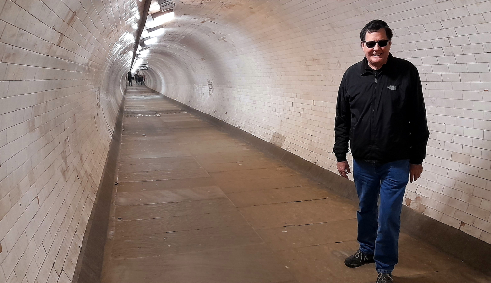
Near the Greenwich Pier is the rotunda that houses the staircase and lift to access the Greenwich Foot Tunnel which passes under the River Thames connecting the south bank with the Isle of Dogs at Millwall.
Tile-lined Greenwich Foot Tunnel.
The tunnel was designed by civil engineer Sir Alexander Binnie for London County Council and constructed by contractor John Cochrane & Co. The project started in June 1899 and the tunnel opened on 4 August 1902. The tunnel replaced an expensive and sometimes unreliable ferry service allowing workers living south of the Thames to reach their workplaces in the London docks and shipyards in or near the Isle of Dogs. Its creation owed much to the efforts of working-class politician Will Crooks, who had worked in the docks and, after chairing the LCC’s Bridges Committee responsible for the tunnel, later served as Labour MP for Woolwich.
Northern rotunda with view of Cutty Sark across the Thames.
The cast-iron tunnel is 1,215 feet (370.2 m) long, 50 feet (15.2 m) deep and has an internal diameter of about 9 feet (2.74 m). The cast-iron rings are coated with concrete and surfaced with some 200,000 white glazed tiles.
Riverside view of the University of Greenwich.
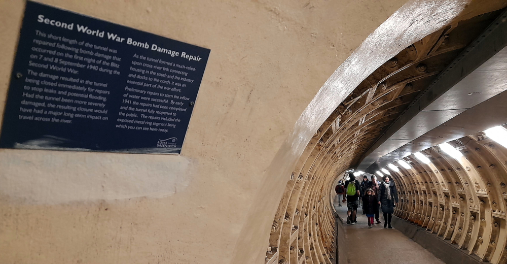
The northern end was damaged by bombs during WWII and repairs included a thick steel and concrete inner lining that substantially reduces the diameter for a short distance. The northern shaft staircase has 87 steps; the southern one has 100.
Site of WWII bomb damage & tunnel repair.
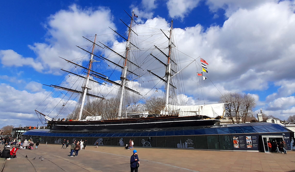
Retracing our steps we emerge next to the Cutty Sark. Since we both visited it years ago, its hull is now encircled by a transparent shell which protects it and also provides visitors the opportunity to view the hull from below.
Cutty Sark was built exclusively for the China tea trade. Tea had been enjoyed in Asia for centuries, but it did not reach Britain until the 1650s. Initially hailed for its medicinal qualities, tea was mainly enjoyed by the wealthy. But by the early 19th century working families were consuming it twice daily. It was also huge business, with over 28 million kilograms imported in 1869 alone.
A fashion developed among Victorians for consuming the first tea to be unloaded in London. This spurred the ‘great tea races’ and a spirit of intense competition: get home first and you could command huge prices. That’s why, as a clipper ship, Cutty Sark was designed to be fast.
On its maiden voyage, the ship departed London on 15 February 1870, bound for Shanghai. On this outward voyage the ship carried a general cargo, including wine, spirits and beer and manufactured goods. After successfully reaching China on 31 May, the ship was loaded with 1,305,812 lbs of tea. After only 25 days in port in Shanghai the ship sped back to London, arriving on 13 October the same year [Royal Museums Greenwich].
The Cutty Sark.
Walking back to the hotel we pass by Greenwich Market, a pretty 19th-century covered market selling unique gifts and knick-knacks, which is absolutely heaving this afternoon.
Greenwich Market.
25 March, 2024
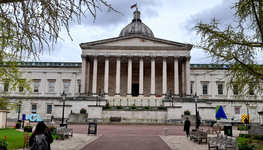
Today, Lynn has arranged to meet up with another friend and former colleague, Dr Elizabeth Shepherd, who is Professor of Archives and Records Management and Head of Department at University College London (UCL) and currently on sabbatical writing her 3rd book, this time about the role of women archivists in recent history.
Wilkins Building & Main Quad, UCL.
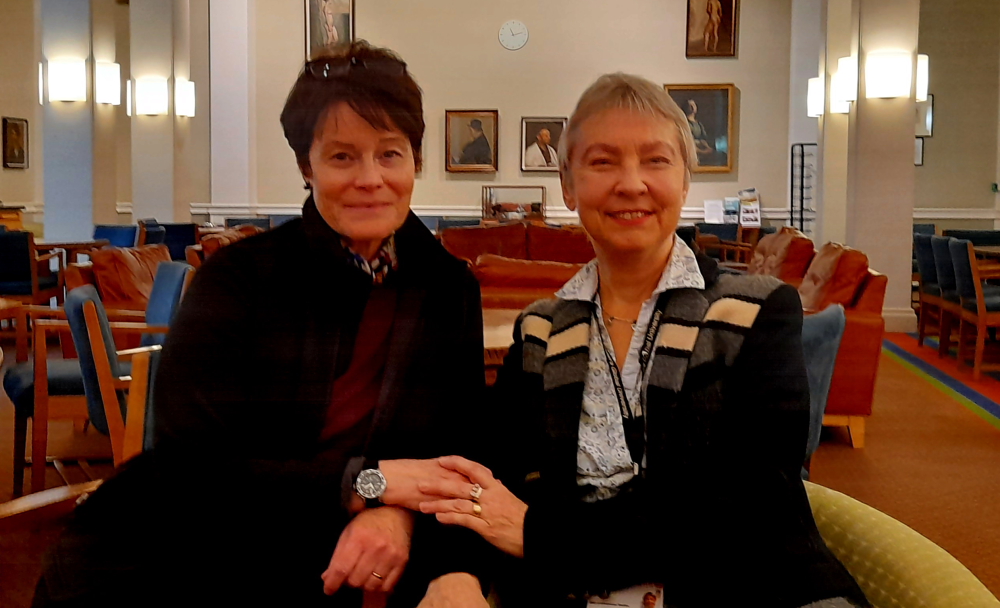
Elizabeth joined the Department of Information Studies (as it is now known) at UCL in 1992. They met in 1993 when Lynn was organising, on behalf of the International Records Management Trust, a team of consultants to visit The Gambia on an Overseas Development Agency trip to advise The Gambian Government and its civil servants on archives and records management in government. Both were consultants on that trip.
Catch-up coffee in the Houseman Room, UCL.
Their association continued when Lynn undertook her MSc at UCL during 1995-97. Elizabeth employed Lynn as a Research Assistant then later for a semester as a Lecturer in Records Management to undergrad. students, both part-time positions.
It truly was about ‘geographies’ as the interviewer, an MA student, was in London on a Skype call to Lynn in Northern Ireland as we’d just arrived from our trip to Iceland and were about to return to the USA to continue our travels there, only to fly home to Australia from San Diego a week later on 19 March due to COVID.
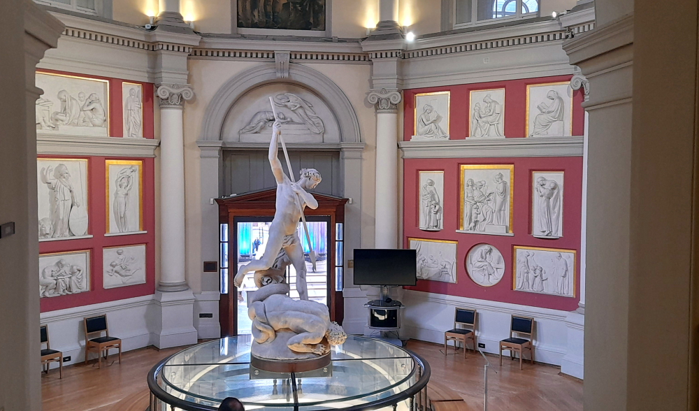
Flaxman Gallery, UCL Library.
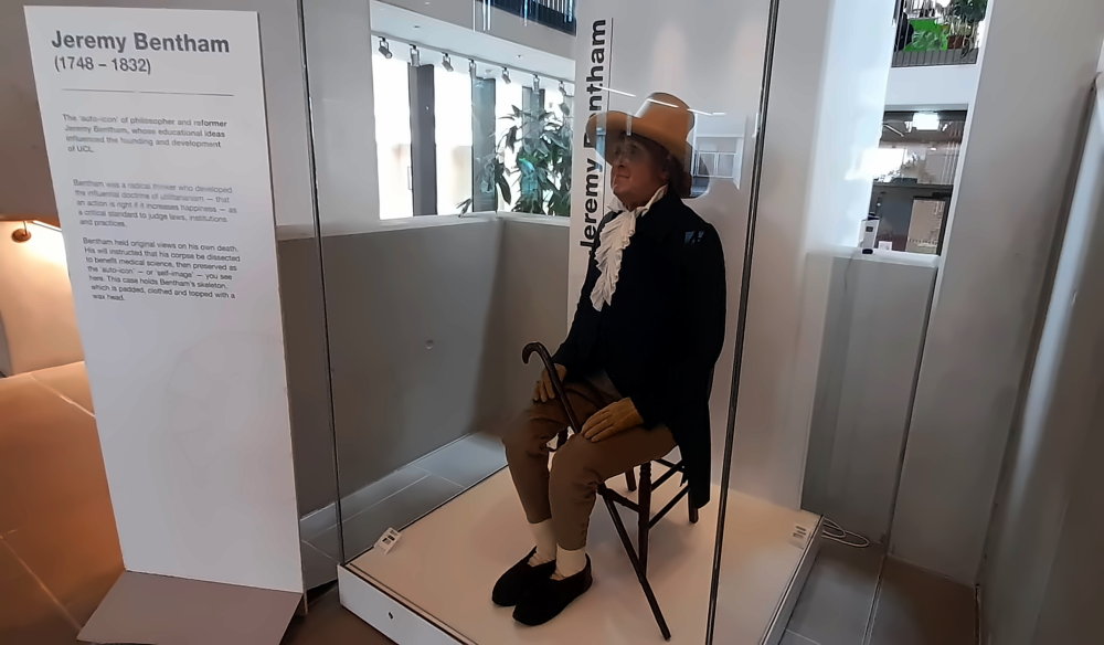
Elizabeth took us on a brief tour of the campus including the Library, the Jeremy Bentham booth, the Henry Morley building where the Department used to be located to Foster Court, its current location.
I learnt that the ‘mannequin’ of Jeremy Bentham displayed below is framed around his skeleton and that his head is actually an artifact in a box in the UCL Archives. Weird, or what!
The strange “auto-icon” of Jeremy Bentham, founder of UCL.
As we have 2 hours before we need to meet up with another friend of Lynn’s, we decide to take the Tube to Mile End to check out the Jewish cemetery, the Novo Cemetery, located within the grounds of Queen Mary University, the one we missed on Saturday.
In 1657 with the encouragement of Oliver Cromwell, then Head of State, Jews were allowed to return to England after an absence of over 350 years. Many who arrived were descendants of families that had fled persecution in Spain and Portugal. Upon arrival in London they founded a synagogue in the City of London (at Duke’s Place) and acquired a burial ground (the Velho) in Mile End, at an adjacent site, on the now Alderney Road, which was used from 1696 as a cemetery by London’s growing Ashkenazi (Eastern European Jewish) community.
By the beginning of the 18th century, the Velho was nearly full. Plans were made for a second, much larger Sephardi burial ground nearby. In 1726, about 400 metres to the east of the Velho, another former orchard, was leased by the Sephardi community.
The first burials at the Novo (new) cemetery took place in 1733. Over the next 150 years, most Sephardi burials in London took place here. By the middle of the 19th century, another expansion became necessary, and in 1855 a further 1.7 acres were added to the east, between the pre-existing cemetery and the Regent’s Canal. Those buried here include the comic actor David Belasco, alias David James (1839-93); Joseph Elmaleh (1809-86), chief rabbi of Mogador and Austrian consul in Morocco, and several members of the prestigious Montefiore family.
By the end of the century, London’s more affluent Sephardim had moved away from the City and East End and, in 1897 the Novo was effectively superseded by a new Sephardi burial ground at Hoop Lane in Golders Green. The north-eastern part of the Novo remained open for adult burials until 1906.
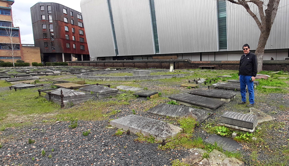
Standing next to a couple of Hart tombstones in The Novo Cemetery, Mile End.
Here amongst the Montefiores, da Costas and Belascos I find a couple of Hart and Garcia tombstones, but not the ones we are specifically searching for – Joseph Hart buried 1884 and his wife, Esther nee Garcia, buried 1853.
Back on the Tube we arrive at 33 King William Street, Wells Fargo’s London HQ, with 15 minutes to spare. Unfortunately, we discover that Lynn’s friend, Masaki, has had to work at home today due to childcare issues, so we continue to Greenwich.
We dine at the local Pizza Express and I have to say that both their pizzas and wine offerings aren’t half bad and are reasonably priced.
26 March, 2024
There’s the off-chance that Masaki may be able to make it to Greenwich today. In the meantime we catch up with the blog and get organised for our trip to catch LeShuttle from Folkestone tomorrow and our upcoming 7.5 week trip through Luxembourg, southern Germany, Switzerland, NW Italy, and France.
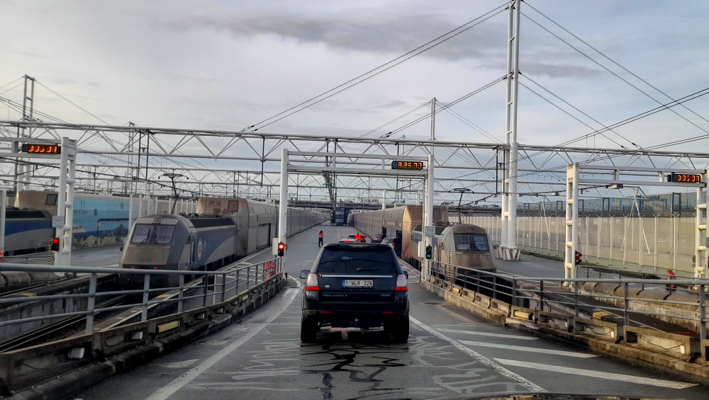
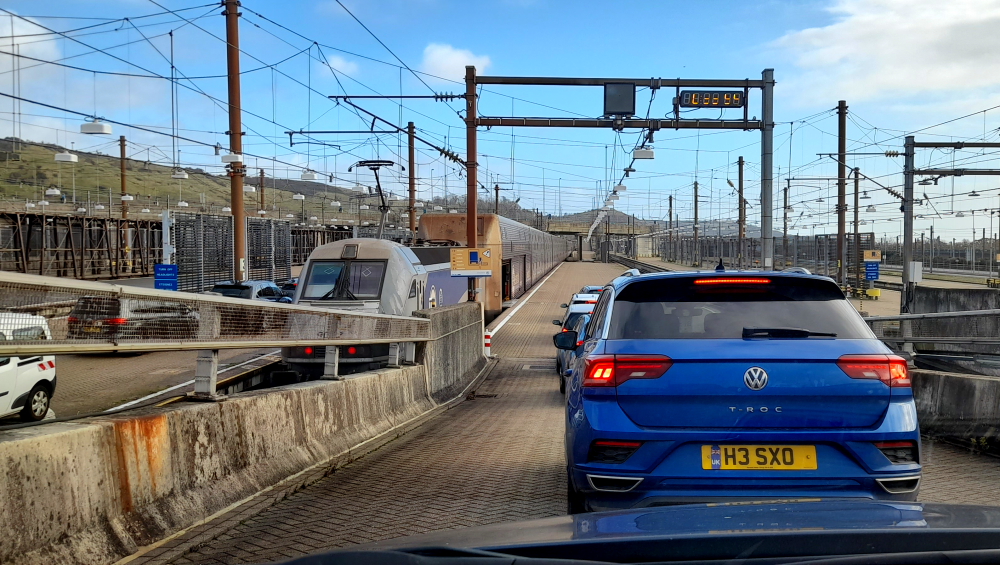
We end up leaving our accommodation half an hour earlier than planned which means we are at LeShuttle check-in 2 hours before our scheduled departure of 11:18 am. Nevertheless, we are offered an earlier train of 10:18 am which we accept and promptly proceed to the French, then UK, border controls then line up in the short queue to board the train.
Boarding Le Shuttle to depart Calais.
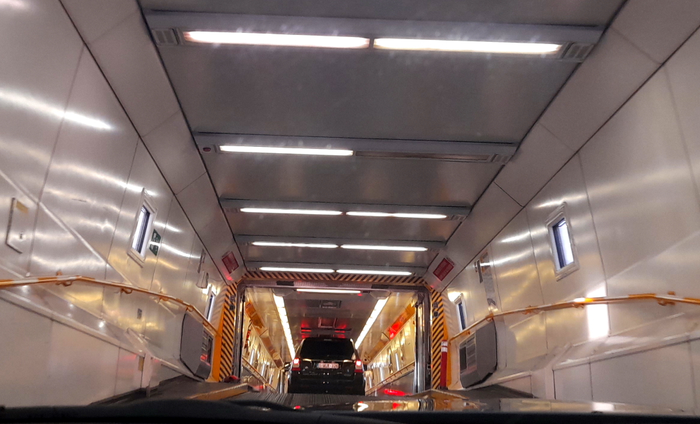
Perhaps the Danish border guards linked our passports on the ‘system’ as since Lynn’s run-in with them in Copenhagen in July last year we’ve not had an issue with her exceeding the Schengen’s limitation while she has been travelling with me in Europe. Result!
Soon we are waved onto the train and park and before we know it, we are rolling – even though the time is only 09:48 am!
Inside Le Shuttle.
35 minutes later we are rolling off the train at Folkestone and half an hour later, after driving through a misty and muddy landscape, we arrive at the Burns’s at Anvil Green.
Foggy Kent on our way to Anvil Green.
After a quick repack we give Alex our cast-offs that are destined for the charity shop and drive 5 minutes in the family’s Daimler to the Compasses Inn, their ‘local’ for lunch with Alex.
Lunch with Alex at her “local”.
When we arrive we have the place to ourselves and quickly commandeer a table by the open fire as it is really chilly outside.
To say their main courses are ‘generous’ is an understatement!
A full rack of dinosaur ribs.
Fond farewells to Alex then we hit the road at 2:45 pm for the 2.5 hour drive to Wokingham in mizzle to stay with Barbaran and Stuart for the next few days.
Arriving in Wokingham.
Although it’s been 15 months since we last saw them in Spain, it’s just like it was yesterday as we sit down to catch up. After watching the 6 Nations rugby match “on the telly” between England and Wales (16-14), we sit down to a delicious homemade meal and have an early night.
11 February, 2024
It’s still grey, raining and miserable so we opt for a lazy day in. After a late breakfast we continue chatting until the next 6 Nations rugby match on TV – Ireland v Italy (36-0) – a masterful display and lesson in how to play the game and much to Barbaran’s delight- given she is Irish.
For dinner we are driven half an hour away to Reading where we are booked into the London Street Brasserie, a former 18th-century toll house by the River Kennet for great food and wine.
On our way home Barbaran insists we call into the local casino to try our luck at roulette. Needless to say we lose our meager bets quickly but I am instrumental in getting Barbaran to place a bet on black and win her some money back.
12 February, 2024
A nice sunny day greets us this morning but we have some chores to get done before we get out and enjoy the countryside today.
First job is to head down to the local pharmacy to get ourselves a flu shot since we can’t get a Covid booster thanks to the inefficiencies of the UK NHS system. It has been well over a year since our last Covid booster so the next best thing is to get a flu shot.
Lynn is eligible for a free shot but mine costs me GBP14.00. I would have been glad to pay for a Covid jab but that was way too hard to organise. Makes you appreciate the Australian health system despite it having a small cost vs the NHS free system. At least we can access the health system when we need it in Australia!
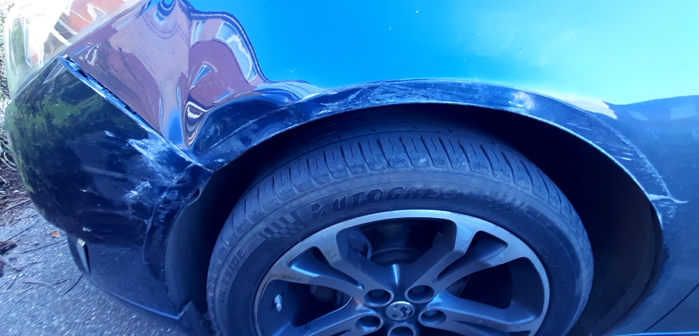
Our second task today is to have three new tyres fitted to the Insignia. I was planning to have the tyres last until we sold the car in May but they are already worn down to the legal limit and we still have a month travelling around soggy Wales before our 2-month driving tour of Luxembourg, Switzerland, Italy and our week with the Leggieries back in the Champagne region.
The third compulsory task today is to visit the car wash that Stuart and their eldest son, Alexander, own to have the Insignia cleaned inside and out. The car is still sporting Spanish dust from our 9 days in Montblanc and the mud from Kent.
Once the shots and the new tyres have been done I leave the car at the car wash and we all go for a drive in the countryside.
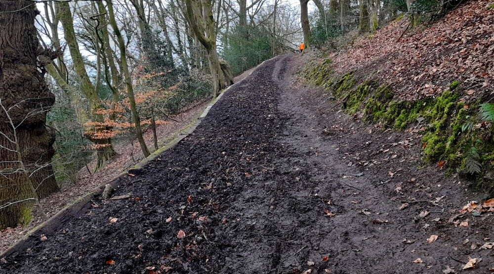
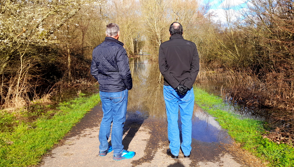
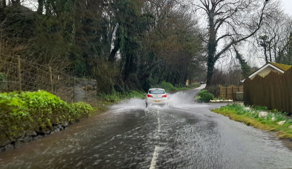
A walk in the sunshine interrupted by a flooded trail.
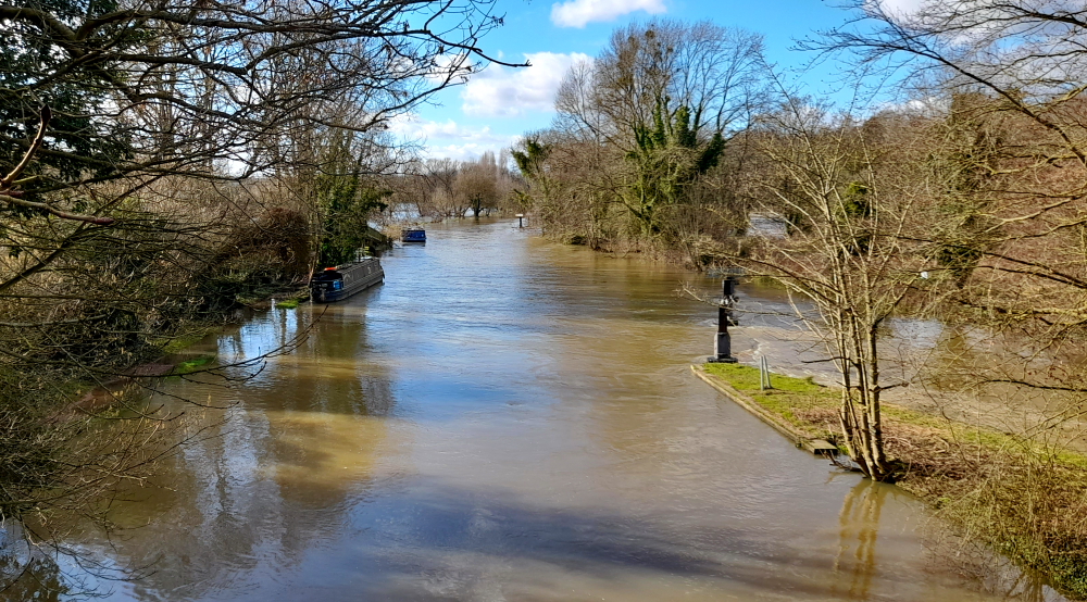
Initially we were going to walk around a lake near Sunbury-on-Thames and have a spot of lunch at the local pub but, alas, the path is flooded, the pub is closed and the area is about to be over-run by a film crew.
Canal has flooded into the Thames River.
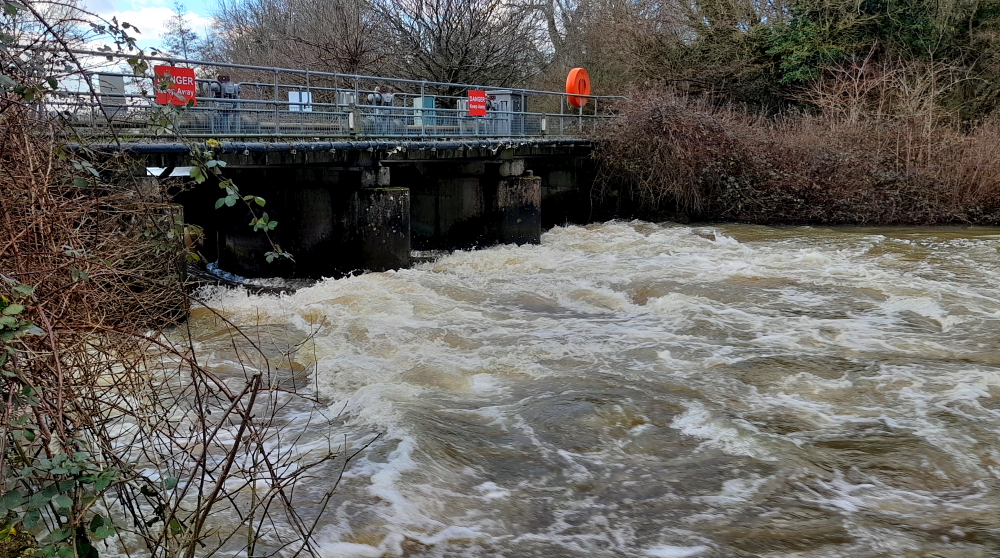
Plan B is to drive 45 minutes in the opposite direction to Hurley Lock which is between Henley-on-Thames and Marlow. We park in the charming village of Hurley and take the path to the Lock. Although the canal and the Thames are flooded, at least we don’t need to abort our walk.
Even the weir has overflowed.
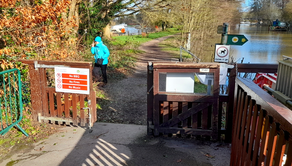
Several dog walkers are out and about but it will be several months before the tea shop is open again.
No Music here.. just looking for a loo.
Walking back into the village we check out the St Mary the Virgin Church. The first church was probably built c.700 AD when St. Birinus passed up the Thames. During the next 200 years the Danes may have sacked Hurley during their occupation of Reading and the battle of Danesfield. Next mention is in 894 when the Danes are reported to have “Traversed Herlei” during their march from Essex to Gloucester.
The village grew around the small Saxon church and the lands came under the control of Esgar (Asgar), the Chief Staller and Master of the Horse to Edward the Confessor in the middle of the 11th Century.
After the Conquest, William I confiscated all the lands at Hurley and gave them to his trusted supporter, Geoffrey de Mandeville, for services rendered. In 1086, at the request of Geoffrey de Mandeville’s second wife Leceline, Bishop Osmund of Old Sarum dedicated the rebuilt church at Hurley as a Benedictine Priory, a cell to Westminster Abbey.
The Domesday Book, compiled during this time, states that the village of Hurley consisted of a church together with a mill, 2 fisheries, 25 villagers, 12 cottagers and 10 slaves.
St Mary the Virgin Church, Hurley.
1536 saw the Dissolution of the Monasteries by Henry VIII and Hurley Priory did not escape. The entire eastern end of the church and the transepts were demolished until only approximately the present day building was left.
In 1545 the estates passed to John Lovelace and much of the materials from the Old Priory were used to build the first Ladye Place Mansion. At the turn of the 17th century, Richard, 1st Baron Lovelace of Hurley, installed the bell turret and the largest bell. A major restoration took place in 1852.
From there we walk to the Olde Bell – today a stylish coaching inn with a restaurant and rooms that dates from 1135 – for a spot of lunch. Now this pub serves lunch from noon-5:00 pm – how civilised!
Lunch at the Olde Bell, Hurley.
When we return to the house Stuart and I drive down to the car wash to collect the Insignia.
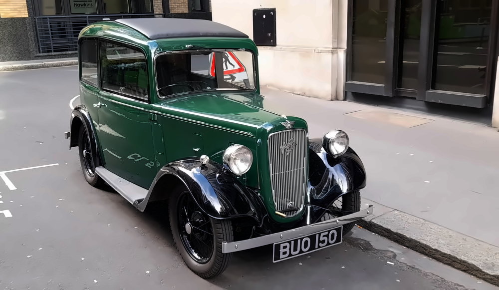
Sparkling clean car at the Waves Car Wash, Wokingham.
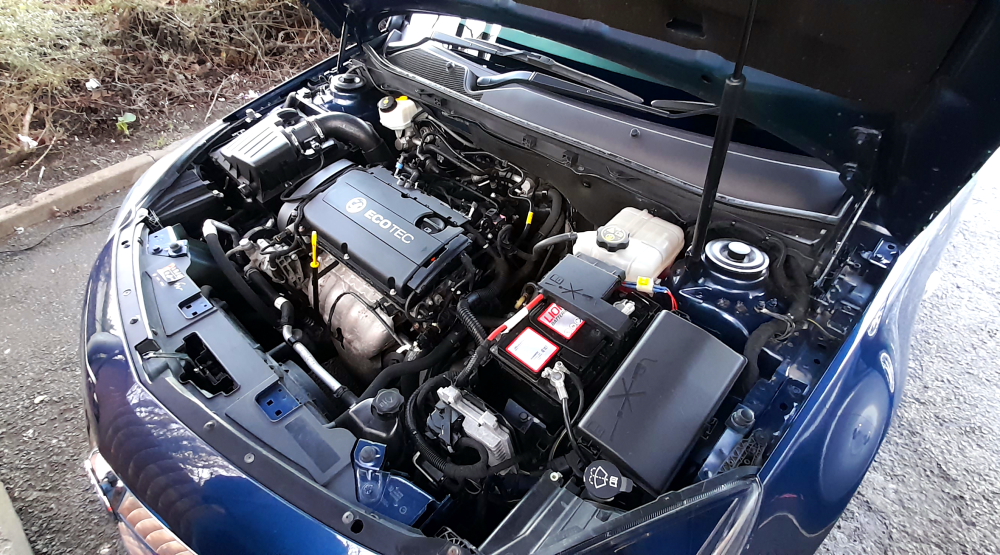
It has been a while since we had the inside of the windows cleaned and as I’m running out of ceramic car polish I also have a coating of it applied. The car now looks immaculate. I take some photos of the car so that when we come to sell it in May I have the photos ready just in case the weather is not conducive when we need it to be.
I also had the engine bay cleaned just to help the sales process. It’s also come up a treat.
Like brand new under the bonnet.
Barbaran cooks us a delish chilli con carne which we have while we watch a movie on TV, then hit the sack.
13 February, 2024
It’s 9 Deg. C. and mizzling when we say farewell at 11:45 am for our 197 km drive to Cwmdu, Wales, via Tesco’s first for fuel and provisions as the weather forecast for the next few days is – rain.
Hitting the road again.
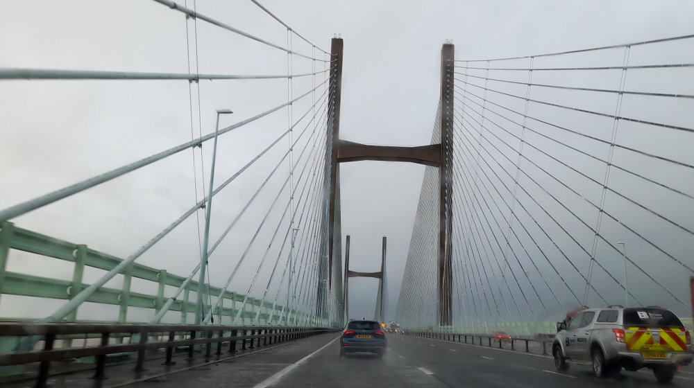
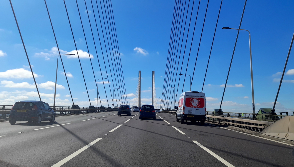
Mizzle soon turns to rain and while crossing the Prince of Wales Bridge from England to Wales over the River Severn, it’s bucketing down.
Crossing the Prince of Wales Bridge from England to Wales.
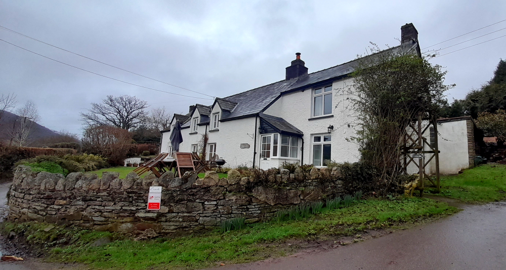
We arrive around 3:00 pm and settle into our “Scenic Welsh Cottage in the Brecon Beacons”.
Our cottage for the next 4 days.
Not too sure about scenic as we can’t see the surrounding countryside thanks to the mist but it is definitely a cozy, 3-BR farmhouse cottage, lovingly looked after by the family since the 1950s, complete with family heirlooms.
During our drive here we noticed that there isn’t a supermarket or a pub that is open for the next two nights within a 20 minute drive so after we unpack we have to head out to look for a supermarket. My GPS says that there is a Tescos 13 km away. Little did I realise that 13km meant “as the crow flies” and due to the hills, valleys and lack of main roads the drive is 25km and takes over half an hour. Driving back to the cottage in the dark and wet is a major headache and one of the reasons that we would never live in a remote country region of the UK. Nice place to visit but WHO THE HELL WOULD LIVE HERE?.
14 February, 2024
A grey start to the day but we get glimpses of the surrounding hillsides as rain shower after rain shower pass by.
View from the cottage.
We spend the day catching up the blog and doing several loads of washing and ironing. We even have a visit from a guy from a broadband company who’s come to extend the WiFi coverage at one end of the cottage. Lynn asks him if he wants a cup of tea to which he replies in a magnificent Welsh accent: “Thanks, but can I have a glass of the Council’s pop, please.” Turns out he wanted a glass of water!
Before we know it, it’s dusk. Time for another meal in and a movie on TV. Hopefully the local pub is open tomorrow night as I have no intention of trying to drive these narrow lanes in the dark and wet again.
15 February, 2024
It’s cold and raining again today so we take the opportunity to go through our “stuff” to jettison anything that is unnecessary. I also backup our photos of the past couple of months and make a few alternative plans for when we are back in the UK in late May for selling the car.
It doesn’t help that we slept in until after 11:00 am and didn’t have breakfast until midday. It’s nice to be able to just hibernate occasionally when the weather outside is cold and wet and the countryside is absolutely quiet. Not even a bird or sheep to break the silence.
Tonight we plan to go to the local pub for dinner but when we arrive at the hotel car park there are no lights on. The publican comes out to meet us in the car park to apologise that they planned to be open but are having electrical issues, the electrician has not been able to rectify the problems so they won’t be opening tonight. She assures us that they will be open tomorrow night.
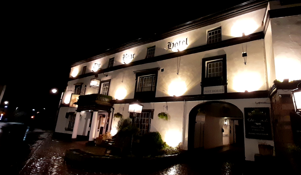
The next closest pub is the Bear Hotel in Crickhowell which is about 7 km away. I hate driving in these wet conditions when the narrow roads are busy with local traffic but we have no choice.
The Bear Hotel.
Luckily the food is excellent and there is good parking and a lively atmosphere in the pub. Hopefully our local is open tomorrow night.
16 February, 2024
We are out of bed slightly earlier than we were yesterday but it’s still raining outside. It looks like we will have another lazy day inside and do the little things that we have neglected these past few months.
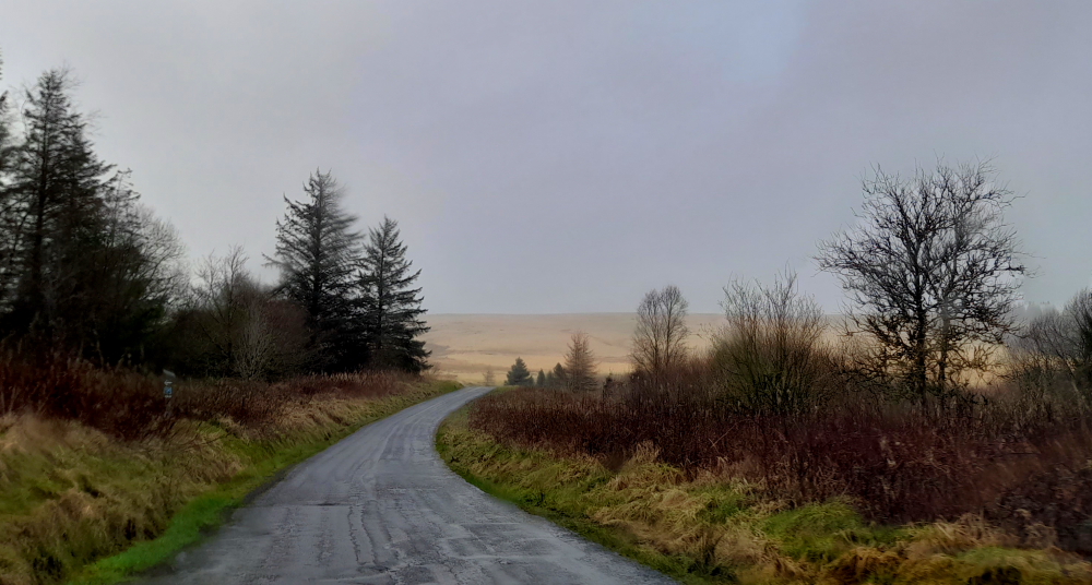
It’s now 2:30 pm and there is a break in the weather and for the first time in Wales we can see patches of blue sky. It’s not forecast to be dry very long so I map out a driving route through the Brecon Beacons National Park for our relocation to Llanelli tomorrow. Since the ground is absolutely saturated we decide to minimise our driving on local roads and try to at least stay on A roads. Even taking a zig-zag route through the Park it’s still only a couple of hours’ drive from here to Llanelli.
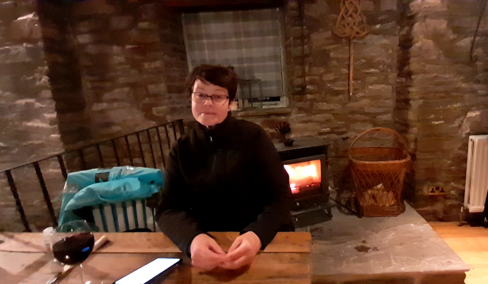
Tonight we try to have dinner at the pub just down the road but again we are told that they are not serving food tonight. How hard is it to open the kitchen on a Friday night? We have to drive down to the neighbouring village. This time we stop at the Nantyffin (try to pronounce that!) Cider Mill Inn which is a few kilometres closer than the Bear Hotel. The food is not quite as good as the Bear’s but it will do on this very wet and windy night. At least we have a table by the fire.
Red wine and a warming fireplace.
17 February, 2024
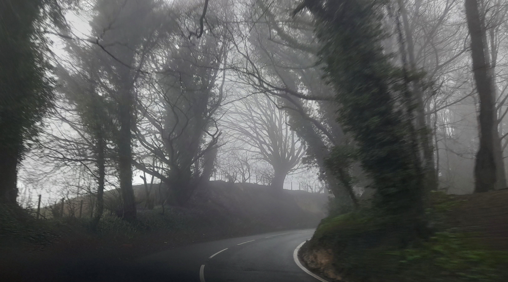
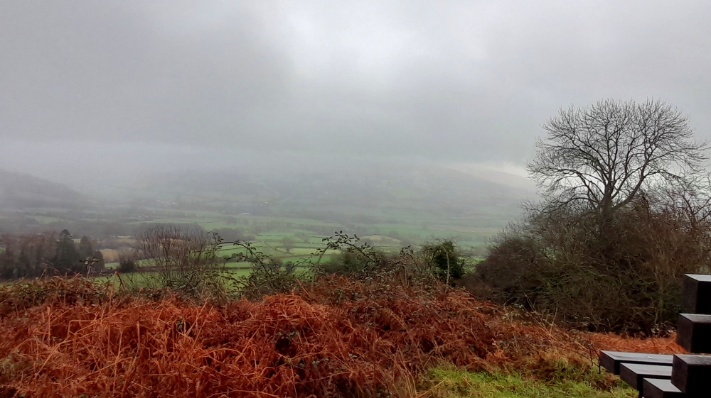
We are out of bed early (or at least early for us) this morning as we have to check out by 10:00 am. How uncivilised on a winter’s morning! The weather is no better this morning so our drive around the National Park is in heavy rain and regular fog patches. Just getting to an A road is an effort as our GPS takes us up and over the hills behind the cottage. Luckily there are very few cars or tractors on the lanes this morning.
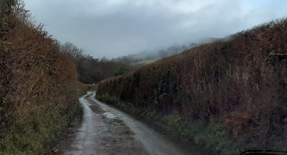
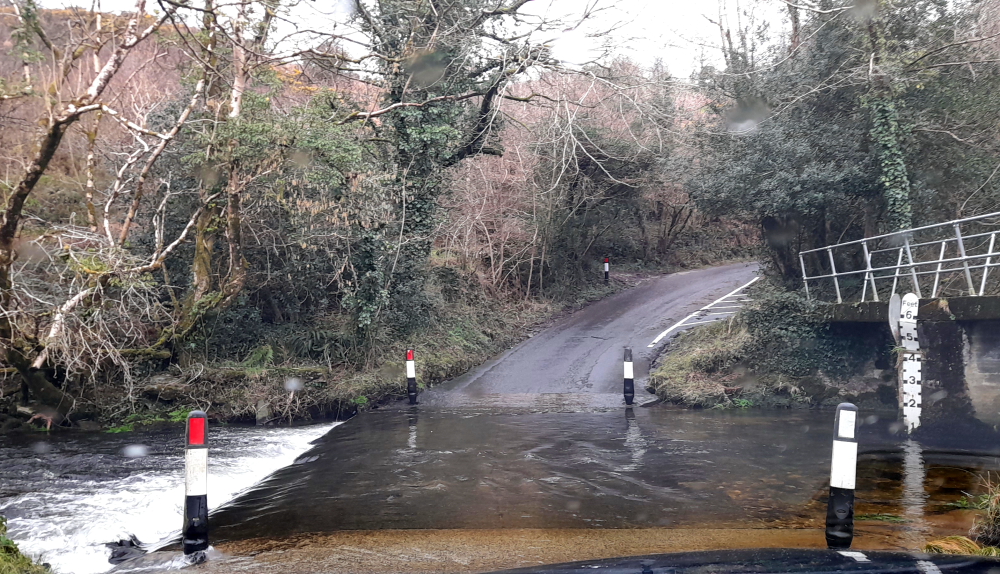
That’s not a road!
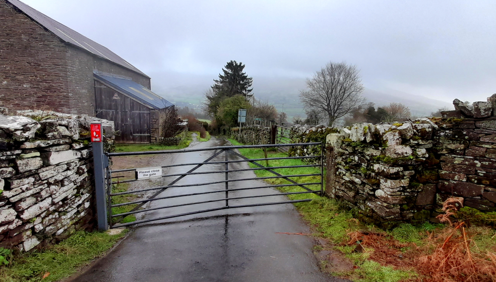
The country lanes even take us over a number of cattle grids and we come across a closed gate on the main road between villages. Talk about back of beyond.
Lynn gets wet manning the gate.
As we climb higher into the National Park we find ourselves driving in thick fog. The plan was to stop at a few lookouts to get some views of the National Park. All we see are views of low cloud.
Best view we get all day.
It’s Saturday morning and at every lay-by in the National Park there is barely a parking space available. These crazy Welshpeople are all out either hiking, jogging or cycling in this crazy weather that is almost too poor to even drive through.
At the highest point on the drive through the Park the sun is almost shining through the clouds. The edge of the road is an absolute bog so passing cars in the opposite direction means we have to come to a complete stop without leaving the bitumen. We even come across a small car on its roof and it appears that they drifted on to the muddy verge and slid into the ditch and rolled over.
Almost sunshine at the highest point of the Park.
By 2:00 pm we arrive in Llanelli and stop in at the local Tesco for supplies. We are camped in a 1970s house on a housing estate for the next 4 nights. Another AirBnB equivalent that should not be on Booking.com. Still, with this weather forecast for the next few days at least it is warm and dry inside. The original plan was to visit the local beaches and drive around the Gower Peninsula Area of Outstanding Natural Beauty but not if this weather persists. Maybe another four-day rest may be in order. At least we can watch the rugby on TV.
18 February, 2024
After breakfast there is a hint of blue sky so we take the opportunity to take a 25-minute walk each way back to Tesco to buy a few items that we missed yesterday. At least we get some exercise and fresh air.
On our return to the house Lynn finds a tea towel in a kitchen drawer featuring the Welsh alphabet. Even with this, the language makes absolutely no sense what so ever. Chinese is easier!
The Welsh Alphabet.
This afternoon we spend time putting together an itinerary for our trip back to the Champagne region in May, ready for our Skype call with our Philly friends, Becky and Jerry, on Tuesday to finalise.
19 February, 2024
Sunshine! Time to hit the road to check out the Gower Peninsula and its Area of Outstanding Natural Beauty. When we were in Ireland early last year staying at the Golf Resort we met a Welshman there and he said: “If ever you get to Wales make sure you visit the Gower Peninsula. It is incredible!” So, we’ll see …
Exiting Llanelli all we see is litter along the A484 roadside and all things rugby – rugby fields, impressive rugby stadium (Parc y Scarlets) and even rugby goal posts on a roundabout. These rugby posts were used in Llanelli’s famous 9-3 victory over the touring New Zealand All Blacks in 1972. The posts, 9.6m tall and set 5.5m apart, faced an uncertain future after Llanelli’s Stradey Park, where they stood for decades, was replaced by Parc y Scarlets. Now they are the gateway to the town.
Stradey Rugby Posts – Berwick Roundabout.
We drive over the bridge which straddles the RIver Loughor and take the B4295 along the coast through Penclawdd to Oldwalls then a small road past the Britannia Inn, onto Frog Lane.
This takes us through Llanmadoc trying to get a view of the beach. We come to a dead end. Typical of Wales, we are stopped by a caravan park that has prime real estate overlooking the beach so we backtrack to St Madoc’s Church.
Stone walls, houses & hedges on the B4295.
St Madoc is reputed to have founded a church here in the 6th century, and the present building is 13th century.
Set in one windowsill is a lettered stone dating from the 6th century which was discovered in 1861 in the walls of the old parsonage house, and commemorates ‘Advenctus son of Guanus’. In the west wall is a crude pillar cross and a boundary marker dating from the 7th to 9th centuries, whilst the font is probably Norman.
During the 12th century the parish was controlled by the Knights Templar, before passing to the Knights Hospitaller of St John of Jerusalem, though no visible evidence now remains of this. The Revd J D Davies, a skilled woodcarver, was Rector here from 1860 to 1911. He carved the oak altar frontal and led the major restoration begun in 1865.
13th century St Medoc’s Church.
From here we return to Oldwalls then drive through Burry to join up with the A4118 to Port Eynon.
Lifesaving hut & beach at Port Eynon Bay.
According to the visitswanseabay.com: “Port Eynon Bay is safe, sandy and award winning, with both a Blue Flag and a Seaside Award.” Porkies??!!
Award winning, “sandy” Port Eynon Bay Beach.
Returning along the A4118 we turn off onto Kittle Hill Lane, drive down the hill to the junction with the A4067 then turn right to drive to the Victorian seaside town of Mumbles – Mwmblwls to a Welshman!
View of Swansea Bay from the A4067 to Mumbles.
We stop for a coffee at Verdi’s Restaurant at Knab Rock then drive past the Mumbles Pier and Ferris Wheel before we turn around and drive to the intersection with the A4216. We were planning on booking accommodation here but I’m glad we didn’t. Today’s a Monday. The place is heaving; there’s not much parking available and half the town is under scaffolding.
View of Swansea across the bay from Mumbles Road.
The A4216 takes us north up to the top of the Peninsular to rejoin the A484 to Llanelli. Our conclusion: the Gower Peninsula is not a patch on the Ring of Kerry or even the Beara Peninsula in SW Ireland.
Flowering jonquil verges along the A4216.
En route we stop at the Tesco shopping centre. Yesterday, we noticed a Trespass store there with an end of season sale so we call in to see if we can find an outdoor hiking jacket for Lynn to replace her bright blue Helly Hansen sailing jacket we bought in Ireland in 2014. As luck would have it we find a navy blue replacement for Eur133 so, sadly, her HH jacket will be consigned to Vinnies.
Cracking a bottle of Jean Milan Blanc de Blancs Extra Brut.
Now, we have 2 bottles of champagne that we need to enjoy so we crack 1 of them to celebrate Lynn’s new jacket – and its participation in many more new adventures. So, any old excuse, really!
20 February, 2024
Yet another cold, dark and damp day in 1970’s Llanelli. Between rain showers we decide to walk the 25 minutes to the shopping mall to pick up a few items for dinner and see if Timpsons have a replacement watch band for Lynn’s dive watch.
The rain holds off for the entire trip so not only do we get a replacement watch band but Lynn also has her shoulder bag restitched. It cost more to repair it than it did to buy it at the market in Cordoba, Spain over a year ago but the bag works for Lynn and we are unlikely to find another at the price for a long time.
A few more stores visited and we have everything done that needed repairing or replacing. We even manage to return to the house before the rain starts again.
Tomorrow we are heading to Fishguard on the West Coast of Wales which is a short ferry ride to Ireland from the Goodwick Harbour.
Since Fishguard is only about 1.5 hours’ drive away we will take the coast roads but still try to avoid B roads due to the likely risk of local flooding.
21 February, 2024
We leave Llanelli around 11:00 am. It’s 12 Deg. C. and raining and drive a rambling route that takes us by Carmarthen, St Clears, Tenby, Pembroke, over the Daugleddau River, Newgale, Solva, Saint David’s, Trevine, Mathry, Goodwick and into Fishguard.
Travelling around we are constantly reminded we are in Wales, with the bi-lingual road signs and other reminders like Ambulance/Ambiwlans. Some Welsh words are totally unrecognisable, but some are similar to English – like when a deaf person speaks and they don’t quite get the enunciation right. And, if the pronunciation of Ll is Fl as in Llandudno, then is Ff pronounced Lf as in ffrani (frenzy)??
An Ambiwlans.
By 12:10 pm we arrive at the popular Victorian seaside town of Tenby with its cobbled streets, pastel-coloured houses, Tudor Merchant’s House and Museum, and harbour.
Some of Tenby’s pastel houses on the harbour front.
Apparently Tenby has not 1, but 4, sandy beaches and, in summer, there are daily boat trips to Skomer, Skokholm and Caldey Islands, the latter home to Cistercian monks who hand make chocolates and perfume. Today we can hardly see the harbour thanks to the rain obliterating the view. Of what we see, Tenby looks like a place worth a visit in the sunshine.
Five Arches, Tenby – part of the original 13th century town wall gate.
Regardless of our attempts to avoid local flooding we can’t avoid it on the A4139 between Penally and Lydstep, the other side of Tenby. Funnily enough, we drive past a sign that says: “Pond Field Glamping”!
Even the A roads are flooded.
Finally, after 2 hours of constant rain, it stops and the sun comes out. By this time we are cresting the hill overlooking the beach south of Newgale and St Brides Bay.
Sunshine at last – St Brides Bay & Newgale.
More local flooding is evident here at Newgale where a small lake has formed on low-lying land adjacent to the A487.
Newgale-on-Pond?
15 minutes’ later we are driving through picturesque St David’s via the pretty hamlet of Solva. St David’s is Britain’s smallest city with the largest cathedral dating back to the 12th century. It’s documented that 2 pilgrimages to St David’s equaled 1 pilgrimage to Rome.
Nun Street, St David’s.
Shortly after we are driving through Mathry, twinned with Champagne-Vigny, France – closer to Cognac than Epernay.
Mathry near the A487.
Here we get a glimpse of the countryside towards the coast.
Sweeping pastoral views from Mathry towards the Preseli Hills.
The A487 takes us to Goodwick at the opposite end of the harbour to Fishguard. Here the Stena Line ferry is sailing for Rosslare, Ireland, reminding us of this harbour’s history as more than a century ago, in the midst of the race for ever-faster transatlantic travel, Fishguard achieved global fame when the Mauretania sailed in from New York.
The Cunard Steamship Company had chosen Fishguard as its first port-of-call for its Atlantic liners. In its inaugural crossing from New York to Fishguard, the Cunard ship Mauretania gained the much-coveted Blue Riband for the fastest Atlantic passage time of 4 days and 14 hours.
The Daily Mail described scenes of excitement as it was first sighted on the headland on 30 August 1909: ‘her four great red funnels with their black tops were sighted round Strumble Head. Every point of vantage from the cliffs on the Goodwick side to the ruined fort on the old Fishguard side was lined with people, whose cheers crossed the dancing blue waves, borne on the brisk southerly breeze to greet the Cunarder.’
The Stena Line ferry leaving Goodwick for Rosslare, Co. Wexford.
Ten local women in Welsh costume presented sprigs of white and purple heather to the passengers as they landed, flags hung from every house, local lifeboats danced on the waves and the Territorial Artillery fired a salute [Ports Past & Present].
Quite a contrast to today where there is hardly a soul about the harbour and the town thanks to the freezing cold wind.
“An Artist’s Cottage” in Fishguard.
At last we arrive at our accommodation, an 18th century stone cottage owned by an artist who is also using the cottage as a gallery of her artwork. Needless to say it has a colourful and characterful interior design, a nice change from some of the more unimaginative self-catering places we have stayed in.
Lounge room.
However, as I find out, it’s more functional as an art gallery than as a house. But the cottage’s location is excellent, just a 5-minute walk to the local Co-op supermarket and, better still, just a 2-minute walk to what turns out to be the excellent Royal Oak pub, which becomes our ‘local’.
Like sleeping in an art gallery – oh, that’s right, we are!
Now, this local pub is not your ordinary local. 227 years ago tomorrow, on 22 February 1797, four French warships sailed into Fishguard Bay with a force of 1400 soldiers led by Colonel Tate, an Irish/American veteran of the American War of Independence. They hoped to set up a base in Fishguard and recruit a revolutionary army to march on England.
However, Fishguard was well defended by a fort, the ruins of which can still be seen on the cliffs overlooking Lower Town, and when it fired its cannon (with blanks!) at the small fleet as it entered Fishguard bay, they beat a hasty retreat landing instead at Carreg Wastad near Llanwnda, a few miles down the coast from Goodwick.
Three days later the army surrendered in the Royal Oak pub on Fishguard Square and the Battle of Fishguard was over.
Off to the Royal Oak pub.
After some delicious pub grub we return to the cottage to watch a couple of Netflix movies, after sorting out a hitch with the heating.
22 February, 2024
It rained hard all last night but we both get a good night’s sleep. It’s freezing cold and windy outside so we plan to spend the day inside and catch up on the blog and do some laundry. I have spent most of the morning fighting with the pathetic internet. Typical of an 18th century cottage – the internet can’t penetrate the thick stone walls and the power points aren’t in accessible locations. It doesn’t help that the owner is an artist and uses the cottage as an art gallery. It’s a better art gallery layout than a functional cottage.
The below-mentioned couch & unsuitable occasional table in the sitting room.
In desperation I move the laptop closer to the router but there is no comfortable table or desk so I try to use the couch and an unsuitable occasional table for the laptop. My back is going to be very painful by tonight.
View of the cottage terrace from the kitchen.
We’re booked into the excellent Royal Oak for dinner again this evening, followed by more Netflix movies tonight.
23 February, 2024
After breakfast we head to our local – for their excellent coffee – then venture over the road to the Town Hall to view the Last Invasion Tapestry.
The Town Hall and Library.
The story of the Battle of Fishguard in 1797 is told in an embroidered tapestry which was designed and sewn by 73 local women and at least 3 men. It’s in a similar format and shape as the Bayeux tapestry and like the Bayeux tapestry is 100 foot long. The tapestry was commissioned as a permanent legacy of the Invasion Bicentenary commemorations in 1997. It took four years to complete and is on permanent exhibition in a purpose-built gallery attached to the Library in Fishguard Town Hall.
The Last Invasion Tapestry – all 100 feet of it.
Opposite the Town Hall is St Mary’s Church where a headstone was erected in 1897 in memory of Jemima Nicholas (1750-1832), a Welsh heroine during the 1797 Battle of Fishguard.
Headstone for Jemima Nicholas.
According to folk legend, armed with a pitchfork, Nicholas led a group of women and rounded up 12 French soldiers who had been drinking, and held them captive inside a locked church overnight. The French soldiers may have mistaken local women wearing their traditional tall black hats and long red cloaks for Grenadier Guards, and surrendered before they realised their mistake. The French surrendered shortly afterwards at the Royal Oak. She was awarded a lifetime pension for her efforts.
View of River Gwaun outlet from Bridge Street.
Although rain looks imminent, we walk down the A487 to Lower Town/Fishguard (Abergwaun) en route to the Fishguard Fort. We cross the bridge over the River Gwaun then take a left to walk up the hill. During this time there are several rain showers which test Lynn’s new jacket.
We pass by the Ship Inn made famous by the filming of Under Milkwood in 1971 as the cast and crew, notably Richard Burton and Peter O’Toole, regularly frequented this pub.
The Ship Inn.
After scaling the hill we take a pathway off the main road where we get a view of the fort ruins on the point directly on the Pembrokeshire Coast Path Trail.
Fishguard Fort is an 18th-century fortification on the rocky promontory of Castle Point. In 1779 an American privateer named the Black Prince captured a local ship and demanded a ransom of £1000 from the Fishguard townsfolk. The Black Prince sailing under a French flag, and its captain Stephen Manhant, a Boston native, were commissioned by the US government to attack British targets as part of their efforts to gain independence from Britain. The Black Prince was very successful as a privateer, destroying more than 30 British ships over the course of three months.
The townsfolk of Fishguard rejected Manhant’s ransom demands who responded by bombarding the town, damaging St Mary’s Church and several houses. A local ship fired back, followed by cannon fire from the shore. Manhant decided it wasn’t worth the trouble, and the Black Prince sailed away.
Fishguard Fort ruins at Castle Point.
To prevent similar attacks in the future, an artillery fort was built on Castle Point, at the eastern approach to the harbour. Fishguard Fort was completed in 1781, just two years after the attack.
The fort was armed with eight 9-pounder cannons. It was manned by three invalided gunners from Woolwich, London. The fort later became the headquarters for the local militia, known as the ‘Fishguard Fencibles’.
Gun battery.
The Last Invasion was the only action that the fort ever faced. The fort continued to be manned until the early 19th century, but was then allowed to decay. However, it came back into use during WWII when searchlights and Lewis machine guns defended Fishguard Port against German seaplanes.
View from the fort looking NE to Cemaes Head.
We retrace our steps and have a good view of the entry of the River Gwaun into the harbour, Lower Fishguard and its Quay Street where parts of Under Milkwood were filmed in 1971.
Lower Fishguard and its Quay Street.
Not that we are creatures of habit or anything, but we are looking forward to more delicious tucker at our ‘local’ tonight.
Having Welsh Faggots for dinner at The Royal Oak.
24 February, 2024
As usual it is a cold, wet and windy day so the plan today is to watch the 6 Nations Rugby on TV at the pub. We were told to be at the pub by about 1:00 pm to get a good seat. However when we arrive the place is heaving and seating is impossible so we head back home to watch the game on our TV.
After a half hour of trying to access live TV (based on the instructions provided by the cottage owner) we have to phone the owner to come and sort the TV.
After a lot of trial and mostly error we manage to get the game live on the Welsh BBC channel which means that the commentary is in Welsh. At least we can watch the game.
First up is Wales vs Ireland which Ireland wins quite easily 31-7. Perhaps just as well we didn’t go to the pub – no doubt lots of glum faces. We change to the UK BBC channel to watch England vs Scotland for the second game of the afternoon – 30-21 to England.
25 February, 2024
It will take us just over 2 hours to arrive at our next accommodation at Llawryglyn so we decide to make a couple of stops along the way.
We leave at 10:15 am and a chilly 8 Deg. C. 20 minutes’ drive away is our first stop, the archaeological site known as Pentre Ifan – a Neolithic burial chamber. Today it is a dolmen, the bare bones of a burial chamber that would originally have been covered with an earthen mound. The giant 5m ‘capstone’ appears to be precariously balanced on three ‘uprights’, though it has remained in place for over 5,000 years.
Pentre Ifan’s outline neatly frames the Preseli Hills towering above, the source of the famous Pembrokeshire ‘bluestones’ that went into the making of Stonehenge as well as Pentre Ifan itself.
Pentre Ifan.
To rejoin the A487 the GPS takes us on an exit road, only to be confronted by a ford. Given the amount of rain that has fallen recently, thank goodness the water is less than a foot deep.
How deep is the water?
Our next stop are the Aberystwyth Castle ruins. The castle was built in response to the First Welsh War in the late 13th century, replacing an earlier fortress located a mile to the south. During a national uprising by Owain Glyndŵr, the Welsh captured the castle in 1404, but it was recaptured by the English four years later. In 1637 it became a Royal mint by Charles I, and produced silver shillings. The castle was slighted by Oliver Cromwell in 1649.
Aberystwyth Castle curtain wall.
The inner ward was built in a diamond-shaped concentric castle, with a twin D-shaped gatehouse keep and mural towers at each corner. The outer ward is described as consisting of a “twin D-shaped gatehouse, a barbican, a rock-cut ditch and a large curtain wall with towers”.
Aberystwyth Castle North Gate.
After shopping for supplies at Morrisons we take the A44 across country through a pretty river valley with pine forest-clad hills rising either side.
B4569 with view of Trefeglwys in the distance.
After we join the A470 it takes us to Llanidloes where we take the B4569 to Trefeglwys. Turning left at the centre of the village on the road to Llawryglyn we drive another 5 minutes and arrive at the cottage at about 2:30 pm. We are surrounded by sheep-dotted steep, green hills that drop into a stream.
Just as wonky on the inside as well.
Fortunately the cottage is nice and warm. It seems to be a former family cottage that was turned into a holiday rental some 15 years ago without alteration or de-cluttering.
Mind your head!
Original furniture and furnishings and typical of old, rural cottages, cobwebs, dust, low doorways and ceilings and narrow stairs!
26 February, 2024
Thanks to a skylight in the bedroom we are woken by brilliant sunshine. Venturing outside the cottage we are greeted by freezing cold air and all we can hear is the breeze in the trees and the sound of fast, flowing water from the Afon (River) Trannon below.
View from the front door.
Our cottage garden has loads of spring flowers coming into bloom: cherry blossom trees, daffodils, jonquils, crocuses, snow drops and primulas.
Early morning crocuses.
To make the most of the sunshine we take the B4569 through Caersws to Newtown which turns out to be a disappointing sprawling town with few charming Victorian buildings.
As we approach the cottage on our return we decide to continue on this road to the hamlet of Llawryglyn then on back roads to the B4518 for a view of the Clywedog Reservoir.
Glimpse of the Clywedog Reservoir.
Turning north then east on more back roads we rejoin the road back to our cottage.
How green is my valley?
Our local pub, The Red Lion, in Trefeglwys won’t be open for dinner until Wednesday evening, so we’ll dine in again tonight. Probably just as well as it’s forecast to be -1 Deg C tonight.
27 February, 2024
As today’s forecast is for 9 Deg. C. and 36% chance of rain we decide to go for a bit of a drive so we drive south for 45 minutes to the Victorian spa town of Llandrindod Wells, or ‘Landod’ or ‘Dod’ as it’s known to locals.
Station Crescent, Dod.
The ‘healing qualities’ of the local spring waters, first enjoyed by the Romans, attracted visitors to the area in large numbers during the mid 18th century.
Chalybeate (iron rich) spring near the Pump Rooms.
As a result, the town enjoyed an economic boom and a number of hotels were built.
1879 spring water fountain donated by the Lord of the Manor.
During the ‘season’ between May and mid-September, visitors to Llandrindod would take the waters at the pump rooms at the Rock Park and Pump House Hotel entertained by orchestras, and in its heyday the resort enjoyed a vast array of activities ranging from golf to horse racing.
The Glen Usk Hotel.
Most of the town’s architecture dates from the boom periods of the Victorian and Edwardian eras when ornate hotels and shops were built, including the Metropole and the Glen Usk hotels and the Albert Hall theatre.
An example of the style of shops during its spa town era.
The town attractions include an 18 hole golf course, (originally 9 holes built in 1893), 3 international standard outdoor bowling greens dating from 1912 which regularly host national and international events and is a regular venue for the start/finish of many annual National Car, Bike and Cycle rallies. [Visit Mid Wales]
However, on this cold (now 7 Deg. C.), dull and drizzling day it’s not a patch on Buxton, another Victorian spa town, in Derbyshire.
On our route back to the cottage we drive via the Elan Valley, 70 sq. miles of hills, woodlands and lakes within the rugged Cambrian mountains.
The Elan Valley Reservoirs are a chain of man-made lakes created from damming the Elan and Claerwen rivers within the Elan Valley. The dams, reservoirs and 73-mile aqueduct were built a hundred years ago to supply desperately needed clean water to Birmingham. It was an epic feat of civil engineering set within an area of outstanding scenic beauty.
There are four dams on the river Elan; from the lowest Caban Coch, to Garreg Dju, Peny Garreg and the highest, Craig Goch.
Caban Coch Dam – view of the dam wall and downstream.
Caban Coch Dam is the simplest and most functional in appearance of all the dams, resembling a natural waterfall when the reservoir is full.
Caban Coch Dam – view of the wall and dam behind.
It’s such an impressive sight, driving to the top of the wall, as illustrated by its statistics. Height: 37m. Length: 186m. Area: 220ha. Volume: 35,530 megalitres (ML – 1 million litres).
Continuing along the winding road, the next dam is Garreg Ddu which serves a dual role. It is a low, completely submerged dam which plays a vital role in maintaining a constant supply of water to Birmingham.
Garreg Ddu Dam.
It also supports masonry pillars carrying the access roadway to the neighbouring valley of the River Claerwen.
Nant Dolfolau brook that flows into Garreg Ddu Dam.
Pen y Garreg is the third dam up the Elan Valley, often referred to as the ‘middle dam.’ Height: 37m. Length: 161m. Area: 50ha. Volume: 6,055ML.
Pen y Garreg Dam.
Finally, Craig Goch Dam, the highest upstream of the series of dams and is often referred to as the ‘top dam.’ As with all the dams, work started with the arrival of the railway line at the site. With this dam the line had the furthest to go and a rocky outcrop had to be blasted and dug through on the route to the site, now known as ‘Devil’s Gulch.’
Craig Goch Dam.
Work on excavating the foundations for a secure base for the structure started in July 1897, some three years after the start of work on the lowest dam at Caban Coch.
Craig Goch Dam – domed valve tower.
Craig Goch is seen by many as the most attractive of the dams, with an elegantly curved retaining wall and a series of arches carrying a narrow roadway across the top of the dam.
Craig Goch Dam – dam-side view of the roadway.
It has a domed valve tower and the structure is typical of the ‘Birmingham Baroque’ style of much of the waterworks scheme. Height: 36m. Length: 156m. Area: 88ha. Volume: 9200ML. [Cwm Eden Valley].
The GPS then takes us to the village of Rhayader on the A470 via the mountain road.
Mountain road at the northern tip of the Craig Goch reservoir.
It’s only as we approach the cottage around 4:00 pm that the rain, that has been falling since we left, actually stops – 36% probability my foot!
28 February, 2024
Another cold and wet day – perfect for catching up the blog and getting organised for our departure tomorrow.
This evening our “local”, the Red Lion, is serving food from 5:00 pm. En route I drop Lynn off at the road junction in Trefeglwys village for a photo of the village church while I park the car at the pub.
Sitting in the middle of the village and looking out over the surrounding countryside is St Michael’s church, a local landmark. It was originally founded by Bledrws in the 12th century, and the building has been adapted and refurbished over the years since then. The present building dates only from the 1863-5 refurbishment. Its unusual square, timbered bell turret consists of four louvred apertures and houses its 15th century bell.
St Michael’s Church, Trefeglwys.
The pub is empty when we arrive just after 5:00 pm, only the 3 staff and the chef, who we share a joke with, but soon the local men drift in to sit at the bar with their pints and to have a natter.
The Red Lion pub & some of the locals.
By the time we leave an hour later all the bar seats are taken. Apparently the pub is under new management and there are signs that it will do well – good food and heavy, local patronage. After all, the locals would have to drive 10 minutes in either direction for a pint if this pub shut down.
29 February, 2024
As we need to check out by 10:00 am and can’t check in until 3:30 pm we have some 5 hours to kill so I plan another circuitous route. It’s 8 Deg. C. when we depart and for once – no rain!
When we get to nearby Caersws we take the A470 NW to meet the A489 then SW, driving through the town of Machynlleth with its distinctive clock tower which was built by the town’s residents to celebrate the coming of age of the eldest son of the Fifth Marquess of Londonderry – Charles Stewart Vane-Tempest (Viscount Castlereagh) – in 1873.
A competition to design the clock tower attracted 30 to 40 entries. The winner was architect Henry Kennedy, of Bangor. His design was built by Edward Edwards, a local builder. It was made mostly of stone from Tremadog, near Porthmadog, complemented by red sandstone from Mansfield, Nottinghamshire. The tower stands 24 metres high, to the base of the weathervane.
Town clock, Machynlleth.
The clock tower became a meeting point for temperance (anti-drunkenness) campaigners. Hundreds of people gathered here in 1907 to greet General William Booth, founder of the Salvation Army, who paused for five minutes while on his way to Aberystwyth. [historypoints.org].
Here we turn north to take the A493 SW to the coast but find that the road is – CLOSED! With no diversion signs we continue north until we can turn left on to the B4405 past the lake, Llyn Mwyngil, on a parallel route to the coast.
Just as we make the turn we are startled by the sight of a large, military cargo plane heading straight for us at low altitude before it continues its lumbering way up a nearby valley.
Low-flying military cargo plane.
This route takes us down the pretty valley of Afon Dysmynni with its astonishingly green pastures – greener than Irish green!
Afon Dysmynni valley.
We join our intended A493 on the coast and follow it up past Fairbourne until we join the A470 near Llanelltyd then the A487 to Portmadog. Here we drive through a town with 16 letters in its name – Penrhyndeudraeth – that’s over half the letters in the (English) alphabet!
View of sand spit from the A 493 with Fairbourne this side & Barmouth the other.
Originally we were going to visit the picturesque village of Portmeirion, which is near Porthmadog, but it would have cost us GBP20 for the privilege.
Portmeirion Village
As Lynn had already spent a week living in the village one Christmas including dining at the Hotel Portmeirion for Christmas lunch, I declined the suggestion to visit for myself.
To enter Porthmadog we drive across The Cob sea wall, the building of which was the idea of William Alexander Madocks (1773-1828). Madocks built the town of Porthmadog (Port Madoc originally). Before The Cob people had to employ experienced guides to cross the sands safely, and a boat had to be used at high tide. Work began in 1805 and it was opened officially in 1811. [People’s Collection Wales].
Crossing The Cob.
After stocking up on supplies and fuel at Tesco we drive past Criccieth and its castle to the Promenade and beach at Pwllheli.
Pwllheli beach.
We still have 2 hours to kill so we drive across the peninsula and cross the Menai Suspension Bridge to the pretty town of Beaumaris on the island of Anglesey.
Entering Beaumaris, Anglesey.
Our intention is to spend some time visiting Beaumaris Castle but with nearby parking costing GBP6 on top of the castle entrance fee of GBP18, I stay with the car while Lynn jumps out and takes some photos.
View from Beaumaris Castle to the mountainous shoreline of North Wales.
The Castle was built as part of Edward I’s campaign to conquer north Wales after 1282. Work began in 1295 following the Madog ap Llywelyn uprising. Edward’s invasion of Scotland soon diverted funding from the project and work stopped, recommencing after an invasion scare in 1306. When work finally ceased around 1330 a total of £15,000 had been spent, a huge sum for the period, but the castle remained incomplete.
In 1403 the Castle was taken by Welsh forces during the rebellion of Owain Glyndŵr, but recaptured by royal forces in 1405. In March 1592, the Welsh Roman Catholic priest and martyr William Davies was imprisoned here and was eventually hanged, drawn and quartered a year later.
South Gatehouse, Beaumaris Castle, Anglesey.
Following the outbreak of the English Civil War in 1642, the castle was held by forces loyal to Charles I, holding out until 1646 when it surrendered to the Parliamentary armies. Despite forming part of a local royalist rebellion in 1648, the castle escaped slighting and was garrisoned by Parliament, but fell into ruin around 1660, eventually forming part of a stately home and park in the 19th century. In the 21st century, the ruined castle is still a tourist attraction.
UNESCO considers Beaumaris to be one of “the finest examples of late 13th century and early 14th century military architecture in Europe”. The fortification is built of local stone, with a moated outer ward guarded by 12 towers and 2 gatehouses, overlooked by an inner ward with 2 large, D-shaped gatehouses and 6 massive towers. The south gate could be reached by ship, allowing the castle to be directly supplied by sea. Today, this access is blocked by houses and a large car park.
Beaumaris Castle & its partial moat.
Time to head to our accommodation so we cross the impressive Menai Suspension Bridge once again, which is undergoing repairs.
In 1819, civil engineer Thomas Telford began working on ambitious improvements to the journey between London and the port of Holyhead for vessels to Ireland. Recognising the danger to travelers that crossing the Menai Straits involved, Telford designed a groundbreaking piece of civil engineering – the Menai Bridge.
Menai Suspension Bridge between the mainland & Anglesey.
Completed on 30 January 1826, the Menai Bridge was the biggest suspension bridge in the world at the time. Sixteen huge chains held up 579 feet of deck, allowing 100 feet of clear space beneath. This allowed tall sailing ships navigating the seaway to pass underneath, whilst spanning the Straits at its narrowest point.
One-way traffic due to repairs.
The Menai Bridge not only made Telford’s reputation as a civil engineer, together with his road improvements, it also dramatically reduced the time and danger it took to travel from London to Holyhead – the journey time was cut 36 hours to 27. [Menai Heritage].
By 3:30 pm we arrive at Graianog Farm, a working sheep farm, which is off the A487 between Llanllyfni and Pant Glas – and it is freezing. Apparently the farm is really busy this time of year thanks to lambing. That makes for hardy lambs and hardy farmers. Our host greets us wearing what can only be described as foul weather gear that trawler men wear – the antidote to Welsh wind and rain he tells us.
We move into the stone farmhouse conversion next to the main farm house and settle in for the evening.
1 March, 2024
4 Deg. C. is the forecast maximum today with an overnight of -1. And, as predicted, around 10:00 am it starts to sleet with flurries of snow for an hour or so.
Sleeting at the farm.
We’re booked into The Goat Inn – Tafarn Yr Afr – at Glandwyfach, about 6 minutes’ drive away for dinner. The sun is starting to break through around 4:00 pm so by 5:15 pm we decide to head to the pub early for a pre-dinner drink and to ensure we drive at least one way on the narrow lane in the daylight.
This morning’s snow still evident on the hill tops.
It’s lucky that we leave early as the road (more like a driveway) is not registered on our GPS. The lane is narrow and potholed but not much worse than the longer alternative. It’s a very chilly 3 Deg. C. outside and there is snow on all the hill tops either side of the valley.
The Goat Inn.
The Goat Inn car park is nearly full as we arrive at around 5:30 pm. For a country pub this one seems more like a 4 star restaurant. It is warm and cozy inside and since they have a gin specialty Lynn orders a Hendricks and I order a Morretti Berra while we interrogate the menu. The food is quite reasonable quality and similarly priced. It must be the best pub in the area as it is booked out tonight including a party in the adjoining room.
Our drive back to the cottage is slow and careful in the very cold and dark night. No street lamps on this route!
2 March, 2024
The cold weather is very conducive to a late sleep-in and since we plan to have a quiet day in we don’t finish breakfast until nearly midday. Lynn books us on GuruWalks for Heidelberg, Turin, Tallinn, Riga, Kaunas and Vilnius.
At least there are patches of blue sky today but I’m starting to be very over the cold and wet of not-so-sunny Wales.
The sheep yard across the road.
Ha! Just read that Wales has had its warmest February since records began in 1884. Hate to be here for its coldest!!
3 March, 2024
A sunny but chilly catch-up day where Lynn finalises arrangements for our week in London between meeting up with some more of her friends and finishing off our ancestry research.
4 March, 2024
Check-out time is 10:00 am, so after a farewell chat with our host, Guto, we take the A487/A55/A470 to LLandudno.
Told you Wales is wet & boggy!
We are about 3 km from Llandudno when the highway comes to a complete stop. There is no indication of the problem and no escape off the highway. We sat for about 20 minutes in the line of traffic before it started to move again. Along the way there were no signs of what caused the delay. Just another road closure without any proper traffic management. Typical of European thoughtlessness.
Llandudno is the largest seaside resort in Wales located in Conwy County Borough. The town’s name means “Church of Saint Tudno”.
View of snow-capped mountain range before the A55/A5 junction.
The town developed from Stone, Bronze and Iron Age settlements over many hundreds of years on the slopes of the limestone headland, known to seafarers as the Great Orme (207m) and to landsmen as the Creuddyn Peninsula which juts into the Irish Sea. Its origins in recorded history are with the Manor of Gogarth conveyed by King Edward I to Annan, Bishop of Bangor in 1284.
Great Orme from the Pier.
Mostly owned by Mostyn Estates, the Great Orme is home to several large herds of wild Kashmiri goats originally descended from a pair presented by the Shah of Persia to Queen Victoria and subsequently given to Lord Mostyn.
In 1848, Owen Williams, an architect and surveyor from Liverpool, presented Lord Mostyn with plans to develop the marshlands behind Llandudno Bay as a holiday resort. These were enthusiastically pursued by Lord Mostyn.
North Parade in 1887.
The waterfront buildings have changed very little since the Victorian Era.
North Parade in 2024.
The influence of the Mostyn Estate and its agents over the years was paramount in the development of Llandudno, especially after the appointment of George Felton as surveyor and architect in 1857 with much of central Llandudno developed under Felton’s supervision between 1857 and 1877.
Llandudno Pier.
The Llandudno Pier is on the North Shore. Built in 1877, it’s a Grade II listed building.
View towards the end of the Pier.
The pier was extended in 1884 in a landward direction along the side of what was the Baths Hotel where the Grand Hotel now stands.
Snow on the background mountains of Snowdonia seen behind the Grand Hotel.
The West Shore is a quiet beach on the estuary of the River Conwy. It was here at Pen Morfa that Alice Liddell (of Alice in Wonderland fame) spent the long summer holidays of her childhood.
The Grand Hotel by the Pier.
That explains the number of Alice in Wonderland character sculptures that dot the town.
Llandudno Esplanade.
For most of the length of Llandudno’s North Shore there is a wide curving Victorian promenade.
The St.George’s Hotel where I stayed over 20 years ago.
The road, collectively known as The Parade, has a different name for each block and it is on these parades and crescents that many of Llandudno’s hotels are built.
The St.George’s Hotel dining room.
Elisabeth of Wied, the Queen Consort of Romania and also known as writer Carmen Sylva, stayed in Llandudno for five weeks in 1890.
Neville Cres at the East end of the Promenade.
On leaving, she described Wales as “a beautiful haven of peace”. Translated into Welsh as “hardd, hafan, hedd”, it became the town’s official motto.
Looking West back to Llundudno.
Running behind the promenade is Mostyn Street leading to Mostyn Broadway and Mostyn Avenue.
Mostyn Street near Holy Trinity Church.
These are the main shopping streets of Llandudno with Mostyn Street lined with high street shops with pavement verandahs, major banks and building societies, two churches, amusement arcades and the town’s public library.
Emmanuel Christian Centre (L) & Conwy Town Hall (R) on Lloyd Street.
A little known fact is that Australia’s 7th Prime Minister, Billy Hughes, attended school in Llandudno.
After a stop a Llandudno Junction’s Tesco for provisions and fuel we go to join the A55 for a short distance to get on to the A470 south only to find that it is – CLOSED! Fortunately the A547 does the same thing so soon we are on the right road and arrive at the town of Llanrwst and our accommodation, The Coach House, about 20 minutes later.
Arriving at The Coach House in Llanrwst.
While unpacking our very pleasant hosts arrive (their office is in the stone cottage next door) to introduce themselves and to check that we have everything.
5 March, 2024
Today’s forecast is for 10 Deg. C. and 10% chance of rain so we decide to get out the door for one of the scenic drives we had planned on taking during this stay. 2 seconds out the gate it starts to rain.
As we are driving through the charming village of Bets-y-Coed, gateway to Snowdonia National Park, we stop at a Trespass outdoor shop and buy Lynn a new pair of winter trousers for half price as her other pair are beginning to disintegrate after constant wash and wear since their purchase in December 2022.
From here we take the A5 to Capel Curig then the A4086 past Llynau Mymbyr lake which has a smattering of snow on the opposite hilltop.
Lake Llynau Mymbyr.
Further on we take the A498 fork which passes by Llyn Gwynant.
A498 driving towards Llyn Gwynant.
We stop at a view point above Llyn Gwynant at which time it starts to rain heavily. I think we’ve passed the 10% chance of rain point.
Llyn Gwynant.
The road continues past the next lake, Llyn Dinas, until we arrive at the village of Beddgelert.
Road past Llyn Dinas.
By now it’s 12:30 pm and still raining so we find a cafe for a hot beverage. Unfortunately, it seems to be the ‘only cafe in the village’ so it attracts a number of rain-bedraggled walkers who choose to bring their pooches indoors, too. It’s like dining in a kennel with snarling, barking, whining, drooling, sneezing and shedding dogs!
Let’s hope that Australia doesn’t fall into the trap of allowing dogs into eating establishments.
Stone bridge crossing the Afon Colwyn at Beddgelert.
Needless to say we make a quick exit after there are 4 dogs occupying the confined space and retrace our route to Llanwrst.
By the time we return to the viewpoint overlooking Llyn Gwynant once again it has stopped raining. In front of us is a clearer view of the opposite side of the valley at the top end of the lake.
Opposite side of the valley towards Gallt y Wenalt.
In the opposite direction to the lake there is now a clear view of drifting cloud in front of a snow-capped peak.
View NE from Llyn Gwynant view point.
Tonight we have a Skype call with our Philly friends, Becky and Jerry, to finalise our trip to the Champagne region with them in May.
6 March, 2024
Sunshine and the promise of 11 Deg. C. and a 5% chance of rain convinces us to scoot out the door and drive the 32 minutes to the Llanberis Lake Railway depot at Gilfach Ddu in order to get a good view of Mt Snowdon.
View of the main house from upstairs bedroom window.
To a certain extent we retrace our route from yesterday along the A5 to Capel Curig.
A4086 driving past Lake Llynau Mymbyr.
But then we take the A4086 through the Llanberis Pass.
Through the Llanberis Pass on the A4086.
Then onto Nant Peris, past Llyn Peris, the 13th century Dolbadarn Castle, skirt Llanberis, cross the Afon y Bala to arrive in the car park that serves both the Railway depot and the National Slate Museum at around 11:50 am.
Llanberis Lake Railway returning to Gilfach Ddu station from Llanberis Station.
The small steam engine will take us on a 5-mile, 1 hour, return journey alongside Lake Padarn, in the heart of Snowdonia, hauled by one of Railway’s restored vintage steam engines rescued from the nearby Dinorwic slate quarries.
Counterweight mechanism that delivered a slate-filled dolly to the Vivian Quarry base & an empty one to the top at the same time.
The train departs at 12:15 pm but first drives to the nearby station at Llanberis to deposit and collect passengers, then the small engine skips to the front again to take us on our journey.
Moving the engine at Penllyn Station for the return trip.
From Llanberis the train runs non-stop through the Padarn Country Park passing the former Dinorwic slate quarries and workshops at Gilfach Ddu station.
View of Mt Snowdon.
It joins the 1845 slate railway route to run along the shores of Lake Padarn to Penllyn.
Checking out the cabin’s simple interior.
Along the lake and at Penllyn we have great views of Snowdon, the highest peak in England and Wales.
Short stop at Cei Llydan.
There’s a short stop at Cei Llydan on the return journey and we alight at Gilfach Ddu where we visit the National Slate Museum.
At its peak in the 19th century, Dinorwig was the second-largest slate quarry in the world. In the mornings, thousands of men in flat caps hiked up the zig-zag path to the quarry huts which perch high on Elidir’s mountainside, their clogs clacking on slate waste. Once, slate carved from the quarries here in North Wales was sent all around the world, literally roofing the Industrial Revolution.
The National Slate Museum established 3 years after the quarry closed in 1969.
Located in the Victorian workshops that were built in the shadow of Elidir mountain on the site of the vast Dinorwig quarry is now the Museum.
Museum courtyard with one of the quarries, Vivian Quarry, in the background.
Its workshops and buildings are designed as though quarrymen and engineers have just put down their tools and left the courtyard for home.
Parlour in the Chief Engineer’s house.
The Dinorwig Workshops were built in 1870 and serviced all the needs of the quarry. Over 100 men were employed here with skills to make the operation self-sufficient.
Slate trimming after having split the slates.
Wood from local trees was lifted in by crane to make trucks, sleepers and engines for slate tansport. In the smithy and foundry, men built and repaired machinery.
The foundry with moulds in the sand.
Pattern makers crafted hugh wooden pattern templates for cast metal machine parts.
Wooden casting patterns on the wall.
The giant water wheel provided power. Today it’s the largest working waterwheel on mainland Britain – 15.4m in diameter, 1.5m wide and built around a 0.3m axle it was constructed in 1870 by De Winton of Caernarfon.
Quarry water wheel.
The original was replaced in 1925 by a Pelton turbine, still in use, but remarkably the water wheel was not scrapped. Restored to full working order in 1982 it’s powered by water from the opposite side of the valley, carried by a 0.6m diameter cast iron pipeline. Water is gravity fed onto the wheel without the need for pumping.
Gravity-fed water wheel.
At its height, Dinorwig Quarry employed 3,000 men. By this time the landowner (Assheton) had built Port Dinorwig at the nearest coast, he’d built a steam railway to transport the slate there, and he’d also built a grand workshop and state-of-the-art quarry hospital.
As we exit the Museum around 3:00 pm the air is getting chilly. We stop in at the Snowdon Mountain steam railway office but are advised that the train up Mount Snowdon won’t be running until 23 March.
Driving back along Lake Llyn Peris we can see the extent of the Dinorwig Quarries on the opposite side where the mountain’s slate bones are exposed in a series of square-cut quarried galleries that reach almost to its summit. Names like Australia, Tasmania, The Mills, Serengeti, Wellington, Hefod Owen and even Mordor!
Alarmingly, for every ton of slate produced, 20 tons of waste material was dumped.
The remaining scars of the former Dinorwig slate quarries.
Back home we treat ourselves to a warming cuppa and a slice of buttered bara brith.
7 March, 2024
Today’s forecast is for 8 Deg. C. and rain so we opt for a day in to catch up. Late afternoon we walk around Betws-y-coed and have dinner at The Stables – another dog-loving restaurant!
As tomorrow’s forecast is for 9% rain and 9 Deg. C. we plan to drive the northern coast of Wales through Colwyn Bay to Rhyl.
8 March, 2024
At 11:50 am it’s cloudy and 8 Deg. C. when we hit the A548 and drive to the Point of Ayr which is at the NE tip of Wales.
Past Abergele at Towyn where the A548 runs parallel to the beach we see depressing caravan park after caravan park lining the road. What a tawdry part of Wales.
Depressing caravan parks in Towyn.
Who in their right mind would want to holiday here? It would be exchanging one housing estate for another!
Bridge over River Clwyd at Foryd Harbour.
We stop on West Parade at Rhyl to check out the views. Firstly straight out to sea where the river mouth empties into the Irish Sea.
View of River Clwyd mouth from West Parade, Rhyl.
And a view of the beach front looking NE up West Parade.
View NE up the beach at Rhyl.
Driving through Rhyl we come across 2 features: its Skytower and …
Rhyl Skytower.
… its town clock.
Rhyl Clock Tower.
At the Clock Tower roundabout West Parade becomes East Parade and finally Marine Parade. The beach view is pretty much the same – boring mud flats (with a hint of sand) and dirty miniture waves.
When we get to the Point of Ayr there is nil view of the beach from the levy path as it’s obscured by a vast swathe of grassland. Our advice: give this part of Wales a miss. That’s 3 hours of our life we’ll never get back!
Beach view SW down Marine Parade towards Rhyl town centre.
Around 4:00 pm we drive into Betws-y-coed for dinner. I manage to find an eatery that doesn’t cater to bloody dogs – the Hangin’ Pizzeria – which is near the railway station.
Betws-y-coed Railway Station.
The Pizzeria is a delight: serving food Midday til 8 pm, quirky industrial decor, well organised and laid out, clean, varied drinks and pizza menu at reasonable prices, excellent service by a young staff and delicious 12″ pizzas.
Bar within the Hangin’ Pizzeria.
Why can’t all UK eateries be this good??
9 March, 2024
It’s dull and raining when we emerge this morning and rain is also forecast for all day tomorrow. We were contemplating circumnavigating Anglesey today but thanks to poor visibility there is no point. During the afternoon I stumble across the thrilling England v Ireland (23-22) 6 Nations Rugby match on TV which England wins by 1 point thanks to a quick field goal in the dying seconds of the game. Unfortunately we miss the earlier game between Italy v Scotland which Italy surprisingly wins 31-29.
10 March, 2024
Today we’ll do a final load of laundry, tie up some loose ends with our future bookings and watch the Wales v France rugby match. Although holding their own in the first half, Wales fades and France wins 45-24. We also have a catch up Skype call this evening with our friends Larry and Joan who now live on Vancouver Island.
11 March, 2024
Another dull and damp day which we’ll spend packing up and getting organised for our trip to Ludlow, Shropshire, tomorrow.
We have four days in Ludlow and four more days in the Cotswolds before spending a week in London catching up with some of Lynn’s friends and finalising the last of our Ancestry research. Then it is back across the Channel to complete our last couple of months traveling around the parts of France, Italy, Luxembourg and Switzerland that will complete our bucket list locations.
Last night Alex made a wonderful Argentinian casserole for dinner. It was warm and filling on a very cold and raining night. We slept soundly.
It is still raining this morning but luckily we only have to repack our suitcases for our trip to France and Spain tomorrow and head over to a Tesco Supermarket to restock some supplies and refuel the car. It is a good chance to test the car which ran faultlessly and see if I still know how to drive on the correct side of the road. Tomorrow I will see how I go driving a Right Hand Drive car in a Left Hand Drive country. It will be interesting at least. I prepare the car with all the French requirements and we sort and repack ready for the next three months in France and Spain.
Alex has very kindly offered to do our laundry while we are out shopping and saves us a lot of time so Lynn not only irons my newly-laundered clothes but irons 12 of Ross’s business shirts as well.
Tonight we are taking Ross and Alex out to dinner at the local pub. The pub is packed full tonight so it is lucky that Alex booked us a table. We all eat well and had some good bevvies. We will also sleep well again tonight.
Dinner at The Compasses Inn.
19 November, 2023
It is windy by the time we are out of bed at 8:00 am but at least the rain has stopped. A quick breakfast, pack the car and farewells and we are driving the 20 minutes to Folkstone to catch Le Shuttle (English Channel Tunnel railway) to France. We have to traverse a number of very narrow lanes to the M20 then straight in to the loading area for the shuttle train.
The narrow country lanes of Anvil Green.
The train is not very busy this morning so we are loaded on the 10:45 am train instead of our booked 11:50 am scheduled service.
About to load on Le Shuttle in Folkstone.
It is only takes about 35 minutes to make the crossing and it is so much easier than flying or taking a car ferry.
Driving along the top deck of the train to exit.
On the other side of the English Channel we emerge in bright sunshine but obviously after rain. It is now a matter of getting used to driving our car in France.
Emerging in France.
It isn’t long before the clouds build and it starts to rain heavily. We manage to arrive two hours early at 1:00pm at our accommodation in Boulogne-sur-mer but since it is off season the owner arrives and agrees to let us check in early.
We unpack and head downtown to get some provisions for dinner as most restaurants are closed on a Sunday evening and as we find out, so are most of the supermarkets. We manage to find a small store and pick up some essentials to have with a bottle of wine for dinner.
The Maison is beautifully restored and even has a number of peacocks and peahens roaming around the grounds.
Some of the local livestock.
20 November, 2023
Since it is bucketing down with rain and there is a strong wind outside Lynn’s decided she will spend the day resting to nurse her cold. I have a few emails to catch up on and some Ancestry information to correct so I spend the day at the PC down in the breakfast area. I also use the time to again deal with HSBC issues and buy the grandchildren’s Christmas presents online. It would be far better to have Christmas with the grandkids but they are still too young to remember this one. However, we hope that the Christmas letters from Santa which we organised whilst at Santa’s Village in Finland back in June may surprise them.
There are only two rooms booked at this B&B at the moment and the other couple who are French are out all day sight seeing around Calais. On their return they tell us that it rained so heavily that they saw nothing all day. It felt like I had this Grand Maison to myself for the day.
Maison Grandsire.
We have to venture out tonight to find a restaurant for dinner. Unfortunately it is still raining and since it is almost winter it is also very dark, very early. To our surprise driving back into the town is a pain as the traffic is very heavy. Where is all this traffic coming from or going to? As was the case last night many restaurants are not open and there is absolutely no parking anywhere near our restaurant choices. In the end we give up and settle for that famous Scottish Restaurant as they have plenty of parking. Tomorrow morning we will go into town and find some suitable places to park with restaurants close by. It is still forecast for rain again tomorrow but we can’t miss seeing some of this town.
21 November, 2023
It is still raining this morning as we go down to breakfast. The other guests are checking out today so we have the house to ourselves for the next two days.
After breakfast I locate a free parking area next to the old town walls so we drive in to see if we can find a restaurant for tonight and explore some of the old town. It is so much easier with less traffic and in daylight. There is plenty of parking and the rain has eased off a little.
The North Gate with Basilica behind.
We have parked right by the North Gate of the fortified old town. Rue de Lille with Place Godefroy Bouillon (named after a local lord who departed from the port of Boulogne in 1096 to lead the first Crusade and was made King of Jerusalem) at one end and the Basilica at the other end, is lined with shops and restaurants which we check out for tonight.
Surely some of these places are open tonight?
Boulogne-sur-Mer’s Ville Haute is a beautifully preserved medieval town with the Basilica Notre Dame which has the longest crypt in France (dating back to Roman times). Cobble stone streets, ancient buildings, a chateau museum, quirky shops and restaurants. Also, the UNESCO-listed Belfry where cannon balls were fired on the town by King Henry VIII when he laid siege to the town in 1544.
The Town Hall & 12th century Belfry.
Julius Caesar took off from this town to invade England in 55BC. Napoleon mustered an Armada for the same purpose centuries later.
In fact, Napoleon Bonaparte spent three years in Boulogne planning an invasion of England. He stayed in a mansion called the Imperial Palace, now a university building, at the Place Godefroy de Bouillon.
Napoleon’s House – the Imperial Palace.
Past the Imperial Palace the road changes its name to Rue du Puits d’Amour which continues through the city wall where one can climb the stairs and stroll around the ancient, boulevard-wide ramparts which have 17 towers.
The Lower or Southern Gate beneath the ramparts.
The archway frames a French flag and monument known as ‘Le souvenir francaise aux enfants de Boulogne morts pour la patrie’ (French memory of Boulogne’s children who died for their homeland).
Children’s Memorial at the Lower Gate.
The Basilican of Notre Dame, built on the site of other churches dating to AD636, is unique – part Rome’s Pantheon, London’s St Paul’s Cathedral and Les Invalides in Paris – it was designed by a priest with no architectural experience but is magnificent.
Back to the Basilica.
As it starts to rain again we reach the car and head back to the Maison to do some washing and update the blog. Early this evening we will head back to hopefully find a functioning restaurant.
Driving along the D96 into town the Basilica dominates the skyline and there are several pieces of very good street art along the way.
Street Art in town.
Once again we park by the city wall where the illumination of the Basilica’s Dome is rather impressive.
The Basilica at dusk.
Unfortunately, none of the restaurants in Rue de Lille in the old town is open so we walk to Place Dalton where we find a pub and bistro open with boards outside illustrating the food they serve.
Pub for dinner watching Curling.
It’s now about 5:30 pm. After perusing the menu which lists both drinks and food, the waitress promptly comes to our table to take our drinks orders. When she delivers the drinks we go to order food but she says: “Non, non, non! Ze kitchen duz not open until 7 pm for food!”
Buggar! We sit and nurse our drinks for 1.5 hours while we watch the curling on the Eurosport channel. At 7:40 pm our food finally arrives and is almost inedible. So much for French cuisine!!!
22 November, 2023
Finally, the rain has stopped and this morning is bright and sunny with a top forecast of 11 Deg. C.
After our solitary breakfast we drive into town.
The Basilica dominating the skyline.
This is the other piece of street art that is on the D96 drive into town.
More Street Art.
Today we park closer to the West Gate entrance to the old town which has a more ornate facade.
West Gate.
Once inside the gate there is a set of stairs leading up onto the ramparts that totally enclose the old town.
From here we get another view of the Belfry which is behind the Hotel de Ville (Town Hall).
Bell Tower from the top of the Old Town Wall.
Also from here we get an aerial view of the Square of A. Mariette-Pacha, the famous Boulognaise Egyptologist. In the square is a monument to the man, atop a pyramid, behind that a step period and behind that a modern gold-capped obelisk with hieroglyphics. Alongside the square is an Egyptian boat.
Square of A. Mariette-Pacha.
François Auguste Ferdinand Mariette (11 February 1821 – 18 January 1881) was a French scholar, archaeologist and Egyptologist, and the founder of the Egyptian Department of Antiquities, the forerunner of the Supreme Council of Antiquities. He discovered the ruins at Saqqara in 1851 and other significant Egyptian discoveries. In 1869 he even wrote a brief plot for an opera which Verdi accepted as the subject for Aida.
Walkway on top of the town walls.
When we arrive at the stairs to the Basilica we descend and enter the church.
The first Christian building on the site was probably built by the Romans during the 4th or 5th century, on the peak of the hill that forms the modern haute ville. In around 1100 a new church was built on the site and over the next few centuries underwent numerous changes.
In 1567, on the creation of the Diocese of Boulogne, the church was elevated to be its cathedral, and flourished until the French Revolution. The building was then demolished in stages. Of the original cathedral, only the impressive Romanesque crypt from the medieval building survives.
A local priest and self-taught architect, Benoît Haffreingue, vowed to rebuild the destroyed cathedral. After a vigorous campaign he was able to gain the support of many, including Victor Hugo and François-René de Chateaubriand, and soon had considerable public opinion behind him.
Better view from the wall.
Construction of his design began in 1827 with the building of the rotunda and continued for nearly fifty years. The dome that now dominates the town was finished in 1854 and its western towers were completed in the 1870s. In 1879 the rebuilt church was declared a minor basilica.
Main altar.
Notre-Dame was built to a new design inspired by both Classical and Renaissance styles, and bears many similarities to St Paul’s Cathedral.
Inside the dome.
The area beneath the dome was initially designed to form the complete church, but additional funding allowed the expansion to the nave and transept that form a Latin cross. This gives the finished building the unusual internal appearance of being formed by two distinct churches, each of which is equally beautiful.
Another altar off the dome area.
Decorated in Romanesque style, the crypt’s walls are covered with frescoes and there are relics on display. Here Edward II of England married Isabelle of France in 1308. Their son Edward III later started the 100 years war.
In the Crypt.
When Haffreingue began work on the new church in 1827, the workmen discovered a crypt that had lain unknown for centuries, having probably been filled in during the 1544 siege of Boulogne by Henry VIII of England. The crypt is 128 metres long in total, and is believed to be the longest in France. Its Romanesque columns date back to the 11th century.
The Romanesque Crypt.
With 19th-century masonry accompanying the original medieval work, the many rooms also include the foundations of a Roman temple dedicated to Mars and evidence of Roman barracks.
The Treasury – Liturgical Goldsmithing.
Back up on the ramparts it’s a short walk to the Chateau which was built in the 13th century by Philippe Hurepel (1180-1234), count of Boulogne and son of Philip II of France.
The Castle.
The castle is built in the eastern corner of the medieval walls surrounding the Haute Ville, the walls themselves reconstructed by Hurepel. The eastern part of the castle was built over the corner of the Roman wall, parts of which are still visible in the basement. Housing together the political, legal and economic powers of the time, it was also a residential and defensive site.
The Castle Moat.
Classified as a court castle it has its own moat. It’s accessible from both the outside – the large gateway to the city is still used today – as well as from the castle courtyard.
Castle entrance over the drawbridge.
With its 9 cylindrical towers joined by curtain walls its shape resembles an irregular polygon.
After passing the main entrance, which has lost its original drawbridge, the first building on the left is what was the state room when the castle was built then follows the chapel, armoury, lodgings and kitchens.
Safely across the drawbridge.
After completing a circuit of the ramparts we jump in the car and drive 3 minutes to Rue Napoleon.
Napoleon built 2000 boats and was so sure of success he had a 54 metre high victory column (Colonne de la Grand Armee) erected 3 km away from the old town at Wimille between 1804 and 1841. The column is topped by a statue of Napoleon Bonaparte turning his back on the sea. His ambitions didn’t go to plan, but the column remains.
Napoleon’s Column.
After we return to the Maison, I order a Clean Air Certificate (Crit’Air) for the car which has been a requirement since August if you want to drive in 13 of France’s towns. We’ll be staying in 3: Toulouse, Nice and Reims so I organise for it to be delivered to our accommodation in St Emilion. It only costs Eur3.70 and is for the lifetime of the car, but if you don’t have one the fine can be up to Eur135.
As we can’t find a restaurant that opens before 7:00 pm for dinner we opt to drive to the large Leclerc supermarket 4 minutes away to buy something to cook at home.
Tomorrow we drive the 240 km to Honfleur, about 2 hours away.
23 November, 2023
After our host, Nick, kindly produces a compressor so that I can inflate the car tyres, we are away at 11:10 am driving under an overcast sky with an outside temperature of 13 Deg. C.
The GPS takes us down the A16 then the A28 and A29 to our destination of Honfleur.
About to cross the Pont de Normandie on the A29.
So, 2 tolls and a bridge fee later – for crossing the impressive Pont de Normandie over the River Seine – we arrive around 1:30 pm and check in.
Pont de Normandie.
Honfleur is located in the Calvados area of Normandy. It is located on the southern bank of the estuary of the Seine across from Le Havre and very close to the exit of the Pont de Normandie.
View from our room – the impressive Pont de Normandie in the distance.
Honfleur is especially known for its old port, characterized by its houses with slate-covered frontages, painted frequently by artists – such as Gustave Courbet, Eugène Boudin, Claude Monet and Johan Jongkind, who formed the école de Honfleur (Honfleur School) which contributed to the Impressionist movement.
The Honfleur Harbour.
The first written record of Honfleur is a reference by Richard III, Duke of Normandy, in 1027. By the mid-12th century, the city was a significant transit point for goods from Rouen to England.
After 1608, Honfleur thrived on trade with Canada, the West Indies, the African coasts and the Azores. As a result, the town became one of the five principal ports for the slave trade in France. During this time the rapid growth of the town saw the demolition of its fortifications.
The wars of the French revolution and the First Empire, and in particular the continental blockade, caused the ruin of Honfleur. In recent times its recovery as a significant port has been hindered by the development of the modern port at Le Havre.
After the Normandy landings, Honfleur was liberated together by the British, Belgian and Canadian armies on 25 August 1944 without any combat.
North end of the Harbour.
The Sainte-Catherine church, dedicated to Saint Catherine of Alexandria, has a bell tower separate from the principal building, and is the largest wooden church in France. The church is partially covered in chestnut shingles, which are called “essentes” in the local dialect.
St Catherine’s Church.
The first nave is the oldest part of the building, dating to the second half of the 15th century, constructed right after the Hundred Years’ War. It was built on the model of a market hall, using naval construction techniques, which gives the impression of an upside-down ship’s hull.
Inside the wooden Church.
In the 16th century, a second nave was added, whose vault was like the wooden vaults of modest Gothic churches. This second part was more round, and did not look like a ship’s hull.
The Altar.
The famous “Axe masters” of the naval yards of the city created this lovely building without using any saws, just like their Norman ancestors (who can be seen in action in the Bayeux Tapestry), and like the Vikings before them.
The 14th Century wooden bell tower.
The bell tower was built a good distance away, so that parishioners would not be burnt in case of a fire. Indeed, the bell tower drew lightning strikes due to its height and its position on the side of a hill.
Narrow lanes and 14th Century buildings.
We stop at the ‘Green Parrot’ Bar & Bistro which is one of many that line the harbour – but one of few that is open at the moment – for its special: Le Vin Chaud de Maison!
Stopping for hot wine by the harbour.
24 November, 2023
Finally, the rain has stopped so we decide on a walk along the Seine then through the Jardin des Personnalities to the Croix de Grace just before the beach commences.
Walk in the park.
The garden is landscaped over more than 20 acres and pays tribute to 21 people.
Claude Monet.
Each person has a space of his/her own, within a boat-shaped hedge and with a bust and a sign with homage to their work. There are 4 categories: painters, artists, navigators and historical figures.
The River Seine at Honfleur.
At the top end of the garden is an exit onto the promenade which ends where the beach commences.
The Seine as it enters the sea. Le Harve in the background.
Walking back to the Old Harbour we pass by La Lieutenance. The lieutenancy building (la Lieutenance) is at the entrance to the old harbour. It is an old building of the 18th century, and the former home of the Governor of Honfleur. One of the sides of the building is an old gate of the city, the Port de Caen, which was to be part of the city’s fortifications. It was between 1684 and 1789 home to the Lieutenant of the king. In 1793 it became the commerce tribunal.
La Lieutenance.
Opposite is Le Vintage Bar and Restaurant so we pop in for a coffee and a hot chocolate to warm up.
Hot chocolate for lunch.
After hot beverages we cut down Rue Haute which has more restaurants and shops and Boulevard Charles V.
Lynn’s a big fan.
In Boulevard Charles V we come across the house where Erik Satie, another notable Honfleur artist, was born. Satie (1866-1925), a French composer and pianist was born and lived in Honfleur as a youth. He studied at the Paris Conservatoire and in the 1880s worked as a pianist in a café-cabaret in Montmartre, and began composing works, mostly for solo piano, such as his Gymnopédies and Gnossiennes.
A meeting with Jean Cocteau in 1915 led to the creation of the ballet Parade (1917) for Serge Diaghilev, with music by Satie, sets and costumes by Pablo Picasso, and choreography by Léonide Massine.
Satie’s example guided a new generation of French composers away from post-Wagnerian impressionism towards a sparer, terser style. Among those influenced by him during his lifetime were Maurice Ravel, Claude Debussy, and Francis Poulenc. There is a museum dedicated to him in Honfleur in the house where he was born.
And more…Erik Sartie’s house.
At this point we part company with me returning to the hotel while Lynn continues to explore.
While photographing Jongkind’s house in Rue du Puits she hears a small bang and a tinkle of falling glass to witness a truck that has reversed into a shop window and pierced it with the edge of its extra long tray.
Hit and run – French Style.
She photographs the truck, both immediately after the incident and as it drives away, as well as the damage to the window. This shop, nor the 2 related shops opposite, is open.
The truck and the damage done.
Returning to the hotel she walks past the top end of the harbour and calls into the Eglise Saint-Leonard.
Walking back past the harbour.
There already existed a sanctuary in 1186 on the site of the current church as evidenced by a charter from Grestain Abbey. The facade is in the flamboyant Gothic style and is the only remaining part of the old Gothic building. There are also some Renaissance elements remaining. Most of the church was burned by the Huguenots during the wars of religion in the 16th century. Most of the building was rebuilt in the 17th and 18th centuries, which explains the particular shape of the dome bell tower, rare in Normandy, but reminiscent of those found in Eastern France.
Eglise Saint-Leonard.
Near to the hotel is a fun fair which, when we had arrived, looked like it had been closed down for the winter, but along one side several booths have been opened and behind them is a large stall serving goodies like crepes, churros and ice creams.
The carnival concessions are open this evening.
Arriving back at the hotel Lynn phones the shop and leaves a message that the shop window has been damaged and that she has photos if the driver of the truck hasn’t been in contact with the owner.
25 November, 2023
At breakfast Lynn gets an SMS from the shop owner asking for her photos and thankful that she had left a message as apparently the driver hasn’t been in touch.
A sunny morning but 4 degrees cooler today at 8 Deg. C. The plan is to walk to Mont Joli to see the view but as we head out we realise that as it’s Saturday, it’s market day. In the Cours des Fosses car park there are clothing, leather and jewellery stalls set out which then continue along the edges of the harbour.
Saturday Markets – clothing section.
Then along the street next to the Eglise Sainte-Catherine and in the church’s square are food stalls.
Saturday Markets – fruit and vegetables.
We walk through the town then up a very steep roadway then a steep switchback path to the summit of Mont Joli.
Hike to the top of Mont Joli.
The hill dominates the city and offers a panorama of the Seine valley and the Pont de Normandie which connects Honfleur to Le Havre.
The view of Honfleur from Mont Joli.
We had planned to go out to dinner later this evening but the local French food is uninspiring and I seem to be developing a gut ache so we just have a snickers bar and a cookie with a cup of tea in our hotel room for dinner.
Lynn went for an early evening walk to get some supplies from the local supermarket and to see what was causing all the thumping noise and doof-doof music. Apparently the carnival is open tonight from 2:30 pm to 11:00 pm so we are assaulted with the noise and music until late. There are not many people at the carnival which we can understand with a night time temperature of 4 Deg C.
Dodgem car ride.
26 November, 2023
It’s our 7th wedding anniversary today so we’ve booked a more upmarket restaurant for lunch. Since it’s Sunday many of the local restaurants will be closed tonight.
Each year Lynn sends me an anniversary email, this year with a very appropriate message attached:
Reflecting Lynn’s reduced hearing.
I had a bad night’s sleep spending much of the night on the loo. Bloody French food. It makes Polish food seem excellent quality.
We head off to lunch just after midday. The food is a little better but these restaurants wouldn’t survive a week’s reviews in most places around the world. And they allow diners to bring their dogs in with them!
Smile! Anniversary lunch.
I order a fatty and gristly entrecote and Lynn orders duck breast which she tells me is delicious.
I am still feeling unwell – I suspect a mild case of food poisoning – so we head back to the hotel where I update the GPS. At around 4:30 pm we get an email from next week’s hotel advising us that they have decided not to bother opening during our booking. This is the third French hotel to cancel our booking that we made last June. I knew there was a reason that I hate the bloody French. Couldn’t organise a piss up in a brewery.
And the carnival is open again this afternoon, too. Thump! Thump! Thump! Thump!
27 November, 2023
It has been raining all night but at least the carnival closed down early by about 9:00 pm.
Heavy rain most of the way to Beauvoir.
We only have a short 1 hour 50 minute drive on toll-free roads to our next stay at Beauvoir where we have a partial view of Mont-Saint-Michel from the bedroom window.
This stay is in a gite but for some very strange French reason we are not supposed to check in until 5:00 pm. There obviously isn’t a French word for ‘Service’ as most of our French accommodation so far has been a hassle one way or another (excluding the Maison). At least we don’t have to check out of the Mercure Hotel in Honfleur until midday.
A break in the weather to see Mont-Saint-Michel.
As I’m fed up with French cuisine, when we arrive we drive to the local supermarket in nearby Pontorson and stock up on wine and food so that we can eat in for the next 3 nights.
28 November, 2023
Bliss! Finally a lie-in this morning thanks to the quiet village we are in and the external window shutters. When we finally surface we are greeted by a stunning, 9 Deg. C. sunny day with no wind.
We’re out the door at 11:15 am to drive the 3 minutes to the car park then walk the short distance to the free shuttle bus that departs immediately.
Sunny day at Mont-Saint-Michel.
The bus takes about 10 minutes from departure, with a stop at the hotels, across the causeway to drop off at the footbridge. They run every 10 minutes up until 10:00 pm.
At this point Lynn reveals that it has been almost 19 years since she last visited here, on 26 December 2004 – otherwise known as the day of the devastating Aceh Tsunami.
We deliberately chose this time of day – 3 hours before low tide – to ensure access to the Mont.
Tide’s out.
Today’s high tide earlier this morning was 12.72m. Low tide at 2:20 pm will be 2.36m. By comparison, today’s low tide at Snapper Rocks (near Burleigh Heads) was 0.26m and high tide was 1.8m. Apparently at the Spring high tide the Mont’s causeway has been known to be inaccessible as the bay of Mont-Saint-Michel is the zone of the highest tides in continental Europe, with a tidal range of up to 15 metres. The sea then reaches the coasts “at the speed of a galloping horse”, as the saying goes.
Walking around the ramparts.
A statue of Saint Michael placed at the top of the abbey church rises 157.10 meters above the shore. The urban ramparts seen today are essentially the work of Abbot Robert Jollivet. In 1417, it surrounded the lower town and the foot of the Mont with a continuous enclosure with a crenelated parapet. The abbey and its outbuildings are classified as historic monuments by list of 1862; the islet and the coastal strip of the bay have been on the UNESCO world heritage list since 1979.
The road in. These days usually above the high tide mark.
The mountain also benefits from a second world recognition as a stage of the Routes of Saint-Jacques-de-Compostelle in France for “pilgrims from Northern Europe (who) passed through the Mount when they went to Galicia”.
The economy of the Mount has been dependent, for twelve centuries, on numerous pilgrimages, notably until the French Revolution. People came from all over Northern Europe on pilgrimage to the abbey.
Fast-running tide.
Originally it was known as Mount Tombe. There were two oratories, one dedicated to Saint Symphorien, the other to Saint Stephen, built by hermits in the 6th and 7th centuries. Following this first Christianization of Mont Tombe, an oratory was erected in honor of the Archangel Saint Michael in 708 (709 for the dedication), as indicated in the Annals of Mont-Saint-Michel written at the beginning of the 12th century.
View of the mud flats from the ramparts.
For the first time in 710, the Montoise island lost its name of “Mont-Tombe” and took that of “Mont-Saint-Michel-au-peril-de-la-Mer”, referencing the passage of pilgrims crossing the bay getting stuck in the mud or drowning, before the name “Mont-Saint-Michel” was gradually established.
Outside the Abbey at the top.
In 709, Aubert, bishop of Avranches, installed a community of twelve canons on the site to serve the sanctuary and welcome pilgrims – the mountain became both a place of prayer and study, and pilgrimage. It was at this time that the mountain, to the east of the rock, welcomed the first villagers who were fleeing Viking raids.
Maisons’ marks for accounting purposes.
This first habitat must have housed the different trades necessary for the construction of the first sanctuary: stonemasons, masons, laborers and carpenters. Most houses had to be built of wood and cob. It is likely that the pilgrims found room and board in one of the village inns, which appeared to welcome them at the foot of the mountain. The village thus developed in the shadow of its medieval abbey, growing at the turn of the year 1000 thanks to the protection of the Benedictine abbots.
Casting a shadow over the bay.
The replacement of the canons by Benedictine monks took place in 965 or 966, the year being the founding of the abbey of Mont-Saint-Michel. From then on, the Dukes of Normandy wanted to make the mountain one of the great centres of pilgrimage in Christianity and launched vast construction projects. It was the beginning of the glorious era for the abbey which would be led by 41 Benedictine abbots, from 966 to 1622.
The impressive interior of the Abbey.
It was these first Benedictine monks who endowed the abbey with the pre-Romanesque double-nave church of “Notre-Dame-sous-Terre” (966), then had the nave of the abbey church whose transept crossing was established on the top of the rock. The island of the mountain being too small to house a stone quarry, the granite came from the quarries of the nearby Chausey Islands where it was cut from the rock by stone cutters, transported by sea (blocks hauled under small boats or barges, by means of hawsers and a winch operated at high tide) and assembled in blocks sealed by masons.
The human treadmill to lift the stone to the Abbey.
Through the centuries the Mont was owned by various dukes and kings, was besieged, fortified, burnt numerous times and subsequently rebuilt numerous times. In 1731 part of the abbey became a state prison and after incarcerating some 14,000 prisoners was finally abolished in 1863 by Napoleon III.
3 July 1877, the grandiose celebrations of the coronation of the statue of Saint Michael took place in the abbey church, in the middle of a period of sacral recharge. Celebrated by the Bishop of Coutances in the presence of a cardinal, eight bishops and a thousand priests, these festivities attracted 25,000 pilgrims.
Coronation of the statue of Saint Michel – reproduction.
Urgent work to consolidate and restore the abbey, classified as a historic monument in 1862, was carried out from 1872 by Édouard Corroyer, archivist of Historic Monuments, with the mission of restoring it to its original condition. The bell tower and the spire, which suffered storms and lightning having set the abbey on fire twelve times, were rebuilt by the architect Victor Petitgrand between 1892 and 1897, in styles characteristic of the 19th century – neo-Romanesque for the bell tower, neo-Gothic for the spire.
The Cloisters.
The Archangel Saint Michael (statue in laminated, embossed and gilded copper plates) which crowns the spire (finally completed in 1898) was made in 1895 by the sculptor Emmanuel Frémiet. Measuring 3.5 m, weighing 800 kilograms and having cost 6,000 francs (or 15,000 euros today), it was erected on August 6, 1897 in spare parts. Damaged by lightning strikes and corroded by sand-laden winds which caused its gilding to disappear, the statue underwent a removal, restoration and re-installation operation, via helicopter, in 1987 and 2016.
In 1922, worship was restored in the abbey church. From 1965 to 1966 the last major restorations were carried out by Yves-Marie Froidevaux.
View from the Cloisters.
Since the 19th century, romantic authors and painters came to the mountain, for its unique charm and its picturesque qualities, such as Guy de Maupassant.
It would be hard to warm this place in winter.
At the end of the century, several hotels were established on the mount. In the second half of the 20th century, the transformation of the site into a world-class place to visit made the small Normandy town one of the leading tourist destinations in France.
The commercial alleyways below the Abbey.
Since 2001, brothers and sisters from the Monastic Fraternities of Jerusalem, coming from the Saint-Gervais church in Paris, have provided a religious presence all year round. They replace the Benedictine monks, who had returned to the Mount since 1966. They are the tenants of the Center des monuments nationaux and do not intervene in the management of the abbey.
Every day, the community meets for services in the abbey church (or in the Notre-Dame des Trente Candles crypt in winter), thus returning the building to its original destination, to pray and sing.
Starting to cloud over as we head home.
In 2020, the commune had 27 inhabitants, called the Montois. In 2023, the village of Mont-Saint-Michel joined the list of villages labeled Heritage Village, which work to highlight their heritage.
A short drive back to Beauvoir.
Over time, the islet of Mont Saint-Michel has become an emblematic element of French heritage.
Back at the gite in the afternoon sunshine.
29 November, 2023
After a late sleep-in we wake to another relatively sunny day. It is cold outside but we plan a quiet rest day – except that Lynn has some ironing to do.
We have now managed to rebook properties where the French seem to think that it is OK to cancel bookings made 6 months ago at the last minute. We have caught up on the blog, done the washing and ironing so the only thing outstanding is to deal with 3 HSBC banking issues. The bank must be seriously employing untrained monkeys as, after three months they still have not returned my AUD Term Deposit funds, can’t seem to fix Lynn’s Global View so that she can transfer funds and now, there One Time Password by SMS has failed so we couldn’t make a payment last night for out accommodation in Cannes.
They respond quickly to my complaint emails apologising for the inconvenience but nothing actually gets fixed. Still the issues persist. I have now had to resort to reporting them to AFCA which they promptly apologised for but still nothing is done. It seems that HSBC is employing more mindless Chinese staff like we encountered just before we left Oz when we had to go to the branch manager (Australian guy) to get things rectified. That problem was caused by a poorly-trained Chinese girl who only partially entered our residential address despite reading it off our drivers’ licenses.
Tomorrow we are off to Quimper where we booked 4 nights in a Best Western Plus hotel 6 months ago in the old town only to be told a few days ago that they will be closed this weekend and have cancelled two of our four booked days. We manage to find a Mercure hotel a little further away for the other two days. Originally we were going to cancel all four days and stay at the Mercure but we decided that the original hotel is closer to the old town and it also gives us the ability to give them a proper serve when we do their review!
30 November, 2023
7:00 am and it’s still dark outside! After packing the car we leave at 9:40 am and drive away under an overcast sky and in 5 Deg. C. temperature.
Rather than take the toll road direct to Quimper, we stop firstly at Saint-Brieuc – named after the monk, Brioc. Unfortunately it is chucking down rain so we continue on. As we are driving out of the town we can see that it is quite picturesque with houses on cliff tops and cliff faces that descend into deep valleys. In fact, the town is crossed by two valleys where the Gouët and Gouédic rivers flow.
Crossing from Normandie into Bretagne.
Our second stop is Morlaix which is also a picturesque town with a fine marina and a massive viaduct, a railway structure which allows the crossing of the Morlaix river and the service to the city station by the line from Paris-Montparnasse to Brest.
Construction of the viaduct began on 20 July 1861. It measures 292 meters long and rises to 62 meters high. Its main span is 15.50 m. It includes two levels with nine arches on the lower level and fourteen arches on the upper level.
In January 1943 the Royal Air Force dropped 43 bombs on the town in order to cut the rail line by damaging the viaduct which it only managed to do fleetingly. A few hours later the Germans had repaired it, but the other 42 bombs killed 80 residents and injured many others.
The viaduct at Morlaix.
From here we take the D785 SW then the N165 to Quimper. The D785 bisects heath land where we drive through misty rain and see enticing glimpses a lake through scudding low clouds.
Lac de Brennilis.
A bit reminiscent of driving through the Scottish Highlands with the odd cottage here and there, a thin ribbon of a road with scant traffic on it and wild weather enveloping the heath.
On the road to Quimper/Kemper – bilingual road signs in French & Breton.
After enduring torrential rain, suddenly it is blue sky and sunshine as we arrive in the town of Pleyben. Its most striking feature is the Pleyben Parish Close housing the opulent Gothic and Renaissance-styled Eglise Saint-Germain, a triumphal arch and a monument called ‘the Calvary at Pleyben’.
And as we drive through town we pass a guy walking along the footpath with 2 baguettes under his arm, happily munching on a piece he broke off one of them.
Eglise Saint-Germain in Pleyben.
Around 1:30 pm we arrive at the hotel and promptly walk the 180m to the commencement of the old town while the weather holds.
Quimper is the capital of Finistere in Brittany. It was the ancient capital of Cornouaille, Brittany’s most traditional region, and has a distinctive Breton Celtic character. Its name is the Breton word kemper (having the same linguistic derivation to the Welsh ‘cymer’), meaning “confluence” – the confluence of the rivers Le Steir and L’Odet. It’s even twinned with Limerick, Ireland.
The lane from our hotel to the old town centre Quimper.
Quimper was originally settled during Roman times. By AD 495, the town had become a Bishopric. It subsequently became the capital of the counts of Cornouailles. In the eleventh century, it was united with the Duchy of Brittany. During the War of the Breton Succession (1341–1364), the town suffered considerable ruin. In 1364, the duchy passed to the House of Montfort.
The Cathedral of Saint-Corentin, with its Gothic-style façade, was constructed between the 13th and 16th centuries. It is the oldest Gothic structure in lower Brittany. Its two towers are 76 m (250 feet); its spires were added in the 19th century.
Cathedral of Saint-Corentin, Quimper old town.
The 15th-century stained glass windows are exceptional.
3 different styles of stained glass in the Cathedral.
Monseigneur René Nicolas Sergent pressed for an altar to match the grandeur of the cathedral and Mon. Boeswilwad, the architect-in-chief of “Monuments Historiques” was put in charge of the project. He commissioned the goldsmith Placide Poussielgue-Rusand to create the altar. Poussielgue-Rusand’s altar was exhibited at the 1867 Exposition Universelle and was gifted to the town of Quimper by Napoleon III. The altar is consequently known as the L’autel d’Or or the autel Napolėon and was consecrated in 1868.
L’autel d’Or.
The cathedral is dedicated to Quimper’s first bishop, Corentin.
Inside the Cathedral.
The pedestrianised streets of Vieux Quimper have a wide array of crêperies, half-timbered houses, and shops.
Quimper old town centre.
The town has a rustic atmosphere, with footbridges spanning the rivers that flow through it. The town’s eating establishments boast some of the best crêpes and cider in Brittany. The town has also been known for copper and bronze work, food items, galvanised ironware, hosiery, leather, paper and woollen goods.
On Pont Medard – Le Steir River running through town.
The town’s best known product is Quimper faience, tin-glazed pottery. It has been made here since 1690, using bold provincial designs of Jean-Baptiste Bousquet. Quimper even has a museum devoted to faience.
Banksy-style street art rat with a selfie stick.
It’s chilly so we decide that it must be wine o’clock so we call into a Tabac and order “deux vins chauds, s’il vous plait”.
Stopping at a Tabac for a vin chaud each.
As usual, restaurants here won’t open until 7:00 pm for dinner. On the way back to the hotel I espy a pizzeria which opens at 6:30 pm – that’s got my vote!
Unfortunately, when we turn up at the pizzeria they advise that they are only open at 6:30 pm for take-a-way orders and the restaurant is not open until 7:00 pm. We leave.
Since we have to wait another half an hour we decide to head back to the warmth of the hotel and then head out at 7:00 pm to Mario’s, a trattoria in the same street as the hotel. It is a good choice as the food is delicious, the house wine quaffable and the prices reasonable. So good that we order veal scaloppine and book a table for pizza tomorrow night – at 7:00 pm, naturally.
Half a litre of drinkable red wine for Eu 8.00.
1 December, 2023
The weather forecast is for a sunny day but as I throw open the curtain it is cold, dark and cloudy outside. The plan for today is to walk the town to see all the tourist hot spots in Quimper. It is only a small town so that shouldn’t take long.
Since it is very cloudy outside we have a slow breakfast and don’t emerge from the hotel until about 12:15 pm. There is a very cold wind blowing and it is about 7 Deg C outside. I describe it as like having an ice cream headache.
Our first stop is close by just on the other side of L’Odet River – the Max Jacob Theatre. In 1893, the lawyer Urbain Couchouren (1864-1893) bequeathed to the city of Quimper a plot of one hectare, located on the edge of the left bank of the Odet, on the condition that this land be used for the construction of an old people’s hospice. However, the town hall is committed to the project of building a theater on this land, while allocating funds to the construction of the hospice desired by Urbain Couchouren, but on land close to the civil hospice.
The Max Jacob Theatre building being renovated.
This non-compliance with the will causes a legal dispute leading to lawsuits. The Council of State was seized, and the President of the Republic Émile Loubet ended up signing a decree on 20 August 1899, which authorizes the Quimper municipality to carry out its project. These adventures are the plot of Max Jacob’s play, Le Terrain Bouchaballe, written twenty years after the events.
It was the proposal of the Nantes architect Georges Lafont which was chosen, the sculptures of the facade being entrusted to the Nantes sculptor Émile Gaucher and the interior decor to the Parisian Adrien Karbowsky. Work began in the spring of 1902 and the building was inaugurated in 1904. In 1913, Sarah Bernhardt performed here in l’Aiglon while in 1997, the theater was renamed the “Max-Jacob Theatre”.
Multiple pedestrian bridges over L’Odet River.
Walking back along the Odet River we are impressed by the number of footbridges, and a couple of road bridges, that cross it. Further down the river we come across a sign that indicates this river bank, where cars are parked, can become inundated during high tides.
Odet River, footbridges, cathedral & fortified wall remnant.
On both sides of the river there are traditional French apartment buildings and other impressive buildings, one of which is the Prefecture of Finistere building.
Prefecture du Finistere government building.
Continuing along the river’s edge we arrive at our destination, Le Quartier de Locmaria which comprises: the Museum of Faience (Quimper pottery); the Art Embroidery School and its exhibition space, and the Church of Locmaria – the Place of Mary.
The Locmaria district is emblematic of Quimper. Initially the place of the original port city in the 1st century AD and the place where the oldest abbey of Quimper was established, Locmaria is known today as the district of earthenware makers where Quimper earthenware – faience – is manufactured.
At the beginning of the 18th century, the prioress brought in, through a Benedictine convent, a Provençal earthenware maker named Pierre Bousquet who became the founder of the first factory, which later became La Hubaudière-Bousquet (HB). The development of earthenware gave Locmaria the character of an industrial suburb of Quimper for the following two centuries.
Church of Locmaria.
Architecturally, the Notre-Dame church is a very fine example of the beginnings of Breton Romanesque style. Built from the 11th and 12th centuries, it was modified in the 16th century by the addition of a Gothic portal with ribbed vaults, the apse was rebuilt in the 17th century, then restored in its Romanesque layout in the 19th century. It is one of the best preserved Romanesque buildings in Brittany.
Side chapel.
The church is flanked by a 17th century cloister along the south aisle which connects it to the adjoining priory to the west. Excavations revealed the classic plan of a Romanesque abbey organized around its cloister.
In 1150, there were 8 nuns in the choir, which is a significant number for a simple priory. During the Middle Ages, Locmaria is one of the four female abbeys in Brittany. In 1633 the priory was rigorously reformed. During the Revolution, the monastery closed and the 22 nuns who occupied it left. After being disused, the church was reassigned to parish worship in 1857.
The river adjacent to the quarter here ceases to have a dock alongside, rather showing mudflats at low tide. Obviously this is as far as boats can go upstream thanks to the number of low-level pedestrian crossings.
End of the shipping part of the River.
Our next stop is back along the river and into the old town, at La Place Terre-au-Duc – the Duke’s Land. During the Middle Ages, this square was the center of the secular city of the city of Quimper. The dukes exercised their power here – the court, the prison, the mill and the market of the Duke of Cornwall. Many typical houses were found here, called “timbered houses” or even “half-timbered” which have given them their reputation today. Apparently, in 1745, Terre au Duc was the largest and most beautiful district of the city.
La Place Terre-au-Duc.
Next is Les Halles, the market hall. Opened in 1847, on the site of the former Saint-François convent, it is the only covered market located in the heart of Quimper.
Les Halles – the market hall.
Today it has a modern look but unfortunately a lot of stalls were closed.
One of a handful of stalls open today in the market hall.
Walking to our next location, we walk past a shop that has a yellow-tiled frieze saying in black writing: ‘Faiences de Quimper’. It may have been a pottery shop in the past but today it is a beauty salon. The building still retains its shingle showing a woman in traditional Breton dress (with a tall lace hat) sitting while painting pottery.
Faiences de Quimper.
Around the corner is the Cathedral and its Episcopal Palace which is now the Breton Departmental Museum.
Entrance to the Breton Departmental Museum.
In the corner of the Cathedral square is an interesting half-timbered house which has lots of plates decorating its exterior – advertising that it is a souvenir shop. Inside it has a huge variety of quality Bretagne souvenirs…
Souvenir shop.
…including an extensive range of painted, pottery plates. Lynn buys some Christmas postcards as we have 2 old-school friends who don’t have Internet so we need to post Christmas cards to them instead.
Painted plates.
The post office is around the corner and along the way we pass by remnants of the 14th century fortified wall. Cards duly posted we walk north to another section of the fortified wall which has an intact tower called La Tour Nevet.
A small section of the old fortress wall.
The Nevet Tower is the only defense tower that remains today. Nearby is La Place au Beurre.
More wall and turret at the northern end of the old town.
Formerly called Place aux Ruches, then Place au Beurre-de-Pot, this is where winter butter was once sold – very salty so it kept for a long time in stoneware pots. This square could now be renamed Place aux Creperies, as their terraces occupy most of the place.
La Place au Beurre.
On our way back to the hotel Lynn calls into an artisanal patisserie that we had walked past earlier and purchases a canale – a small French pastry (a specialty of Bordeaux) flavoured with rum and vanilla with a soft custard centre and a dark, thick caramelized crust – to have with her afternoon cuppa.
Canale.
2 December, 2023
Today we need to drive a whole 450m SE from our existing hotel to the Mercure Quimper Centre. It’s forecast to be raining the next 2 days with a top of 8 Deg. C on Saturday and 12 on Sunday.
Apparently the Breton Departmental Museum has free entry on weekend afternoons during winter so we’ll probably mosey along there to check it out.
And, yes it does! The Museum presents the archaeology, popular and decorative arts of Finistère.
Torque from Irvillac.
Ancient arts include gold jewelry from the Bronze and Iron Ages, silver dishes from a Roman temple and gold coins from the Gauls, France and England.
The above torque has been dated to Middle or Late Bronze Age (1300-900 BC). It’s 80% gold, silver and copper. It’s a torsade gold belt (a decorative twisted braid, ribbon, or other strand used as trimming) with connections to similar jewellery made in Ireland at the beginning of the Late Bronze Age and discovered in NW France.
Part of 203 mainly royal gold coins contained in 2 pottery ‘moneyboxes’ (1360-1394).
2 floors are dedicated to Breton traditions and arts such as costume, furniture and Quimper earthenware.
Popular faience 19-20th centuries.
Costumes are covered extensively for men, women and children showing differences between each area of Brittany, according to occupation (fisherfolk versus farmers) and activity (every day to celebrations such as weddings, religious festivals and Sunday best). Sunday best included velvet, colourful embroidery, satin and lace, ribbon work and buttons.
Women in their Breton hats.
Interestingly, after WWI Breton men stopped wearing their traditional waistcoats, jackets, trousers and hats with ribbons but women continued. In particular, Brittany stove-pipe white lace hats grew 39 cm in height between 1915-1935!
Variety of men’s hats, most with ribbons.
And, of course, footwear based originally on sabots, or clogs.
Modern clogs.
By late afternoon it is bucketing down outside. We have a booking at one of the few restaurants nearby which is only about 6 minutes’ walk away but by the time we sit down for dinner we are drenched. The restaurant is called ‘Asia’ and is a type of Asian Fusion. The owners are Vietnamese and Chinese but only speak French. Still, the food is good and worth getting wet in both directions.
The Mercure is a bit further away from the town centre (by about 300m) but also further away from restaurants. It is hard enough finding restaurants open this time of year in France let alone away from the town centres. We are having trouble getting our room warm. The heating is up full blast but the best we can do is to get the room to about 15 Deg C!
3 December, 2023
The forecast is for heavy rain all day today so we rug up to keep warm in our cold hotel room and I spend the day developing our annual Christmas e-card. The FX rate between the Euro and the AUD spikes a little in our favour this morning so I purchase enough currency to get us through to July next year. At this stage the planned trip to Estonia, Lithuania and Latvia in July and August is not certain depending on the idiot Putin and his dictatorial mates.
Since today is Sunday we have even less dining options tonight but head out again in even heavier rain. We find a Chinese restaurant and it seems that we are the only customers tonight. The food is very ordinary but it is either here or a kebab take-away. We look like drowned rats by the time we are back in our chilly room at the hotel.
Tomorrow morning we are off further south to Rochefort which is about 400km further south and hopefully a bit drier and warmer.
Today’s mission is to head south to Lutterworth, Leicestershire. It is only an overnight stop on our way to Anvil Green where we will be leaving our car for three months while we travel around Northern Europe. The plan is to fly out of London Heathrow airport to Warsaw on Wednesday. We will overnight at the Burns’ residence tomorrow then take a train to Heathrow and stay overnight on Tuesday at the Sofitel, Terminal 5.
On our way to Lutterworth we have a couple of things to do. The first being to stop at a car accessory store in Stafford to buy a ‘Europe Drive Pack’ so that our car will be compliant for our planned drive around the south of France which we begin two days after we return from Northern Europe in three months’ time.
The second task is to stop in Stone, a market town in Staffordshire, at The Three Crowns pub to have lunch with Bob McLean who is a former colleague of Lynn’s. It’s probably been at least 15 years since they last met.
Lunch with Bob McLean.
After a delightful lunch we head on to our overnight stay at the Lutterworth Best Western Plus Golf Resort. The resort is very comfortable and we have a large suite to allow us to repack and sort our “stuff” before we have to drop off the car tomorrow for the repairs and decide what to take for our flight to Warsaw for our 3 months in Northern Europe.
We also try again to prepay the Dartford Crossing Toll which we tried over the weekend. This time they had finally fixed the online payment issues and we successfully pay the GBP4 toll. The crossing has only electronic tolls (no booths) but it also doesn’t have electronic tag accounts so the only way to pay the toll is online. The whole process falls apart when the online payment system fails. Looks like the Department of “finding the hardest way to do things” has been active again in the UK.
21 August, 2023
A sunny 21 Deg. C when we depart Lutterworth at 10:00 am, due to arrive Anvil Green Farm at 12:46 pm. All goes well for 45 minutes until we hit ‘congestion’ on the M1 – 7 kph in a 113 kph zone. The cause – 5 minutes later we pass a slight accident. 15 minutes later more ‘congestion’ due to a stranded car on the hard shoulder. What??!! – another 7 kph in a 113 kph zone due to absolutely nothing blocking the motorway??
But, a highlight of the ‘crawl’ on the M25 is the sign on the back of a Davies lorry that Lynn sees: ‘SuperCalibreFrigoLogisticsExportImportDavies’ – someone had fun coming up with that.
Stuck in traffic but entertained.
When we finally get to the Dartford Bridge that crosses over the Thames, it is traffic free in our direction but backed up for miles going the other way into the Darftford Tunnel.
The Dartford Crossing south.
We arrive at Alex and Ross’s house about 1:30 pm, 45 minutes late due to the tail backs. After quickly unloading the car we follow Alex to the car repair garage, drop it off and get a lift back with Alex in her ‘truck’.
Next we book and pay online for tomorrow’s train tickets from Ashford International to Heathrow Terminal 5 via Kings Cross/St Pancras, then finally get to relax over a chilled bottle of Prosecco – after all, it’s 26 Deg. C. now – while we catch up with what the Burns Clan has been doing since we last saw them in early November last year.
Finally, son Hayes returns from Cricket Camp and Ross gets home from work so we all bundle into the truck and drive to Canterbury for dinner where we meet up with the Burns middle daughter, Ivy, at Cafe des Amis, a Mexican restaurant near Canterbury’s ancient and awe-inspiring West Gate.
Dinner with the Burns Clan – sans Amy.
Knowing my policy on tipping, you will understand that I absolutely hated that the restaurant had quietly added a GBP33 tip to our bill (10% service fee) then Ross left a GBP30 cash tip not realising that the restaurant had already included their own tip. No wonder the waitress returned to our table and thanked us for our ‘very generous’ tip!!
West Gate in Canterbury.
Notwithstanding, a great evening with the Burns Clan – as always!
22 August, 2023
We leave our excess baggage at the Burns house then depart at 11:25 am for Ashford. While collecting our physical tickets at the window, the train guy suggests just going from Ashford to Stratford International – the stop before Kings Cross/St Pancras – then underground via the Elizabeth Line to Heathrow Terminal 5 – an easy change and faster.
All the trains are on time and fast. We even have WiFi on the express from Ashford. However, at Stratford we have a bit of a walk from the station exit to the Underground station entrance through a Westfield Shopping Centre. The down escalator to the Elizabeth Line platform is broken so we take the overcrowded lift down and proceed to Platform 5 only to find that the lift up to the platform is also broken. Our choice is to either backtrack a distance to another lift or for me to carry both our 20kg suitcases each up 3 flights of stairs (just like China). Pity wheel chair people…
Once on the platform we wait 15 minutes for the next direct train to Terminal 5. As we get onto the train there is a Middle Eastern guy and an Indian guy sat in area for luggage and handicapped, etc but it is an English gentleman who stands up to allow Lynn to sit next to me with our luggage. Rule Britannia!
One of the reasons we chose the Sofitel is its easy access from the Heathrow Terminal 5 underground station and easy access to Terminal 5 itself for tomorrow. The usual, lovely Sofitel-standard hotel where we finish our flight check-in and print our boarding passes.
23 August, 2023
An excellent night’s sleep thanks to soundproofing and blackout curtains followed by an excellent breakfast complete with entertaining patter from the egg chef.
Again an easy walk to the terminal from hotel. But, the big question today is: “Is Lynn going to be allowed into Poland?”
Dropped baggage proves to be a fairly easy process. Not so much security which involves more faffing than necessary with insufficient space for people to pack the bins. Time to head to Immigration.
But, where is border security?? Lynn checks with the BA Customer Centre to be told that the UK doesn’t care who leaves the UK, just who comes in. So, how would an Aussie passport holder prove that they left the UK before the 6-month deadline?
As we left plenty of time in case we had Immigration processing issues, we end up hanging around terminal gates for several hours.
Leaving the sunny and green UK.
Surprisingly, the BA flight departs on time and we have a vacant seat between us. Then typically, the guy behind Lynn has a coughing fit and isn’t wearing a mask. Luckily, we are. Nice, comfy seats for Economy Class but, as usual, no leg room for me.
Crossing the coast in to Europe.
We arrive Warsaw 10 minutes early and proceed to the ‘All passports’ lane at Immigration as I’m traveling with a non-EU passport person. There are only two booths open so it takes a bit longer than we were used to with Euro passports. Will Lynn be let in? She has all the EU documents and copies of the “Practical Handbook for Border Guards” in multiple languages printed and ready to defend her right to be excluded from the 90/180 day stay limitation in the Schengen area.
The border guard is very friendly and processes us both with no issues or drama. Just as well, as all our European travel plans and bookings from now until we return to Oz next year have been based on that right. On to baggage collection.
Warsaw Airport has very efficient baggage handlers as by the time we arrive at the carousel the last bag from the flight has already been loaded so only half an hour between plane arrival and exiting the terminal but, no driver waiting for us!
The driver was supposed to meet us with a sign in the Arrivals Hall but it turns out he is just a taxi driver who has been assigned to us. Once I get Internet in the terminal we are told to go to the Departure area which is upstairs to meet the driver at a specific door which is not sign posted. Way too hard to find. It would have been easier to just catch a cab. I usually prepay for a driver when we go to a city for the first time until we learn the best way to get from an airport to our hotel. After a phone call he finally meets us and 20-minutes later we are at the Mercure in town.
Apple with Vodka & Polish Dumplings.
The usual Mercure-style hotel and a spacious room. And not 1, but 2 sets of vouchers for free drinks. In the restaurant we try some Polish delicacies – dumplings washed down with an apple juice and vodka cocktail. Very refreshing!
Interestingly, a breaking news report is that a plane has crashed in Russia, on a flight from Moscow to St Petersburg. Apparently Wagner chief, Prigozhin, and 2 of his leadership are on board. No survivors. It is exactly 2 months after the Wagner founder’s armed revolt.
After travelling down the M6, an hour later we arrive at Mike and Janet’s lovely home in Wigan. The last time we saw them was in San Francisco in September 2010, in a hotel bar, when Lynn and Mike converged there to attend an ARMA conference with me and Janet as +1s.
The back garden of Mike and Janet’s house in Wigan.
Yesterday Lynn received an email from Mike letting us know that, as soon as we arrive, we would be attending a family birthday celebration with them. Turns out it is their daughter-in-law’s 40th birthday and is being held at the ‘Neon Jambon’ restaurant a couple of blocks from ‘Penny Lane’ in Liverpool where we see the barber shop and the bank.
Mike, Stephen and Lauren (the birthday girl).
We are warmly welcomed by their son, Stephen, plus Lauren and are quickly introduced to their 2 boys plus other friends, relatives and assorted kids.
Party time with Janet.
It is a big, loud, vibrant family affair with kids, young and old, enjoying the festivities. We sit – or should I say, fall about – with Janet most of the time. That woman is a hoot! She should do standup.
Happy 40th birthday.
Our return route is via Queens Drive where we see Brian Epstein’s former residence. We’re home by 7:00 pm, have a cuppa then retire upstairs to our suite, unpack and fall into bed.
31 July, 2023
Some of today is dedicated to family tree research so after breakfast we brave the mizzle and drive east-ish on the M61/60 to Prestwich, north of Manchester.
The Parish Church of St Mary the Virgin is our destination. It’s recorded that here on 10 February 1841, Lynn’s maternal 3 times great grandparents, Henry Lord and Sally Howard, were wed. (The original ‘When Harry met Sally’??)
Where Henry Lord married Sally Howard.
Half-an-hour later we arrive further east at Lower Fold Avenue in Royton which is north of Oldham. Here on 1 April 1842 William Lord, son of Henry and Sally, was born. His future wife, Sarah Halkyard, was also born in Royton.
The area where William (Bill) Lord was born.
Presumably Henry and Sally moved from Prestwich to Royton (12 miles away) after they were married in order to work in the local cotton mill. Records show that in 1861 William was an Overlooker and Sarah a Frame Tenter, both cotton mill occupations at that time.
A surviving mill building near to Henry Lord’s birthplace.
A 10-minute walk from Lower Fold Avenue is the derelict ‘Lion’ mill in Fitton Street. Currently a Grade II listed building, it is a former cotton spinning mill, steam powered and built in 1890 to the designs of Wild, Collins and Wild, for the King Spinning Company Ltd. This is an example of the type of mills in Royton but due to its construction date, not one that the Lords would have worked in. A list of Royton mills is here: https://en.wikipedia.org/wiki/List_of_mills_in_Royton
At its peak, there were 40 cotton mills in Royton—some of the largest in the United Kingdom—employing 80% of the local population. Imports of foreign cotton goods began the decline in Royton’s textile industry during the mid-20th century, with its last mill closing in 1998.
Originally, Lynn thought that just William and Sarah Lord had emigrated to Australia in August 1863. Further research revealed that Henry left the UK for the Australian goldfields in 1856 on the “Royal Charter”. Apparently he did rather well and sent for his family who arrived in early 1863 on the “Great Tasmania”. William and Sarah had already married but by the time they arrived Henry had purchased land at Mitta Mitta, Victoria. William then purchased a farm on neighbouring land.
Interestingly, a 3-minute walk from Lower Fold Avenue is the ‘Bulls Head Hotel’. It’s now an Indian restaurant but 30-odd years ago when Lynn first visited Royton, it was still operating as the pub. Co-incidentally, the grand daughter of William, Myra Lord, ended up living on a diary farm at Bullhead, near Tallangatta, Victoria.
By the time we finish our research it is bucketing down again so we head back to Wigan just in time for a hot cuppa.
1 August, 2023
As neither of us has been to Liverpool before Mike and Janet kindly offer to take us there for a few hours today.
The Liver Building in Liverpool.
We drive by the Liver Building and docks before we park nearby then walk to The Cavern Quarter where the famous Cavern Club was/is located. The doorway was originally where the Cilla Black statue now stands.
Mathew Street. Home of the Cavern Club.
Through seven eventful decades, before, during, and after The Beatles, this legendary cellar has seen its share of setbacks yet has played a role in each epoch of music, from 1950s jazz to 21st century indie rock.
Statue of John Lennon.
16/01/1957 – The Cavern Club opened in a warehouse cellar at 10, Mathew Street, Liverpool. Owner Alan Sytner named the club after the Paris jazz club, Le Caveau De La Huchette and planned for it to become the top jazz venue outside London. Top of the bill on the opening night was the Merseysippi Jazz Band. 600 jazz fans crammed inside and hundreds more queued in Mathew Street, hoping to get into the club.
The Cavern Club – near to the original site.
09/02/1961 – the Beatles first performance at the Cavern Club featured John Lennon, Paul McCartney, George Harrison, Stuart Sutcliffe with Pete Best on drums. They soon established themselves as the Cavern Club’s signature act.
19/08/1962 – Ringo Starr appeared at the Cavern Club as the Beatles drummer for the first time.
Inside the Cavern Club.
Cilla Black knew she wanted to work as an entertainer so she took a job as a cloakroom attendant at the Cavern Club and was often able to sing there to help start her career. Today a statue of her graces Mathew Street.
Cilla Black bronze statue in Mathew Street.
09/11/1961 – Liverpool businessman Brian Epstein, whose family owned the nearby record store NEMS, visited the Cavern Club for a lunchtime session and saw his first performance by The Beatles. Brian Epstein offered to become the band’s manager and by June 1962 had secured a recording contract for them with Parlophone Records.
Brian Epstein statue.
Liverpool’s docks dominated global trade by the early 19th century. When it opened in 1846, Albert Dock changed the way the docks worked here forever.
Pier Head’s 3 Graces – Royal Liver, The Cunard & Port of Liverpool Buildings.
Its warehouses were fireproof and secure; traders could do deals before their import taxes were due; hydraulic cranes hauled heavy cargoes across the flagstones. The speed with which ships unloaded and turned around was cut in half. Construction cost the equivalent of £41 million today.
The old docks in Liverpool with new buildings.
Post-war, the Dock was awarded Grade I listed status, and is now the largest single collection of Grade I listed buildings anywhere in the country. In the 1970s containerisation moved the city’s dock focus north towards Seaforth and the City Council decrees the docks a conservation area.
The Royal Albert docks.
By 1981, the entire Albert Dock complex is abandoned. The Merseyside Development Corporation was established to regenerate Liverpool’s waterfront and docks. In 2004 it was awarded World Heritage status and Royal status in 2018 .
By the River Mersey on a windy day.
Today, the Docks house the Tate Liverpool, The Beatles Story, Merseyside Maritime Museum and International Slavery Museum, alongside a vast array of shops, bars and restaurants.
As our ‘thank you’ to Mike and Janet for their hospitality we treat them to dinner at Albert’s, a stylish nearby restaurant in Standish which now includes a modern extension attached to the former Beeches Hotel, originally built in the late 1800s as the family home of the Almond family who ran the brewery and chain of pubs.
Dinner at Albert’s.
2 August, 2023
Today we continue with our family tree research. Calthwaite, where our next accommodation is located, is about 2 hours’ drive north, but en route we will be stopping at several villages in Cumbria from where Lynn’s paternal grandmother’s ancestors hailed. Naturally, is it bucketing down with rain throughout our journey.
In search of Lynn’s Crosby ancestors.
Crosby Ravensworth is where John Park (Lynn’s 3 times great grandfather) was born in 1792 and where his son, John Bartholomew, was listed to have lived in 1841, aged 4, and later worked here as a blacksmith.
The Old Forge.
We had no other information about this village, but when we find the parish church we come across a wealth of information about the headstones in the surrounding graveyard and collect burial data about the Park and related Ellwood and Salkeld families.
St Lawrence Church, Crosby Ravensworth.
The name ‘Crossebi’ links to the existence of a cross in the dale in the late 7th century, with a Saxo-Danish wooden church developed by the end of the 10th. The early church was replaced by a stone-built Norman Church in the possession of Whitby Abbey from the year 1109. During Henry II’s time in the 1200s the church was rebuilt and in 1487 it was re-modeled by Sir Lancelot Threlkeld.
Finding family graves at St. Lawrence Church.
Between 1809 and 1816 the church underwent major reconstruction and re-modelling with funding from wealthy benefactors. Construction materials – 2,566 cart loads of limestone, lime, state, etc – were all brought to the site by local inhabitants with the large timbers coming from Melkinthorpe Wood on hired wagons and by Lord Lonsdale’s own team and carriages. Another restoration in the mid-1800s used the services of JS Crowther, the famous Manchester Architect.
Today, the original 1190 Norman entrance door archway still stands as does the remains of the early Saxon (7th century) stone cross, which stands on the south side of the church.
Next stop at Maulds Meaburn.
A mile north is Maulds Meaburn. According to records Mary Salkeld, wife of John Park, was born in Maulds Meaburn in 1803 and Mary Bailey Ellwood (Lynn’s 3 times great grandmother), wife of Mark Coulston, was born here in 1815.
Stone bridge at Maulds Meaburn across Lyvennet River.
From the inscription on one of the headstones in the St Lawrence Church in nearby Crosby Ravensworth, we learn that Annie Park of Meaburn Hall died January 11th, 1955 aged 89 years.
Meaburn Hall.
The Historic England Register has Meaburn Hall as a Grade II Listed building (No. 1326730). The Gatehouse Gazetteer describes it as: ‘Site of medieval hall house, fortified house and tower house, demolished in 1610 and replaced by the present hall house. The south wing of the present house contains foundations of the old tower. The property belonged to the Vernon family in the later middle ages and passed from them to Sir John Lowther in 1602. It ceased to be a residence of that family c. 1750. ‘
Apparently slow children in Reagill.
3.2 miles NW is Reagill where John Park lived in 1872 (aged 80) and where his son, John Bartholomew Park, was born in 1837. Today there are just a couple of farms here.
Next stop, Morland.
3.6 miles further north is Morland where Thomas Thompson and Margaret Robinson (Lynn’s 6 times great grandparents) were married in 1741. We have no record as to where so assume it was in the local parish church of St Lawrence.
St Lawrence Church, Morland.
St. Lawrence Church in Morland, a Grade I listed building, has the only Anglo-Saxon Tower in the North West of England. Although the top story was added in the 17th century, the rest retains many original features. The tower contains a 17th century bell-chamber housing three bells, dated 1696, 1727 and 1764.
Although nothing is known of the original building that went with the tower, the present 12th century nave and 12th and 13th century chancel and transepts are well documented. The chancel was largely rebuilt in the 16th century, but some original features were retained.
The interior was restored in the 1896, with the woodwork being influenced by the ‘Arts and Crafts’ movement. Luckily some of the earlier woodwork was kept, including two medieval screens, a 17th century communion rail and font cover (1662 stone font), and and early 18th century pulpit.
A lot more of Lynn’s ancestors in Cliburn.
1.9 miles NNW from Morland is Cliburn where the majority of the ancestors are located. We were going to visit this village in 2 days’ time, but as it is so close we decide to check it out now.
12 relatives are listed for this village:
Mary Dalton (Lynn’s 7 times great grandmother) was born in 1667 and married Thomas Crosby here in 1691. The Crosby family originated from Crosby Ravensworth. One of their daughters was Ann Crosby.
The entrance to St Cuthbert’s Church, Cliburn.
Henry Coulston was born (1692), married Ann Crosby (Lynn’s 6 times great grandparents) in St Cuthbert’s Church, Cliburn (1722) and died (1781). Ann Crosby was born (1693), married (1722) and died (1766).
St Cuthbert’s Church, Cliburn.
Thomas Coulston (son of Henry Jr) was born (1764), married Mary Thompson (1795) and died (1838). Mary Thompson was born (1767), died (1852) and assumed to be buried with Thomas in Westmorland.
The only pub in Cliburn (now closed).
Mark Coulston (son of Thomas) was born (1803) and lived here as a farmer (1841) after he married Mary Bailey Ellwood in Lowther (1835). They are both buried in Yackandandah, Victoria.
John Bartholomew Park married Ann Coulston here in 1862 and were living here in 1871. They died in Bethanga, Victoria.
Mary Baily Ellwood lived in Garbridge Lane, Appleby-in-Westmorland, 7.6 miles SE of Cliburn, in 1851.
Garbridge Lane, Appleby-in-Westmorland.
Kirkby Thore is 4.9 miles NW of Appleby and 4.7 miles E of Cliburn. Here Thomas Crosby (father of Ann) was born (1670) and died (1724) presumably buried in St Michael’s Parish Church. He had married Mary Dalton in Cliburn in 1691.
St Michael’s stands to the NE of the earlier Roman cavalry fort of Bravoniacum. Founded in c. 80 AD, the fort was rebuilt in stone in the 2nd century, had a garrison of c. 500, and protected the junction of the York-Carlisle road and the Maiden Way over the Pennines to Whitley Castle and Hadrian’s Wall. Thus the village of Kirkby Thore marked an important link in the Roman communications network in the north.
The first mention of St Michael’s is in 1179 with the grant of land by the Lord of the Manor (the Whelp family) to build the church. The 12th century church, using stone from the Roman fort, followed a simple Norman plan of nave and chancel with a tower at the west supported by stepped buttresses. Almost all of this church was destroyed 200 years later in a Scottish raid into Westmorland, probably in 1388. Some lower parts of the tower and western nave remain, including a 13th century single lancet window.
In 1540, when Shap Abbey was closed by King Henry VIII, the Abbot ‘arranged’ to become Rector of St Michel’s and brought with him the bell, Big Tom, raising the height of the tower to accommodate it.
St. Michael’s Church of Kirkby Thore.
Mid-afternoon we arrive at our ‘penthouse’ accommodation on a redeveloped farm, unpack, put on a load of washing and drive the 11 miles NE to Carlisle to shop for groceries.
3 August, 2023
Lynn has arranged to have lunch with a former colleague of hers from her Trust days in London, so we are meeting up with Frank and his wife Margaret at The Punchbowl Inn, Askham today. After that we will visit the church in Askham, and the nearby villages of Lowther and Barton to finish off the family tree research here in Cumbria.
Askham for lunch at The Punchbowl Inn.
Lynn met Frank while she worked at the International Records Management Trust, Russell Square in London during 1992-1995. Frank was one of numerous Public Record Office (National Archives) staff that volunteered as consultants for the numerous in-country projects the Trust ran in conjunction with the UK’s then Overseas Development Agency and the governments of The Gambia, Ghana, Uganda and other developing Commonwealth countries.
Lynn and Frank first worked as part of a 10-member team that visited Ghana to help overhaul its National Archives, records legislation, staffing, resourcing and training. Subsequently they worked together on numerous occasions as a 2-man team in The Gambia.
Margaret had also been employed by the PRO including running its Family Records Centre but this is the first time we’ve met her.
Lunch at The Punchbowl Inn with Margaret and Frank.
As usual, although it’s been some 27 years since Lynn and Frank last met, as Frank and Margaret left London and moved to the Lake District c. 2004 and Lynn left London in 2010, conversations just seemed to be picked up and continued.
After a very pleasant lunch and lots of reminiscing and catching up we part company and drive just down the road to the parish church. It’s recorded that John Thompson (Lynn’s 5 times great grandfather) was married to Elizabeth Harrison in Askham in 1766.
St Peter’s Church, Askham.
Records show that a Church dedicated to St Kentigern existed in 1240, and as far as is known stood until 1832. Sir Robert Smirke who was at the time working on the design for Lowther Castle, also designed the present church building – the foundation stone of which was laid on 28th June 1832.
Internally the grade II listed Church is simple and unadorned whilst being light and airy. The quality of light is achieved by the uniquely curious design of the windows. These are made of individual leaded diamond panes in blown glass, each being set at an angle so that the available light from outside is ‘caught’ at any daylight hour.
The South Transept, which was originally the Sandford family burial chapel (1225), was rebuilt on the ground plan of the old church. In 1950 the Sandford Chapel was dedicated as a Baptistry, containing the 17th Century font from the old church.
A third of a mile up the hill from St Peter’s Church is St Michael’s Church and Mausoleum of the 2nd Earl of Lonsdale which is a mile’s drive from Lowther Castle, Gardens and Estates. In 1835 Mark Coulston and Mary Ellwood married in Lowther.
St Michael’s Church & Mausoleum, Lowther.
Lowther Castle is a country house in the historic county of Westmorland, which now forms part of the modern county of Cumbria, England. The estate has belonged to the Lowther family, latterly the Earls of Lonsdale, since the Middle Ages. It is a fully-managed ruin, open to visits by the public to the shell of the castle and some of the gardens since 2011. Additional work was completed since that time, most recently on the extensive gardens.
Francis Knollys escorted Mary, Queen of Scots to Lowther Hall (as the house was then known) on 13 July 1568 on her way to Wharton and Bolton Castle.
Lowther Castle.
In the late 17th century John Lowther, 1st Viscount Lonsdale rebuilt the family home on a grand scale. The current building is a castellated mansion which was built by Robert Smirke for William Lowther, 1st Earl of Lonsdale between 1806 and 1814, and it was only at that time that the site was designated a “castle”. The family fortune was undermined by the extravagance of the 5th Earl of Lonsdale, a famous socialite, and the castle was closed in 1937. During the Second World War, it was used by a tank regiment. Its contents were removed in the late 1940s and the roof was removed in 1957. The shell is still owned by the Lowther Estate Trust.
Lowther Castle entrance.
Barton is the last location to visit where the only building in the surrounding farmland, besides the Rectory, is St Michael’s Church. The Grade I listed building stands in a circular churchyard, and possesses the only central Norman tower on a medieval church in Cumbria.
In 1716 Thomas Thompson was born in Barton and lived here, presumably with his wife, Margaret Robinson, although they married in Morland in 1741. In 1813 his son, John, died in Pooley, Barton – burial details unknown. There is no information about his wife, Elizabeth Harrison, other than they married in Askham in 1766.
St.Michael’s Church, Barton.
The ancient parish of Barton covered the entire Ullswater valley. The church’s plan is dominated by a squat 12th century central tower, whose narrow windows show that it may have been used for defence during the border raids. The original narrow arches connecting the chancel to the nave were widened in the 14th century to give the church a double arch feature which is thought to be unique in this country.
Nice form but not sure that it is functional.
All four corners of the Norman nave survive, and the north and south aisles were added in the 13th and early 14th centuries. The nave and chancel have striking wagon roofs. The west window, dated 1912, is by the prominent Victorian designer Charles Kempe.
St Michael is the Wordsworth family church. The poet’s grandfather, aunt and cousin are buried here, his father grew up in the parish and his nephew owned the Queen’s Head in nearby Tirril. I tried the Tirril Pilsener a few nights ago but really not to my taste.
One of the rural views from our apartment in Calthwaite.
By 5.30 pm we are back at the apartment. The tumble dryer has only lived up to half of its name – all tumble, no drying. Time to call the property manager to get it fixed before we leave in a couple of days’ time. We end up drying the clothes on a drying rack but the property owner has promised to replace the dryer tomorrow.
4 August, 2023
Typical, just when we are due for several days ‘in’ to catch up on ancestry.com and the blog, the rain has stopped and the sun is shining! As promised, a tradesman turns up this afternoon with a new tumble dryer. I’ll give it a whirl the day before we leave.
View out the front of the apartment.
While Lynn continues doing catch up all day I head over to Lazonby 10 kms away to buy some cream for the apple pie that we bought at Tesco. Apple pie is just not right without cream or custard or ice cream or all of these things. We are definitely remote here as the closest shop is over 15 minutes’ drive away. At least there is a local pub just 2 kms away for dinner tomorrow night.
5 August, 2023
Ahhh, a long lie-in this morning listening to the pitter-patter of raindrops on the windows. More work updating ancestry.com and dinner tonight at the local pub, The Globe Inn.
We are well overdue for a few quiet days in to relax and do some catch ups.
The “local” pub.
The Globe Inn food is typical pub grub but it is only a 3-minute drive away and has a good atmosphere.
6 August, 2023
There is still more rain about today so yet another rest day. This may be the last rest day for some time as we have a full schedule for the next two weeks then we are off to Poland, northern Germany, Netherlands, Belgium, Czechia, Slovakia, mid-Germany and Austria for three months.
7 August, 2023
A sunny day, a cool 16 Deg. C, and a 10:00 am departure for our trip into Scotland visiting Hawick (pronounced Hoyk), Galashiels and our hotel located near St Boswells in the Scottish Borders. We drive along the A7, the Borders’ Historic Route.
Rolling hills of the Scottish Borders region.
About an hour and 20 minutes later we arrive in Hawick, the largest of the Border towns and internationally famous for fine quality knitwear, including the now-closed Pringle factory.
Pronounced Hoyk.
The town was formally established in the 16th century, but was previously the site of historic settlement going back hundreds of years. By the late 17th century, the town began to grow significantly, especially during the Industrial Revolution and Victorian era as a centre for the production of textiles, with a focus on knitting and weaving, involving materials such as tweed and cashmere. In fact, the term ‘Tweed’ originated here as a result of a miscommunication of twill for the River Tweed upon which the town is located.
Downtown Hawick.
By the late 20th century, textile production had declined but the town remains an important regional centre for shopping, tourism and services. Hawick’s architecture is distinctive in that it has many sandstone buildings with slate roofs.
My 2 times great grandmother, Agnes Henderson, was born in Hawick in 1848. Unfortunately, 4 Back Row where she was born must have been renamed as we’ve been unable to find it. (Subsequently we discover it is now called Drumlanrig Square.)
Hawick Town Hall in the High Street.
17 miles north and 50 minutes later we arrive in Galashiels, known locally as ‘Gala’. The town is a major commercial centre for the Borders region with extensive history in the textile industry including the present day. Galashiels is the location of Heriot-Watt University’s School of Textiles and Design. And in 2021 a new £6.7m Great Tapestry of Scotland Centre opened in Galashiels to house one of the world’s largest tapestries and community arts projects.
Further North to Galashiels.
The Great Tapestry of Scotland was hand stitched by over 1,000 people across Scotland and had been taken for display around the country throughout its six-years’ creation, the original brainchild of Edinburgh-born author Alexander McCall Smith, whose vision it was to create a tapestry telling the history of Scotland.
27 High Buckholmside, Galashiels.
Galashiels is where my 2 times great grandmother, Agnes Henderson, lived at 27 High Buckholmside after she married John King Watson.
11 Hall Street, Galashiels.
And died at 11 Hall Street, in 1882. Interestingly, she married at 4 Back Row, Hawick on 27 February 1866, next door to where Agnes Murdie Watson was born on 4 October 1866.
We drive 9.5 miles SE of Galashiels towards the Dryburgh (pronounced like Edinburgh) Abbey Hotel via the B6360/B6356 and stumble across 2 gems: Scott’s View and the William Wallace statue.
Scott’s View provides a stunning vista of the River Tweed, the Eildon Hills and the ancient Gledswood to the right. The hills serve as a reminder of the volcanic activity that once took place in the area. The lookout was known to be one of Sir Walter Scott’s favourite places to come and reflect.
Stopping for the view at Scott’s View.
3 minutes’ drive south is a statue commemorating William Wallace statue near the grounds of the Bemersyde estate, near Melrose.
A walk through the forest to see the William Wallace statue.
It was commissioned by David Stuart Erskine, 11th Earl of Buchan. Made of red sandstone by John Smith of Darnick it was erected in 1814. It stands 31 feet (9.4 m) high and depicts Wallace looking over the River Tweed.
Tiny Lynn next to William.
As we are an hour too early to check in, we visit the structure that gives its name to our hotel, namely Dryburgh Abbey, which is conveniently located over the fence from the Hotel.
Visit to the Dryburgh Abbey.
The abbey was established by Premonstratensian canons in 1150. Hugh de Moreville, Constable of Scotland and Lord of Lauderdale, had invited them to this idyllic spot from Alnwick Priory, Northumberland. Dryburgh became the premier house in Scotland of the French order, which was established by St Norbert of Xanten in 1121 at Prémontré. Its six Scottish houses also included Whithorn Priory.
Portal to the past.
Dryburgh was never as wealthy or influential as the abbeys at Kelso, Jedburgh and Melrose, and monastic life was on the whole pretty quiet. However, the abbey did suffer four savage attacks – the most famous in 1322 – when Edward II’s soldiers turned back to set fire to Dryburgh having heard its bells ringing out as the English army retreated. The Protestant Reformation of 1560 effectively ended monastic life at the Abbey. By 1584, just two brethren remained alive.
Would have been impressive.
The church is a fine relic of Gothic architecture. The cloister’s highlight is the 13th-century chapter house with its faintly-visible painted wall plaster.
The Abbey’s Chapter House.
In the 1700s, the ivy-clad ruin attracted the attention of David Erskine, 11th Earl of Buchan and chief founder of the Society of Antiquaries of Scotland. Buchan bought Dryburgh House and set about creating a charming landscape in which the ancient abbey figured prominently. When he died in 1829, he was laid to rest in its sacristy.
Sir Walter Scott’s grave.
Sir Walter Scott, antiquarian and novelist, and Buchan’s close friend, was buried here three years later, on 26 September 1832. His tomb is in the north transept. A third great Scot, Field-Marshal Earl Haig, was interred beside Scott in 1928.
The River Tweed on the edge of the Abbey estate.
Located in 101 acres of fine wooded grounds by the River Tweed, Dryburgh Abbey Hotel, a castellated mansion formerly known as Dryburgh House (formerly Mantle House), dates from 1845 and was remodeled in 1892, but probably stands on or near the site of a much older building. This site does not appear to be marked on maps until Armstrong’s map of Berwickshire on 1771, although this certainly predates the present house.
This property (and not the abbey) appears to have been held by the Haliburtons of Dryburgh in the 16th, 17th and 18th centuries. The house was home to Lady Grisell Baillie in the 19th century, and the Baillie Lords Jerviswood held the property until 1929 until it was sold and was then used as a hotel.
The Dryburgh Abbey Hotel over the fence from the Abbey.
The house is said to be haunted, although we haven’t had any ‘close encounters of the astral kind’. A young lady of the house fell in love with a monk, but on hearing of the monk’s earthly love, the abbot had the poor man killed. When the young lady found out she threw herself into the Tweed and was drowned. Her apparition, a ‘Grey Lady’, has reputedly been seen on the suspension bridge and in outbuildings of the hotel.
Checking in at the Dryburgh Abbey Hotel.
Fortunately we are able to check in at 2:30 pm as at 3:00 pm, the usual check-in time, we are booked for afternoon tea where we will be meeting, for the first time, a distant cousin of mine, Bill, with whom we share great, great, great grandparents. We made our connection through ancestry.com DNA.
Afternoon Tea with cousin Bill..
We spend a very pleasant couple of hours in Bill’s delightful company sharing family details and stories and an invitation to Bill and his wife to visit when they are next in Australia.
Saying goodbye after an informative catch up.
8 August, 2023
A light breakfast this morning as we need to be in Melrose, 15 minutes’ drive NW, at 12:30 pm to meet another distant cousin John, and his wife Marjory, for lunch at ‘Burt’s Hotel’.
Burt’s Hotel Melrose
After a tasty lunch we clear the table so that I can compare notes with John via laptops, phones and paper records for several hours.
As it happens, Marjory, an artist, has a showing at the Courtyard Gallery, Bowhill House, Selkirk this afternoon so we invite ourselves along.
Bowhill House.
The exhibition is called ‘WASPS SELKIRK’ which stands for Workshop & Artists Studio Provision Scotland (not White Anglo-Saxon Protestants!).
Exhibit Poster.
The 12 studios and their artists are located at St Mary’s Mill, Selkirk. 8 artists are being exhibited: Joy Parker, Alan Richmond, Marjory Boyle Crooks, Jim Douglas, Liz Douglas, Fiona Miller, Rob Hain and John Berry.
John & Marjory at the Courtyard Gallery.
Marjory has ventured into oils recently. Her 4 paintings represent the movement of energy, growth and the connection to earth.
Marjory’s Art.
After a large lunch at Burt’s Hotel and a long day driving around Selkirk we are back at the Abbey Hotel for a very light dinner of a starter followed by apple crumble – but not as we know it! We have a long drive tomorrow so we pre-pack the suitcases so that we can be on the road by 10:00 am.
9 August, 2023
We only have one stop on the way to Driffield today. We plan to stop at Sledmere to see the church where Lynn’s 5 times great grandparents (John and Allis King) lived and died.
We have a 4-hour drive south today and the Garmin is taking us around the York bypass. We are mainly driving on A roads today and the trek takes us through some very nice rolling hills on the Scottish border.
The York bypass takes us onto the A64 and the GPS then takes us around the double roundabout near the University of York Campus East. Almost through the last set of lights on the roundabout and, as we are about to exit, an impatient driver decides that he wants to speed past a lorry and try to cut around us on our left hand side. He didn’t quite make it and hit us on our front, near-side guard (or ‘wing’ using UK speak).
Soft French car panels.
As you expect from today’s technology our dash cam decides that today is a good day to stop working. I can understand how the other driver chose the wrong lane. The road lane markings have worn away so he didn’t see that his lane wasn’t meant to continue right.
Bloody inconvenient.
Unfortunately, without dash cam evidence, this incident is going to cost us an excess plus an increased premium on renewal as we will lose our no claim bonus.
This won’t polish out!
After exchanging details we continue on to Sledmere. We easily find St. Mary’s Church and stop in to see what we could find. We don’t expect to find any family graves as the people for whom we are looking died in the 18th Century and very few headstones still exist from that era.
The entrance to St Mary’s Church, Sledmere.
While Lynn checks out the inside of the church I walk around the graveyard but as expected nothing is evident from earlier than the 1920s.
St Mary’s Church, Sledmere.
We head on to Driffield and check in at our holiday let for the next two nights and unpack the car. Since we have no provisions we are then back in the car and in to Tesco for supplies including two bottles of red wine. After today’s events that may not be enough.
Back at the house we unpack and I try to download the dash cam videos without success. I swap over the SD card in the hope that I may be able to recover the video over the next few days. In the meantime I call the insurance company to start the claims process. Thankfully they are very good to deal with and the car is now booked in for assessment and repairs while we will be away on our Northern European trip from late August.
At least the car is drive-able despite the fact that the insurance premium which is due in a few weeks will be even more expensive than last year.
Time for red wine!
10 August, 2023
We noticed that there is a car hand wash business in town. We had originally planned to have the car cleaned inside and out while we were in Driffield as it is covered in mud after the last few weeks of driving around country lanes. The car is also booked in for an MOT inspection next week so I have to remove excess mud from the car. The car has also not been washed since Northern Ireland in April so the inside really needs a good clean out. After the car is washed most of the Peugeot paint has washed off. Cheap French cars!
While the car is being washed we stroll along Market Street to check out market day and we stop in for a quick coffee. We also take the opportunity to drop off some of our old clothes and glasses at the opp shop.
Driffield Market Day.
Lynn has spent most of the remainder of the day dealing with her Schengen issues so that she has the facts when we fly into Poland in a couple of weeks. I may well be traveling alone in Northern Europe for the next three months. I hope that she has a Plan B in place.
11 August, 2023
It’s 22 Deg C. at 10:20 am when we depart Driffield for Camblesforth where we are due to catch up with Jan and Bill (Lynn’s sister and her husband) from Nagambie, Victoria, over lunch at noon.
En route we need to stop 15 minutes’ drive SW from Driffield at Middleton-on-the Wolds which is where Hannah Witty (Lynn’s 4x great grandmother) was born c. 1776.
St. Andrews Church, Middleton-on-the-Wolds.
Although we had no records in relation to the local parish church, St Andrews, for her, we call in anyway and find a number of Wittys’ headstones in the church yard. It looks like a bonanza of information that will need to be added to the family tree.
Job done. Now a 45-minute drive to Camblesforth where we are due to arrive at 11:40 am.
Typical – the road we are due to take is closed for bridge repairs so we need to turn back onto the A614 which is fine for 30 minutes when we find ourselves at the end of a slow-moving traffic jam at 11:36 am.
45 minutes to drive less than 3km.
We finally break free by taking a diversion through Howden rather than via the M62 tailback and past the monstrous Drax Power Station to Camblesforth.
Drax Power Station.
Where we arrive at the Black Dog Inn at 12:20 pm. Fortunately Jan & Bill, driving from Halifax, had no such issues and have been patiently awaiting our arrival for over half an hour.
Lunch at last in Camblesforth.
Not to worry. We tuck into an excellent pub lunch while catching up on what’s been happening since we stayed with them in Nagambie in May 2022 plus their travel experiences in Greenland, Lofoten Islands and Iceland last month and Scotland and England plans until the end of August when they return home.
Lunch at the Black Dog Inn.
It’s now 2:45 pm (and a warm 26 Deg. C) so we need to part company and drive via the M62 (no traffic jam to be seen!), M180 and A161 to Gainsborough.
Roger Hiley (Lynn’s 4 x great grandfather) lived in Gainsborough and was buried at All Saint’s Church in 1835. The church is shut and there are no headstones in the church yard. Also in Gainsborough, his son, Roger Hiley, was born in 1794 and in 1837 Ann Gurnill, his daughter-in-law (married to Roger Hiley), died.
The All Saints Church in Gainsborough.
1.6 miles away is Tealby Close where the Lynn’s 5 x great grandfather, Roger Hiley lived, once farmland but now a housing estate.
Once a farm now a housing estate, Gainsborough.
Half an hour later we arrive at our stylish accommodation in Gibraltar Hill, Lincoln, where we’ll spend the next 5 nights.
View of downtown Lincoln from our deck.
The apartment is small but comfortable and has everything that we will need for the next 5 days.
12 August, 2023
Lynn has some chores to do downtown so heads out while I update ancestry.com.
River Witham.
Bisecting High Street is the River Witham that looks a lot like a canal.
At the top end of High Street it splits in two: St Martin’s Square and The Strait.
The Strait, Lincoln.
The Strait becomes Steep Hill at the Jews House – 0.2 miles of puffing before it becomes Bailgate at the top of the hill.
The Jews House – the beginning of Steep Hill.
At least there are lots of good restaurants within a steep but short walk.
And Steep it is!
Lynn has managed to walk 12 kms today and mostly up and down steep streets.
Tudor-style Lincoln Visitor Centre cnr Castle Hill, Bailgate & Exchequer Gate.
After Lynn returns we head out to find 4 of her ancestor sites in Lincoln.
Sounds about right.
Firstly, Water Lane where the grandson, Richard Hiley, lived at No. 6 according to the 1861 census and No. 5 where his wife, Elizabeth Keep lived according to the 1851 census.
Water Lane.
Today it is a spare block wedged between commercial buildings close to North Witham Bank and the river.
The river at the end of Water Lane.
As we walk back up High Street we come to an archway through a stone wall. The Guildhall and Stonebow has been the meeting place of Lincoln City Council from Medieval times to the present. The term Stonebow, which is derived from the Danish word stennibogi, indicates a stone archway that visitors entering the city from the south, along the High Street, would have passed through.
Stonebow & Guildhall.
Lynn retraces her steps from this morning and leads me up High Street, the Strait and Steep Hill until we arrive at the junction of Castle Hill, Bailgate and Exchequer Gate where St Mary Magdalene church is located. Here Elizabeth Keep and Roger Hiley, her 3 x great grandparents, were married in 10 November, 1825.
Parish Church of St Mary Magdalene dwarfed by Lincoln Cathedral behind Exchequer Gate.
As expected, the view up Castle Hill is Lincoln Castle, a major medieval castle constructed during the late 11th century by William the Conqueror on the site of a pre-existing Roman fortress. The castle is unusual in that it has two mottes. There are only two such castles in the country, the other being at Lewes in East Sussex.
Lincoln Castle.
Through Exchequer Gate the full magnificence of Lincoln Cathedral is revealed. Also known as Lincoln Minster, the Cathedral Church of the Blessed Virgin Mary of Lincoln and sometimes St Mary’s Cathedral. Construction commenced in 1072 and continued in several phases throughout the High Middle Ages. Like many of the medieval cathedrals of England, it was built in the Early Gothic style.
Lincoln Cathedral.
It became the tallest building in the world upon the completion of its 160 metres (525 ft) high central spire in 1311. It was the first building to hold that title since the Great Pyramid of Giza, and held it for 238 years until the spire collapsed in 1548 and was not rebuilt. Had the central spire remained intact, Lincoln Cathedral would have remained the world’s tallest structure until the completion of the Washington Monument in 1884. For hundreds of years the cathedral held one of the four remaining copies of the original Magna Carta, now securely displayed in Lincoln Castle.
Inside the Lincoln Cathedral.
Our last stop is the Canwick Road Old Cemetery. Originally we were going to drive the 1.7 miles but we decided we need the exercise so off we trot to the river valley on the other side of town.
Long walk to Canwick Road Old Cemetery.
The cemetery is extensive and without a map it will take us forever to find the headstone of Roger Hiley buried here in 1865 and possibly his wife Elizabeth who died in 1872. Fortunately, the cemetery is managed by Lincoln City Hall which has a website and phone number that we can consult.
After a couple hours to rest the feet and after a rain storm we walk the 4 minutes back to The Strait to Lawson’s Bar & Bistro for dinner and paid a reasonable price for 2 courses each of some very good food.
Plans are to drive to Mansfield and Nottingham tomorrow on the ancestry trail.
13 August, 2023
Leaving Lincoln on an overcast day with 18 Deg C. we drive via the A45/52, due to arrive in Nottingham at 11:11 am. That goes well for 20 minutes until we hit a long tail back – at another blood roundabout – where we drive at 6 kph in a 113 kph zone! We eventually arrive at the Victoria Centre car park at 11:20 am only to be held up by an old codger who becomes confused at the barrier as to which machine he needs to use and when he needs to pay for parking.
We exit the car park on the ground floor of the Centre’s mall and decide on a precautionary pee before we head out. But, where are the loos? None to be found until we spot a sign for loos in the House of Fraser store where they are tucked away on the 2nd floor. Come on, people! Who designed this shopping mall??
45 Lower Parliament Street this side of Pryzm.
The Centre exits onto Lower Parliament Street, which is one of the streets that we are interested in – No. 45 to be precise. This is where Lynn’s 3 times great grandfather, James Franks, lived during the 1871 census as an inn keeper. No inn is in evidence today at that location which is near today’s Pryzm building. Originally named the Palais de Danse when it opened as a dance hall in 1925, it later became the popular nightclub Ritzy in the late 1980s, then the Palais, Oceana and currently Pryzm.
One of the pubs on Lower Parliament Street, Nottingham.
Next we walk down Clumber Street which runs along the side of The Old Dog & Partridge pub, past the very impressive Exchange building to Peck Lane which runs between Poultry and St Peter’s Gate. Here at the lower end of Peck Lane at St Peter’s Gate, in the 8 Bells Inn, James’ widow, Lucy Adlington, died in 1885 aged 73.
The top end of Peck Lane.
The 8 Bells Inn was located at the lower end of Peck Lane across the street from St. Peter’s Church. The Inn was replaced in the early 1970s by a typically ugly 1970s architecture shop.
Where the 8 Bells Inn once stood.
The original building would have been much better than a 1970s concrete block.
The old 8 Bells Inn as it was in the early 20th C.
There are no records as to where either James Franks (d. 1875) nor Lucy Adlington were buried upon their deaths in Nottingham.
The St.Peter’s Church opposite Peck Lane, Nottingham.
However, St Peter’s Church is across the road from where the 8 Bells Inn was located on St Peters Gate, so perhaps here?
Lynn’s paternal step-grandfather came from Nottingham, but as we are only researching blood relatives we won’t be investigating the Smith family.
Inside St Peter’s Church, Nottingham.
It’s now 24 Deg. C. when we leave Nottingham to drive 25 minutes up the A614 north to Mansfield. Here, Lucy Adlington was born in 1812 and her son, James Franks, in 1831; where Lucy and James Franks married in 1827 and where James (Jnr) lived at 154 Bull’s Head Lane during the 1851 census. This lane no longer exists but is now Portland Street on which St Mark’s Church is located.
St. Mark’s Church, cnr Portland Street & Nottingham Road, Mansfield.
We have no details as to where James and Lucy were married in Mansfield, but perhaps St Mark’s Church given its proximity to the former Bull’s Head Lane?
After being out and about and driving these past 5 hours we’re both keen on something quick for dinner so we walk 4 minutes down the hill to the nearest restaurant which is a hole-in-the-wall pizzeria, ‘Slow Rise’, that has seating capacity for about 15 people.
The Slow Rise Pizza Parlour.
For a vegetarian pizzeria (which we discover once seated) the food is delicious and reasonably priced, the booze cold and refreshing and the service fast and friendly. Later we discover it has a 4.9 rating. No wonder!
14 August, 2023
It is back to winter weather again this morning. It is bucketing down outside and since we have lots to do adding the data that we have recently collected to Ancestry we are happy to have a day in.
By late afternoon the rain has eased and we need to go to Tesco to buy some wine for our 3-day stay with Karen and Chris at Scalford. The original plan was to find a good restaurant for dinner tonight but while we are at the supermarket we just source enough supplies to eat in for the next 2 nights. There is nothing better than a couple of rest days after some hectic travel.
The apartment has Netflix and Amazon available so we treat ourselves to a movie after dinner. ‘Living’ starring Bill Nighy is available to watch. We had planned to see this movie when we were in Anvil Green with the Burns clan last November but didn’t see it due to scheduling times. We both enjoy the movie and Bill Nighy did a great job. He seems to get better with age and he does have lots of age.
15 August, 2023
The sun is finally shining this morning by the time we drag ourselves out of bed. Lynn has a hair appointment this morning and it is washing day for me.
All a bit domestic but these things have to be done and very soon we will be repacking for northern Europe.
16 August, 2023
A sunny 20 Deg. C. when we depart Lincoln at 10:25 am for an hour’s drive to Scalford to stay with Karen and Chris for a couple of days. Lynn was last here in 2006 when she met Chris and it was at Lynn’s leaving bash at the Royal Exchange, London, in April 2010 when Lynn last saw Karen.
Getting a lift back from the mechanic’s garage.
Before we can settle down for a catch up, the first order of business is for me to follow Chris to his local garage to drop off the Insignia for its pre-check, any subsequent repairs and get its MOT done for another year of car registration. It is great to get a lift back in his 2001 model MR2 as it reminded me of the days when I owned my British Racing Green MR2.
Hopefully the garage will also be able to finish the boot water ingress issue. I suspect that the car will also need some work done on the exhaust in addition to its annual service.
Taking tea in an English country garden.
Car delivered we settle in for a long lunch and chat in the garden enjoying some rare British sunshine.
17 August, 2023
Today Chris and Karen are treating us to a bit of a drive around the local countryside including a visit to Woolsthorpe Manor, Isaac Newton’s birthplace, ancestral home and apple orchard.
Sir Isaac Newton farm.
Before our allocated time slot to enter the house, we inspect “the” tree – ancient and gnarled – which had been blown down and damaged centuries ago but had regrown and still produces apples.
The ancient apple tree where gravity was “invented”.
A genetically identical tree is growing at Newton’s alma mater, Trinity College, Cambridge. Several more grow at Parkes Observatory in Australia, and another at the Massachusetts Institute of Technology. Descendants and clones of the Woolsthorpe Manor tree dot college campuses and research centers on every continent, except Antarctica.
The Newton farm house.
Inside, sketches drawn by the revolutionary physicist, mathematician, and astronomer still adorn the house’s walls and in his bedroom is a glass prism placed in front of a slit in a wooden partition producing a spectrum on the opposite wall.
Sir Isaac Newton’s bedroom with “graffiti”.
Time for lunch so we drive to the town of Stamford, Lincolnshire, 15 minutes’ drive SE. The town has 17th- and 18th-century stone buildings, older timber-framed buildings and five medieval parish churches.
It is a frequent film location including Middlemarch (1994); Pride & Prejudice (2005); Bleak House (2005) and Elizabeth: The Golden Age (2007). Its name has been passed on to Stamford, Connecticut, founded in 1641.
Lunch at The Tobie Norris pub in Stamford.
Lunch is in The Tobie Norris pub. Dating back to 1280, the building was once owned by the Tobie Norris family who were bell founders and made their smaller bells in this building which features cracked oak beams, wonky walls and vertiginous staircases.
On the drive back home we travel via Rutland, the smallest county in the country, to visit its reservoir and unusual structure that appears to float on the lake when the reservoir is full. Normanton Church – originally St. Matthews Church – served as a parish church until the early 1700s when a large part of the village was demolished to create an estate for the Heathcote Baronets. These wealthy aristocrats used the church as their private chapel and mausoleum.
However, in 1920, the Heathcote family relocated and their estate was divided up. St. Matthews Church remained as a lonely, isolated mausoleum, unloved, unwanted and without purpose until the creation of Rutland Water.
Normanton Church saved from the waters of Rutland Reservoir.
A suitable site for a much-needed new reservoir was required and the Gwash valley in Rutland was chosen c. 1970. The valley had to be cleared of several villages and so Normanton Church was deconsecrated and scheduled for demolition, but the general public protested and were successful.
Sailing on the artificial lake.
When it came time to flood the area, it became obvious that the church would be partially submerged once the high-water level was reached so a causeway was built connecting it to the nearby shore of the lake and an embankment constructed around the building.
After a walk around the church in beautiful sunshine we treat ourselves to ice cream.
Resting under the shade of the lakeside trees with an ice cream.
18 August, 2023
A cool and misty start to the day after some overnight rain. We are driving to several villages in search of more of Lynn’s paternal ancestors but today we are taking the little blue car – the electric one – rather than the SUV as it will be easier to navigate the villages’ narrow streets and lane ways.
The electric car experience.
Ancaster is a 35 kms NE drive away. Here we stop at St Martin’s Church where I immediately find the 2 headstones we are looking for. They are in front of the church and are legible as they are made of engraved black slate which doesn’t erode and are lichen-free.
St Martin’s Church. Finding the Hales.
Robert Lister Hales and his wife Ann King – Lynn’s 3 times grandparents – were buried here at St Martin’s Church in 1849 and 1859 respectively.
Karen also has an MA in Local History and is able to use several additional resources to provide us with information about the church and its graves.
Inside St Martin’s Church, Ancaster.
According to the 1841 and 1851 censuses, Robert (merchant) and Ann (draper) lived at 11 Ermine Street, Ancaster, close to the church, and Louisa Hales, their daughter, was born in Ancaster in 1831.
3 kms E is the hamlet of Wilsford where Robert Lister Hales was born in 1797.
St Mary’s Church, Wilsford.
Perhaps he was baptised in this church?
Inside St Mary’s Church, Wilsford.
2 kms S is the village of Kelby, where John King, farmer, lived and presumably also his wife, Allis Frankes.
Their son, Stephen King, and his wife, Hannah Witty, were buried at St Andrew’s Church, Kelby, respectively in 1835 (aged 71) and in 1861 (aged 87) underneath an obelisk-shaped monument.
Finding the King family at St Andrew’s Church, Kelby.
Also inscribed on the sides of the monument are the death details of their son John, who died in 1814 (aged 10) and their daughter Emily Louisa who died 1836 (aged c. 1).
The St Michael & All Angels Church.
In Heydour, 2.5 kms further South, we stop at St Michael & All Angels Church where we find the graves of possible relatives, George King, died 1886 (aged 78) and his wife Ann who died 1892 (aged 78). Adjacent is the grave of Alice King who died 1845 (aged 3 months).
Lastly we visit St Bartholomew’s Church in Welby, 4.5 kms drive SW. Hannah Witty lived in Welby at 33 Main Street in 1851 but although there are numerous cottages bordering this long street, we couldn’t find a No. 33, nor any family graves in the church yard.
St Bartholomew’s Church, Welby.
On our way back to the house we call into the garage in Melton Mowbray to collect the Insignia. The cost is an eye-watering GBP678.00 but they did a full service, found a cracked rear coil spring (both rears replaced), sorted out a seized rear brake caliper and hopefully resolved the leaking boot. This is the first time that we have had the car seriously checked over so it is worth the money if everything is sorted.
Tonight, Karen and Chris have another village pub in mind for dinner so we drive 17 kms NE to the village of Denton to visit another Welby, this time The Welby Arms pub.
The Welby Arms Pub, Denton, for dinner.
The food is excellent and the beer is cold. What more do you need?
19 August, 2023
As it’s our last full day, after putting on a load of washing we drive to Melton Mowbray, 6.3 kms S of Scalford to wander about the town. Mowbray is the Norman family name of early Lords of the Manor – namely Robert de Mowbray. The town is also the home of the Melton Mowbray pork pie and is the location of one of six licensed makers of Stilton cheese.
Out for a green drive in a blue car to Melton Mowbray.
Windmill sites and signs of ironstone working and smelting suggest that the town site was densely populated in the Bronze and Iron Ages. In Roman times, Melton benefited from proximity to the Fosse Way and other major Roman roads.
Melton has been a market town for over 1,000 years. Recorded as Leicestershire’s only market in the 1086 Domesday Survey, it is the third oldest market in England. Tuesday has been market day since royal approval was given in 1324. The market was founded with tolls before 1077.
The Regal Cinema, Melton Mowbray.
In addition to medieval buildings, Melton has a variety of architecture including an Art Deco cinema with a colourful facade formed with faience tiling.
Melton Mowbray pork pies are made by a specific “hand-raising” process and recipe. In 2008 the European Union awarded the Melton Mowbray pork pie Protected Geographical Indication status.
Old-fashioned butcher selling pork pies.
Only pies made in a designated zone round Melton using uncured pork may bear the Melton Mowbray name. The pork was originally a by-product of cheese making as the whey was fed to pigs. Karen buys 2 types that we sample at lunch.
Stilton cheese was and is only made in the Leicestershire, Nottinghamshire and Derbyshire border area. The makers took it to Stilton, Cambridgeshire, to sell it to travellers on the Great North Road (now the A1). So they called it Stilton, as in it’s the cheese sold at Stilton. Today the cheese is still made in Melton at the Tuxford & Tebbutt creamery, one of only six dairies licensed to do so.
More local Pork Pies.
One of the town’s ancient buildings is Anne of Cleves House. This was built in 1384 and housed chantry priests until the Dissolution. It was then included in the estates of Anne of Cleves by Henry VIII, as a divorce settlement in the 16th century, although there is local debate about whether she ever stayed there.
Anne of Cleaves House. Now a pub.
The town is also famous for the saying … “Painting the Town Red”. I will leave that up to you to research.
As a last hurrah, we are back in Melton tonight for a slap-up Italian. Tomorrow we are heading to Lutterworth via Stone. At Stone we have a lunch planned with another of Lynn’s UK work associates.
This is the last of our Midlands trip as we head south in the morning and start our move to Europe for three months.