Category Archives: Germany

Heidelberg to Tortona via Switzerland.

5 April, 2024

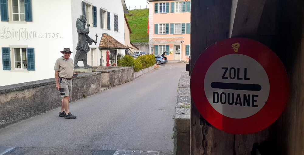
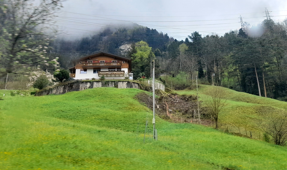
After a quiet morning we walk a few steps to the bus stop and get the 1:00 pm No. 33 bus that goes right to the Rathaus stop in the Old Town where we need to get off.

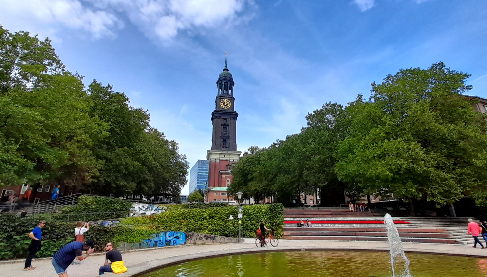
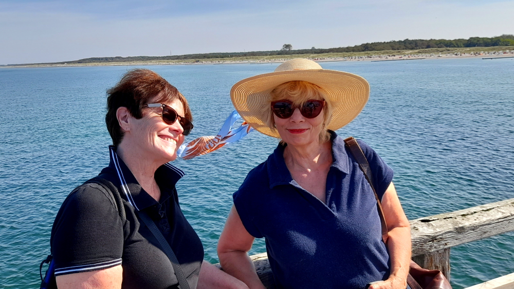
Lynn tells me that she last visited Heidelberg in June 1985. What she remembers is: the Old Bridge with its ‘salt and pepper’ towers; discovering that footpaths in town are divided into a pedestrian lane and bicycle lane and make sure you don’t walk in the wrong one (DING-DING!), and attempting to watch an episode of ‘Bonanza’ on TV that was dubbed in German with Lorne Greene’s gracious and melodious voice replaced with a harsh, guttural one, more akin to Hoss’s!

Kornmarkt with Heidelberg Castle on the hill.

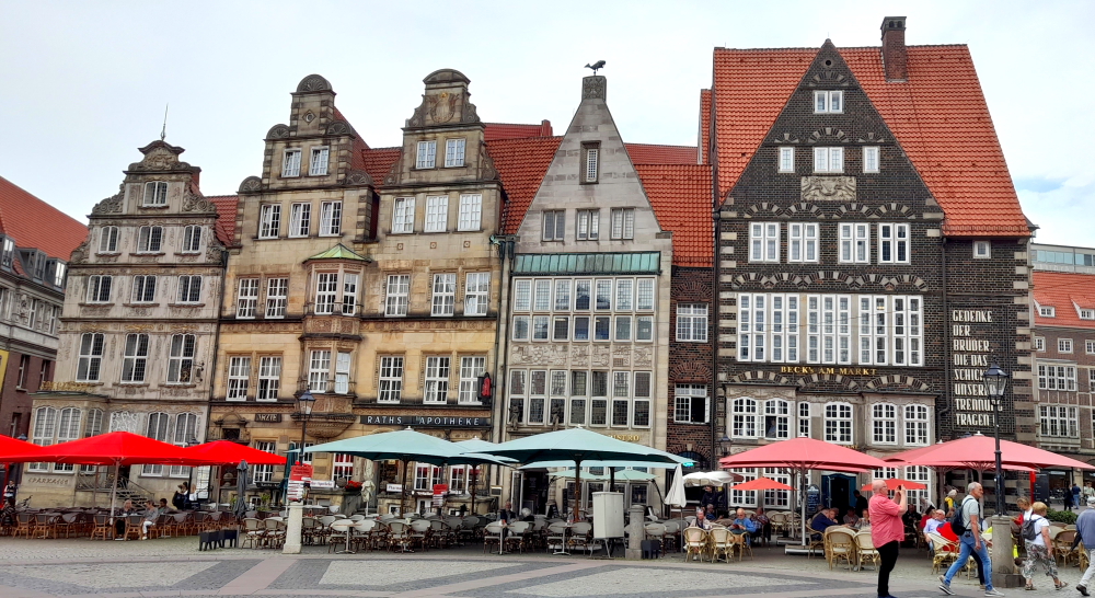
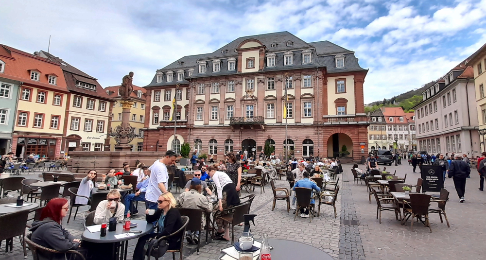
We are booked on a 2:00 pm GuruWalk and need to meet in front of the Rathaus in Marktplaz. As we arrive 30 minutes early we go for a quick wander. Yesterday, we arrived in rain and 13 Deg. C. Today it’s due to be 26 and tomorrow 27!

Rathaus in Marktplaz.

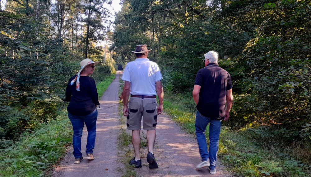
By the time 2:00 pm arrives, it has clouded over and a cold breeze has arrived. Unlike our guide – “look for a guy with a moustache” – but we find the rest of our party: Catherine, French but lives in Germany and Johanne and her husband from Canada who now live in Israel.

Steingasse off Markplatz leading to the Old Bridge (Alte Brucke) over the Neckar River.

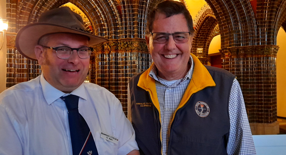
We all thought we had been communicating with our guide, Henry, a Brit who has lived in Heidelberg for 12 years, but turns out our guide today is Viktor, from Siberia, who is undertaking his PhD in this university town of Heidelberg.

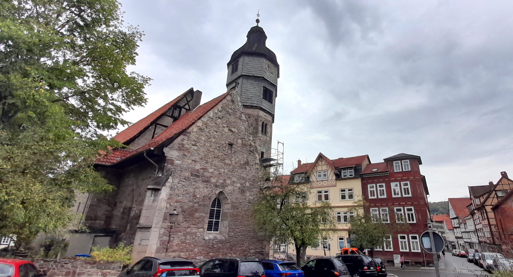
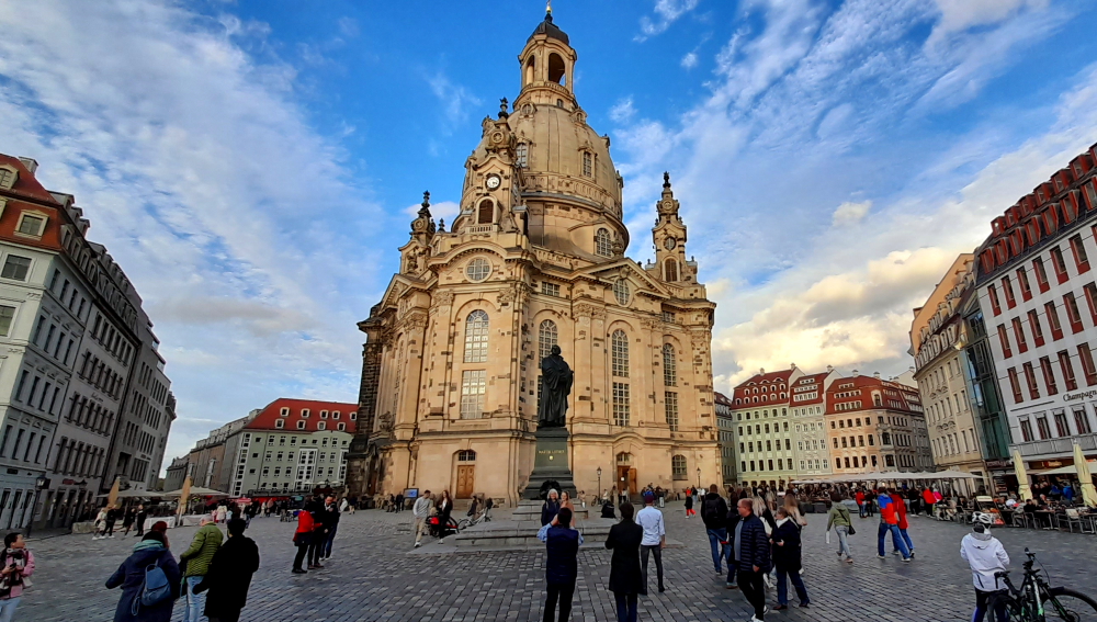
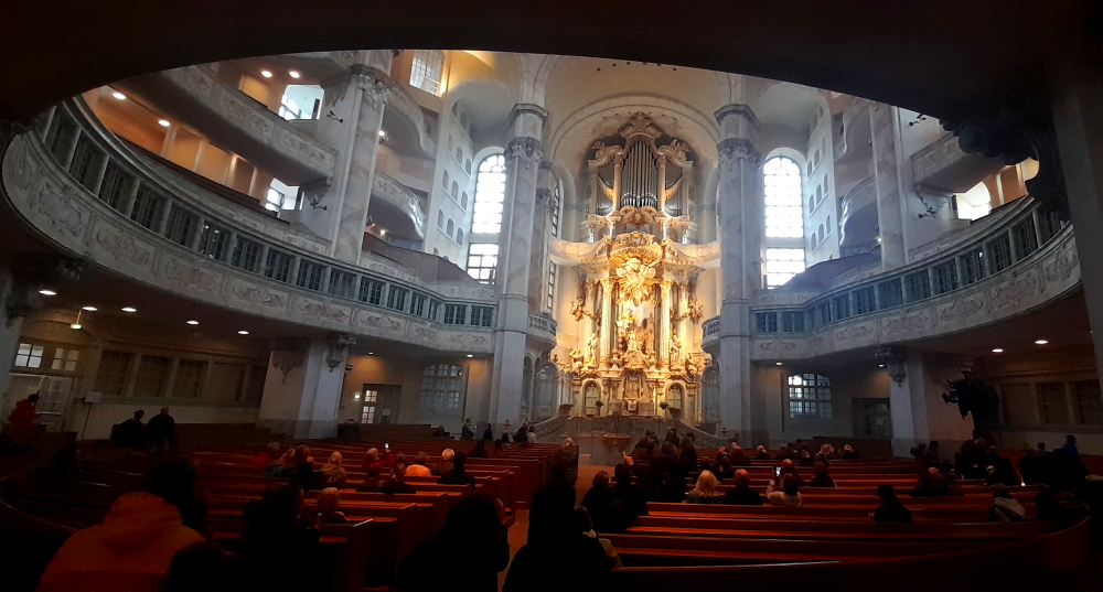
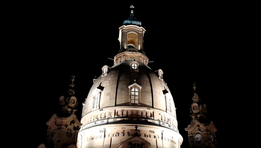
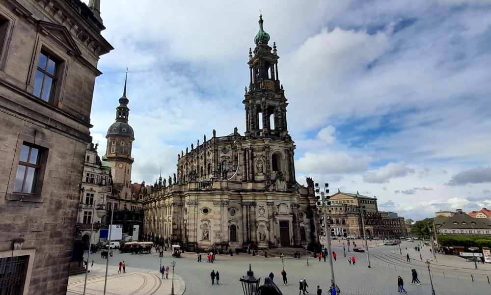
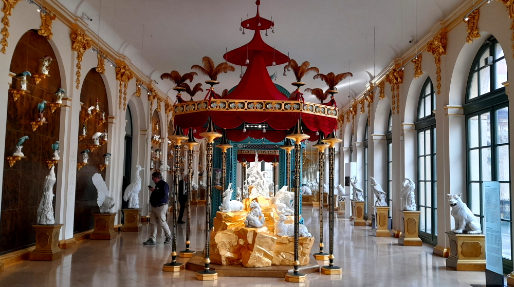
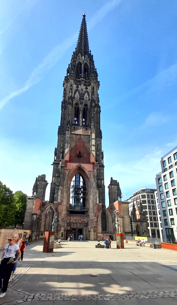
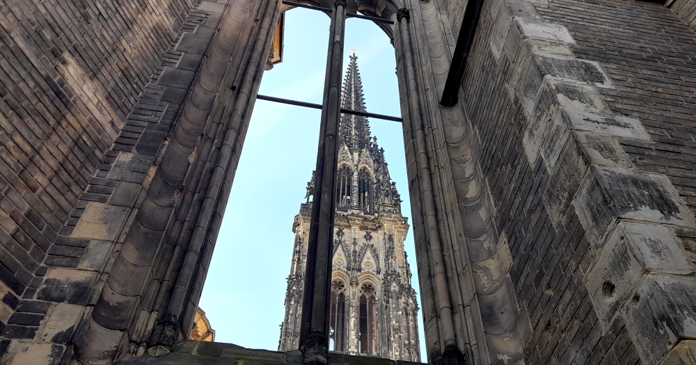
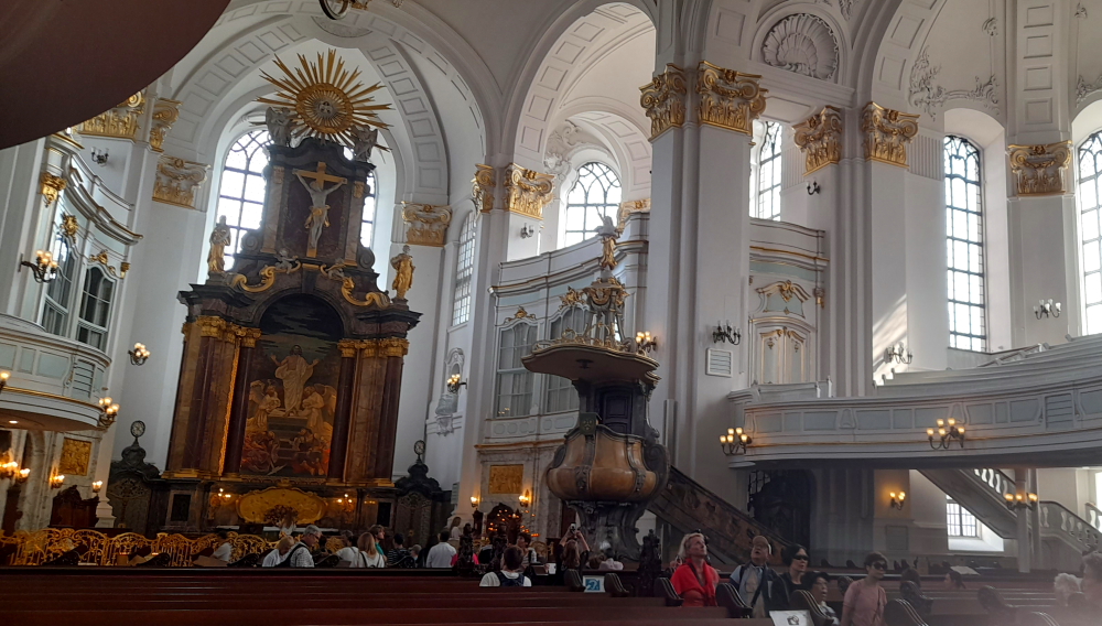
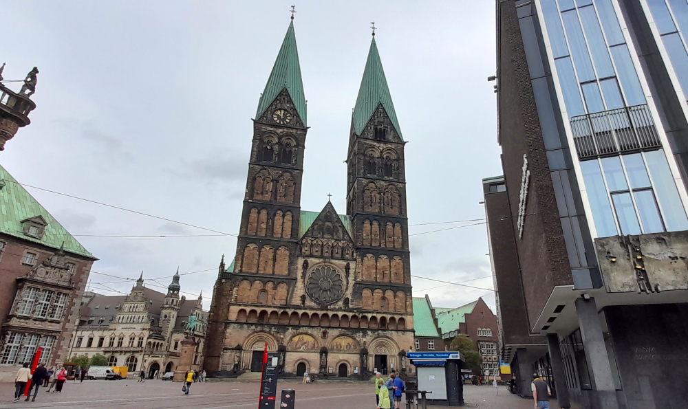
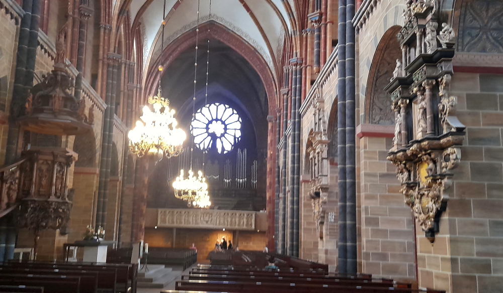
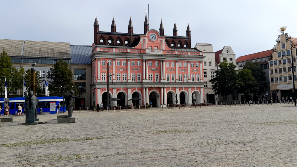
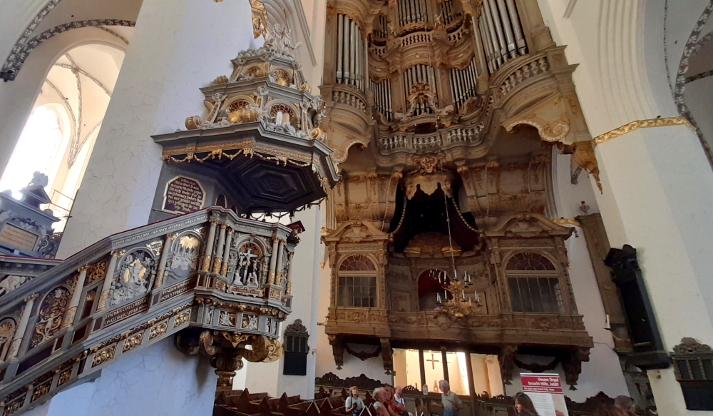
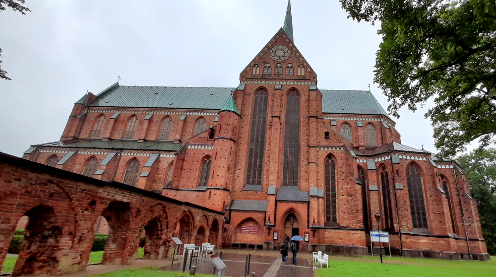
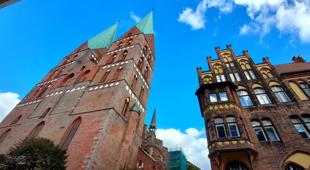
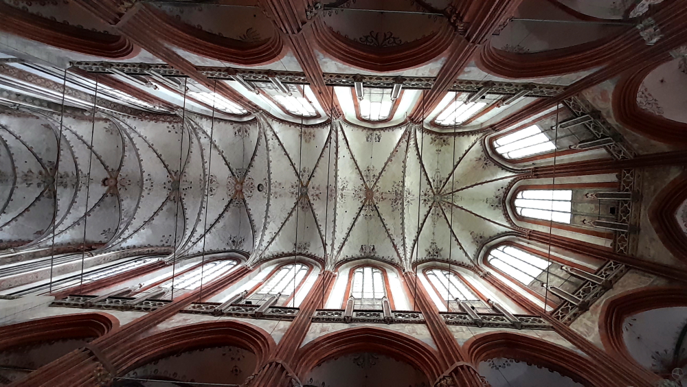
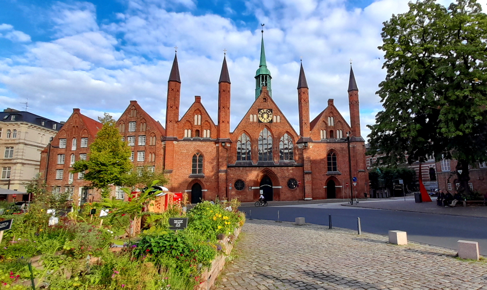
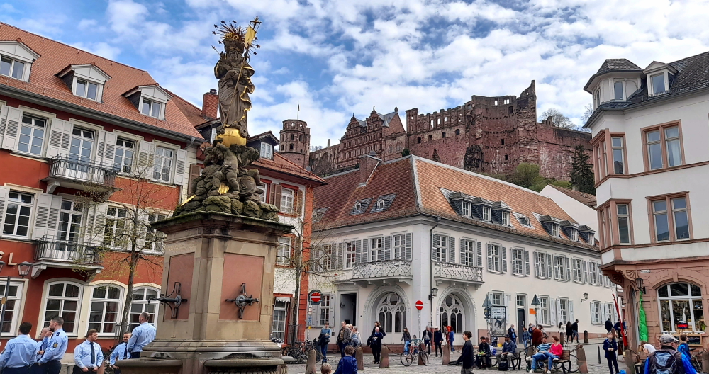
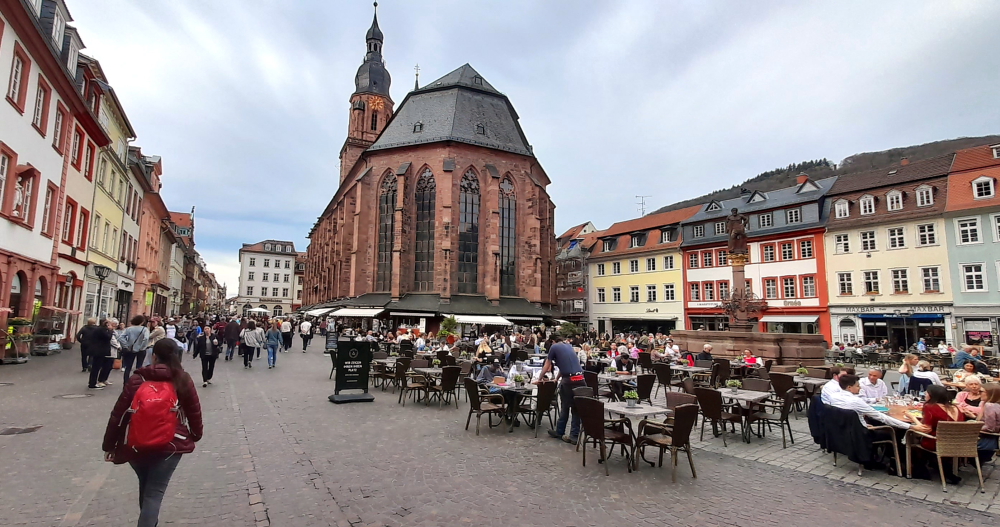
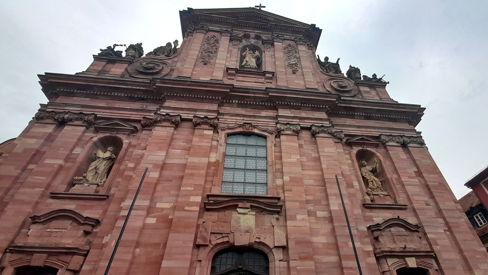
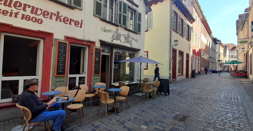
Our first stop is outside the Heiliggeistkirche on Marktplatz. founding year 1398. Ludwig III laid the foundation for the later famous Palatine Library, the Biblioteca Palatina, by having the first books placed in the galleries of this church. During the reign of Louis V (1508-1544), when the most important palace buildings were also being constructed, the tower continued to be built and completed.

In the course of the Reformation, the church changed several times between Lutheran and Reformed-Calvinist denominations. In 1563, the Heidelberg Catechism emerged as the Reformed confession. With the 30 Year War and the conquest of Heidelberg by Catholic troops, the city, and the church became Catholic for many years, and as spoils of war, Pope Gregory XV had the Biblioteca Palatina brought to Rome in 1623.

Marktplaz & the rear of the Church of the Holy Spirit (Heiliggeistkirche).

In the course of the Palatine-Orléans War of Succession, the church was severely damaged in 1693. Only the one tombstone of the Elector Ruprecht II, the founder of the church, is preserved. Of the once 5000 books and 3524 manuscripts, only 885 made it back to Heidelberg in 1816, all the rest remained in the Vatican.

In the following two centuries, both Catholics and Protestants laid claim to the church in equal measure, so that, separated by a dividing wall, Catholic mass was celebrated in the chancel and Protestant services in the nave. 1936 an agreement was reached with the Catholic Church whereby the church passed entirely into the possession of the Protestant Church in Baden [heidelberg-marketing.de].

The Jesuit Church

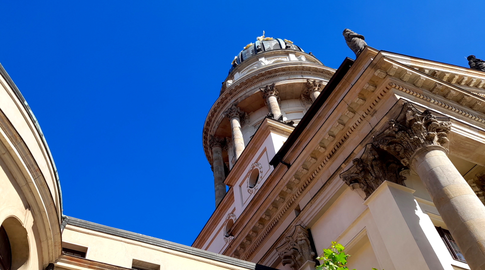
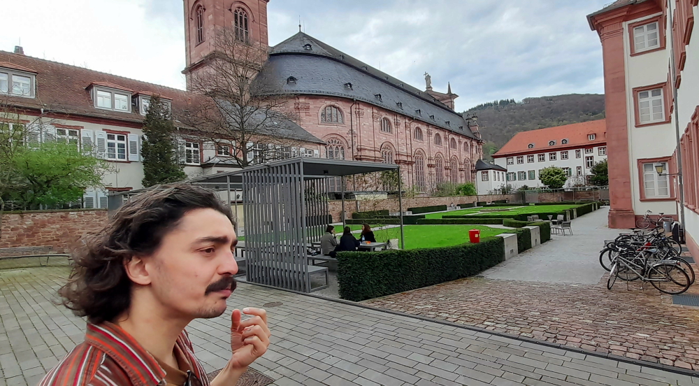
From the Marktplatz our next stop is the Jesuit Church (Jesuitenkirche). During the 16th century Heidelberg was the centre of a tug-of-war between Lutherans, Calvanists, Catholics and Protestants. The construction of the Jesuit Church began in 1712, and was built in several phases, the last one adding the tower from 1866 – 1872.

Inside the church.

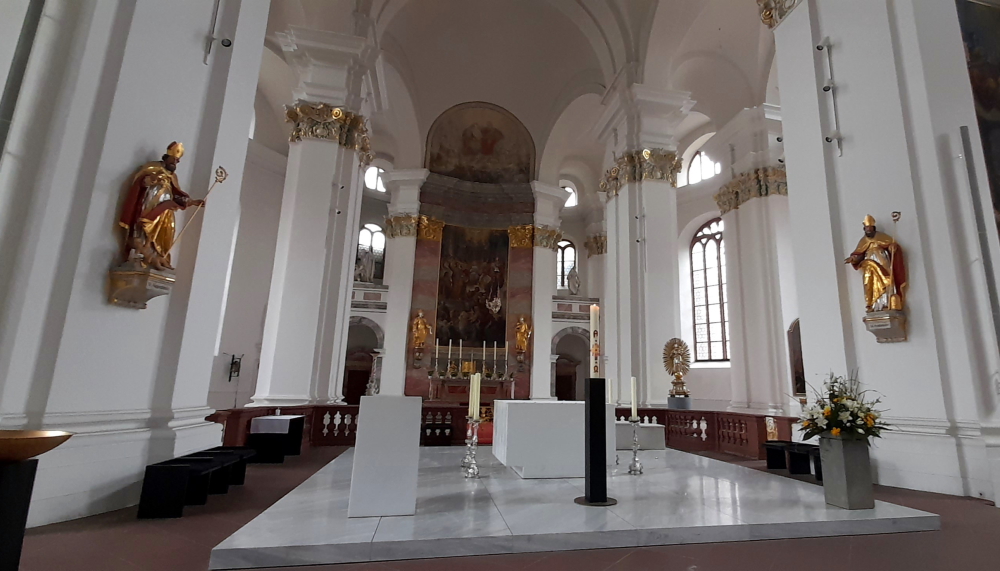
The baroque furnishings are no longer preserved today but the altar painting by the Kaulbach student Andreas Müller has been. The Elector Frederick the Victorious is buried in a crypt in the northeast corner of the church.

University of Heidelberg building near the Jesuit Church.

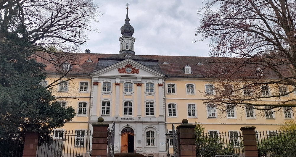
To the east of the church is the entrance to the former Jesuit college. Originally, the facilities of the Jesuits comprised a grammar school (today the Philosophical Seminary) and the Carolinum seminar, which is now used by the university administration. The church is home to the Museum of Ecclesiastical Arts (Museum für sakrale Kunst und Liturgie) [heidelberg-marketing.de].

Vikor & the Jesuit College/garden next to the Jesuit Church.

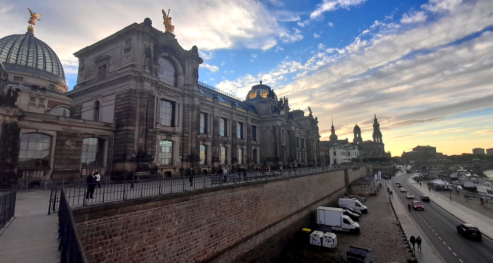
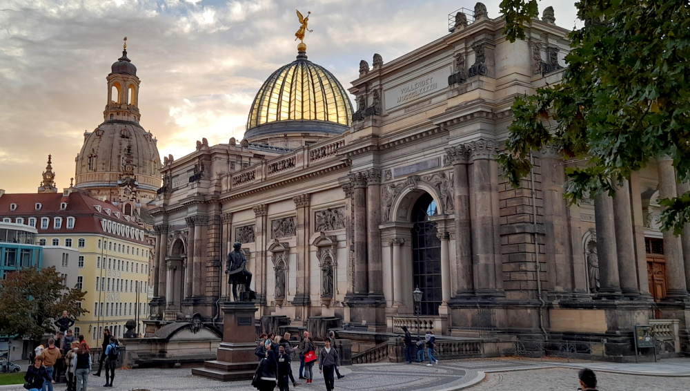
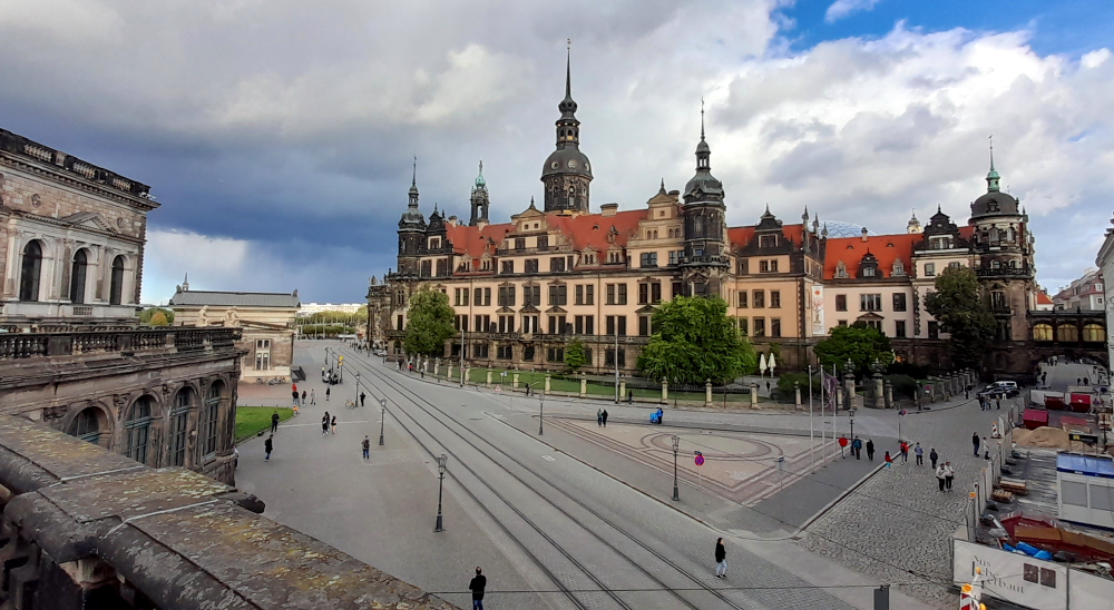
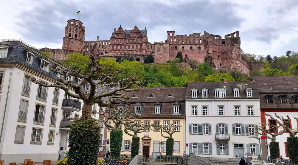
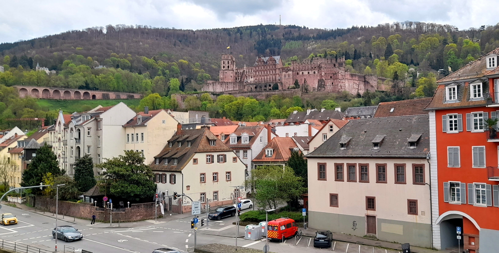
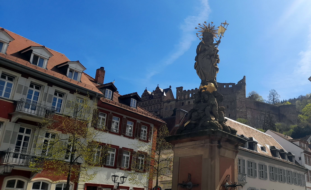
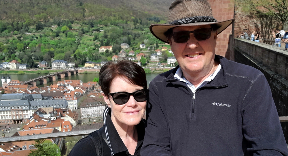
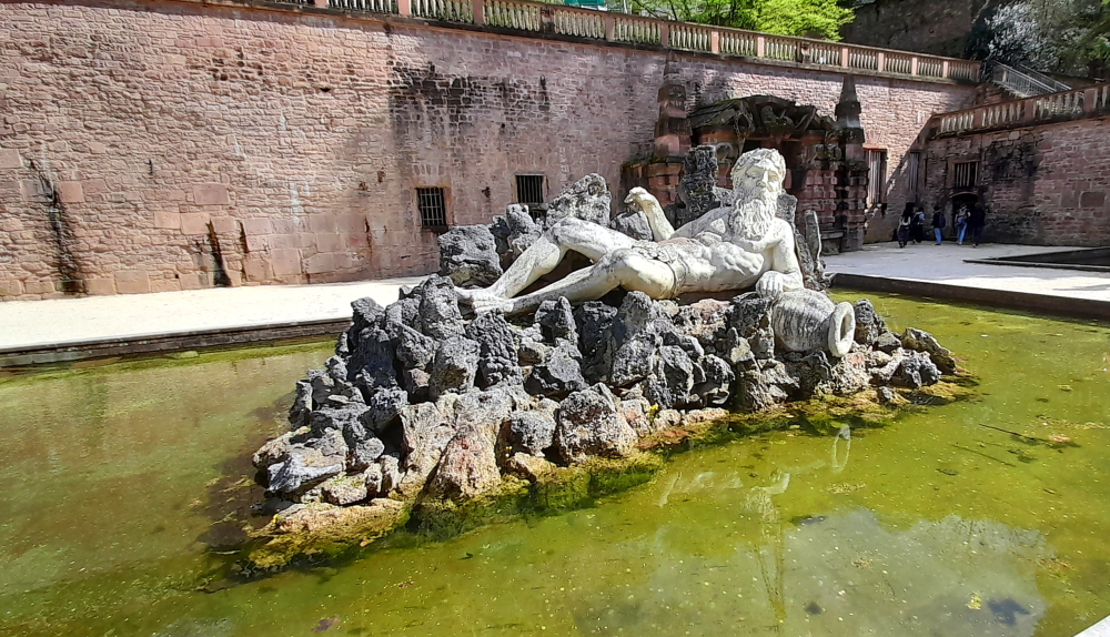
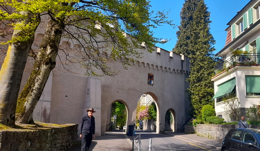
From here we walk to Karlsplatz (Karls Square) where we are treated to an unobstructed view of Heidelberg Castle. Named after Grand Duke Karl Friedrich of Baden, the square extends over the area of the Franciscan monastery, which was demolished in 1803.

Not only home to the Heidelberg Academy of Sciences and the Palais Boisserée, the Square is also home to two of Heidelberg’s oldest and best-known student pubs and several fraternity houses. Generations of fraternity students have been guests at the “Zum Seppl” inn, built in 1634, and the “Zum Roten Ochsen,” built right next door in 1703 [heidelberg-marketing.de].

Karlplatz.

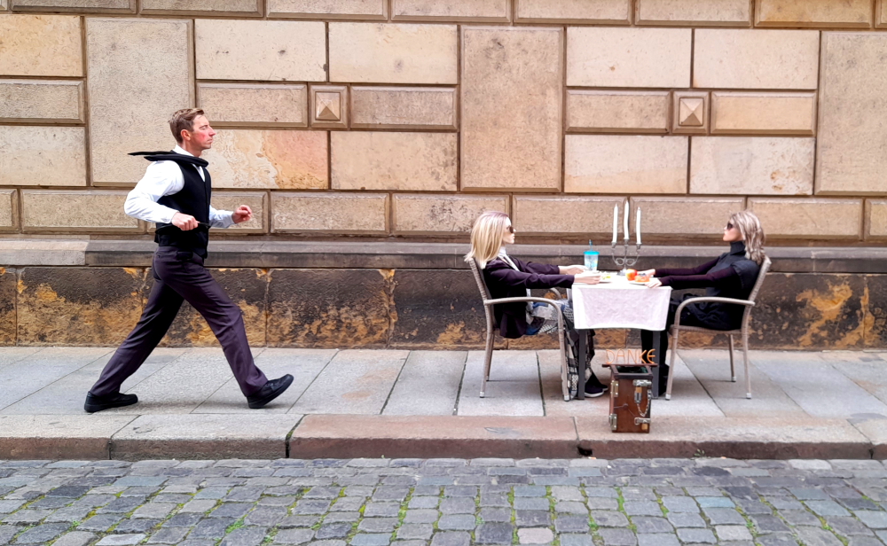
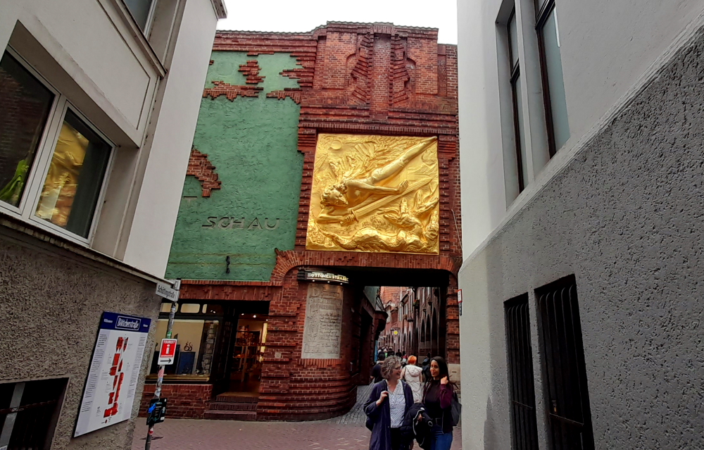
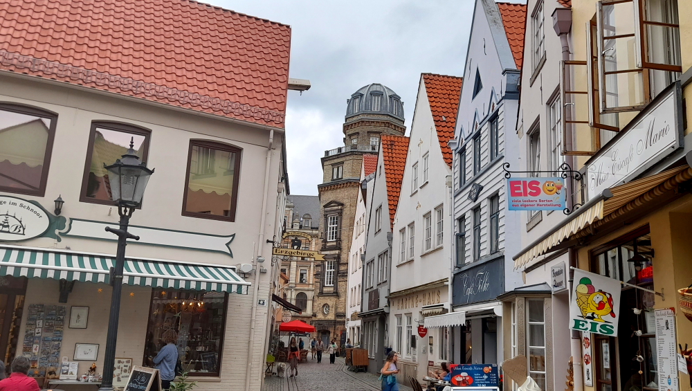
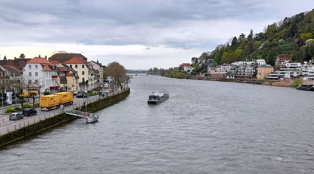
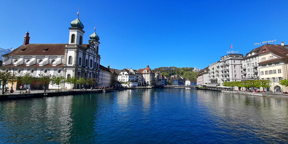
Walking towards the river we walk past the ‘salt and pepper’ pillars of the Old Bridge (which we return to after the tour) to Chocolaterie Knösel on Haspelgasse. Established in 1863, it soon became a popular meeting place among Heidelberg’s residents, male students and the young ladies attending Heidelberg’s finishing school whose governesses and chaperones were never far away.

Chocolaterie Knösel on Haspelgasse.

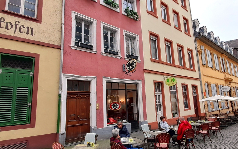
These secret longings did not go unnoticed by the chocolatier, Fridolin Knösel. One day he created a particularly delicious chocolate delight, which he impishly called the ‘Studentenkuss’. Given as a present, it was such an exquisite, gallant token of affection that not even the chaperones could object [heidelbergerstudentenkuss.de].

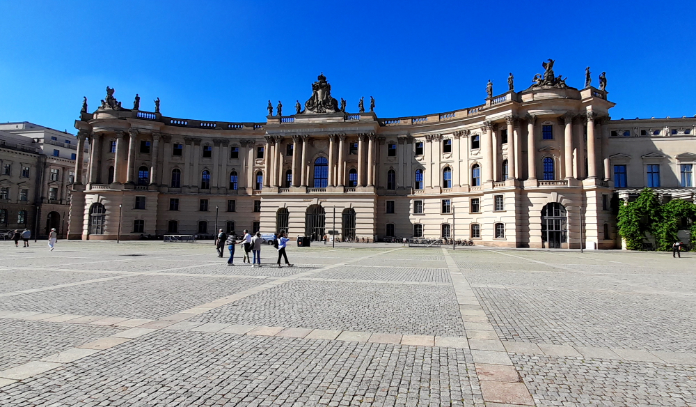
A short walk from here we arrive at Universitätsplatz where there is a plaque dedicated to Martin Luther. Heidelberg University played a leading part in Medieval Scholasticism, Renaissance humanism, the German Reformation, and in the subsequent conflict between Lutheranism and Calvinism during the 15th and 16th centuries.

Plaque commemorating Martin Luther’s Heidelberg Disputation, 1518.

In April 1518, a few months after proclaiming his 95 Theses, Martin Luther was received in Heidelberg, to defend them.

Tower at the University’s History Department.

He was invited to introduce his theology at the tri-annual meeting of his Augustinian Hermits order in Heidelberg. The Heidelberg Disputation took place on April 26, 1518, in the lecture hall of the liberal arts faculty at the University.

Zeit Fur Brot on Hauptstrasse – best cinnamon buns in town!

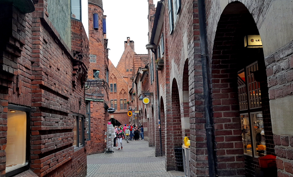
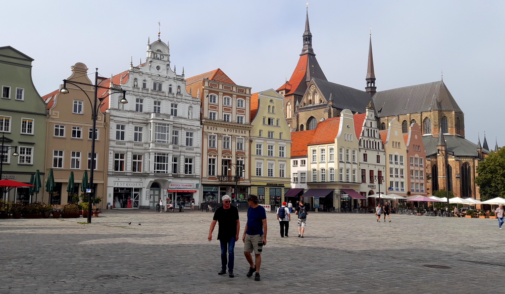
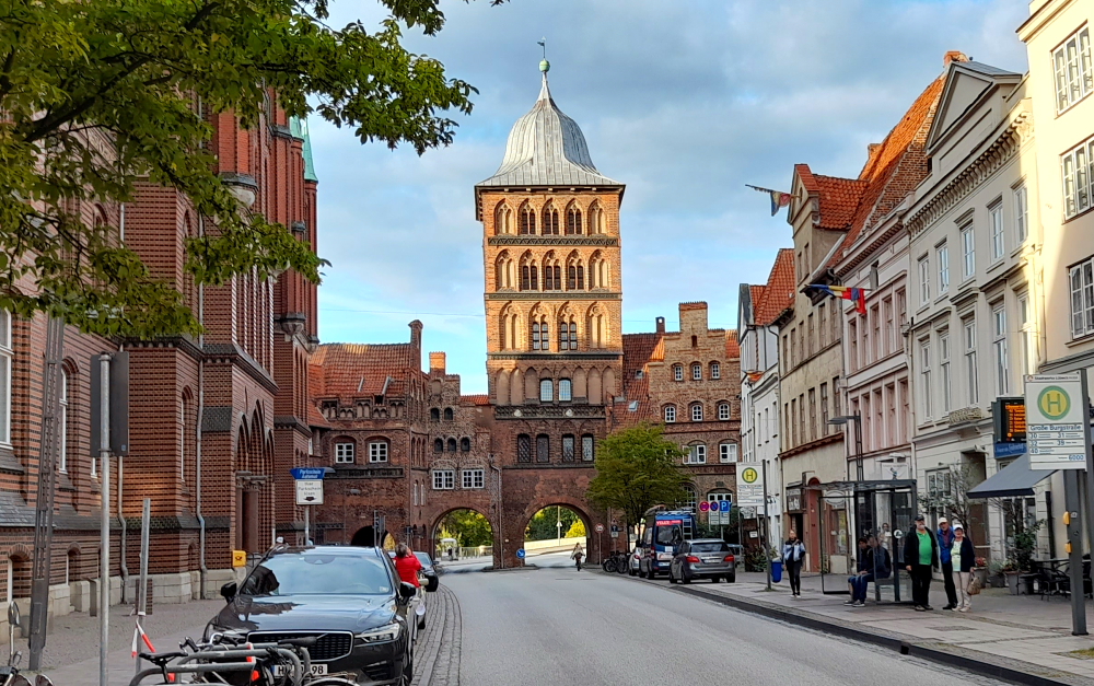
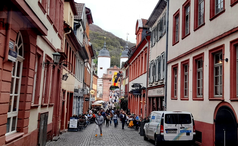
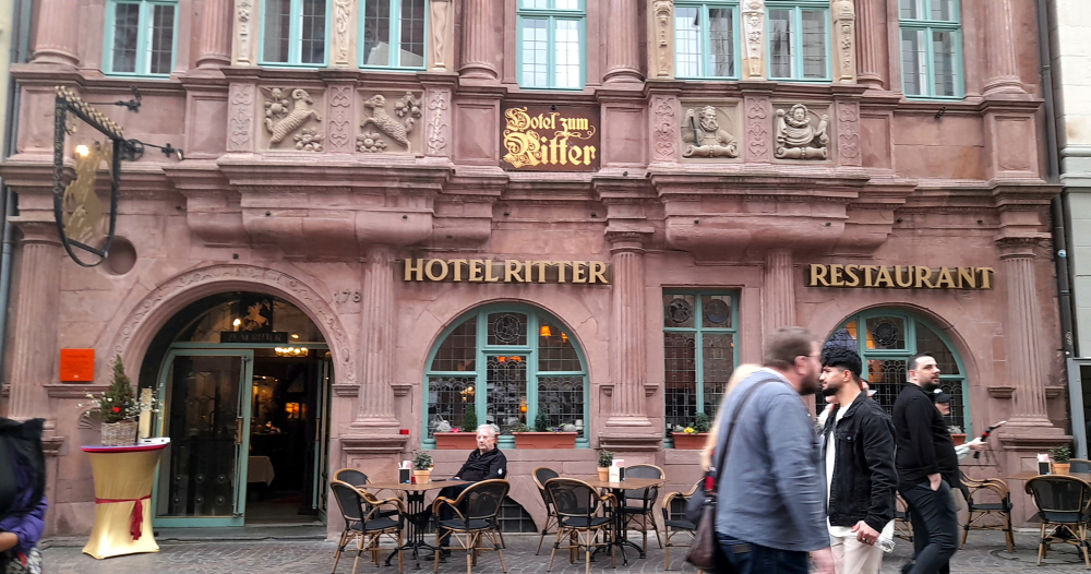
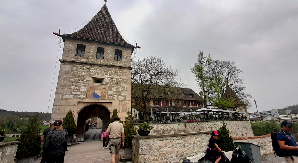
Walking up Hauptstrasse towards Marktplatz our final stop is in front of Hotel Ritter. The historic town house Zum Ritter Sankt Georg (Knight St. George) was built in the year 1592 by the cloth merchant Carolus (Charles) Belier and served as an inn already 300 years ago. It is one of the few buildings to survive the War of Succession not to mention numerous fires. Standing across from the Church of the Holy Spirit, it was built in the style of the late Renaissance. It is named after the sculpture at the top.

Hotel Ritter.

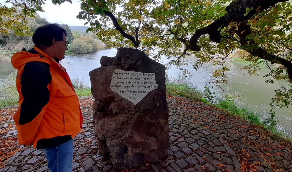
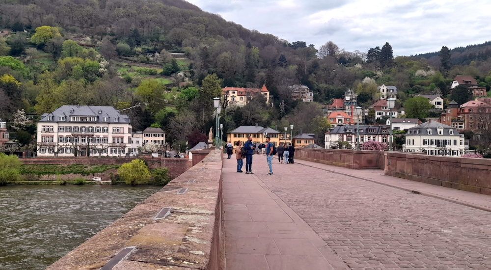
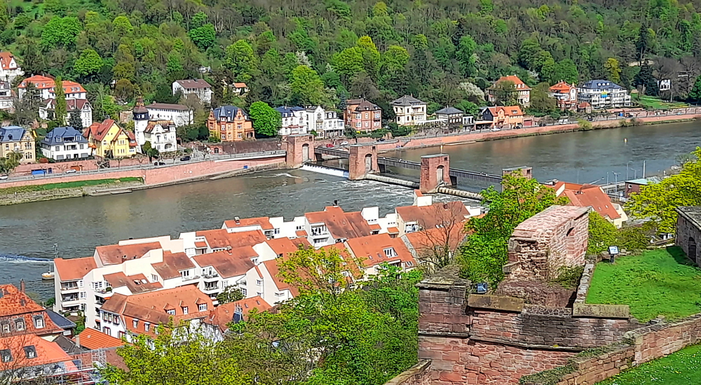
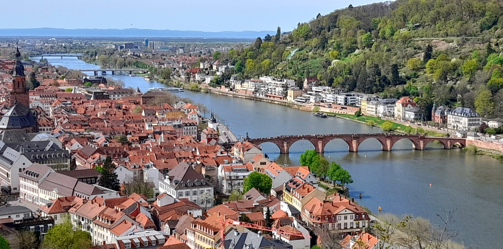
From here we head to the river and the iconic Alte Brucke.

View from the bridge towards the Old Town.

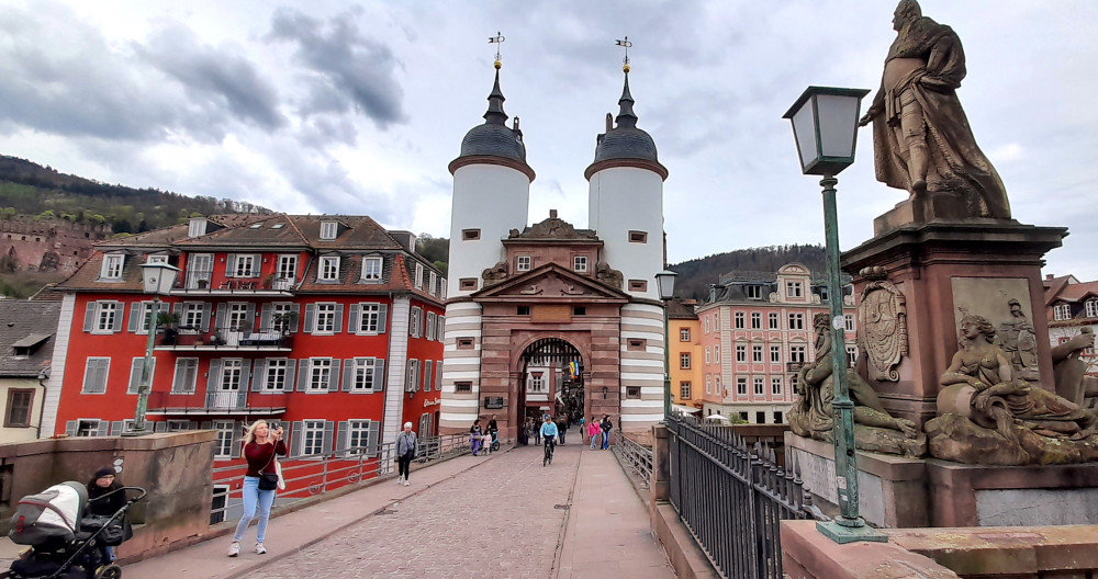
The Karl Theodor Bridge, commonly known as the Old Bridge (Alte Brücke), is an arch bridge in Heidelberg that crosses the Neckar river.

View of Heidelberg Castle from the bridge.

It connects the Old City with the eastern part of the Neuenheim district of the city on the opposite bank.

View towards the Neuenheim district on the opposite bank.

The current bridge, made of Neckar sandstone and the ninth built on the site, was erected 1786-1788 by Elector Charles Theodore, and is one of the best-known landmarks and tourist destinations in Heidelberg.

Neckar River view upstream towards weir.

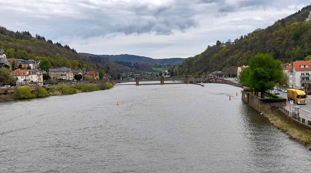
A medieval bridge gate is on the side of the old town, and was originally part of the town wall. Baroque tower helmets were added as part of the erection of the stone bridge in 1788.

View downstream towards the Theodor-Heuss-Brucke.

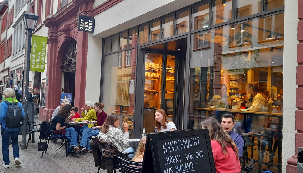
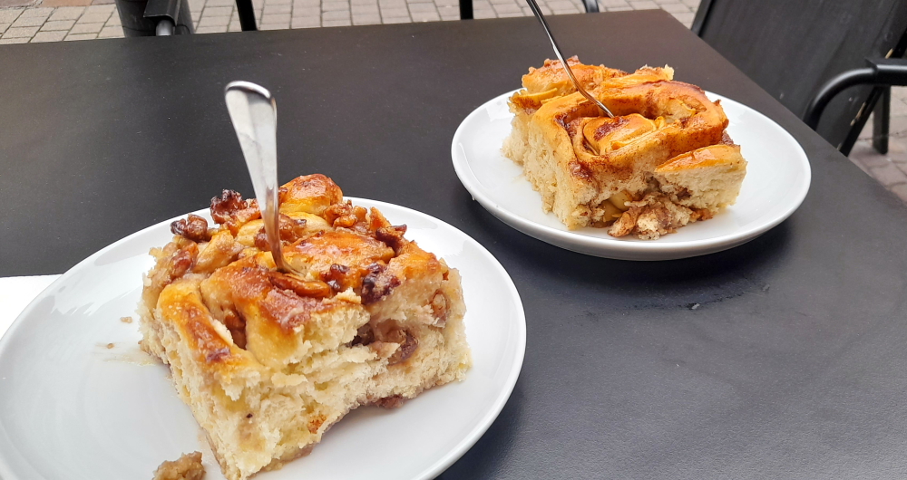
By this time we are absolutely famished so we make a beeline for Zeit Fur Brot on Hauptstrasse for a cinnamon bun each.

Cinnamon buns – one with walnuts, the other with apples.

Then catch the No. 33 bus back to the Aparthotel.

6 April, 2024

Another 27 Deg. C. day today so around 10:30 am we catch the No. 22 tram that terminates at Bismarkplatz where we swing by a Deutsche Bank ATM before promenading along the Hauptstrasse to the Old Town.

Exotic tulips near Bismarkplatz.

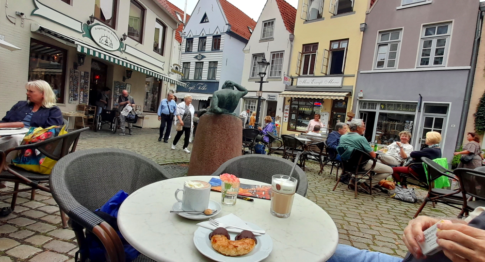
Lynn has a hair appointment at noon and as it’s 11:30 am we stop for some excellent ‘kaffee und kuchen’ at La Fee cafe, near Marktplaz. It’s a nice haven from the busy cafes and heaving Hauptstrasse just one block over.

La Fee cafe on Untere Strasse.

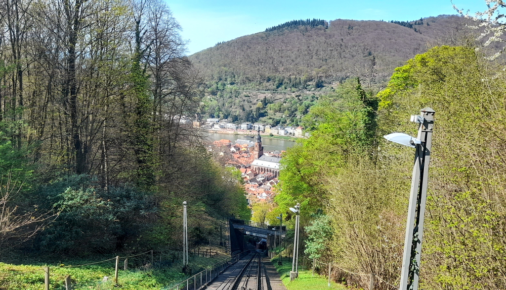
During the 30 minutes that Lynn is under the scissors, I wander over to Station Kornmarkt to find out how to procure tickets for the funicular to Heidelberg Castle.

Kornmarkt-Madonna.

The beauty of buying the funicular tickets is that it’s for the return trip, it includes access to 2 museums within the castle and I can buy it from an English-speaking ticket machine with a credit card and without having to wait in a queue. Result!

Funicular car arriving at Station Kornmarkt.

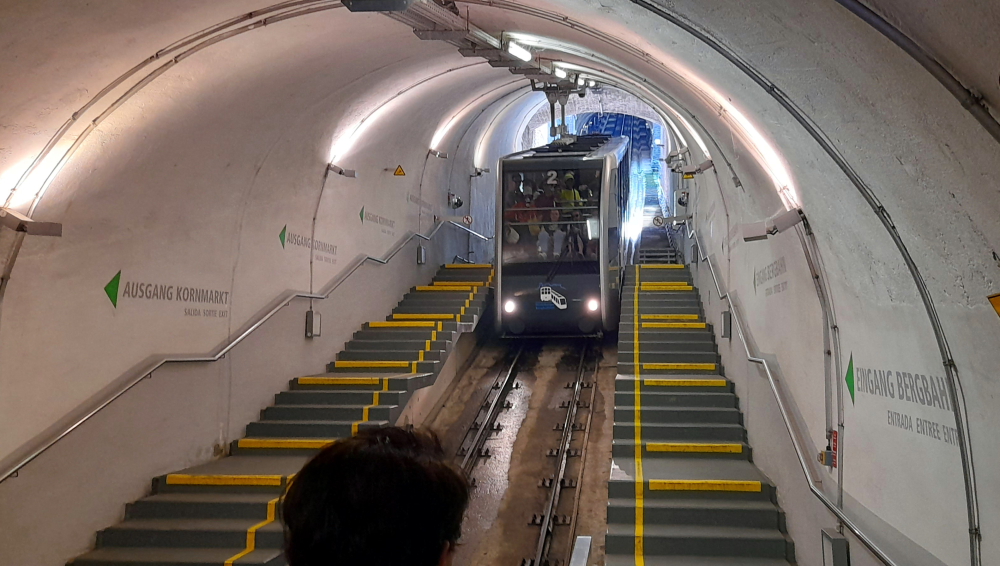
As soon as Lynn arrives we walk through the barriers and within a couple of minutes a car arrives. The Heidelberger Bergbahn funicular railway runs from Kornmakt to the summit of the Königstuhl via the castle. We get off at the Castle stop.

View of the Old Town from the Castle’s western wall.

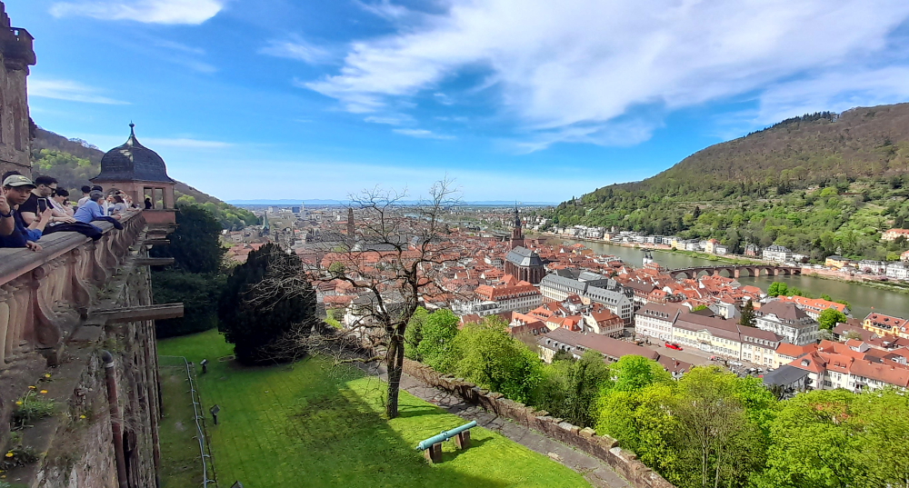
Needless to say the Castle and its grounds are busy and by the time we leave some 3 hours later it’s absolutely heaving.

View of the Neckar River & the Old Bridge (Alte Brucke).

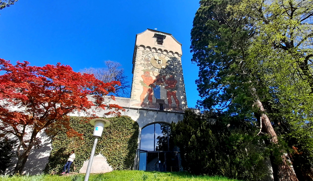
Towards the entrance to the Castle is the Elizabeth Tower (Elisabethentor). Built in 1615 by the French engineer and garden architect Salomon de Caus in the style of a Roman triumphal arch, and renovated in 1951.

Elisabethentor.

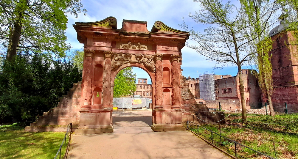
Built in only 1 night by Kurfurst Friedrich V (1610-19) for his spouse Elisabeth Stuart as a birthday present, originally integrated in the ornamental garden on the raised bulwark, the “Stuckgarten”.

Castle inner courtyard.

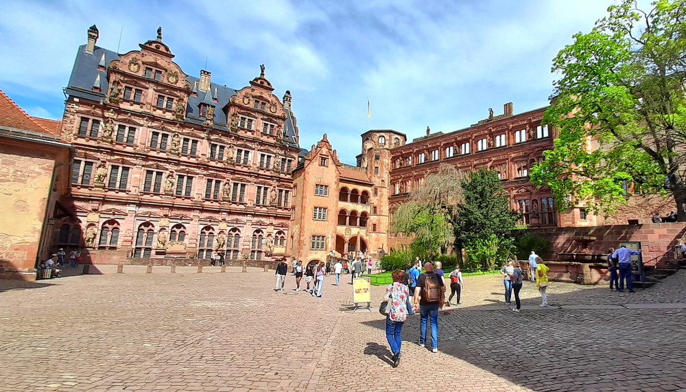
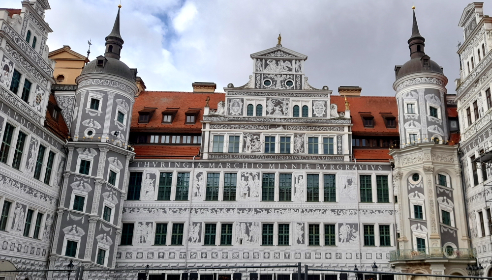
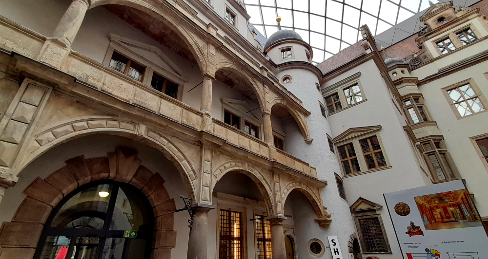
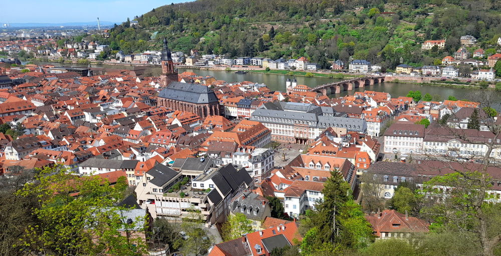
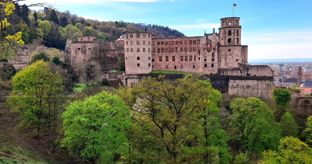
The castle is a mix of styles from Gothic to Renaissance. Prince Elector Ruprecht III (1398–1410) erected the first building in the inner courtyard as a royal residence.

View from the Castle Balcony.

In the 16th and 17th centuries, the Prince Electors added two palace buildings and turned the fortress into a castle.

View towards the weir on the Neckar River.

The two dominant buildings at the eastern and northern side of the courtyard were erected during the rule of Ottheinrich (1556–1559) and Friedrich IV (1583–1610). Under Friedrich V (1613–1619), the main building of the west side was erected, the so-called “English Building”.

Prince-Elector Friedrich V had the Hortus Palatinus, a representative palace garden, installed between 1616 and 1619. Grottoes, ornate beds, intimate garden alcoves, and “magical machines” were planned across staggered terraces, for the pleasure of courtly society. However, today, it is uncertain how many of the plans were implemented. In the western area of the palace grounds, old fortifications gave way to the garden. The Artillery Garden was built here as a walled-in, private pleasure garden for Electress Elizabeth.

Gesprenger Turm blown up during the Palatinate War of Succession in 1693.

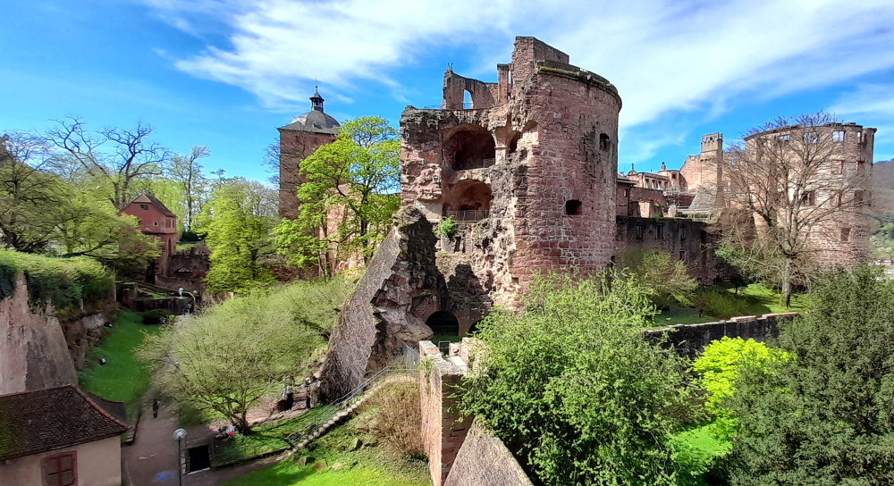
The castle and its garden were destroyed several times during the Thirty Years’ War and the Palatine War of Succession. As Prince Elector Karl Theodor tried to restore the castle, lightning struck in 1764, and ended all attempts at rebuilding.

View of the castle from the Scheffelterrasse.

Later on, the castle was misused as a quarry; stones from the castle were taken to build new houses in Heidelberg. This was stopped in 1800 by Count Charles de Graimberg, who then began the process of preserving the castle.

Old Bridge view from the end of the Scheffelterrasse.

The castle is surrounded by a park, Schlossgarten, where the famous poet Johann von Goethe once walked. A bronze bust next to a large, stone bench are in his honour.

Father Rhein (Vater Rhein) sculpture in front of Large Grotto (Grosse Grotte).

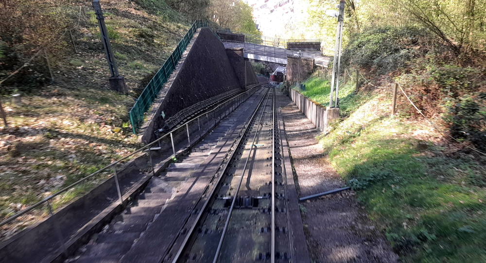
At 2:45 pm we join the queue to get back onto the funicular to ascend 1 more stop to the Molkenkur station.

View from the funicular from Molkenkur Station.

From there, one of the oldest electrically-operated mountain railroads continues to the King’s Chair (Konigstuhl), the highest point in the city, at an altitude of over 550 metres. But, the waiting time to get this train is over an hour so we stay in the car and ride it back down to Kornmarkt Station.

Steep descent to Schloss Station.

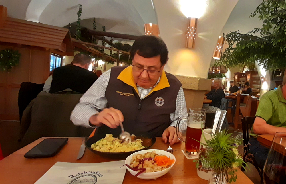
One of Viktor’s restaurant recommendations is the “Schnitzelbank” on Bauamtsgasse, a 10-minute walk towards Bismarkplatz. Excellent choice!

It turns out to be a hole-in-the-wall tavern. A small, rustic wine bar steeped in history, established in 1882 as a cooper’s workshop that made barrels for the local winemakers then became a bar in 1900. Indoors it’s very snug with a few former wooden workbenches for tables to share and old workshop tools for decoration. It offers authentic dishes from Baden and the Pfalz region. Outdoors there are a few tables on the pavement. Besides kitchen staff who we don’t see but hear above banging away at schnitzels, it’s run by 2 great guys who work in an impossibly small serving area with a dumb-waiter and a dishwasher.

A cooling, crackling, Rose.

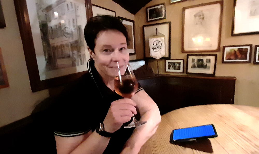
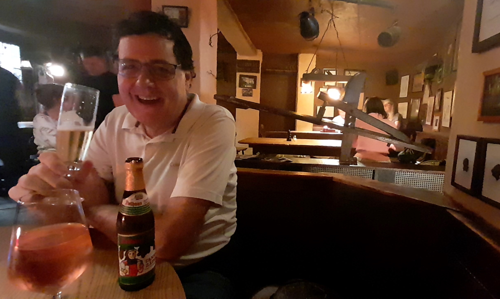
We opt for the cool interior after walking around in the sun the past few hours. As it’s around 3.30 pm we get a table to ourselves and indulge our taste buds with delicious classic schnitzel dishes accompanied by salad, potatoes and noodles, washed down by a chilled pils and a semi-dry rose.

When I ask my standard question to one of the waiters whether there is WiFi, he chuckles and says, “Sorry. You’re here to eat, drink and talk!”

Wooden workbenches & old tools decorate this small tavern.

Time to walk back to Bismarkplaz and catch a No. 22 tram to the Aparthotel. While Lynn goes to the local Alnatura supermarket I put on a couple of loads of laundry. Long story short, the hotel’s guest laundry is busy (including a hotel guest who doesn’t understand the WeWash app and tries to highjack our washing machine, mid-wash!) and by the time the tumble dryer finishes its 2.5 hour cycle (!) it’s midnight.

7 April 2024

Another sunny, 24 Deg. C. day. Thanks to the late night we have a late start to the day which is taken up with ironing, packing and catching up on 2 days of blog.

Tomorrow we drive 275 km over 3 hours to a self-catering holiday home in Altenburg, Germany which is just down the road from Rheinfall, Switzerland, for a couple of days.

8 April, 2024

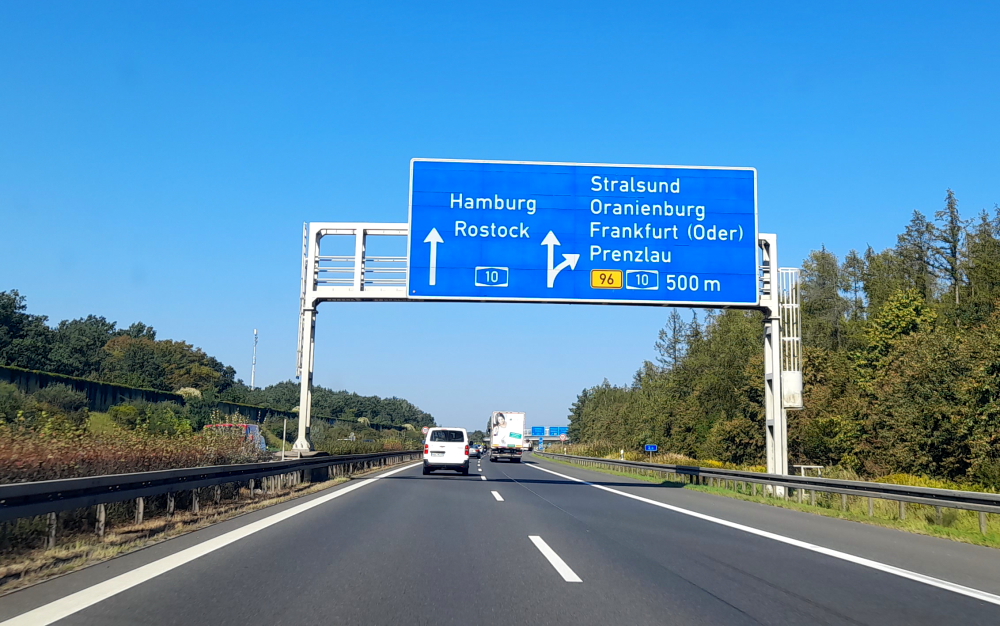
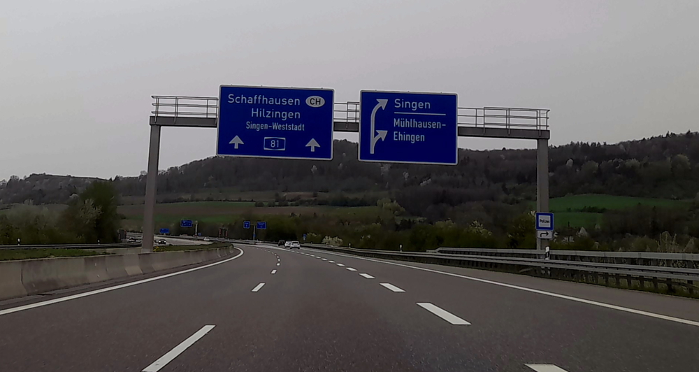
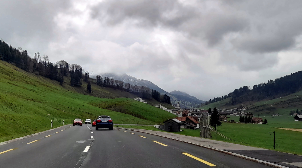
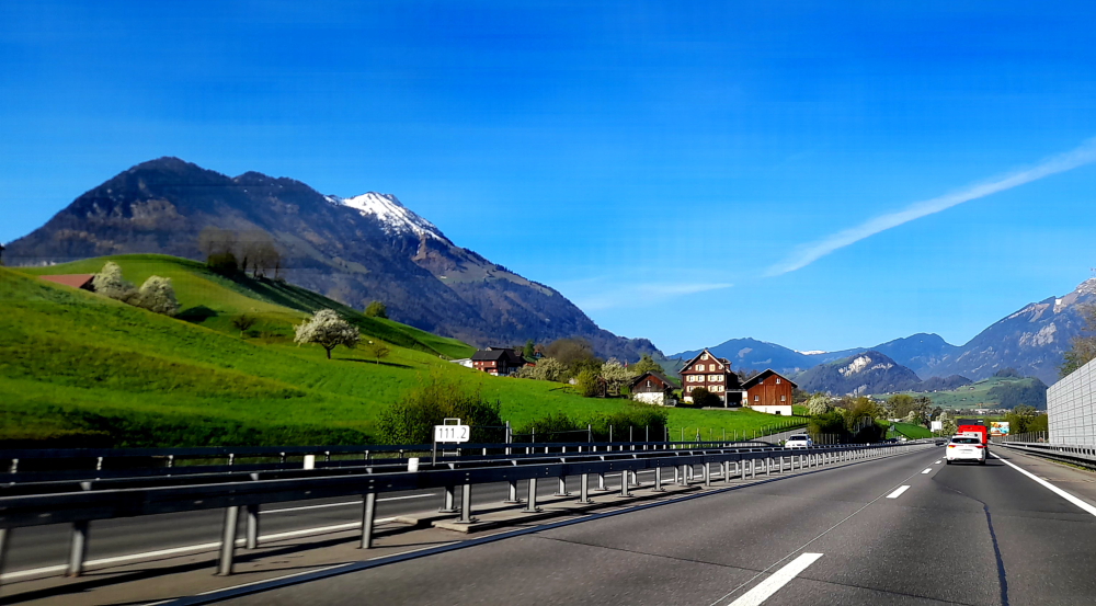
By the time we hit the road at 11:00 am it has clouded over but it’s 26 Deg. C. Originally we were going to take the 5, 8, 81 roads past Stuttgart to the Swiss border but just before we are to take the 8, I get a traffic notification that there is a 17-minute tailback so we continue on the 5.

Road sign to CH – Switzerland.

The GPS ends up taking us to Freiburg im Breisgau, over some hills to join the 81 just outside of the border – an extra 60 km and an extra hour. Which is why I love German autobahns with no speed limits. Got the Insignia up to 161 kph!

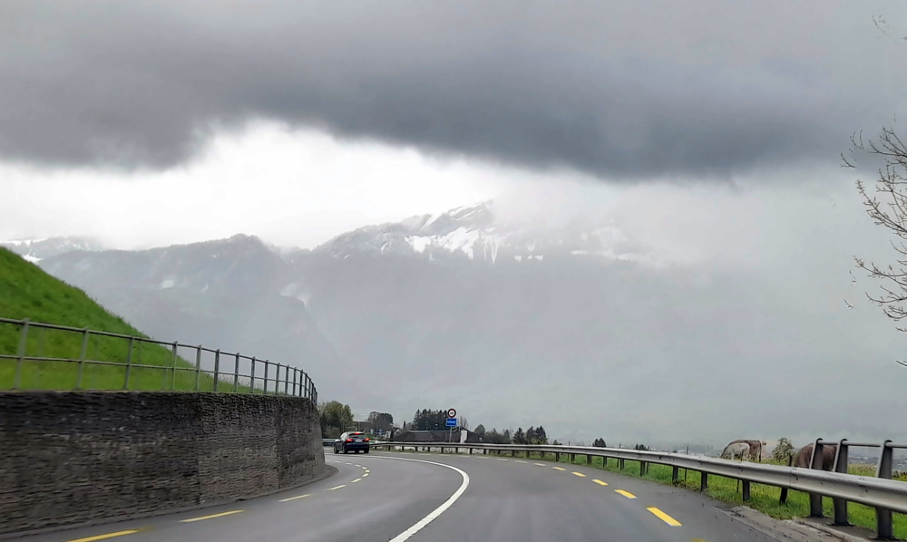
In the meantime it starts to rain and I discover that the left windscreen wiper blade is disintegrating. Now, it would have been useful to have found this out yesterday as our hotel was directly over the road from an Opel dealership!

Swiss border near Thayngen, Switzerland.

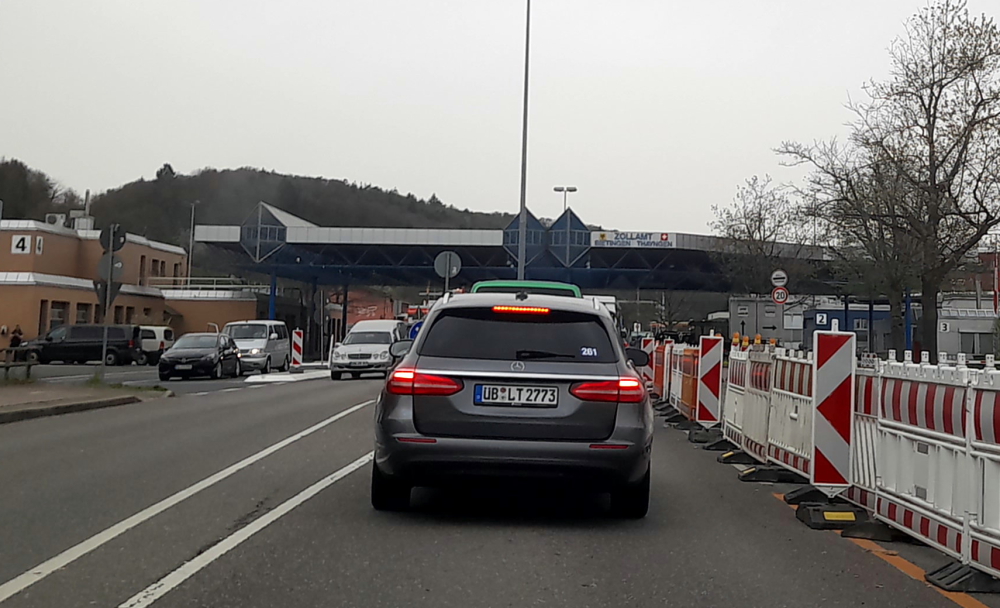
Although there are plenty of Swiss border guards at the barrier the booths are unmanned so we drive through and stop immediately at a cash point to purchase our mandatory highway vignette for Eu40 and stick it on the windscreen. They are valid for 14 months from 1 December of the preceding year through to 31 January of the following year – i.e. ours will expire on 31/01/2025.

Turnoff to Rheinfall.

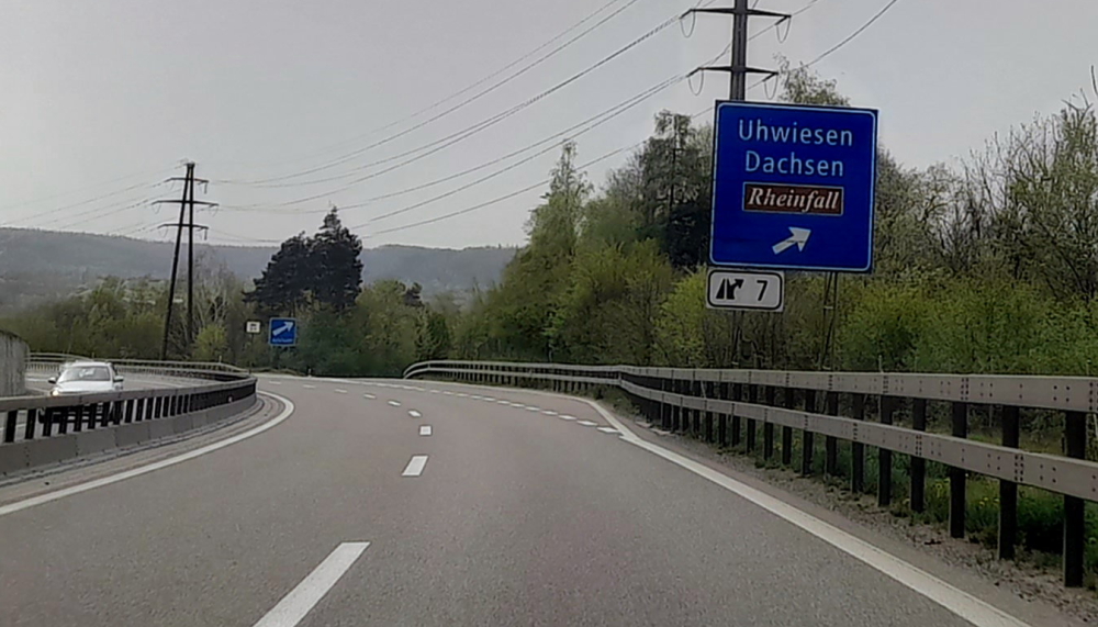
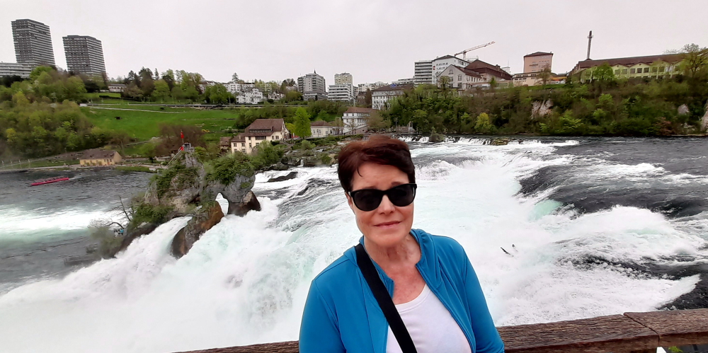
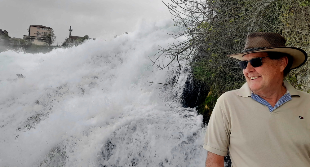
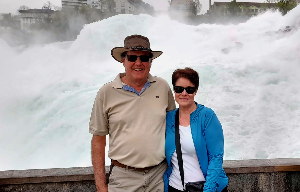
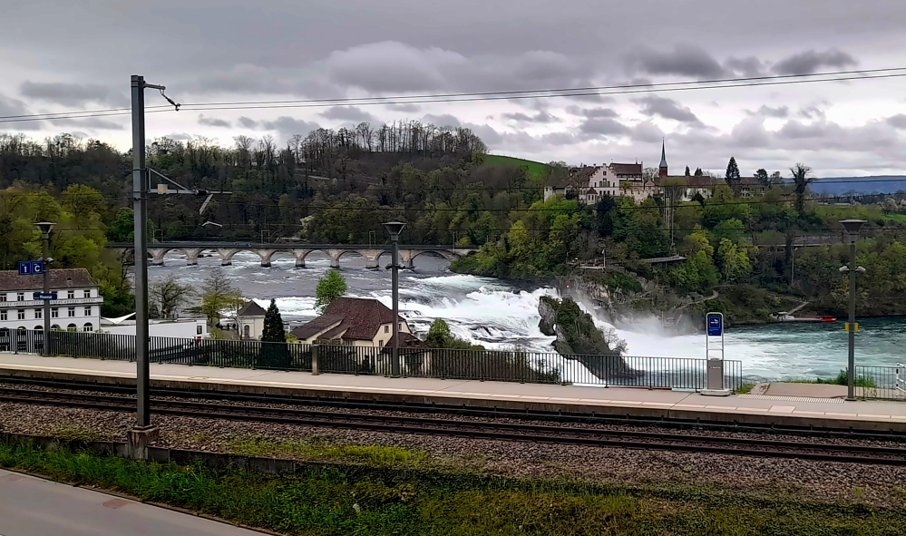
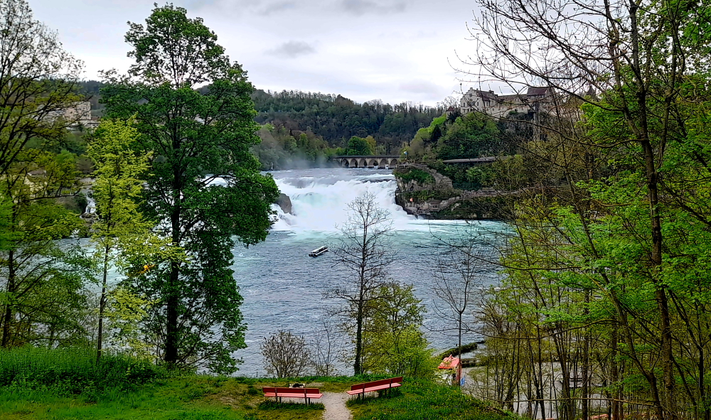
Also, our original plan in staying at Altenburg for 2 days was to visit the awesome Rheinfall but as the weather forecast is to change tomorrow to over 90% rain and the temperature to drop from 26 Deg. C to 14, we decide to call in on our way.

Laufen Castle entrance to the Falls.

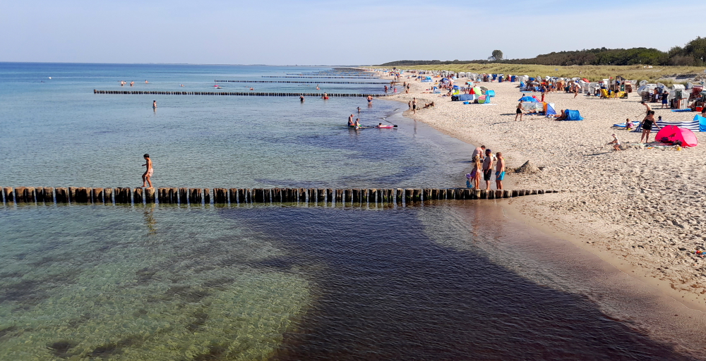
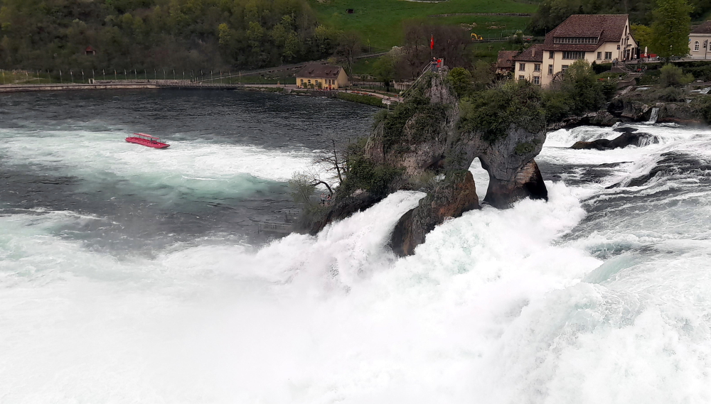
When I was last here around 2005 it was free to view this amazing natural phenomenon. Now, it’s CHF5 for parking and CHF5 each to go through the turnstile!

Boats embark from the opposite side of the river & travel to the base of the falls.

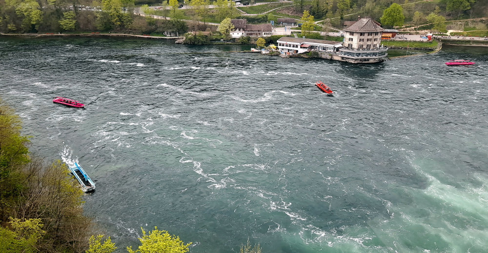
And, last time there were no boats. Now there are several that embark from the opposite side of the river and either motor to the base of the falls or one will actually drop you off at the rocky outcrop mid-stream.

Rocky outcrop in the middle of the Rhine River & Falls but sports a Swiss flag.

Honestly, this place is becoming just like the Niagra Falls’ experience, but with smaller boats!

Commencement of the falls.

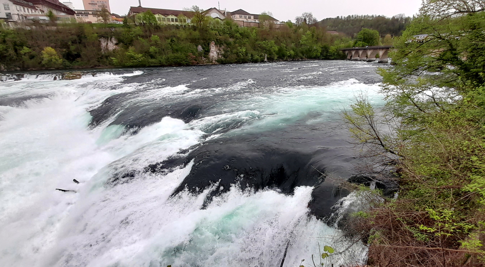
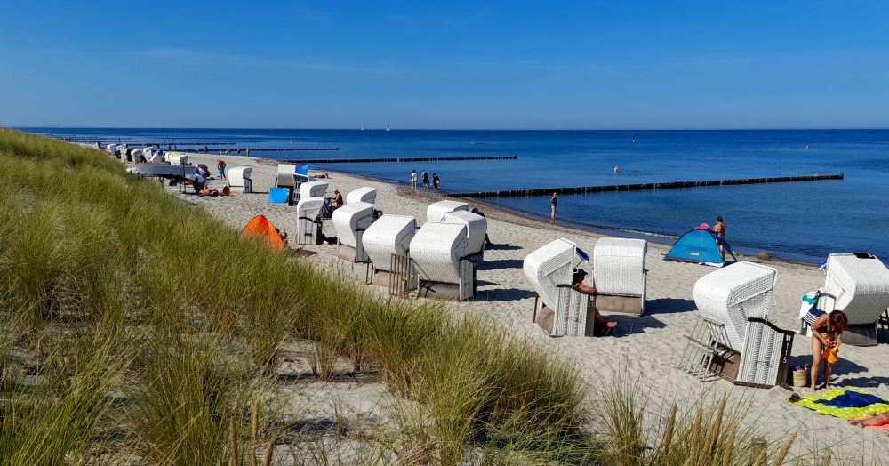
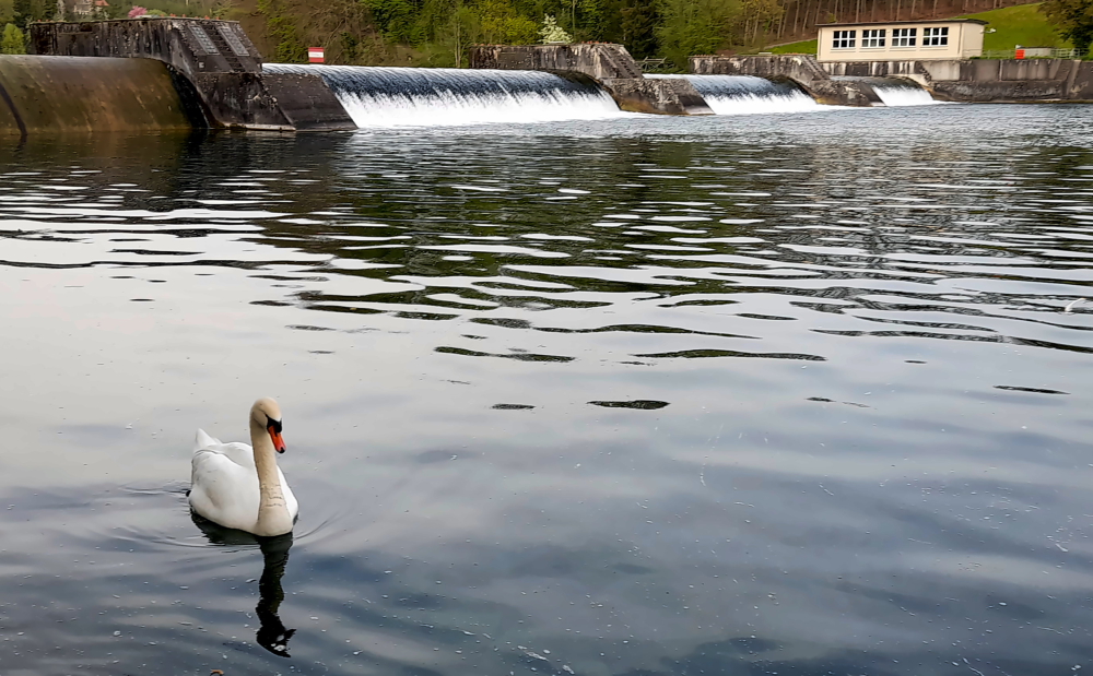
The Rhine Falls, formerly also called Grosser Laufen, located 4 km SW below the city of Schaffhausen, is one of the 3 largest waterfalls in Europe.

Falls with the town of Neuhausen on the opposite bank.

The others are The Sarpsfossen in Norway, which is equally high, and the Dettifoss in Iceland, which is twice as high. The Sarpsfossen has an average of 577 m³/s with more water, while the Dettifossen only has about half as much water.

Fischetz – the highest of the viewpoints.

The reason we are here today is because we gave the one in Norway a miss as it was too far off our route to view it, when we could so easily come here.

Middle viewpoint with Fischetz viewpoint just visible above it.

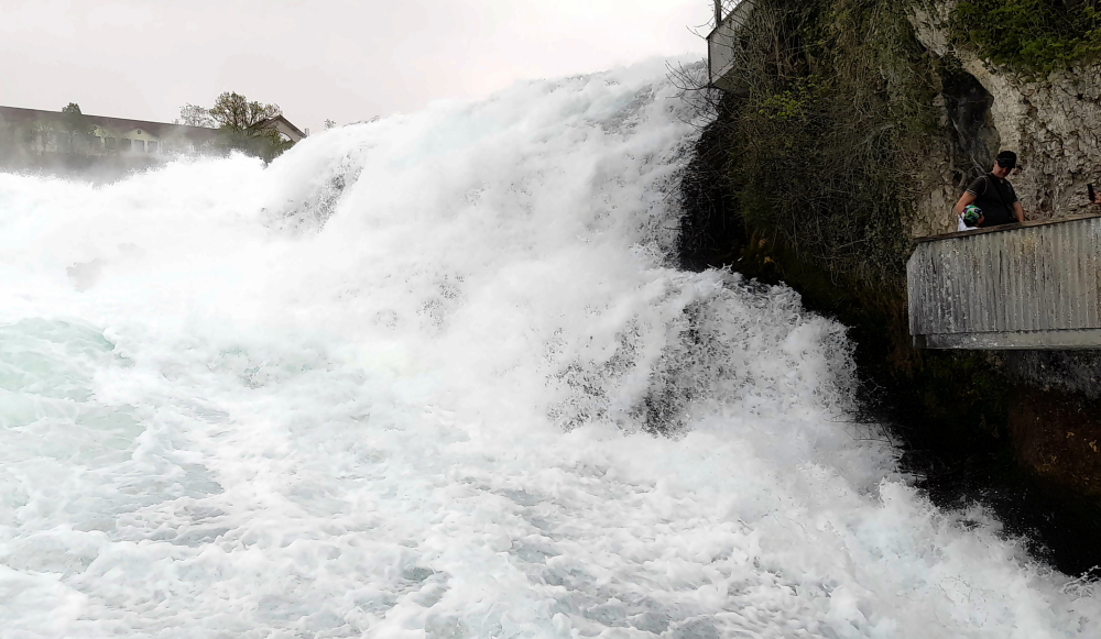
The Rhine Falls is 23 metres high and 150 metres wide. The scour in the impact zone is 13 metres deep.

Kanzeli – the lowest viewpoint – a protruding platform over the rapids.

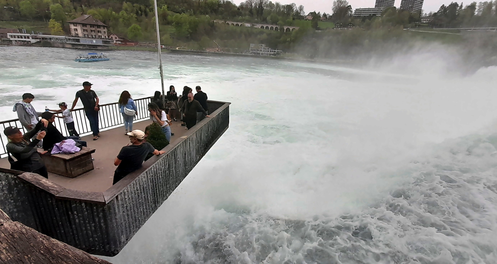
At average water levels in the Rhine, 373 cubic metres of water per second fall over the rocks in the Rhine Falls (average summer discharge: around 600 m³/s). The highest flow rate was measured in 1965 at 1250 cubic metres, the lowest flow rate was in 1921 at 95 cubic metres/second. The outflow was similarly low in 1880, 1913 and 1953. In 2013 it was visited by 1,300,000 visitors.

On Kanzeli platform – behind you!!!

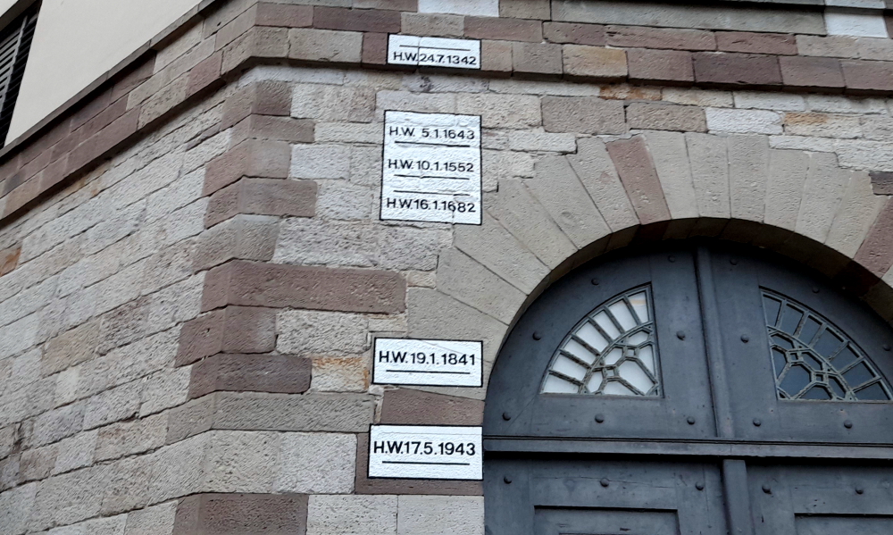
After a quick stop at a nearby supermarket we drive the 10 minutes’ to our accommodation in Altenburg. This involves crossing back into Germany at a small, semi-derelict, closed border control building at a rural T-junction.

Schellenberg 2, Altenburg.

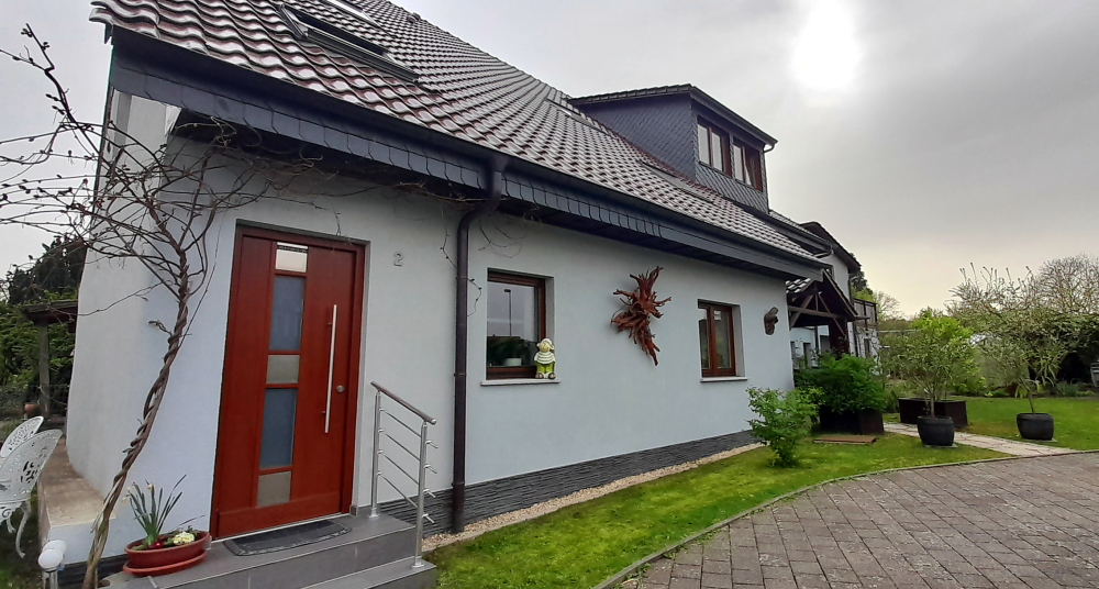
It turns out that our small cottage, adjacent to the owners’ house (to the right) is also attached to a much larger, and old-style farmhouse at the rear which has a yard. In this small community, there are a number of older-style, large farmhouses, interspersed with smaller, newer dwellings.

Rhine River – upstream.

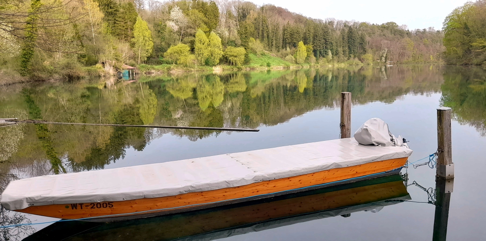
And the Rhine River is just a 5-minute walk away, so after a quick unpack we head out the door, walk part way down Trottenberg (street), then take a small downhill path past people’s grassy backyards until we arrive at the shoreline.

Rhine River – downstream with covered bridge in the distance.

It’s difficult to imagine that we are downstream from the turbulent waters of the Falls, as the water is almost at a standstill. So still and clear that we can easily see the vegetation on the bottom.

Small weir.

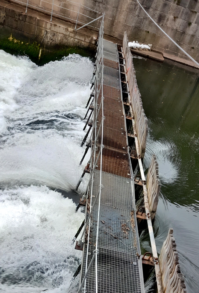
Part of the reason for the water’s stillness is a small weir between where we arrived at the shoreline and the covered bridge further downstream.

Zollbrucke to town of Rheinau.

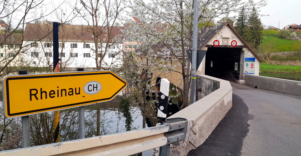
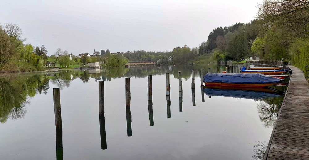
When we arrive at the bridge we discover it’s the border between Germany and Switzerland, again. Switzerland is on the other side with the border actually running down the middle of the river.

The Rheinau-Altenburg Rhine Bridge.

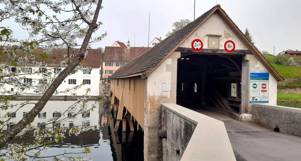
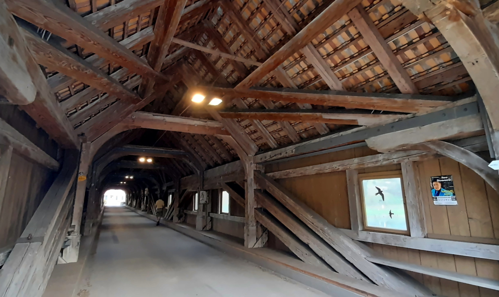
The Rheinau–Altenburg Rhine Bridge is a road bridge that spans the High Rhine and the border between Switzerland and Germany. The covered wooden bridge is designed for one lane and is one of the rare pile bridges today.

Wooden interior of the bridge.

The first references to a Rhine bridge near Rheinau date from the year 1247 and it was documented in 1324. The narrow, covered wooden bridge with four to five pile bays was mentioned in a purchase agreement in 1355 by the Rheinau abbot Heinrich V. von Aitlingen and initially served the Rheinau monastery as a connection to its lands on the northern side of the Rhine.

From 1444 to 1799 the bridge was subjected to damage during numerous wars. Between 1804 and 1806, Blasius Balteschwiler built the current oak structure on behalf of the Canton of Zurich for 6,600 guilders. Major repairs were carried out in 1885, 1918-1930 and 1954 with extensive repair work costing 2 million francs in 1988.

Swiss side with bronze statue of patron saint, Saint Nepomuk replacing the 1732-1872 sandstone one.

As we are retracing our steps I see a flurry of bubbles hit the river’s surface which to me indicate there are divers below. Sure enough, it is a dive site due to little current, high visibility and the canyons and sinkholes in the Rhine.

Beavers???

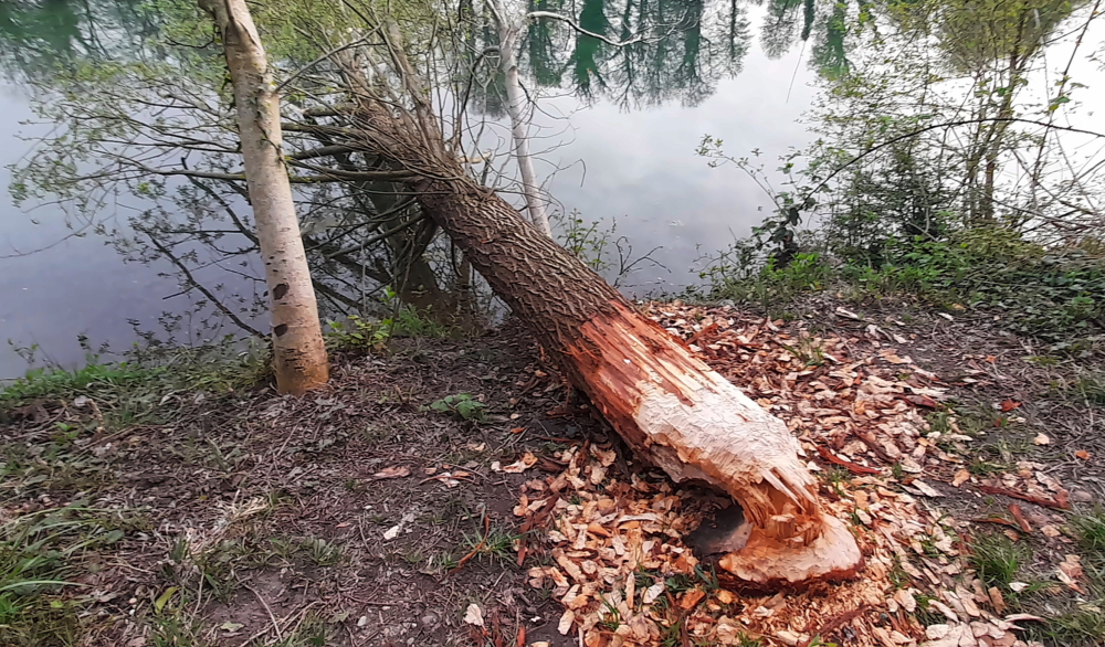
On the map we see that we can take the shoreline path past our entry point to a path that joins Trottenberg. We pass by a tree that has been felled into the river by what appears to be by axe, except there are teeth marks on the trunk! Beavers?? And apparently there are, along the Rhine between Lake Constance and Basel and we are halfway along that route.

Huck Finn – sans fishing rod.

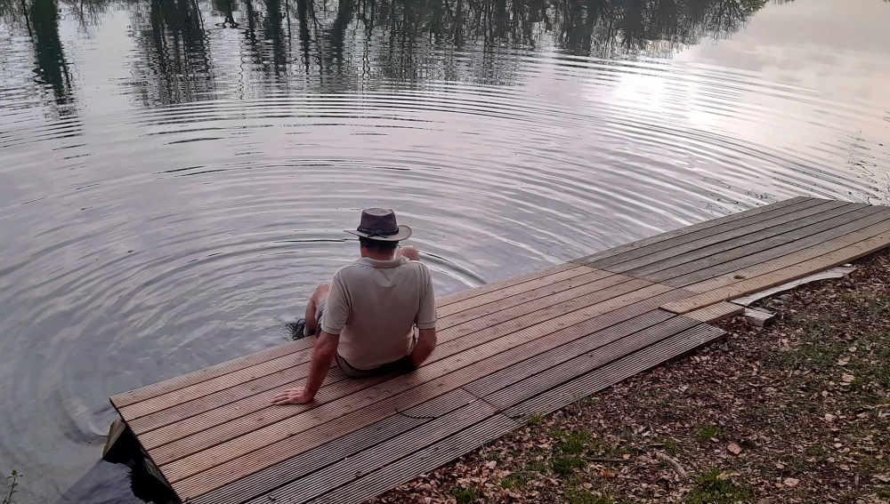
At the point where the track joins Trottenberg there is a space where several long, streamlined canoes are stored by the shore. Here we wash the soles of our boots from the muddy patches we’ve walked through. It is just so quiet and peaceful sitting here on the decking.

9 April, 2024

No rain yet, but it’s 9 Deg. C. outside. Brrr!

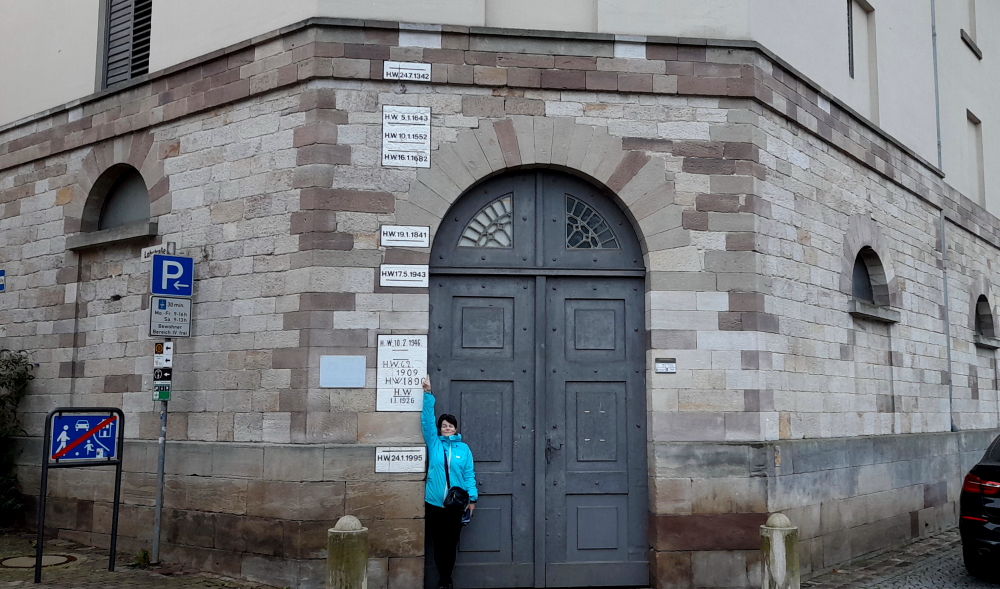
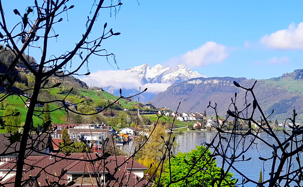
Yesterday, when driving along the road from the supermarket to our accommodation, we saw the Falls from the other side of the river and the imposing Laufen Castle above on the Zurich side. So we pop out over the border to get a photo this morning.

Laufen Castle above the Falls.

Unfortunately, there are no places to park to take a shot on Nohlstrasse, so I have to park briefly in a private car park while Lynn scampers about trying to capture the scene – hindered by a railway line, traffic, trees and overhead cables.

Interestingly, as we drive back to Altenburg, past the closed, old border post, there’s a black van filled with border guards parked out front!

View of the Castle & Falls further downstream.

We spend the rest of the day catching up the blog and getting organised for our drive tomorrow which will take us further south into central Switzerland to Beckenried on Lake Lucerne.

10 April, 2024

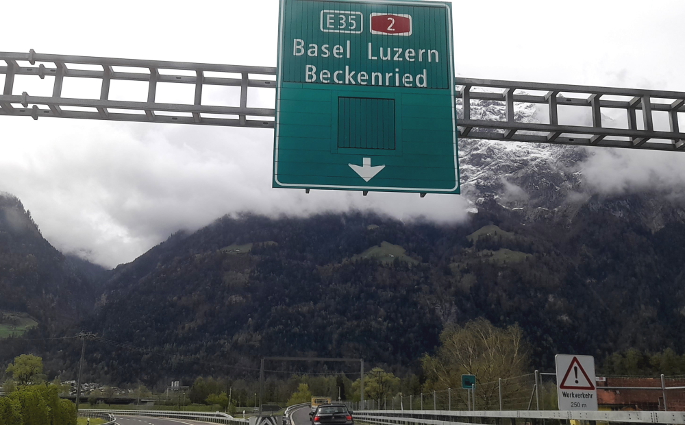
Today’s trip is around 120 km that should take us about 1.5 hours. At 10:00 am when we depart it’s sunny and 10 Deg. C. We have at least 2 stops on the way: 1 to refuel and the other to purchase new windscreen wipers. But, before then, 12 minutes later we cross back into Switzerland at Rafz-Solgen.

Getting new windscreen wiper blades fitted at Glattbrugg.

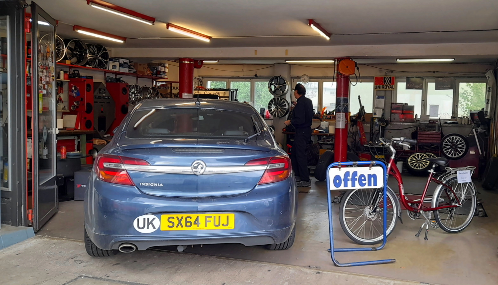
The A51 takes us around Zurich airport and about an hour after our departure I find a small servo that has an even smaller auto workshop attached in Glattbrugg. For CHF50 we get new, flexible blades and the guy even fits them for us. Hoorah! (Incidentally, turns out to be a good price as they would have cost the same in Australia, but unfitted!)

Driving through the suburbs of Zurich.

I want to avoid the direct route to our next destination as it will take us through Lucerne.

Driving alongside Lake Zurich (Zurichsee) near Thalwil.

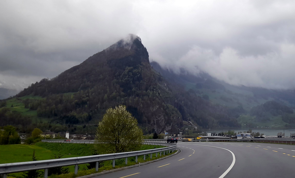
Instead, we take the 3 road SE that hugs Lake Zurich past Thalwil, where we stayed in 2012 when we visited Meg, Nev and the kids, until Wollerau where we take the 8 south across the hills. It’s now raining but the new wiper blades are working a treat.

Steep, green slopes & snow-covered hills.

The landscape changes to steep, green hills with snow-capped hills looming in the distance. It’s now 5 Deg.

Road near Seewen.

In need of a pit stop, we cut down to Seewen on the shores of Lauerzersee (Lake Lauerz).

Dramatic geology at Seewen on Lauerzersee.

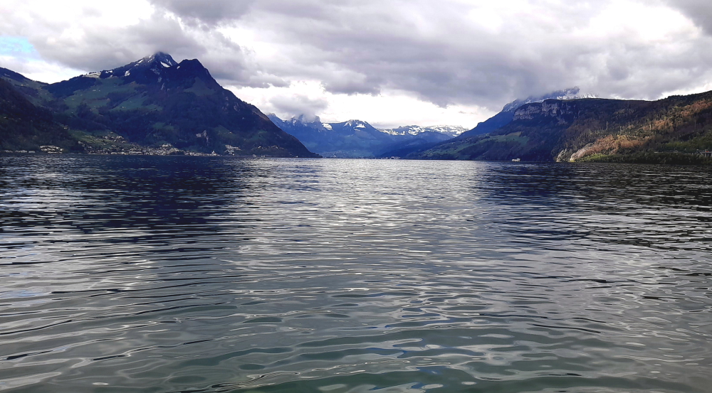
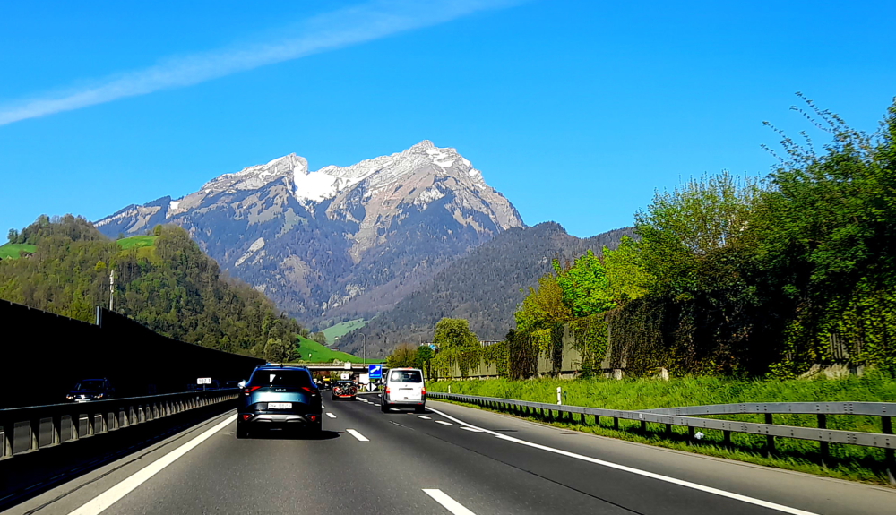
Soon after, having driven through the 1.1 km Mosi Tunnel that bypasses Ingenbohl, we are driving on the A2 that hugs the shoreline of the southern branch of the next lake, Lake Lucerne.

Axenstrasse, Lake Lucerne.

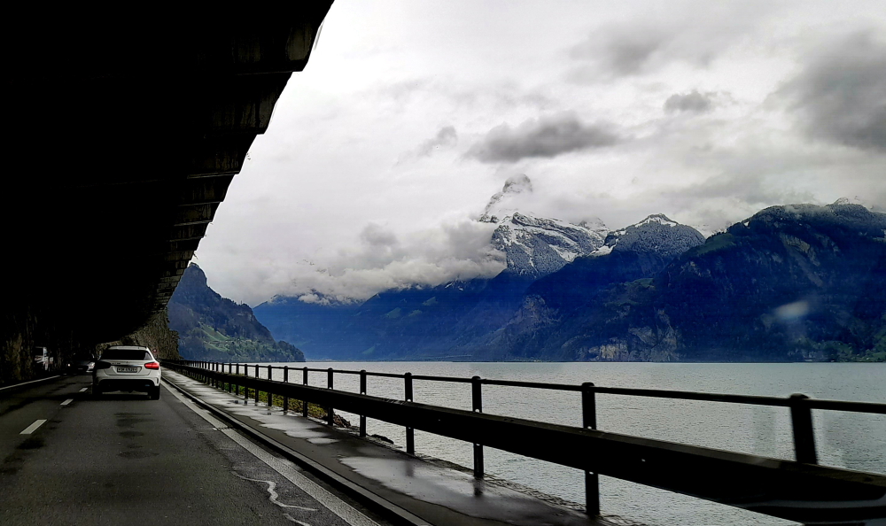
Along this part of the shoreline, on Axenstrasse, we are driving either through short tunnels or under massive concrete overhangs with impressive mountainous views across the lake.

Typical dwellings & landscape near Sisikon, Lake Lucerne.

Finally, at Fluelen, at the bottom end of the lake, we see a sign to our destination, Beckenried.

Sign to Beckenried at Fluelen.

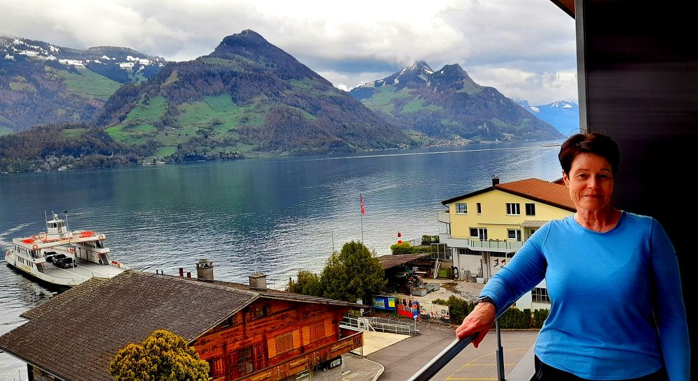
From here we drive NW up the lake, through the 17 km Seelisberg Tunnel, to our lakeside hotel at Beckenried Neiderdorf and arrive around 1:00 pm – in sparkling sunshine!

A refreshing drink while we wait for check-in.

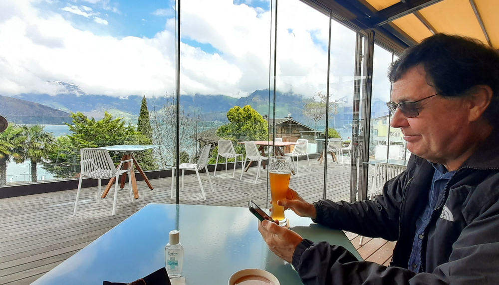
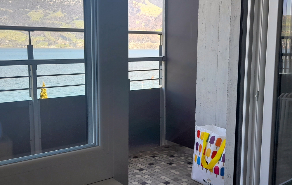
While we wait for our room to be ready we take advantage of the hotel’s terrace and its gorgeous views over the lake. About an hour later we move in, unpack and have a cuppa with chilled milk from our cold bag (no minibar in our room) which we’ve located on the balcony. With the balcony out of the sun, cold overnight temperatures and the freezing balcony tiles it’s up to the task!

Our DIY fridge.

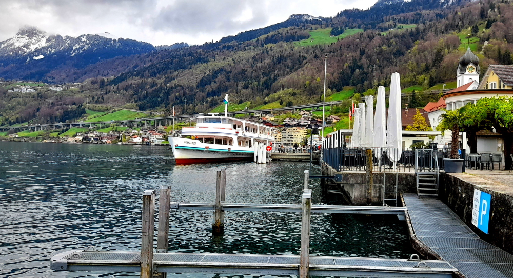
Around 4:00 pm we decide to walk the 20 minutes into the village of Beckenried to check it out and also the bus and ferry transportation options into Lucerne.

Ermitage – public park in Beckenried.

The town is full of both traditional, wooden shingle or carved wooden houses and ugly, newer tiled ones.

One of the more traditional dwellings in Beckenried.

At Beckenried village there is the terminal for the passenger ferry that goes to Lucerne, whereas next door to our hotel is the car ferry that crosses the lake.

View NE up the lake towards Ingenbohl.

Our original plan was to take the passenger ferry to Lucerne and return for a day trip. After our inquiries today we discover that it would cost us CHF64 each and a total of 2.5 hours. To take the bus and connect to the train in Stans would cost us CHF20 each and 2.5 hours.

The passenger ferry to Lucerne.

Taking the car has won out as it will cost us CHF8 for 3 hours’ parking, CHF8 for fuel and 45 minutes. That’s CHF128 v CHF40 v CHF16 or, the Ozzie equivalent of AUD215 v AUD68 v AUD26. Obviously the Swiss have no interest in promoting cheap, public transport! Perhaps they could meet their zero emissions targets but promoting public transport.

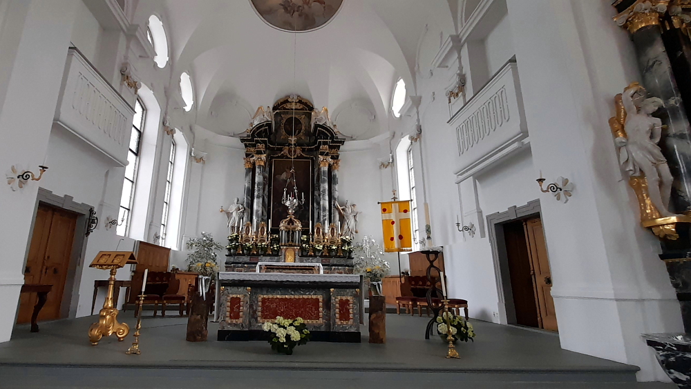
Across the road from the passenger ferry terminal is St Heinrich’s Church. A first chapel (Heinrich’s patron saint) is mentioned as early as 1323. Today’s church was constructed by Niklaus Purtschert in 1792-1807. Inside it has baroque features reminiscent of the Catholic churches that Lynn saw in Austria.

Katholische Kirche St. Heinrich, Beckenried (photo by Phyllis Taylor).

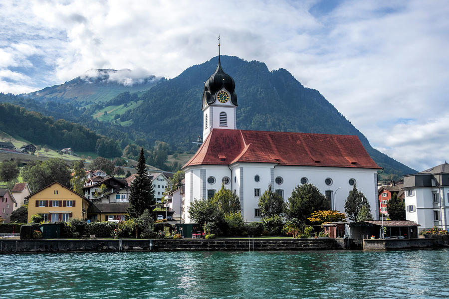
As the above photo by Phyllis Taylor (uploaded to fineartamerica.com on 26/07/2019) conveys both the beauty of the church and the town far better than our meager street shot and only possible from a boat, we’ve used it instead.

Altar, St. Heinrich Church.

An interesting fact that she mentions is that the church has its own boathouse on the lake!

The town also has a cable car that travels up the mountain called Klewenalp which is behind the town. Sadly, it’s closed for maintenance until May.

Street view of our Hotel Seerauch, with modern extension at the rear.

We get back to the hotel around 5:00 pm then head to its restaurant an hour later.

View from our balcony with car ferry about to dock.

Glad we don’t plan on eating here every night. Lynn has consomme (CHF13 – AUD22) and I have a small chicken breast (CHF32 – AUD54). We avoid alcohol and have a carafe of tap water instead – even that cost CHF2.50 (AUD4.20). What a joke!

Sunset across the lake.

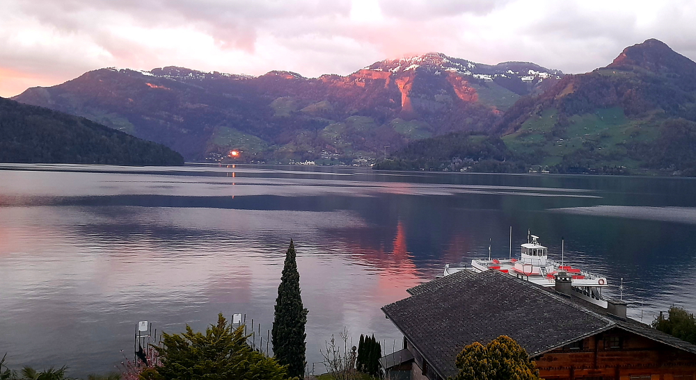
Fortunately, the colours of sunset make up for it – priceless!

11 April, 2024

Although a top of 15 Deg. C. and sunshine is forecast for today we decide we’ll have a rest day to enjoy the gorgeous view and will drive into Lucerne tomorrow as it’s due to be sunny and 19.

Alarmingly, we sit and watch the snow on the opposite hillsides melt before our very eyes!

Hotel pier.

After a late breakfast we walk down to the piers in front of the hotel.

Mt Pilatus – view from the shoreline.

Here we get a better view of the mountain towards the west which is Mt Pilatus. The mountain is composed of several peaks, the highest (2,128.5 m) is named Tomlishorn. During the summer, the “Golden Round Trip” — a popular route for tourists — involves riding a boat from Lucerne across its lake to Alpnachstad, ascending on the cogwheel railway, descending on the aerial cableways and panorama gondolas, and catching a bus back to Lucerne. I hate to think what that would cost! Luckily we couldn’t do it this time of year, anyway.

Mt Pilatus – up close & personal, from the hotel.

Tonight we are going to try a small, Swiss restaurant for dinner which is over the road from the hotel – Restaurant Schafli. Hopefully it will have more realistic prices or we might be on a diet of pizza for the next few days. As it turns out it has a very limited menu – tonight it’s serving a toasted cheese and ham sandwich and a small, cold meat and cheese platter. Together with a small, local beer and glass of rose cost us Eu50 (A$90) cash!

12 April, 2024

It’s 14 Deg. C. and 9:30 am as we drive out of the hotel car park on our 20-minute drive into Lucerne.

Driving on the A2 towaards Lucerne.

Why are we visiting Lucerne? So that Lynn can see the Kapellbrucke (Chapel Bridge) which captured her imagination in the 1960s when she was about 9 or 10 years old when she first saw a Peter Stuyvesant advert before a Saturday matinee at the Regent cinema in her hometown of Albury.

Mt Pilatus – with much less snow than yesterday!

She has a vivid memory of the advert that showed a group of beautiful people, enjoying a jetset lifestyle, arriving on Lake Lucerne and the bridge was in the background. She said to her mother who was sitting next to her: “Wow! Where is that?” to which her mother replied: “Somewhere in Switzerland, I think.”

Despite the advert’s impact, over the past 55 or so years she has not resorted to “… Peter Stuyvesant, your international passport to smoking pleasure” – rather she has enjoyed many years of traveling pleasure thanks to her own passports!

Multi-story bike park near the Bahnhof.

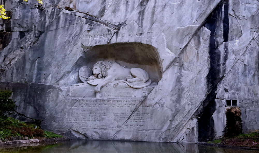
Lynn has chosen 4 sites for us to visit today: the Lion monument, the Musegg Wall, the Old Town and the Chapel Bridge.

Carved out of rock, “Dying Lion of Lucerne” commemorates the heroism in 1792 of hundreds of Swiss soldiers serving King Louis XVI who died attempting to protect his Tuileries Palace in Paris during the French revolution.

Carl Pfyffer von Altishofen (1771-1840) who was a young Swiss Guard’s officer witnessed events of the French Revolution but was on furlough in Lucerne during the insurrection of 10 August 1792. Creating a monument to his fallen comrades that day became his life’s purpose. Designed in Rome by Danish artist Bertel Thorvaldsen and carved in the rock face of a former quarry by stonemason Lukas Ahorn from Constance, in 1821 he saw the work completed.

Mark Twain has described this monument as: “…the saddest and most moving pieces of rock in the world”. [The Official Lucerne City Guide].

“Dying Lion of Lucerne”.

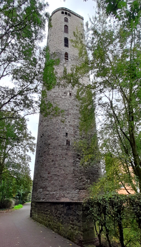
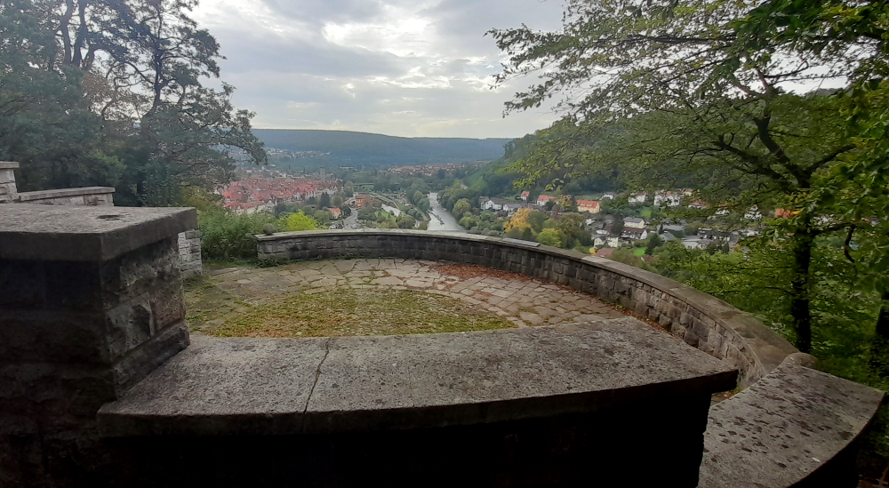
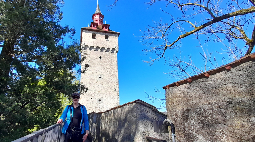
10 minutes’ walk SW brings us to the Musegg Wall. With its 9 towers it forms part of Lucerne’s historic fortifications.

The Musegg Wall.

We enter via the Schirmer Tower. Dating from 1420 it was last restored in 1995 after being partially destroyed by fire the previous year.

Musegg Wall & the Pulver Tower.

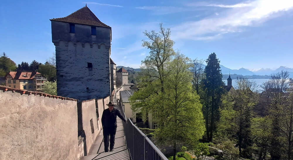
Walking along the Wall past the Pulver Tower we come to the Zyt Tower – the clock tower.

Zyt Tower – side view.

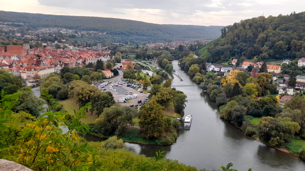
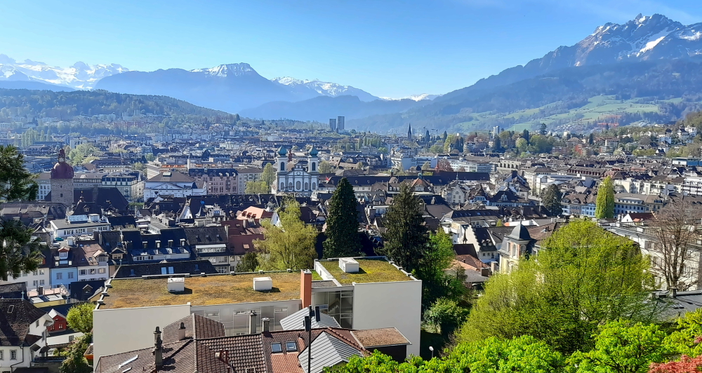
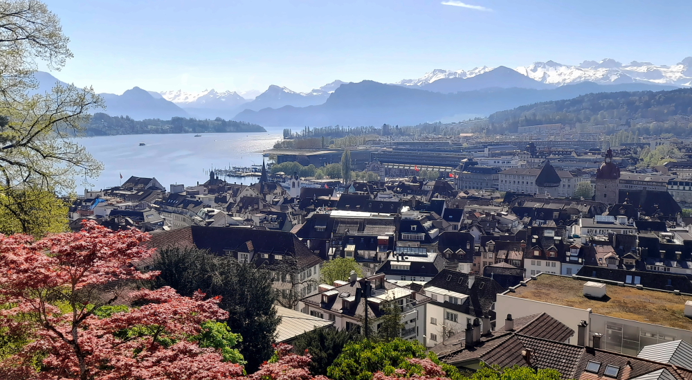
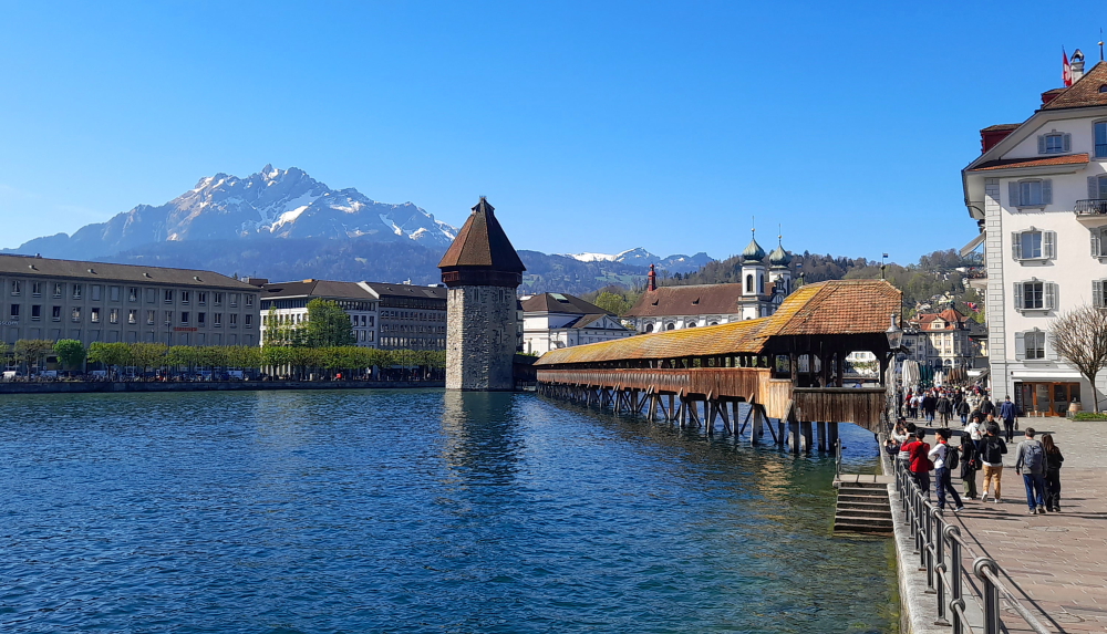
From the city wall to the right we have a commanding view of the mountains to the south of Lucerne plus the Old and New Towns.

Mt Pilatus (R) & Urner Alps (L).

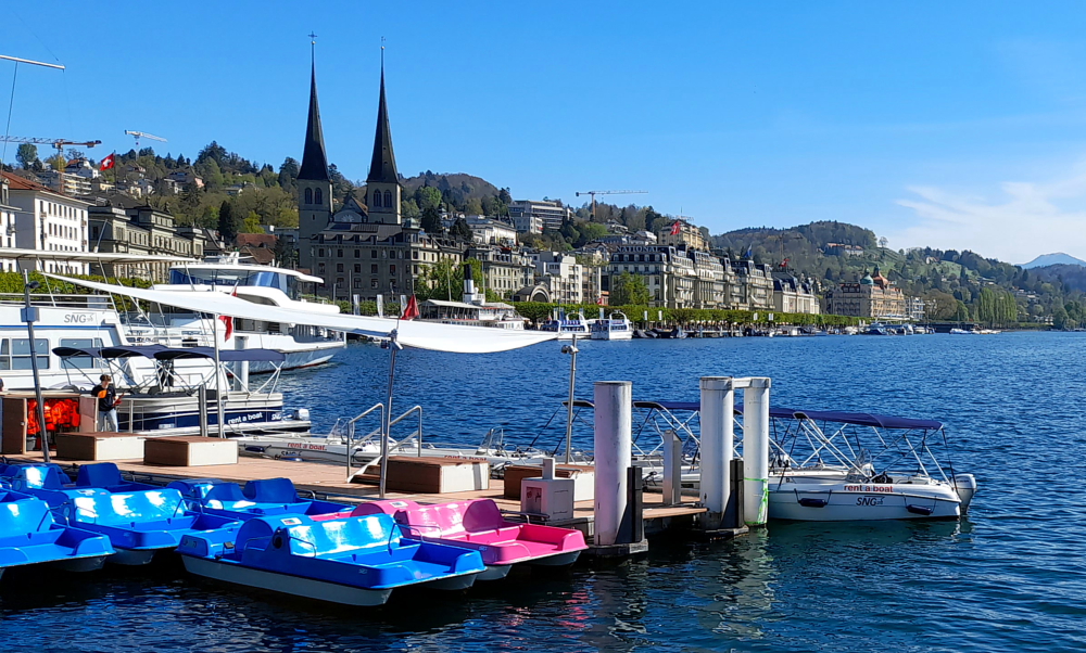
And to the left the Water Tower that is part of the Chapel Bridge, the Bahnhof and the beginning of Lake Lucerne.

View over the Bahnhof and Lake Lucerne.

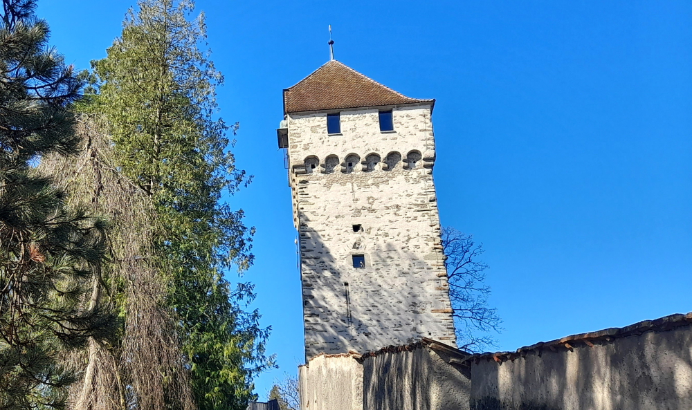
Walking as far as we can on the city wall we come to the Wacht (Watch) Tower. The medieval tower replaced by the Wacht Twer was being used to store 350 hundredweight of gunpowder when it was hit by lightning on 30 July 1701. The town’s fire wardens relocated to the Wacht from the Luegisland Tower in 1768.

Wacht Tower.

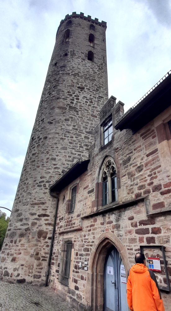
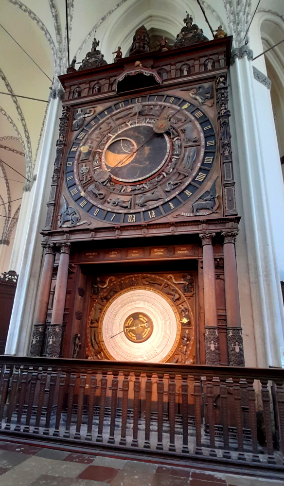
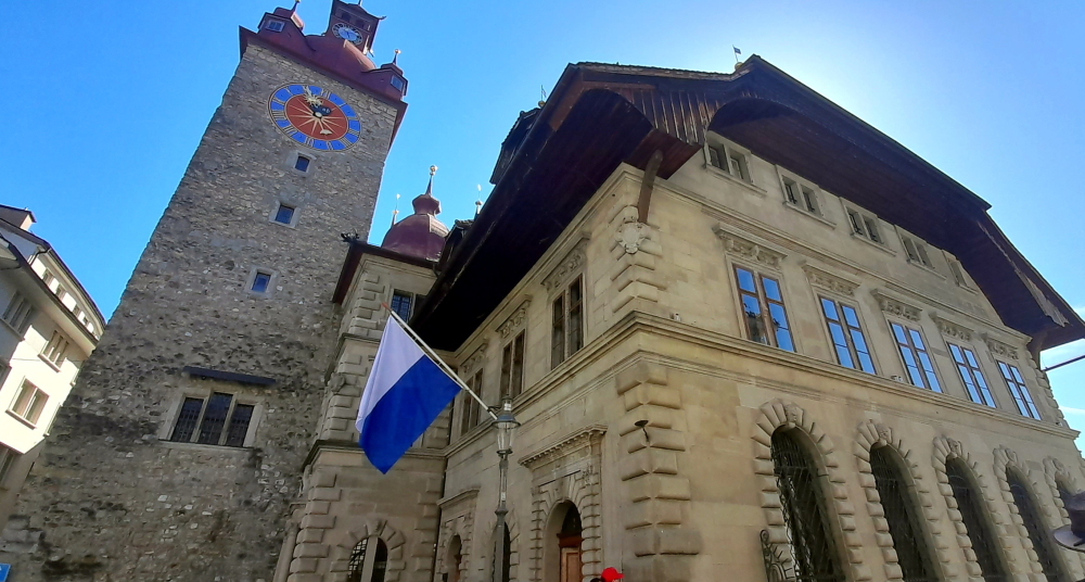
Retracing our steps we enter the Zyt Tower. This tower was erected in 1403 for defensive and timekeeping purposes.

A clock mechanism in the Zyt Tower.

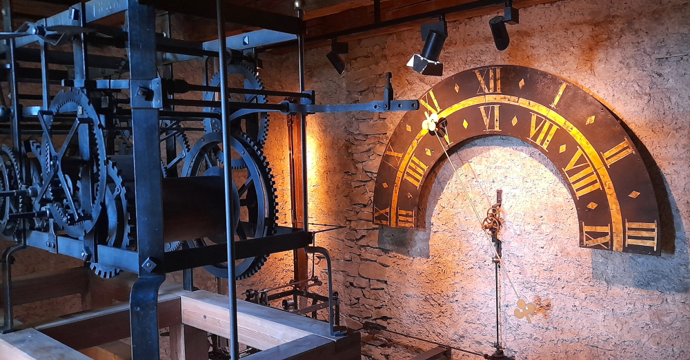
At the time, it accommodated the oldest public clock in existence. The clock turret once rose alone above the battlements until 1408 when it was incorporated within the tower’s newly-created attic floor.

Another clock mechanism on the ground floor of the Zyt Tower.

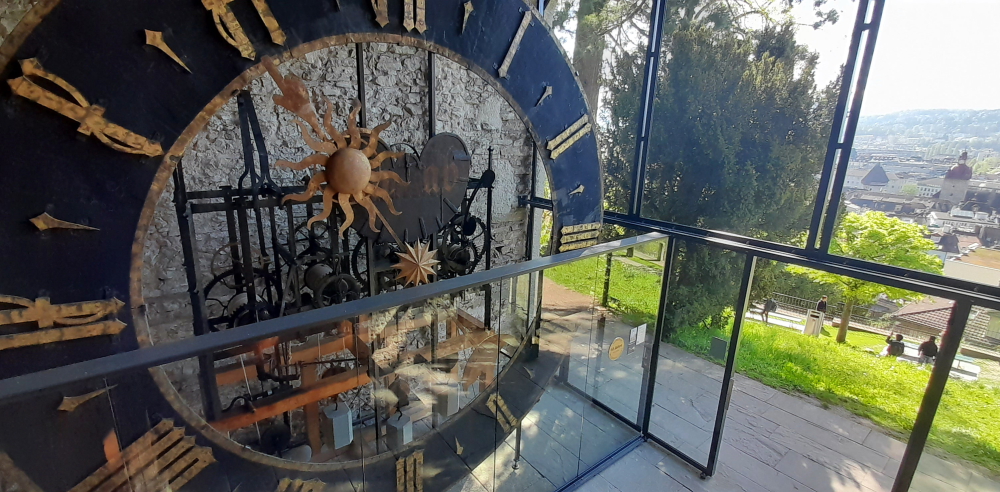
The clock mechanism was replaced in 1535. This clock has the privilege of chiming the hour 1 minute before all the other clocks in the town – which we can attest to when we exited the tower at 2 minutes to 11 o’clock.

Zyt Tower – front view.

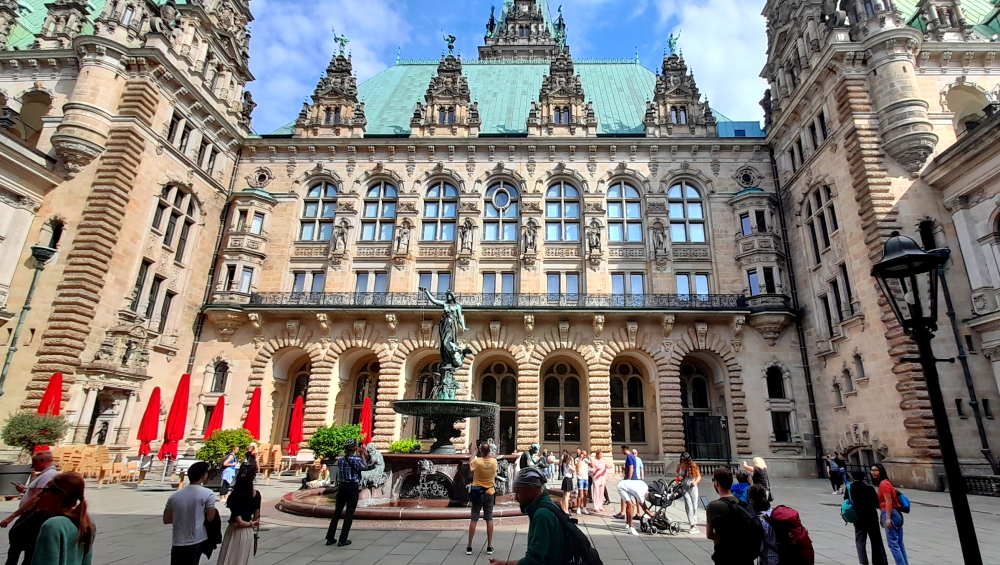
Straight downhill from here we enter the Old Town and the Kornmarkt 7 minutes later. Here at the Kornmarkt, in the middle of the Old Town near the Reuss River, is the Rathaus where photos of a small wedding are taking place.

Rathaus on Kornmarkt.

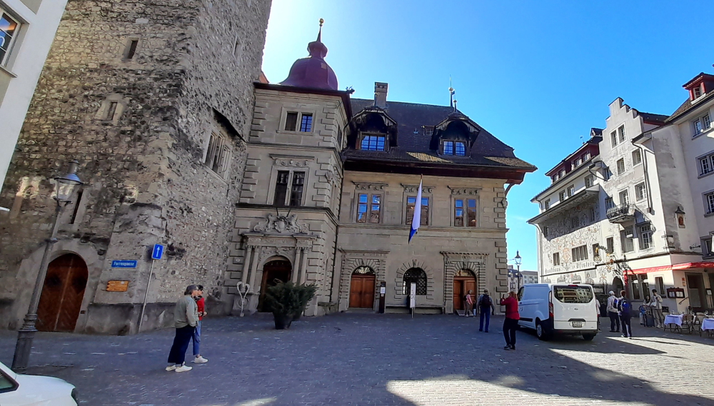
The Italian architect and master builder Anton Isenmann built the structure between 1602 and 1606 in the Italian Renaissance style. The grain chute is on the ground floor. It used to be a department store and is now used for exhibitions and concerts.

On the 1st floor is the Parliament Hall with two monumental paintings by painters Melchior Wyrsch and Josef Reinhart. The coffered ceiling, paneling and 18th century oven give this room its character. The Conference Hall is in the empiric style, built by Josef Singer. Today, civil weddings are primarily celebrated here.

Rathaus & Tower.

The Old Chancellery of Renward Cysats is located on the upper floor of the medieval family tower, while the New Chancellery, built in the Italian Baroque style, is located between the town hall and the tower. The wide, drawn-down roof is a Bernese farmhouse roof. In the attic is a dovecote, built in 2003 [luzern-com].

Market stalls in Rathaus colonnade next to Reuss River.

Adjacent to the Rathaus is the Rathaussteg Bridge, a narrow pedestrian bridge which crosses over the Reuss River next to the Chapel Bridge.

Reuss River view upstream from the Rathaussteg Bridge.

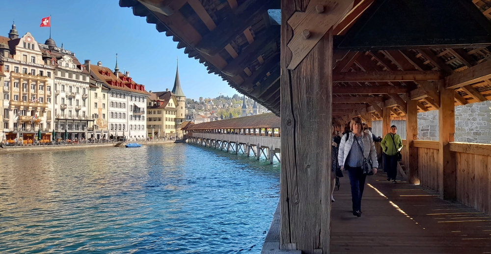
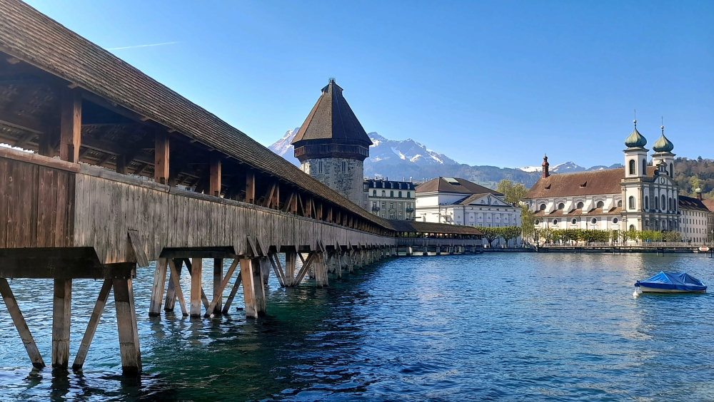
Finally, THE iconic bridge and its Water Tower – or as Lynn knows it as, the Peter Stuyvesant bridge.

View of Chapel Bridge & Water Tower from Rathaussteg Bridge.

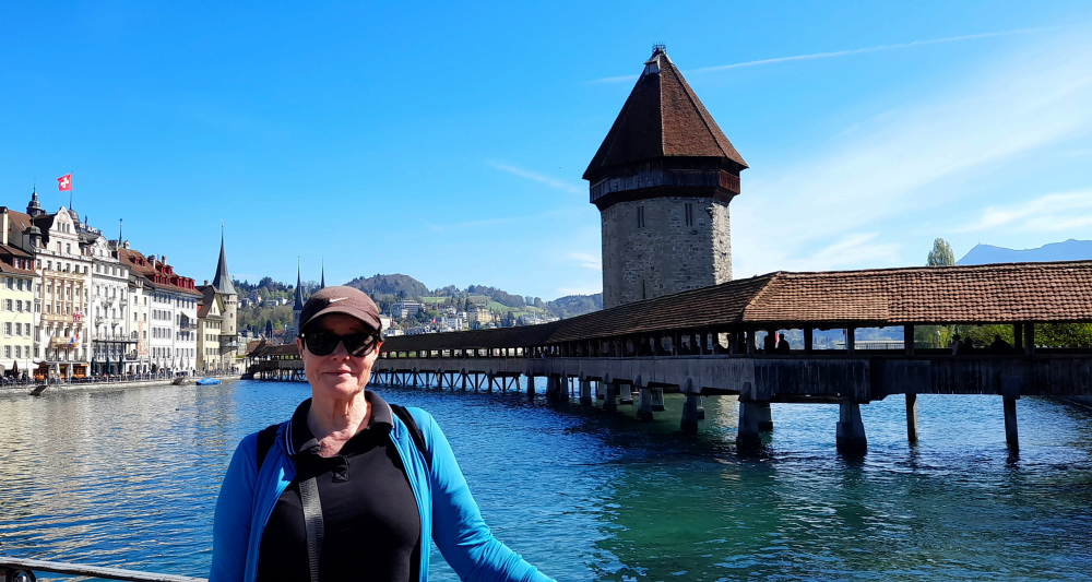
Built around 1300 – before the Chapel Bridge – the octagonal tower stands in the middle of the Reuss River.

The Bridge dog-legs across the River.

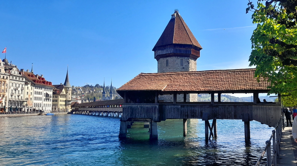
It served as a fortification and lookout post and was a cornerstone of the defenses.

View of the Bridge & Tower from the southern bank.

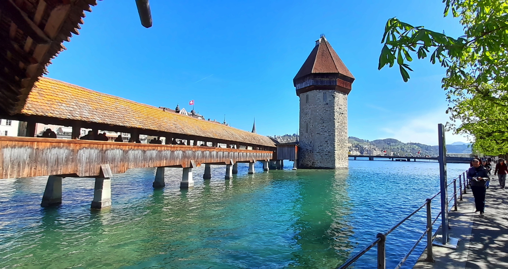
Over the ensuing years it was used to store the town’s archives and treasure, and it even saw use as a prison and torture chamber. Over 34 m in height, this Lucerne landmark is Switzerland’s most-photographed monument.

Ttriangular painting in bridge’s gables.

The Chapel Bridge is the oldest and, at 204.7 m, the 2nd longest roofed timber bridge in Europe. It was built around 1365 as a battlement and links the Old Town and “New Town” which are separated by the Reuss. The bridge’s gables feature triangular paintings depicting important scenes from Swiss history.

View from the bridge towards the Zur-Gilgen Tower on the northern bank.

On 18 August 1993 the bridge fell victim to a blaze, which as blamed on a carelessly discarded cigarette. “Appropriate” says Lynn, “given the Peter Stuyvesant connection!”

View of eastern side of the bridge from northern bank back-dropped by Mt Pilatus.

The conflagration destroyed a large part of the structure including 78 of the 111 famous pictures. Swiftly rebuilt and restored it was inaugurated and reopened to pedestrians on 14 April 1994.

View of western side of the bridge from Rosengartplatz on the northern bank.

Across Rosengartplatz and through an alleyway next to Peterskapelle is another marketplace, Kapellplatz. Here, at the entrance to Lucerne’s Old Town stands the Fritschi fountain with its colourful column. The fountain features a bannerman atop a pillar adorned with multiple carnival masks, among them those of Fritschi and his spouse. Water pours into the fountain’s base from four jester masks. Designed by the architect August von Rhyn, the fountain was unveiled on October 14, 1918.

Fritschi Fountain in Kapellplatz.

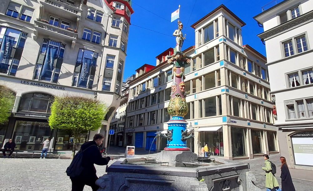
The Fritschi fountain holds significance in Lucerne’s annual carnival celebrations, the roots of which stretch back to the 15th century. The Fritschi parade starts Carnival Season whereby a life-sized straw effigy of Fritschi is paraded through the city in the company of various guilds and clubs. The procession is led by drummers and pipers, trailed by soldiers donning substantial beards and armor. This parade commemorates both the onset of the Lenten Season and a historic military triumph.

View from Seebrucke where the river joins Lake Lucerne.

The car park is a short, 3 minute walk from here. We’ve been away for 1 hour and 45 minutes.

Lynn’s former employer, Credit Suisse, now owned by UBS.

Driving back to the hotel we can see that snow that is on the lee side of hills on this side of Lake Lucerne still have snow, unlike their counterparts on the opposite side of the Lake.

Driving south on the A2 towards Beckenried.

We’re back just after noon. All up, our return trip to Lucerne has cost us less than we thought – about CHF7 (A$12) compared to CHF 128 (A$215) by ferry.

Around 4:30 pm we walk into Beckenried to the bakery/eatery opposite the ferry terminal and pick up a couple of salads and apple strudels which we’ll have for dinner, sitting out on our balcony watching the sun set.

13 April, 2024

A bright and sunny 26 Deg. C today. So, another lazy day catching up the blog and soaking up the lakeside view. Around 4:00 pm we walk into town to the pizzeria.

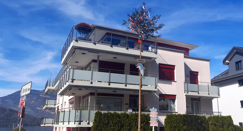
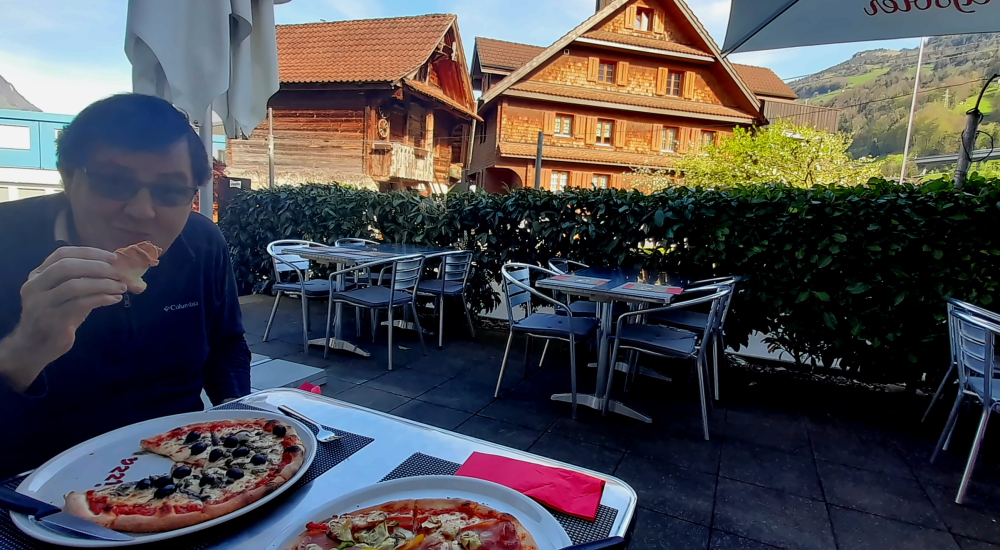
On our way we pass by several houses that have notices outside indicating that they each have had a new arrival to the household – signs with the baby’s name, date of birth, even weight! One house has taken the novel approach of decorating a very tall fir tree in their front yard for baby Anina. So what looks like a Christmas tree is, in fact, a Baby tree. Actually, I suppose they are the same thing!

No, it’s not a Christmas tree – it’s a Baby tree.

Next door to the cable car station is Pizzeria Klewen. On Sundays it’s open from 10:30 am which is why we are here at 4.30 pm and have the place to ourselves. We order a 10″ pizza each which is the perfect size and take in the views down to the lake, the surrounding neighbourhood and up the hill.

Traditional Italian pizza, traditional Swiss houses.

Tomorrow we have a 3 hour 15 minute drive to Tortona in Italy.

14 April, 2024

Another 26 Deg. C. day in Beckenried as we depart the hotel at 10:15 am while it’s still only 15. When we arrive in Tortona around 1:30 pm it should be 28.

As soon as we turn onto the A2 that runs past Beckenried the car GPS informs me that we have 170 km before we turn off.

View of Mt Bristen (3073m) from the A2 near Erstfeld – 20 km before Gotthard Tunnel.

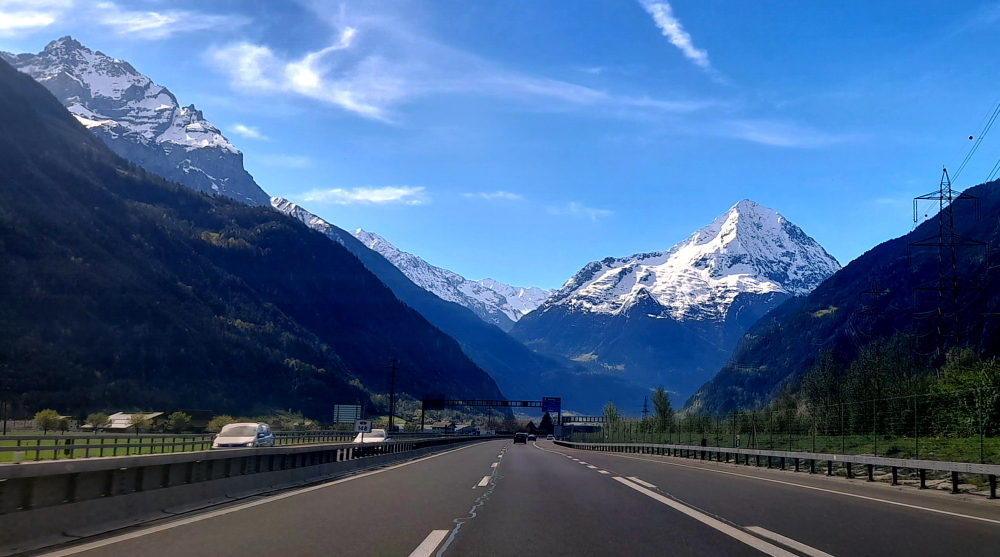
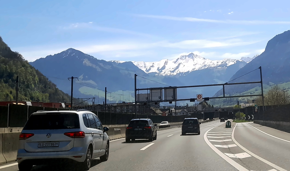
About 30 minutes later we are stopped on the freeway – for a set of traffic lights on red. Turns out this is the beginning of the Gotthard Tunnel – all 17 km of it – that passes under the mountains from Goschenen to Airolo. When we enter the tunnel it’s 20 Deg. C. but driving through it the outside temp. gets to 31!

Which is when we realise that the car’s air conditioning system isn’t bloody working! The same air conditioner that we had fixed back in October 2022, a couple of weeks after we bought the car. We resort to driving with the windows down.

Heading towards the Italian border.

When we emerge from the tunnel on the other side of the Alps, the landscape has taken on a distinct Italian look and feel, such as ‘Uscita’ for exit instead of ‘Ausfahrt’ and ‘Benvenuto’ instead of ‘Willkomen’ – even though the border is still another hour (111 km) away.

Approaching the Italian border near Chiasso.

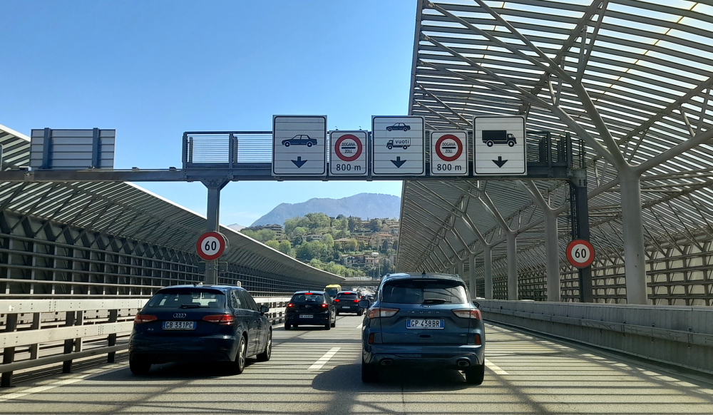
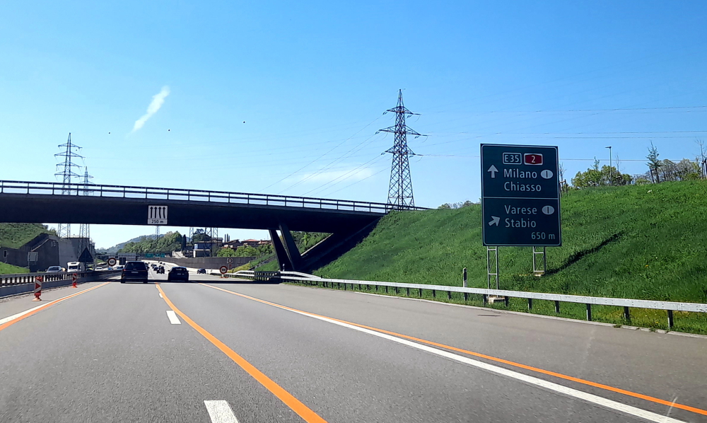
Finally, the border hoves into view – thanks to the tailback that has formed. At the barrier the fast lane becomes the slow lane as it’s that lane that the border police are stopping cars. The lane that we are in continues unhindered.

From here on the A9 then A7 it takes us 1 hour 15 minutes to bypass Milan and Pavia, and pay 3 Italian tolls totaling Eu11, to arrive at our gorgeous Art Deco guest house on Castle Hill in Tortona. Like our last visit to Italy back in 2014 it costs more for tolls than it does for fuel.

Casa Cuniolo Guest House, Tortona.

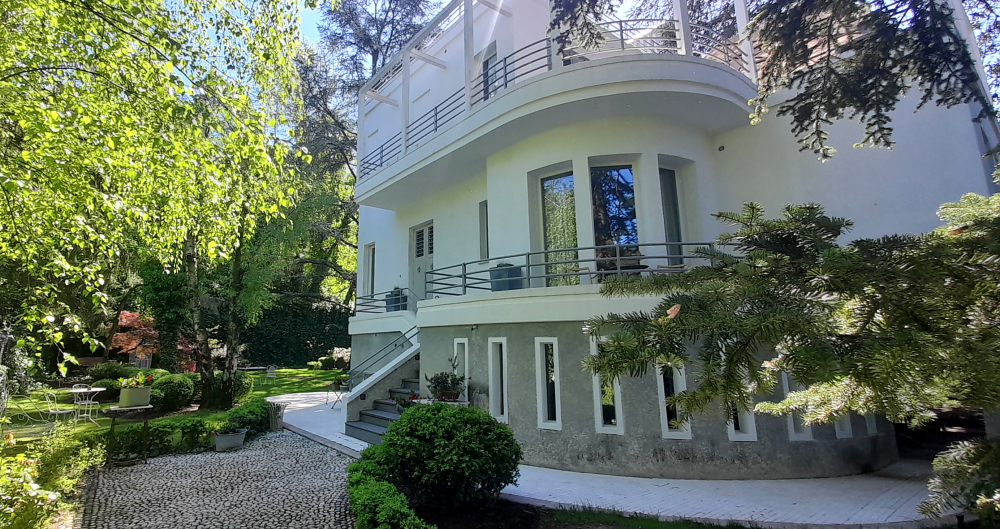
Cuniolo house was built in 1936 on the grounds of Castle Tortona alongside the Royal Gate. The surrounding Castle Park, overlooking the centre of Tortona, is built on the old fortress that dates back to Roman times but which has had many transformations over the centuries from Barbarossa and Spanish rule to Napoleon.

Our 2nd-floor bedroom’s balcony.

It was built by Giuseppe Cuniolo to be used as a home for the family of his son, the painter Gigi Cuniolo (1903-1976), a Piedmontese exponent of 20th century landscape painting.

And our terrace.

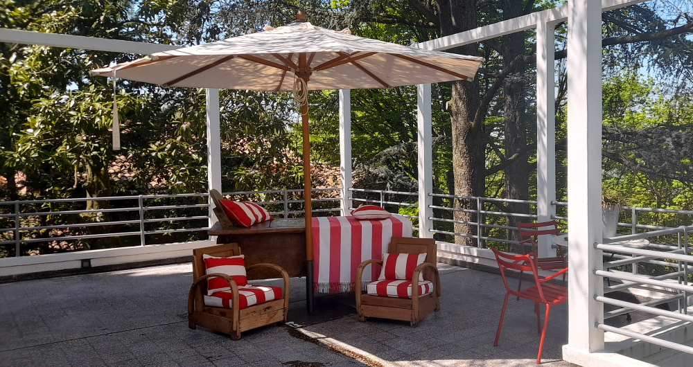
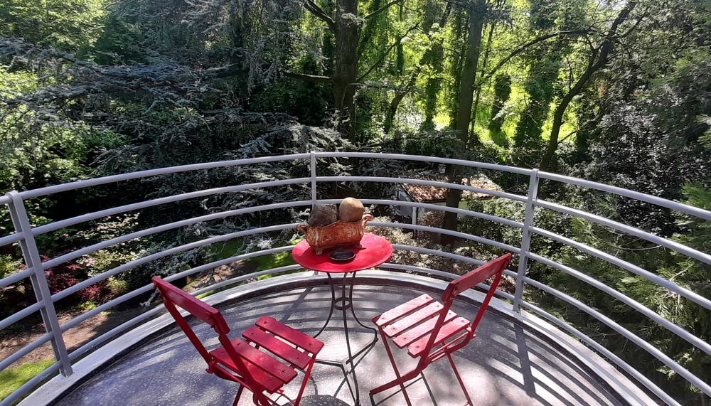
We have a large room on the 2nd floor, with a large bathroom, a small balcony and a large terrace facing opposite aspects.

After we unpack I check under the bonnet and conclude that it is possibly the air conditioner’s compressor or its clutch that is the problem, so not a cheap fix. Tomorrow I’ll have to get our host to phone the Opel dealer in La Spezia, where we are next staying for a week, to check the car in.

And we soon realise we are back on Italian time for dinner – nothing opens before 7:30 pm where we are booked at a local trattoria, some 15 minutes’ walk down the hill.

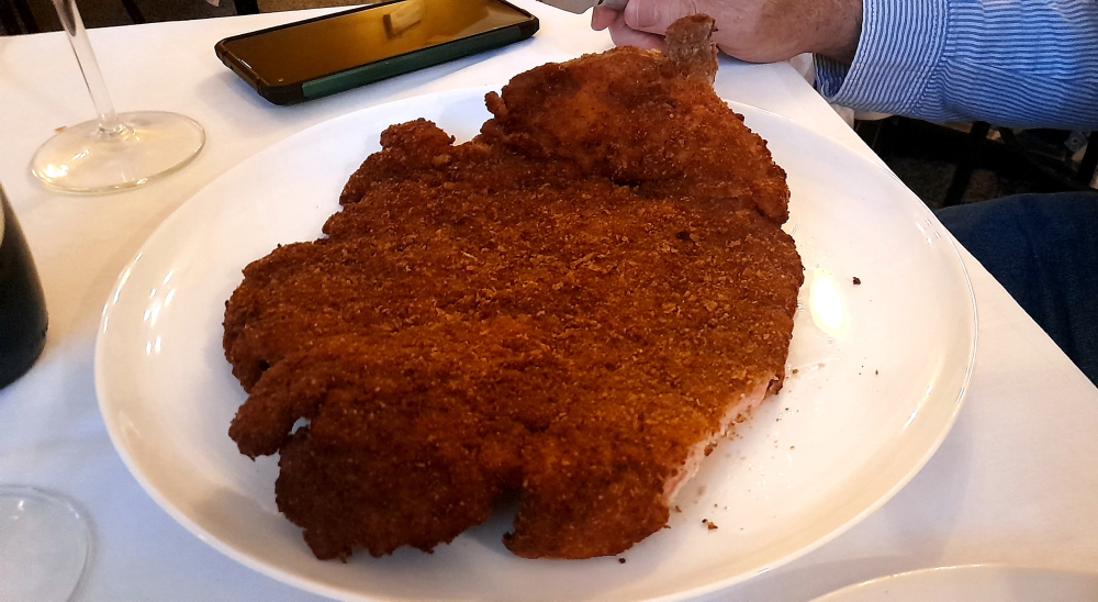
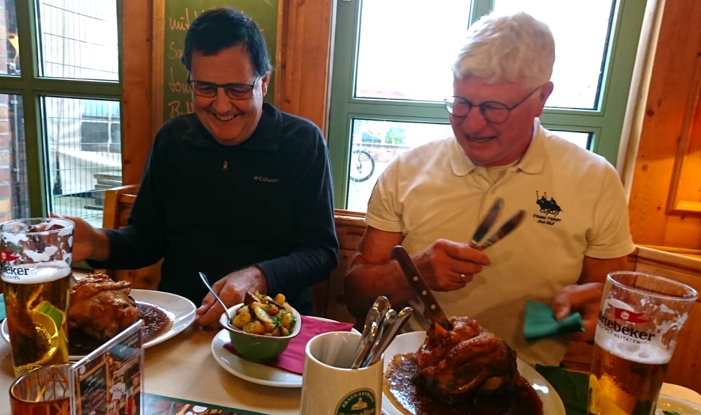
The tratt isn’t very elegant and has a very limited menu but I order the house special which turns out to be a massive 30cm schnitzel and Lynn just orders a couple of vegetable side dishes. We also ordered a half bottle of very nice red wine. I could only manage half of my schnitzel so it will be lunch for tomorrow. At least the price for dinner was a little more realistic than we experienced in Switzerland. Our total bill was EU 36.00 (A$60).

Gigantic House Special.

Hannoversch Munden and Dresden

12 October, 2023

As forecast it started raining heavily from about 4:00 am. With our window open we could listen to the babbling river as well as the rain on the roof. It was very difficult to wake up but the alarm went off just as the workers arrived to start up their heavy machinery outside our window to continue on the river edge stabilisation project.

We have a few days of blog backlog to complete today (perhaps we should call it our backblog???) so a wet day is not an issue. I also have to sort out the hire car border fee with the hire car company and try not to do another rant on the blog. Late last night I escalated the issue with the hire car company head office in Krakow and threatened to publish their poor service experience on a number of review sites.

By the time we finished breakfast and started the backblog (I like the sound of that..) I received a phone call from the head of the car rental service. He was most apologetic and promised to complete the refund today. I explained that I understand errors occur but when I send all the proof to the company and get no responses to my constant emails over the past month it becomes unsatisfactory. When will companies realise that they can run off more customers than advertising can attract if they don’t have good customer service? An error quickly rectified can gain a customer for a long time but a small error poorly managed can alienate a customer and their friends for life.

My rant for the day.

We managed to get the backblog up to date and I even managed to step out for a while to acquire some red wine for Lynn and check out a few of the local stores.

Interesting way to manage the water flow rate – wooden sticks.

I brought Lynn back a bottle of red wine and once she completed the blog edit we headed out to find a suitable place for dinner.

On the way, just around the corner from the hotel we noticed a number of flood markers from the past 650 years.

Flood markers down by the river.

We know that the 1943 marker was caused by the dam busters who blew up a dam further upstream but the big floods were years before.

High Water markers.

We decided to try out the restaurant and bar located in the cellar of the city hall.

The Rats-bruhaus.

Like many famous restaurants the hype is better than the actual experience. The food just barely acceptable and the prices were aimed at tourists. We both had goulash.

Goulash and a beer.

Maybe Italian tomorrow night or perhaps back to last night’s German restaurant.

The Rathaus restaurant bunker.

On the way back we dropped in to the mini market for some biscuits to have with a cuppa after dinner.

13 October, 2023

It has continued to rain overnight but after breakfast we decided to explore the wider areas of the town now that the rain has eased.

We headed to the outskirts of the old town with the plan to follow where the old fortifications surrounded the medieval village. There are a number of lookout towers and sections of the original wall to explore.

Courthouse with Hampescher Turm (tower) in the distance.

We will then walk to the parks that are outside the wall and Lynn wants to walk up to a lookout to see if there is a view of the town.

One of the 6 remaining towers.

Our next stop was at the St Aegidienkirche where Dr Johann Andreas Eisenbart was buried in 1727. Eisenbart was known as a craft surgeon – experienced in his art of eye cures, stone, cancer and fracture cutting – a travelling ‘physician’ usually practising in tents at market squares and selling his potions. During his career he received a number of privileges, one of which was Braunschweig-Lüneburg (1710) with Hanover and Lower Saxony , which is why Eisenbarth was able to call himself the Royal British Country Doctor after the establishment of the personal union with Great Britain from 1714.

St Aegidien Church.

At the southern end of town the Ferry Gate Tower was purchased by the Haendler & Natermann company in the late 19th Century in order to heighten it and convert it into a shot tower (renamed the Hail Tower) to manufacture lead musket balls.

The Ferry Gate/Hail Tower.

From here we cross over the Muhlenbrucke Bridge near our hotel to the Tanszwerder Island opposite.

On the Unterer Tanzwerder Island.

This island is surrounded by the Fulda, Kleine Weser and Werra Rivers.

The Werserstein where the Fulda and the Werra Rivers meet.

Next we cross half way over the Alte Werrabrucke bridge to the small island of Doktorwerder which is now a parkland with a number of statues by local artists.

Back to the bridge we continue to the Northern side of the Werra River where a short distance downriver is a 70 KWH hydro electric generator, which is an unconventional twin-screw generator but only one of these is working today.

The Wasserkraftwerk hydro generator.

Lynn wants to walk up to the Weserliedanlage lookout to see if she can get a view of the town from the top of the hill. I tag along for part of the way but as my knee is hurting Lynn sends me back to the hotel while she continues up the steep hill alone.

The lookout above the town.

This is the view from the lookout. Our hotel is at the far left, at the top of the waterway which is the Werra River.

Looking down the Fluda River with our hotel on the far left.

While Lynn edits the blog this afternoon I start checking out transport for the 2nd quarter of next year and beyond. By 3:45 pm it is red wine time and a break before we head out for dinner. We have decided that we will check out by 10:00 am tomorrow so that we can do a laundromat stop on the way to Dresden.

For dinner tonight we head back to the restaurant where we had dinner the first night. A light dinner is all we need so I order another schnitzel and Lynn orders currywurst. Unfortunately it is not the curried sausages that can be found in the UK or Australia. The German version consists of a German sausage covered in tomato sauce and sprinkled with a very mild curry powder. Yuck!

Curried sausage Jim, but not as we know it.

14 October, 2023

At 9:58 am and a chilly 13 Deg C we leave the hotel to drive to Dobeln, 2 hours and 45 minutes away where I’ve located a landromat. Then it will only be a 45-minute drive to Dresden.

Although chilly it’s a bright, sunny day as we hit the 38. We can’t believe it, after the bumper-to-bumper and heavy freight traffic and frequent tailbacks we’ve recently experienced, there’s hardly anyone else on the road!

So far so good with light traffic.

After bypassing Leipzig we turn onto the 14 and are soon surprised by a road sign that says “Schloss Colditz” and sure enough we can see it perched in the distance.

A vacation stop in Colditz?

The GPS takes us directly to the edge of Dobelne where we find the laundromat next door to an angling shop.

Very compact, clean, tidy and with multi-lingual machines and parking we finish our washing, drying and folding an hour later and drive to Dresden.

An hour stop to do the laundry at Dobelner.

We are a little concerned as we drive into the old town centre of Dresden as there seems to be an inordinate number of police cars about.

Our suite overlooking the Dresden Market Square.

We park in the garage underneath the hotel and check in. To our delight we’re informed we’ve been upgraded to a suite overlooking the Neumarkt Square.

Looking out the window we see that a demonstration is winding up – either about Ukraine or the new war between Hamas and Israel – hence the police presence.

The view from our room.

As we’re in Germany and it’s October we decide it’s about time we had a German beer to celebrate our very own, mini Oktoberfest – so we raid the free minibar and indulge.

A local beer with a view.

Rain is forecast tomorrow so we walk out the door to explore our beautiful surrounds.

The Verkehrsmuseum (Transport Museum) on the Square.

Next door to the hotel is the astonishing Frauenkirche (the Church of Our Lady), a Baroque Evangelical Lutheran church. Considered a magnificent example of Protestant sacred architecture, it has one of the largest stone church domes north of the Alps and is considered one of the largest sandstone buildings in the world.

The Frauenkirche was built from 1726 to 1743 based on a design by George Bähr. From the beginning it was plagued with serious structural defects that could never be properly remedied. At the end of WWII, its most important supporting parts were so weakened by the heat of the firestorm raging in Dresden during the air raids on the nights of February 13th and 14th, 1945 that it collapsed, burnt out, on the morning of February 15th. The ruins were preserved in the GDR and were left as a memorial against war and destruction.

The Frauenkirche on the Square.

After Germany’s Reunification in 1989 the clearing of rubble began in early 1993 and the reconstruction of the church building began in 1994. The work, completed in 2005, was largely financed by support associations and donors from all over the world.

Inside the Church.

From here we walk towards the River Elbe. Up some stairs we find ourselves on top of the Bruhlsche Terrasse or Bruhl Terrace which extends for about 500 meters along the Elbe between the Augustus and Carola Bridges. The Brühl Terrace is also known as the “Balcony of Europe”, a term coined at the beginning of the 19th century and later widely used in literature.

As part of Dresden’s fortifications, the Brühl Terrace was built in the 16th century. The name goes back to Heinrich von Brühl, who had the so-called Brühl glories (gallery, library, belvedere, palace and gardens with pavilion) built on the fortress by Johann Christoph Knöffel. As a result of the development, the terrace lost its military significance.

In 1814, Prince Nikolai Grigoryevich Repnin-Wolkonsky, who was governor general of the occupied Kingdom of Saxony after Saxony’s defeat in the Battle of Leipzig, issued an order to open the terrace to the public.

Down by the Elbe River.

Walking along the top of the terrace is a series of beautiful buildings.

Dresden Academy of Fine Arts.

One of three buildings of today’s Dresden Academy of Fine Arts, the former Royal Academy of Arts, built in 1894, is located at a prominent position in town on Brühl’s Terrace just next to the Frauenkirche.

Various buildings of the Fine Arts Academy.

Since 1991, the building built by Constantin Lipsius on Brühl’s Terrace between 1887 and 1894 – the glass dome of which is also known as Lemon Squeezer due to its form – has been heavily renovated and the parts that were destroyed during WWII were reconstructed.

The Church’s Dome and the “Lemon Squeezer”.

Directly across the river is the rather imposing Finance Ministry building and to the right of it, the Saxon State Chancellery, the office of the Minister-President of Saxony.

View across the Elbe.

That will do for sightseeing today. After dinner we have a night cap in the hotel’s rooftop bar on the 6th floor.

The hotel rooftop bar.

The main reason we visit the bar is to see the Church’s illuminated dome – up close and personal.

View of the Church dome from the bar.

15 October, 2023

Our Townhouse Hotel is just across the square from the start of our Dresden Old Town walking tour today at 11:00 am.

The Townhouse Hotel on the corner.

From Neumarkt we walk into Augustusstrasse which connects the Schloßplatz with Neumarkt and runs roughly along the line of the medieval Dresden city wall which was demolished here between 1546 and 1548. The name refers to the Saxon Elector and Polish King August the Strong. The most important sight is on the south side the procession of princes (Furstenzug) on the outer wall of what is today the Langer Gang (Long Corridor) in Dresden Castle, including August the Strong.

900 years of Dresden history on ceramic tiles.

As early as 1589, the outer north wall of what was then the stable yard of the Dresden Residential Palace had just been built and over time, weathered. In 1865, the historical painter Wilhelm Walther presented a design for the redesign of the wall: A procession of Saxon regents, suitable for the upcoming 800th anniversary of the Wettin princely house in 1889. Between 1868 and 1872, Walther created a one hundred meter long and four meter high original drawing with charcoal on squared paper. The creation of the mural using the sgraffito technique, a plaster scratching technique, lasted from 1873 to 1876. However, due to weathering, it was transferred to tiles during 1904-1907.

Today, the Princely Procession is a larger-than-life image of a cavalry procession, applied to around 23,000 tiles made of Meissen porcelain. The 102-meter-long work of art, which is considered the largest porcelain mural in the world, represents the ancestral gallery of the 34 margraves, dukes, electors and kings from the family of the Princely House of Wettin who ruled in Saxony between 1127 and 1873.

All the way up to the start of the 20th Century.

While we are listening to the guide we are entertained by a street artist who has set up his ‘scene’ on the footpath underneath the mural. He is the waiter and the 2 women are mannequins. He is completely still but, as soon as someone puts some money in his tip box, he acknowledges comically and moves into a new stationary position.

Complete with 21st Century street artists.

Next we walk into a courtyard of Dresden Castle or Royal Palace. It is one of the oldest buildings in Dresden. For almost 400 years, it was the residence of the electors (1547–1806) and kings (1806–1918) of Saxony from the Albertine House of Wettin as well as Kings of Poland (1697–1763). It is known for the different architectural styles employed, from Baroque to Neo-renaissance. Today, the residential castle is a museum complex.

The original castle was a Romanesque keep, built around 1200. After a major fire in 1701, Augustus II the Strong rebuilt much of the castle in the Baroque style. The collection rooms were created at this time in the western wing. The Silver Room, Heraldic Room and the Precious Hall were built from 1723–1726. The Fireplace Room, Jewel Room, Ivory Room and Bronze Room were built from 1727–1729. The 800th anniversary of the House of Wettin, Saxony’s ruling family, resulted in more rebuilding between 1889 and 1901.

External decoration using the sgraffito technique.

Most of the castle was reduced to a roofless shell during 13 February 1945 bombing of Dresden in WWII. The collections survived having been moved to another location earlier. Restoration began in the 1960s with the installation of new windows and has occurred rapidly since then. The castle’s restoration is ongoing, including the installation of a plastic dome over its courtyards.

Modern dome over Castle courtyard.

From here we walk along Schlossstrasse to the Kulturpalast – a modern Palace of Culture, part of which faces Altmarkt square. Unlike the other buildings in the Altmarkt square, the Kulturpalast is designed in the unadorned International Style. A modernist building by Wolfgang Hänsch built during the era of the German Democratic Republic (GDR) it was the largest multi-purpose hall in Dresden when it opened in 1969.

On its upper wall is a 30-by-10.5-metre (98 ft × 34 ft) mural designed by Gerhard Bondzin and created in 1969 by a working group from the Dresden Academy of Fine Arts. The mural, titled Der Weg der roten Fahne (The Way of the Red Flag), is made of concrete slabs electrostatically coated with colored glass.

Here, while facing Altmarkt, our guide told us about the firestorm that was created by Allied bombings on the nights of 13 and 14 February, 1945 which destroyed the residential buildings in that area which is now a large, open space.

East German Communist propaganda art.

After walking back to Neumarkt we proceed onto Buhl’s Terrace to view Dresden Cathedral, formerly the Catholic Church of the Royal Court of Saxony (Katholische Hofkirche).

It was designed by architect Gaetano Chiaveri from 1738 to 1751. The church was commissioned by Augustus III, Elector of Saxony and King of Poland while the Protestant city of Dresden built the Frauenkirche (Church of Our Lady) between 1726 and 1743. While the general population of the city was Protestant, its rulers were Catholic. The Catholic Elector built the cathedral for his own use and for the use of other high-ranking officials, connecting it to his home, Dresden Castle, with an ornate high level walkway. It is one of the burial sites of the House of Wettin, including Polish monarchs.

The 18th Century Catholic Church.

From here we walk past the Semperoper, the opera house of the Saxon State Opera and the concert hall of the Saxon State Orchestra. It is also home to the Semperoper Ballett. The building is located on the Theaterplatz near the Elbe River.

The opera house was originally built by the architect Gottfried Semper in 1841. After a devastating fire in 1869, the opera house was rebuilt, partly again by Semper, and completed in 1878. The opera house has a long history of premieres, including major works by Richard Wagner and Richard Strauss.

Semperoper.

Nearby is the Dresdner Zwinger. The Zwinger is a building complex with gardens. The total work of art consisting of architecture, sculpture and painting, built under the direction of the architect Matthäus Daniel Pöppelmann and the sculptor Balthasar Permoser, is one of the most important buildings of the Baroque period and, along with the Frauenkirche, is the most famous architectural monument in Dresden.

The Zwinger entrance.

“Zwinger” goes back to the common name in the Middle Ages for a part of the fortress between the outer and inner fortress walls, although the Zwinger no longer fulfilled a function corresponding to the name when construction began.

Reconstruction of the Orangery.

The Zwinger was built in 1709 as an orangery and garden and festival area. Its richly decorated pavilions and the galleries lined with balustrades, figures and vases bear witness to the splendor during the reign of Elector Friedrich August I (also called “August the Strong”) and his claim to power. In the elector’s original concept, the Zwinger was intended as the forecourt of a new palace that would occupy the space up to the Elbe.

The plans to build a new palace were abandoned after the death of August the Strong, and with the move away from the Baroque, the Zwinger initially lost its importance. It was only over a century later that the architect Gottfried Semper completed it with the Semper Gallery facing the Elbe.

One of the courtyards.

The Semper Gallery, opened in 1855, was one of the most important German museum projects of the 19th century and made it possible to expand the use of the Zwinger as a museum complex, which had grown since the 18th century under the influences of the times. The air raids on Dresden in February 1945 hit the Zwinger badly and led to extensive destruction. Since reconstruction in the 1950s and 1960s, the Zwinger has housed the Old Masters Picture Gallery, the Mathematical-Physical Salon and the Porcelain Collection.

Hall of Antiquities in the Old Masters Picture Gallery.

As the tour ended here at the Zwinger, we opt to visit the Old Masters Picture Gallery and the Porcelation Collection.

Roman statues.

Within the gallery is also the Hall of Antiquities which appears to be the display of Egyptian, Greek and Roman collections purchased from German private collectors.

The Old Masters Picture Gallery shows masterpieces from the 15th to 18th centuries and is one of the most renowned collections in the world. The focus of the collection is Italian painting of the Renaissance. The gallery also presents outstanding paintings from early Dutch and early German paintings. The most famous painting is the Sistine Madonna by Raphael .

When Elector August founded the Dresden Electoral Art Chamber in 1560, paintings still played a subordinate role in this universal collection alongside collection items from all possible areas of science. Under the two Saxon electors who ruled between 1694 and 1763, August the Strong and his son, Friedrich August II, systematic collecting activity began in the first half of the 18th century. After purchasing the 100 best works from the outstanding collection of Duke Francesco III of Modena the collection had grown rapidly in 1746. This collection era was crowned in 1754 with the acquisition of Raphael’s picture Sistine Madonna. The collection had now achieved European fame thanks to its valuable acquisitions. The Seven Years’ War that now began ended the active expansion of the collection for many years.

The Old Masters Art Collection.

The Dresden Porcelain Collection is one of the most extensive and valuable special ceramic collections in the world. The porcelain collection includes around 20,000 exhibits of Chinese, Japanese and Meissen porcelain. The holdings of early Meissen porcelain as well as East Asian porcelain from the 17th and early 18th centuries are of particular importance.

The collection was founded in 1715 by the Saxon Elector August the Strong. It was originally located in the Dutch Palace on the banks of the Elbe in Neustadt. After moving to the Johanneum in 1876, the collections, which were largely relocated during WWII found their permanent home in the southern part of the Zwinger in 1962.

Porcelain Collection.

A minute to check out the view from the roof gallery of the Zwinger across to the Castle before we walk back to the hotel. Thankfully, the predicted rain today didn’t materialise but, boy is it freezing cold. Yesterday’s temp. was 22 Deg C., today, it’s 11 with a chilling wind.

Time for a hot toddy to warm up.

Dresden Castle from the Porcelain Collection building.

16 October, 2023

This morning I had an unexpected message from the property we’d booked near St-Emilion, France in early December, which we’d booked and prepaid in late June, that the property would be closed in December and so a cancellation was necessary. Bloody French!

The property had everything we wanted: on a vineyard, classic, ambience, onsite parking, king suite, etc. Which meant that a replacement accommodation property had to have these things or more.

I had to phone Booking.com to resolve. Fortunately, on our second attempt, we were directed to another property that had almost all these things (missing classic ambience a bit) but it had Euro200 knocked off the price so we took it.

This and trying to sort out an issue with HSBC blew most of the day. I get so annoyed when my time is constantly wasted sorting out problems that other people create for us.

After a quick walk to the shopping mall at the Altmarkt to visit a pharmacy for eye drops, we return to the hotel to get ready for our 6:30 pm dinner date.

Lynn had kept in touch with a colleague, Russell, over the years, since she last saw him around 2005. He had moved from working in London to Dresden and when she told him we were visiting Germany this trip he urged us to visit.

Caroline & Russell.

So, after meeting up in our hotel lobby and introductions all round, we walk across Neumarkt to an excellent tapas restaurant, then to a Champagne Bar on the other side of Neumarkt for a night cap.

Russell & Lynn.

A great night out with lots of reminiscing, stories and laughs. Looking forward to hosting Russell and Caroline sometime in the future when they venture to Australia and Brisbane.

.

Bremen & Hamburg, Germany

16 September, 2023

The hotel internet (or lack of) has meant that we spent the entire day swearing and cursing at the unreliable internet. I managed to add all the photos early in the morning but Lynn spent the next few hours trying to write the blog. She gave up and decided to write the blog in a Word document and I would have to cut and paste it on to the blog when she (eventually) finished it.

What a waste of a day!

Wasting a full day due to very poor internet at the hotel.

While I waited hour by hour I took the occasional stroll over to the Bremen Hbf station to check out where we will catch the train for our day trip to Hamburg tomorrow. The station is a bit seedy and while I was there at least two pick pockets were arrested by the station police. There is a permanently-manned police van in the square outside the station.

Perhaps Bremen, in hindsight, was not a good tourist stop. Or perhaps it is just the Best Western Hotel here. I have seen faster dial-up internet in the 1990s.

17 September, 2023

While we were at Anne and Jurgen’s place Anne helped us book a train trip to/from Hamburg while we are staying at Bremen. The train fare included unlimited use of the underground and buses for the day in Hamburg.

We cautiously head over to the Bremen Hbf railway station which is only about 100 metres away. That, and a good breakfast, is about the only thing going for this hotel.

Bremen Hbf Station.

We easily find the correct platform and the train is already at the station when we arrive so we board and take a good seat. The train doesn’t seem to be that busy but then again it is a Sunday.

Time to board the train to Hamburg.

The train comes complete with a reasonable quality WiFi signal but no power outlets. With power we could have brought the laptop and avoided the hotel WiFi frustrations.

The train internet is faster than our hotel internet.

It takes us about 1 hour 20 minutes for the all-stops run to Hamburg but we enjoy the very comfortable ride checking out the scenery on the way and catching up with some emails.

Once we arrive at Hamburg Hbf (Central Rail Station) we walk over to the underground metro to the U1 line to Stephansplatz at the Botanical Gardens. Why not? Just as good as any for our starting point to check out Hamburg for the day.

The Japanese Garden in Hamburg Botanical Gardens.

The gardens don’t seem that impressive and they are in need of some serious weeding but that may be because summer is coming to an end and very soon everything will be in hibernation. However, there are lots of people out enjoying what could be the last warm weekend.

The Alster Fountain on Lake Binnenalster.

Lynn decides that we should walk to our next stop. I would have taken the metro since there is no additional cost but Lynn rightfully remarks that we need the exercise after a week of over indulgence in way too much food and drink.

Lynn wants to see the Hamburger Kunsthalle which houses 7 centuries of world art. I make the snide remark by asking is it stolen Nazi art. That came with a slap from Lynn. I have no interest in paying a hefty fee to see art that should be on display for free so we just pass by and take a photo from the outside.

I did however ask Lynn if there are Hamburgers on display (perhaps an old Big Mac?) since it is called the Hamburger Kunsthalle. Ouch, another slap!

The Hamburger Kunsthalle Art Museum.

By this point we have walked along the North West bank of the city lake known as Binnenalster. We continue along the South West bank and get some great views of the lake and the town centre.

Not sure that the Telecommunications tower adds to the scenery.

In the centre of the lake is a large fountain. This giant water spray reaches up to 60 metres and has a city backdrop.

We are heading for the Hamburger Rathaus (yes, that is its official name). It conjures up visions of a giant Big Mac with Rats running through it.

On the way we pass Kleine Alster which resembles the canals of Venice only with better-built buildings. It seems that Hamburg was also built on swampy grounds which were later turned in to canals and a very productive harbour.

One of the many canals around Hamburg.

Hamburg City Hall (German: Hamburger Rathaus) is the seat of local government of Hamburg and the seat of one of Germany’s 16 state parliaments. The Rathaus is located in the Altstadt quarter in the city centre, at the Rathausmarkt square, and near the lake Binnenalster and the central station. Constructed from 1886 to 1897, the city hall still houses its original governmental functions with the office of the First Mayor of Hamburg and the meeting rooms for the Parliament and the Senate.

Hamburger Rathaus.

We have a quick look inside the Town Hall but visitors only have limited access to the main entrance since it is a working Parliament Building and it is a Sunday.

Inside the Rathaus.

Its courtyard is decorated with a Hygieia fountain. Hygieia is the goddess of health and hygiene in Greek mythology and its surrounding figures represents the power and pureness of the water. It was built in remembrance of the cholera epidemic in 1892, the former technical purpose was air cooling in the city hall.

The inside courtyard of the Rathaus.

Lynn has a number of places to visit on her itinerary but unfortunately they require significant walking. I am sure that we could have taken the metro… Our next stop is the St Nicolai Church which is now just ruins from WWII and has been converted to a war monument.

St. Nikolai Main Church.

The clearly visible tower of the Church of St. Nicholas served as a goal and orientation marker for pilots of the Allied Air Forces during the extensive air raids on Hamburg. On 28 July 1943, the church was heavily damaged by aerial bombs. The roof collapsed and the interior of the nave suffered heavy damage. The walls began to show cracks, yet neither they nor the tower collapsed.

After the war, the basic structure of the Gothic church remained intact to a large extent and reconstruction was a realistic option. Nevertheless, it was decided to demolish the nave while leaving the tower untouched.

The tower and some remains of the wall have since been preserved as a memorial against war. For several decades they were not cared for, and, consequently, they gradually decayed. In 1987, the Rettet die Nikolaikirche e.V. (Rescue St. Nicholas’s Church) foundation began to restore the existing fabric of the building and erected a so-called “place of encounters” (a room for events and exhibitions) in the crypt. The organization attempts to salvage pieces of rubble that were removed in 1951, such as pieces from the destroyed nave pulled from the River Elbe in November 2000. A reconstruction of the church, as done with the Church of Our Lady in Dresden, is not intended. However, a 51-bell carillon was installed in 1993 as a memorial.

View through the ruins of the church.

It is now starting to get quite warm at around 26 Deg C so I am truly ready for a rest and perhaps a cool drink. No? More trudging to do… We are now heading towards yet another church past more waterways with buildings that look like they all have a rising damp issue.

The waterways of Hamburg.

Only 15 minutes walk away Lynn proudly announces. But that really means 15 minutes to the next stop and we will be another 15 minutes further away from a rest stop. Hopefully we can find a metro station for the return journey.

St. Michael’s Church.

St. Michael’s Church is one of Hamburg’s five Lutheran main churches (Hauptkirchen) and one of the most famous churches in the city. St. Michaelis is a landmark of the city and it is considered to be one of the finest Hanseatic Protestant baroque churches. The church was purposely built Protestant unlike many other Hamburg churches which were originally built by Roman Catholics and were converted to Protestantism during the Reformation. It is dedicated to the Archangel Michael.

Inside St. Michael’s Church.

Offering 2,500 seats, the Michel is the largest church in Hamburg. The church has a Latin cross plan with 44 m width, 52 m length and 27 m height.

The church has five organs including a Marcussen organ and a large Steinmeyer organ with its 85 registers, 5 manuals and 6674 pipes. On 9 October 2008, St. Michael’s received a new crypt organ, named after Felix Mendelssohn Bartholdy.

In fact, among the famous people who have been to this church was pianist and composer Johannes Brahms who was baptized here.

The pulpit is in the centre of the building which was crafted out of marble by sculptor Otto Lessing from Dresden in 1910. It was designed to look like a rounded chalice and features a magnificent staircase. The large pulpit roof is crowned by the Angel of Annunciation.

St Michael’s Church as we head to the harbour.

The 132 m (433 ft) clock tower is a significant feature of the city skyline and was a navigation aid for ships sailing on the river Elbe. The clock features an 106 m (348 ft) observation level which allows a panoramic view of the city and harbour. The clock tower features four 8 m (26 ft) clock faces and are the largest clock faces in Germany. The minute hands are 4.91 m (16.1 ft) and the hour hands are 3.65 m (12.0 ft).

While we were visiting Lubeck that only had a couple of brick warehouses, Jurgen suggested that we visit the extensive Warehouse District in Hamburg while we are there. Really? More walking…

The Warehouse District (Speicerstadt) is well south of the town centre and serviced by lots of waterways. Lynn also wants to get up close to see the odd-looking Elbphilharmonie Building.

Elbphilharmonie Hamburg building behind the Harbour.

The Elbphilharmonie (“Elbe Philharmonic Hall”), popularly nicknamed Elphi, is a concert hall in the HafenCity quarter of Hamburg, on the Grasbrook peninsula of the Elbe River.

The new glassy construction resembles a hoisted sail, water wave, iceberg or quartz crystal resting on top of an old brick warehouse (Kaispeicher A, built in 1963) near the historical Speicherstadt.

We are now well and truly in the Warehouse District – blocks and blocks of brick warehouses stretching into the distance and straddling either sides of a number of artificial waterways.

The Speicherstadt museum in the Warehouse District of Hamburg.

The Speicherstadt (literally: ‘City of Warehouses’, meaning warehouse district) in Hamburg, is the largest warehouse district in the world where the buildings stand on timber-pile foundations, oak logs, in this particular case. It is located in the port of Hamburg—within the Hafen City quarter—and was built from 1883 to 1927.

The district was built as a free zone to transfer goods without paying customs. The district and the surrounding area have been under redevelopment for many years as the port industry has evolved. As an exceptional example of Neo-Gothic and modernist architecture, and for its testimony to the development of international maritime trade, the Speicherstadt was awarded the status of UNESCO World Heritage Site on 5 July 2015, along with the Kontorhaus District.

Just a load of old buildings?

I don’t know what I expected to see in the Warehouse District but blocks of warehouses seem a bit dull. I think that I expected waterside cafes and converted 19th century buildings in to shops and boutiques like the Sydney Rocks area. Nope, just brick building after brick building.

Even Lynn is starting to need a break so we find the nearest metro station (which is still a good kilometre walk away as the nearest one is closed, of course) and head back to the Binnenalster lakeside where we know that there are some good cafes overlooking the lake.

We stop at Cafe Alex for a late lunch or early dinner and order drinks, a light meal and a loo stop. Lynn rounds off her meal with a glass of chocolate ice cream covered in Baileys.

After a long rest we head back to the metro and take the train to Central Station for our trip back to Bremen, in the hope of catching an earlier train than is listed on our return ticket. Much to our surprise (since it is now late Sunday afternoon) the platform is absolutely heaving with people trying to get on the train from Hamburg to Bremen. Did I miss something? Is this a war-time refugee train – the last one out of Hamburg???

No, this is a normal Sunday afternoon exodus from a day in town for the locals. We manage to manoeuvre our way on and find a seat each, albeit not together for the run back to Bremen. Un-German like, the train is 5 minutes late leaving Hamburg and as we pull out of a station half way home the train behind us pulls in. Surprisingly our train doesn’t stop at any of the remaining scheduled stops to Bremen so we get back a little faster than expected.

18 September, 2023

The plan for this morning is to continue the fight with the pathetic hotel internet to try and do our best to catch up on the blog then to go on our booked guided walking tour which is scheduled for 2:00 pm this afternoon.

By the time we have breakfast Lynn receives a message from our guide to inform us that he has cancelled as he needs 5 people for the tour to be viable and apparently we are the only 2. Not happy. This is the 2nd Bremen walking tour that has been cancelled on us in the past 3 days. Lynn hurriedly pulls together an itinerary so it will be a Lynn-guided walking tour. With all the issues with the hotel internet and our day trip to Hamburg we have seen almost nothing of Bremen after 3 days. I just hope it will be worth the trip here at all.

We head towards the old town which was encircled by an old town wall. The wall is gone now, as you would expect, but once we leave the seedy part of the more recent parts of Bremen we encounter what you could describe as being quite charming.

No gun control here.

Walking into town we are quite surprised to see a gun shop on the main street, and not just revolvers but semi-automatics and knives, lots of knives – and no reinforced shop windows, either!

Crossing the old town moat.

Crossing the bridge we have a view of Beck’s Muhle, now a restaurant.

The Marktplaz – old town market square.

A couple of minutes later we arrive in Marktplaz, the old town market square. Several prominent buildings border it: the Town Hall, the Cathedral and the Schutting.

Bremen City Hall (German: Bremer Rathaus) is the seat of the President of the Senate and Mayor of Bremen. It is one of the most important examples of Brick Gothic and Weser Renaissance architecture in Europe. The old town hall itself was originally constructed in the 15th century. Since 1973, it has been a protected historical building. In July 2004, the part consisting of the Roland Statue and the Town Hall was listed as a UNESCO World Heritage Site because of its outstanding architecture and its testimony to the development of civic autonomy in the Holy Roman Empire.

Bremen Town Hall.

The Bremen Cathedral is, in general, a medieval building. The oldest visible structures are its two crypts. Since the late 1220s, vaults and walls were erected in bricks, partly hidden by sheets of sandstone. St Peter’s is one of the largest historic brick structures in Europe, but it comprises too many stone structures to be subsumed to Brick Gothic. During the great restoration of 1888 to 1901, the western towers and most of the western façade were rebuilt. The crossing tower was a new addition, using the medieval crossing tower of Worms Cathedral as an example.

St. Petri Dom Church.

At least parts of the market place had been in use since the age of Charlemagne. In fact, the building ensemble which flanks the Marktplatz is considered one of the most beautiful in Germany with sandstone and brick being uniformly used for the facades of the buildings. The entire complex is listed as a heritage site.

Historically significant buildings on Bremen Old Town Square.

On the opposite side of that square there is the ancient guildhall, called Schutting, still today the seat of the board of commerce.

Schütting.

Near the northern corner of the town hall, there is a sculpture by Gerhard Marcks of the Town Musicians of Bremen based on a German fairy tale collected by the Brothers Grimm and published in Grimms’ Fairy Tales in 1819.

The town emblem.

An alleyway off the Marktplatz is the Böttcherstraße. Only about 100 m (330 ft) long, it is famous for its unusual architecture and ranks among the city’s main cultural landmarks and visitor attractions.

Bringer of Light (Der Lichtbringer).

Most of its buildings were erected between 1922 and 1931, primarily as a result of the initiative of Ludwig Roselius, a Bremen-based coffee-trader, who charged Bernhard Hoetger with the artistic supervision over the project.

Böttcherstraße.

The street and its buildings are a rare example of an architectural ensemble belonging to a variant of the expressionist style. Several of the houses can be classed as Brick Expressionism. Since 1973, the ensemble has been protected by the Monument Protection Act.

At 2:00 pm the Glockenspiel starts to chime and it goes on for 15 minutes while a fake window rotates displaying important figures in the aviation industry.

Glockenspiel House.

At the end of the street is the banks of the Weser River and its promenade where various sailing vessels now used as bars and restaurants are moored.

Weser River Harbour.

Nearby is Schnoor, a neighbourhood in the medieval centre of Bremen and the only part of it that has preserved a medieval character.

The Schnoor Quarter.

The neighbourhood owes its name to old handicrafts associated with shipping.

We found a cafe and some outside seating so Lynn orders a hot chocolate and a Mandelhornchen (a German almond horn cookie). I had a simple Cafe Latte.

Coffee and cake stop in the Schnoor.

The alleys between the houses were often associated with occupations or objects: There was an area in which ropes and cables were produced (string = Schnoor) and a neighboring area, where wire cables and anchor chains were manufactured (wire = Wieren).

Lovely shops in the Schnoor.

The neighbourhood is adjacent to the parkland that borders what would have been a moat around the original town. This parkland is called Wallanlagen.

Walking along the old moat fortifications.

As the cathedral was closed when we first arrived, we return to the Markplatz to venture inside.

Back to see the inside of St. Petrie Dom.

Back at the hotel Lynn makes us a nice cup of tea. Again the internet has failed so I try my luck at taking the laptop down to the business centre. The internet is even worse in the business centre but I try unplugging the hotel computer from the data port and plugging the laptop into the same data port. Presto! I have reasonable internet and get stuck into trying to catch up on the last couple of days. By 6:30 pm I have completed everything except today’s wording. Time for dinner and I may try to complete the last of the blog either tonight or in the morning before we check out.

Tomorrow we leave Bremen for Leeuwarden in the Netherlands. Hopefully the internet will be better there. If nothing else we need some down time to rest after a few hectic weeks.

A week with Anne & Jurgen

8 September, 2023

Time to leave Berlin for our trip to Neu Thulendorf near Rostock to stay with our friends, Anne and Jurgen, whom we met in 2017 on a Halong Bay cruise in Vietnam.

It should take us 2.15 hours to drive the 229 kms there. At 11:25 am it’s 21 Deg. C and by the time we arrive the mercury has climbed to 29 Deg. C.

On the road to Rostock.

Thanks to Anne’s excellent directions we easily find their gorgeous home in a semi-rural setting surrounded by a luxurious garden complete with pond, turtles, carp, apple trees and a veggie patch. And a very friendly dog named Twiggy.

Anne & Jurgen’s home in Neu Thulendorf.

After a very warm welcome by Anne and Jurgen (and Twiggy) we unpack and tuck into a light lunch and a local beverage – the first of many!

The start of a 7-day feast.

Later we drive to a nearby forest to take Twiggy for a walk.

Taking Twiggy for a walk in the forest.

As it’s such a hot day, we welcome a cool al fresco drink in the shade. A feature of the garden is this amazing wicker, double-seater lounge with canopy and inbuilt foot stools and drink holders that the guys commandeer. Later, we enjoy a twilight dinner under the stars.

Pre-dinner drinks in the back garden.

9 September, 2023

Another hot day is forecast today with rain later in the week so while Jurgen works in the garden Anne drives us to Graal-Muritz to view the Baltic Sea, its beaches and how Germans spend their beach-side leisure time.

Beach life on the Baltic Sea.

We find that the double-seater, canopied, wicker lounges are also very popular along all the beaches that we visit. In fact, the “Strandkorb” beach chair was invented in 1882 in the beach resort of Warnemunde (see below). Apparently it provides comfortable and healthy seating while taking in the sea air and now enjoys a world-wide reputation – including the Garbe Family’s garden.

No waves on this beach.

Today, the Baltic Sea is flat, blue with clear water and the beaches a combination of white sand and pebbles.

Soaking up the sun on the pier.

One of the features of this area is its long pier.

Seaside Artwork.

Even here there is artwork – this time advertising exactly what this building’s function is.

Ferry from Hohe Dune to Warnemunde.

20 kms away, on the coast, is Hohe Dune, where we park the car and catch the ferry with other passengers, cyclists and some cars – a 5-minute ride – across the river mouth to Warnemunde, a Baltic seaside resort town.

Ferry ride across the Unterwarnow River, Rostock Harbour.

This is another harbour associated with Rostock which is about 12 kms further upstream. Here in Warnemunde the AIDA cruise line office is located and today the AIDA Diva ship is moored.

When we disembark we come across an elaborate sand sculpture with hints of Kraken constructed for the Summer Festival. In fact, the whole town is packed and everyone is in a festive mood with live music and even a brass band marching along the streets.

Sand sculpture for the Summer Festival.

Walking past the train station we cross the Alter Strom canal/harbour and arrive at the old town.

The Rostock council archives reveal that the “Alter Strom” was excavated as early as 1423 and fortified with bulwarks. Until 1903 it was the only and therefore most important shipping access from the Baltic Sea to the port of Rostock. As early as 1288, the Hanseatic city of Rostock took care of the maintenance of the Warnemünde harbor.

The first inhabitants of today’s Warnemünde were Slavs. They were followed by the Frisians and finally Lower Saxony, who founded the village of “Warnemünde” west of the “Alter Strom” around 1100 and settled there. The architectural style of the historic houses south of the station bridge has been preserved to this day.

The Alter Strom (Old Stream) boat harbour.

Until the 19th century, only the streets “Vörreeg” (today “Am Strom” ) and “Achterreeg” (today “Alexandrinenstraße” ) existed. Both streets were built parallel to the Alter Strom.

The 18th Century Captain’s Houses, complete with balconies, on the water’s edge.

We join everyone else walking along Warnemünde’s promenade in the direction of the west pier and lighthouse and pass by many lovingly renovated captain’s houses with shops and restaurants. Groups of people are relaxing at outdoor restaurants and cafes watching fishing boats, excursion boats and yachts sailing by or watch other people strolling through boutiques and small shops along the Alter Strom.

At the end of the pier we retrace our steps to the 36.90m tall lighthouse which was put into operation in 1898.

The Leuchttum Warnemunde Lighthouse.

At the base of the lighthouse is a restaurant called the “Teepott” where we gladly rest in the shade of its outdoor terrace with a view of the beach and the sea beyond while sipping on homemade lavender lemonade.

Homemade lemonade in 28 Deg C heat.

We arrive back at the house at the same time that a hot and sweaty Jurgen is finishing off mowing the lawns. After a shower, cocktail and another delicious al fresco dinner we head inside, enticed by Anne and Jurgen’s invitation to play a new game: Tiominoes.

The nightly ritual game of Triominoes.

5 nights later it appears I have somewhat mastered the game as I come out on top of the leader board of 11 games with 1,701 points followed by Lynn (1,520), Anne (1,512),then Jurgen (1,121). Definitely a game we’ll purchase when we get home to Brisvegas.

10 September, 2023

Today Anne and Jurgen are taking us on a guided tour of historic Rostock.

Throughout the eight centuries of its history, the university, shipyard and port city of Rostock has always been the most powerful and progressive municipality in Mecklenburg, though never its capital (Schwerin).

Beim Grunen Tor – old town gate.

600 AD – the Slavs, who lived in patriarchic clans, form the largest ethnic group in Europe and settled at the Warnow river. In the 7th century these Slavic tribes named their settlement “Roztoc” which means “River that widens”.

In 1218 Rostock’s town privileges (town charter of Lübeck) were acknowledged. Rostock became one of the most important cities of the Hanseatic League – a medieval commercial and defensive confederation of merchant guilds and market towns in Central and Northern Europe. The other German cities were Bremen, Hamburg, Lubreck and Luneburg. Evidence is still visible today in Rostock in its typical merchant houses.

We walk past the old town gate to the fortress – its previous existence evidenced by a moat, bastion walls and a lake which was once a water supply. At the other side of the moat on August-Bebel-Strasse is the Zeecksche Villa.

The Rostock old town fortress moat.

One day a year there is an Open Day of buildings in Rostock that aren’t usually open to the public. Today is that day! And the Zeecksche Villa is one of those buildings.

The Zeecksche Villa was designed in the style of a baroque country house and was the residential and commercial building for the family of department store owner Gustav Zeeck who had lived in Rostock since 1896. The house was built in 1909 by Heinrich Quade based on designs by architect Paul Korff.

Front entrance to the Zeechsche Villa.

After WWII Russian officers were quartered in the villa. The Rostock district court was based here in 1949. In 1953 the Zeeck family was expropriated and moved away. Then the University used this buillding until 1996 when the Zeeck family got their villa back and sold it to a building contractor who began renovations in 1998. Until 2015 the Institute of Physics used the building which was then purchased by the Arcona hotel group at the end of 2017 and extensively renovated. It’s now the hotel group’s Rostock HQ.

Back of the house.

Through a gate in the town wall we come to the Monastery Church of the Holy Cross (University Church) where we make a quick visit to its Kulturhistorisches Museum and view a collection of medieval art and religious artifacts.

Top end of Rostock old market place.

Through the museum gates we walk along the Universitatsplatz to Kropeliner Strasse until we reach Neuer Markt and the Rathaus.

The old market square.

The historic town hall building – the Rathaus – was originally a group of three houses, dating back to the 13th century. It is the oldest preserved secular building in the city and is considered – like the Lubeck town hall – to be one of the most important secular brick Gothic buildings in the Baltic region.

Rathaus (Town Hall), Rostock.

After a lunch of a huge half pizza each at the nearby L’Osteria restaurant we retrace our steps to the St-Marien-Kirche.

The Marienkirche (St Mary’s Church) in the background.

Built in the 13th century the triple-nave cross-shaped basilica is in Brick Gothic, a building style typical of the Hanseatic port cities of northern Germany. The huge tower was not completed until the end of the 18th century.

The Alter piece in St Mary’s Church.

Besides its 1290 bronze font, the Renaissance pulpit in 1574 and the striking high altar built in 1721, a stunning feature is its astronomical clock built in 1472 by Hans Duringer, a clockmaker from Nuremberg.

Astronomical Clock.

It comprises 3 partitions:  Top – an ‘apostle-go-round’. Middle – a clock with daily time, zodiac, moon phases and month. Bottom – a calendar which is valid until 2150 (in 2018 this table replaced the 4th, which lasted from 1885 to 2017). The medieval clock is the only one of its kind still in working condition with its original clockworks.

Photo of organ

The church pulpit and organ.

Another striking feature is the huge baroque façade of the “Marienorgel’, designed and built in 1770 by Paul Schmidt, a Rostock organ builde. While Jurgen, Lynn and I take the Church Tower tour, Anne does the organ tour including being able to actually walk into the organ mechanism itself.

The bells of St Mary’s.

To get to the top of the tower requires walking up some 200 brick steps of a tight, spiral staircase. Unfortunately I only get half way thanks to an excruciating pain in my knee so I hobble back down.

The view from the bell tower.

So it’s thanks to Lynn being 3 years younger than me and my skiing and squash knee injuries trumping her basketball knee injuries that she is able to capture these cityscapes from the top of the church tower.

View to the old Rostock Harbour from the bell tower.

Lastly we visit another Open Day building, Hausbaumhaus (House Tree House).

Built in 1490 it is one of the oldest merchants’ houses in Rostock and a wonderful example of a late Gothic gabled house from the 15th century. The support for the house is one, large tree trunk supporting several levels.

Tree as a vertical foundation.

11 September, 2023

As today is Monday and there aren’t any museums open today, we have a bit of a catch up day.  This morning is a video conference call with our financial advisor.  This afternoon Lynn and Anne head off to Ribnitz-Damgarten to get their hair cut.

But firstly they drive to Putnitz where they walk a short way along the River Recknitz to view the Gutshaus Putnitz where one can rent large, comfortable and stately-furnished holiday apartments in this former manor house.

Gutshaus Putnitz.

Next they drive to Damgarten where they visit a factory which produces jewellery and other items using amber. There is also an Amber Museum in Ribnitz-Damgarten which outlines amber findings on the coast of Mecklenburg-Vorpommern, the history of amber hunting, the amber turning trade in the Middle Ages and the large-scale amber extraction in the 19th century.

Amber Factory.

Finally, after being coiffed, they call into the fishmongers to buy herring for a future evening meal.

Town gate to Ribnitz-Damgarten.

12 September, 2023

Our historical education continues today with a trip to the Freilichtmuseum (open air museum) at Klockenhagen, between Ribnitz and Graal-Muritz. The museum represents a 6 hectare “village within a village” where historical buildings from 18 villages in Mecklenburg-Western Pomerania were dismantled, rebuilt and renovated here showing what village life looked like over the past 300 years.

Harvest display at the museum entrance with the Bauernhaus Strassen to the left.

Various farm/smoke houses with a central corridor which usually housed several families – the smoke leaking through the ceiling rather than via a dedicated chimney.

Bauenhaus Klockenhagen.

Outbuildings for grain or machinery, a windmill, a structure surrounding a large oven, an innumerable examples of progressive farming technology.

One of the buildings has the collection of this year’s Harvest Corn Crowns accompanied by the judges’ placements in the competition.

Harvest Corn Crowns.

Various crops are in the fields including sunflowers, an orchard and several flower gardens including medicinal herbs.

Sunflower garden.

This restored windmill demonstrates how windmills worked originally – where the entire housing swiveled in response to the wind, rather than just the roof.

Wooden windmill.

Always on our return to the house we are individually greeted by an eager Twiggy.  She had already demolished one of her toys so we bought her another. But no sooner she gets her fangs around it, she manages to remove the “squeaker” in it and then promptly dismantles it, too.

Playing with Twiggy.

Tonight we drive back into Rostock down by the harbour.

Walking to dinner along the harbourside.

I expressed my desire to consume a truly traditional German meal – pork knuckle.  Jurgen knows of an excellent restaurant that serves such traditional fare.  I’m not disappointed. Both of us order the 1 kg pork knuckle dish with a side of sauerkraut and fried potatoes and a half litre of Pilsen. I manage to finish ¾ of it while Jurgen polishes off the lot!

A 1 kilogram pork knuckle – each!

13 September, 2023

As predicted, when we wake this morning it’s raining, with rain dripping off the cut edges of the roof thatch.

Not to be deterred, we drive to Bad Doberan to see its Minster – a 13th century ex-Cistercian abbey-church dedicated in 1368 with rich medieval furnishings. 

Waking up to rain on the thatched roof.

The first abbey in Mecklenburg, founded in 1171 was also used as the burial site for the regional rulers which continued after the dissolution of the abbey in 1552. Of special importance are the architecture and furnishings in the Minster.  The interior was mostly spared the ravages of war. No other European Cistercian abbey can lay claim to such a large amount of original interior still intact. Among the treasures are the main altar which is the oldest wing-altar in art history, the monumental cross altar and the sculpted tomb of Danish Queen Margarete Sambiria.

Bad Doberan Minster.

What is also significant about this building is that it was built on a swamp, with timber piles driven into the bog. There is also a circular charnel house located next to the Minster.

Monuments to the dead.

Besides the royal tombs, the most stunning item is the monumental double-sided cross (1360-1370). Photo of leafy cross

The cross is shown as the tree of life, per the words of Christ: “I am the vine and you are the branches – John 15:5. Decorated with what looks like green enameled metal in the shape of leaves with gold flashes and diamante orbs, presumably representing grapes.

Off on a steam train ride.

We drive to Bad Doberan Bahnhof where Jurgen, Lynn and I jump on the Molli – the Mecklenburgische Baderbahn Molli GmbH – for the 30-minute, 15.4 km journey to Kuhlungsborn West where the Molli Museum is located.

Full steam ahead.

The steam engine is one of 3 built by Orenstein & Koppel (99.321-23) that were delivered in 1932 and train carriages delivered during 1910-1930.

Train in the main street.

Anne meets us as the terminus then takes us on a drive around the sea resort that was known as Arendsee in 1910 – still a luxurious resort town full of regal hotels and guest houses reminiscent of a former era.

Swapping engines at the end of the line.

Nearby is Heiligendamm with its beach-side gated community and the luxury Grand Hotel Heiligendamm on the Mecklenburg Baltic coast. The hotel was the first seaside resort in Germany and was founded in 1793 by the then ruler Friedrich Franz I. Guests included Felix Mendelssohn Bartholdy, Queen Luise of Prussia, Nicholas I of Russia, later Adolf Hitler and Bemito Mussolini.

Heiligendamm.

The complex consists of 6 buildings which were all built as a seaside resort between 1793 and 1870 and is renowned to be the first example of resort architecture. The main building (Haus Grandhotel) was built in 1814 and reopened in 2003 after 3 years of revitalisation work.

The Grand Hotel Heiligendamm.

The G8 summit was held here in 2007 when thousands of anti-capitalist activists blocked the roads to Heiligendamm and a further 25,000 anti-globalization protesters demonstrated in Rostock.

14 September, 2023

Today is our last full day here. Happily, the sun is shining and we are off to another of the Hanseatic cities, Lubeck, which is about a 1.5 hour drive west but first we stop at Tressow so that Anne can show us an example of a schloss.

Werner von derschulenburg (1832-1880) inherited the estate in 1847 and greatly reduced its debts. During 1862-65 he had the late classicist mansion, Tressow Castle, built on a hill south of Lake Tressow by a student of Schinkel. Next to the manor house a stately stable was built based on the model of the Scherwin Grand Ducal Stables.

The Tressow Schloss.

One of its inheritors, Fritz Dietlof von derschulenburg (1902-1944) was hanged as one of the group responsible for the failed assassination attempt on Hitler.

In the 1980s the building fell into disrepair. In 2000 the new owners began renovations and now offer holiday apartments in the Castle and wedding opportunities.

Next we drive to Klutz to visit another castle in an idyllic park, Schloss Bothmer – billed as ‘A piece of England in Mecklenburg’. At the peak of his career, Count Hans Caspar von Bothmer lived in London – in the legendary 10 Downing Street. From there he had the magnificent complex built in the Klutzer Winkel starting in 1726.

Schloss Bothmer from the Avenue.

He was the first Prime Minister to live at 10 Downing Street, which was then called Bothmer House which meant that his castle in Mecklenburgh actually became a true English country house. The Counts of Bothmer lived here until 1945.

Before we stroll around the grounds we make a bee-line for the Orangerie Schloss Bothmer café for refreshments, including a plate of ice cream for Jurgen which he promptly wears on his nice, white shirt.

Schloss Bothmer – full frontal.

It’s mid-afternoon by the time we drive into Lubeck, or should I say sit in a traffic jam on the edge of the island where the old town of Lubeck is located.

The Lubeck canal.

After parking the car we cross the Stadttrave onto the island. It seems that a number of structures here would give Pisa a run for its money.

No spirit levels in Lubeck.

A row of warehouses by the river lean alarmingly. Even the stunning grand town gate with its fairy tale turrets has wonky walls.

The leaning Holstentor Tower Gate.

The considerable inclination and sag of the Holstentor’s south tower is clear to see. This is caused by insufficient foundation during the construction period in the 15th century. As the gate was built on marshy subsoil, close-set piles were driven into the ground onto which two layers of beams were laid, forming a so-called raft foundation. However, only the towers where built on top of this construction, while the heavy middle wing is unsupported. The towers therefore sank unevenly into the ground, tilting toward each other as a result of the immense pressure from the massive middle section.
These movements were not stopped until the restoration of 1933/34.

The gatehouse from the rear.

Soon we arrive at St Marien zu Lubeck. Massive in height it isn’t a patch on the other churches we have seen so far. 

St Mary’s Church in Lubeck.

It also has an astronomical clock but not a patch on the one in St Mary’s in Rostock.

Try painting this ceiling.

Photos in the church show how it was destroyed during WWII, including the felling of the bells and how it was restored. Of interest is the “Dance of Death” chapel which shows a modern frieze of traditional ones featuring skeletons dancing with people used in churches to convince congregation members to repent.

The bells where they fell during WWII.

After that macabre note we walk around the corner to Das Café Niederegger, this famous café known for the creation of marzipan. After viewing the array of cakes in the circular display case we all opt for cups of hot chocolate only.

Anyone for Marzipan?

Across the way is the extensive Rathaus. When we enter we are greeted by the porter who, it turns out, has visited Australia including Brisbane and the Gold Coast. After a chat with us he kindly agrees to a photo op.

An Australian fan at the town hall.

We had planned to dine at a famous fish restaurant here in Lubeck but after we visit it we discover that it is booked out until after 8 pm.

Urban garden in Lubeck.

So Anne calls another of her favourite restaurants, Schlumachers with an Italian-inspired menu, where we arrive at 6.30 pm, taking a circuitous route via the other town gate.

The other town gate – Lubeck.

After an excellent meal we leave around 8.30 pm for the 1.5 hour drive home in the dark.

Poor Twiggy.  She’s been cooped up in the house since we departed this morning so was she glad to see us – and the garden! Even though it is now 10:00 pm we opt for another 2 games of Triominoes over a bottle of champers.

15 September, 2023

After a leisurely breakfast and booking and printing out train tickets to Hamburg from Bremen for Sunday, we bid Anne, Jurgen and Twiggy a sad but fond farewell. What an amazing week they’ve shared with us. Such a high bar for when they come to visit us in Brisbane. Challenge accepted!

It’s 12.15 pm, 21 Deg. C, and 3.15 hours’ drive to cover the 312 kms to Bremen.

Saying farewell to Anne, Jurgen and Twiggy.

We have to contend with the usual reduced lanes on freeways and congestion tail backs which delays us a further 30 minutes. Around 4:00 pm we arrive at the Best Western near the railway station in Bremen. Contrary to its somewhat modern exterior, it turns out to have a rather dated interior, with an even more dated internet.

Sitting in traffic on the way to Bremen.

As we are now 7 days behind on the blog we were planning on catching up while we are here but not if the internet isn’t fast enough.  We try 2 other rooms to see if they have a better connection but it appears that the internet coverage is strong in reception and the corridors but as soon as you go into a room, including the ‘business centre’ absolute nada. What is even worse is the receptionist’s attitude. She gives us the keys to view the 2nd room and says, “Last chance!”

After I ask to see the manager she quickly changes her tune. We come to the conclusion that we’ll stay in our original room and see just how bad the internet connection is while using the laptop. For our trouble we are allowed to order what we like to eat and drink at the bar for free.

Needless to say we are in bed, asleep by 9:00 pm.

A well-deserved free beer in Bremen.

5 Days in Berlin

4 September, 2023

11:00am is the meeting time at the Rotes Rathaus (Red City Hall) for our 2.45 hour walk through the historic part of what was East Berlin. We walk up the road to Stadtmitte Underground and catch the U6 to Unter den Linden then the U5 to Rotes Rathaus – about 20 minutes all up.

Trying out the U-Bahn in Berlin.

We arrive with about 30 minutes to spare so we check out the square.

St Mary’s Church

The square is dominated by the Berlin TV tower (Berliner Fernsehturm) which looks like a ‘Sputnik-on-a-Stick’. It was constructed between 1965 and 1969 by the government of the German Democratic Republic, or East Germany, as both a functional broadcasting facility and a symbol of Communist power.

At the edge of the square, on a more human scale, is St Mary’s Church (St Marienkirche). It is located on Karl-Liebknecht-Straße (formerly Kaiser-Wilhelm-Straße) in central Berlin, near Alexanderplatz. It is mentioned in German chronicles in 1292 and so is presumed to date from earlier in the 13th century.

Inside St Mary’s Church.

It’s the oldest church in Berlin, made from granite and brick. It was heavily damaged by Allied bombs. After the war, this area was cleared of ruined buildings and today the church stands in the open spaces around the Alexanderplatz, and is overshadowed by the East Berlin television tower.

59 years ago, at the invitation of Willy Brandt, Mayor of West Berlin, Dr. Martin Luther King, Jr, traveled to Cold War Berlin in September 1964 to speak at the 14th annual cultural festival. After learning that an East Berliner had been shot when he attempted to escape to West Berlin, King insisted that he also visit East Berlin.

During a sermon at the Marienkirche, East Berlin, on September 13, 1964 he preached essentially the same sermon he gave earlier that day in West Berlin to 2,000 standing-room-only East Berliners: “…we are all one in Christ Jesus, for in Christ there is no East, no West, no North, no South, but one great fellowship of love throughout the whole, wide world.”

The Neptune Fountain in front of the Red Town hall.

Designed by Reinhold Begas, the Neptunbrunnen was built in 1891. The Roman god Neptune is in the center. The four women around him represent the four main rivers of Prussia at the time the fountain was constructed: the Elbe (with the allegorical figure holding fruits and ears of corn), Rhine (fishnet and grapes), Vistula (wooden blocks, symbols of forestry), and Oder (goats and animal skins). The Vistula is now entirely in Poland, while the Oder forms the border between Germany and Poland.

The fountain was removed from its original location at the Schlossplatz in 1951, when the former Berliner Schloss (Berlin Palace) there was demolished. Eventually, after being restored, the fountain was moved in 1969 to its present location between the St Mary’s Church and the Rotes Rathaus.

The town hall of Berlin is the home to the governing mayor and the government of the state of Berlin. The name of the landmark building dates from the façade design with red clinker bricks built between 1861 and 1869. Heavily damaged by Allied bombing in World War II it was rebuilt to the original plans between 1951 and 1956. After German reunification, the administration of reunified Berlin officially moved into the Rotes Rathaus on 1 October 1991.

The Rotes Rathaus (Red Town Hall).

Our walking tour kicks off at 11:05am with 23 patrons & JR, our American guide. First stop is at the Marx-Lenin-Forum which also borders the square between Spandauer Strasse and the Spree River..

Marx & Engels statues.

Crossing over the bridge at the Spree River we arrive at the Berliner Schloss, also known as the Prussian Palace. The Berlin Palace (colloquially City Palace ) on the Spree Island in the historic center of Berlin was from 1443 the main residence of the Electors of Brandenburg from the House of Hohenzollern , who had been kings in Prussia since 1701, kings of Prussia from 1772 and German emperors since 1871. It, too, was damaged in World War II and blown up in 1950. From 2013 to 2020 it was reconstructed with the help of donations and now primarily serves the Humboldt Forum as an exhibition and event location.

The rebuilt Prussian Palace.

Also on the island at the rear of the Lustgarten is the Alte Museum Old Museum) for displays of Greek and Roman artifacts.

The Alte Museum.

But the most prominent building is the Berliner Dom (Berlin Cathedral) at the Lustgarten on the Museum Island. The largest Protestant church in Germany, it was built in the years 1894-1905 according to designs by Julius Raschdorff in Neo-Renaissance and Neo-Baroque style and is one of the most important dynastic burial sites in Europe.

The Berlin Cathedral.

As we cross another bridge over the Spree River we are now on Under den Linden Boulevard and arrive at the Neue Wache (New Guard), a listed building.

Neue Wache housing the Memorial to the Victims of War & Tyranny.

Erected from 1816 to 1818 according to plans by Karl Friedrich Schinkel as a guardhouse for the Royal Palace and a memorial to the Liberation Wars, it is considered a major work of Prussian Neoclassical architecture. After reunification, in 1993 the Neue Wache was rededicated as the Central Memorial of the Federal Republic of Germany to the Victims of War and Tyranny.

????

At the personal suggestion of the Federal Chancellor of Germany Helmut Kohl, the East German memorial piece was removed and replaced by an enlarged version of Käthe Kollwitz’s sculpture Mother with her Dead Son. The pietà-style sculpture is directly placed under the oculus, and so is exposed to the rain, snow and cold of the Berlin climate, symbolizing the suffering of civilians during World War II.

Close by we walk into the quadrangle of what was the Berlin University, now the Humboldt University. Here was the site of the famous Nazis book burning events.

The Humboldt University – site of the Nazi book burning.

From here we walk 7 minutes south to the French Dom. The French (Reformed) Church of Friedrichstadt or Französischer Dom (‘French cathedral’) is in Berlin at the Gendarmenmarkt, across the Konzerthaus and the German Cathedral.

Louis Cayart and Abraham Quesnay built the first parts of the French Church between 1701 and 1705 for the Huguenot (Calvinist) community. During this time, Huguenots constituted about 25 percent of the city population. The French Church was modelled after the destroyed Huguenot temple in Charenton-Saint-Maurice, France.

The Französischer Dom was severely damaged during World War II and rebuilt between 1977 and 1981. Today, it is used by its congregations, and for conventions of the Evangelical Church in Germany.

The French Cathedral.

Usually the Gendarmenmarkt is on the tourist route, but of course it is cordoned off, under repair.

From here we walk 3 minutes onto the main throughfare of Friedrickstrasse to the Russian House of Science and Culture. What a Soviet monstrosity!

The Russian House.

Also in Friedrichstrasse we see some blue, decommissioned Friedrichstrasse station U-bahn entry points. At the time of the division of Germany, Friedrichstraße station was one of the most important border crossing points between East and West Berlin .

Decommissioned Friedrichstrasse Station U-bahn entry points.

Nearby we see at pavement level some bronze blocks known as “Stolpersteine” – stumble stones.

“Stumble Stone” monuments to Jewish victims.

Each individually list the name of a Jewish person who was removed from the building and their death date.

Checkpoint Charlie (from the East Berlin side).

10 minutes later we are at the East Berlin side of Checkpoint Charlie where, if we had continued, we would have been entering the American Sector, back in the day.

Demonstrators & Soviet tanks, 17 June 1953.

At the junction of Friedrichstrasse and Zimmerstrasse (Checkpoint Charlie) are hoardings which show historical photos of scenes at this junction. Above, demonstrators flee from Soviet tanks behind the border line at the corner of Friedrichstrasse and Zimmerstrase, 17 June 1953.

Friederichstrasse crossing, 14 August 1961.

Closure of the border, access routes blocked off at the crossing point at Friedrichstrasse, 14 August 1961.

At our feet is a plaque that marks where the Berlin Wall stood during 1961-1989.

Berlin Wall location near Checkpoint Charlie.

5 minutes’ walk west from the Checkpoint along Zimmerstrasse we come across the ‘Topography of Terrors’, and outdoor/indoor history museum which we will visit ourselves tomorrow.

Remnants of the Berlin wall and location of Nazi torture house.

Across the road is a huge, Nazi-looking building which, during the war, was the Luftwaffe building. Today, it houses the Federal Ministry of Finance.

The ex-Luftwaffe Building.

Around the corner on Leipziger Strasse is a Communist propaganda mural on the wall of the Finance Ministry building showing an idyllic communist existance. It faces the “People’s Uprising of 1953 Plaza”.

1950s Communist propaganda mural.

Here in the Plaza is a photograph from the 1953 Uprising, the same size as the propaganda mural which demonstrated that the communist idyllic didn’t exist, at all.

Location of 1953 uprising against the Communist rule.

After walking through the Mall of Berlin we come to Gertrud-Kolmar-Strasse and an ordinary car park facing an apartment building. Apparently this was the site of Hitler’s Bunker where he and Eva Braun took their lives and their bodies burned, as instructed.

The location of Hilter’s Bunker. Now a parking lot.

In the next block is the “Memorial to the Murdered Jews of Europe” or the Holocaust Memorial, designed by architect Peter Eisenman and Buro Happold. It consists of a 19,000-square-metre site covered with 2,711 concrete slabs or “stelae”, arranged in a grid pattern on a sloping field. The stelae are 2.38 m long, 0.95 m wide and vary in height from 0.2 to 4.7 metres. hey are organized in rows, 54 of them going north–south, and 87 heading east–west at right angles but set slightly askew.

Building began on 1 April 2003, finished on 15 December 2004 and inaugurated on 10 May 2005, 60 years after the end of World War II in Europe.

Memorial to the Murdered Jews of Europe – the Holocaust Memorial.

In the next block is the Brandenburg Gate (Brandenburger Tor), an early neoclassical triumphal gate that stands on the west flank of the square Pariser Platz in Berlin’s Mitte district that was built in the years 1789- 1793 on the instructions of the Prussian King Friedrich Wilhelm II according to designs by Carl Gotthard Langhans. The sculpture of the Quadriga crowning the gate is a work designed by the sculptor Johann Gottfried Schadow.

At the Brandenburg Gate, Berlin.

The gate is the only surviving one of the last 18 Berlin city gates. After severe war damage, the gate was restored by 1958. A comprehensive, almost two-year renovation took place in 2002 by the Berlin Monument Protection Foundation.

The gate is the most famous Berlin landmark and a German national symbol, with which many important historical events of the 19th and 20th centuries are connected. After the 1806 Prussian defeat at the Battle of Jena-Auerstedt, Napoleon was the first to use the Brandenburg Gate for a triumphal procession, and took its quadriga to Paris. 8 years later, after Napoleon’s defeat in 1814 and the Prussian occupation of Paris by General Ernst von Pfuel, the quadriga was restored to Berlin. It was now redesigned by Karl Friedrich Schinkel for the new role of the Brandenburg Gate as a Prussian triumphal arch.

Until the Iron Curtain came down, it stood right on the border between East and West Berlin, symbolizing the clash between the Warsaw Pact and NATO during the Cold War. Since 1990 the Brandenburg Gate has also been seen as a symbol of overcoming the division of Germany and Europe.

The Adlon Hotel at the Brandenburg Gate.

Not to be outdone, facing the Gate is the Hotel Adlon where, on 19 November 2002, the 44-year-old King of Pop (Michael Jackson) showed himself to the waiting fans at the window of his fifth-floor suite shortly after arriving at the Hotel Adlon – and he also presented his youngest son, nine-month-old Prince Michael II. With a white cloth over the baby’s head, he held the baby in one arm over the balcony railing then seemed to lose his grip on the child.

It’s now around 2:00pm and 27 Deg. C. Only another 25 minutes of walking back to the hotel where we can put our feet up.

5 September, 2023

Yesterday’s walk didn’t include the Tiergaten, the Reichstag, nor the ‘Topography of Terrors’ so these are on our agenda today.

We walk to the Stadtmitte U-bahn station and catch a U2 to Zoologischer Garten, then the U9 to Hansaplatz. A stroll down Altonaer Strasse brings us to the heart of the Tiergarten – the Siegessaule – the Victory Column.

At the Zoo Garden underground train station.

The Victory Column was designed by Johann Heinrich Strack. Construction began in 1865 and took eight years. The winged sculpture of Goddess Victoria on top was designed by Friedrich Drake.

The Victory Column.

The monument is meant to commemorate Germany’s victories against Denmark, Austria and France between 1864 and 1871, a fact that is indicated by the sculpture’s victorious pose as well as the gilded gun barrels on the columns and the mosaic by Anton von Werner in the colonnade.

Bullet holes in the bronze reliefs.

The base is decorated with four bronze reliefs depicting the most important battles of the German wars of unification – the Battle of Düppel in the German-Danish War (1864), the Battle of Königgrätz in the German-German War (1866), the Battle of Sedan in the German- French War (1870) – and the victorious entry of the allied troops into Berlin (1871).

More shots taken.

We exit the monument and walk for 30 minutes through the Tiergarten on a path parallel to the Strasse des 17 Juni, towards the Brandenburg Gate.

Just before we reach Ebertstrasse, we call into the Soviet War Memorial which is stark and intimidating with 2 tanks sitting on each side.

The Soviet War Memorial in the Tiergarten.

Then off to the left is the Reichstag. Typically, it is surrounded by temporary fencing with the forecourt ripped up and pile drivers by the fence. The view from here doesn’t show the odd glass dome that tops the roof at the centre of the building. Looks a bit like the Hiroshima Dome, but with glazing. Later we see from historical photos that there used to be a large copper dome with squared-away edges.

The Reichstag building was built between 1884 and 1894 according to plans by Paul Wallot. With the proclamation of the German Empire in 1871, Berlin became the capital of the empire. Wallot wanted to create a representative and monumental building, so he combined elements of Renaissance, Baroque and Classicism.

The inscription in the gable “Dem Deutschen Volke”, which is still preserved today, was only added in 1916. The Reichstag was badly damaged during the war and was not used again for the time being. The dome had to be blown up for structural reasons.

The Reichstag Building.

A first conversion began in 1957 by Paul Baumgarten. Baumgarten glazed the plenary hall and pushed back almost all of the building’s historic features. In a second conversion phase from 1994, the British architect Sir Norman Foster implemented his designs for the glass dome, among other things.

The Reichstag building has been the seat of the German Bundestag since 1990 with the first session of the Bundestag in the new Reichstag building on April 19, 1999.

The Brandenburg Gate from the Reichstag.

We turn right and walk along Ebertstrasse between the rear of the Brandenburg Gate and the Tiergarten. The Tiergarten is the green heart of Berlin. Between the Brandenburg Gate and the zoo, the park, with its large meadows and shady trees, offers plenty of space for relaxation, sport and leisure. It’s three kilometers wide and one kilometer deep, and looks like an inner-city island.

There once was the Wall in front of the Gate.

The Tiergarten repeatedly suffered major damage during World War II. Especially the last year of the war and the fighting in the center of Berlin were catastrophic for the park. After the war, the park was almost completely cleared by Berliners looking for firewood. The reforestation of the park began in 1949 and at that time could only be carried out with tree donations from other German cities.

Cooler walking through the garden.

From here we can see the Reichstag dome more clearly. The 800-ton structure made of steel and glass measures 40 meters in diameter and 23.5 meters in height. On the inside, two spiral paths wind up to the viewing platform and back down to the roof terrace.

The glass dome of the Reichstag.

At the end of Ebertstrasse is Potsdamer Platz. The Potsdam Gate was built in 1734 during the construction of the Berlin customs and excise wall. With the Potsdam long-distance train station , the underground station and the numerous tram and bus lines , Potsdamer Platz was one of the busiest places in Europe until the end of the Second World War.

Remains of the Berlin Wall at Potsdamer Platz.

After the end of the war , Potsdamer Platz formed a “border triangle” between the Soviet, British and American sectors in the divided Berlin . From August 1961, the Berlin Wall ran across the square, which for almost three decades eked out a marginal existence as inner-city wasteland . After the Wall came down on November 9, 1989, a new situation arose: early in the morning of November 12, a section of the Wall at Potsdamer Platz was cleared and a provisional border crossing created.

10 minutes’ walk away is the “Topography of Terrors”.

Intact wall at the Topography of Terrors.

It’s located on Niederkirchnerstrasse, formerly Prinz-Albrecht-Strasse, on the site of buildings, which during the Nazi regime from 1933 to 1945 were the SS Reich Security Main Office, the headquarters of the Sicherheitspolizei, SD, Einsatzgruppen and Gestapo.

The back side of the Berlin Wall.

The buildings that housed the Gestapo and SS headquarters were largely destroyed by Allied bombing during early 1945 and the ruins demolished after the war. The boundary between the American and Soviet zones of occupation in Berlin ran along the Prinz-Albrecht-Strasse, so the street soon became a fortified boundary, and the Berlin Wall ran along the south side of the street, renamed Niederkirchnerstrasse, from 1961 to 1989. The wall here was never demolished.

Checkpoint Charlie.

Lastly, a walk past Checkpoint Charlie on our way back to the hotel.

5 September, 2023

I don’t like Street Art, but my wife does. Lynn has booked herself on another walking tour this morning entitled: “Berlin Wall – Graffiti and Street Art in Kreuzberg”. Another journey on the U-bahn, she arrives at the meeting point by 10:00am, along with 20, like-minded beings.

Berlin has long been a global capital of street art. From the murals that covered the west side of the Berlin Wall during the Cold War, to the pieces found across the city today, few creative progressions explore the intersection of art, society and politics quite like graffiti. With a mission to reclaim public space, graffiti transforms this city’s walls into enormous, always-evolving galleries.

At the time of the Berlin Wall, the smaller post code area of SO 36 in Kreuzberg was surrounded on three sides and developed an alternative culture of its own on the eastern edge of West Berlin. Here David Bowie, Iggy Pop, Nick Cave, Depeche Mode, among others, created an alternative and counterculture atmosphere that is still lived in its streets today.

“Graffiti is 100% art,” says Dan Pearce (mixed media artist). “It’s a symbol of rebellion, and it presents a fantastic new form of creativity, but what makes it art is an individual’s opinion” – think Banksy. But there is a moral line that shouldn’t be crossed. “Graffiti can fall into the category of vandalism or ‘defacing’ when it is a random tag on any old wall that has no meaning,” he accepts. Street art, on the other hand, can be thought of as (licensed), image-based artistic expression in a public space – think large-scale installations commissioned by local councils or communities.

Victor Ash’s ‘Astronaut/Cosmonaut.

One famous artist is Victor Ash. His ‘Astronaut/Cosmonaut’ might be one of the most recognized works of graffiti art in the world. Reprinted on tee shirts, postcards, poster prints and stickers this mural is prominently displayed on the side of a white cement building in the Kreuzberg district of Berlin. ‘Astronaut/Cosmonaut’ tells the story of a spaceman suspended in both atmosphere and time. His face is obstructed by his helmet and black paint drips past his frame and all the way down the wall. The painter himself has been working in the graffiti art medium since the early 1980s and is considered one of the pioneers of contemporary Berlin street art. His pieces always aim to comment on present-day issues, especially those significant to the city’s youth.

Today, however, his ‘canvas’ has been encroached upon by other graffiti-ists, such as 1UP and slightly more respectfully, Paradox.

Advertisement created by Urban Artists.de.

A more recent phenomenon has been the commissioning of artwork on buildings for advertising purposes, rather than massive advertising posters. The above done by Urban Artists.de.

After wandering through the neighbourhood learning about various graffiti collectives and identifying their work, techniques and messages, the tour crosses the River Spree and eventually comes to the East Side Gallery.

Once it was the Berlin Wall. Now it’s the longest open-air gallery in the world. At 1,316 metres long, the open-air art gallery on the banks of the Spree in Friedrichshain is the longest continuous section of the Berlin Wall still in existence. Immediately after the wall came down, 118 artists from 21 countries began painting the East Side Gallery, and it officially opened as an open air gallery on 28 September 1990. Just over a year later, it was given protected memorial status.

In more than a hundred paintings on what was the east side of the wall, the artists commented on the political changes in 1989/90. Some of the works at the East Side Gallery are particularly popular, such as Dmitri Vrubel’s Fraternal Kiss and Birgit Kinders’s Trabant breaking through the wall.

East Side Gallery – East Berlin side of the wall (graffiti).

Two-thirds of the paintings were badly damaged by erosion, graffiti, and vandalism and have been subject to remediation in 2000 and 2009, so instead of the originals from 1989/90, only the replicas from 2009 exist today.

East Side Gallery – West Berlin side of the wall (street art).

Paintings from Jürgen Grosse alias INDIANO, Dimitri Vrubel, Siegfrid Santoni, Bodo Sperling, Kasra Alavi, Kani Alavi, Jim Avignon, Thierry Noir, Ingeborg Blumenthal, Ignasi Blanch i Gisbert, Kim Prisu, Hervé Morlay VR and others have followed. The paintings at the East Side Gallery document a time of change and express the euphoria and great hopes for a better, more free future for all people of the world.

Below is a photo of Ignasi Blanch at work on the Wall in 1990.

Artist Ignasi Blanch.

And here is the finished product, preserved today.

Parlo D’Amor – Ignasi Blanch’s finished product.

According to Kinder: “The Trabi is a symbol for the East with its corners and edges, narrow and eternally gray security, little technical progress and stinking loud. Completely made of plastic, it offered little driving comfort and safety. The Wall was a military bulwark of the division of Berlin, Germany, Europe and the world. Now this unstable little Trabi bangs through this thick wall, with the urge for freedom!!! However, the Trabi is not damaged in any way – not even the mirror is off. This is my metaphor for the “PEACEFUL REVOLUTION” – no bloodbath, no war!!! Instead, dancing people between the Brandenburg Gate and the Reichstag. Only through the painting of artists from all over the world has the wall now become a meeting place for people from Berlin, from Germany, from Europe and from all over the world. We artists have achieved that the whole world meets peacefully at the ESG for dialogue. It is only through our pictures that the testimony of the division as a whole is almost completely preserved.

The title “TEST THE BEST” is exemplary for the many Trabis that drove over immediately after the fall of the Berlin Wall to test the West for the best, but then to be able to confidently drive home again. Despite the shortage, many East Germans have created a beautiful home for themselves that they did not want to give up.”

Test the Best – Birgit Kinder’s Trabant.

Lance Keller is an American artist. At the end of the 1980s he was in West Berlin, where he painted murals in restaurants. In 1990 he transferred the cover photo of the album “The Wall” (“Die Mauer”) by the rock band Pink Floyd from 1979 to the Berlin Wall as an oversized copy.

The enlarged copy of the cover photo of Pink Floyd ‘s album “The Wall” was apparently made on the occasion of the rock band’s concert on July 21, 1990 in the border strip at Potsdamer Platz. The original from 1979 comes from the artist Gerald Scarfe. In the picture, figures distorted like monsters look through gaps in a white wall. In the center marches an army of hammers.

Lance Keller – The Wall (Pink Floyd).

“My God, Help Me to Survive This Deadly Love”, sometimes referred to as the “Fraternal Kiss” (Bruderkuss), is a graffiti painting by Dmitri Vrubel on the eastern side Berlin wall. Painted in 1990, it has become one of the best known pieces of Berlin wall graffiti art. The painting depicts Leonid Brezhnev and Erich Honecker in a socialist fraternal kiss, reproducing a photograph taken in 1979 during the 30th anniversary celebration of the foundation of the German Democratic Republic.

Leonid Brezhnev and Erich Honecker kissing as painted by Dmitri Vrubel.
And Hot off the Press!!

At the end of the Gallery, the tour continues over the Oberbaumbrucke Bridge and next to the elevated railway line is another of Berlin’s famous murals.

The Pink Man by BLU.

BLU’s ‘The Pink Man’ is an enormous mural visible from the Oberbaum Bridge in Berlin’s Kreuzberg district, and one of the most famous works of graffiti art in the city. ‘The Pink Man’ features a building-sized monster made up of hundreds of tiny, naked humans clinging to one another in fear. The monster, mouth gaping, appears ready to consume one of the miniature humans.

Lastly, nearby, is a recently-painted mural on an apartment building entitled: “No Border. No Nation”.

No Border. No Nation.

After a 2.5 hour walk in 29 Deg. C. heat everyone is ready for a very cold beer.

A very cold beer in the hotel’s beer garden.

7 September, 2023

Today has been a very frustration and unproductive day. We have one last hotel booking to complete for the France / Spain trip for November / December / January / February. We also have to book the car ferry from Folkstone in the UK to Calais and return.

It has taken all day! Firstly HSBC in their wisdom has decided that they don’t like the activity on Lynn’s Global Money card so they put a stop on it. We only found out because her card and then my Everyday Global card were rejected by the tunnel train company. We spent hours getting both cards operating again. It seems that HSBC security system is so secure that you can’t actually use your own accounts. If we had another option we would tell them where to stick their accounts. Not Happy Jan!

Trying to find suitable accommodation from Ardres, France to Calais was also as frustrating. It seems that the French in this area really don’t care about quality accommodation. Perhaps they only cater for the English crossing the channel for an overnight stay to stock up on duty free wine.

Tomorrow morning we are heading to Rostock, Germany to spend a week with our dear friends Anne and Jurgen who we met back in 2016 in Halong Bay, Vietnam. We have been trying to visit with them since that date and finally we get to see them again.

We spend the evening frantically repacking so we can get on the road before 11 am tomorrow.