North along Finland’s West Coast.

24 June, 2023

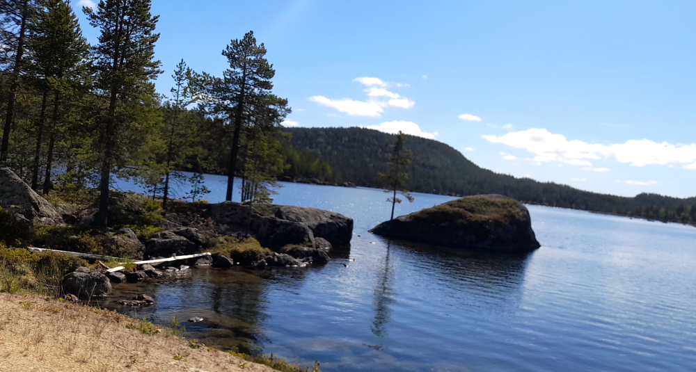
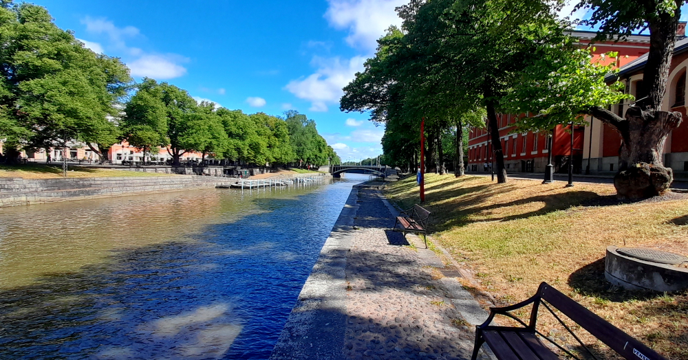
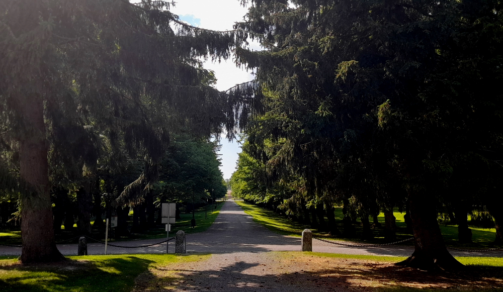
At 1:55 pm today we need to collect Alan from Central train station so this morning we’ll go for a walk and investigate some of the sites across the river from our hotel.

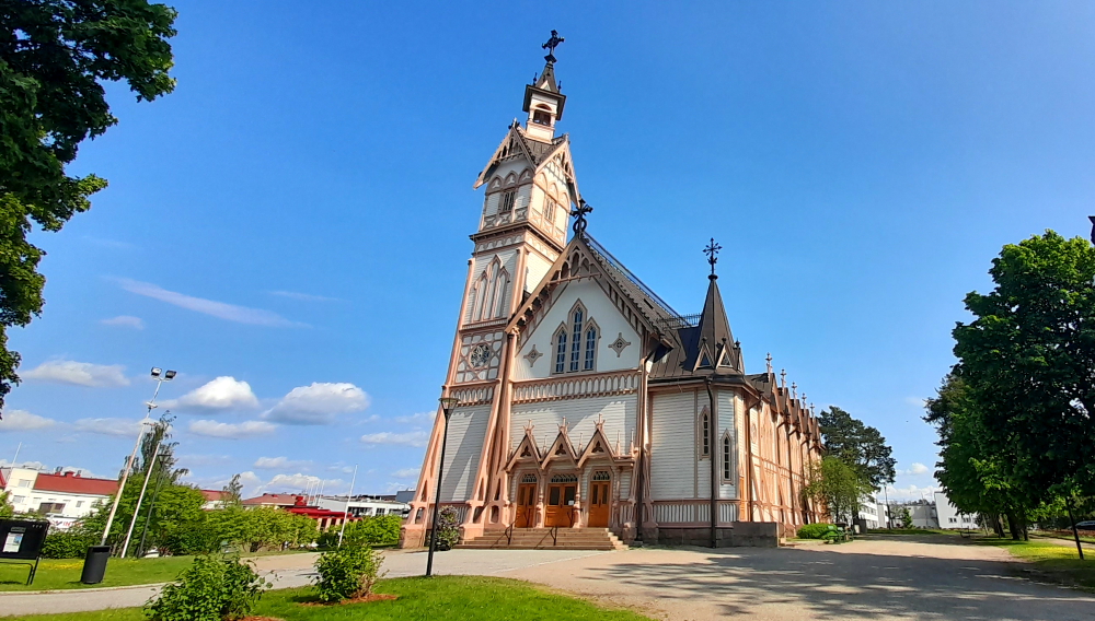
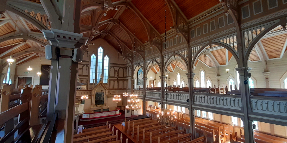
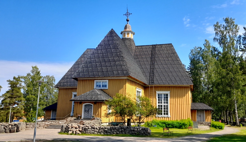
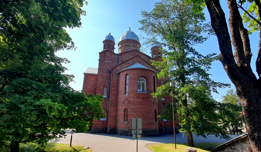
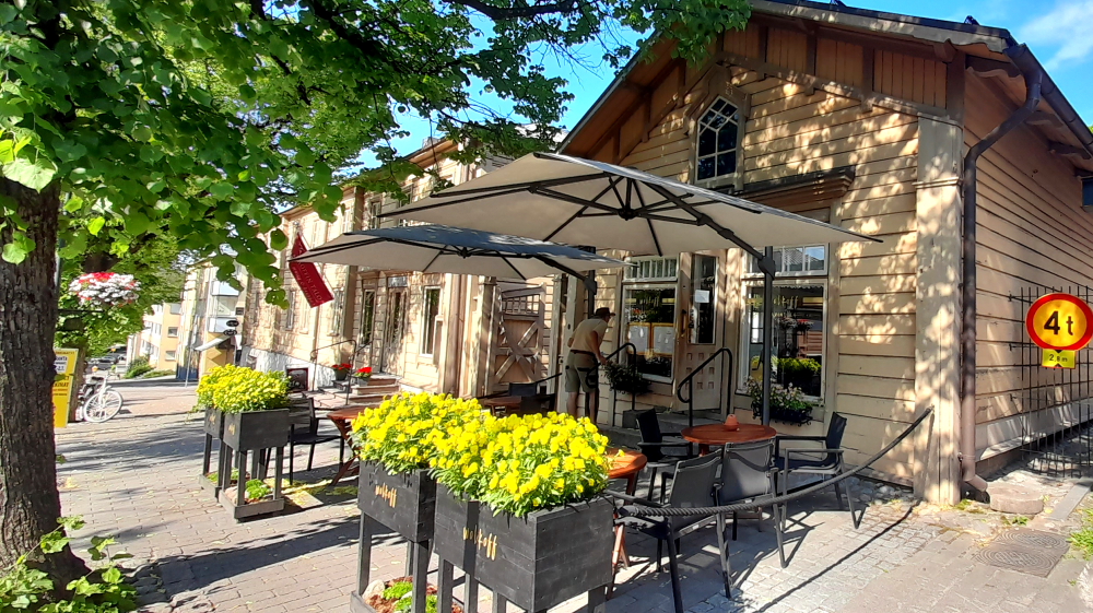
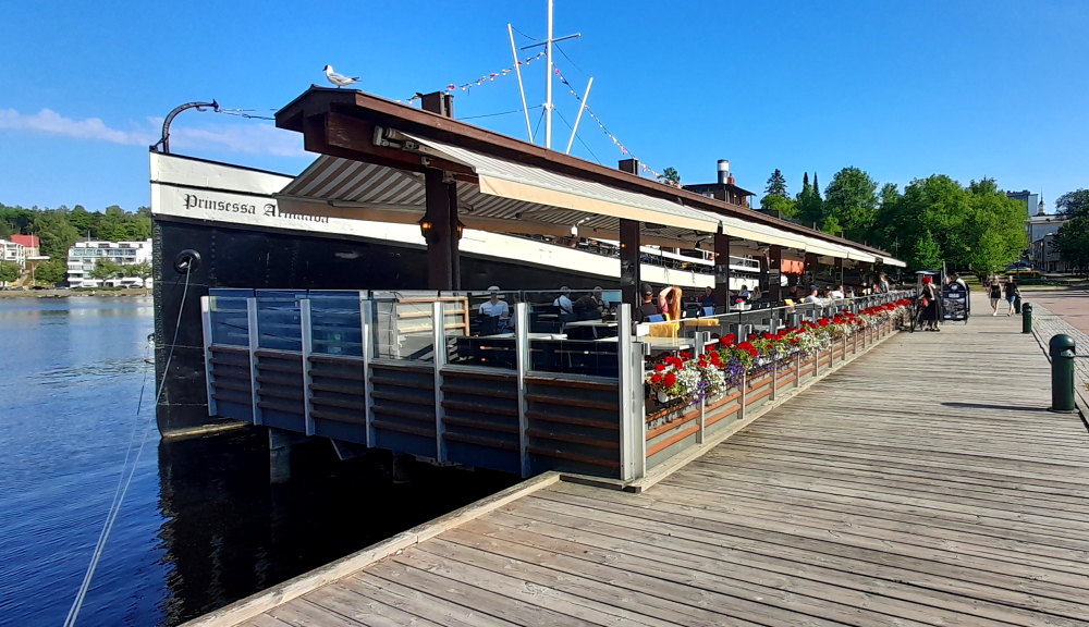
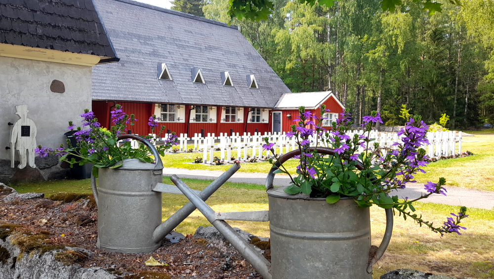
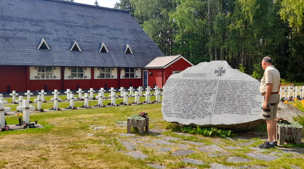
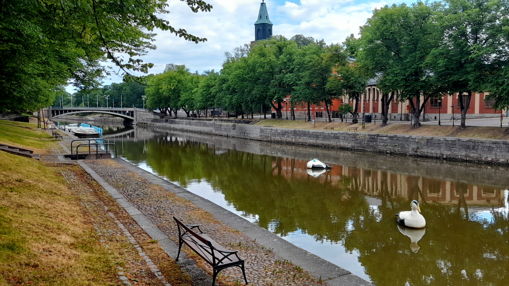
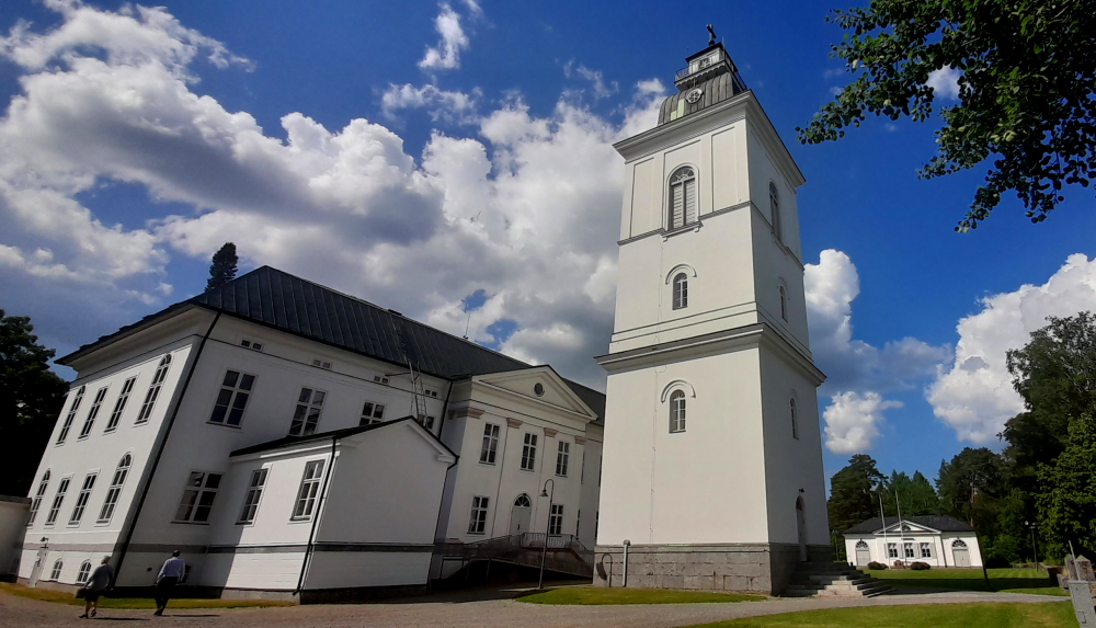
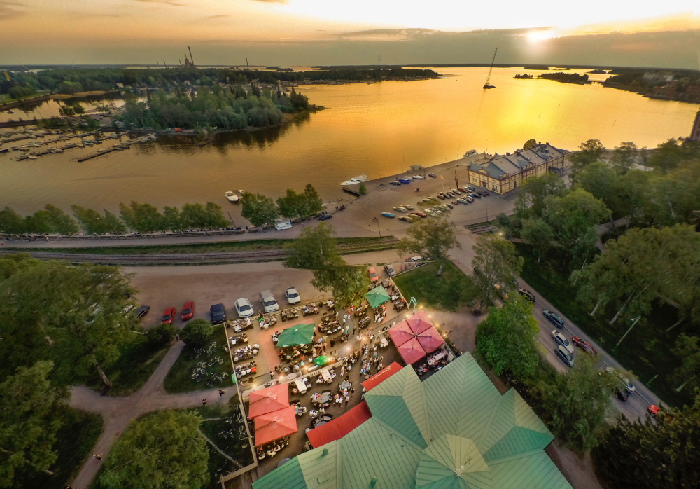
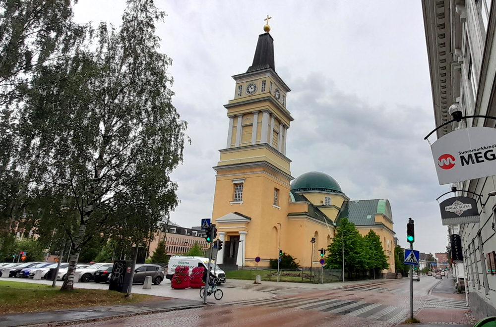
Immediately across the bridge is Turku Cathedral and its park. Today there is seating and food and drink marquees set up in front for midsummer celebrations.

Aura River that runs through Turku.

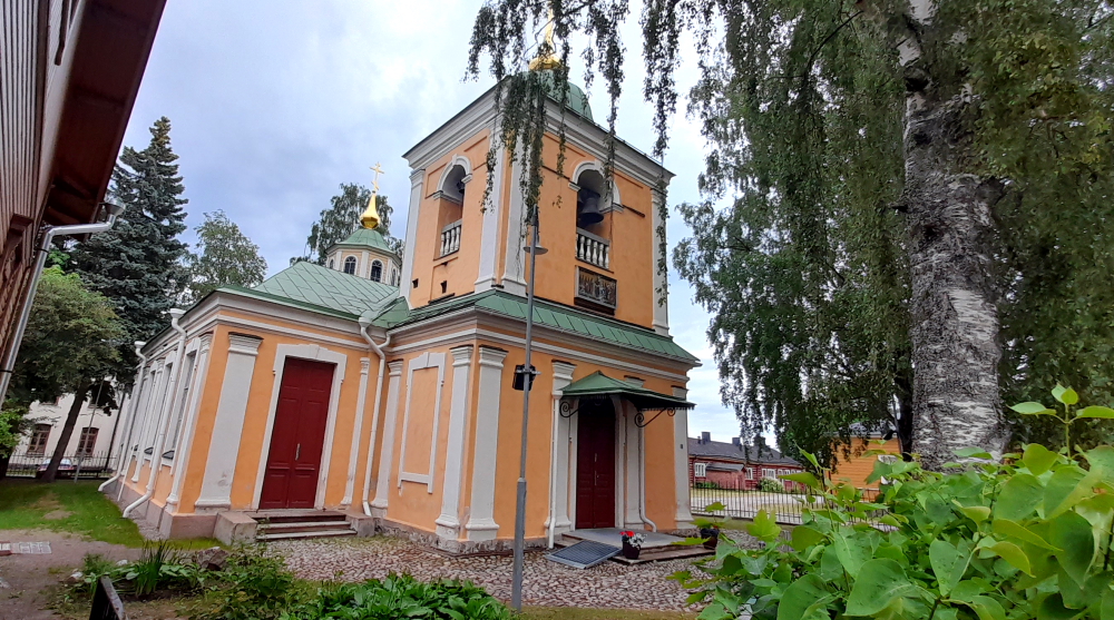
A small parish church was built on the hill of Unikankare in Turku, and consecrated as the church of St. Mary around the middle of the 13th century. The church, originally made of wood, and later rebuilt with stone, was consecrated as the Cathedral in 1300.  At the same time,  the Cathedral was dedicated to the patronage of St. Henry, the first bishop in Finland. 

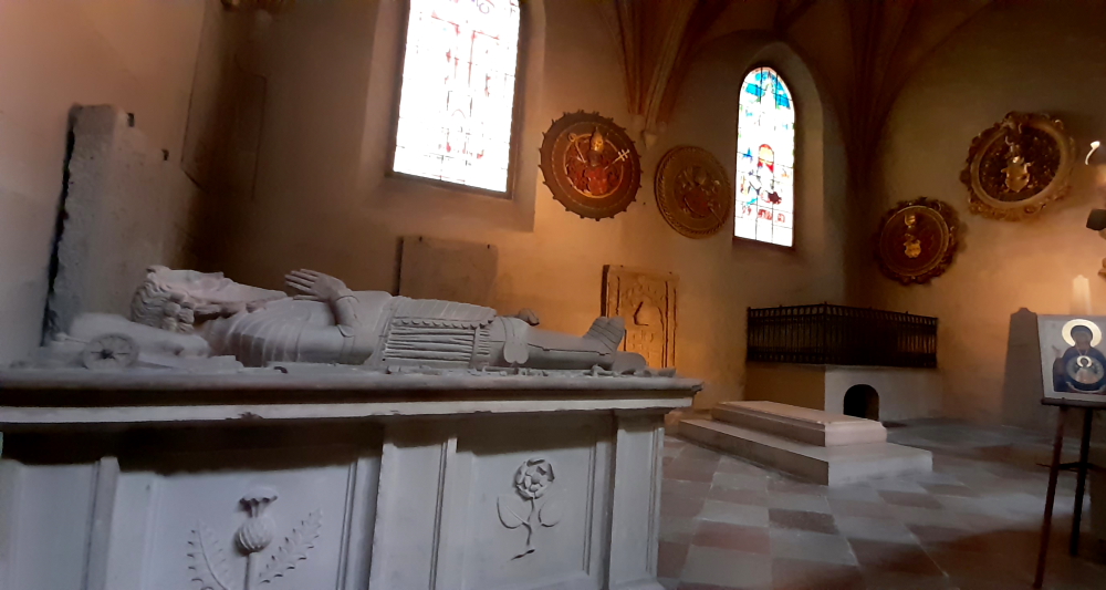
The monuments and details of the Cathedral record the history of the Finnish people over seven centuries. Bishops, military commanders, and a queen, among others, have found their last resting places in the Cathedral. The most famous tomb is the sarcophagus of Queen Karin Mansdotter, the wife of King Erik XIV, who spent her later years in Finland, and was buried in the Cathedral in 1613.

Turku Cathedral.

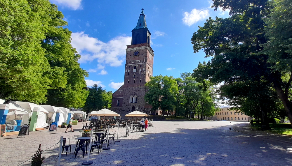
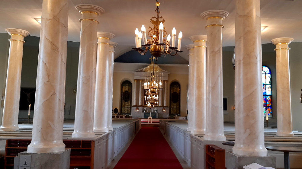
By the end of the Middle Ages the church had approximately taken on its present shape. The major later addition to the Cathedral is the tower, which has been rebuilt many times, as a result of repeated fires. The worst damage was caused by the Great Fire of Turku in 1827, when most of the town was destroyed, along with both the tower and the interior of the Cathedral. The present tower reaches a height of 101 metres above sea level, and is visible over a considerable distance. Most of the present interior also dates from the restoration carried out in the 1830s, following the Great Fire.

Dead people….Tavast Family burial chapel.

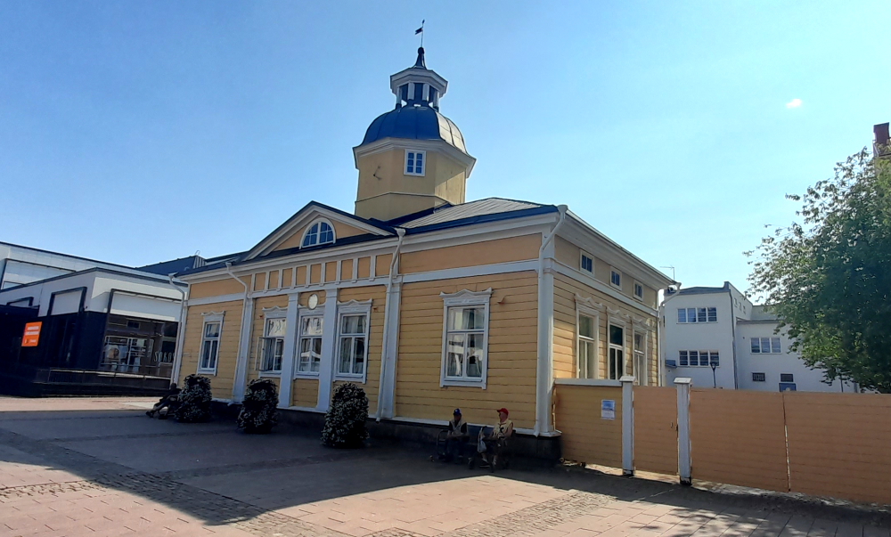
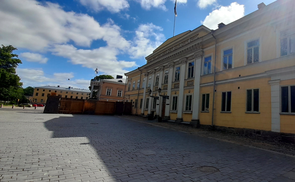
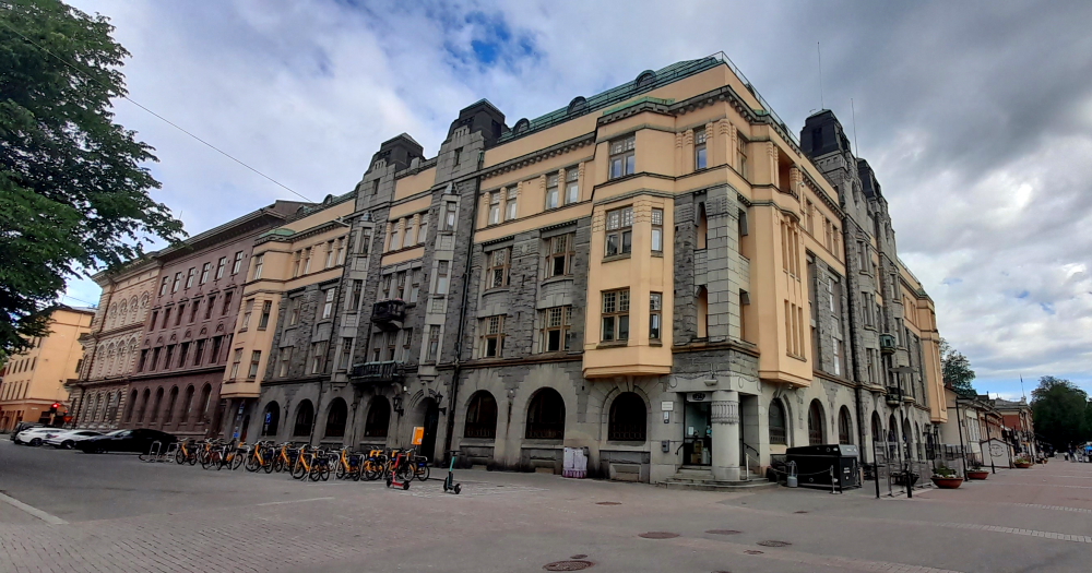
Across the road and through a park is the Old Great Square – the heart of Turku’s historic centre of the oldest city in Finland. The Square hosts Christmas markets and a medieval market in summer. It is surrounded by buildings of historic interest such as the Brinkkala Mansion and the Old Town Hall.

Brinkkala Mansion.

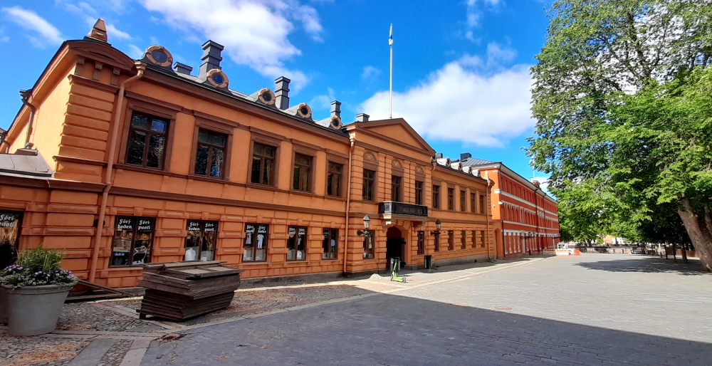
The earliest records of the Brinkkala Mansion date back to the 16th century. During its history the mansion has functioned as the town house of the owners of Brinkhall Manor, as a hotel and as the home of a Russian Governor General.

Government offices next to the Old Town Hall.

After the fire of 1827 in Turku, the Brinkkala Mansion was renovated as the new town hall. It is best known as the place where Christmas Peace has been declared every Christmas Eve at noon since 1886.

Further down the Aurajoki River.

A block back from the river and in Vartiovuorenpuisto (Guard Mountain Park) is the Vartiovuori Astronomical Observatory. A former observatory designed by Carl Ludvig Engel, was originally built for the Royal Academy of Turku, the Grand Duchy of Finland’s only university at that time. The neoclassical building was completed in 1819. The beginning of research at the observatory was delayed for a further five years, since the telescope ordered from Germany arrived only in 1824.

The observatory.

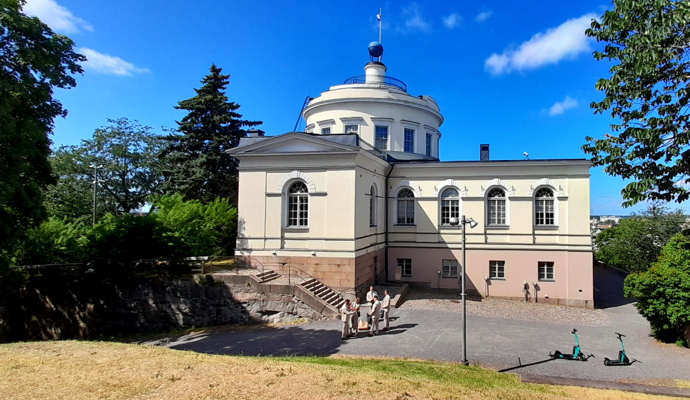
Most of the city was destroyed in the Great Fire of Turku, but the Vartiovuori observatory survived. After the fire the Royal Academy was transferred to Helsinki, the new capital of the grand duchy. The observatory became defunct in 1836 since the researchers and the equipment were transferred to Helsinki. Today the building is owned by the Åbo Akademi University Foundation and houses the foundation’s offices.

View of Turku from the Observatory.

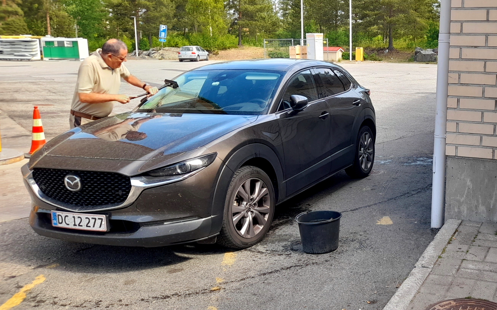
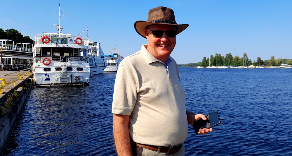
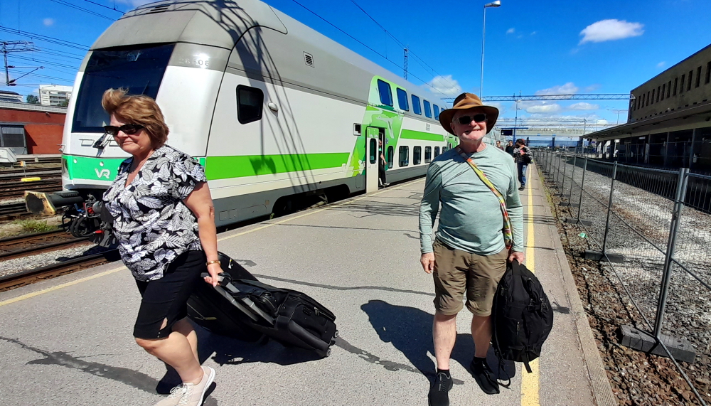
We leave the hotel at 1:40 pm for the 4-minute drive to Turku Central Station only to arrive 3 minutes before the train does due to road works, closed roads, detours and one-way streets!

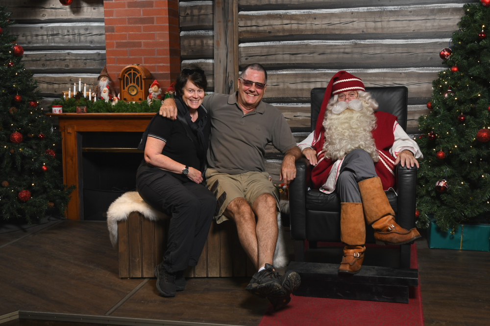
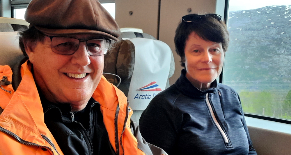
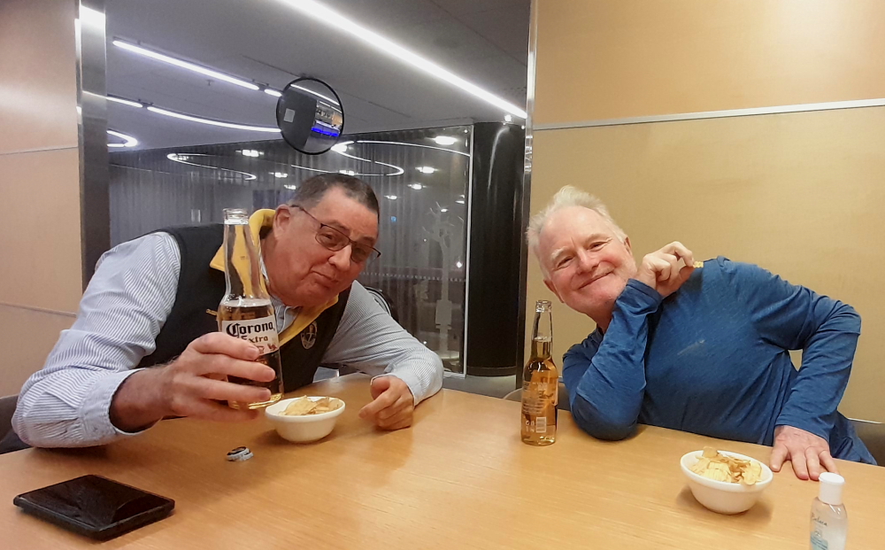
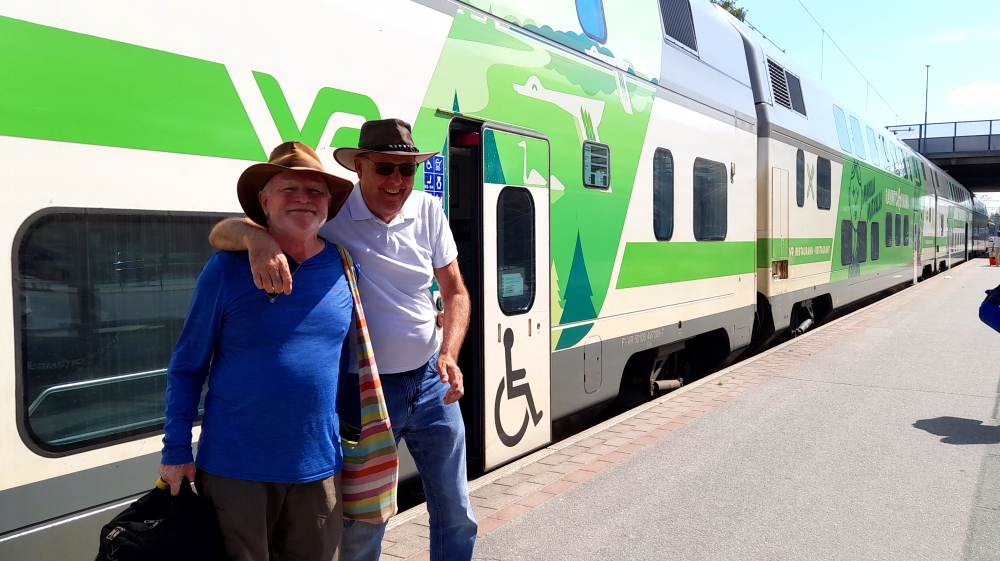
Right on time the train arrives from Helsinki, via Toijala, at Platform 7 and at the end of the exodus the happy, smiling Alan (our leprechaun from Melbourne) emerges.

Meeting Alan at the train from Helsinki.

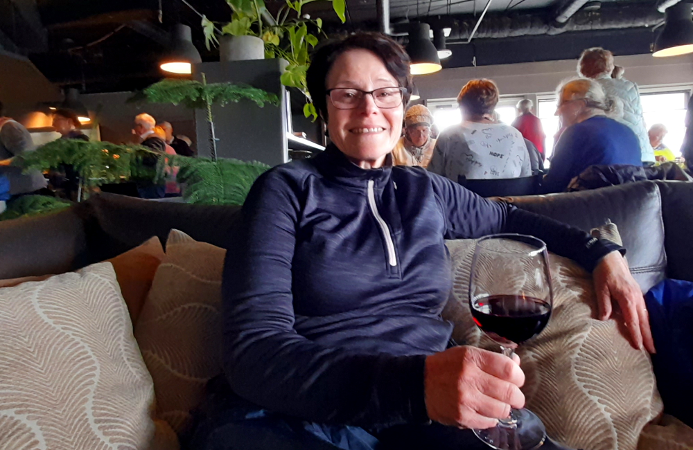
Once he is settled into our hotel, we head downstairs to the lounge for a couple of bevvies and a catch up. It’s been 2 years since we last saw Alan and his wife, Lyndal, when they stopped in Brisbane for a couple of days on their way to FNQ (Far North Queensland).

A welcome beer.

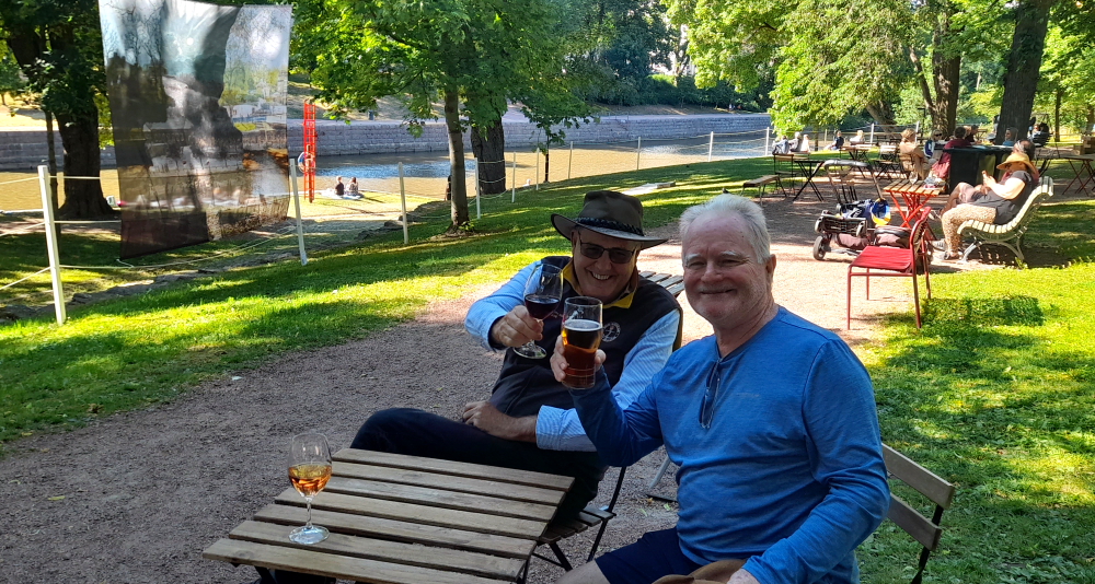
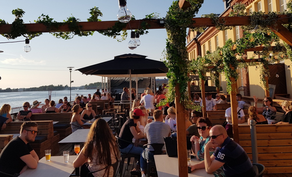
Before dinner we decide to cross over the bridge again towards the Cathedral and sit in the riverside park to celebrate midsummer with the locals with two wines and a beer to the accompaniment of some very nice music.

A drink in the park for Midsummer celebrations.

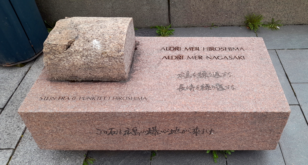
In a televised address today Putin denounces Prigozhin’s rebellion as “treason” and that he and his troops will be wiped out. But later this evening we learn that Prigozhin has turned his troops around, that he and his troops will be relocated to Belarus and everyone pardoned. Damn! The opportunity for civil unrest and the toppling of the current regime that should have happened is lost before it barely started. But, the President has said in the past that the only thing that he can’t forgive is betrayal. To boot, a photo of him is circulating on WhatsApp with the caption: “Pity that Prigozhin committed suicide next week.” Dead man walking.

25 June, 2023

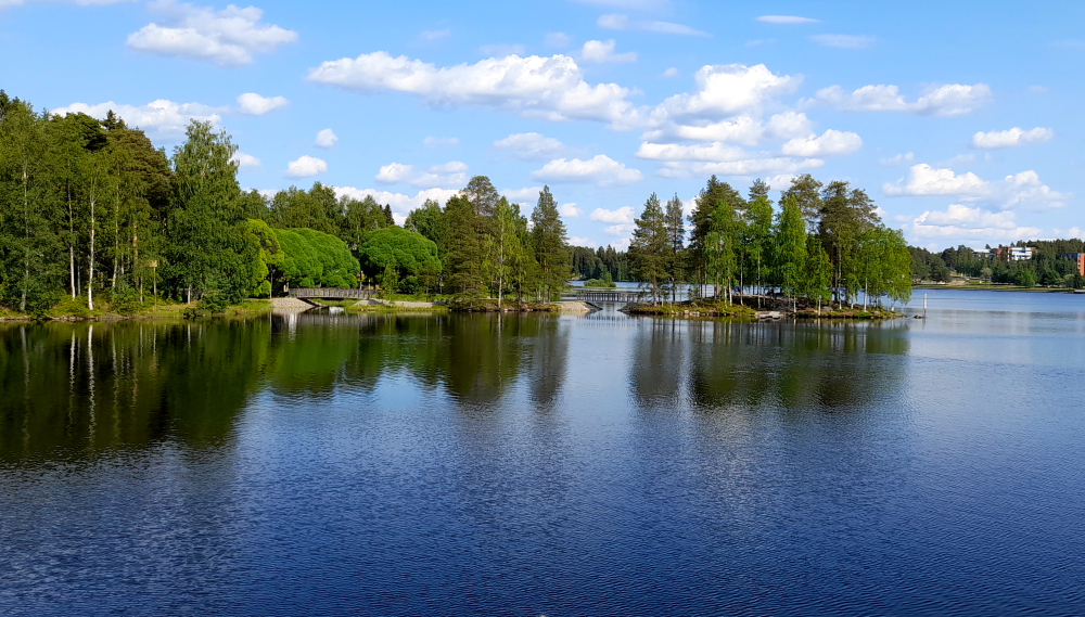
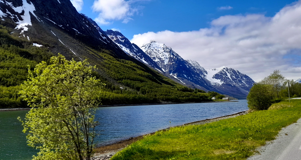
After breakfast today the plan is to walk down this side of the river to the Turku Castle then back the other side. After a warm day yesterday (27 Deg C) it is a cooler 20 Deg C today. Just perfect for our planned 10 km walk on either side of the river.

The Turku Library.

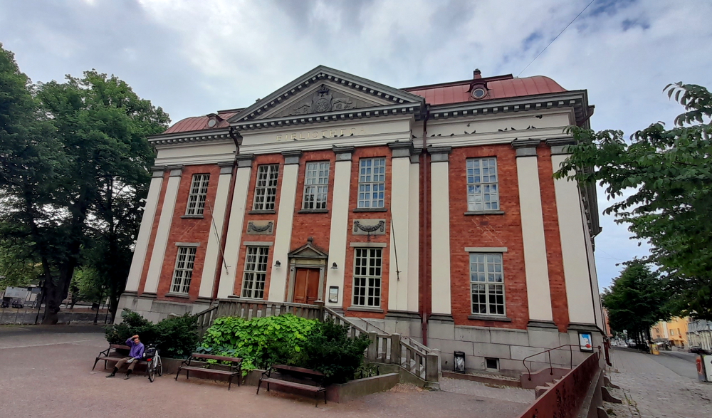
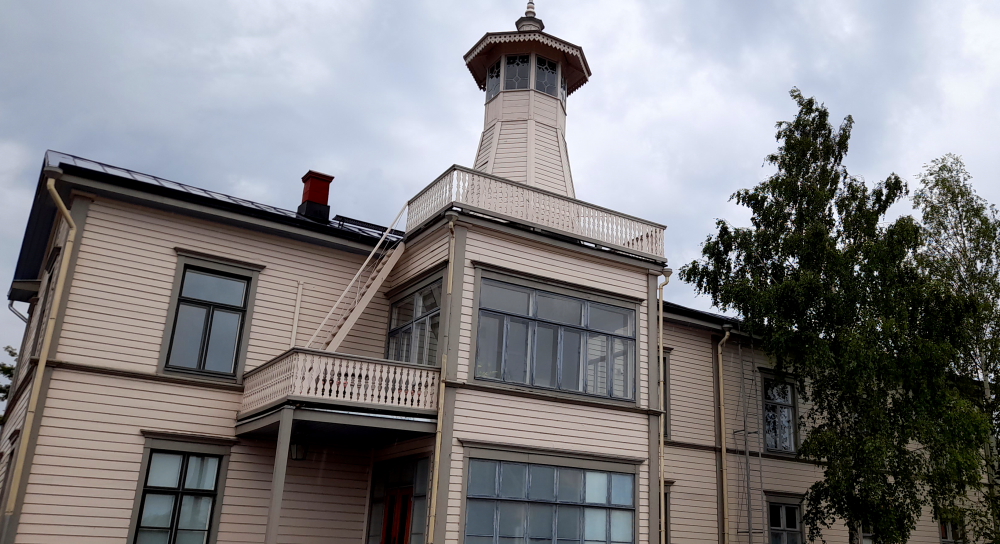
From our hotel room we can see a very impressive building with a red metallic roof. It turns out to be the Bibliotheca.

Plastic giant ducks on the river.

Nearby, on the river bank, is an unusual tableau statue.” Meeting in Turku 1812″ is a bronze sculpture by the Russian sculptor Andrei Kovaltšuk. It depicts the meeting between the Russian Emperor Alexander I and the Swedish Crown Prince Kaarle Juhana in Turku in 1812 . It was a work commissioned by the Russian consulate with the co-operation of the city of Turku and unveiled in 2012 in connection with a seminar organized in honor of the 200th anniversary of the incident.

It wasn’t until we returned to the hotel to write the blog that we discover that the statue caused controversy in 2012 and again in 2022.

In the work, Alexander I sits on a chair and offers Kaarle Juhana a seat next to him on a chair that already has the crown prince’s headdress. The public can take part in the historic moment by sitting for a while on Kaarle’s chair (which is what Alan did). Kaarle Juhana (Bernadotte) still wore Napoleon’s marshal’s uniform, even though he no longer served in the French army at that time. The crown prince was originally named Jean-Baptiste Jules Bernadotte, and from 1818 onwards he was King of Sweden under the name Karle XIV Juhana.

According to the city of Turku, the figure of Kaarle Juhana was added to the sculpture only after requested by the city. Originally, the Russian donor hoped that it would only have Aleksanteri. The statue project was presented to the city of Turku by the Russian Consul General Aleksandr Svertshkov with the help of Aleksandr Belov. Belov was the secretary of the Finland group of the Russian Duma; at one time in the Finland-Neuvostoliitto (Soviet Union) society and as a military interpreter, which possibly meant that he was trusted by the Soviet intelligence service. Some say that Belov was the real mastermind behind project as he had previously organized a statue of Empress Maria in Mariehamn. It was also sculpted by Kovalchuk, regarded as Vladimir Putin’s favorite artist.

“Good to meet you, Sir Alan of Melbourne”.

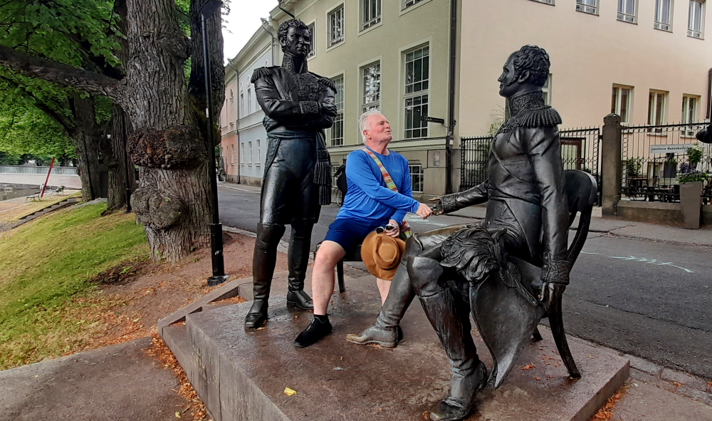
The statue is not representative of the actual event because the emperor’s chest has badges of honor that he received only after 1812, and the heir to the Swedish crown, Kaarle Juhana, is wearing Napoleon’s army uniform. So the sculpture sparked a heated debate not only regarding the associations related to the meeting, but also regarding the appearance and location of the statue.

It was proposed to remove the sculpture in the spring of 2022 after Russia invaded Ukraine and again in October 2022.

Building more like those in Helsinki.

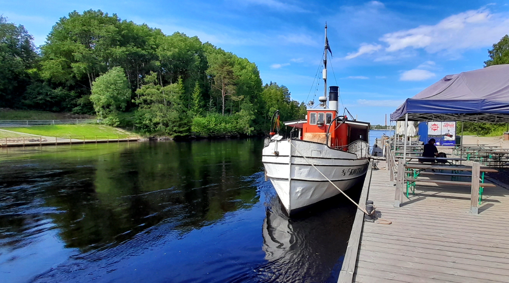
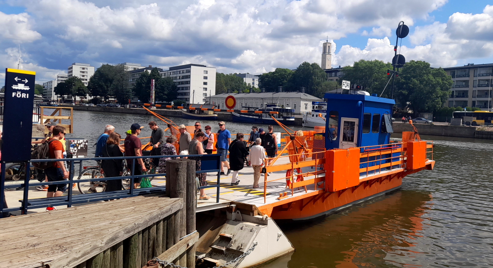
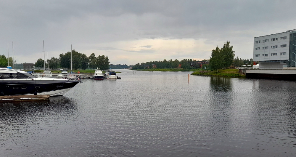
Further down the river is the Fori, the foot passenger ferry, which takes about 2 minutes for the river crossing from the east to west bank.

The ferry was completed in 1903 and put into service in 1904. It is the oldest vehicle used in everyday commercial traffic in Finland and can accommodate a maximum of 75 passengers at a time.

The Ferry or “Fori”.

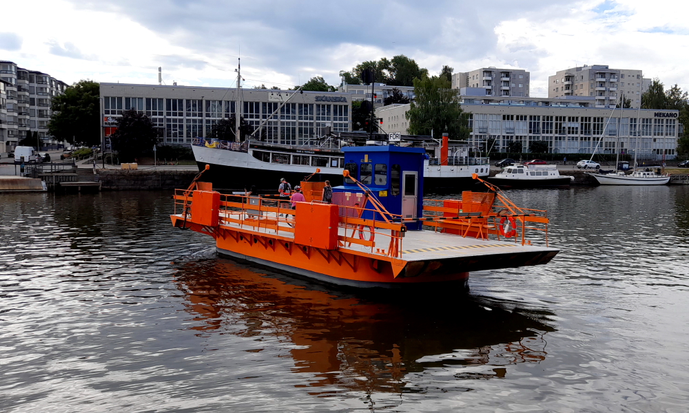
The chain-driven Föri works with electric motors powered by batteries charged overnight. Originally it had a steam engine that was dieselised in 1953 then replaced with electric motors in 2017.

Coffee stop along the way at Nooa Cafe.

Nearby is a fountain sculpture entitled “Harmony” by Achim Kühn, a German sculptor and blacksmith.

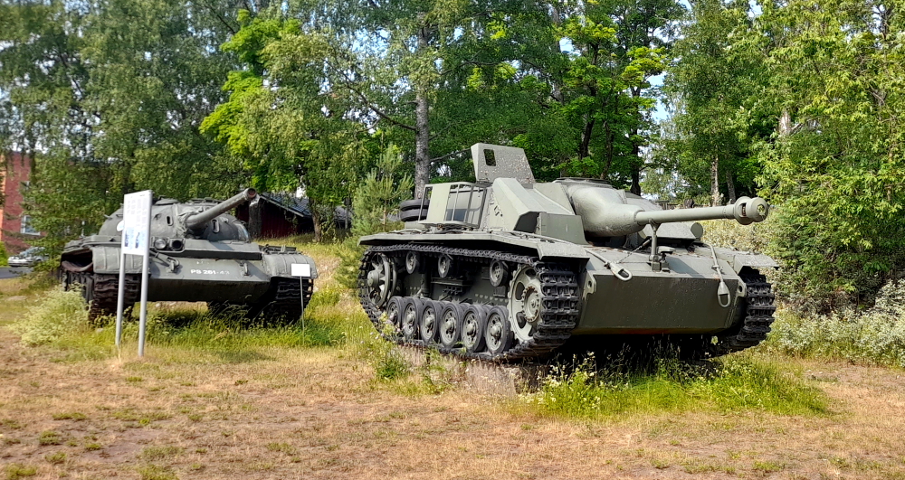
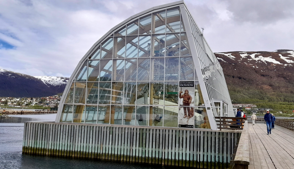
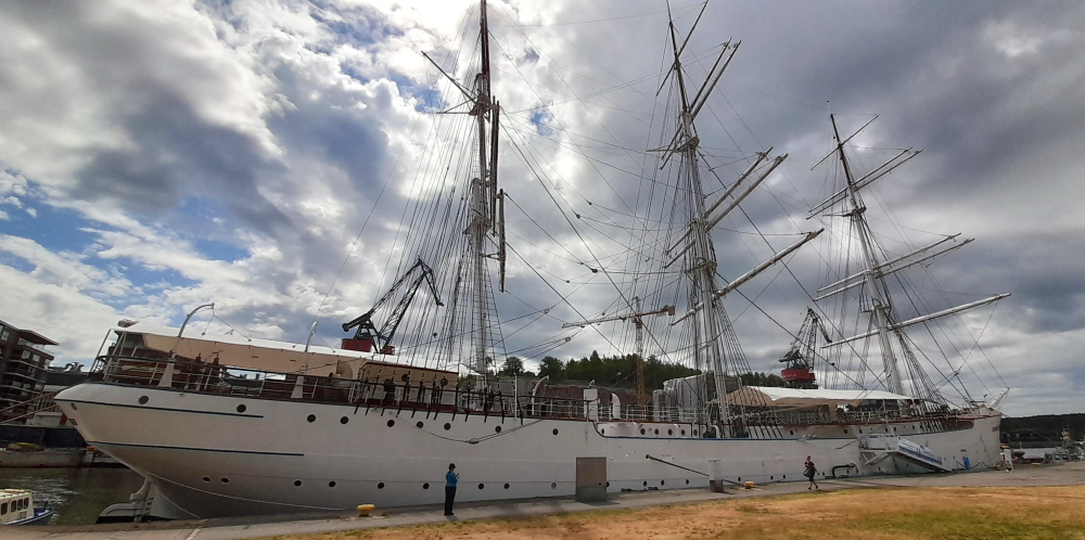
Towards the mouth of the river is the Forum Marinum, a maritime museum founded in 1999 by merging the Turku maritime museum established in 1977 with the Åbo Akademi University museum of maritime history established in 1936. It has 13 ships/boats in its collection, 2 of which are the “Sigyn” and the “Suomen Joutsen”.

Having a whale of a time.

Sigyn, a wooden merchant ship, was built in Gothenburg 1887, even at a time steam ships were taking over the most important routes, Sigyn was planned for another niche: the small size and small draught made her suited to use small remote harbours.

The first decade Sigyn sailed the Atlantic on tramp trade, mostly with wood (pine, spruce, pitch pine, mahogany, cedar) and also coal. In 1897 she made one journey to Bangkok. After 1900 she sailed mostly in European waters.

After being severely damaged while seeking shelter outside Kristiansand in 1913, Sigyn was rerigged as a barquentine. She was already old for being a softwood ship and the freight prices on ocean trade were declining, so a cheaper rig suited for coastal trade on the Baltic and North Sea seemed appropriate. This changed with the World War: transatlantic trade became very profitable and she crossed the Atlantic 12 times in 1915 and 1916.

After Sigyn ran aground in 1917 the copper hooding protecting against shipworm was removed and sold. Sigyn was no longer fit for the oceans and was bought by a Swedish sawmill. In 1927 Sigyn was sold to Finland to Arthur Lundqvist from Vårdö in the Åland islands, one of the last big peasant shipowners.

In 1936 Åbo Akademi proposed the foundation of a maritime museum in Turku. A museum ship was needed and Sigyn was soon considered the best alternative. At that time there were only a few museum ships worldwide and Sigyn was to be the first in Finland. She was bought in 1939 and first opened to the public in June of that year.

The Barque “Sigyn”.

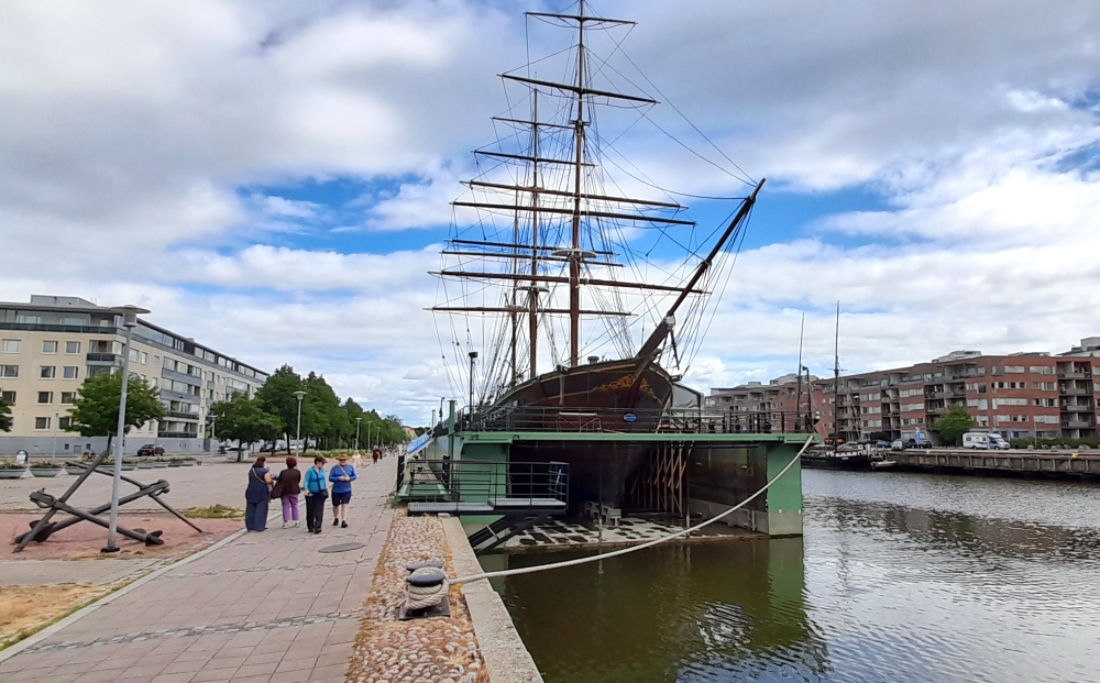
Suomen Joutsen is a steel-hulled full-rigged ship with three square rigged masts. Built in 1902 by Chantiers de Penhoët in St. Nazaire, France, as Laënnec, the ship served two French owners before she was sold to German interest in 1922 and renamed Oldenburg. In 1930, she was acquired by the Government of Finland, refitted to serve as a school ship for the Finnish Navy and given her current name. Suomen Joutsen made eight long international voyages before the Second World War and later served in various support and supply roles during the war. From 1961 on she served as a stationary seamen’s school for the Finnish Merchant Navy. In 1991, Suomen Joutsen was donated to the city of Turku and became a museum ship moored next to Forum Marinum.

“Suomen Joutsen”.

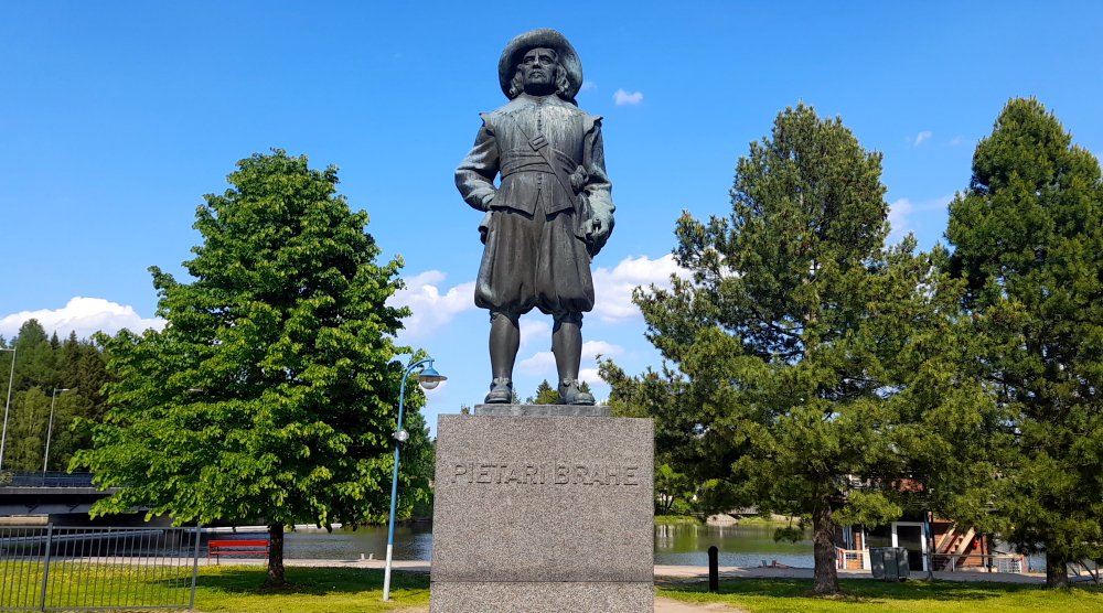
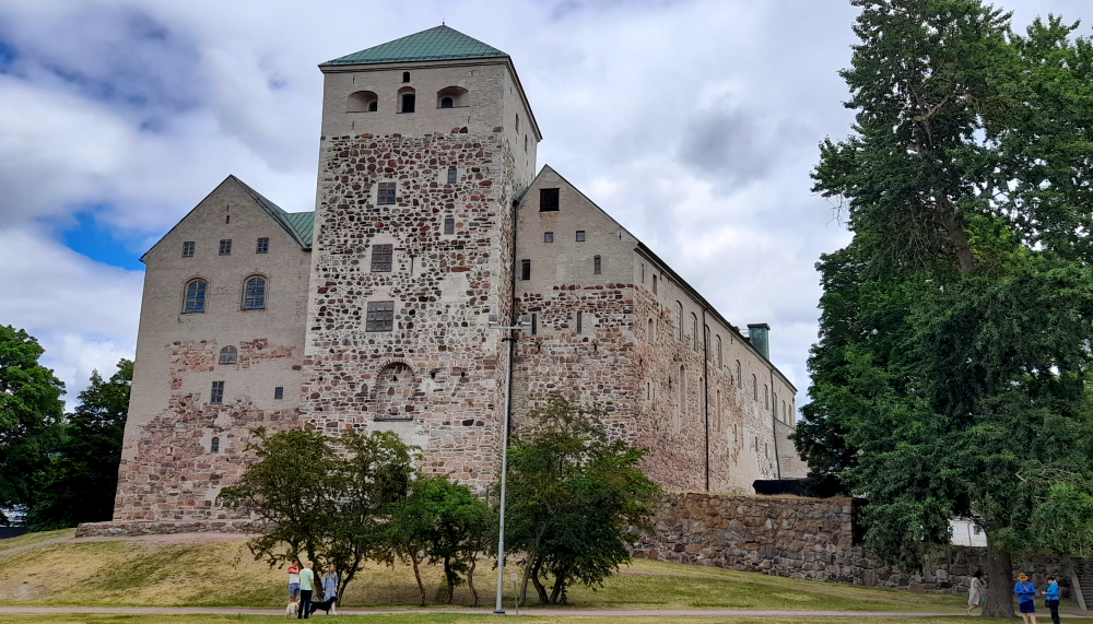
At the river mouth is Turku Castle. Together with Turku Cathedral, the castle is one of the oldest buildings still in use and the largest surviving medieval building in Finland. It was founded in 1280 and served as a bastion and administrative centre in Eastland, as Finland was known during its time as a province of Sweden. Only once did the castle figure in the defense of the realm, when Russian invaders from Novgorod destroyed Turku in 1318. It more frequently played a role in internal struggles for power within Sweden and the Kalmar Union.

Turku Castle.

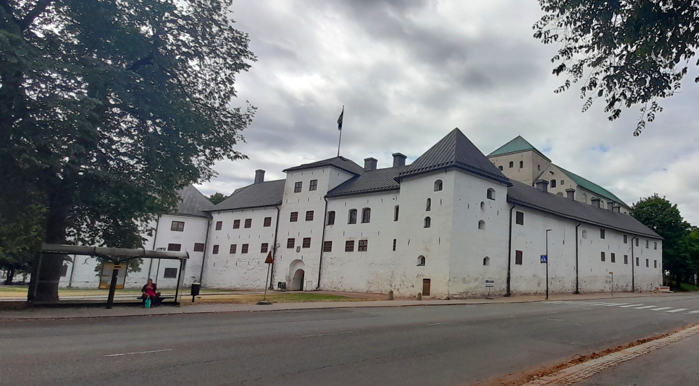
The castle’s heyday was in the mid-16th century during the reign of Duke John of Finland and Catherine Jagellon. That was when the Renaissance Floor and King’s and Queen’s hall were built. It lost its status as an administrative centre in the 17th century after Per Brahe’s period as governor-general of Finland came to an end. Turku castle is today Finland’s most visited museum, with attendance reaching 200,000 in some years. Today it is closed for midsummer.

The rear of Turku Castle.

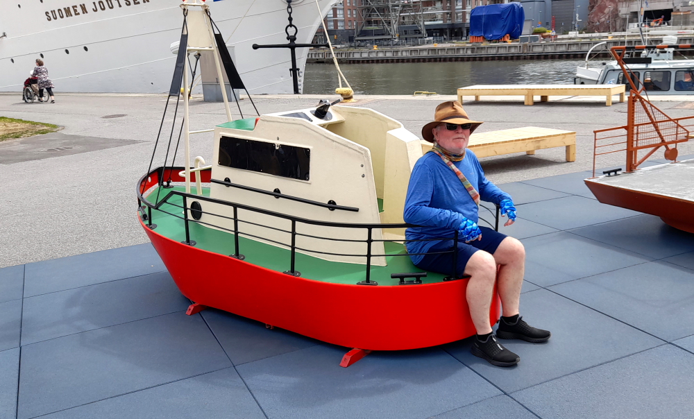
We retrace our steps and walk back through the dock area of the maritime museum. Did we mention that Alan is a leprechaun??

More Alan’s size of ship.

This time we jump on the Fori for a trip to the eastern bank.

Crossing over the river.

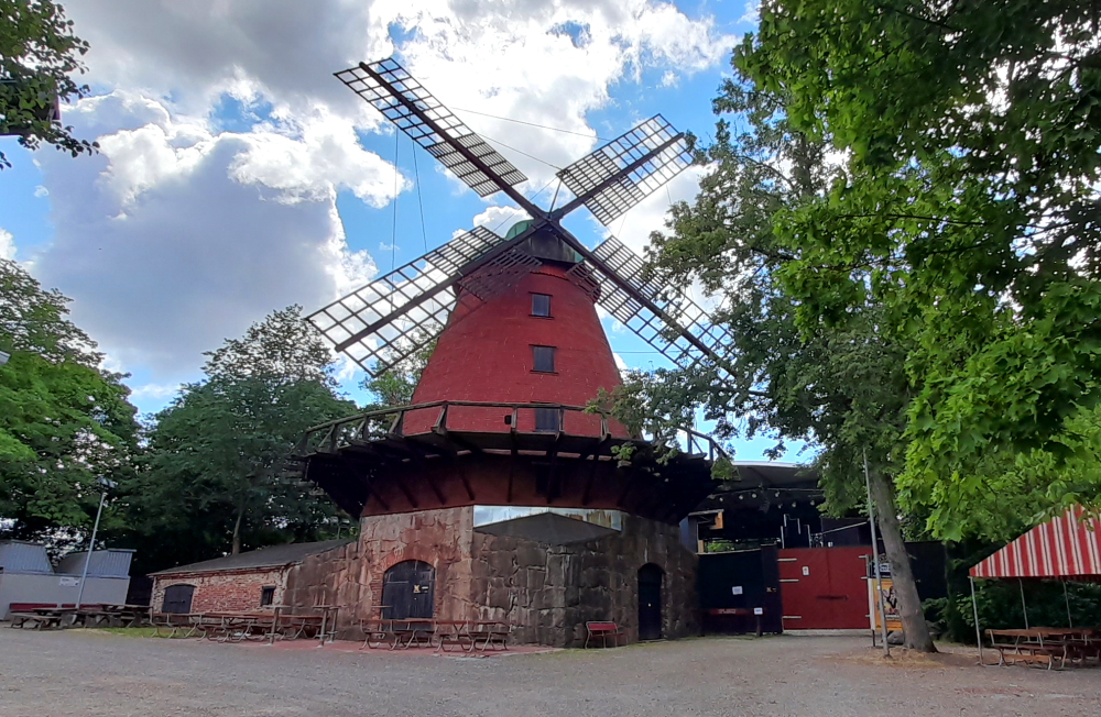
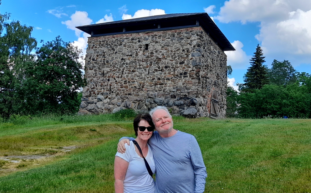
And walk a couple of blocks to Samppalinnan tuulimylly (Samppalinna Windmill). The mill was built in 1859-1860 by sailor Juho Antinpoika. It stopped operating after changes of ownership at the beginning of the 20th century and it became an observation tower. Over the years, the very large mill has become familiar to many townspeople, probably due to the popular summer theatre “Samppalinna summer theatre” next to the mill.

The windmill.

26 June, 2023

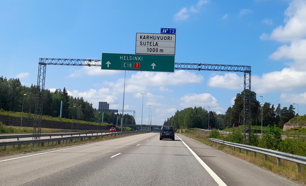
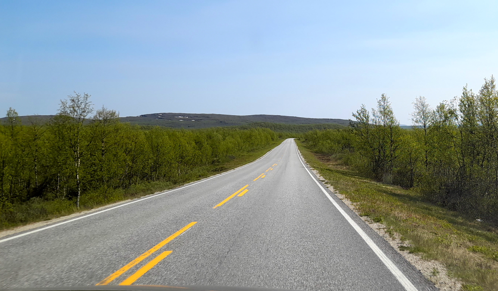
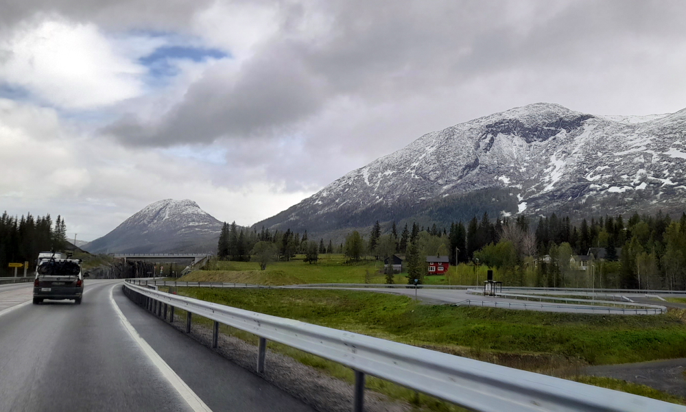
As we have 3 sites to visit en route to our next destination, Vaasa, the 3 of us depart the hotel at 10:40 am and hit the E8 highway. It should take us around 4.5 hours to cover the 350-odd km.

Forests give way to farmland.

Today, the 3 stops along the way are the meteor crater near Sundom (Meteoria Soderfjarden); the Mustasaaren Kirkko and the old Vaasa ruins – the last 2 of these are about 8 kms SE of Vaasa.

The Finland Tractor Factor.

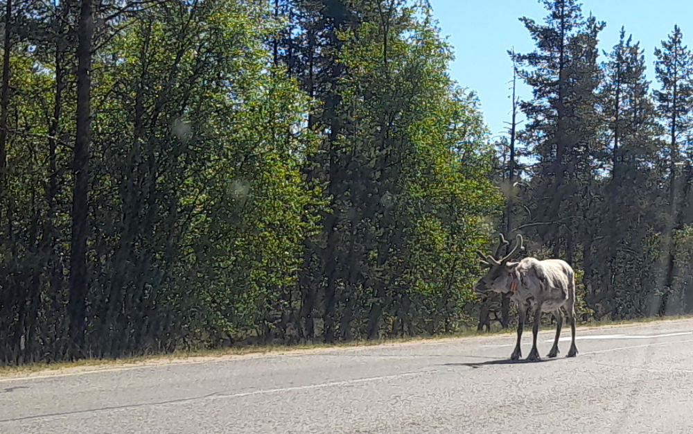
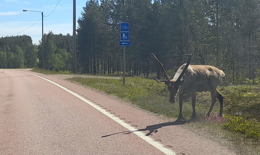
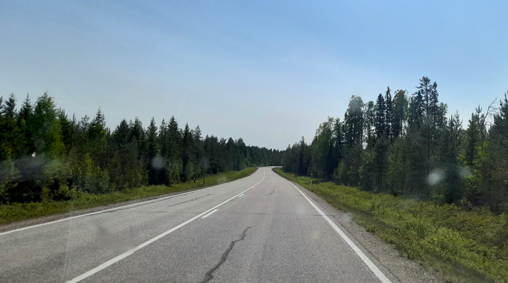
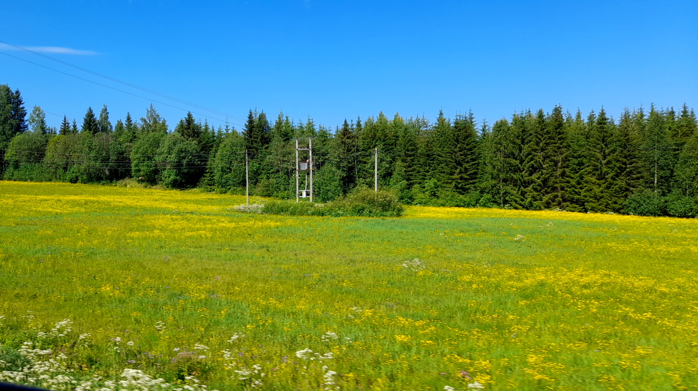
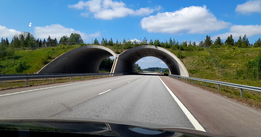
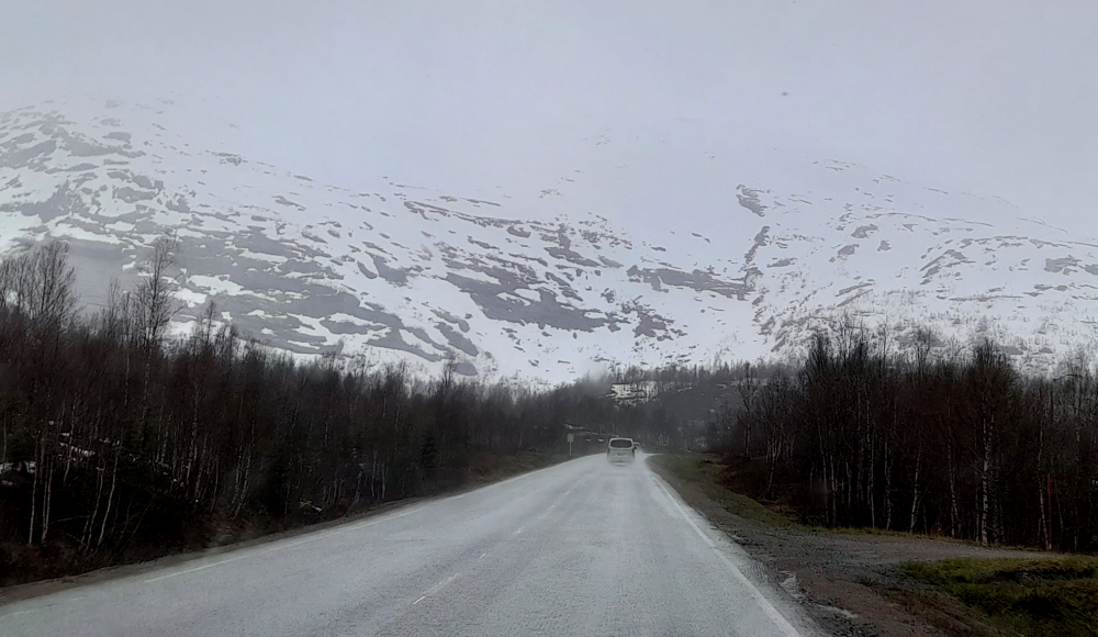
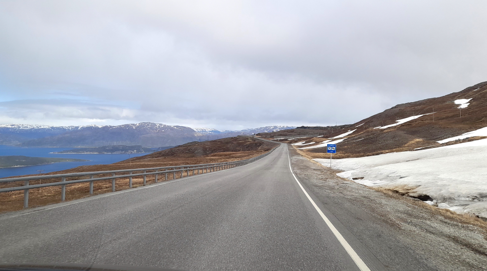
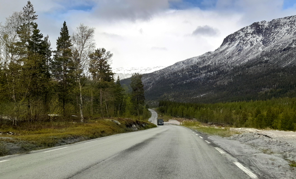
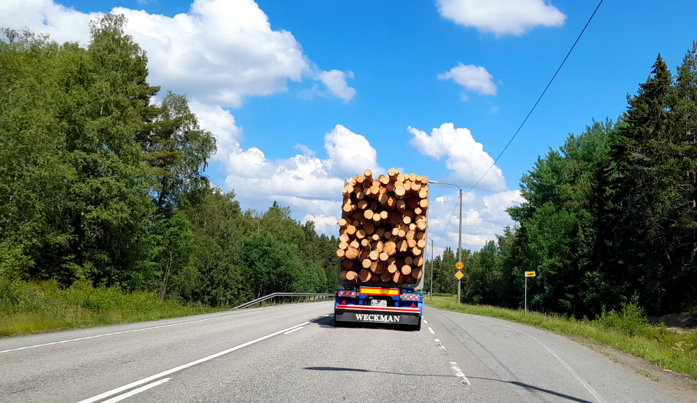
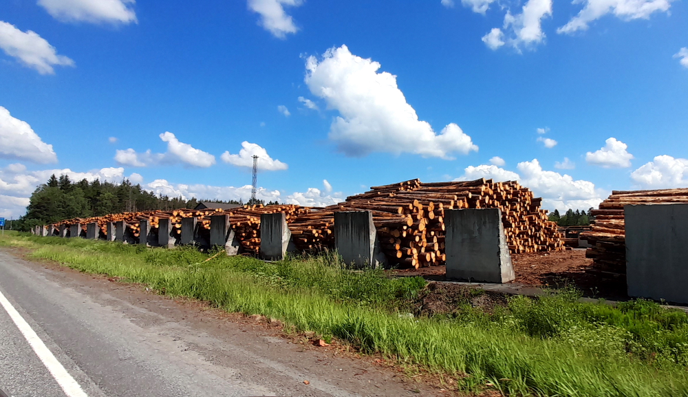
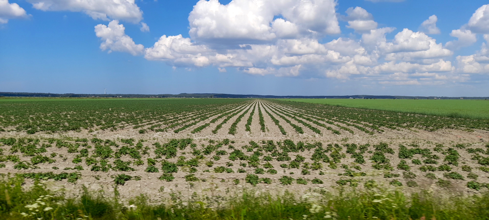
The E8 is a nice, wide highway with the usual 100 kph limit. There are some industrial areas, extensive farmland on both sides of the road including commercial glasshouses (frames covered in white plastic, that is) and greater logging activities.

Logging is a major industry.
Timber is mostly burnt for heating.

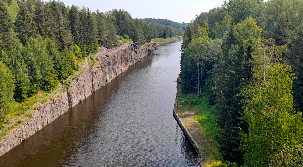
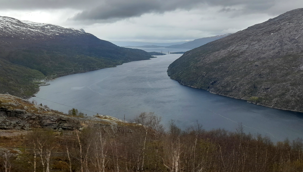
We are all looking forward to seeing the meteorite impact crater which was formed some 520 million years ago. Certainly on the MapsMe App there is quite a large disk area shown which is about 5.5 km across, in the middle of which is the Visitor Centre. However, on approach, all we can see is extensive farmland and perhaps a slightly-elevated edge covered in pines on the periphery. Unlike the rest of Finland there are no forests growing inside this area. Plus there is about a 2.5 km gravel road to get to the Information Centre, so we continue on to the church.

A crater??

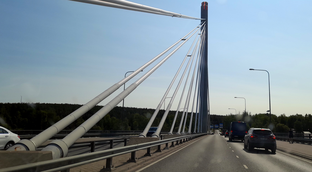
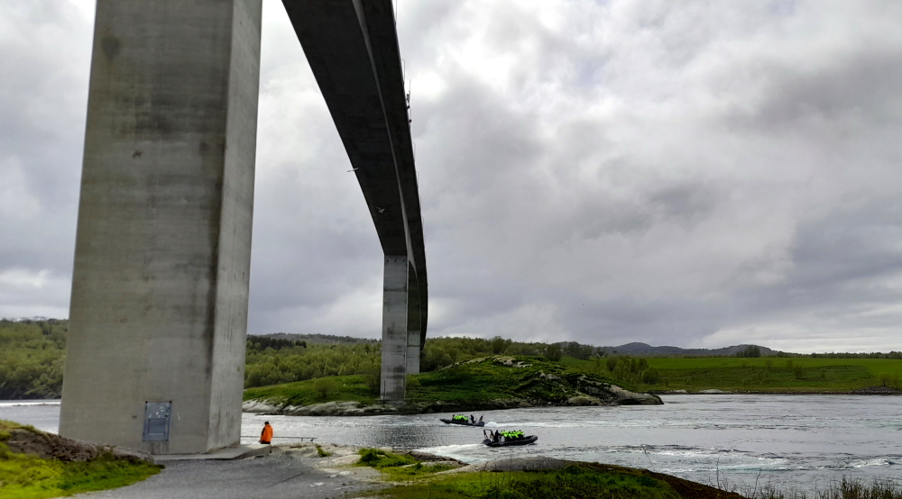
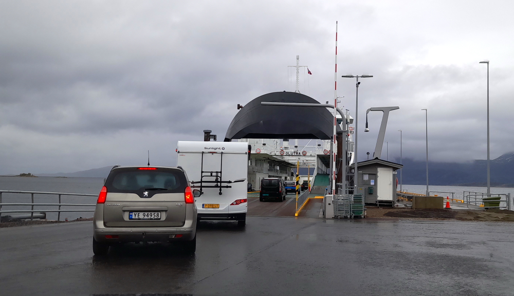
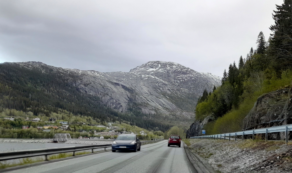
The road takes us around the western edge of the “crater”, over 2 bridges that connect the island of Vaskiluoto to the mainland and through the town of Vassa.

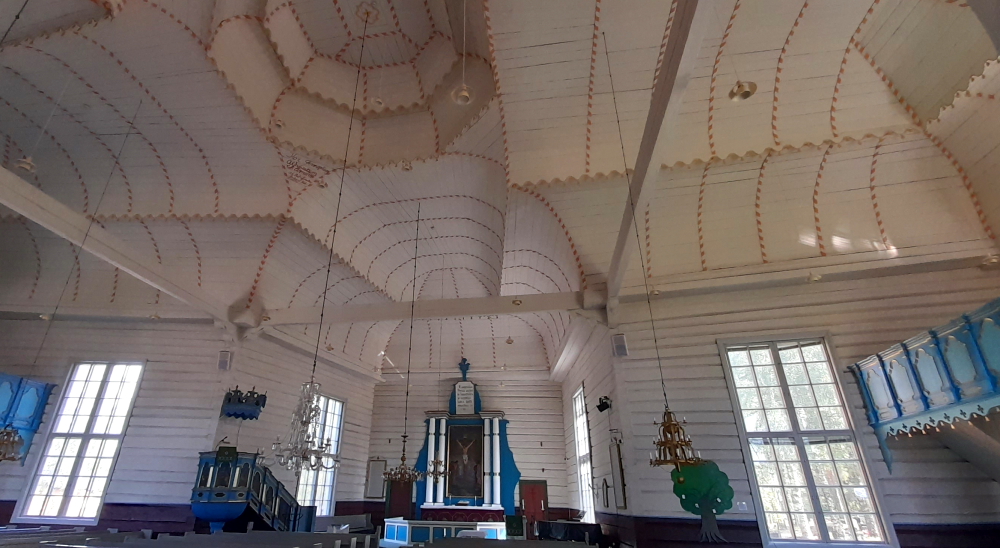
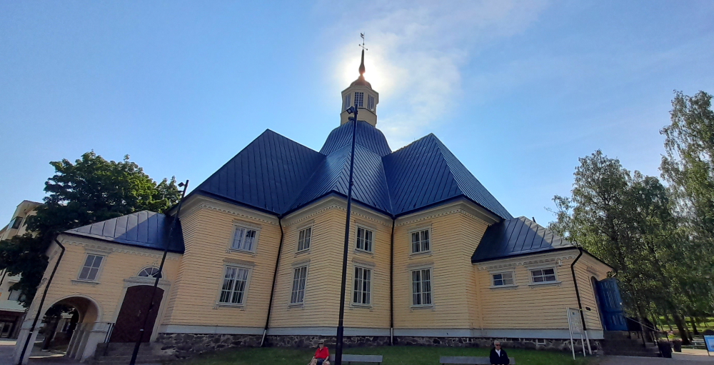
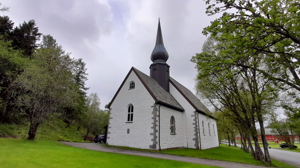
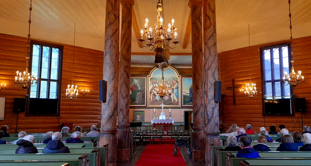
Lynn chose to visit this church as it is unlike any she has seen in Finland, or Scandinavia, so far. We discover the reason is because the building didn’t start out as a church, but rather as the Vaasa Court of Appeal when the town of Vaasa was located here pre-1852.

Designs for the building were commissioned from the royal architect Carl Fredrik Adelcrantz. The designs were approved by King Gustav III after he had presented his own demands for the building’s architecture. The inauguration of the Court, described as a magnificent occasion, was held at the Royal Palace in Stockholm on 28 June 1776. The courthouse was completed in 1786 under the direction of Johan Davidsson Elfstrom, master mason and fortification expert.

The old Vaasa Court of Appeal.

A public park designed by Adelcrantz connected the Court with the site of the Korsholm Castle. The esplanade park, with its four rows of lime trees, was spared the 1852 great fire and was modelled after the Place de Stanislas Leszczynski in Nancy, France.

Lime tree-lined avenue.

After the 1852 fire, the courthouse was converted into the Mustasaari Church as the court was moved to the new town. A new belfry was added to the building. The conversion was carried out by Carl Axel Setterberg, a Swedish-born architect who had designed the town plan of the new Vaasa, and Erik Kuorikoski, a famous church builder from Ostrobothnia.

The “new” bell tower.

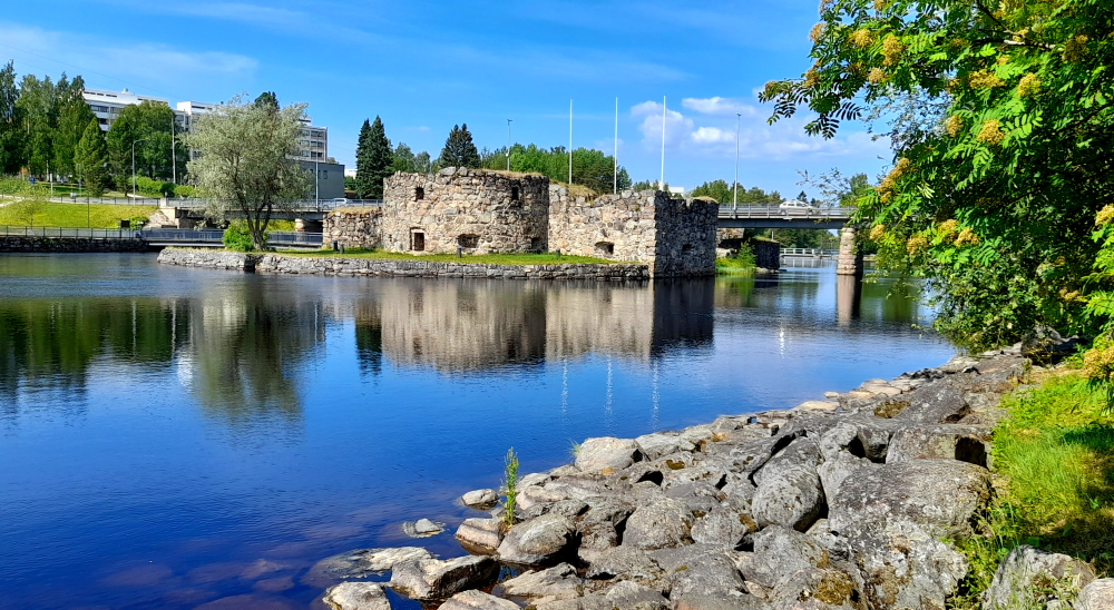
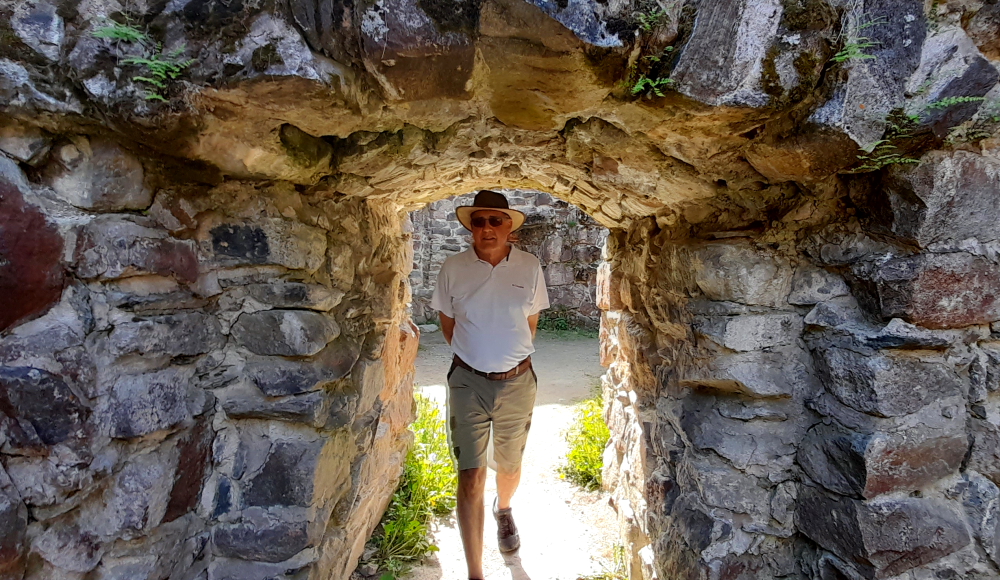
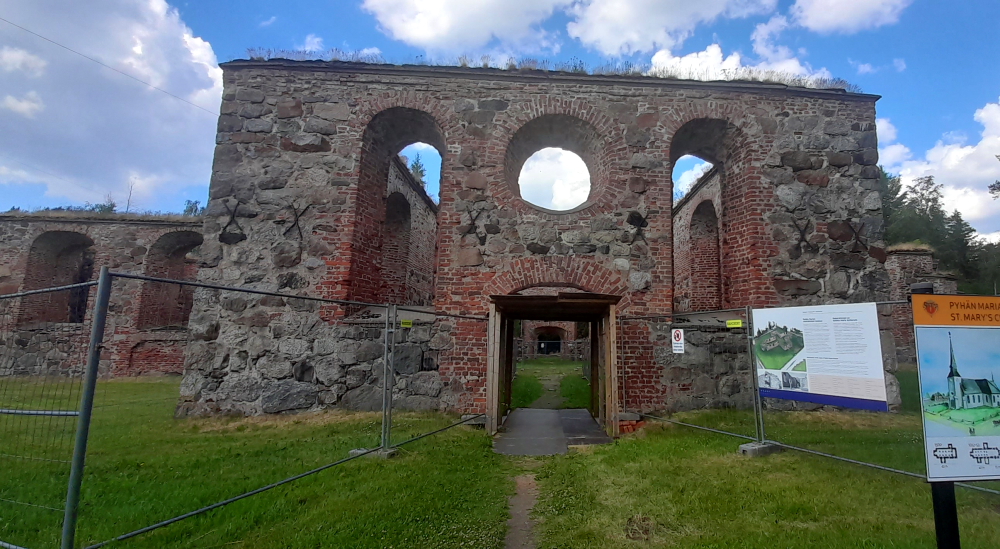
A kilometre away and closer to town are the old town ruins. Those marked are the Grammar School, the bell tower, St Mary’s Church, and the town hall. Only the bell tower and the church have substantial remains.

The surviving stone plinth of the original bell tower in old Vaasa.

The bell tower was built in 1675. Gabriel Gabrielsson Oxenstierna, Count of Korsholm and Vaasa, promised the parish a new church bell in 1668. It soon became clear that the bell, weighing more than 1,000 kgs, required a sturdier tower. The townspeople wanted a stone tower while the rural parish folk favoured wood. Only the stone plinth survived the fire.

A stone church dedicated to St Mary was built in the Mustasaari parish in the early 16th century and it later became the church of the town founded here in 1606. The church was constantly extended as the number of churchgoers grew due, in part, to Puritanism which called for increasing control of churchgoing with the seating order strictly regulated. The present cruciform church was inaugurated in 1753 as Sofia Albertina Church. After the great fire, the decision to convert the house of the Court of Appeal into a church sealed the fate of the stone church to remain a ruin.

The ruins of the old Vaasa church.

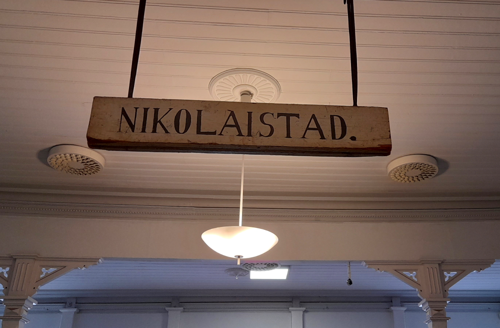
In 1611 the town in Ostrobothnia, Finland, was called Wasa in honour of the ruling Swedish royal house. Sweden ceded Finland to Russia under the Treaty of Hamina in 1805. Following the great fire that razed Vaasa in 1842, the town was moved to the Klemetso peninsula. In tribute to the Russian emperor who had died in 1855 this new town was named Nikolainkaupunki, or Nicholas’ town. The name Vaasa was reinstated during the 1917 Russian revolution some time before the independence of Finland on 6 December 1917.

The sign for Vaasa in the railway station.
The Statue of Liberty of Finland.

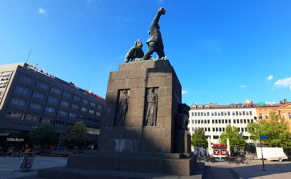
When Lynn learnt that there is a “Statue of Liberty” in Vaasa she was intrigued. It turns out to be a monumental bronze sculpture located in the Market Square. The statue celebrates the victory of the Whites in the Finnish Civil War in 1918. The height of the work with its pedestals is 14 metres (46 ft), the height of the figures is 6 metres (20 ft) and the sculpture weighs 3.6 tonnes (4.0 tons). Designed by by Yrjö Liipola and Jussi Mäntynen, it was unveiled in 1938.

27 June, 2023

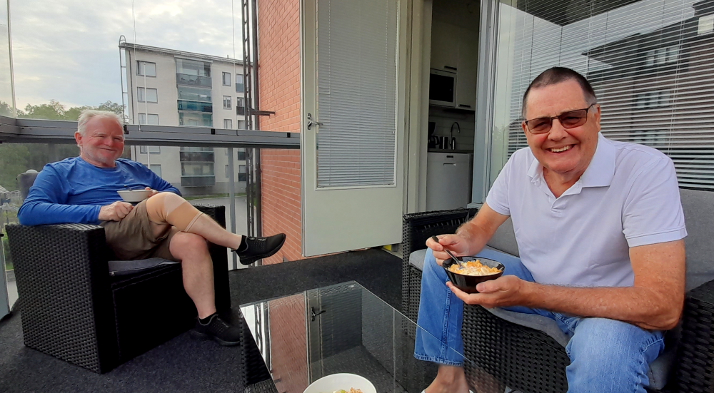
Sadly, Alan is leaving us today to catch the train back to Helsinki and to continue his onward travels through eastern Europe. He joins us on the apartment’s balcony for breakfast.

Breakfast on the balcony.

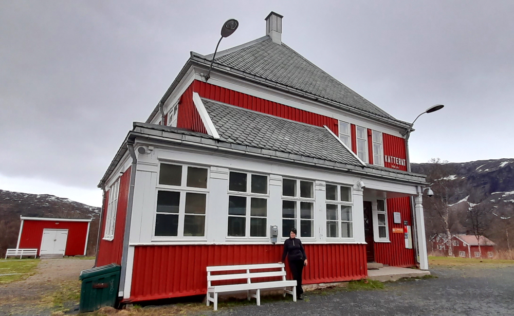
While Lynn goes off to get her woolly, pom-pom hairstyle tamed, she sends Alan and I to the nearby Auto-ja moottorimuseo (Car and Motor Museum to you and I) – Finland’s largest private car museum owned by the Vaasa Veteran Automobile Association.

A visit to the Vaasa Motor Museum.

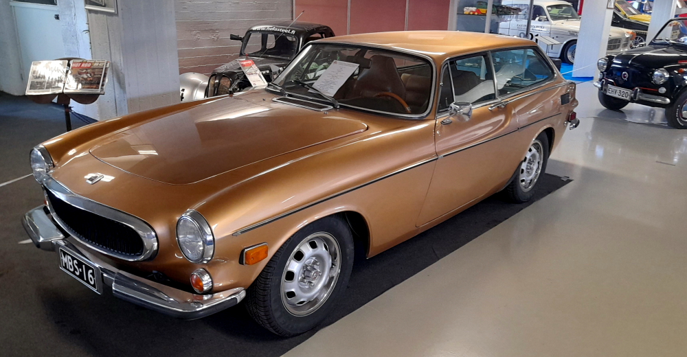
There are 3 floors of exhibits: Floor 1 – German masterpieces over the decades; Floor 2 – sports cars and historic pick-up trucks and Floor 3 – a cross section of the cultural history of modern society (old TV sets, old Nokia phones, etc).

Conveniently, Lynn’s hair salon is located in the wooden train station building so we call by the apartment to collect Alan’s backpack and park ourselves in the train station cafe until Lynn joins us.

Lynn’s new hair cut.

We bid Alan a fond farewell. Uncharacteristically, the train is almost 1 minute late in departing at 12:48 pm.

Alan heading back to Helsinki.

28 June, 2023

Today is a rest day. Well, at least from being a tourist. We spend most of the day doing the remainder of the November bookings for France and northern Spain. We are now booked all the way out to mid-January, 2024.

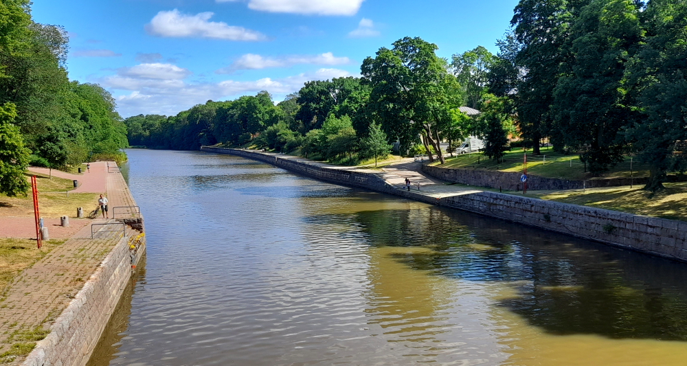
It is warm and sunny outside so after a long day in front of the computer we are walking the 25 minutes to the waterfront to the Strampen Restaurant.

The Vaasa Inner Harbour waterfront.

It is still rather warm even with a slight breeze off the water. This area is so much better preserved than the 1970s architecture of most of the town.

Old customs warehouses on the harbour front, now the Kuntsi Museum of Modern Art.

We get the last outdoor table on the deck just as a queue starts to form at the restaurant entrance. Still, inside would have been very charming with its old-world styling but the Finns are sun worshippers so the sunny deck is packed full this evening.

Bird’s eye view over the Strampen Restaurant.

Restaurant Strampen began in 1868 when confectioner Sebastian Coray was granted permission to build a pavilion in the park surrounding the Court of Appeal. Coray commissioned architect C.A. Setterberg to design the summer pavilion. His earlier work included two local landmarks, the Vaasa main Lutheran Church and the Vaasa Orthodox Church. The construction of the summer restaurant lasted for two years, 1868-1869. In 1876 restaurateur Heinrich Ernst bought the pavilion and maintained the business for years. The original building had eight corners. In the 1930s the building was modified to its present footprint. In 1980 the terrace was added. Since then it has remained the largest and sunniest terrace in town. In the winter of 1997-1998 the interior was restored and renovated to its original state.

Dinner on the deck in the sunshine.

Dinner is reasonable. I have pork ribs and Lynn has her usual 2 starters. The 25-minute hike back to the apartment is needed to walk off dinner but I don’t really appreciate it.

29 June, 2023

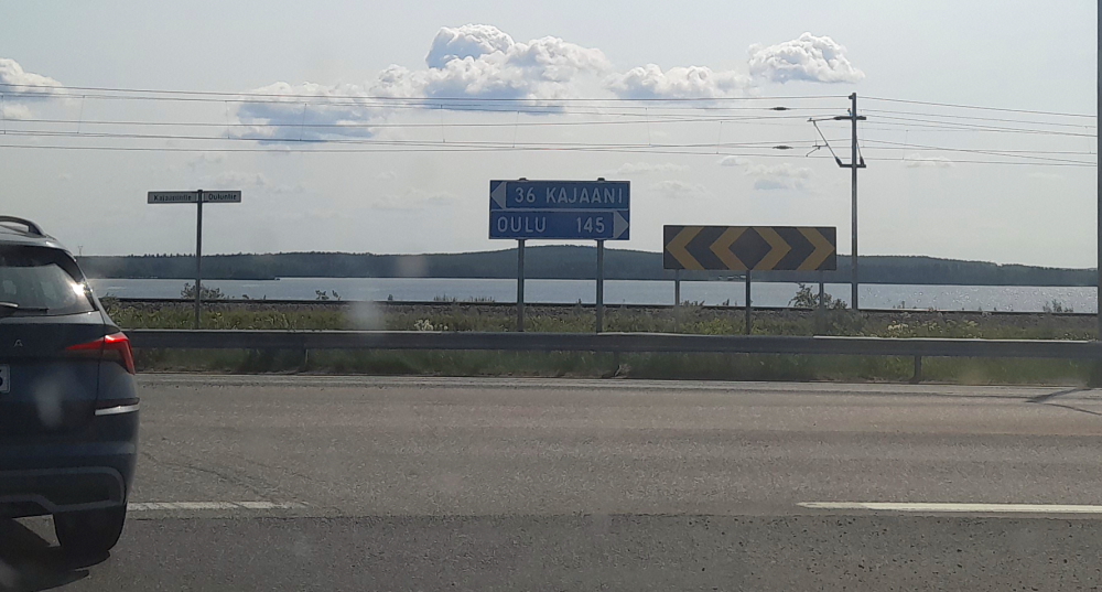
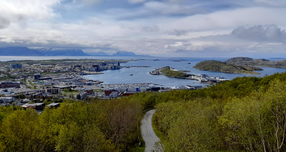
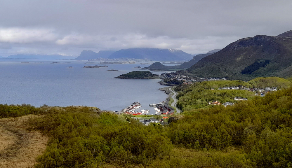
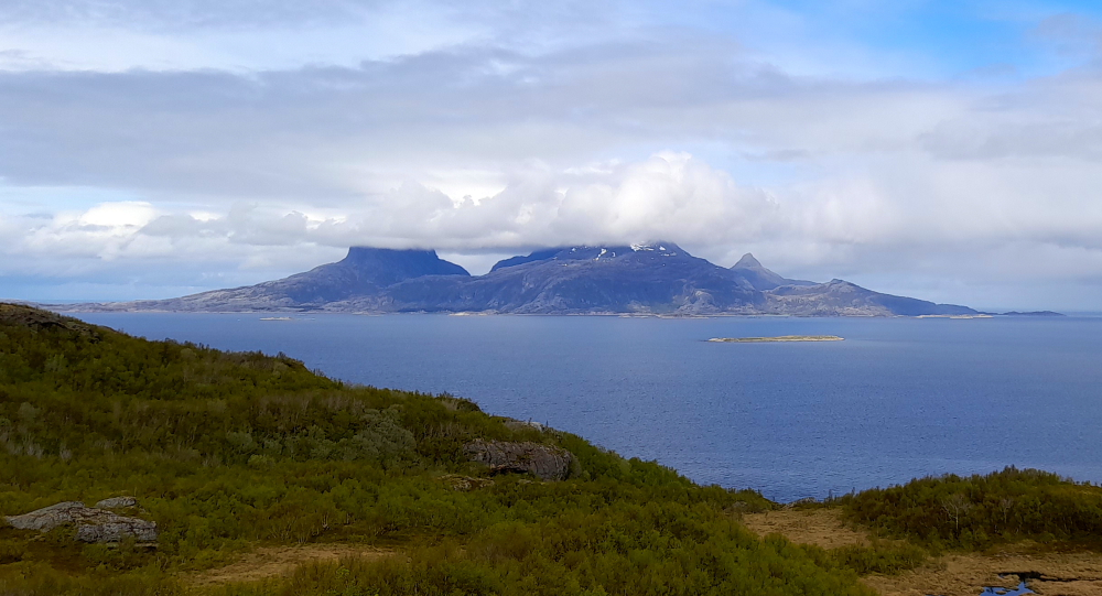
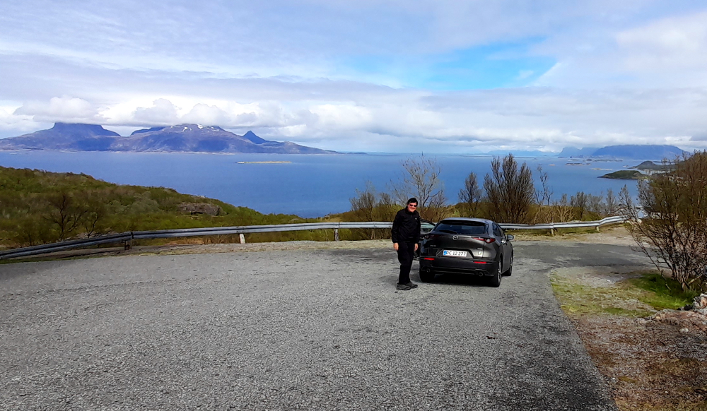
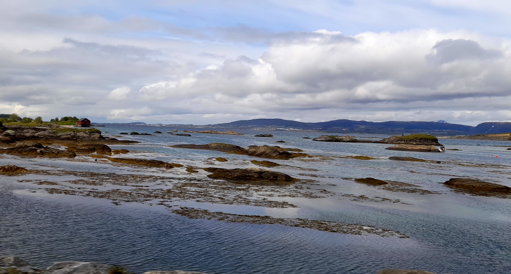
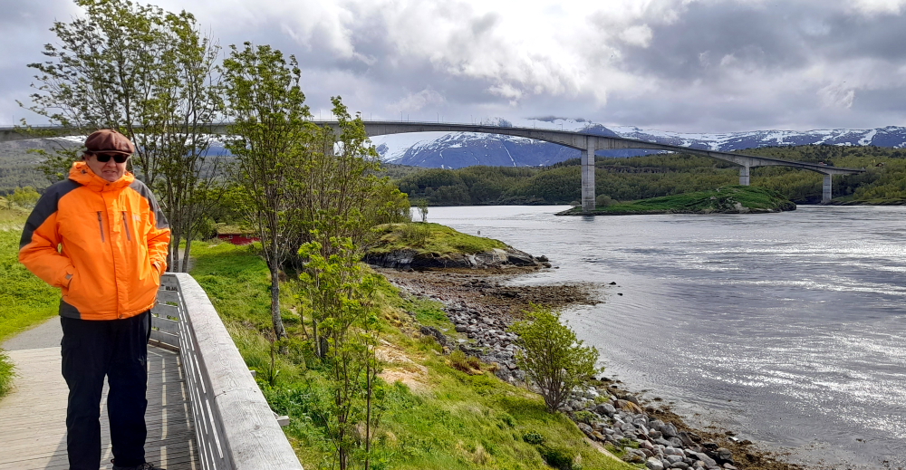
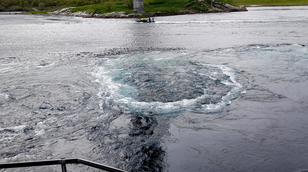
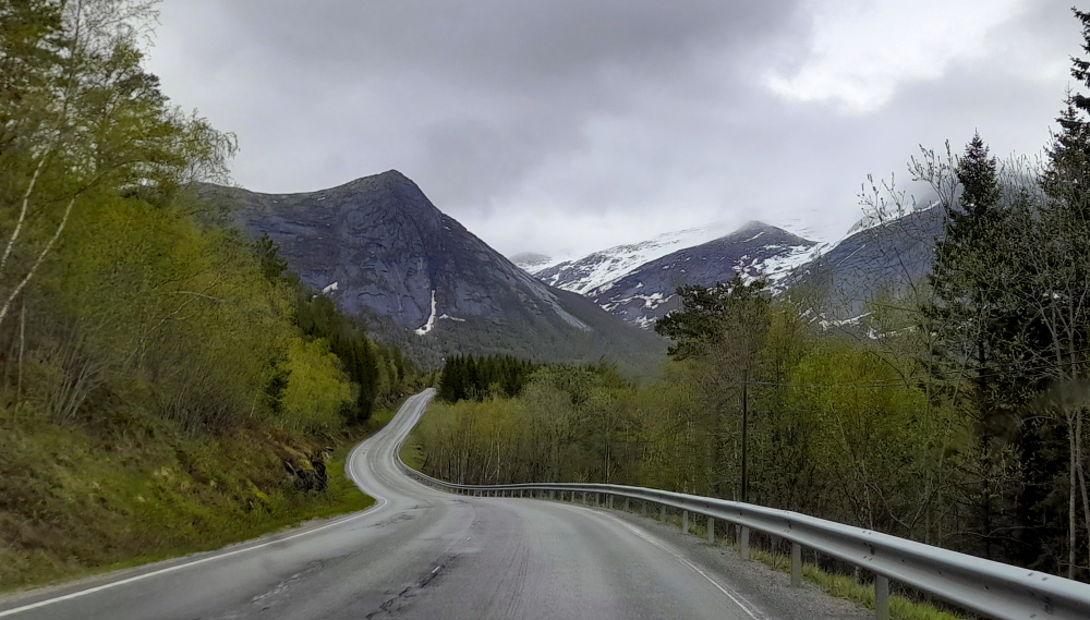
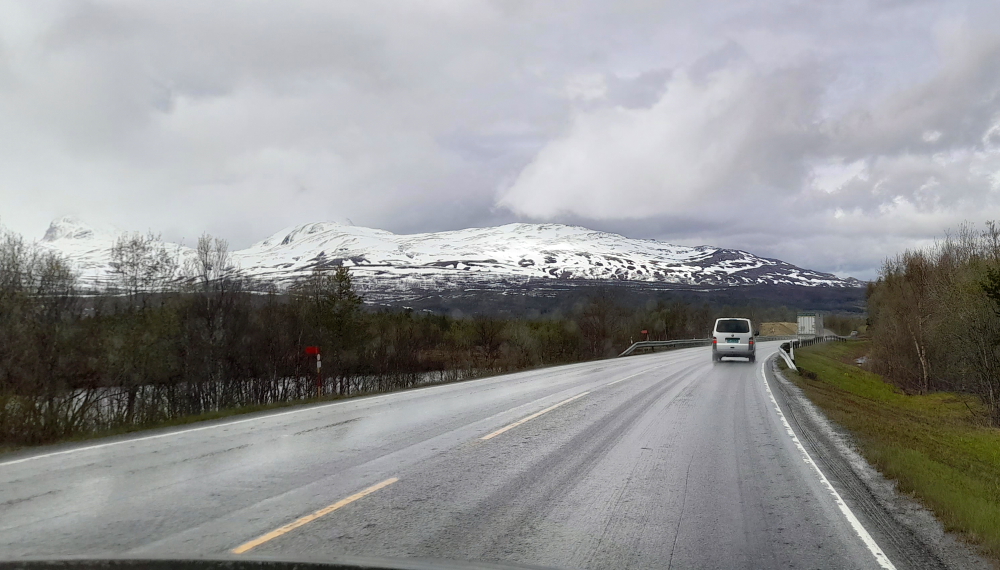
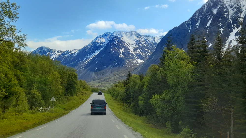
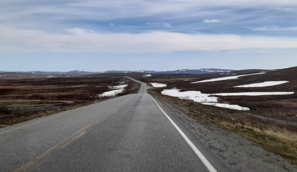
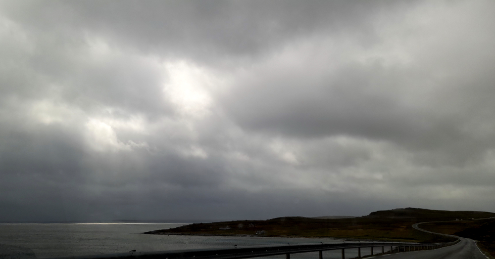
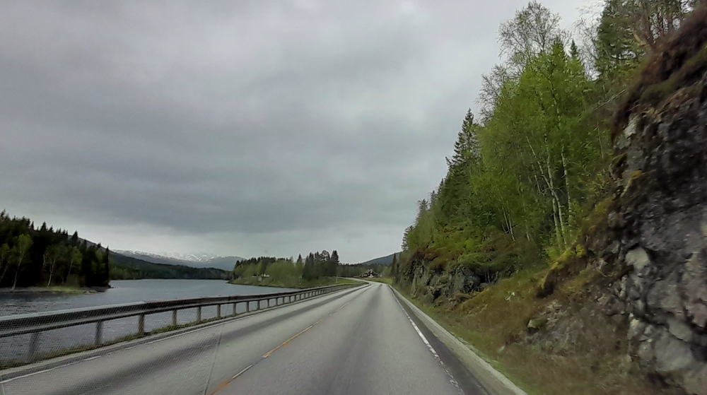
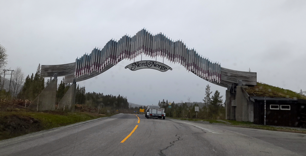
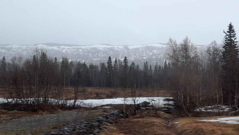
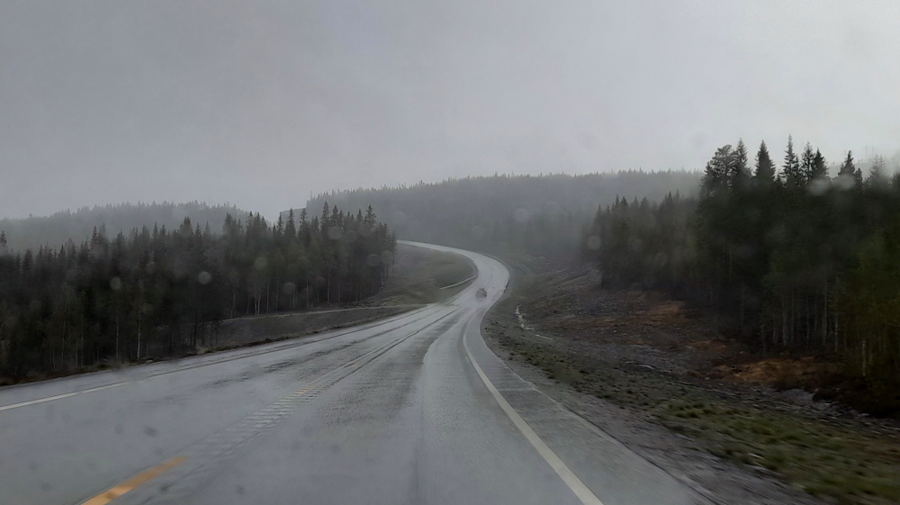
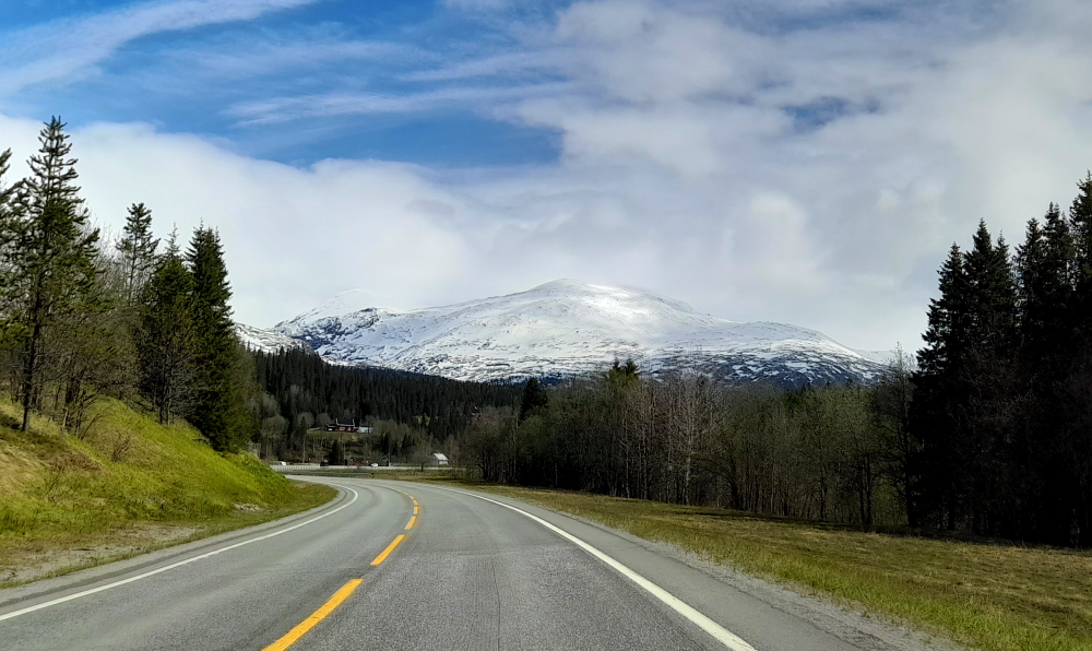
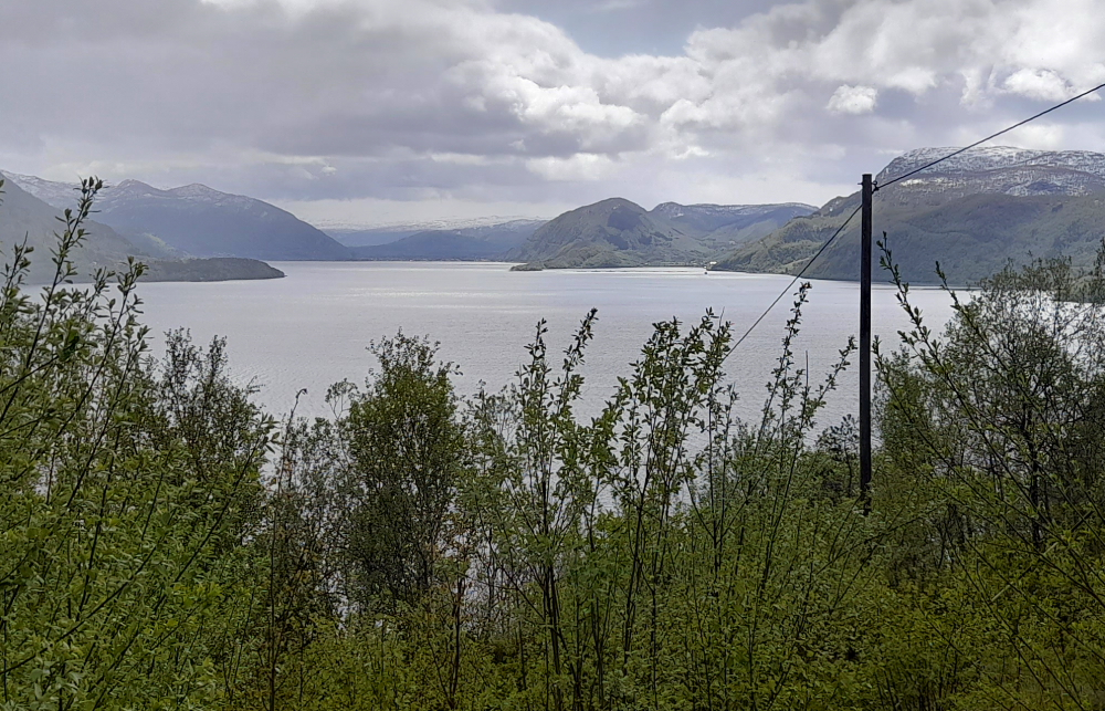
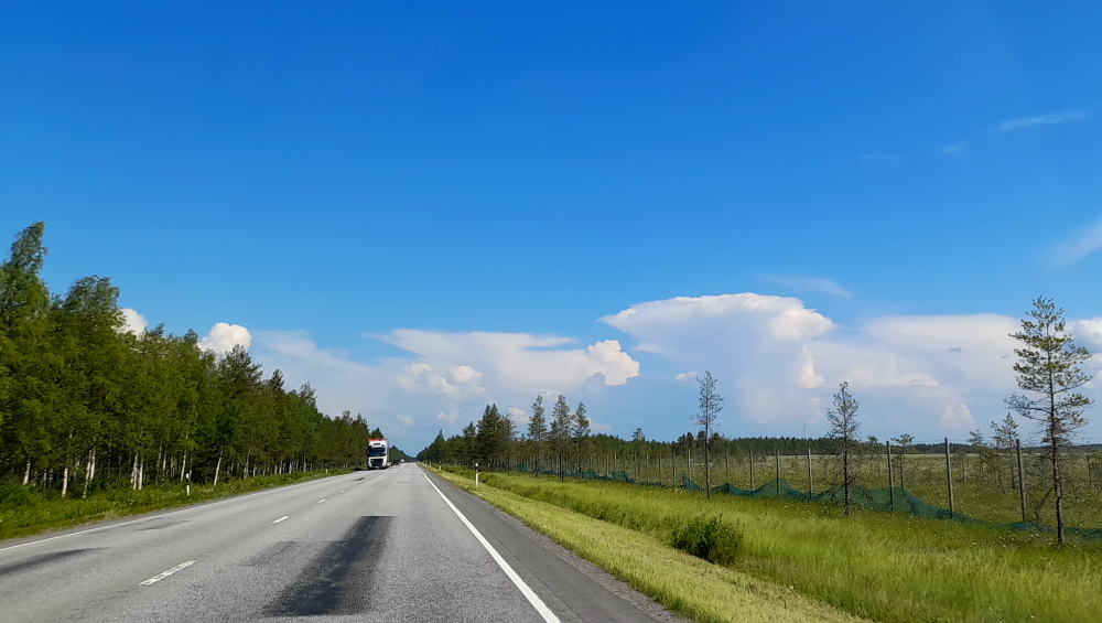
We are moving on to Oulu this morning for the next two days – our last in Finland for this trip as we head for Sweden and then trek south to Denmark. As usual, the 4-hour drive from Vaasa to Oulu is a bit boring with pine forests, farmland, logging and speed cameras the usual suspects. We don’t get to see much coastline, just the one glimpse near Arvasgarden plus crossings of small rivers.

The weather is a warm 24 Deg C with bright sunshine. Traffic in the opposite direction is quite heavy with most being RVs and caravans. Luckily the traffic going in our direction is flowing well with very few caravans.

Tiny bus shelters on the highway.

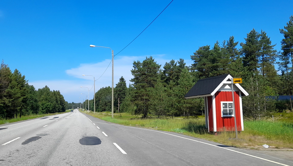
The most interesting thing is the tiny house-shaped bus shelters. Let’s hope Sweden is a more interesting drive.

Cloud formations are the second most interesting sight today.

We check into our hotel in Oulu where the parking is free and easy to access. The first thing I make Lynn do is my ironing using the communal iron/board located in the corridor outside our room – which has no fan or air conditioning. Although we had a washing machine at our last place, alas no iron/board (go figure!).

Naturally, there is no air conditioning in the room but by late afternoon the clouds are building and a cool breeze is wafting through the now open window. The small, electric rotating fan helps, too. Pity we didn’t have one of these in our last place!

We take a prevening stroll through town down to the harbour and find that summer food markets have been set up in the Old Market Square, in front of the traditional Market Hall.

Oulu Market Hall.

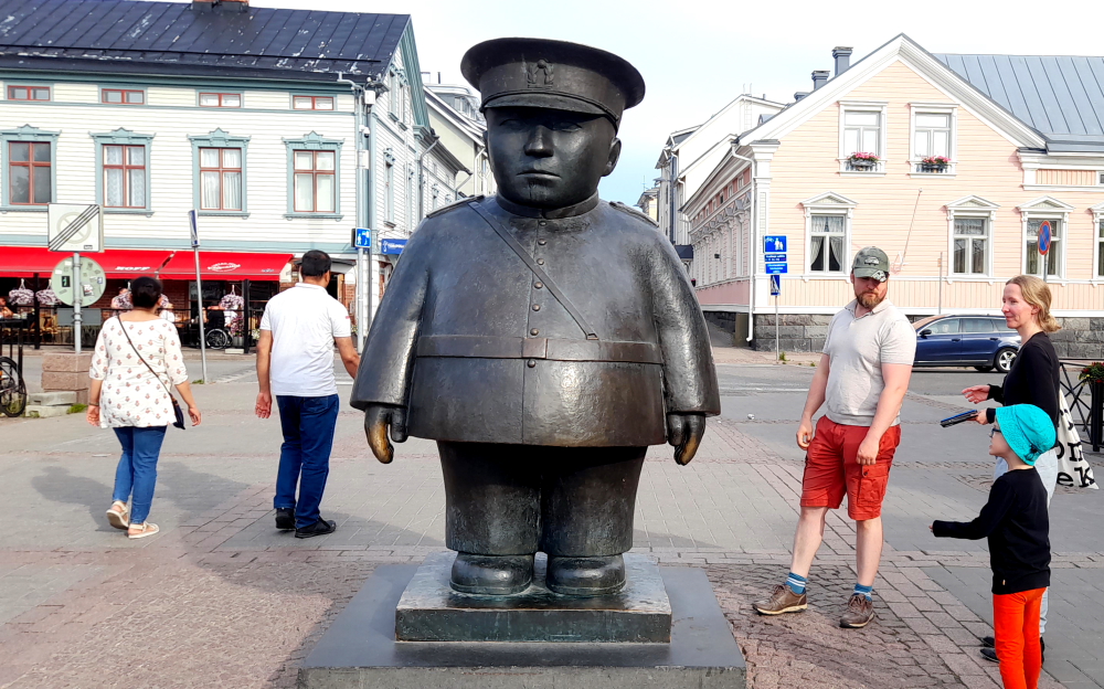
Over the centuries the Oulu Market Square has offered its visitors a year-round, lively meeting and trading place which has also required guarding. A peculiar feature in the local policing history were the Market Square policemen who kept an eye on the Market Square and maintained order there during 1934-1979. Then the policemen were commemorated through a citizen’s fundraiser for erecting a bronze statue in front of the Market Hall. The Market Square Policeman’s 2.2 metres tall statue was designed by sculptor Kaarlo Mikkonen.

A Toripolliisi – a market square cop.

Traditional tan-coloured, wooden buildings line the harbour including this lively pub.

Kahvila Makasiini pub.

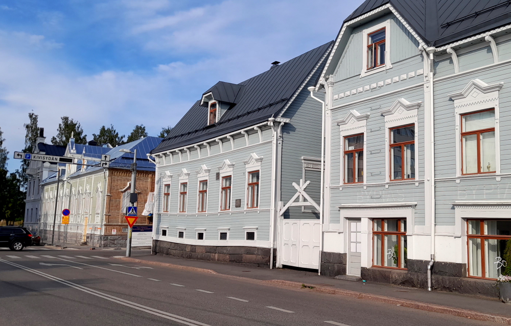
Our walk back to the hotel features various wooden buildings with simple to more intricate adornment. This one caught our eye with its warped base.

Wonky floors?

Situated by the Gulf of Bothnia, at the mouth of river Oulujoki, Oulu is an ancient trading site. The city proper was founded in 1605 by King Charles IX of Sweden, opposite the fort built on the island of Linnansaari. This took place after favourable peace settlements with Russia, which removed the threat of attack via the main east–west waterway, the river Oulu.

In 1822, a major fire destroyed much of the city. The architect Carl Ludvig Engel, chiefly known for the neoclassical (empire style) buildings around Helsinki Senate Square, was enlisted to provide the plan for its rebuilding. With minor changes, this plan remains the basis for the layout of Oulu’s town center. During the Åland War, part of the Crimean War, Oulu’s harbour was raided by the British fleet, who destroyed ships and burned tar houses, leading to international criticism.

Today, Oulu is a city and seaside resort of about 210,000 inhabitants and is one of the largest cities in the world for its latitude. Due to its large population, economic and cultural/historical location, Oulu has been called the “capital of Northern Finland”. It’s also considered one of Europe’s “living labs”, where residents experiment with new technology (such as NFC tags and ubi-screens) on a community-wide scale. Once known for wood tar and salmon, Oulu has evolved into a major high-tech centre, particularly in IT and wellness technology. It has been chosen as the European Capital of Culture for 2026

30 June, 2023

After weeks of sunshine we wake to a dull day that soon evolves into a rainy day. While I do some year-end figures, Lynn braves the rain to see the local sights.

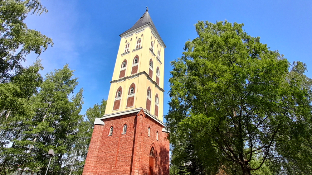
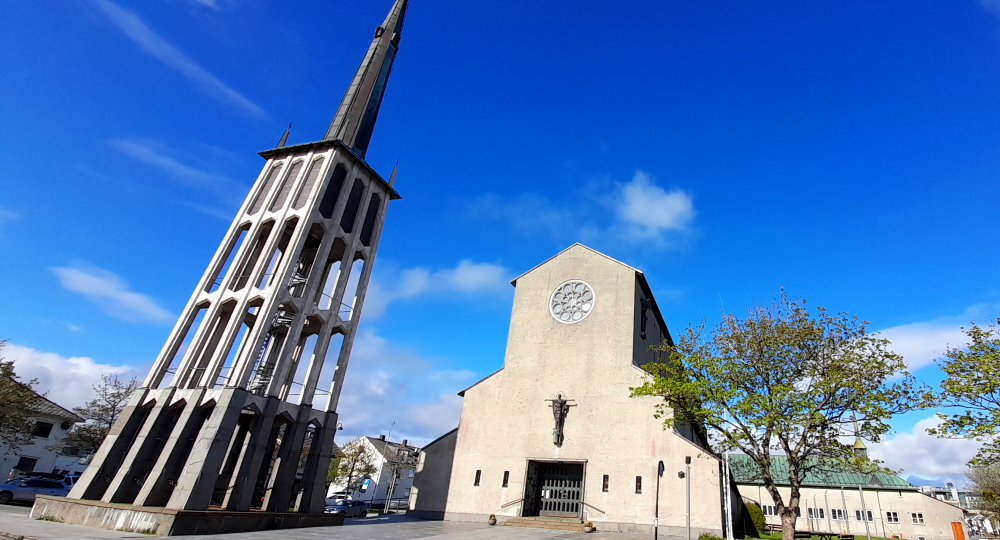
Nearby is the Oulu Cathedral built in 1832 to Carl Ludvig Engel’s designs, with the spire being finished in 1844.

Oulu Cathedral.

Today, like a lot of buildings in Scandinavia, it’s undergoing maintenance.

The Cathedral’s interior.

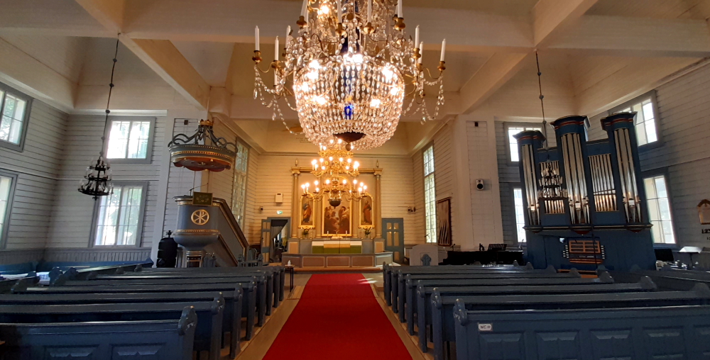
I don’t know what Lynn will do when we get to Europe and see some serious Cathedrals. Perhaps she takes photos of these country churches in Scandinavia as the towns don’t have much else to see.

Floral daleks?

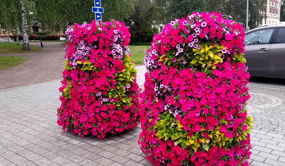
In the UK, summer floral decorations for city streets are usually hanging baskets. In Oulu they look more like some daleks (minus metal extensions) have been captured and decked out with petunias.

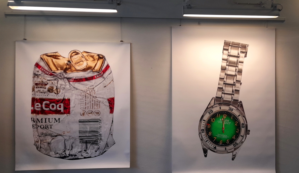
Opposite the City Hall (also undergoing a massive external renovation) is located the Cultural Centre Valve – a mix of historical and modern buildings.

Cultural Centre Valve.

Not only an event venue, it is also the home for many cultural organisations and works in co-operation with different actors, artists and event organisers.

Some of the artwork on display within Valve – ‘Fun of the Month’ images.

Art for Art’s sake?

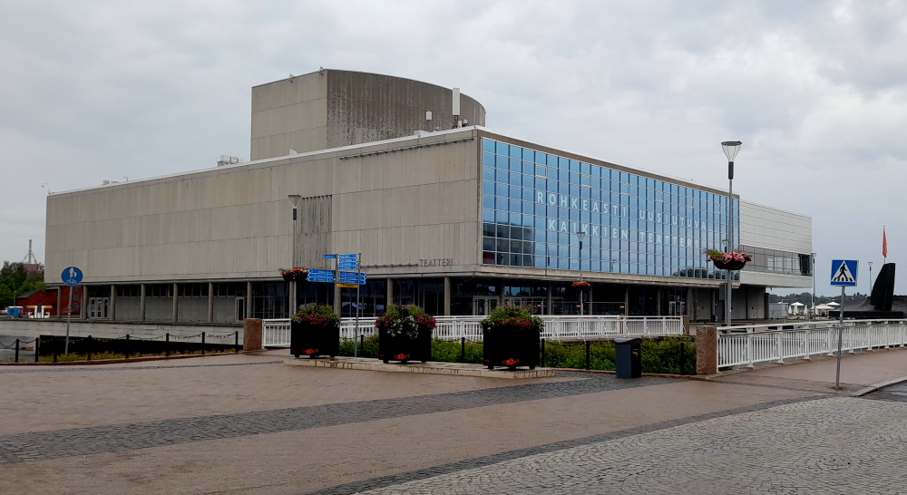
Back down at the waterfront is another ‘modern’ building, the Oulu Theatre which is built on a small, artificial island named Vänmanni. In existence since 1931 it has 350-400 performances per year for an audience of 80,000 across 4 stages. The 100 staff include c. 35 artists, 15 set and costume makers, 30 technical employees, and 20 in admin, production, marketing and sales.

Oulu Theatre.

Directly across from Vänmanni via a narrow pedestrian bridge is the island of Pikisaari (Pitch Island) and its wooden old town. The island got its name from an old pitch works founded in the 17th century. Besides that, the island has housed shipyards, a sawmill, a distillery, a wool mill, and a machine workshop.

Oulu was an important sea and port city in the 19th century and the most important tar port in the world, and a considerable number of the city’s inhabitants were sailors by profession.

Sailor’s Home Museum.

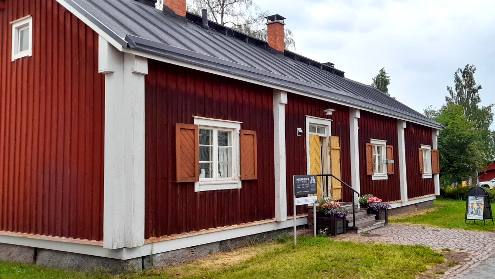
Sailors’ families lived in small wooden houses on the outskirts of the city, such as Matila’s house, which is now a Sailor’s Home Museum.

Kitchen & oven.

The building is the oldest surviving wooden house, dating from 1739, having survived, among other things, the great fires of Oulu in the 19th century.

Little bed for little sailors.

Another building of note is the old, decorative office of the local machine workshop from the 1880s, nowadays used as a residential house. It represents the neo-renaissance style with a tower that is a notable landmark among the houses on the island.

Yet another fire hazard masquerading as a building.

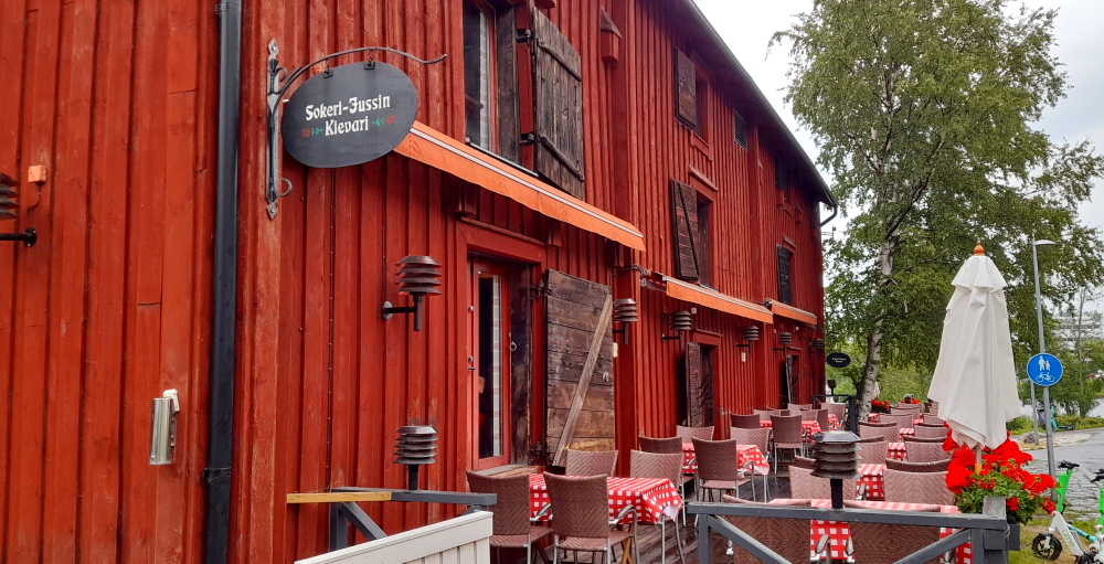
Nowadays the island is the home and studio for many artists and artisans, not to mention boutique accommodation and charming restaurants like the Sokeri-Jussin Kievari.

More wooden buildings.

Back on the mainland at the harbour’s edge Pikisaari Island can be seen in the distance behind the Oulu Theatre.

Distant view of Pikisaari Island from the harbour.

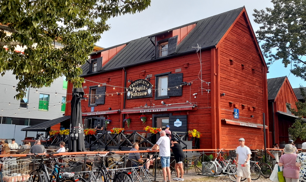
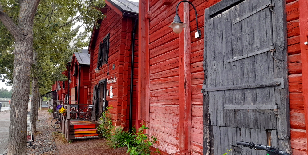
Next door to the Kahvila Makasiini pub on the Old Market Square is a series of wooden buildings, old granaries, housing artisanal shops.

Yet more wooden buildings.

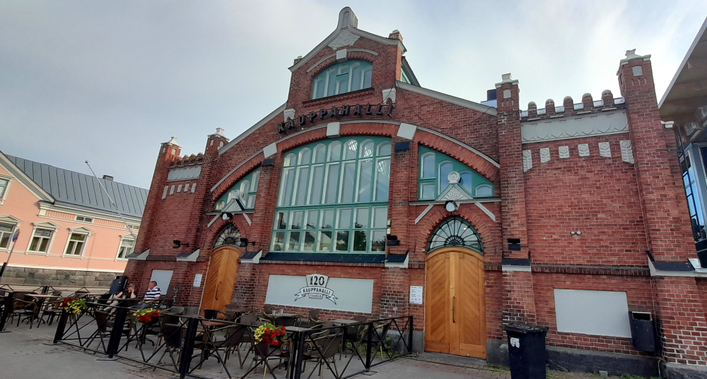
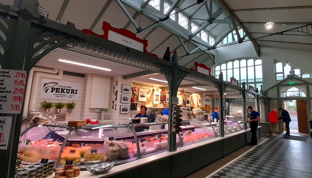
Inside the Market Hall it looks like a miniature version of the one in Helsinki.

In 1889 the Oulu city council decided to build the market hall due to the tightened food safety regulations in Finland. Specifically, butchers were to be moved from the open market square to the covered market. The market hall was designed by architects Karl Lindahl and Walter Thomé and completed in 1901. Along with two aisles there were 62 wooden shop stalls. The warehouses surrounding the Hall are former granaries converted into handicraft shops.

At the fish shop.

Tonight we are having dinner at what seems to be a very nice looking restaurant in the centre of town. Unfortunately the menu was very limited and quite expensive even for Scadinavia generally. I had a small piece of fried chicken breast with boiled potatoes and almost cooked cauliflower and Lynn had a couple of pieces of fried tofu with similar vegetables and the bill came to A$77. They even charged us A$3 for tap water. That has to be the most expensive KFC (although not as good as KFC) that I have even eaten.

Tomorrow morning we are still heading north but then crossing over to Lulea in Sweden. It will take us about 3 hours to drive the remainder of the Finish west coast. I just hope that the food improves in Sweden (maybe they have flat pack food there). At least I am losing weight but we dropped by the supermarket after our dinner “snack” and picked up some chocolate and another 6 pack of Long Drink (Gin & Grapefruit).

Heading South through Finland.

16 June, 2023

Today our trip to Rovaniemi, Finland, is 437 kms away. We depart at 10:20 am and should arrive around 5:00 pm thanks to an hour’s time difference.

Although it’s 10 Deg. C when we leave, it’s due to be around 21 Deg. C when we arrive so I’ve cracked out the shorts and polo shirt for the trip. Ahhh, nothing like fresh air around one’s knees and ankles.

At the Finland border.

15 minutes after leaving the hotel we cross over the Karasjohka RIver and into Finland. Immediately we notice the difference. We really feel like we are in the back blocks of Finland – it’s all scrub as far as the eye can see, hardly any traffic on the 92 and no houses.

The undulating 92.

As we progress down the road the landscape changes to forests of conifers and lakes. Often we can’t see the lakes for the trees.

At 12:10 pm the speedo registers 5,555.5 kms – that we’ve put on the car since we hired it.

An hour later we turn right onto the 4.

Lake Pitkavuono.

The landscape reminds us of driving across the top of some US states near the Canadian border where the road makes its way through masses of small lakes, sandy soil, boggy land and there are only trees on either side of the road for miles.

Crossing the Juutuanjoki at Inari.

The section of the 4 between Inari and Ivalo is very picturesque with glimpses of sections of Lake Inari, which is massive.

Near the Wilderness Hotel Inari.

The lake water is crystal clear but near freezing point. Not a sole in sight even thinking about going for a summer dip.

View of Myossajarvi, one of the many lakes near Lake Inari.

At the roundabout at the entry to Ivalo we’re met with an interesting road sign – Murmansk! Taking the 91 only 295 kms or 4.25 hours away. We need to get used to the fact that Finland’s eastern border abutts Russia.

Just after we go over the roundabout, lo and behold we see an urban reindeer which has decided it will just stand in the middle of the road with his back to oncoming traffic. I flash our headlights at an oncoming truck and he slows down. Just as the reindeer moves off the road another dashes out of the trees right in from of the truck. If the truck was still going at speed he would have been reindeer stew tonight.

Trying to be road kill.

Half an hour later, another reindeer wants to go play in the road! This guy looks a little more experienced with traffic and waits until the traffic stops before crossing.

Why did the reindeer cross the road. Because he wanted to piss drivers off.

That would make a large dent in the car.

It’s about time for a pit stop. Hopefully, the loo that is marked on the map is actually there. Last time we were confronted with a layby, bush and mozzies! Lynn decides this one warrants a photo as it is so nicely carved and has windows in the door! Unfortunately, it is one of the crappiest crappers we’ve had to use in a long time. Apparently Finish drivers don’t need to pee.

Finnish dunny.

As we get closer to Rovaniemi, more and more houses and small holdings appear, mostly not as neat as their Norwegian counterparts.

By the time we get to our accommodation at the Santa Claus Holiday Village (had to stay here for the grandkids!) we can hardly see through the windscreen, thanks to the clouds of bugs we’ve been driving through all day.

Our cottage in Santa’s Village.

As soon as we check in we take a quick tour around the village. Two of the most important buildings are Christmas House where Santa can be met every day between 9:00 am and 6:00 pm and the Santa Claus Main Post Office, same opening times.

Postmark from Santa’s Village.

We are checking out what postal services Santa and his elves offer when we come across a large set of pigeon holes divided by country names and labelled “Letters to Santa Claus”.

Letters from Ozzie kids to Santa.

Just outside the post office is Central Square which has lots of signage as to where the Arctic Circle bisects the Square.

Straddling the Arctic Circle.

On the way north when we crossed the Arctic Circle in Norway it was high in the mountains and freezing cold. This time, on our way south through the plains of Finland, it is a warm 24 Deg C.

Same circle different Longitude.

So far we have experience the Scandinavian summer in single digits Deg. C. Today at 4:45 pm and it is 24 Deg. C at the Arctic Circle – UNBELIEVABLE! Finally some summer weather.

24 Deg C in the Arctic.

Of course, there is the mandatory sign post to various places around the globe. They should have a sign pointing down to Australia.

Still lost???

Curiously, there is a small wooden hut nearby called the “Roosevelt Cottage”. Rovaniemi and Lapland were the first recipients of aid provided by Unicef’s predecessor UNRRA in post-War Finland. Known as the “soul” of UNRRA, Eleanor Roosevelt visited Rovaniemi on 11 May 1950. The cabin was constructed in just 2 weeks as the reception ceremony venue. The event was an important ground breaker for tourism on the Arctic Circle. It marked the first effort to attract a growing number of visitors to stop and enjoy a coffee break, buy souvenirs and send a postcard home bearing the special Arctic Circle Postmark.

The Roosevelt Cottage.

As this is our last stop above the Arctic Circle we thought we’d better document the “Midnight Sun” at midnight.

Midnight sun at Santa’s Village.

This 24 hour daylight thing is starting to get a bit tiresome. Oh, for a dark night to get some proper sleep. So far we haven’t had a single hotel room with proper black out curtains.

17 June, 2023

Must be laundry time again so we head into town to one highly recommended on the Internet. Tucked away down the side of a home wares building we finally see its sign. What a joy compared to our experience in Denmark! It’s open, it’s clean, the machines work, there are easy instructions in English, we can ‘tap & pay’ with a debit card and we even get free coffee and WiFi and a loo thrown in plus parking outside the door for free.

A proper laundromat with free WiFi and coffee.

An hour later we drive to “Arktikum” which is an interactive science centre and museum in town. Two separate exhibitions operate at Arktikum – the Arctic Centre and the Provincial Museum of Lapland which examine culture, history, and modern life in the Arctic. Arktikum opened to the public on 6 December 1992, the 75th anniversary of Finland’s independence. The crescent-shaped new annex was completed in autumn 1997.

The floors are made from Perttaus granite – the hardest type available in Finland – and from lime-washed Lappish pine. The chairs are made from birch and reindeer hide.

The most visible part of the museum, its glass corridor, is 172 metres long and it is dissected by the 30-metre wide Kittilä highway. The tube serves as the “Gateway to the North”, as the entrance foyer is at the southern end and guests head north when coming in.

A visit to the Arctic Museum.

One of the exhibits is devoted to the Aurora Borealis, known as the Northern Lights. The ceiling projection viewed while lying prone.

Cheaper than going to Iceland.

Another to the indiginous tribes that call the Arctic home.

Could have used these clothes a few weeks ago.

Wildlife feature, too, including stuffed specimens of birds, otter, fox, wolf, bears and an elk.

Bears in Finland at the museum.

This time the moose is stuffed unlike the moose that we saw from the Arctic Train in Narvik that we thought was stuffed because it didn’t move a muscle as the train passed it by very closely.

This one is definitely stuffed – so’s the moose!

And a section specifically devoted to the Sami.

Traditional Sami clothing.

After an hour or so we drive home for a couple of hours before returning to the town centre to dine at “Yuca”, a tacqueria, to be greeted by an old friend – Bundaberg Ginger Beer! And the margarita wasn’t half bad either.

Driving around the town of Rovaniemi we were surprised how big the town is. This has to be the biggest town that we have seen since Oslo in Norway. As it turns out, Rovaniemi is the second-largest city of Northern Finland after Oulu, and, together with the capital city Helsinki, it is one of Finland’s most significant tourist cities in terms of foreign tourism. Almost totally destroyed during World War II, today it’s a modern city known for being the “official” home town of Santa Claus, and for viewing the Northern Lights.

Rovaniemi is a unilingual Finnish-speaking municipality and, uncommonly for larger Finnish towns, it is also known by its Finnish name and spelling in the Swedish language.

18 June, 2023

It is a beautiful sunny day today with an expected top temperature of 25 Deg C. Polo shirt and shorts weather today. After breakfast we plan to head to the post office in Santa’s Village to organize letters to the grandkids from Santa at Christmas.

While we are there we stop in to see Santa and he insists that we get a photo with him which I also send off to the kids.

Santa is taking a break from the toy factory.

Time to say goodbye to all the elves…

Santa’s Elves.

19 June, 2023

Next stop is Kajaani some 345 kms SE away. We should arrive around 4.25 hours later at 2.30 pm.

Firstly, we drive across the road from the Village to a Shell servo to fill the tank – well, a 50-litre limit at EU 2.01/litre and yet again, no bucket and brush for Lynn to scrub the bug-splattered windscreen.

Considering the clouds of bugs we’ve been driving through since we entered Finland, you’d think a bucket and brush would be a constant at servos, as they are in Norway.

We take the 4 into town then the 78 as we cross the appropriately-named Lumberjack’s Candle Bridge over the Kemijoki River, part of the lake on which Rovaniemi is located.

Jätkänkynttilä – Lumberjack’s Candle Bridge over the Kemijoki River, Rovaniemi.

En route, Lynn was considering stopping at the Ranua Zoo/Wildlife Park about an hour away. It opened in 1983 and is the northernmost zoo in Finland. The zoo’s animals consist of approximately 50 wild animal species and 150 individuals, including top predators such as lynx, brown bears and wolves but also foxes, European moose, deers, birds and Finland’s only polar bear. However, as it is summer, and it is hot, and the animals reside in a large, mozzie-filled, forest-setting she’s not sure that we will get to see a lot of the animals, so we give it a miss. https://ranuaresort.com/en/wildlife-park/animals/

Same view – trees, bugs and road.

It’s official – Finns don’t pee! After a couple of hours’ driving through the same groundhog-day landscape, it’s time for a pit stop. Unlike Norway, which has regular road-side, WC-signed lay-bys, Finland has nada. We decide to stop at a Shell servo which has a cafe attached, only to find that it isn’t a Shell and the ‘cafe’ looks like the back entrance to a mechanic’s workshop. Fortunately, we return to a cafe that we passed driving into town which seems to be a community centre. Problem solved.

Around 2:00 pm we arrive at the T-junction of the 78 with the 22 at Paltamo – 36kms to Kajaani to the left or 145kms to Oulu to the right. It will be another 10 days before we are due to arrive in Oulu. We head towards Russia – but turn southwards shortly after back on to the 78.

Towards Russia or towards Sweden?

We arrive at our hotel on the banks of Lake Nuasjarvi just after 2:00 pm in 25 Deg. C heat. The hotel looks like a Russian hotel from the 70s. Our room is hot and there is no air conditioning. With very little darkness Lynn decides that it will be too hot to sleep in this room so she goes to reception to get a fan.

She is informed that there are no fans available but we are offered an upgraded room on the shaded side of the hotel. It is a family room and seems to be a bit cooler.

Walk around the hotel.

While we check in Lynn picks up a town map and notices several walking paths through an adjacent forest and around the lake so we choose one which will take us to several ‘must see’ locations in Kajaani.

Cool walk in the forest.

After walking over one of the numerous bridges we arrive in town and immediately head for an ice cream vendor on Raatihuoneentori square – our first ice cream treat for the season.

Yummy ice cream to cool off.

The town centre is much like our hotel, outdated and in need of demolition and a modernised rebuild.

Nearby, some street art catches Lynn’s eye. Compared to the simple stencil art that adorned the walking trail underpass, this panel is rather sophisticated but we can’t find any reference to it on the Internet.

Street art in Kajaani.

Back on Raatihuoneentori square, the town hall designed by C.L. Engel was completed in 1831 and is the most important and oldest building in the Kajaani city centre. Here the town council used the hall as its meeting place until the early 1950s. Many a celebration also took place in the town hall in the 1800s – after all, there were no other suitable facilities in the region. The building looks nearly the same as back then.

The Raatihuoneentori square located in front of the town hall was previously the centre of business in Kajaani and the place for organising two major markets each year.

The old town hall.

From here we can see a tall spire in the next block – the Kajaanin Kirkko.

The current church was completed in 1896. It was designed by architect Jacob Ahrenberg. The building represents the most decorative neo-Gothic style of late 19th century Finland. Placing the church tower to the side of the central axis is of German origin. The slender tower with its open parts refers to the Italian Renaissance and Baroque style.

The wooden Lutheran Church.

The altarpiece “Savior and Peter on water” was painted by the artist Toivo Tuhkanen from Kajaani in 1925.

Inside the church.

Walking back to the hotel we pass by another landmark – the statue of Per Brahe the Younger, the Swedish Governor-General of Finland. Kajaani was one of the cities founded in 1651 by Per Brahe. At that time, the Kainuu region—as wood country—was an important producer of tar derived from pine, and the tar trade was its major industry.

Per Brahe – the founder of Kajanni.

Kajaani, historically known as Cajanaburg (Swedish: Kajana) is the most populous town and the capital of the Kainuu Region of Finland. It is located southeast of Lake Oulu (Oulujärvi), which drains into the Gulf of Bothnia through the Oulu River (Oulujoki).

Walking back to the hotel.

Per usual, we have dinner in the hotel restaurant tonight. Once again we are asked if we are paying the bill separately or together. You obviously go Dutch in Finland!

20 June, 2023

Another sunny day has been promised, although with possible rain this afternoon, so we take another walk after breakfast. We walk further along the lakeside trail past the Kajaani Castle Ruins to the nearby tar canal.

Tar was used as a water repellent coating for boats, ships, and roofs and it was also a panacea in Finland. The Finns have a saying “if sauna, vodka and tar won’t help, the disease is fatal”.

The fort ruins.

In the 19th century Kainuu was the single most important tar producing region in Europe, thanks to her enormous forests and the natural transportation route along the Oulujoki water system. However, the rapids of the river Kajaaninjoki were a real obstacle for tar transportation because the boats had to be taken ashore and pulled past the rapids.

The Tar Lock.

The first attempt to solve this problem was to build, in 1820, boat chutes by the river but these proved insufficient. In 1825 the Emperor of Russia, Alexander I, gave permission to build canals in the rapids of River Kajaaninjoki. The construction begun in 1836 and the canals were completed 11 years later. Both were designed for the long tar boats and they were heavily used until the early 20th century.

The lower lake.

Up to 24,000 barrels of tar were shipped through the canals per year until 1915 when, in that year, the decline of tar transportation and the deteriorating condition of the canals finally caused their closure.

Lower lake steam ship – S/S Kouta.

We retrace our steps as far as the Kajaani Castle Ruins which we access from the other side of the river next to the main bridge

Checking out the castle ruins.

The Kajaani Castle was built in 1604-1619 to stabilise the Lake Oulujärvi region and to supervise the vital waterway River Kajaaninjoki. The city of Kajaani describes the destruction of the castle as follows:

“The Russian beat the Finnish army in the battle during the Great Northern War in 1714, a period also known as the Great Wrath. The Russians destroyed parts of Kainuu Region in order to invade Kajaani, too. The Chief of the castle heard about their plan, however, and warded off the first attack. In December 1715 Commander Tshekin arrived with his cavalry of 4,000 men. The Russians laid siege to 50 rangers and approximately 70 women and children in the castle for about 5 weeks. Finally (24 February 1716) the residents had to surrender as they had lost men to battle. The people in the castle were imprisoned and taken to Siberia. The castle was vacated and blown up. Only the stone ruin of the castle remained but even that was gradually destroyed as the locals picked up rocks for the foundation of their houses.”

No change there, then! These days, history repeating itself.

Weird Art Museum exhibit.

Finally we call into the Kajaani Art Museum. There have been many art museums in Denmark, Sweden and Norway that we could have visited, but this is our first. Mainly because I’m not interested, considering them a total waste of space, but also because this is the only one with free entry. Exiting the building, I’m still of the same view plus, I’ll never get that 15 minutes of my life back again!

We head back to the hotel to start work on our hotel bookings for the winter months and specifically for Christmas when we will be in Spain and southern France. It is slow going and we don’t make much progress with Booking.com. It seems that they have made some significant changes to Booking.com and now it is all but worthless. Sometimes progress is a step backwards. Hey, guys… if it ain’t broke, don’t fix it!

21 June, 2023

To everyone else in the world, today is mid-summer aka the summer solstice, the longest day of the year. However, the Scandinavians this year have chosen Friday, 23 June to be mid-summer eve and therefore Saturday, 24 June, mid-summer’s day. Go figure. Plus they celebrate mid-summer’s eve with a national holiday. You would too, if you lived in a world of darkness most of the year.

We depart Kajaani at 9.45 am for our 448 kms, 5 hour 40 minute drive to Lappeenranta – it’s 24 Deg. C.

Forests changing to open fields.

The landscape starts to change from endless forests of conifer and silver birch to sections of mown fields having been carved out of said forests and more houses and farms.

Every time we drive past a service station we try to see if they have buckets and brushes next to the bowsers, but to no avail. We decide to try a new service station, one attached to an ABC supermarket and lo and behold, Lynn spies a guy pulled off to the side who is using a bucket and brush on his windscreen. Apparently these items are secreted away in a cabinet on forecourts labelled “vesi/ilma” (water/air) where the buckets/brushes are kept along with the air hose and a watering can. Mystery solved!

Can see for the bugs, now.

As the windscreen is so thick with splattered bugs and Lynn is too short to have any leverage with the brush, I get to do the deed.

Detour for a church?

En route to Lappeenrata we take a slight detour to the village of Lemi to see its church. Construction of the first church was started in 1668, but it was destroyed by arson in 1670. The next one was completed in 1688 and used for one hundred years. The present one was built in 1786 by the local church builder Juhana Salonen.

Inside the church.

Although it has been renovated over the years, it hasn’t altered in appearance. The altarpiece was made by local artist Antti Muukka in 1925. The church also possesses a crystal candle crown from St. Petersburg, which was generously donated. The wooden cruciform-shaped church is one of the most valuable wooden churches in the Europe.

Something else that is different about today’s landscape is the proliferation of blue, purple and pink lupines along the roadsides, together with other wildflowers and flowering weeds with white, yellow and purple blossoms.

Lupines – roadside flowers.

It’s around 4:15 pm when we arrive in 26 Deg. C heat at the Hotelli Rakuuna, and are greeted by army tanks at the entrance to the old military base.

Putin wants to know if he can borrow these.

With a history dating back to the 1890s, the past comes alive as officers’ and servicemen’s lodgings, old garrison buildings, hospital, artillery halls, stables and root cellars have been repurposed – such as the hotel and residences..

The Rakuuna Hotel.

The cavalry unit Suomen Rakuunrykmentti (Finnish Dragoon Regiment) was formed in Lappeenranta by decree of the emperor on April 17, 1889. and the first red brick barracks were built on this hill in 1889-1894. At most, the garrison was 1,600 men and 1,500 horses strong.

Part of the old garrison.

The dragoons’ glamorous reputation dates back to 17th and 18th centuries when Finns fought in the Swedish cavalry. In the Thirty Years’ War they were known as “Hakkapelite” and their battle cry “Hakkaa päälle!” was widely feared.

Cavalry training was very demanding and dangerous. After the men were taught the correct riding position and how to use a sabre, they moved on to advanced riding skills. The days ran on a tight schedule but the dragoons were also a common sight on the city streets. The dragoons could be boyish, proud and even reckless but they had a very strong sense of honour.

Standing guard outside our hotel room door.

The last cavalry battles were fought in the First World War. In the Second World War horses were used, for example, as draught animals for artillery. The last of the cavalry regiments was disbanded in 1947. The unit continued in Lappeenranta until 1989 and the tradition was continued by the Dragoon Troop of the Army Academy until 2016. Today, the tradition lives on in the Dragoon Band and the traditional cavalrymen that patrol the city streets every July.

Nearby, the Lappeenranta Church was inaugurated on 12 August, 1924. The Church was initially built as a garrison church for the Orthodox Church.

Church of Lappeenranta.

After we check in and unpack we head out to explore the town as it is only about a 15-minute walk from the hotel. Jani, the receptionist, recommended several restaurants to us. One is the Wolkoff located on Kauppakatu – a pedestrian street.

What’s for dinner here?

Next, we check out the harbour, a couple of blocks away on Lake Saimaa. The city is located in the area between the southern bank of the Saimaa watershed and the Russian border which is about 20 kms SE away.

Time for a cold one?

Summer activities are in full swing with “Tivoli” a fun fair between the hilly promontory and the lake and the 20th annual giant sandcastle/ sand carvings made from 3 million kilos of sand at the promontory’s tip, the end of Linnoitusniemi Cape. This year the theme is “fairy tales”.

Sand Castle art.
What wizardry is this?

Another recommended restaurant is the Prinsessa Armada, a moored boat at the harbourside where we end up for dinner.

Drinks first then dinner? Then ice cream?

22 June, 2023

The plan today is to visit all the sites in and around Lappeenranta then crack on with some more winter accommodation bookings.

St Mary’s Church.

St. Mary’s Church of Lappee is a wooden Evangelical Lutheran church in the center of town. The construction began in 1792 and the church was consecrated partially unfinished in 1794. The adjacent bell tower was built half a century later in 1856.

Lappee Church belfry.

The church was built by Juhana Salonen, a church builder from Savitaipale, and has a capacity of 840 people. Architecturally it is a double cross church and the only surviving such church from the 18th century in Finland.

The altarpiece was painted by Alexandra Frosterus-Saltin in 1887 and depicts the Ascension of Jesus.

Inside St Mary’s Church.

In complete contrast is the modern church built in the nearby Lauritsala township. The Lauritsala Church, known as the “Heavenly Light” was designed by architects Toivo Korhonen and Jaakko Laapotti. The church was completed in 1969, and is in the shape of an equilateral triangle. The concrete roof of the church was constructed using a slipform casting method and it features a large glass roof. The wall behind the altar has vertical windows, to the top of the church. This means that “heavenly light” can enter the church both through the end wall and the skylights.

Lauritsala Church.

Time to visit the Russian border so we take the 13 ostensibly to visit the church at Nuijamaa. St Petersburg is only 192 kms from Lappeenranta, about a 2 hour 45 minute drive away. This will probably be the closest we will ever get to St Petersburg in our lifetime.

Too close for comfort to the Russian border.

Just before the border barrier the road to Nuijamma turns left.

Nobody crossing this border.

The border checkpoint is quite large with at least 10 lanes, all with a large red X illuminated above each and not a single vehicle in any laneway.

And stay there!

The first church in Nuijamaa was completed in 1887, when the area still belonged to the rural parish of Vyborg (Russia). This church burnt down in June 1941. The new Evangelical Lutheran church was the first church built in the post-war reconstruction period. Of national romantic wooden design by the husband and wife architect team of Tarja Salmio-Toiviainen and Esko Toiviainen, the new church was consecrated in December 1948, with the belfry being finished a year later.

Nuijamma Church and belfry.

Prominent white, wooden crosses mark the graves of those who died during WWII.

The last time the Finns had to keep the Russians out.

It is so quiet and peaceful at the Church with the fragrance of summer flowers and birdsong. Difficult to believe that the church is only a couple of hundred yards from the Finnish-Russian border.

In fact, the road that runs along the church boundary has forest on the other side with large signs saying “Stop! Border zone”.

Taking a leak on the Russians.

Regardless of what ASDA Mobile thinks, we DID NOT enter Russia!

My phone thinks that it is in Russia.

Close-by to the church is the Saimaan Canal which initially empties into the Nuijamaa Lake.

The Saimaa Canal from the Joutsenontie Bridge

We drive back towards Lappeenranta but call in at the Saimaa Canal Museum which is located near the start of the Canal which is 3 km N at the Saimaa Lake.

The Canal Museum and cafe.

There is quite a nice parkland that borders the waterways – both the old and new canals and their locks.

The Saimaa Canal runs from Lake Saimaa to the Gulf of Finland and is the most historically important canal in Finland. The Canal opened in 1856 and significantly influenced the overall industrialisation of Eastern Finland. The Canal is 43 km long and has eight locks, controlled from the remote control centres at Mälkiä and Brusnitchnoe, whereas the old ‘imperial’ canal had 28. In 1968, the canal was inaugurated in its present-day form. Nearly half of the Canal runs through a land area leased from Russia.

The old ‘imperial’ Canal locks.

While we spend the afternoon booking accommodation for Christmas and New Year in Spain and SW France, it starts to rain and, thankfully, settles the dust.

After dinner we take advantage of the mid-summer sun and visit the fortress and the site of the original town on the Linnoitus promontory. The establishment of the city of Lappeenranta was proposed in 1649. The city’s area at the founding stage was 1.1 km², comprising mostly the ridge that protrudes into the Saimaa in the area of ​​the current Fortress and the town had a few hundred inhabitants. In the Battle of Lappeenranta of the War of the Hats, on August 23, 1741, Russian troops captured the city from Swedish rule.

The town was part of the Russian Empire during 1743-1811. In 1812, Lappeenranta was joined to the autonomous Grand Duchy of Finland, like the rest of Old Finland . At the same time, the city changed from a border fortress to an inland city.

After the Russian Revolution, a Red Guard regiment was founded in the town in 1917. In late April, 1918 the Reds carried out massacres. The civil war left the city, like the rest of the country, with long-term trauma and bitterness.

The Commandant’s House at Lappeenranta Fort.

The oldest buildings of the Fortress including the guardhouse at the Main Gate that nowadays hosts the Cavalry Museum, the Orthodox Church and the Commandant’s House date from the latter part of the 18th century.

The Church of the Virgin Mary is the oldest orthodox church in Finland and is situated in Linnoitus, the Fortress of Lappeenranta. There was a wooden church on the site in 1742, the present church was completed in 1785. The most valuable icon here is the 200-year-old Communion of the Holy found in the middle of the north wall.

Orthodox Church.

Most of the wooden buildings are from the late 1800s, whereas the red-brick military barracks date from the early 20th century.

Exploring the Lappeenranta Fort.
View of the harbour entrance from the walls of the Fort.
The Cavalry Museum.
The Vyborg Gate.
Defense lines below the Fort.
Monument of the Battle of Lappeenranta, 1741.

In the park below the Fort, homage to the town’s dragoon heritage.

Dragoon sculpture.

23 June, 2023

Today we are driving to the other side of Finland, to Turku, Finland’s oldest town on the west coast. It’s 389 kms away and will take about 4 hours.

We leave around 11:00 am in cloudy but sunny weather, 21 Deg. C, several degrees cooler than yesterday thanks to the rain showers yesterday evening.

The trip takes us along the 6, a major highway, onto the 26 which is like a country road.

About an hour later we’re driving along the E18/7 at 120 kph onto the Ring 1/101 road around Helsinki – a drag at 60/70/80 kph with speed cameras all along the way.

On the E18 towards Helsinki.

Onto the E18/1 which is a major highway that takes us to Turku – otherwise known as the Turku-Helsinki Mootioritie! Overall, this has been one of the smoothest and fastest drives in Finland to date.

Cruising on auto pilot.

Initially Turku looks very modern but once we cross the bridge we are into the old town where our Scandic Hotel is located. Ahh, a real hotel once again with a bar and restaurant, where we have dinner.

Tomorrow we are collecting Alan, our Irish friend of Alan and Lyndal fame from Melbourne (whom I first met in the surf at Burleigh Heads c. 2015), from the Turku train station around 2:00 pm. Alan will be with us for the next 4 days here in Turku then driving to Vaasa with us where he will catch a train back to Helsinki while we continue driving north to Oulu.

It’s later today we hear that, after months of diatribe, the leader of the Russian mercenary group Wagner, Yevgeny Prigozhin, has decided to rebel and march to Moscow, disputing the reasons Putin gave for invading the Ukraine. Watch this space!

Inside the Arctic Circle

2 June, 2023

After paying for 3 hours’ parking, at noon we collect the car from the public car park and head out for a couple of hours to visit the Bodin Church, the lookout at Linken at West Rønvikfjell and the tide change at Saltstraumen Straits.

The nearby Bodin Church served Bodo and surrounding area for quite some time before a church was built in the town and eventually the cathedral. The white, stone church was built in a long church style around the year 1240. In 1785, a transept was built. In 1894, the old portion of the medieval church was dismantled and rebuilt in the same style. Today, the church is characterized largely by an interior from the 17th and 18th centuries.

Bodin Church.

After going through several tolls in town we drive up a steep, narrow road to a telecomms tower called ‘The Link’ at West Rønvikfjell.

The Link.

On one side of the hilltop we have great views over the city and its harbour.

The town of Bodo.

On the other side we had great views towards Landegode, Lofoten and Steigen.

Towns of Lopsmarka & Storvollen & Lofoten in the distance.

In the distance some low clouds sit on the snow line of the outlying islands of Landegode.

Landegode.

The narrow road to the Telecomms tower is quite steep and starting to break up. It would be a difficult drive up in the winter but this time of year we are met by a number of hikers out walking their dogs.

We did drive up here.

Back through town again and onto the 80 to the junction with the 17 where we drive alongside Saltfjorden then park adjacent to the Salstraumen Bridge 30 minutes later at 1:30 pm.

Saltfjorden.

As it was high tide at 11:56 am and low tide is due at 6:12 pm we are about 1.5 hours too early to see the full effect of the changing tide so we take a short walk to the lovely Saltstraumen Hotel where we have a leisurely brew enjoying the ambience and the view of the distant snow-streaked peaks.

Resting with a red wine at the Saltstraumen Hotel.

After our break we head back to the bridge. It is cold and a little windy out. Lynn wants to take photos from the top of the bridge but I have no intention of being on a high bridge in this weather. I will take my photos down and close to the water.

Saltstraum Bridge.

Sure enough, when we approach the base of the bridge at 3:00 pm we can see the turbulence begin between the 2 fjords of Skjerstadfjorden and Saltenfjorden.

I would hate to try to swim across this.

Four times a day, a huge volume of water forces its way through the 150-metre narrow strait in Saltstraumen, making enormous whirlpools that swirl between the fjords.

Tall skinny bridge.

Apparently 400 million cubic metres of seawater cross the narrow strait moving at an impressive 13 kilometres per hour on average. It is reputedly the world’s strongest tidal current.

Wouldn’t want to try to swim here.

I managed to get some pretty good video footage of the run out tide but Lynn gets a bird’s-eye view of the torrent.

Deep black & jade green water as viewed from the bridge.

A local boating company takes passengers on RIBs through the straits to experience the maelstrom ‘up close and personal’.

Not as fast as it looks.

Time to head back to Bodo. Unbelievably at 15:45 pm there is a long line of traffic heading out of town causing traffic jams on the multiple roundabouts on the 80.

Oddly, the control tower for the Bodo Airport straddles the main road, the 80, into town. Possibly due to lack of space as the runway is to the immediate left of the tower, running parallel to the 80 on one side and the fjord foreshore on the other at the tip of the Bodo peninsula.

Bodo Airport control tower.

Tomorrow we are driving about 5 hours north to Narvic so the plan is to head off by about 10:00 am. That means feeding the parking meter again in the morning for an hour’s worth of parking. I truly believe that the Scandinavians hate cars and think that the people should either stay at home or take public transport to work. There isn’t a free parking car space in the entire town of Bodo.

3 June, 2023

It’s 6 Deg. C and raining when we depart Bodo at 9:45 am to drive the 304 kms to Narvik. We leave the 80 at Fauske and head roughly NE on the E6 once again.

For the first 2 hours of driving the landscape is dominated by tunnels, lakes, narrow valleys with rapid streams and snow on the ground to the point where we are confronted by this bleak landscape.

Bleak scene on Morsvikveien.

Then the scenery changes to massive, bare rocky outcrops, with great slabs of rock having been hewn away by tons of ice flows over aeons.

Bare rocky hills.

The outside temperatures regularly drop to below 4 Deg C and the road gets quite slippery.

Krakmotinden – this would be difficult to climb!

At 12:55 pm we arrive at the Bogness ferry terminal, 3 minutes earlier than our usual. Right on midday the ferry departs, crossing Tysfjorden for Skarberget where we dock 30 minutes later when we, and 10 other vehicles, disembark.

On the Bognes-Skarberget Ferry.

From Skarberget we drive across a couple of peninsulas, joined by the Kjerringstaumen Bridge.

Kjerringstaumen Bridge.

After skirting the Ofotfjord’s shoreline we cross the Beisfjord Bridge and arrive at Narvik.

View of Ofotfjord near Vidrek.

We’re staying in a holiday home which has an amazing view of the fjord from its lounge window. We quickly unpack and drive to the station 2 minutes away to check details about our Arctic Train trip tomorrow.

There doesn’t seem to be a ticket office at the station so we go into the cafe to enquire. As luck would have it, the waitress we speak to, Rita, will be the conductor on the train tomorrow.

Nearby is a shopping centre so we call into its Extra supermarket and buy supplies for the next 3 days of self-catering.

Time for a beer while enjoying the view before we return to the railway station cafe for dinner.

Cold beer after a long drive.

I wasn’t all that fussed by the Norweigan fare on offer so I talk Lynn into sharing a reindeer meat pizza – not realising just how big the pizza would be!

Bloody big Reindeer pizza.

Netflix is on offer at the accommodation so I flix through the menu and come across a movie entitled “Kampen om Narvik” – the battle for Narvik.

Poster for the movie.

The Battles of Narvik were fought from 9 April to 8 June 1940, as a naval battle in the Ofotfjord and as a land battle in the mountains surrounding Narvik as part of the Norwegian Campaign of WWII.

The two-month land campaign was fought between Norwegian, French, British and Polish troops against German mountain troops, shipwrecked Kriegsmarine sailors and German paratroopers. Although defeated at sea off Narvik, losing control of the town and being pushed back towards the Swedish border, the Germans eventually prevailed because of the Allied evacuation from Norway in June 1940 following the Battle of France.

Narvik provided an ice-free harbour in the North Atlantic for iron ore transported by rail from Kiruna in Sweden. Both sides in the war had an interest in securing this iron supply for themselves and denying it to the enemy, thereby setting the stage for one of the biggest battles since the Invasion of Poland.

So we watch ‘Narvik’ in Narvik with the fjord featured in the movie right outside our window. Most of the film’s dialogue is in English with French subtitles, but we really have to concentrate when German is spoken (with French subtitles) or written script is in Norwegian (with French subtitles). Needless to say we get the gist.

Lynn takes a photo of the sun from the lounge window at 10:45 pm and tracks it to the right side of the fjord at 00:00 but it is obscured by cloud. 11 minutes later it appears above the fjord again!

‘Midnight’ sun at 10:45 pm.

4 June, 2023

Thank goodness for self-catering and the chance to have a lie-in! It has rained overnight but clear when we drive to the station at 10:45 am for a coffee in the station cafe before we get on the Arctic Train.

Bang on 11:40 am the train departs on time. The only warning we get is a PA announcement: ‘Doors closing’, and they do and we’re off.

Rita, our train conductor, today.

The train runs on the Ofototen Line which opened in July 1903. Today it won’t go to Kiruna in Sweden as it’s too early in the season. Rather we are going to Bjornfjell 36.7 kms away just before the Swedish border with short stops at Rombak, Katterat and Sosterbekk.

Immediately leaving Narvik we pass the Halogalands Bridge, a suspension bridge with the second-longest bridge span in Norway which crosses the Rombaksfjorden. Construction began in 2013 and completed in 2018.

The Halogalands Bridge.

Shortly afterwards we spy a moose just below the railway track but as it doesn’t move or even flinch an inch as we pass by we laugh it off as a stuffed moose put there for the tourist trains.

Taking photos along the way.

The train continues along the edge of Rombaksfjorden, an offshoot of the main Ofotfjorden.

The Rombaksfjorden.

Our first stop 20 minutes later at noon is at Rombak.

The first stop of three.

I remembered to bring the selfie stick with us today – the one we bought in Singapore 9 months ago – so I’m going to go mad with it.

Warmer inside than out.
Reverse view of Rombaksfjorden with its Rombaks Bridge in the distance.

The fjord comes to an end at the delta of the Rombakselva river.

Deep clear water and high waterfalls.

Unlike the map which indicates water at this point, there is an alluvial river plain between the mountainous sides of the valley.

Crumbling mountains.

Katterat is our next stop, 15 minutes later where we find a small community of red wooden buildings with white trim and grey, scalloped, wooden tiled roofs.

Our second stop.
The R. Send.

During the 10-minute trip between Katterat and Sosterbekk, we pass the tall, iron bridge that featured in last night’s ‘Narvik’ movie – the one the Norwegians tried to demolish with dynamite.

The bridge from last night’s movie.

We stop briefly at Sosterbekk to drop off some supplies on the platform.

A quick stop to drop off supplies.
A tunnel – snow protection for winter.

5 minutes later we arrive at our final destination, Bjornfjell.

Final stop near the Swedish border.

We are due to leave after 10 minutes but that stretches to 25 minutes. Apparently the ore train that passed us at the platform going back towards Narvik developed problems so we have to wait until they fix it.

Selfie in the snow at Bjornfjell.

Speaking of iron ore, the total tonnage of goods on the Ofoten Line annually is 23 million tons – no doubt most of that being iron ore.

Passing the iron ore train.

As we probably won’t get to see another moose, we diligently watch out the window for the stuffed moose so we can take its photo. But do you think we can see it?? Blow me down, it must have been a real moose after all!!!

5 June, 2023

Another very wet and cold day in Narvik. The plan this morning is to head down to the bank to see if we can pay our Norway Road Toll invoice over the counter then to check out a few of the city tourist sights.

We are having a problem paying our toll invoice as it keeps being returned to us. Unlike Australia the Norwegians don’t make it easy to pay bills online. We can’t pay online with a Debit or Credit card but the invoice does have a bank deposit slip attached. However, at the bank you can’t actually pay the invoice over the counter unless you have an account with the bank. I think that the cold weather freezes the Norwegians’ brains. They seem to find the most difficult way to do things in this country.

Lynn has a couple of things that she wants to see but they have little interest to me. I head back to the shopping mall where we parked the car and wait for her out of the cold before we buy some more supplies including a couple of bottles of Australian wine for which we pay three times the Australian price. Tell me again why people live in this country?

Lost in the cold and wet of Narvik.

In front of the Radhaus is the Hiroshima Stone. In 2005, Hiroshima’s mayor, Tadatoshi Akiba, took the initiative for the worldwide organization “mayors for peace”, and Narvik was one of the municipalities that signed up. Akiba presented Narvik with a stone from the so-called ground zero Hiroshima and was unveiled on 6 August 2006 in connection with the new monument “Peace is a promise of the future”. Both monuments are located on Rådhusplassen in Narvik.

Does it glow in the dark?

We retire to the apartment for the evening, enjoying a glass of red in front of the picture window watching the midnight sun traverse the sky.

Nice place to watch the midnight sun.

6 June, 2023

Our trip to Tromso today is 232 kms and should take us about 3.5 hours. We head out just before 11:00 am in 7 Deg. C overcast weather.

We follow the E6 over the Halogalands bridge which we saw from the Arctic Train. 12 minutes later, on the outskirts of Bjerkvik-Rahkka, we see a lone reindeer buck, complete with fuzzy rack, grazing at the edge of the road in a field.

Just before the village of Ose, we stop at a Battle of Narvik monument that is on the shore of Storvatnet. War History Sites is a project initiated by Norwegian Army Force Command in order to commemorate the war actions that took place in the areas around Narvik and the soldiers who participated in the war during two months in the spring of 1940.

The six monuments and information boards are erected on sites being viewpoints for arenas where particularly hard fightings between the Norwegian and allied forces and nazi-Germany took place: Skjomnes, Bjørnfjell, Bjerkvik (Herjangen), Øse, Lapphaugen and Bardufoss.

One of the WWII tributes to the Battle of Narvik at Ose.

Today’s landscape is pretty much the same as the last leg except for the E6 becoming a single lane, country road. The cold and rain definitely continues and peeking through misty clouds we get tantalizing glimpses of massive, jagged, snow-covered mountain peaks.

Cold and wet drive to Tromso.

At Vollan we turn left off the E6 and onto the E8 which skirts an arm of the fjord that Tromso, and its island, Tromsoya, is on.

The Arctic Cathedral in Tromso.

On approach to the bridge that takes us to the island is the Arctic Cathedral. Tromsdalen Church, also called the Arctic Cathedral, was inaugurated on 19 November 1965. The architect, Jan Inge Hovig, created a sailing landmark that can be seen from the Tromsø Sound, from the bridge and during landing by plane. The 11 aluminium-coated concrete slabs on each side of the roof give the cathedral its shape.

The main entrance in the west wall is surrounded by a large glass facade with a prominent cross.

Front of the Arctic Cathedral.

The east wall’s glass mosaic, created by artist Victor Sparre, first appeared in 1972. It depicts God’s hand from which emanate three luminous rays; one through Jesus, one through woman and one through man.

The Cathedral’s interior.

From the front of the Cathedral is a commanding view of the Tromso Bridge and the town of Tromso on its own island.

Across the bridge to Tromso Island.

After unpacking at the Enter Viking Apartments we discover that the apartment we’ve been allocated doesn’t have a dishwasher, as advertised, so we call into Reception and they offer us a free upgrade to a 2-bedroom ‘luxury’ apartment around the corner.

Our apartment on the ground floor.

Just as well, as the original apartment is a bit scruffy, on the 3rd floor via a wooden, external staircase and is a bit of a fire hazard. The new apartment is on the ground floor, better laid out and with better appliances but we wouldn’t go as far as saying that it represents a ‘luxury’ apartment. Looks like it has been a DIY refurb. We’re rapidly changing our original perception that Norway is a sophisticated country – more like 3rd world!

7 June, 2023

Sunshine! Time to check out the town and visit the Polar Museum.

En route we visit the statue of Roald Amundsen, Norwegian polar explorer, nearby.

The Roald Amundsen Statue in Tromso.

His statue looks towards the harbour.

Sunshine at last over Tromso Harbour.

Across the road from Amundsen’s statue is the Tromso Cathedral. This cathedral is notable since it is the only Norwegian cathedral made of wood. The yellow, wooden cathedral was built in a long church format and the Gothic Revival style in 1861 by the architect Christian Heinrich Grosch. It is probably the northernmost Protestant cathedral in the world.

Yet another church.

The cathedral interior is dominated by the altar with a copy of the painting Resurrection by the noted artist Adolph Tidemand. Stained glass windows in the front of the church, designed by Gustav Vigeland, were installed in 1960.

Inside yet another church.

Walking around the harbour front to the Polar Museum we pass by another enigmatic museum.

Troll or Toll?

Finally we arrive at the Polar Museum which charges a modest NOK50 for seniors, A$14.50 for the 2 of us, and we arrive just in time for a guided tour.

The Polar Museum.

The museum is arranged according to theme – trapping in the Arctic; seal, walrus and polar bear hunting; Henry Rudi and Wanny Woldstad; Arctic aircraft; Roald Amundsen and Fridtjof Nansen.

The old way to “Go Clubbing”.

The Armundsen collection represents his life and various expeditions to the Northwest Passage, South and North Poles and rescue mission on the “Latham” flying boat where he went missing.

Roald Engelbregt Gravning Amundsen; (16 July 1872 – c. 18 June 1928) was a Norwegian explorer of polar regions. He was a key figure of the period known as the Heroic Age of Antarctic Exploration.

Born in Borge, Østfold, Norway, Amundsen began his career as a polar explorer as first mate on Adrien de Gerlache’s Belgian Antarctic Expedition of 1897–1899. From 1903 to 1906, he led the first expedition to successfully traverse the Northwest Passage on the sloop “Gjøa”. In 1909, Amundsen began planning for a South Pole expedition. He left Norway in June 1910 on the ship “Fram” and reached Antarctica in January 1911. His party established a camp at the Bay of Whales and a series of supply depots on the Barrier (now known as the Ross Ice Shelf) before setting out for the pole in October. The party of five, led by Amundsen, became the first to successfully reach the South Pole on 14 December 1911.

Following a failed attempt in 1918 to reach the North Pole by traversing the Northeast Passage on the ship “Maud”, Amundsen began planning for an aerial expedition instead. On 12 May 1926, Amundsen and 15 other men in the airship “Norge” became the first explorers verified to have reached the North Pole. Amundsen disappeared in June 1928 while flying on a rescue mission for the airship “Italia” in the Arctic. The search for his remains, which have not been found, was called off in September of that year.

The story of Amundsen.

On our way to the Olhallan pub we walk past a barber’s shop and I finally stop prevaricating and stride into the shop for a “No. 2 all over” some 6 months after the last No. 2 I had done in Spain. Then it cost me Euro8. Today, $A31, only $A4 more than I would normally pay at home. Result!

At the end of the street is a Sami Shop which we noticed earlier in the day. As we are now in Northern Norway we are approaching Sami territory.

The Sami people live in four countries: Norway, Sweden, Finland and Russia. The total population in these four countries is estimated at approx. 80,000, of whom around half live in Norway. Slightly under half of these people talk Sami. The Sami language is a member of the Uralic linguistic group along with languages such as Finnish, Estonian and Hungarian.

Lynn bought sami socks at the Sami Shop.

Around 2,600 Sami people in Norway make their living from herding reindeer, and the majority of the region of Northern Norway is actually used for raising reindeer. Traditionally, most Sami people have supported themselves through fishing, livestock farming, and hunting, along the coast, on the fjords and alongside the large rivers farther inland.

The reason we are on our way to the Olhallan pub is that one of the Polar Museum’s rooms is dedicated to Henri Rudi (1889-1970), “King of the Polar Bear”. From Tromso, he was one of Norway’s best-known trappers. From 1908-1948 he shot and trapped 713 polar bears. He was also a popular figure at the Olhallen pub.

Olhallen Pub.

Mack’s brewpub Ølhallen opened in 1928 and is the oldest pub in Tromsø. Referred to simply as “The Hall” in its younger years it was known as a place of sanctuary and at the time was teeming with fishermen, farmers, and townspeople.

The picture gallery near the men’s.

One of the walls inside the pub is dedicated to Rudi which we came here to see. While here, we decide to imbibe – a Mack pilsner for me and a Gamel Opland Aquavit for Lynn after which she declares that Aquavit is her new ‘go to’ beverage.

Is this the Queensland Bundy “Drop Bear”?

Close by to the Olhallan is the M/S Polstjerna, Norway’s best-preserved a sealing ship. The Polstjerna is owned by the Tromso University Museum, and since 2004 it been exhibited in a dry dock in a conservation building near Polaria in Tromso.

The vessel was built and launched at Moen’s shipyard near Risor in the spring of 1949. The ship had 33 fishing seasons and harvested close to 100,000 seals from the West Ice and East Ice, before its final season in 1981. It was then purchased by the Arctic Society (Arktisk Forening) and later transferred to the University Museum. The building that houses the dry-docked ship was designed by the Per Knudsen architectural firm, which won a architectural competition for the facility.

Unfortunately this museum is closed over the summer for maintenance. Pretty much like most of Norway!

Keeping their boats under glass?

Next door is Polaria, the world’s most northerly aquarium. Rather than a mainly scientific aquarium Polaria, which opened in May 1998, is designed to be an educational experience, with particular emphasis on displays for children.

The building itself is also worthy of note. Its striking design represents ice floes that have been pressed up on land by the rough seas of the Arctic or pressure ridges. This piece of modern architecture echoes the Arctic Cathedral across the harbour on the mainland.

Dominoes?

Up a slight rise from Polaris and in front of a museum building is “Kyrkkja Park Hotell” – mobile kittiwake hotels – essentially 3 tripods and at each apex, 3 steeply-angled sheets of metal with ‘ledges’ and some vegetation arranged on them and seem to have an ‘arty’ vibe about them. Surprisingly, most ‘ledges’ are occupied by pairs of noisy gulls.

Krykkjer are gulls that nest in flocks. Their natural habitat is in rock cliffs on the coast. Due to environmental changes, terns move into urban areas, where they find safe surroundings to nest and raise their young. In recent years, many pairs have nested at the Tromsø art association. The nesting causes smell and damage to the building. To avoid nesting on the building, “hotels” have been built.

Seagull hotel and a museum.

If the Musèparken project is a success, the mobile hotels will be used elsewhere in the city. The project is a collaboration between Tromsø municipality, AT Plan and Architecture, the Norwegian Institute for Natural Sciences (NINA), Tromsø art association and, of course, the artists Lawrence Malstaf and Kåre Grundvåg.

Tonight we’re going to treat ourselves to the sushi buffet at the ‘Tiger Sushi Bar’ on Gronnegata. A$33 each for all you can eat sushi – not a bad deal for Norway.

Celebrating my new haircut.

8 June, 2023

Although it is reasonable weather (for this part of Norway) outside we have heaps to do today. It is washing day and I am working on converting the last couple of months of the blog to a word document (Volume 17 of our travels). Lynn is busy planning the next week’s activities and she still has the task of planning our Christmas travels.

Tomorrow we are driving further north to Alta which is our second-last drive north before we start heading south again to warmer weather.

9 June, 2023

According to Lynn’s MapsMe app our trip today will be 379 kms and will take about 5.5 hours, so departing at 10.35 am we should arrive around 4:05pm. The MapsMe route takes us via the E8 and E6 skirting the edge of waterways most of the way, totally ferry free.

Leaving Tromso.

But when I put Alta’s co-ordinates into the car GPS we’re due to arrive at that time but the kms are about 100 short! Curious. The answer comes 25 minutes later when the car GPS takes us onto the 91 to Breivikeidet to take the ferry to Svensby.

This time we arrive some 20 minutes before it is due to depart at 11:45 am and sit in the second queue. Luckily we arrived now as after this ferry the next one isn’t until 1:00 pm and hourly after that.

Waiting for the ferry to Svensby.

About a 25 minute ferry ride and we disembark at Svensby for the 15 minute drive alongside Ullsfjord to Lyngseidet to catch another ferry to Olderdalen.

Driving alongside Ullsfjord.

Needless to say the scenery is stunning on this sunny day with towering, rocky, snow-streaked mountains lining the opposite shore.

On the 91 from Svensby to Lyngseidet.

Toblerone mountains everywhere!

Looking back along Ullsfjord.

This time the next ferry is unloading its vehicles as we arrive 5 minutes before departure time. Likewise, after this voyage the ferry will only run on an hourly basis today.

Waiting for the ferry to Olderdalen.
Sunny weather for a change…
…but a cold wind – Lynn & her busby.

And just like that we shave 100 kms off today’s journey.

Frosty on one side blue water on the other.

At Olderdalen we rejoin the E6 and drive along Kafjord which is connected to the sea.

Nokland Island in the Kavaenangen.

Before we enter the Ailegastunnelen the landscape has become quite sparse, rocky and snow covered. When we emerge from the tunnel we are in a different environment: snow and misty clouds on one side of the road and water and clear skies on the other. No wonder there is a designated lookout spot here.

Cold and windy up here.

We then descend to sea level and pass through forested areas. And lo and behold – wild reindeer. First one cautiously crossing the road who did look both ways before it crossed….

Can you see the Rain Dear?

…definitely reindeer here…

Moose vs Reindeer signs.

…then lots of them.

Herd of reindeer.
What big eyes you have!
E6 bridge before Kvenvik.

As we cross the bridge just before Kvenvik we only have 10 minutes’ driving left before we arrive at the Guesthouse we’ve booked for the next 2 nights.

During the day Lynn accessed the Booking.com app on her phone to check the facilities at tonight’s accommodation only to find, alarmingly, that none of our bookings, which we can usually access offline, are showing. In fact, it looks like Booking.com has no bookings for us at all – all 6 months of them!

So it was chaotic when we arrive at the Guesthouse to find that reception is closed and a typed note stuck to the front door saying to refer to the message/email that we would have received for the door code to get into the building and the room allocated to us.

Nada! And from the small group of weary travellers we encounter at the 2nd door they’ve not had any message either. It also didn’t help that ringing the 2 phone numbers provided, both went unanswered.

Finally, the receptionist turns up and we move into our cosy room with a stunning view of the sea and surrounding snow-streaked mountains. It appears that as of today, Booking.com no longer offers its information offline. All our bookings reappeared once we logged onto the Internet.

By 9:00 pm I’m in bed and asleep – totally exhausted.

10 June, 2023

A stunningly beautiful day – sunny, slight cool breeze and 10 Deg. C with an expected top of 16. A heatwave for this latitude! And a stunning buffet breakfast to match! Truly, one of the best breakfasts we’ve had in Scandinavia by an independent.

Downtown Alta is located just below the 70th latitude and is closer to the North Pole than it is to much of Central Europe and the British Isles. In spite of its high latitude the local climate is seldom severely cold thanks to Gulf Stream moderation in the prevailing wind. As a result of its shielded position leading to mild summers, the coastal areas of the municipality are warm enough for forests. Due to Norway curving above its Nordic neighbours, Alta is located further east than almost all of Sweden and much of southern Finland.

View from our window in Alta.

Our sightseeing today starts at the Northern Lights Cathedral in town. Unfortunately, not open on weekends. During 2009-2013 this modern church was built in a circular style and constructed of concrete and wood with an external cladding of titanium sheets. The central feature is its large spiral with belfry and interior artwork by Peter Brandes.

The cathedral is the result of an architectural competition launched in 2001 and was designed by Schmidt Hammer Lassen Architects in collaboration with architect Kolbjørn Jenssen of Link Arkitektur. It was consecrated in 2013 with the Crown Princess Mette Marit in attendance. Prior to the opening of this church, the main church for the parish was the historic Alta Church.

The Northern Lights Cathedral, Alta.

Alta is also famous for its World Heritage Rock Art Centre at Hjemmeluft.

From the balcony of the Alta Rock Art Museum.

Founded in the 1960s and 70s and included on UNESCO’s World Heritage list in 1985, it features rock carvings, rock paintings and prehistoric settlements connected with rock art. There are about 6,000 figures ranging from 2,000 to 7,000 years old.

7,000-year-old rock carvings.

The rock art here is the largest known collection of rock carvings in Northern Europe made by hunter-gatherers. Initially museum staff outlined the carvings in red paint to make them easier to see but the paint is gradually being removed to bring them back to their original state. Low-angled light makes it easier to see the carvings. And it’s much easier to see the painted ones, I can tell you!

Red-painted rock carvings – detail.

A rock carving is a figure which is carved, polished or chipped into a stone or bedrock outcrop using a hammer made of stone or antler and a chisel made from hard stone. They are often based upon real models: animals, objects or people. Rock carvings have 2 meanings, either they represent a concrete situation, or they have a symbolic meaning.

The most common pictures are of animals, especially reindeer and moose. But there are also other animals such as bear, birds and fish plus fishing nets, spears and boats as well as people in a variety of activities. Most of the figures are relatively small, between 20 and 40 cm high. Some are relatively naturalistic, others more geometric and stylized.

Rock carving in the raw – a long boat with prominent prows & people inside.

As we are in Arctic Norway we are going for a Sami eating experience for dinner tonight at Sami Siida. There are 2 options: the restaurant or the Laavupub. A laavu is a conical tent similar to a Native American one with a central fire pit. We opt for the restaurant which turns out to have its own fire pit, too.

Sami traditional dress.

Reindeer is what Sami do, so Lynn opts for Bidu, long-cooked meat (turns out to be reindeer stew) surprisingly served with syrup bread (fresh raisin bread with butter) and I go for the Stezan (schnitzel) – breaded ground meat. Both are very nice but the meat is lacking the flavour that beef or lamb provide.

Rudolph won’t be shining bright tonight.

11 June, 2023

Time to drive to our northern-most stop at Honningsvag. We leave Alta just before 11:00 am under a cloudy but sunny sky and 17 Deg. C and immediately take the E6 NE once again.

The rocky outcrops covered in conifer forests that feature on the way out of Alta are soon replaced by a desolate-looking landscape with snow patches, boggy soil, yellow grass streams and small lakes.

Desolate territory up here.

Occasionally, we come across a weatherboard house or hut, or clusters of buildings that are unkempt compared with their counterparts in southern Norway with most of them having covered snow mobiles parked at their front doors.

Long straight road.

And there are more reindeer up here and evidence of Sami communities.

A young buck.

After the desolate highlands we descend to sea level and come to a T-junction at the town of Olderfjord which is at the head of Porsangerfjorden. We turn left onto the E69 to Honningsvag. We’ll be coming back to this junction in a couple of days’ time when we start to travel south and re-take the E6 here to Karasjok.

Would you believe it’s 19 Deg. C!

From the E6 to the E69 at Olderfjord.

The E69 follows the western shoreline of Porsangerfjorden.

Calm & crystal-clear waters of Porsangerfjorden.
Another herd of reindeer.

After driving through the 4 km-long Nordkapptunnelen which links the island of Mageroya to the Norwegian mainland, we pass by one of the 5 fishing villages on the island – Sarnes.

Sami laavu tents at Sarnes.
No trees this far north.

We arrive at The View hotel, Honningsvag around 2:30 pm.

The View Hotel.

As soon as we drop our bags we head out to explore Mageroya – its famous North Cape (Nordkapp) and 3 of its fishing villages.

Arriving at Honningsvag.

A 30-minute drive NNW on the E69 brings us to North Cape which makes it the northernmost point in Europe that can be accessed by car and makes the E69 the northernmost public road in Europe.

As far north as we can drive – GPS proof.

The plateau is a popular tourist attraction with c. 280,000 visitors annually. The cape includes a 307 metre high cliff (1,007 ft) with a large plateau on top, where visitors, weather permitting, can watch the midnight sun and views of the Barents Sea to the north.

King Oscar II’s monument.

There are also several monuments and artwork located here including: a monument commemorating King Oscar II of Norway and Sweden’s visit to Nordkapp on 2 July 1873; The Globe; North Cape Milestone and ‘Children of the Earth’.

The Globe at Nordkapp back-dropped by the Barents Sea.
This way to the North Pole.

So many degrees – 18 Deg C at 71 Deg N – heatwave!

As far north as we can go without a boat.

Each year in June, The Children of the Earth Prize is awarded during a public ceremony at North Cape, Norway. The prize currently amounts to 150,000 Norwegian kroner (NOK), equal to about 15,500 euros or 17,500 US dollars. The prize is presented to an individual or a project which, over time, has demonstrated compassion and ability to help children that suffer somewhere in the world. Anyone may nominate candidates for this prize.

The Children of the Earth sculpture.

The second part of the sculpture, a woman and child, which faces the discs.

The North Pole is that way.
Great view from up here at 307 m above sea level.

In this gorgeous weather when leaving NordKapp we get a great view of Storstappen, a rocky outcrop that Lynn will visit tomorrow to see puffins.

View of the island Storstappen from the E69.

On our way back to the hotel we call into Skarsvag, the northernmost active fishing village in the world.

Skarsvag.

Where we first see the practice of air drying fish in the great outdoors – and our first swarms of mosquitoes.

Drying fish at Skarsvag fishing village.

Driving back towards Honningsvag offers some scenic views.

Stopping for a photo on the way.
Viewpoint at Skarsvagrevva.

The next fishing village we visit is Kamoyvaer.

Pretty drive in to Kamoyvaer.
Kamoyvaer.

The information sheet the hotel gave us described Kamoyvaer as “no shops, a small art gallery normally open when we have cruise ships”.

East of the Sun Art Gallery.

Last for today we visit Nordvagen – “closest to Honningsvag, no restaurants or shops”. Also “not much character at all” should be added to the description.

Nordvagen.

It’s 5:20 pm by the time we return to the hotel, just enough time to unpack before our 6:00 pm buffet dinner.

The view from The View hotel.

12 June, 2023

Several days ago Lynn studiously checked the weather for Honningsvag to determine which day would be best for a boat trip to view puffins (a bucket list item). Today is that day. She was planning on taking the 11:45am-1:15pm tour. Just after breakfast she gets a message from the company that they have an extra tour operating at 11:00 am so she grabs her stuff and we fly out the door as it’s a 30 minute drive to Gjesvaer (the 5th fishing village on the island) and she needs to be there 20 minutes beforehand to purchase her ticket priced at NOK950 (A$138).

View of Storstappen on our way to Gjesvaer on the 8038.

We arrive at the tour company’s office/jetty at 10:30 am. On the jetty is another fish-drying frame.

Different dried fish at Gjesvaer.

Inside the office is a coffee shop, gift shop and a display of stuffed birds that will be seen on the tour.

This one is really stuffed! Or really Puffed out.

Lynn, and a busload of tourists, jump on the ‘Lundekongen’ and putter out of the bay on calm waters. She opts for the bow so that she has a better view of the puffins on the water.

Bon voyage!

As the boat leaves the protection of the small archipelago, the waves get rougher. At the tip of the outcrop below, the bow drops into 10′ deep troughs.

Heading for rough water.

Fortunately, the boat provides binoculars for its passengers. Although it is easy to watch the dozen eagles soaring above the outcrop without them, the birds are truly magnificent magnified.

Eagles aloft.

Turning the boat around, there they are – millions of puffins on the water as far as the eye can see. Well, lots and lots of black dots on the water, that is!

Puffins everywhere.

This is where the binoculars are invaluable as the camera on her mobile phone just can’t capture their cuteness.

Easier to see with binoculars.

As the boat comes up behind them they swim away, constantly looking over their shoulders and either fly off, often dragging their butts in the water, or they dive.

Hard to take off.

Norway is home to 30% of the world’s Atlantic Puffin population. This is the smallest species of puffin and is also known as the Arctic Puffin. These cute birds are distinguished by bright-colored mosaic-like beaks.

Lots of puffins on the water.

Puffins begin arriving on the island in March, but the peak season is in May. The breeding season comes to its end in August.

Lots of puffins in the air.

Storstappen is a breeding site for a variety of sea birds besides white-tailed eagles and puffins such as razorbills, cormorants, kittywakes, gannets and guillemots. Once breeding season is over every bird leaves – there is no bird life here until breeding season returns the following year.

Lots of sea birds breading here.

Puffins prefer to live on the sea and might be found ashore only during their breeding season. However, the baby puffins or pufflings are carefully hidden in the ground holes to protect them from predators, so it is practically impossible to observe the chicks.

Puffin burrows on the island.

Although this boat trip is billed as a bird safari, a seal decides to get in on the act.

Even spotted seals – see that black spot in the water below the rock?

100 minutes later, the boat docks. Another bucket list item ticked off. Just as well she went this morning as dark clouds are gathering as we drive back to town.

Puffin-sighting mission accomplished.

We get a bit of a surprise as we crest the hill as we are confronted by the large bow view of the ‘Queen Victoria’ which is docked at the cruise terminal this afternoon.

We get an even bigger surprise when we drive into town for dinner this evening as we are confronted by the stern view of an even bigger cruise ship – the MSC Preziosa – which has replaced the ‘Queen Victoria’.

The MSC Preziosa.

13 June, 2023

Tomorrow we start heading south for the first time in a month and a half. It is blowing a gale this morning and driving rain so we spend the day catching up on the usual things like the blog etc. All a bit dull but these things have to be done. I also do some research into how we are going to get home in a year’s time. This may seem a bit premature but we would like to take a cruise at least part of the way home through the Suez Canal but they seem to book out nearly a year in advance.

At 5.30 pm we venture out to the car to drive into town for dinner. It’s 6 Deg. C, real feel 1 Deg. Bbbrrrrr!

14 June, 2023

Today’s weather has convinced us that our planned route south is the correct one. It’s raining heavily, 7 Deg. C and winds are predicted to top 53 kph. It’s blowing a gale as we drive out of town making steering the car a tad difficult.

Still, I would rather be in the car. Pity the poor cyclists we see travelling in the opposite direction, trying to not only make head way but also to prevent their bikes from blowing over and even heavy motorcycles are having a hard time riding in a straight line. Side on to the wind our wiper blades are being blown off the windscreen. Sure glad we don’t cycle (poor bastards). That’s God getting even with them when they run over pedestrains on the footpath in the city and ride past traffic at traffic lights then hold up tax paying car drivers.

Skirting Porsangerfjorden southwards on E69.

Our trip to Karasjok today will be 235 kms, taking approx. 3.5 hours so we should be checking in around 2:00 pm. To date we’ve put 5,237.5 kms on the Mazda Cx-30 odometre.

We will be retracing our route to Olderfjord where we will continue straight on, back on the E6 southwards to the end of Porsangerfjorden and beyond.

Threatening weather over Porsangerfjorden.

As we approach the head of the fjord and are in the lee of the hills covered with forests, the weather changes dramatically to sunny skies, little wind and it’s 16 Deg. C.

Towards the head of the fjord near Lakselv.

The road from Lakselv to Karasjok is across boggy land interspersed with a myriad of small and large lakes.

At Porsangmoen we pass by a military base with some green-painted, lightweight tanks and a string of white-covered skidoos. Next thing we know we see signs that we are about to drive through a military area – and a very pretty area it is, too.

Where the river Lakselva runs into the lake Ovrevatn in the military zone.

We leave the lakes behind and drive across a plain covered in shrubbery before we arrive at our destination on the banks of the Karsjohka River: Karasjohka – the capital of Sapmi – the Sami people’s own name for their traditional territory.

10 minutes away from Karasjok.

Fortunately for us, the Scandic Hotel is located next door to two of the Sami features in town: Sapmi Park and their restaurant Storgammen which becomes the hotel’s restaurant in the summer. It’s built into an earthen mound and has metal chimneys protruding from the top.

Storgammen Restaurant.

After checking out the timber-lined interior of the restaurant we wander around Sampi Park which includes several structures native to Samis.

Timber storage cabin for clothes, food & other equipment not taken to camps.

The most prominent structure is a tent like the ones used by Native Americans – the family laavi. It is a modern large goahti with the tent constructed in the same manner as the traditional goahti.

Stoarragoahti – the family laavi.

Inside, the ground around the central fire pit is often covered with slates.

Laavi interior.

Nearby is a paddock for 3 reindeer.

Domesticated reindeer.

Even the lounge area of the hotel has hints of Sami with its fire, log pile and reindeer skins on wooden benches.

It takes all of 5 minutes to drive around the town. We’re only 15 minutes’ drive from the Finnish border which is further down the river.

Scandic Karasjok lounge.

One item of interest in the town is a 2012 sculpture by Aage Gaup of 2 Sami skiiers in a small park. It commemorates Ole Nilsen Ravna and Samuel Johansen Balto, members of Fridtjof Nansen’s expedition across Greenland in 1888. Fridtjof Nansen, together with five companions, became the first to cross Greenland’s inland. They spent six weeks skiing across the ice cap from east to west and had to spend the winter 1888-89 at Godthaab (Nuuk) on the west coast before they could get a ship back to Norway.

Balto (1861-1921) was born in Karasjok and belonged to the river Sami who live there. He had a background as a forest worker, reindeer herder and fisherman when, as a 27-year-old, he joined Fridtjof Nansen on skis across Greenland. Nansen wanted two mountain Sami with him who were good skiers and experienced in the mountains. Ole Nilsen Ravna and Samuel Balto were engaged for the trip, Balto despite the fact that he was not a mountaineer and Ravna despite being an ‘old man’.

Ravna (1841-1906) was a Northern Saami adventurer, explorer and reindeer herder. When Ravna was forty-six years old, he became a member of the Greenland expedition and was awarded a silver medal for his membership in this expedition.

Ole Nilsen Ravna & Samuel Joansen Balto, Greenland expedition 1888-1889.

At 6:00 pm we enter the Sami-inspired dining room of four turf huts built in different traditional Sami styles. Each turf hut has a hearth in the middle and benches covered with reindeer skins. Ahh, the evocative smell of wood smoke.

Dinner of salmon and beer.

We both choose the salmon for mains and Lynn has the brown cheese brulee with cloudberries for dessert. Delicious all round!

Brown cheese brulee with cloudberries.

While dining, a party of 5 people sat opposite us. We started chatting, as you do, and discovered that they are Greeks (and a Swiss), who live SW of Thessaloniki in Zagori and own Zagori Suites, a luxury suites and apartments hotel. It’s always great to meet fellow travellers, to exchange experiences and stories and, after exchanging business cards, (yes, those last century, funny little bits of cardboard), hopefully we’ll meet again sometime after inviting each other to come visit.

15 June, 2023

It’s half-past June already and hard to believe that we’ve been on the road for almost 9 months now.

Although it’s bright and sunny today, and as we’ve ‘done’ Karasjok, we need to knuckle down and sort out our Christmas plans.

Although we found a few possible places to spend the Christmas period, nothing really inspired us. We usually find that some days are diamonds and some days are stone. This one was stone so it is best to abandon the search today and wait for some inspiration over the next few days. Christmas is off season in Europe so a few days won’t hurt.

However, trying to get a reasonable feed in this down does hurt. Other than spending more on dinner, than we did on the hotel stay last night, our only other option is a cafe that served up meatball buffet with some form of boiled-to-death vegetables. It was almost inedible. At least we are heading to Finland tomorrow and hopefully as we move south the food may improve. Dinner tonight made McDonald’s taste like a gourmet dinner!

Tonight is our last night in Norway. To sum up Norway I would have to say that it is one of few third world countries where you can drink the water. Although the scenery can be spectacular, everything is super expensive, the food will “force diet” you, things are often done the hardest way possible, they hate anyone that uses a car or tries to park a car (including EVs). Road tolls are everywhere even on badly maintained backroads. Their banking system is archaic, GST is 25% and even professional tradesmen produce the quality workmanship of a DYI beginner. Plumbing doesn’t work, power points are located as an afterthought, square timber work is unheard of and duvets only come in single size and showers are so small that you can’t lift your arms up to wash your hair. And don’t get me started on the weather….. Perhaps that is the problem. Perhaps living here will eventually freeze your brain.

Heading North to the Midnight Sun

29 May, 2023

It is cold, wet and windy today and going outside to look around the town of Namsos this morning is the last thing on our minds.

Lynn wants to do some sorting of data for our Northern European trip which means she wants access to my laptop all day. There is not much to see in this little town except the sawmill museum but I am not that interested.

So while Lynn does who knows what on my laptop I decide to brave the elements and take a walk around town. Although today is Monday it is another public holiday because yesterday was Whitsunday and the entire town is deserted except the current sawmill which seems to be the only reason that this town exists. Nothing to see here…..

By 4:00 pm the rain has eased so I drag Lynn away from the computer and we take a short drive up to the lookout which is on top of a large rocky outcrop above the town.

The view of our hotel from the lookout.

From the lookout we can see our hotel on the western side of town and the sawmill on the eastern side.

The Namsos Sawmill with acres of logs.

The Namsos sawmill is the biggest building in town and seems to employ most of the town. Even the shopping centres are closed today.

The view up the fjord.

We may struggle to find a restaurant open tonight but we plan to go to the Tinos Hotel about 200 metres away which is supposed to have the best restaurant in town. At least our hotel restaurant is open tonight as a backup but the menu is very limited.

Just after 5:00 pm we head over to the Tinos Hotel and yes, it is open. Surprisingly it is quite busy considering that the streets are still deserted. The food is typically Norweigan expensive – a glass of red wine is almost the same price as a main meal (about A$16 for a small glass).

As we walk back to the hotel the skies are starting to show signs of blue patches and as we pass below the lookout the sun is shining through.

The rocky lookout above Namsos.

30 May, 2023

Sunshine at 7:00 am but by the time we depart for Mosjoen at 10:50 am it’s mizzling once again and is 9 Deg. C. But, the town is absolutely heaving with people and cars everywhere. Such a contrast to the past couple of days.

Initially, our route takes us along the 17 which becomes the 760 at Skogmo then we turn left onto the E6 at Grong.

Following the Namsen River from Namsos.

Just north of Grong, on the opposite river cliffs, is a fast-flowing waterfall.

Snow melt waterfalls.

At Sagmoen we stop at the bridge to check out the semi-circular dam wall.

Stopped to check out a weir.

The rapids cause a loud din so we can hardly hear each other above the roar.

Plenty of water in the creek.

Surely a large amount of electrical power could be generated with all this water flow.

Loud roar of the river.

Since we started driving on the E6 just before Lillehammer we’ve been confronted by extensive road and bridge works running parallel to the current road. For most of the trip today we witness massive earthmoving works.

Our toll money building a new E6.

While the new roads are being built the old highway is very narrow at times and it is a tight squeeze when large semis are coming the other way.

Working in the frozen north.

After Trones Lynn comments that it looks and feels like we are driving through a part of Canada – single road alongside a parallel railway line and fast-flowing river, and a narrow valley covered with pine trees and snow up top.

End result is a nice road.

Near the Borgefjell National Park and between the villages of Smalasen and Majavatn is the county border between Trøndelag and Nordland marked by an overhead road sign – Norde Norge – North Norway.

Crossing into Norde Norge – North Norway.

The further north we drive snow appears along the roadside and on the hills. The temperature outside is now 5 Deg. C, but 20 Deg. C inside the car and Lynn has her car seat heater on low.

Snow everywhere.

And the mizzle continues but at times the rain is quite heavy making visibility a little difficult.

Cold rain gunna fall.

Considering we are only about 200 metres above sea level the snow is a good covering despite summer being only 2 days away.

5 Deg C outside in the summer.

On three occasions we see reindeer near the road.

3 hours and 15 minutes after departing Namsos we roll into Mosjoen on the Vefsna River and which faces Oyfjellet, a mountain peak.

Apparently there is controversy surrounding a wind turbine project located at Oyfjellet which powers the Alcoa factory in Mosjoen. The local Saami population petitioned the government to stop the project as it would affect their way of life (reindeer frightened off by the wind turbines) – but lost. All a bit woke really as we have stood directly under large wind turbines and there is hardly a sound.

Arriving at Mosjoen with Oyfjellet in the background.

While we wait for the hotel washing machine to become available we drive into town to find the main shopping street – which appears to be just one-block long and is a pedestrian-only area. Just as well our accommodation offers half board. The question is… is it edible?

An old Shell petrol station in Mosjoen.

Just after 7:00 pm we go down to dinner. Dinner is a bit ordinary but no worse than most of the expensive restaurants in Norway. The food will do as it is blowing a gale outside and the rain is nearly horizontal. With very few restaurants in town and with this weather, dinner could be baked beans on toast and it would still be preferable to going out.

31 May, 2023

It is still raining this morning as we head down to breakfast. As we suspected, the further north we go in Norway the more local the food becomes. There is just enough edible options to get us by but not what we would call a good breakfast. I do need to drop a few kilos anyway. At least the coffee is drinkable.

While we sit at our window seat having breakfast the clouds start to lift on the hills opposite the hotel. We can at last see the top of the hills.

The aluminium factory opposite and the snow-capped hills above.

Near to our hotel is Dolstad Church which has intrigued Lynn so she wanders out in the rain to investigate. The red, wooden church was built in an octagonal style in 1734 by the architect Nils Pedersen Beck. The church seats about 500 people.

The earliest existing historical records of the church date back to the year 1544, but the church was likely founded in the 12th century. In the 1640s, the church building was either renovated or completely rebuilt. The altar piece is dated to 1644, so that may have been the year of construction.

The little wooden church in Mosjoen.

In 1814, this church served as an election church. Together with more than 300 other parish churches across Norway, it was a polling station for elections to the 1814 Norwegian Constituent Assembly which wrote the Constitution of Norway. This was Norway’s first national elections.

Besides the four wooden columns in the centre of the church and the two galleries either side, other notable features are a wooden sailing ship and a gilt angel – both suspended from the ceiling just in front of the altar.

The congregation.

At 7:00 pm we head downstairs to dinner. The food is worse tonight than last night. If only there was a Maccas in town. We are not fans of fast food but a tiny Big Mac would beat this lot easily. Unfortunately we have a light dinner included again the next two nights at our hotel in Bodo. Glad we don’t have any more lined up after our next stay.

1 June, 2023

This morning’s breakfast is probably the worst that we have experienced since we left Brisbane last September. Even the yogurt is missing this morning. I managed some baked beans on bread (yes, there is not even a toaster in sight). I just can’t manage cold meat and pickled herring for breakfast.

We are all packed up and on the road by about 10:00 am. The pillows in the hotel were so bad that I now have a crick in my neck that makes turning my head very painful.

We have about a 4.5-hour drive to our next stop at Bodo which is inside the Arctic Circle. The plan is to drive via Saltstraumen Bridge to see the Straits. Saltstraumen is a small strait with one of the strongest tidal currents in the world.

Last night the weather forecast for both Mosjoen and Bodo was for snow but when we opened the curtains this morning there was none of the white stuff. Did it snow en route, though?

Heading north on the E6.

Once again we are on the E6 but we seem to have left the massive earthworks behind.

Bare rocks ground down by glaciers.

Instead the road meanders alongside several lakes: Fustvatnet, Mjavatn, Ommervatn, Luktvatn and alongside Ranfjorden where the town of Mo i Rana is located which featured in the Allied retreat in May 1940 during the Norwegian Campaign of WWII.

As we proceed, it appears that the higher hills did receive a dusting of snow last night.

Sunshine at last.

Time for a pit stop. Unlike the other tin or timber ‘dunnies’ along Norwegian roadsides with the mandatory outdoor wooden picnic bench and seats, this is part of a cabin affair where both loos and picnic tables are indoors within a heated cabin. Just as well as there is snow at the door.

Pit stop.

And surrounded by a snowy landscape.

And this is summer?

5 km further up the road we arrive at 66.55 deg. N – the Arctic Circle – and the Polarsirkelen 1990 – the Arctic Circle Centre located on Saltfjellet (approx. 680 m above sea level) which has approx. 160,000 visitors annually.

Too cold for trees up here.

The centre was opened on 13 July 1990, at the same time as the new E6 was opened over Saltfjellet. A path of marble marks the Arctic Circle through the centre. In the summer of 2009, the Arctic Circle was actually 1039 m further north, and it moves approx. 14.25 m northwards per year.

Crossing the Arctic Circle.

In the area around the centre there are Russian and Yugoslav war memorials from WWII.

Heavy snow in the parking area.

Dashing through the snow we hit the souvenir shop and while I choose some trolls for my grandsons Lynn selects some post cards which we will post from here as they will be stamped with a special Arctic Circle stamp.

On the Arctic Circle.

The shop has WiFi so while we are there I call my eldest daughter on WhatsApp to show her that it is snowing in summer in the Arctic Circle. We have a long chat and she informs me that I am going to be a grandfather again in October.

Searching for souvenirs in the Arctic Circle shop.

By the time we are back on the road we figure that we will have to defer our trip to the straits on the way to Bodo but will do them tomorrow instead.

Heading into snow in summer.

The outside temperature is now down to 1 Deg C and we experience some snow flurries. If this is summer I don’t think that we want to be here in mid-winter.

Coming down off the ridge into glimpses of sunshine.

Soon the E6 starts to descend towards Skjerstad Fjord at sea level where we leave the E6 at Fauske and drive on the 80 until we arrive at Bodo at 3:30 pm.

Getting back to fjords – Skjerstad Fjord.

Typical of Norwegian towns, Bodo is also in the process of having some of its streets cordoned off and ripped up.

Bodø is the capital of Nordland County and lies just north of the Arctic Circle where the midnight sun is visible from 1 June to 14 July.

We stand at the back of the check-in queue and then discover that our ‘free onsite parking’ is actually across the road in a public parking lot which is free from 15:00 to 09:00.

While I settle in, Lynn decides to check out the local Cathedral and the harbour area.

Bodo Cathedral.

Bodo Cathedral, a concrete church, was built in a long church basilica style in 1956. The town of Bodo was established in 1816, but it did not receive its own church for quite some time. The Nordan-designed yellow, wooden neo-Gothic church built in 1887 was destroyed on 27 May 1940 when the whole city center of Bodo was bombed by the Germans during WWII. In 1946, an architectural competition was held for the design of a new church which was won by Blakstad and Munthe-Kaas.

The church has a 36-metre (118 ft) tall free-standing clock tower that contains three bells. There is also a memorial to those who died from Bodø during the War.

Bodo Harbour.

The earliest settlers came to the Bodo area almost 10,000 years ago, at the end of the last ice age, attracted by the unusually abundant stocks of fish and seabirds of the Saltenfjord. The burial mounds found at Saltstraumen highlight the importance of travel through the strait during the Iron Age.

As a town, Bodø is not very old. Established in 1816, it had only 200 inhabitants for its first 20-30 years. The arrival of herring off the coast in 1860, and its presence for the next 20 years caused the town to grow rapidly and extensive industry developed. By the time the herring stocks were exhausted, the town had established itself and had developed more independent industries.

Town Mural.

Another supper included deal tonight which actually wasn’t too bad. Much tastier and varied than Mojoen Hoel’s offerings.

It’s now 9:30 pm and time to hit the sack. Lynn informs me that there is no sunset tonight, and won’t be until 14 July – we will have 24 hours’ sunshine! We don’t drop below the Arctic Circle again until well in to Finland on June 16th.

.